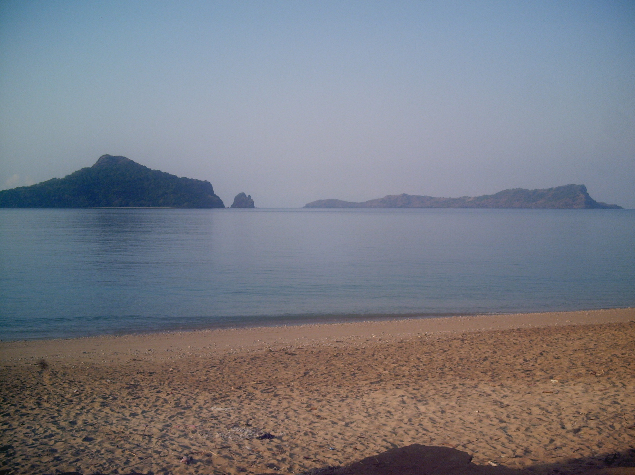

Regional overview
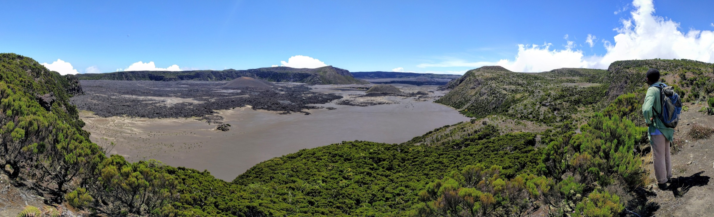
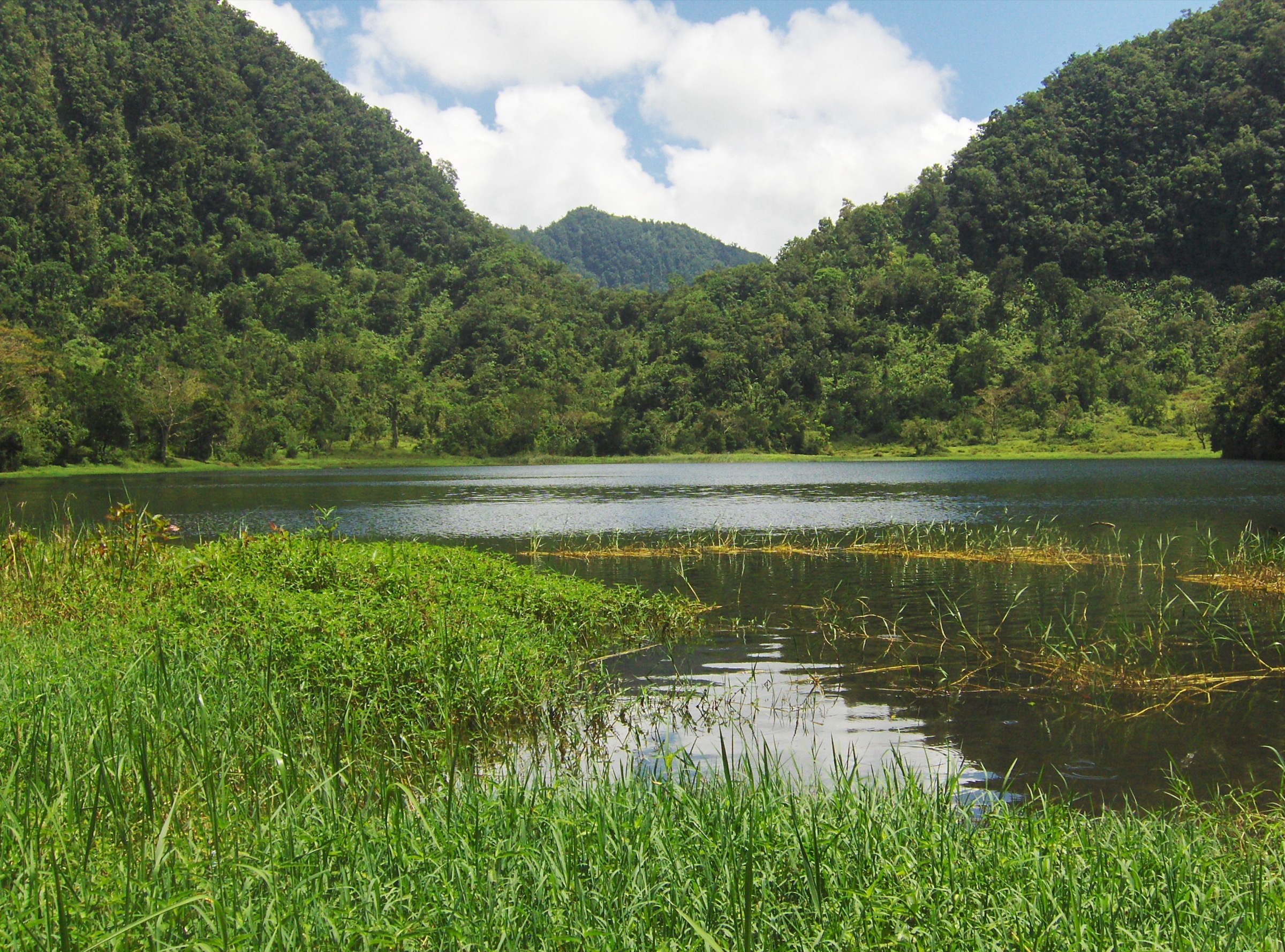
Anjouan is a steep volcanic island with sharp ridges, eroded cirques, deep valleys, and a small remnant of humid highland forest. The central highlands are protected within Mount Ntringui National Park and the Le Mont Ntringui Ramsar site. Ramsar records the site at 3,000 ha, between about 800 m and 1,595 m, including Mount Ntringui, the island high point, and Lac Dzialandzé, the largest freshwater body on Anjouan.
Walking evidence is limited but better than for many Comoros routes: Mount Ntringui and Lac Dzialandzé are documented by Ramsar, park summaries, a route account from Dindri, and a public-domain Commons image of the lake. Most other highland objectives should remain candidate-only until local trailheads and route lines are verified.
The terrain is hot and humid at lower elevation and can be wet, steep, and slippery in the forest. The Ramsar profile highlights erosion, shrinking water resources, deforestation, and agricultural pressure around the lake and highland catchments, so low-impact access and local permission are important.
Selection rationale
The five selections represent Anjouan’s high point, crater lake, forest edge, waterfall/catchment valleys, and ridge systems. The Ntringui summit and Dzialandzé access walk have partial route evidence; the remaining three are retained as research candidates only.
Summary table
| # | Hike | Country | Route type | Distance | Gain | Max elevation | Difficulty |
|---|---|---|---|---|---|---|---|
| 1 | Mount Ntringui from Dindri via Lac Dzialandzé | Comoros | Out-and-back | Unresolved | about 600 m | 1,595 m | Hard |
| 2 | Lac Dzialandzé access trail | Comoros | Out-and-back | about 2 km | Unresolved | 910 m | Easy-moderate candidate |
| 3 | Moya Forest / Trindrini highland edge | Comoros | Unresolved | Unresolved | Unresolved | up to 1,474 m if Trindrini is included | Candidate only |
| 4 | Lingoni / Tratringa waterfall and river-valley walk | Comoros | Unresolved | Unresolved | Unresolved | Unresolved | Candidate only |
| 5 | Tsembehou / Jimilimé eastern-ridge viewpoint route | Comoros | Unresolved | Unresolved | Unresolved | Unresolved | Candidate only |
1. Mount Ntringui from Dindri via Lac Dzialandzé

Snapshot
Itinerary
From the Dindri side, the route approaches the Dzialandzé basin, passes agricultural slopes and wet ground near the crater lake, then climbs steeply through humid vegetation toward Mount Ntringui. The route account describes a poorly visible path, very steep ground, use of roots and branches for balance, and a return by the same line.
Why it is essential
Mount Ntringui is Anjouan’s high point and the central summit of the island’s principal protected highland. It combines the crater-lake basin, remaining montane forest, and the main ridge system of the island.
Equipment
Mountain hiking equipment: sturdy boots, rain layer, water, food, sun protection, navigation backup, and a local guide where available. Long trousers and gloves may be useful on steep vegetated ground.
Hazards and notes
The route is not adequately mapped for independent publication. Hazards include steep rooty ground, route-finding uncertainty, wet vegetation, heat, and possible local access fees or informal gatekeeping around the lake. The lake area is ecologically sensitive and locally sacred; avoid bathing and keep to accepted tracks.
GPX / KML links
| Source | URL | Format / access | Reuse status |
|---|---|---|---|
| OpenStreetMap Mount Ntringui search | openstreetmap.org | Source map | OSM data ODbL; candidate geometry cross-check only; no route relation selected |
External links
- Ramsar Sites Information Service — Le Mont Ntringui
- Route account — Dindri / Lac Dzialandzé / Mount Ntringui
- Mount Ntringui National Park summary
2. Lac Dzialandzé Access Trail

Snapshot
Itinerary
The access walk reaches Lac Dzialandzé from the Koni-Djodjo–Dindri road by a short path. The lake sits on the south-east flank of Mount Ntringui, below wooded slopes, and is documented as a small crater lake and Anjouan’s principal freshwater body.
Why it is essential
This is the most accessible documented natural objective in the Anjouan highlands and gives a shorter route for the crater-lake landscape that underpins the Ramsar designation.
Equipment
Standard hiking equipment: walking shoes or boots, rain layer, water, sun protection, and basic navigation.
Hazards and notes
The lake is ecologically sensitive and locally sacred; swimming is strongly discouraged by the French Wikipedia route note. The Ramsar profile notes declining water levels, erosion, agriculture, pesticides, and sedimentation concerns, so low-impact access is important. Fees and access controls were not officially verified in this pass.
GPX / KML links
| Source | URL | Format / access | Reuse status |
|---|---|---|---|
| OpenStreetMap Lac Dzialandzé search | openstreetmap.org | Source map | OSM data ODbL; candidate geometry cross-check only |
External links
- Lac Dzialandzé — access-path, altitude and lake dimensions
- Ramsar Sites Information Service — Le Mont Ntringui
- Ramsar RIS PDF — Le Mont Ntringui
3. Moya Forest / Trindrini Highland Edge
Snapshot
Itinerary
This candidate targets the Moya forest / southern highland edge and, if an acceptable route exists, the Mount Trindrini sector. The Ramsar text identifies Trindrini as one of the island’s high summits and describes Anjouan’s steep ridges, forest remnants, and agricultural pressure.
Why it is essential
The Moya-Trindrini sector would broaden the selection beyond Ntringui and represent the southern highland block of Anjouan. It remains candidate-only because no mapped day-hike route or measured statistics were verified.
Equipment
Standard to mountain hiking equipment, with boots, rain protection, water, and navigation backup.
Hazards and notes
Route access, land permission, forest condition, water availability, and trail continuity are unresolved.
GPX / KML links
| Source | URL | Format / access | Reuse status |
|---|---|---|---|
| OpenStreetMap Moya / Trindrini search | openstreetmap.org | Source map | OSM data ODbL; candidate geometry cross-check only |
External links
4. Lingoni / Tratringa Waterfall and River-Valley Walk
Snapshot
Itinerary
This candidate would follow one of the highland watercourse or waterfall approaches associated with the Ntringui catchments. Ramsar identifies rivers such as Tratringa and Lingoni and lists the Lingoni waterfall as a tourism attraction, but a day-hike line was not verified.
Why it is essential
Watercourses and ravines are a defining feature of Anjouan’s dissected volcanic terrain. A verified waterfall or river-valley walk would add a lower-altitude counterpart to the Ntringui summit and lake.
Equipment
Standard hiking equipment, with grippy footwear, rain protection, and navigation backup.
Hazards and notes
Flooding, slippery rock, erosion, cultivated land, and access permissions require field confirmation.
GPX / KML links
| Source | URL | Format / access | Reuse status |
|---|---|---|---|
| OpenStreetMap Lingoni / Tratringa search | openstreetmap.org | Source map | OSM data ODbL; candidate geometry cross-check only |
External links
5. Tsembehou / Jimilimé Eastern-Ridge Viewpoint Route
Snapshot
Itinerary
This candidate represents the high ridges that radiate from the Ntringui massif toward the eastern and north-eastern parts of Anjouan. The Ramsar profile describes three mountain chains issuing from Ntringui, including the Jimilimé direction, but no public hiking itinerary was verified.
Why it is essential
A verified ridge viewpoint walk would capture the island’s sharp volcanic relief and village-to-ridge character without requiring the full Ntringui summit climb.
Equipment
Standard to mountain hiking equipment: boots, rain layer, water, sun protection, and navigation backup.
Hazards and notes
Trail existence, public access, exposure, and route statistics are unresolved. This should remain a candidate until confirmed by local or official route sources.
GPX / KML links
| Source | URL | Format / access | Reuse status |
|---|---|---|---|
| OpenStreetMap Tsembehou / Jimilimé search | openstreetmap.org | Source map | OSM data ODbL; candidate geometry cross-check only |
External links
Missing data / follow-up work
- No official GPX/KML was found for any Anjouan route in this pass.
- Mount Ntringui distance and trailhead coordinates remain unresolved.
- Current park fees, guide requirements, and access rules around Lac Dzialandzé require local confirmation.
- Hikes 3–5 are candidate-only; mapped route geometry and measured statistics are still needed.
- No licence-compatible route-specific photos were verified for Moya, Lingoni/Tratringa, or Tsembehou/Jimilimé.
External links
| Source | URL |
|---|---|
| Ramsar Sites Information Service — Le Mont Ntringui | rsis.ramsar.org |
| Ramsar RIS PDF — Le Mont Ntringui | rsis.ramsar.org |
| Mount Ntringui National Park summary | en.wikipedia.org |
| Lac Dzialandzé page | fr.wikipedia.org |
| Route account — Mount Ntringui ascent | cariboumahore.wordpress.com |