Regional overview
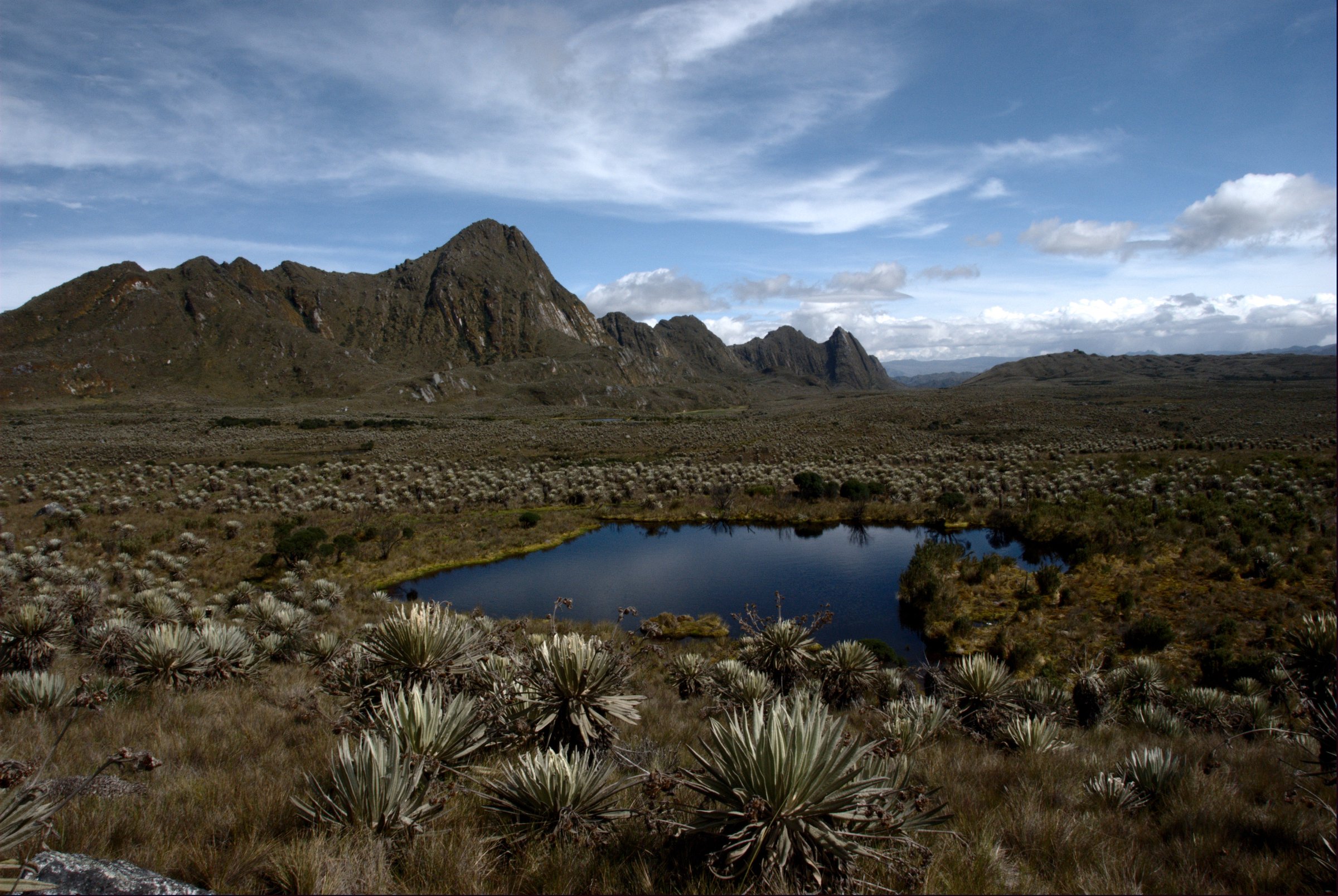
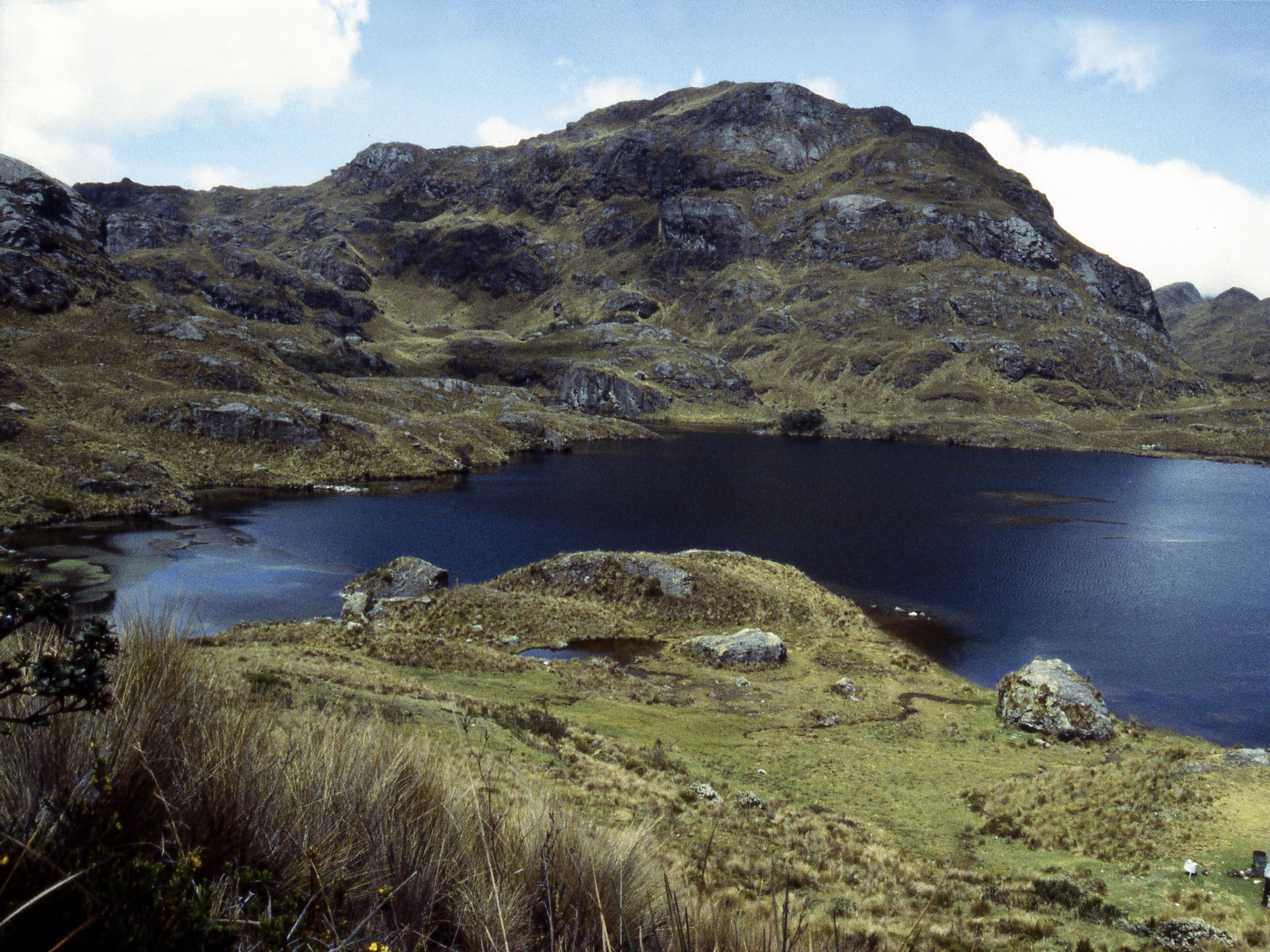
Colombia’s Western Cordillera is a wet, steep, biodiverse range between the Cauca Valley and the Pacific slope. Its hiking character is less standardised than the Eastern Cordillera or Los Nevados: access often depends on local guides, private/community conservation projects, national-park sector status, security conditions, and very muddy trails.
This entry avoids parks currently listed as closed to ecotourism, including PNN Munchique and PNN Las Orquideas. It therefore centres on open or commonly operated routes in Farallones de Cali, the Cali foothills, Cerro Tusa in Antioquia, and the Tatama / Montezuma cloud-forest road-walk area.
Selection rationale
The five hikes represent the range’s major accessible day-hike types: a demanding Farallones summit, a short legal Farallones river-forest route, Cali’s emblematic urban ridge, the iconic Cerro Tusa natural pyramid, and the Tatama / Cerro Montezuma cloud-forest birding ascent.
Summary table
| # | Hike | Country | Route type | Distance | Gain | Max elevation | Difficulty |
|---|---|---|---|---|---|---|---|
| 1 | Pico de Loro, Farallones de Cali | Colombia | Out-and-back | 9.7 km AllTrails; official old page lists 4.5 km sendero | 1,288 m | 2,919 m | Strenuous |
| 2 | Charco Burbujas, Farallones de Cali | Colombia | Out-and-back | 2.1 km | 118 m | 1,852 m | Moderate |
| 3 | Cerro de las Tres Cruces Ecopark, Cali | Colombia | Loop | 8.0 km | 680 m | 1,420 m | Hard |
| 4 | Cerro Tusa, Venecia | Colombia | Out-and-back | 4.0 km | 538 m | 1,871 m | Hard / exposed steep ascent |
| 5 | Cerro Montezuma / Tatama cloud-forest road ascent | Colombia | Out-and-back / road-walk variant | Approx. 10-16 km depending start | Approx. 1,200 m for full road ascent | approx. 3,200 m | Hard |
1. Pico de Loro, Farallones de Cali
Snapshot
Itinerary
The route climbs from the Pance/Topacio side through humid forest toward the sharp viewpoint of Pico de Loro. Parques Nacionales lists Pico de Loro among the principal attractions of Farallones de Cali and the older ecotourism page gives the route window as morning entry with a maximum afternoon exit.
Why it is essential
Pico de Loro is the classic summit day hike of Farallones de Cali: a steep forest ascent to one of the most recognisable viewpoints above Cali.
Equipment
- Boots with grip
- Rain shell
- Water/food
- Gloves useful for mud/rock
- Guide/interpreter
- Headtorch
Hazards and notes
- Steep slippery mud.
- Dense forest.
- Route finding.
- Exposed rocky/steep final sections.
- Protected-area controls.
GPX / KML links
| Source | URL | Format / access | Reuse status |
|---|---|---|---|
| AllTrails: Pico de Loro / Parrot’s Beak | alltrails.com | Source map / downloadable route via account | AllTrails terms apply; source-map reference only |
| Wikiloc: Pico de Loro PNN Farallones de Cali | es.wikiloc.com | Source route / downloadable via Wikiloc account | Wikiloc terms apply; source-map reference only |
External links
- Parques Nacionales — PNN Farallones de Cali
- Parques Nacionales — Farallones mapa-guia
- Parques Nacionales (archive) — Farallones ecoturismo activities
- AllTrails — Pico de Loro
- Wikiloc — Pico de Loro PNN Farallones de Cali
2. Charco Burbujas, Farallones de Cali
Snapshot
Itinerary
The short walk follows humid forest and river terrain to Charco Burbujas, one of the named Farallones attractions. It is not a major summit, but it is an accessible legal way to experience the riverine forest side of the Western Cordillera near Cali.
Why it is essential
It balances the strenuous summit routes with a lower-impact Farallones water/forest walk, important in a region where many deeper park routes are regulated, difficult or access-sensitive.
Equipment
- Grippy footwear
- Water
- Rain protection
- Swimwear/towel if bathing is permitted
- Guide/access confirmation
Hazards and notes
- Slippery river rocks.
- Sudden rain.
- Protected-area rules.
- Water hazards.
GPX / KML links
| Source | URL | Format / access | Reuse status |
|---|---|---|---|
| AllTrails: Charco Burbujas | alltrails.com | Source map / downloadable route via account | AllTrails terms apply; source-map reference only |
External links
3. Cerro de las Tres Cruces Ecopark, Cali
Snapshot
Itinerary
The route climbs from Cali’s urban edge to the landmark cross-crowned hill above the city. It is a steep exercise hike with broad views over Cali and the Cauca Valley, and can be linked into a longer ecopark loop where safe and open.
Why it is essential
Tres Cruces is Cali’s emblematic urban foothill climb, giving a direct view of how the Western Cordillera rises above the Cauca Valley.
Equipment
- Water
- Sun protection
- Grippy shoes
- Early start
- Local safety advice
Hazards and notes
- Heat.
- Steep eroded paths.
- Crowds.
- Urban-edge security; go in active hours/groups.
GPX / KML links
| Source | URL | Format / access | Reuse status |
|---|---|---|---|
| AllTrails: Cerro de las Tres Cruces Ecopark | alltrails.com | Source map / downloadable route via account | AllTrails terms apply; source-map reference only |
External links
4. Cerro Tusa, Venecia
Snapshot
Itinerary
The route climbs the distinctive pyramid-shaped hill of Cerro Tusa from the authorised base area. AllTrails warns that a local guide is essential and that difficult sections may use ropes. The Antioquia government has described recent operation of Parque Cerro Tusa as a biodiversity and responsible-tourism project with restored ancestral paths and new trails.
Why it is essential
Cerro Tusa is one of the most recognisable standalone mountains in Colombia, combining geology, local identity, steep hiking and cultural landscape.
Equipment
- Local guide
- Grippy footwear
- Gloves for rope/handline sections
- Water
- Sun/rain protection
Hazards and notes
- Very steep slopes.
- Rope-assisted sections reported by route source.
- Exposure.
- Heat.
- Access regulations.
GPX / KML links
| Source | URL | Format / access | Reuse status |
|---|---|---|---|
| AllTrails: Tusa Hill | alltrails.com | Source map / downloadable route via account | AllTrails terms apply; source-map reference only |
External links
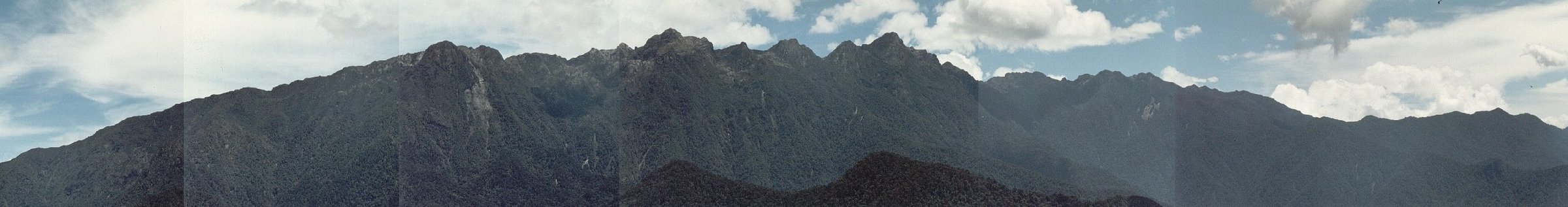
5. Cerro Montezuma / Tatama cloud-forest road ascent
Snapshot
Itinerary
The walking version follows the Montezuma road/track up through exceptional Choco-Andean cloud forest toward Cerro Montezuma. The route is best known in birding circles for endemic and range-restricted species, but it also functions as a demanding forest-and-ridge day walk when access is arranged legally.
Why it is essential
Tatama / Montezuma represents the wet Pacific-facing Western Cordillera: dense cloud forest, extreme biodiversity and a very different mountain character from Cali’s dry urban foothills or Farallones summit routes.
Equipment
- Local guide/operator
- Rain gear
- Mud-ready footwear
- Food/water
- Binoculars optional
- Headtorch
Hazards and notes
- Remoteness.
- Rain.
- Mud.
- Landslides/road condition.
- Limited services.
- Protected-area rules.
GPX / KML links
| Source | URL | Format / access | Reuse status |
|---|---|---|---|
| Wikiloc: Casa PNN Tatama Cerro Montezuma | wikiloc.com | Source route / downloadable via Wikiloc account | Wikiloc terms apply; source-map reference only |
External links
- Parques Nacionales (archive) — PNN Tatama reopened
- Wikiloc — Casa PNN Tatama Cerro Montezuma
- Orniverse — Cerro Montezuma site context
External links
| Source | URL |
|---|---|
| Parques Nacionales — PNN Farallones de Cali | parquesnacionales.gov.co |
| Parques Nacionales — Farallones mapa-guia | parquesnacionales.gov.co |
| Parques Nacionales (archive) — Farallones ecoturismo activities | old.parquesnacionales.gov.co |
| Parques Nacionales (archive) — PNN Tatama reopened | old.parquesnacionales.gov.co |
| Gobernacion de Antioquia — Parque Cerro Tusa operation | antioquia.gov.co |
| Orniverse — Cerro Montezuma site context | orniverse.com |
| AllTrails — Pico de Loro | alltrails.com |
| AllTrails — Charco Burbujas | alltrails.com |
| AllTrails — Cerro de las Tres Cruces Ecopark | alltrails.com |
| AllTrails — Tusa Hill | alltrails.com |
| Wikiloc — Pico de Loro PNN Farallones de Cali | es.wikiloc.com |
| Wikiloc — Casa PNN Tatama Cerro Montezuma | wikiloc.com |