Regional overview
The Wumeng Mountains (乌蒙山 Wūméng Shān; Yi: Vumop Shan) form the structural backbone of the northern Yunnan–Guizhou Plateau, running south-west to north-east across the borders of north-eastern Yunnan, western Guizhou and southern Sichuan. The range is the principal interfluve of the upper Yangtze and Pearl River systems: the Jinsha Jiang (金沙江, the upper Yangtze) carves a deep canyon on the north and west sides, the Niulan Jiang (牛栏江) drains the Yunnan slope into the Jinsha, and the Beipan Jiang (北盘江) and Wu Jiang (乌江) headwaters drain the Guizhou flank into the Pearl River and Yangtze respectively.
The highest summit of the range proper is usually given as Hong’aishan (撼嶬大坡, c. 4,041 m on the Yunnan side near Huize), but the most-visited high peak is Jiaozi Xueshan (轿子雪山, “Sedan-Chair Snow Mountain”), part of the Gongwang Mountains spur on the south-western edge of the massif. Quoted summit elevations for Jiaozi vary between published sources from 4,223 m to 4,344 m; we follow the English-language Wikipedia figure of 4,330 m here, but note the disagreement. Guizhou’s provincial high point sits firmly inside the Wumeng on Xiao Jiucaiping (小韭菜坪), at approximately 2,900.6 m on the Hezhang–Zhongshan border in Bijie prefecture.
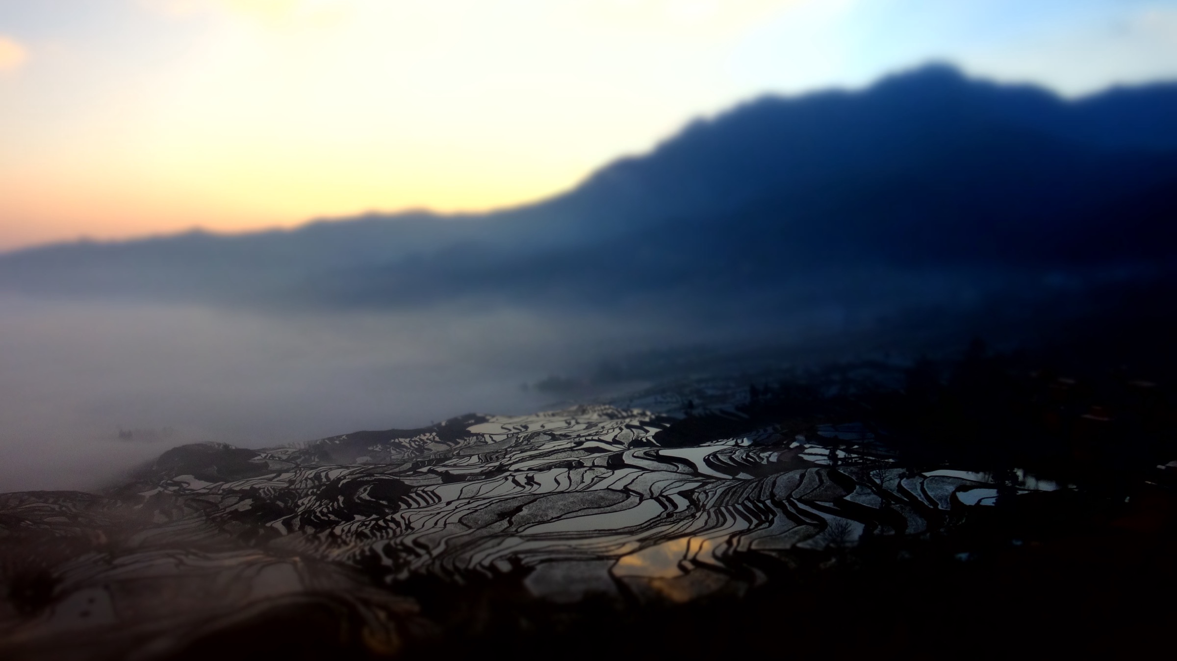
Lithologically the Wumeng is a transitional landscape between the high karst plateaux of central and western Guizhou and the more deeply incised clastic-and-basalt terrain of north-eastern Yunnan and southern Sichuan. The southern and central Guizhou sectors expose thick Permian and Triassic carbonates weathered into peak-forests (fenglin), peak-clusters (fengcong), sinkholes (tiankeng), through-caves (穿洞) and natural arches (天生桥 tiānshēng qiáo); Late Permian Emeishan flood-basalt remnants cap several of the highest summits in the Bijie–Liupanshui–Panzhou belt. North of the karst belt, the Dashanbao plateau, Hong’aishan and the upper Niulan Jiang country show clastic sediments and red-bed sequences cut by steep canyons. The contact between karst and clastics produces an unusual hiking landscape — sub-alpine wetlands at 2,500–3,300 m on impermeable clays, perched above karst gorges with vertical relief approaching 2,500 m on the Niulan Jiang and Jinsha Jiang sides.
Cultural geography reflects the range’s role as a Three-Province Junction (Yunnan–Guizhou–Sichuan). The slopes and high plateaux are home to Yi (彝, including Nasu and Nuosu sub-groups), Hui (回, Sino-Muslim), Miao (苗) and Lisu (傈僳) communities, with Weining Yi, Hui and Miao Autonomous County (威宁彝族回族苗族自治县) on the Caohai plateau the most explicit official expression of that mix. Yi-language names for the larger landscape elements survive in many local references — Wumeng itself derives from an old Yi chieftaincy name retained in Ming-Qing administrative usage.
The high wetlands of Dashanbao (大山包) and Caohai (草海) are central to the ecology of the Black-Necked Crane (Grus nigricollis, 黑颈鹤), the only crane species adapted to high-altitude breeding and wintering. Dashanbao hosts roughly 1,300–1,900 wintering birds (the figure varies year-on-year and between official communiqués), and Caohai is the easternmost regular wintering site for the species, holding several hundred birds plus more than 200 other waterfowl species. Both sites are Ramsar wetlands (Caohai 1992, Dashanbao 2004) and Caohai is a National Nature Reserve.
A note on geopark status: the Wumeng range hosts a Chinese national geological park (Wumengshan National Geopark, 乌蒙山国家地质公园) centred on Liupanshui in western Guizhou, taking in the Beipan Jiang canyon, the Yushe forest plateau and several stratigraphic karst sites. It is not a UNESCO Global Geopark — only a Chinese National Geological Park. The neighbouring Xingyi and Zhijindong geoparks in Guizhou are UNESCO-designated; Wumengshan is not.
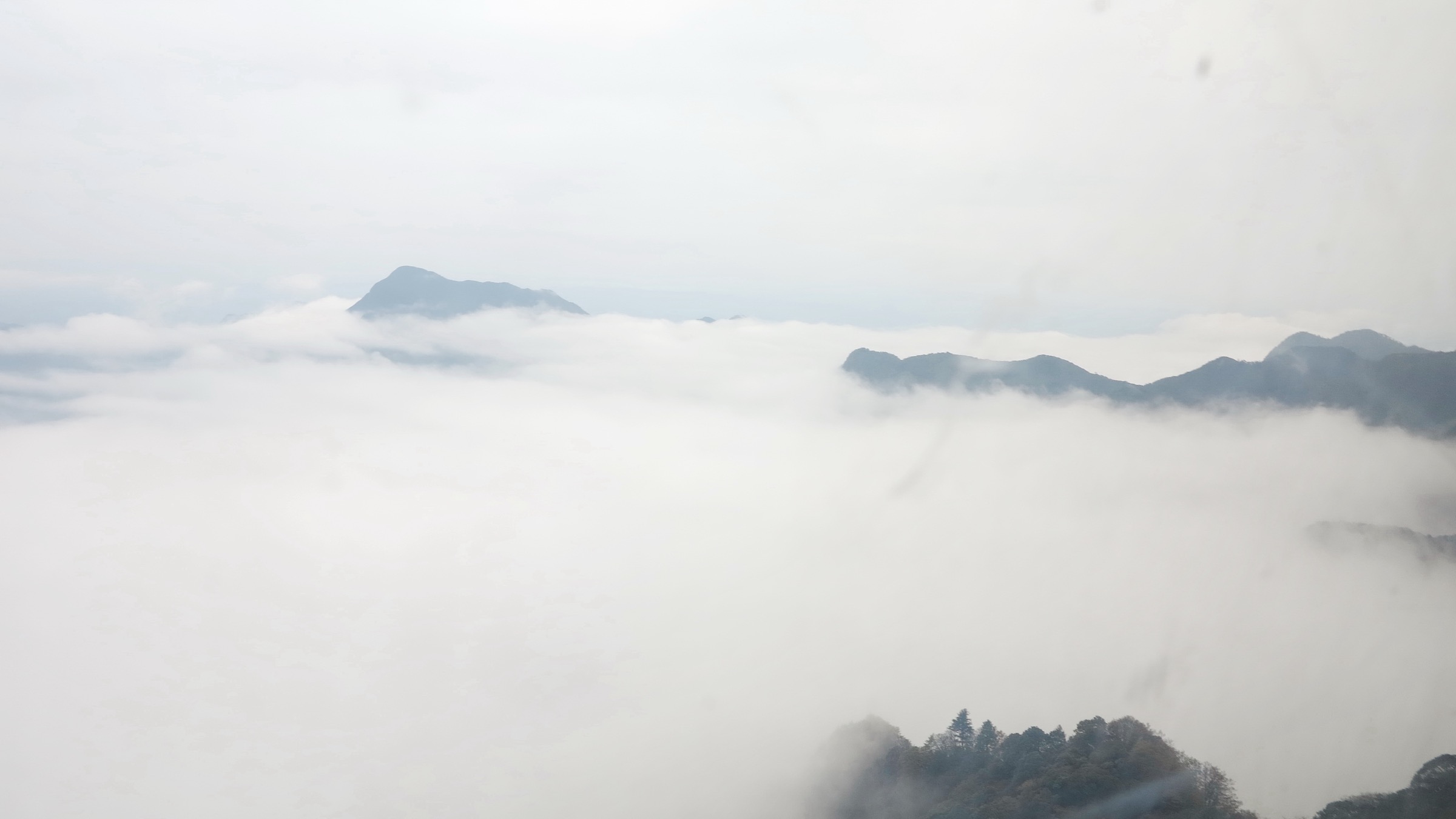
The walking calendar is shaped by altitude rather than latitude. The Wumeng sits above the south-west summer monsoon, but frost can occur in any month at 2,500 m and above; the high plateaux are routinely below freezing from late October to mid-April. The optimum window for the high summits (Jiaozi, Jiucaiping, Wumeng Caoyuan ridges) is mid-May to early July (azalea and rhododendron bloom, snow largely gone) and again late September to mid-October before the first hard frosts. The Black-Necked Crane wintering window at Dashanbao and Caohai is roughly mid-October to mid-March, peaking December–February; this is also the photogenic “sea of clouds” season at the Jigongshan cliff above Dashanbao, but it coincides with sub-zero nights and freezing fog. The leek-flower (Allium sp.) bloom at Da Jiucaiping is unusually short — typically only the first two or three weeks of August.
Access is by Kunming Changshui Airport (KMG) for the Yunnan side, Zhaotong Airport (ZAT) for Dashanbao, Bijie Feixiong Airport (BFJ) for Jiucaiping and the geopark core, Liupanshui Yuezhao Airport (LPF) for Yushe and Wumeng Caoyuan, and Guiyang Longdongbao (KWE) as the principal Guizhou gateway, with extensive high-speed rail links between all four prefectural capitals.
Selection rationale
The five routes below cover the structural and ecological breadth of the Wumeng region while remaining doable as day hikes by fit walkers under normal seasonal conditions. Jiaozi Xueshan is the obligatory iconic high summit — Yunnan’s most accessible 4,000-metre peak and the only route in the range that genuinely climbs to high-altitude azalea forest and seasonal snow. Dashanbao’s Jigongshan cliff loop is the canonical Black-Necked Crane and canyon-rim walk on the Yunnan side, anchoring the wintering-wetland ecological story and the Niulan Jiang gorge geomorphology. Caohai is the corresponding wetland and bird walk on the Guizhou side, with a substantially flatter lake-perimeter circuit through a recognised Ramsar site adjacent to an old Hui-Miao-Yi market town. Da Jiucaiping is the roof of Guizhou and the karst-and-basalt high-plateau experience, also the only place in China with managed wild-leek-flower meadows at 2,800 m. Wumeng Caoyuan (Wumeng Prairie) in Panzhou is the high-altitude grassland and rhododendron walk inside the National Geopark footprint, representing the central Guizhou karst-and-basalt plateau character and the southern Yi cultural area.
Summary table
| # | Hike | Country | Route type | Distance | Gain | Max elevation | Difficulty |
|---|---|---|---|---|---|---|---|
| 1 | Jiaozi Xueshan summit boardwalk (lift-assisted) | China | Out-and-back | 4–6 km | 250–400 m | c. 4,330 m | Moderate (altitude) |
| 2 | Dashanbao Jigongshan cliff loop and Dahaizi wetland | China | Linked walk | 7–10 km | 150–250 m | c. 3,100 m | Easy–moderate |
| 3 | Caohai lakeshore and Yangguanshan loop | China | Loop | 8–12 km | 80–150 m | c. 2,230 m | Easy |
| 4 | Da Jiucaiping summit loop with Xiao Jiucaiping spur | China | Loop with spur | 6–9 km | 250–400 m | c. 2,900 m | Moderate |
| 5 | Wumeng Caoyuan grassland and Sky Lake circuit | China | Loop | 8–12 km | 200–300 m | c. 2,700 m | Easy–moderate |
1. Jiaozi Xueshan summit boardwalk (lift-assisted)

Snapshot
Itinerary
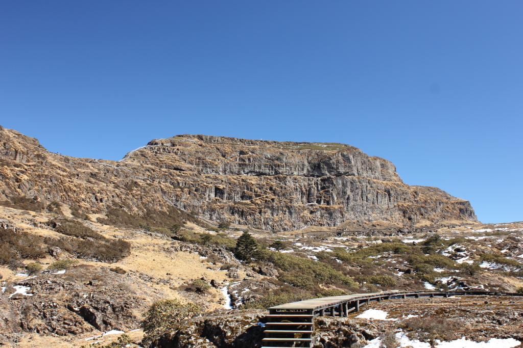
From the main gate the scenic-area shuttle takes visitors to the lower cable-car terminal. Cable car 1 climbs out of the dwarf-bamboo and rhododendron belt onto the Sifangjing shoulder at around 3,800 m, where a short bus transfer crosses to Xipingzi at the foot of the upper cable car. Cable car 2 lifts to Daheiqing on the summit massif at approximately 3,900–4,000 m. From the upper station, a continuous timber plank walkway (栈道, zhandao) and stair system is signed for the main summit (Jiaoding / 轿顶). The walkway climbs through stunted Rhododendron and Pieris heath and across blocky frost-shattered metasediments, passing the Yueliang Yan (“Moon Rock”) platform and reaching the named summit in roughly 1 to 1.5 hours for most visitors.
The summit cluster is a series of crag-tops linked by a perimeter boardwalk; in clear weather the panorama takes in the chain of the Wumeng range north into Sichuan, the Jinsha Jiang gorge to the north-west, and on rare days the Yulong (Jade Dragon) and Haba Snow Mountains nearly 200 km west. The standard return descends the same plank system. A longer variant adds the Huaxi (“Flower Brook”) loop on the descent, traversing the south-east cirque past seasonal icefalls in winter or Primula-and-Caltha wet meadows in early summer before rejoining the upper cable-car station. The route is fully signed and lit, and ranger huts are placed at intervals.
Why it is essential
Jiaozi Xueshan is the only summit above 4,200 m in north-east Yunnan accessible to ordinary day hikers without mountaineering equipment, and it concentrates the entire vertical-bioclimatic sequence of the western Wumeng — sub-tropical broadleaf forest at the gate, Tsuga-and-bamboo forest at the lower cable car, sub-alpine Rhododendron heath at the upper station, and a frost-shattered alpine summit. It is the most southerly snow-capped mountain in China that is regularly visited, and the May–June rhododendron bloom is one of the recognised flower events of Yunnan. The combination of double cable car and stair-and-boardwalk summit access makes it an unusually low-technical-skill way to experience genuinely high terrain.
Equipment
- Sturdy waterproof boots (the boardwalk surfaces ice over readily)
- Windproof and waterproof shell, insulated mid-layer, gloves and hat in all seasons
- Trekking poles for the steeper stair sections
- Sun protection (UV is intense above the cloud base)
- 1.5 L water minimum per person — no reliable refill above the upper cable car
- Microspikes from late November to April when the upper boardwalk is intermittently iced
- Altitude-sickness prophylaxis worth considering — the upper cable car puts visitors above 3,900 m within an hour of leaving Kunming (1,890 m)
Hazards and notes
Altitude sickness is the dominant hazard; the ascent profile (Kunming to summit in under four hours) is unusually fast and gives essentially no acclimatisation. Wind on the exposed summit boardwalks routinely exceeds 50 km/h. The plank walkway can be slick after rain and dangerously icy after dawn in shoulder-season frost; tourism literature explicitly warns visitors to stay on the planking, since the surrounding scree is unstable and rangers enforce the rule. The scenic area closes the upper cable car in storm conditions; if the upper lift is closed the day is functionally cancelled, since walking from Xipingzi to the summit is too long for most visitors. Drone use is not generally permitted inside the scenic area without prior authorisation. Cable-car reservations may be required in peak holiday periods.
GPX / KML links
| Source | URL | Format | Notes |
|---|---|---|---|
| OpenStreetMap (summit boardwalk and upper cable-car terminal) | openstreetmap.org | OSM data (export GPX) | ODbL 1.0; reusable with attribution |
| Jiaozi Xueshan scenic-area official site | — | — | No official GPX or KML published |
No official scenic-area GPX could be located. The summit boardwalks and stair flights are mapped piecewise on OSM as highway=footway and highway=steps. Trailhead coordinates (upper cable-car station, Daheiqing): 26.1497° N, 102.9131° E.
Sources
- Wikipedia — Jiaozi Snow Mountain
- China Highlights — Jiaozi Snow Mountain from Kunming
- Yunnan Exploration — Travel to Jiaozi Snow Mountain
- GoKunming — Hiking among the clouds on Jiaozi Snow Mountain
- Wikivoyage — Jiaozi Xueshan
2. Dashanbao Jigongshan cliff loop and Dahaizi wetland
Snapshot
Itinerary
The Dahaizi (大海子) section of the reserve is the principal Black-Necked Crane wintering area. A boardwalk and gravel path circumnavigates the shallow plateau wetland for roughly 3–4 km, passing observation hides on the northern and eastern shores. In winter (typically late October to mid-March) several hundred to over a thousand cranes use the shallow lake and the surrounding stubble fields; the wider reserve count is in the 1,300–1,900 range, with annual variation and divergence between official communiqués.
From Dahaizi the walk continues by reserve road or short shuttle to the Jigongshan (鸡公山, “Cock Mountain”) canyon rim above the Niulan Jiang gorge. The Jigongshan path links three named cliff-edge viewing platforms and the 2016-opened glass viewing platform, all set at the lip of a vertical karst-and-clastic escarpment. Sources differ on the precise depth: tourism literature variously gives the vertical drop as “nearly 800 m”, “more than 2,000 m” and “nearly 2,600 m” — the lower figure likely refers to the cliff face proper and the larger figures to total relief down to the Niulan Jiang riverbed. The “chicken neck” — a narrow ridge about 70 cm wide linking two of the cliff tops — is the photogenic exposed section. The full Jigongshan circuit returns by a parallel upper path through stunted juniper and Stipa steppe meadow back to the car park, with Black-Necked Crane often visible in the adjacent feeding fields even from the canyon-rim route. The combination produces a credible 7–10 km day at altitudes of 2,900–3,100 m.
Why it is essential
Dashanbao is the single most important wintering site for the endemic high-altitude Black-Necked Crane (Grus nigricollis), and the Jigongshan rim walk pairs that ecological story with one of the most dramatic canyon viewpoints in north-east Yunnan, overlooking the Niulan Jiang’s deep gorge into the upper Yangtze system. The combination of plateau wetland, sub-alpine steppe and a 2,000-metre-plus relief canyon edge inside a single 19,200-hectare protected area is unique within the Wumeng range, and no other single walk in the region delivers comparable wildlife and geomorphological content. It is also the only Ramsar-listed protected area on the Yunnan side of the Wumeng.
Equipment
- Sturdy boots (the Jigongshan boardwalks become very slippery when wet or frosted)
- Strong emphasis on warm and windproof layers October to April — the plateau is routinely below freezing and the canyon-rim wind is severe
- Binoculars or telephoto for the crane observation hides
- Head torch for dawn “sea of clouds” viewing at Jigongshan (recommended cliff-platform arrival 05:00)
- Microspikes useful in mid-winter on the canyon-rim section
- No technical equipment required
Hazards and notes
The Jigongshan cliff system is genuinely exposed — the “chicken-neck” ridge has unprotected drops to either side and the glass platforms project beyond solid ground. Frost and rain make the cliff-top decking slick. Off-trail walking is prohibited inside the Ramsar core zone and enforced by reserve staff. Drone use is prohibited within the crane wintering area between approximately mid-October and mid-April to avoid disturbance. The wetland is a hard-frost environment from November to March, with sub-zero overnight temperatures even when daytime sun feels strong. The crane wintering season is also when most visitor facilities and shuttles operate at full capacity; in the spring–autumn off-peak window some internal transport may not run, lengthening on-foot connections between the two sections.
GPX / KML links
| Source | URL | Format | Notes |
|---|---|---|---|
| OpenStreetMap (Dahaizi wetland and Jigongshan viewing platforms) | openstreetmap.org | OSM data (export GPX) | ODbL 1.0; reusable with attribution |
| Dashanbao reserve official site | — | — | No official GPX or KML published |
No official reserve GPX could be located. Trailhead coordinates (approximate): Dahaizi 27.385° N, 103.292° E; Jigongshan car park 27.367° N, 103.267° E. Reserve coordinates from Wikipedia: 27°23′00″N 103°16′00″E.
Sources
- Wikipedia — Dashanbao Black-necked Crane National Nature Reserve
- Yunnan Exploration — Dashanbao Black-necked Crane Nature Reserve
- InKunming — Dashanbao Black-necked Crane Nature Reserve
- HighestBridges — Dashanbao Glass Viewing Platform
- Adventure.Travel — Jigong Mountain in Dashanbao Township
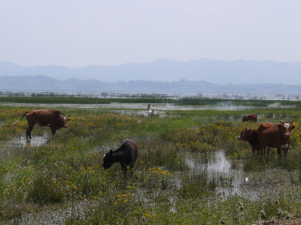
3. Caohai lakeshore and Yangguanshan loop
Snapshot
Itinerary
From the Weining waterfront, the loop heads west along the north shore of Caohai (草海, “Sea of Grass”), passing the Jiangjiawan Wharf where the crane-viewing trail leaves the road and follows a raised dyke between flooded fields and the reed margin of the lake. The path passes the East Caohai National Wetland Park entrance and several hides, with the open lake on the south side and a mosaic of pasture, stubble and small Hui-Miao-Yi village fields on the north. About 4 km from the start, the route reaches the south-western corner of the lake at the foot of Yangguanshan, where a side spur climbs the low ridge to a sunset/overview platform. From here the panorama covers the full sheet of the lake, the Wumeng skyline to the north (including Xiao Jiucaiping on a clear day) and Weining town on the north shore.
The return follows the southern shore via Yangguanshan village and rejoins the wharf via the reed-tunnel boardwalk, completing a full lake-perimeter loop of about 12 km. A shorter version that omits the Yangguanshan ridge is around 8 km and stays at the lake surface elevation throughout. The reserve no longer permits public boating for ecological reasons, so all walking is shoreline-based.
Why it is essential
Caohai is Guizhou’s largest plateau natural freshwater lake, the easternmost regular wintering site for Black-Necked Crane (Grus nigricollis) and one of China’s premier birdwatching wetlands — cited counts include approximately 180–228 protected bird species across the year, with December to March the prime window. It is a Ramsar site, sits at the junction of Yi, Hui and Miao cultural areas in Weining Autonomous County, and is the only essentially flat day-walk in the Wumeng region — a useful complement to the high summits and cliff edges that dominate the other four routes. Its accessibility (the north shore begins 15 minutes from central Weining) makes it the only Wumeng day hike practicable for travellers without private transport.
Equipment
- Walking shoes (no boots required for the lake perimeter)
- Weatherproof shell and warm layer (December to March mornings are below freezing at 2,170 m)
- Binoculars and telephoto for birding
- Sun protection and water
- Identification documents — sections of the lake-edge path pass close to the reserve’s protected zone and ranger checks are common in winter
Hazards and notes
Caohai is a strict National Nature Reserve and a Ramsar site; off-path walking inside the bird-viewing zones is prohibited and enforced. Boating from the historic wharves is no longer permitted. The north shore can be windy and cold in winter, and the unpaved southern shore turns to thick mud in summer rain. Some sections of the perimeter loop follow public road that carries local vehicle traffic. Drone use over the wetland is regulated. The lake-surface elevation of 2,170 m is high enough to cause mild altitude effects in unacclimatised visitors arriving directly from the coast.
GPX / KML links
| Source | URL | Format | Notes |
|---|---|---|---|
| OpenStreetMap (Caohai shoreline and Yangguanshan ridge) | openstreetmap.org | OSM data (export GPX) | ODbL 1.0; reusable with attribution |
| Caohai reserve official site | — | — | No public GPX or KML published |
No official reserve GPX could be located. The lake perimeter and ridge are mapped on OSM as a mix of roads, footways and tracks. Trailhead coordinates (Weining waterfront / Jiangjiawan): 26.857° N, 104.268° E.
Sources
- ChinaHighlights — Caohai Lake
- IntoTravelChina — Caohai Lake Guizhou
- Lonely Planet — Caohai Lake, Guizhou
- National Wildlife Federation — China’s Crane Experiment
- EAAFP — 2021 World Wetlands Day
4. Da Jiucaiping summit loop with Xiao Jiucaiping spur
Snapshot
Itinerary
From the scenic-area car park a stone-paved path climbs through Festuca and Stipa grassland onto the broad rounded summit plateau of Da Jiucaiping (大韭菜坪). The plateau is built on Late Permian Emeishan basalt resting on a karst-and-clastic platform, producing a striking landscape of dark basalt tors and “stone forests” rising above brilliant green sward. The signed loop visits several named viewpoints — “Sword Hill” (剑山), the central stone forest, and the eastern and western edge platforms — over approximately 4–5 km of mostly easy walking. In the first three weeks of August the surrounding sward is covered with the purple-pink flowering heads of a large-flowered wild leek (Allium sp., locally treated as a distinct conservation-protected variety), creating the “purple sea” that gives the site its tourism nickname “Sapphire of the Earth”.
The traditional summit add-on continues from the loop onto the rougher and slightly higher Xiao Jiucaiping (小韭菜坪) ridge to the east — the official high point of Guizhou at 2,900.6 m. The spur adds approximately 2–3 km return. The descent retraces the outward path back to the car park. The whole circuit is at relatively modest altitude by Wumeng standards but is fully exposed to wind and weather above the treeline; average summer temperature is in the 17.8–22.4 °C range.
Why it is essential
Jiucaiping is the geographic high point of Guizhou Province and the only managed wild-leek-flower reserve in the country; its mid-August bloom is one of the recognised flower events of south-west China, with no equivalent at high altitude anywhere else in the Wumeng. The combination of basalt-and-karst geomorphology, alpine Allium meadows and a genuine “roof of the province” summit makes it the obligatory Guizhou-side companion to Yunnan’s Jiaozi Xueshan. It is also the most representative day-walk inside the wider Wumengshan National Geopark area.
Equipment
- Sturdy shoes (basalt scree on the summit spur is sharp)
- Waterproof shell and warm mid-layer (the plateau is exposed and cool even in summer)
- Sun protection — UV is intense at 2,900 m
- Trekking poles useful for the Xiao Jiucaiping scramble
- A wide-brimmed hat or buff for all-day plateau exposure
- No technical equipment required
Hazards and notes
Lightning is a significant summer risk on the open plateau; afternoon thunderstorms are common July to September and the named viewing platforms offer no shelter. Karst sinkholes are present on the lower flanks of the loop and on the Xiao Jiucaiping side; staying on the marked stone paths matters. The “leek-flower” zone is protected — picking flowers or walking off-trail across the bloom is prohibited and enforced. The site is a 4A (AAAA) tourist scenic area and charges entry; the August bloom is the busiest single window of the year and crowding on the platforms is intense.
GPX / KML links
| Source | URL | Format | Notes |
|---|---|---|---|
| OpenStreetMap (Da Jiucaiping and Xiao Jiucaiping summit area) | openstreetmap.org | OSM data (export GPX) | ODbL 1.0; reusable with attribution |
| Jiucaiping scenic-area official site | — | — | No public GPX or KML published |
No official scenic-area GPX could be located. The summit area is mapped piecewise on OSM as highway=footway. Trailhead coordinates (approximate, Da Jiucaiping car park): 26.86° N, 104.62° E; Xiao Jiucaiping summit: 26.87° N, 104.65° E.
Sources
- Baidu Baike English — Jiucaiping
- PeakVisor — Jiucaiping
- China Daily — Jiucaiping
- GoWesternChina — Jiucaiping Travel Guide
- Wikipedia — Guizhou
5. Wumeng Caoyuan grassland and Sky Lake circuit
Snapshot
Itinerary
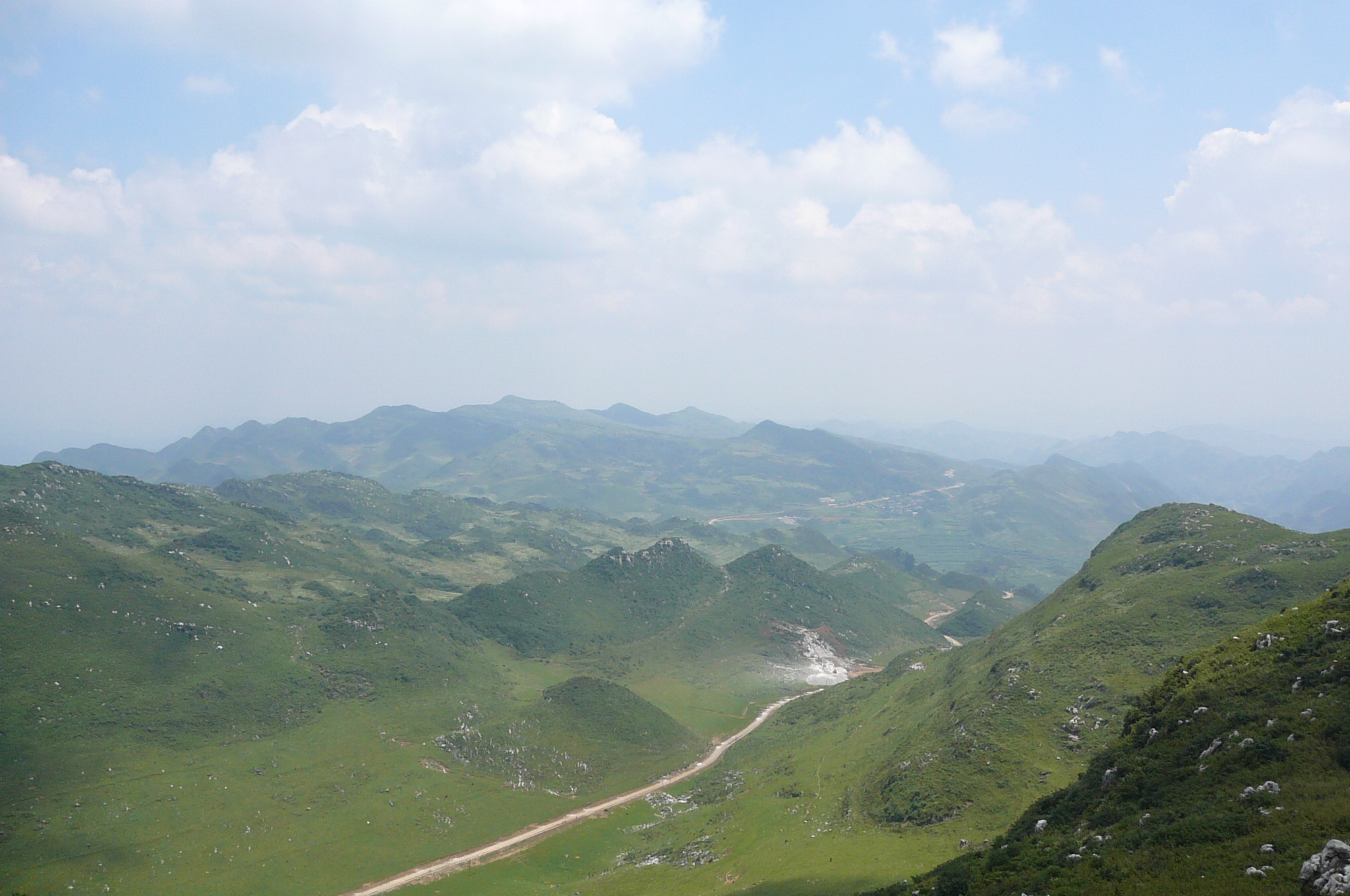
From the main visitor centre the trail crosses open grassland onto the central windmill ridge — the area hosts what Chinese tourism material describes as Guizhou’s largest wind-power plant, with more than 100 turbines visible from the route. The grassland is mapped as south-west China’s largest natural high-altitude grassland, with reported figures of around 67 km² of sward and 27 km² of Rhododendron forest on the surrounding slopes (totals are quoted differently in different sources). The path follows broad ridges with long views over the Beipan Jiang catchment to the south and the Liupanshui karst peak-forest landscape to the east.
From the ridge, a spur path drops to the Sky Lake (Tianchi 天池), a small high-altitude tarn at approximately 2,500 m, before climbing back to the ridge through stunted Rhododendron forest that flowers in April–May. A second loop branch visits a Yi village viewpoint near Pingdi Yi Township and returns to the visitor centre via the eastern grassland. The full circuit covers approximately 10–12 km with gentle elevation change. The grassland is unenclosed and dotted with grazing horses and cattle, and Yi herders are present in summer; tourism literature emphasises its similarity in landscape to Inner Mongolia or northern Tibet despite being at the same latitude as Hanoi.
Why it is essential
Wumeng Caoyuan is the largest and highest natural grassland in south-west China and the most representative non-summit landscape of the Guizhou Wumeng — a high-altitude steppe surface on Late Permian basalt, with managed access via marked tracks rather than the steep peak-and-canyon scenery that dominates the other walks. The combination of grassland, rhododendron forest, a small alpine tarn and a large operational wind farm gives it a distinctive character; it is also the cultural heart of the southern Yi (Nasu) population of western Guizhou, with Yi place names retained throughout the scenic area. As part of the Wumengshan National Geopark footprint (a Chinese national geopark, not a UNESCO Global Geopark), it offers an honest geopark walking experience without requiring entry to the more remote Beipanjiang canyon zones.
Equipment
- Walking shoes (the grassland is rarely muddy but the rhododendron spur can be wet)
- Windproof and waterproof shell (the ridge is exposed at 2,700 m and wind speeds at the wind farm are routinely strong)
- Warm mid-layer
- Sun protection and water
- Microspikes useful December to early March
- Trekking poles sensible against aggressive dogs in Yi settlements in summer
Hazards and notes
The scenic area is large and English signage is limited; carrying offline OpenStreetMap data is sensible. Karst sinkholes are present on the lower northern slopes of the grassland and on the rhododendron flank — stay on marked paths. Afternoon thunderstorms in July–September are a real lightning hazard on the exposed ridge. Wind-turbine access tracks are closed to walkers; observe signage. Grazing dogs in Yi settlements can be aggressive in summer; trekking poles are a sensible precaution. The site is officially a provincial scenic area and charges admission; some areas inside the wider Wumengshan Geopark zone may require separate tickets.
GPX / KML links
| Source | URL | Format | Notes |
|---|---|---|---|
| OpenStreetMap (Wumeng Caoyuan, Tianchi tarn, wind-farm tracks) | openstreetmap.org | OSM data (export GPX) | ODbL 1.0; reusable with attribution |
| Wumeng Caoyuan scenic-area official site | — | — | No public GPX or KML published |
No official scenic-area GPX could be located. Tracks and footpaths are mapped piecewise on OSM. Trailhead coordinates (main visitor centre, from Wikimedia Commons category geotag): 26.140° N, 104.614° E.
Sources
- Baidu Baike English — Wumeng grass plain
- Trip.com — Wumeng Grass Plain
- Wikimedia Commons — Wumeng Prairie Scenic Area
- China Dragon Tours — Wumeng Mountain National Geopark
- Trip.com — Wumengshan National Geological Park
External links
| Source | URL |
|---|---|
| UNESCO IGGP — list of UNESCO Global Geoparks (confirms Wumengshan is not on the UNESCO list) | unesco.org |
| Ramsar Sites Information Service (Caohai, Dashanbao) | rsis.ramsar.org |
| Wikipedia — Jiaozi Snow Mountain | en.wikipedia.org |
| Wikipedia — Dashanbao Black-necked Crane National Nature Reserve | en.wikipedia.org |
| Wikipedia — Guizhou (provincial high point Xiao Jiucaiping 2,900.6 m) | en.wikipedia.org |
| Baidu Baike English — Wumeng Mountains | baike.baidu.com |
| Wikimedia Commons — Jiaozi Snow Mountain | commons.wikimedia.org |
| Wikimedia Commons — Caohai | commons.wikimedia.org |
| Wikimedia Commons — Wumeng Prairie Scenic Area | commons.wikimedia.org |
| OpenStreetMap (ODbL 1.0) | openstreetmap.org |
| China Highlights — Jiaozi Snow Mountain | chinahighlights.com |
| ChinaHighlights — Caohai Lake | chinahighlights.com |