Regional overview
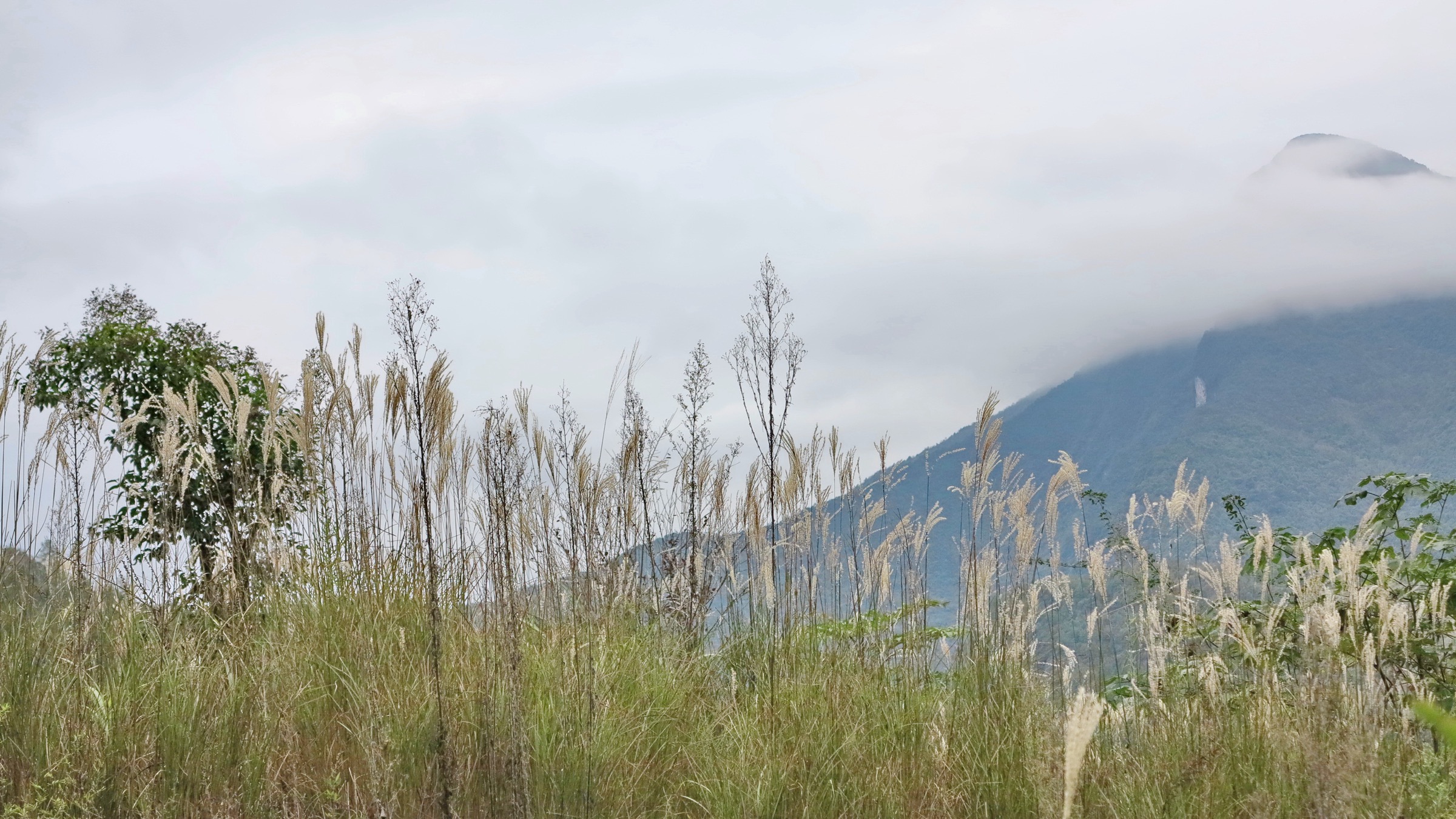
The Dalou Mountains (大娄山, Dàlóu Shān) are a roughly 300 km arc-shaped fold belt of limestone and sandstone ridges running northeast–southwest along the northern margin of the Yunnan–Guizhou Plateau. They form the morphological wall between the Sichuan Basin and Chongqing Municipality to the north and the central Guizhou plateau to the south, acting as the hydrological watershed between the Chishui River system (draining north into the Yangtze at Hejiang) and the Wujiang system (draining east into the Yangtze near Fuling). Most ridge crests sit between 1,500 m and 2,000 m, with the highest summit — Fengjiling (凤吉岭) on Mount Jinfo — reaching 2,238 m and forming the range’s only true table-mountain massif. The anticlines tend to be broad and gentle, the synclines narrow and steep, producing the alternating ridge-and-valley topography that gives the range its name (dàlóu, literally “great storeyed”).
This catalogue covers only the Dalou massif itself, on the Guizhou–Chongqing border: Nanchuan and Qijiang districts in southern Chongqing (most of the Mount Jinfo karst tableland), and Huichuan, Bozhou, Honghuagang and Tongzi divisions of Zunyi prefecture in northern Guizhou (Loushan Pass, the Hailongtun fortress site, the upper Wujiang gorges). The western edge of the range descends into Chishui City, where the sandstone Danxia landform of the Chishui Danxia inscription (part of the China Danxia UNESCO Natural site, 2010) abuts the Dalou foothills around Sidonggou, Foguang Rock and the Bamboo Sea — geologically distinct from the limestone karst of the central Dalou but contiguous with the same massif. Two adjacent regions — the central Guizhou Miao Ridge zone around Fanjingshan and the Western Hills around Kunming — are covered in parallel articles and are out of scope here.
The protected-area network is unusually rich. Mount Jinfo (金佛山) was inscribed in 2014 as the third instalment of the South China Karst UNESCO World Natural Heritage site, alongside Guilin, Shibing and Huanjiang karst, on the basis of its “first table mountain in the world” karst geomorphology, primary subalpine forest and endemic flora. Chishui Danxia, on the western Dalou foothills, was inscribed in 2010 under the China Danxia serial nomination. Hailongtun (海龙屯), the ruined Yang-family tusi castle above Zunyi, was inscribed in 2015 as one of three Chinese Tusi Sites. Loushan Pass (娄山关) and the wider Zunyi battlefield circuit — where the Red Army won its first major victory of the Long March in February 1935 and where the Politburo’s Zunyi Conference reorganised CCP leadership immediately afterwards — is one of China’s most heavily promoted “red tourism” destinations. The framework means that almost all hiking in the region happens inside a ticketed scenic area, normally combined with an internal sightseeing shuttle and, on Mount Jinfo, a cableway.
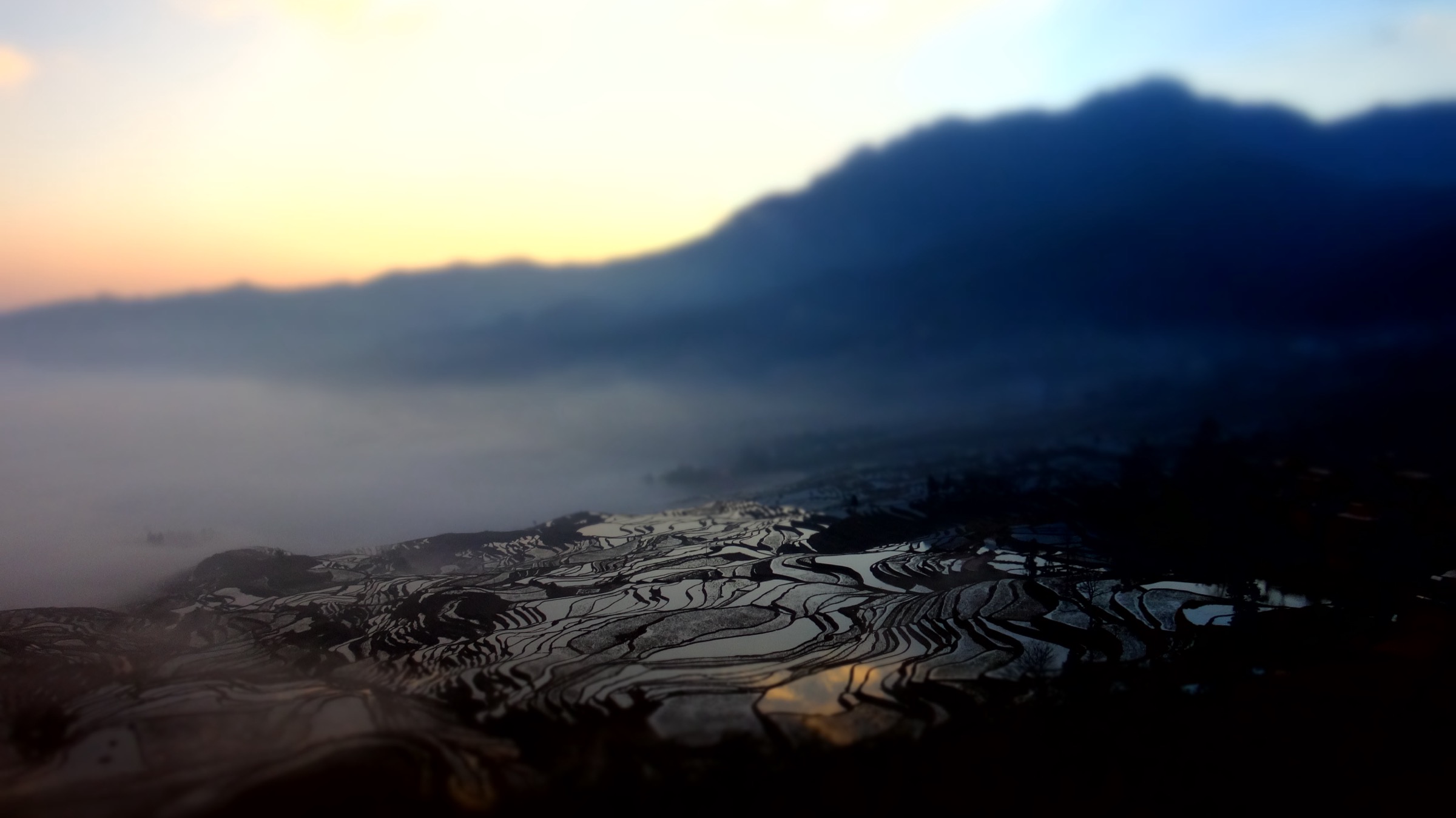
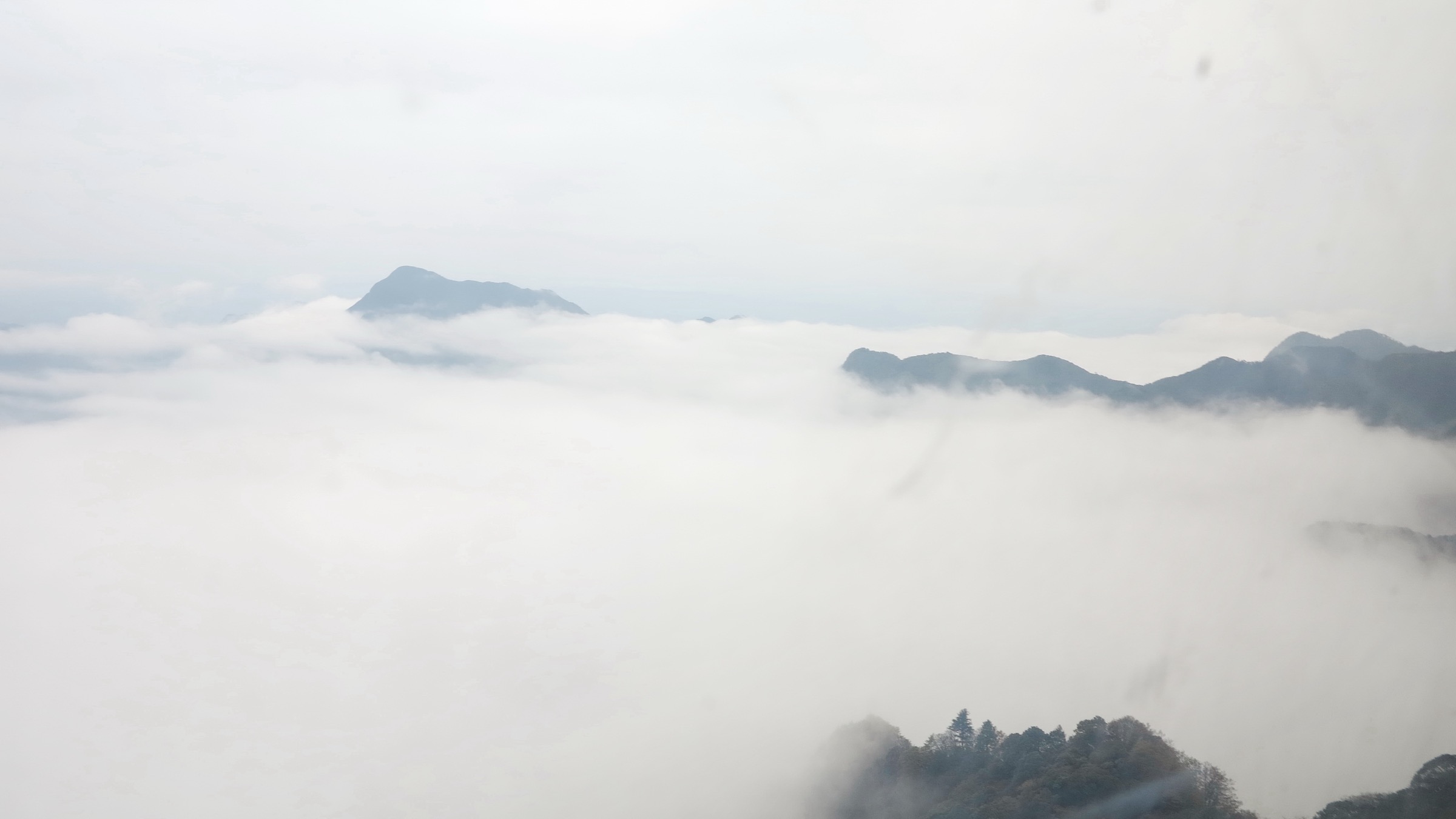
Climate is humid subtropical, strongly influenced by the East Asian monsoon and by the cool-summer “sea of clouds” microclimate that builds against the north face of the Dalou wall. Annual rainfall is high at 1,000–1,400 mm, with most precipitation between May and September. The cool-summer effect makes Tongzi and Nanchuan a long-established summer-retreat (避暑) belt for Chongqing residents, with average August daytime temperatures of roughly 20–22 °C on the upper Jinfo plateau. Best hiking conditions are April–early June (azalea bloom on Jinfo, mild dry weather) and late September–October (clear post-monsoon skies, autumn colour on the higher karst). Winter brings snow and ice to the Jinfo summit and Loushan Pass; Jinfo operates a small ski area between mid-December and February and the cliff plank road is regularly closed in icy conditions. Real-name advance reservation through the Guizhou or Chongqing scenic-area mini-programs (most via WeChat) is now standard for all five sites covered here and should be checked before travel.
A practical note on documentation: although Dalou has stronger English-language coverage than the more remote northern Chinese ranges, no GPX or KML files have been located for any of the five entries, OSM coverage of the internal scenic-area paths is partial at best, and authoritative route statistics from park operators are not consistently published. Distance and elevation figures here are cross-checked best estimates rather than measured route data, and verification labels are stated honestly in each section.
Selection rationale
The five hikes span the geological, cultural and protected-area diversity of the Dalou massif while staying within a single-day walking format. Mount Jinfo’s West Slope full circuit is the canonical Dalou hike: the highest peak in the range, the only table-mountain karst summit, the headline cliff-plank traverse, and the UNESCO South China Karst inscription. Loushan Pass adds the main historical-pass walk on the watershed crest, with the Xifeng Platform high point and the dense Long March memorial complex. Hailongtun is the UNESCO Tusi Sites cultural-heritage walk, climbing the famous 36-step “Heavenly Ladder” through the eastern gates to the New Royal Palace ruins. Chishui Sidonggou represents the gorge-and-waterfall walk on the Chishui Danxia western foothills, on the China Danxia UNESCO inscription. Mount Jinfo’s Azure Stream Valley (Bitan Yougu) is a complementary short cool-water gorge walk inside the same massif but separated from the summit hike, offering a moderate-grade option for less ambitious days or hot summer afternoons.
A Mount Jinfo Old Buddha Cave (古佛洞) sub-walk was considered but rejected as a stand-alone hike because it is normally encountered as a short interpolation on the summit circuit. The Chishui Bamboo Sea National Forest Park and Foguang Rock waterfall were considered but rejected to avoid over-weighting the Chishui sub-area at the expense of the central Dalou. The Daloushan and Liangfengya forest parks around Tongzi were considered but rejected as their walking infrastructure consists essentially of short cool-air boardwalks oriented to summer-retreat tourism rather than serious day-hiking.
Summary
| # | Hike | Country | Route type | Distance | Gain | Max elevation | Difficulty |
|---|---|---|---|---|---|---|---|
| 1 | Mount Jinfo West Slope full circuit (Cliff Plank Road and summit) | China | Loop with cableway option | ~11 km | ~600–900 m | ~2,238 m | Moderate–hard |
| 2 | Loushan Pass historical loop (Xifeng Platform) | China | Loop with internal shuttle | ~4–6 km | ~250–350 m | ~1,779 m | Moderate |
| 3 | Hailongtun Tusi Fortress ascent | China | Out-and-back with plateau loop | ~6–8 km | ~400 m | ~1,354 m | Moderate–hard |
| 4 | Chishui Sidonggou Four Waterfalls boardwalk | China | Out-and-back | ~8 km | <200 m | ~600 m | Easy |
| 5 | Mount Jinfo Azure Stream Valley (Bitan Yougu) | China | Out-and-back gorge boardwalk | ~7 km | <250 m | ~1,400 m | Easy |
1. Mount Jinfo West Slope full circuit (Cliff Plank Road and summit)
Snapshot
Itinerary
The West Slope (西坡) gate is the preferred entry for hikers because it gives the most direct access to the cliff plank traverse and the high karst plateau. From the gate, most walkers take a sightseeing bus the roughly 5 km up the entrance road to the lower West Slope cableway station, from where the West Slope ropeway lifts walkers onto the plateau rim at around 1,900 m in about fifteen minutes. Walking the full road grade is possible but adds substantial elevation gain and time, and is not normally counted in the cited 11 km Wanbu loop.
From the upper West Slope cableway station, the standard summit loop runs anticlockwise. The Sun-toward Golden Turtle Trail (金龟朝阳步道, Jīnguī Cháoyáng Bùdào) is a graded boardwalk along the south-facing rim, with views across the deep karst valley to the south, leading onto the Cliff Plank Road (绝壁栈道) itself. The plank section is cited at 3.0–3.5 km, of which roughly 1.5 km is cantilevered onto a near-vertical limestone cliff some 40–50 m above the talus slope below. The boardwalk is continuous, with handrails on the exposed side and a roof of cliff overhang above. It passes the Sea of Arrow Bamboo (箭林竹海), Swallow Cave (燕子洞) and the Ecological Stone Forest (生态石林), and links the West Slope ropeway head to the Northern Slope ropeway head at the opposite end of the karst rim.
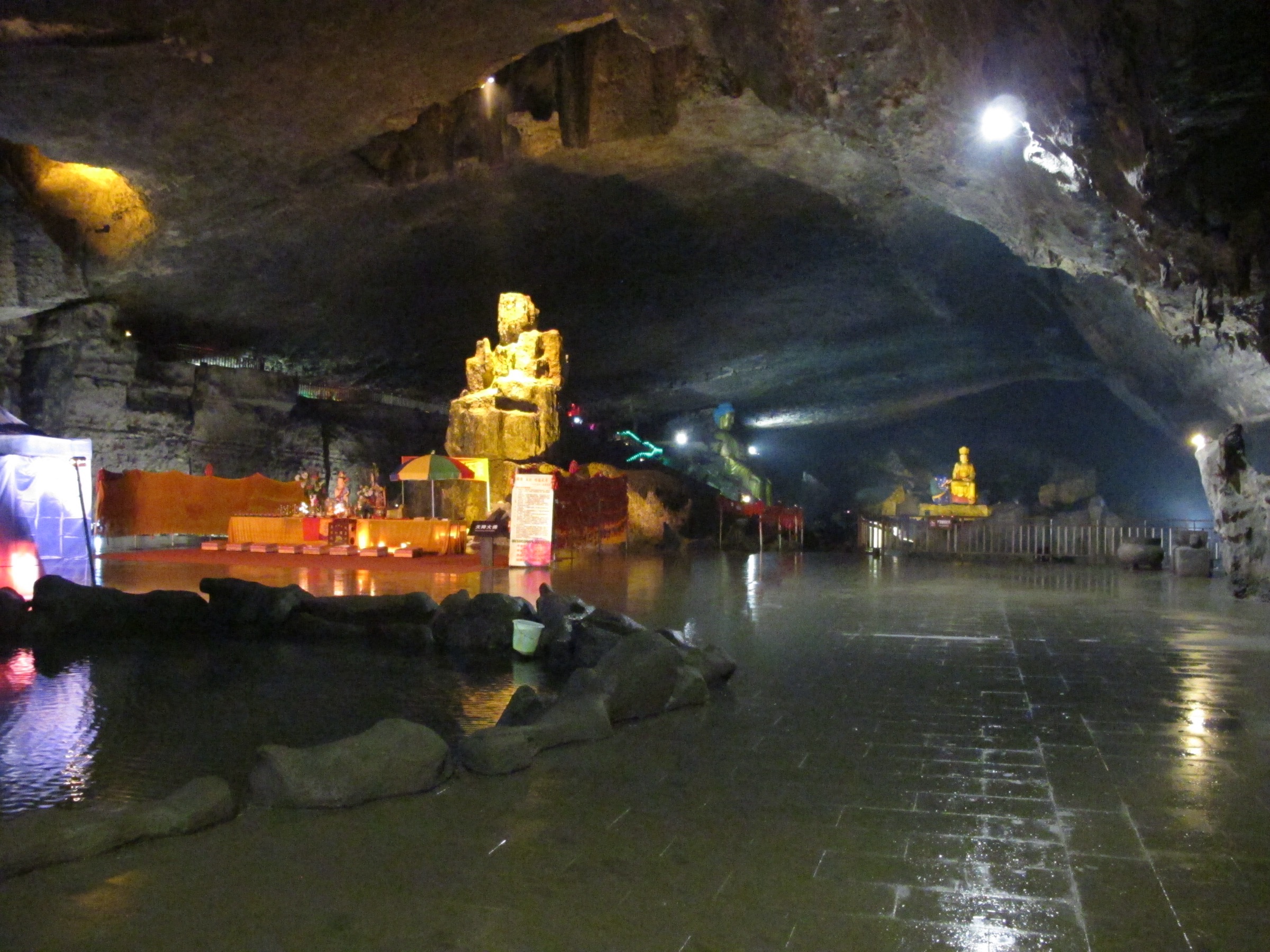
Beyond the plank road the route climbs gently onto the upper plateau, threading the Buddha-Worship Terrace (拜佛台, the cited highest-elevation Buddha viewpoint) and continuing through the Wanbu (萬步, “ten thousand step”) stairway and karst-pavement section to the summit at Fengjiling (2,238 m). The return is normally a descent on the Wanbu staircase to the West Slope cableway station, closing the loop. Variants include descending instead on the North Slope cableway (北坡索道) with a paid shuttle back to the West Slope, or extending the loop with a side trip to the Old Buddha Cave (古佛洞), a horizontal limestone karst cavity with installed Buddhist statuary that adds roughly an hour to the day.
Why it is essential
Mount Jinfo is the highest peak in the Dalou Mountains and the only true karst table-mountain in the range, with a near-vertical cliff rim of around 25 km circumference encircling a high karst plateau of roughly 1,300 hectares. Its inclusion in the 2014 phase II of the South China Karst UNESCO inscription recognises this rare combination of subtropical-humid karst tableland morphology, dense primary subalpine forest (including ancient Cathaya argyrophylla and Davidia involucrata stands) and the exceptional cliff-plank infrastructure that makes the rim walkable. As a single day-hike combining a UNESCO summit, a major cliff-edge plank traverse and a high karst plateau, the West Slope full circuit is the natural anchor of any Dalou catalogue.
Equipment
- Sturdy boots; trekking poles useful on the stair descents
- Weatherproof shell — plateau weather changes faster than the valley below
- Warm layer; the plateau runs 8–10 °C colder than Nanchuan town in any season
- Water (refill points exist at the ropeway stations but are seasonal); food; sun protection
- Headtorch if the loop pushes into late afternoon — the cliff plank section is shaded and gets dark earlier than the rim trails
- Microspikes if attempting the cliff plank in December–February; the boardwalk is regularly closed in icy conditions but partial reopenings do occur
- Cash or WeChat Pay for ticket, mandatory shuttle and cable car — combined ticket-shuttle-cableway is in the order of 200–300 CNY at recent prices; foreign card acceptance is unreliable
- Real-name advance reservation via the Mount Jinfo official WeChat mini-program
Hazards and notes
- Cliff-plank exposure is the main physical hazard: drops of 40–50 m to the talus slope below for much of the 1.5 km cantilevered section.
- The walkway is closed in high wind, lightning and icy conditions without prior notice.
- Crowd pressure on weekends and Chinese public holidays can be very heavy.
- Lightning storms cross the plateau quickly in summer and the upper karst pavement offers no natural shelter.
- Park-internal shuttles and cableways have last-departure times in the late afternoon (commonly 17:00 for the lower ropeway); missing the last cableway can force an unplanned descent on the Wanbu staircase.
- Drone use is restricted across the scenic area; smoking is prohibited park-wide.
Routes and maps
| Source | URL |
|---|---|
| China Discovery — Jinfo Mountain Chongqing | chinadiscovery.com |
| WelcomeCQ — Nanchuan Jinfo Mountain | welcomecq.cn |
| OpenStreetMap — Mount Jinfo area | openstreetmap.org |
| UNESCO — South China Karst | whc.unesco.org |
External links
- Wild Great Wall — Jinfo Mountain travel guide
- Silk Road Travel — Jinfo Mountain: UNESCO Karst Peaks & Buddhist Heritage
- Travel China Guide — Jinfo Mountain, Nanchuan District
2. Loushan Pass historical loop (Xifeng Platform)
Snapshot
Itinerary
The Loushan Pass scenic area covers a long ridge segment on the watershed between Tongzi to the north and Huichuan to the south — the strategic crossing point between the Sichuan Basin and the central Guizhou plateau that has given the pass its military significance since at least the Yuan dynasty. Modern visitors enter through the visitor centre at Banqiao Town on the south side of the ridge, where ticketing (cited as free admission with real-name reservation via the Guizhou 一码游 mini-program; the internal shuttle is separately priced) and the mandatory internal shuttle are handled.
The shuttle climbs the ridge road to the upper drop-off near the Long March Battlefield Site (红军战斗遗址), where the standard walking circuit begins. The route runs anticlockwise, first along the cliff-carving section (娄山关摩崖石刻), past the 25 m × 13.55 m Mao Zedong Poetry Monument carrying his February 1935 ci poem Yi Qin’e — Loushan Guan (“Remembering Qin’e — Loushan Pass”) in his own calligraphy. From here the route climbs the Hundred-Battles Staircase (百战梯), a 365-step stone stairway commemorating the regiments that fought the second capture of the pass on 25 February 1935. The staircase delivers walkers onto the upper ridge boardwalk, which runs roughly 1 km north-northwest along the watershed to the Xifeng Platform (西风台), the high point of the scenic area at a cited 1,779 m. On a clear day the panorama runs north across the Sichuan Basin foothills and south across the upper Wujiang headwaters; the platform is also the standard sunrise and sea-of-clouds viewpoint for the wider Dalou range.
The return route descends a parallel boardwalk on the eastern flank of the ridge, passing the Red Army Battle Memorial Hall, the Changkong Bridge (长空桥, a steel pedestrian span across the pass cleft) and the small interpretive plaza at the saddle itself before re-joining the shuttle road back to the visitor centre. The circuit is normally walked as a single loop of approximately 4–6 km, with the option to extend onto the surrounding Daloushan ridge trails for stronger walkers — though much of the wider ridge is on unmarked agricultural and forestry paths and not part of the formal scenic-area network.
Why it is essential
Loushan Pass is the single defining historical site of the Dalou Mountains and one of the most heavily promoted Long March memorial complexes in China. The Red Army’s second capture of the pass on 25 February 1935 is conventionally treated as the Long March’s first major battlefield victory, won immediately after the Politburo’s Zunyi Conference reorganisation of CCP leadership in mid-January. The walking circuit combines this historical density (battlefield site, Mao calligraphy stele, memorial hall) with a genuine high-ridge crossing on the main Dalou watershed — the only walk in this catalogue where a major panoramic ridge top, a strategic pass and a national-priority cultural-heritage complex coincide on the same itinerary.
Equipment
- Trail shoes or light boots; trekking poles optional
- Weatherproof shell; warm layer (the ridge runs 5–8 °C colder than Zunyi)
- Water (refill at the visitor centre only); food; sun protection
- Microspikes between late December and February in icy conditions; the upper boardwalk and Hundred-Battles Staircase can freeze
- Cash or WeChat Pay for the mandatory internal shuttle
- Real-name advance reservation via the Guizhou 一码游 WeChat mini-program
- Headtorch if remaining for the sunrise or sea-of-clouds shift; the shuttle does not run before scenic-area opening (cited 09:00)
Hazards and notes
- The principal physical challenge is the Hundred-Battles Staircase: long but graded.
- The upper boardwalk passes some exposed sections with sheer drops on the north side; railings are continuous.
- Crowd pressure can be intense on Chinese public holidays and on Long March anniversaries (25 February, 16 October and 1 October).
- Exhibition halls inside the scenic area are cited as closed on Mondays.
- Drone use is restricted across the scenic area; smoking is prohibited park-wide and fire-risk closures occur in dry winter conditions.
Routes and maps
| Source | URL |
|---|---|
| Chinatripedia — Loushan Pass ticket, opening hours and highlights | chinatripedia.com |
| China Dragon Tours — Loushan Pass in Zunyi | chinadragontours.com |
| OpenStreetMap — Loushan Pass | openstreetmap.org |
| Trip.com — Loushan Pass tickets | trip.com |
External links
- Wikipedia — Loushan Pass
- Historical Photographs of China — Loushan Pass, near Wutai
- Wikimedia Commons — Category:Tongzi County
3. Hailongtun Tusi Fortress ascent
Snapshot
Itinerary
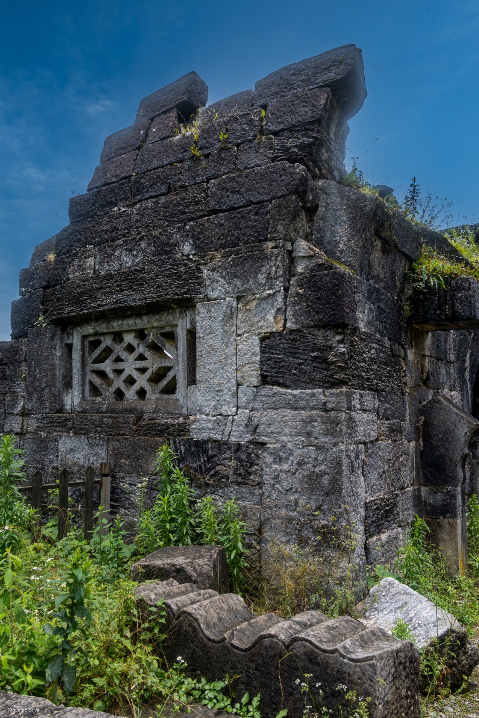
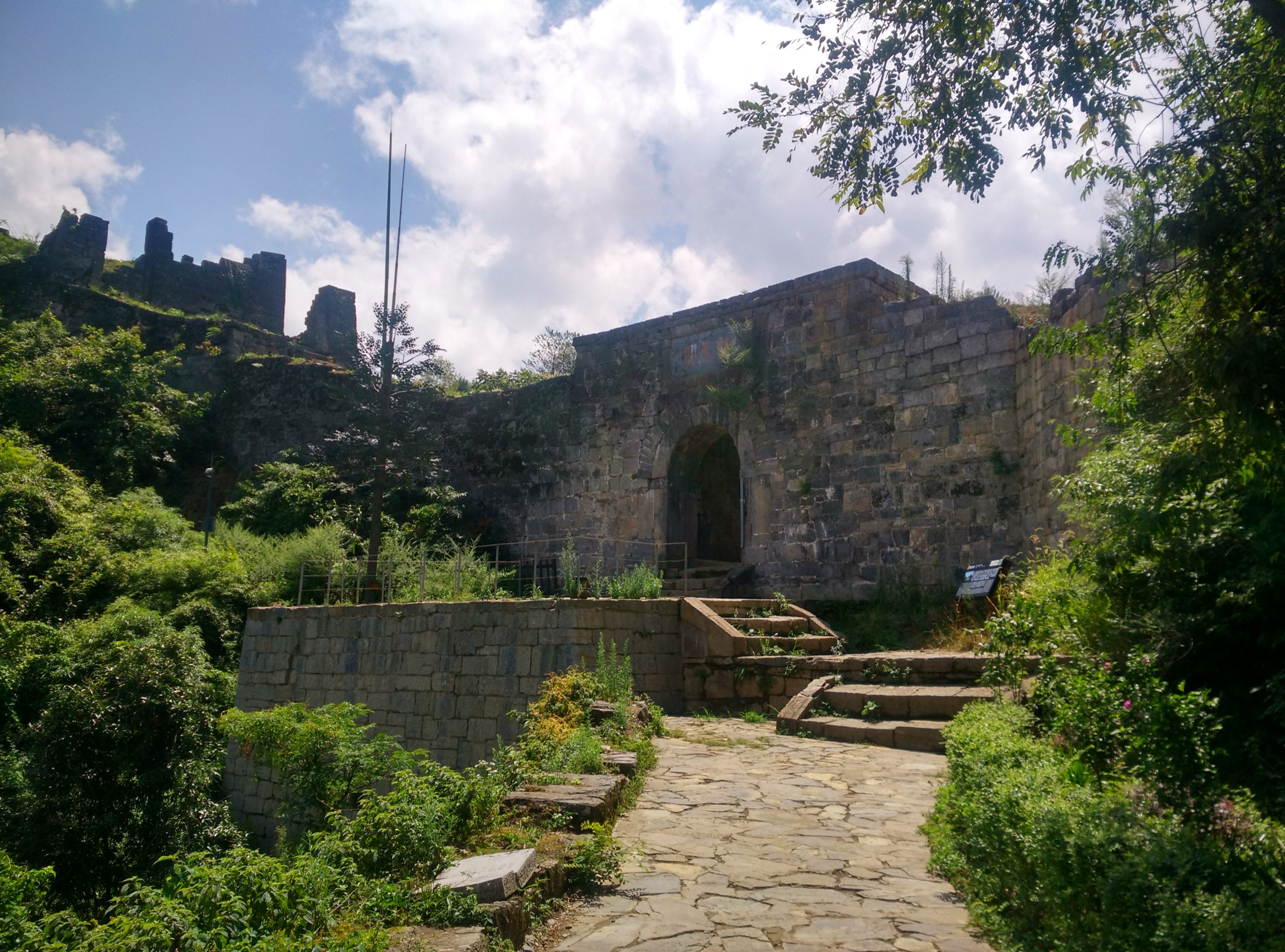
The Hailongtun (海龙屯) fortress occupies a 1.59 km² flat-topped plateau on Longyan Mountain, surrounded on all four sides by Danxia and limestone cliffs and accessible only along a single ridge spine that the Yang-family tusi rulers blocked with a 6 km wall and nine fortified gates between the Southern Song and the Ming. The standard visit climbs the eastern gate sequence and crosses the plateau to the New Royal Palace (新王宫) archaeological site before returning by the same route.
From the visitor centre at Gaoping, the internal shuttle delivers walkers to the lower trailhead at the base of the cliff, at around 911 m. The walking route climbs roughly 400 m on a stone stairway carved into the eastern ridge, passing first the Tongzhu Pass (铜柱关, “Bronze Pillar Pass”) and Tiezhu Pass (铁柱关, “Iron Pillar Pass”) at the lower defensive line. Beyond Tiezhu the route reaches the famous 36-step “Heavenly Ladder” (三十六步天梯), a stone stairway cited at 51.5 m long with a 30° incline and individual step heights reaching 0.5 m — the cruxal climb of the visit, which most visitors negotiate on hands and feet. The Heavenly Ladder delivers walkers to Feihu Pass (飞虎关, “Flying Tiger Pass”), the most defensible gate in the eastern sequence and the standard photographic stop.
Above Feihu the route eases. The path continues through Feilong Pass (飞龙关, “Flying Dragon Pass”) and Chaotian Pass (朝天关, “Heaven-Facing Pass”) onto the summit plateau, where the New Royal Palace ruins — excavated since 2012 and now interpreted with raised boardwalks over the foundations — occupy the central depression. Stronger walkers can extend the loop along the plateau rim to take in the Feifeng Pass (飞凤关) and the western gates of the fortress, where the wall is less restored and the cliff exposure is more striking; this western loop adds 1–2 km and is on unmaintained tracks for part of its length. Most visitors return by reversing the eastern stairway down to the shuttle drop-off.
Why it is essential
Hailongtun is the only well-preserved feudal castle site in southwest China and one of the three components of the UNESCO Tusi Sites inscription (2015), alongside Laosicheng in Hunan and Tangya in Hubei. It uniquely combines a major archaeological cultural-heritage site with a genuinely strenuous walking ascent: the climb to Feihu Pass is the most physically demanding short ascent in this catalogue and rewards walkers with a rare experience of late-Song-to-Ming military architecture in its original cliff-top setting. The site’s significance was sealed by the 1600 Ming–Bozhou War, when the imperial pacification under the Wanli emperor took 114 days to reduce the fortress and ended the four-century Yang-family chiefdom of Bozhou — a campaign documented in the Pingbo Quanshu and now treated as a foundational case study of the tusi system and its imperial replacement.
Equipment
- Sturdy boots with grippy soles (the stone steps are slippery); trekking poles useful on descent
- Weatherproof shell; water (no reliable refill above the base shuttle drop-off); food; sun protection
- Gloves useful for the hand-and-foot scramble on the 36-step Heavenly Ladder
- Hat and high-SPF sunscreen in midsummer — the stairway is south-facing and largely treeless
- Cash or WeChat Pay for ticket (cited at ~95 CNY adult) and shuttle (separate)
- Real-name advance reservation through the Guizhou scenic-area WeChat mini-program
- The 36-step Heavenly Ladder is unsuitable for walkers with significant knee, hip or balance limitations; the alternative is to turn back at Tiezhu Pass
Hazards and notes
- The Heavenly Ladder is the principal physical hazard: near-vertical with irregular and tall step heights, no continuous handrail on the inner edge, and limited shelter from sun and rain.
- The stones are slippery after rain.
- The plateau rim has unprotected cliff edges in several sections; staying on the marked boardwalks is essential, particularly on the western loop where the railings end.
- Lightning storms cross the plateau quickly in summer and the cliff-top offers no shelter.
- The site is heavily visited on Chinese public holidays and the shuttle can have long queues.
- Some sections of the western archaeological zones are periodically closed for excavation.
Routes and maps
| Source | URL |
|---|---|
| Travel China Guide — Site of Hailongtun Tusi Fortress, Zunyi | travelchinaguide.com |
| UNESCO — Tusi Sites | whc.unesco.org |
| OpenStreetMap — Hailongtun area | openstreetmap.org |
| Wikimedia Commons — Category:Hailongtun | commons.wikimedia.org |
External links
- Wikipedia — Hailongtun
- The World of Chinese — Fort Besieged
- People’s Daily Online — Aerial view of Hailongtun Fortress Site
4. Chishui Sidonggou Four Waterfalls boardwalk
Snapshot
Itinerary
The Sidonggou Scenic Area (四洞沟, literally “Four-Cave Gorge”) occupies a 4 km section of stream within the sandstone Danxia landform of the western Dalou foothills, where the Chishui river’s tributaries have cut a narrow gorge through the Cretaceous red beds. The hike follows a single boardwalk on the south bank of the stream, ascending gently through subtropical broadleaf forest with extensive tree-fern and bamboo understory.
From the lower gate at Datong Town, the boardwalk runs upstream past four named waterfalls spaced at roughly equal intervals along the gorge: Shuiliandong Waterfall (水帘洞瀑布, “Water Curtain Cave”, first fall, cited at ~31 m high and ~37 m wide), Yuelang Tan Waterfall (月郎潭瀑布, “Moon Pool”, second fall, ~10 m by ~42 m), Feiwaya Waterfall (飞蛙崖瀑布, “Flying Frog Cliff”, third fall, ~26 m by ~43 m) and Bailong Tan Waterfall (白龙潭瀑布, “White Dragon Pool”, fourth fall, the largest at ~60 m high and ~23 m wide). Each waterfall has a viewing platform and the second and third falls have short side-staircases to mid-cascade and base viewpoints. The boardwalk is largely flat, with short stair sections at each fall, and is graded for general public use.
The standard pattern is to walk the full 4 km to the fourth fall and return by the same route. A shuttle road on the opposite bank operates for visitors who do not want to walk both directions; this is the common pattern for tour groups. The full round trip on foot is approximately 8 km and takes around three hours at a relaxed pace; a leisurely stop at each waterfall with photography time extends the visit to three or four hours.
Why it is essential
Sidonggou is the standard introduction to the Chishui Danxia World Heritage area, which forms the western foothill edge of the Dalou Mountains and was inscribed in 2010 as part of the China Danxia serial Natural Heritage Site. The boardwalk is the most accessible major walking circuit in the inscribed zone; it combines a representative Danxia gorge cross-section, four substantial waterfalls and a particularly dense stand of tree fern (Alsophila spinulosa, listed as a national first-class protected plant in China) that the Chishui area is internationally known for. As the only walk in this catalogue that sits on the sandstone Danxia rather than the central limestone karst, it is the natural complement to Mount Jinfo and rounds out the geological coverage of the Dalou massif.
Equipment
- Trail shoes (boardwalk planks can be slippery after rain)
- Weatherproof shell; light warm layer (the gorge is shaded and runs noticeably cooler than Chishui town); water; food; sun protection
- Tick-bite prevention (long trousers, light insect repellent); the dense fern understory holds ticks in late spring and summer
- Mosquito repellent in July–August
- Cash or WeChat Pay for ticket (~85–100 CNY range at recent prices) and optional return shuttle
- Real-name advance reservation via the Chishui Danxia scenic-area WeChat mini-program where required
- Waterproof camera cover near the larger waterfalls; spray reaches the boardwalk in high-flow conditions
Hazards and notes
- Slippery boardwalk after rain; spray zones near the third and fourth waterfalls retain moisture on planking and stair sections.
- The gorge can flood briefly after intense summer storms; closures are imposed on the lower boardwalk in such conditions.
- Snakes are present and seen occasionally on the boardwalk margin in summer — keep to the centre of the planking and avoid stepping into vegetation.
- Drone use is restricted across the scenic area; smoking is prohibited and red-flag fire days can close the gate.
- Last-entry times are seasonal and should be confirmed with the scenic-area operator.
Routes and maps
| Source | URL |
|---|---|
| Top China Travel — Chishui Danxia Landform Scenic Area | topchinatravel.com |
| Silk Road Travel — Chishui Danxia Tourism Area | silkroadtravel.com |
| Travel China Guide — Zunyi Chishui Scenic Spot | travelchinaguide.com |
| UNESCO — China Danxia | whc.unesco.org |
External links
- Tripadvisor — Sidonggou Waterfall
- Lonely Planet — Sidonggou Gully
- China Wonders Guide — Explore Chishui Danxia
5. Mount Jinfo Azure Stream Valley (Bitan Yougu)
Snapshot
Itinerary
Azure Stream Valley (Bitan Yougu, 碧潭幽谷) is the first major attraction inside the Mount Jinfo West Slope gate and the most-walked short circuit in the scenic area for visitors who do not attempt the full summit hike. From the gate, the boardwalk descends slightly to the gorge floor and then ascends gently along the south side of a clear karst-spring-fed stream that drains the west flank of the Jinfo plateau. The valley is forested almost entirely in broadleaf evergreen and bamboo, with several small pools and a sequence of low cascades. The boardwalk crosses the stream on five timber bridges and includes two short staircase sections where the route bypasses minor rapids.
The standard walk runs roughly 3.5 km one way to the upper gorge, terminating near the lower West Slope cableway station. Most walkers return by the same boardwalk, completing the round trip in one and a half to two and a half hours. An alternative is to continue from the upper end on the cableway to join the summit circuit covered in hike 1, turning the day into a hybrid hike-and-cableway combination. The valley is also the standard “cool retreat” walk for Chongqing summer visitors and is reliably 5–8 °C cooler than the city below.
Why it is essential
The Azure Stream Valley occupies a different sub-environment from the high karst plateau covered by hike 1: a humid, shaded subtropical gorge with karst-spring hydrology, rich understory and the cool-summer microclimate that has made Mount Jinfo a regional summer-retreat destination since the early twentieth century. As an essential hike it earns its place by offering an accessible, family-friendly circuit on the headline UNESCO mountain without requiring the cliff-plank exposure or stair-climbing commitment of the summit loop, and by representing the cool-gorge habitat that is otherwise unrepresented in this catalogue.
Equipment
- Trail shoes; weatherproof shell (the gorge gathers afternoon rain); light warm layer
- Water; food; sun protection (mostly shaded, but the upper end is more exposed)
- Insect repellent in summer; the wet boardwalk margins hold mosquitoes from June to early September
- Cash or WeChat Pay for the West Slope gate ticket (same ticket structure as hike 1)
- Real-name advance reservation through the Mount Jinfo official WeChat mini-program
Hazards and notes
- Boardwalk planks and the two short stair sections can be slippery after rain.
- The stream is shallow but cold; swimming is prohibited.
- The valley closes alongside the rest of the West Slope on red-flag fire-risk days and during occasional structural inspections.
- Last entry and last cableway times are seasonal and should be confirmed at the gate.
Routes and maps
| Source | URL |
|---|---|
| Wild Great Wall — Jinfo Mountain travel guide | wildgreatwall.com |
| Wendy Wei Tours — Jinfo Mountain | wendyweitours.com |
| OpenStreetMap — Mount Jinfo West Slope | openstreetmap.org |
| Trip.com — Gold Buddha Mountain tickets | trip.com |
External links
- China Discovery — Jinfo Mountain Chongqing
- Top Asia Tour — Jinfo Mountain: Location, Opening Hours and Travel Info
- Silk Road Travel — Jinfo Mountain
External links
| Source | URL |
|---|---|
| UNESCO — South China Karst (Mount Jinfo, phase II) | whc.unesco.org |
| UNESCO — China Danxia (Chishui Danxia) | whc.unesco.org |
| UNESCO — Tusi Sites (Hailongtun) | whc.unesco.org |
| Britannica — Dalou Mountains | britannica.com |
| Wikipedia — Dalou Mountains | en.wikipedia.org |
| Wikipedia — Loushan Pass | en.wikipedia.org |
| Wikipedia — Hailongtun | en.wikipedia.org |
| Zunyi municipal government tourism portal | zunyi.gov.cn |
| WelcomeCQ — Chongqing Nanchuan District | welcomecq.cn |
| PeakVisor — Guizhou Mountains | peakvisor.com |
| Wikimedia Commons — Category:Nanchuan District | commons.wikimedia.org |
| Wikimedia Commons — Category:Hailongtun | commons.wikimedia.org |
| Wikimedia Commons — Category:Tongzi County | commons.wikimedia.org |
| OpenStreetMap (ODbL 1.0) | openstreetmap.org |