Regional overview
The Ailao Mountains (哀牢山 / Āiláo Shān) form a narrow, fault-bounded range that runs roughly 400–500 km north-west to south-east along the western bank of the Red River (红河 / Hónghé, called Yuanjiang / 元江 in its upper Chinese reach). The range begins near Chuxiong (楚雄) in the north and extends through Jingdong (景东), Zhenyuan (镇沅), Xinping (新平 / Xīnpíng), Mojiang (墨江), Yuanyang (元阳 / Yuányáng) and Lvchun (绿春) to the Vietnamese border. It separates the higher western Yunnan plateau and the upper Mekong (Lancang / 澜沧江) catchment from the lower Honghe basin to the east. The crest holds 2,500–3,000 m for most of its length, with the highest measured summit at roughly 3,166 m on Damoyan (大磨岩) in Shuitang town, Xinping County.
Geologically, the range is the surface expression of the Ailao Shan–Red River shear zone, one of the most studied continental strike-slip systems in Asia. The narrow belt of high-grade gneisses making up its spine, together with the Diancang Shan to the north-west and the Day Nui Con Voi massif in northern Vietnam, accommodated several hundred kilometres of left-lateral motion during the Oligo-Miocene as the Indochina block was extruded south-eastwards by the India–Asia collision. The tectonic story is why the range is so linear, so steep on both flanks, and why it juxtaposes very different lithologies and soils on its eastern and western slopes — a contrast that shows up in vegetation patterns visible to walkers.
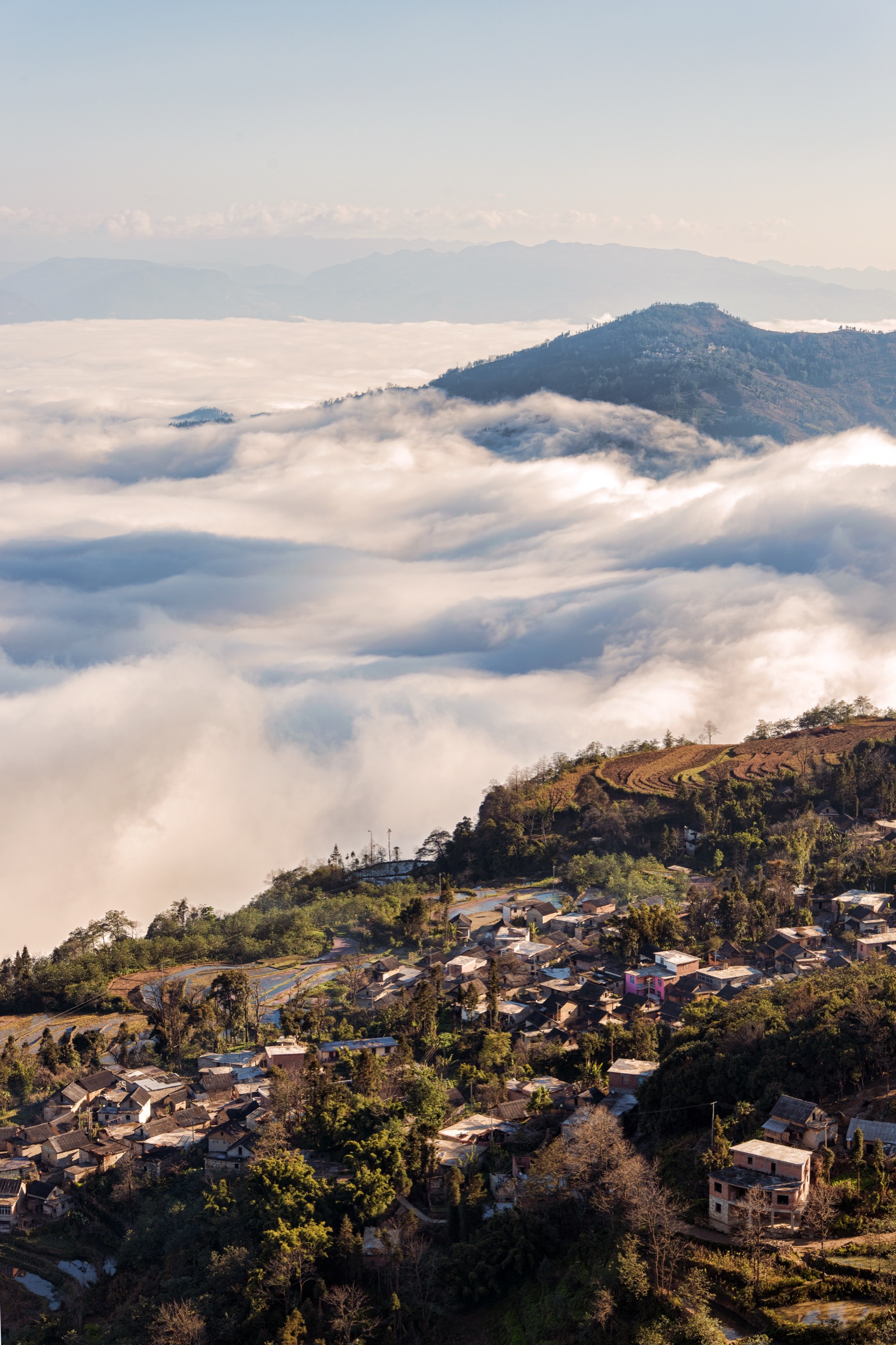
Ecologically, Ailao Shan holds the largest essentially intact tract of subtropical mid-montane moist evergreen broadleaf forest left in China. The Ailao Shan National Nature Reserve, established in 1988 and covering approximately 677 km², is dominated above ~2,200 m by stone-oak (Lithocarpus) forest, with rhododendron, Schima and Castanopsis lower down. The Kunming Institute of Botany / Chinese Academy of Sciences operates the long-running Ailaoshan Station for Subtropical Forest Ecosystem Studies at Xujiaba (徐家坝, 2,480 m), the principal scientific access point for the northern reserve. Roughly 1,500 vascular plant and 800+ vertebrate species have been recorded, including western black-crested gibbon (Nomascus concolor) and the very rare green peafowl (Pavo muticus).
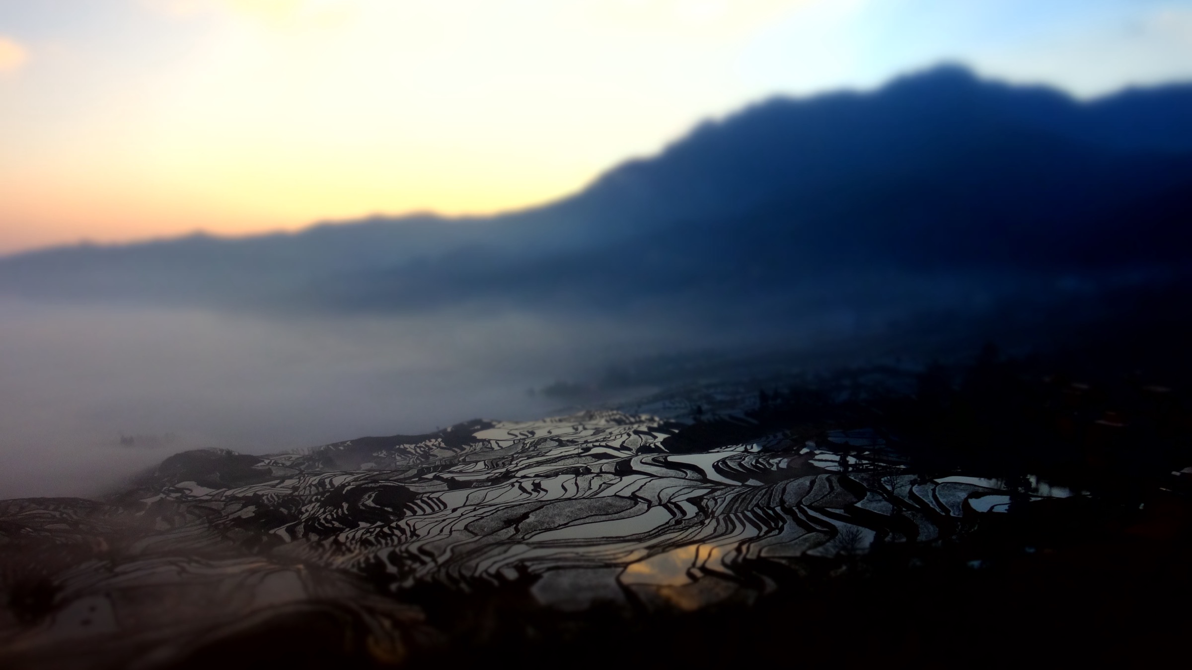
Culturally, the Ailao flank is the homeland of the Hani (哈尼族) people, with substantial Yi (彝族) populations on the upper slopes and Dai (傣族) settlements along the hot lower valleys. On the south-facing slopes between roughly 600 m and 2,000 m, the Hani have, over approximately 1,300 years, terraced the mountainsides into the cascading rice landscape inscribed in 2013 as the UNESCO World Heritage Site “Cultural Landscape of Honghe Hani Rice Terraces” (ref. 1111). The 16,603 ha core area spans Yuanyang, Honghe, Lvchun and Jinping counties. The classic Hani agro-ecosystem stacks four ecological zones vertically — cloud forest at the ridge, village in the warm belt below, terraces below the village, and the Honghe at the foot — with a sophisticated gravity-fed water network distributing snowmelt and rainfall from forest to paddy. Walking here is as much a cultural traverse as a mountain outing.
A critical safety note applies to the reserve interior. In November 2021, four geological surveyors from the Kunming Natural Resources Comprehensive Survey Centre died of hypothermia-induced cardiogenic shock inside the Ailao Shan core zone after a sudden weather change. The incident triggered nationwide press attention, tighter access rules, and a renewed public message that the core reserve is off-limits to unguided travel. Since the late-2024 surge of social-media-driven “wilderness” tourism into Ailao Shan, the Xinping Yi & Dai Autonomous County government and Yuxi authorities have publicly warned that entry into the protected core zone is prohibited, with fines from 100 RMB up to 5,000 RMB for unauthorised entry, and that even the open buffer-zone trails should be walked with a registered local guide. Compasses are reportedly unreliable in parts of the range due to magnetic anomalies, mobile signal is absent inside the forest, and fog with rapid temperature drops is a year-round risk above 2,500 m.
Selection rationale
Five hikes span the full character of this elongate range: two short, photogenic terrace walks in the UNESCO core in Yuanyang (the world-famous Hani agro-cultural landscape, where any catalogue of Ailao Shan day-hikes must start); one terrace-village traverse south of Laohuzui linking lesser-visited Pugaolaozhai and Mengpin; one nature-reserve forest day-walk on the open Xinping side (the Tea-King Trail from Jinshan, the principal legally-walkable forest route into the broadleaf canopy); and one canyon walk in Shimen Gorge that exposes the steep eastern flank of the range and is suitable for less experienced walkers. The Damaolu / Damoyan summit and the truly remote reserve interior are deliberately excluded as essential day-hikes: independent access to the highest peak and to the core zone has been restricted since the 2021 incident, and 2024–2026 official messaging is that these are guide-only or closed. Mojiang Tropic of Cancer Park makes only a brief appearance as a sibling cultural stop rather than an essential mountain walk.
No open, verified GPX files were located for any of the five routes — neither the Yuanyang scenic-area authority nor the Ailao Shan National Nature Reserve publishes track downloads. Routes will need to be traced from OpenStreetMap path geometry and verified on the ground.
Summary table
| # | Hike | Country | Route type | Distance | Gain | Max elevation | Difficulty |
|---|---|---|---|---|---|---|---|
| 1 | Duoyishu — Aichun — Azheke loop | China | Loop / lollipop | ~5 km | ~250 m | ~1,900 m | Easy |
| 2 | Bada — Quanfuzhuang — Pugaolaozhai traverse | China | Point-to-point | 8–15 km | 450–900 m | ~1,900 m | Easy–moderate |
| 3 | Laohuzui — Mengpin — Malizhai descent | China | Point-to-point | 9–10 km | ~250 m | ~1,800 m | Easy–moderate |
| 4 | Ailao Shan Tea-King Trail (Jinshan, Xinping) | China | Out-and-back | ~12 km | ~700 m | ~2,400 m | Moderate (guide required) |
| 5 | Shimen Gorge walk (Gasa, Xinping) | China | Out-and-back | ~5 km | ~200 m | ~1,500 m | Easy |
1. Duoyishu (多依树) — Aichun blue terraces — Azheke (阿者科) loop

Snapshot
Itinerary
The walk begins at the Duoyishu viewing platform on the rim of the upper-eastern Yuanyang amphitheatre. A signed flagstone stairway drops south-east through Hani houses and along the contour of paddies for roughly 1 km, reaching the small Hani village of Pugaolao (普高老) at the head of a side ridge — not to be confused with the larger Pugaolaozhai on Hike 3. The path then bears north along the irrigation channel that feeds the central paddies, contouring across the slope with continuous views back to Duoyishu, and joins a paved village road at Aichun (爱春). Below Aichun, a short detour drops to the so-called “blue terraces” — a cluster of paddies that take on an intense indigo-purple cast in winter sunrise light owing to mineral-rich water from upslope hot springs. From Aichun a second stone footpath climbs north-west and west through forested groves into Azheke (阿者科), a small, well-preserved Hani village of traditional mushroom-shaped (蘑菇房 / mógūfáng) thatched houses, since 2018 the subject of a community-tourism conservation programme run with Sun Yat-sen University. From Azheke the original Duoyishu viewing platform is regained by climbing a forest path north-east for roughly 1 km. Hikers who prefer a shorter loop reverse from the blue terraces directly back to Duoyishu (~3.5 km total).
Why it is essential
This is the single most representative walking circuit inside the UNESCO core landscape: it links the iconic dawn viewpoint, two functioning Hani villages, the surrounding cloud-forest cap and the worked paddy mosaic at human scale, while remaining feasible for non-mountain walkers. Azheke is one of the few Hani villages that has retained nearly intact traditional architecture, and the route exposes all four vertical bands of the Hani agro-ecosystem within a single morning.
Equipment
- Trail shoes (paddy-edge paths are slick after dew or rain)
- Light insulated layer for the pre-dawn platform (2–6 °C in January)
- Windproof shell
- Headtorch for the dark walk to the dawn platform
- 1.5 L water and snacks
- Sun protection — UV at altitude is strong even through haze
- Small banknotes for village fees and tea-stops
- Yuanyang scenic-area pass (~80 RMB, checked at each platform)
Hazards and notes
Paddy embankments are narrow (often <30 cm) and slippery; a fall does not usually injure, but a soaking in winter water can become a hypothermia issue once the wind picks up at the rim. Dogs in Hani villages are tied but vocal; motorbikes share some sections of the village road. Photography drones are restricted inside the UNESCO core — check current rules with the scenic-area office. The site is not closed seasonally, but visual interest collapses between mid-April (paddies dry / transplanting) and mid-June (new growth still pale).
GPX / route file
| Source | URL | Format | Notes |
|---|---|---|---|
| OpenStreetMap — Duoyishu / Azheke paths | openstreetmap.org | OSM data (export GPX) | ODbL 1.0; geometry reusable with attribution |
| Yuanyang scenic-area office | — | — | No official GPX published |
A clean GPX would need manual tracing along the OSM highway=footway / path segments between Duoyishu platform — Aichun — Azheke — Duoyishu. No verified open GPX was located in this pass.
Sources
- UNESCO World Heritage Centre — Cultural Landscape of Honghe Hani Rice Terraces (ref. 1111)
- China Discovery — Duoyishu Rice Terraces
- Yunnan Exploration — Hiking Tours and Travel Tips of Yuanyang Hani Rice Terraces
- FAO GIAHS — Hani Rice Terraces System (PDF)
2. Bada (坝达) — Quanfuzhuang (全福庄) — Pugaolaozhai (普高老寨) terrace traverse


Snapshot
Itinerary
From the Bada main platform the path drops south-west on a flagstone stairway through Hani-managed grove gardens and re-emerges on a contour-following village road. Within roughly 1 km the route reaches Quanfuzhuang (全福庄), the largest Hani settlement in the Bada amphitheatre and one of three “core villages” listed in the World Heritage dossier. From Quanfuzhuang the route continues along the irrigation contour west and south-west, crossing several active water-distribution gates — the “ditch elders” (沟长) system of communal water management — and dropping gradually into Mengpin (勐品). A second descent of approximately 200 m leads through paddies and bamboo to Pugaolaozhai (普高老寨), the lowest of the cluster villages, where the road meets the Quanfuzhuang–Shengcun shuttle network. The long 15 km variant continues north from Pugaolaozhai up to Shengcun (胜村) and then traverses east along the main forested ridge back to Bada, crossing several paddy-fed streams and traditional water-mills before re-entering the Bada platform from above.
Why it is essential
Bada offers the broadest and arguably most cinematic terrace amphitheatre of the entire UNESCO core, particularly at sunset; Quanfuzhuang is the principal Hani settlement of that amphitheatre. The traverse takes the walker across the precise zone identified in the UNESCO inscription as a working agro-cultural landscape rather than viewing it from the rim. The long variant adds the south-facing forested watershed on which the Hani gravity-feed system depends, and is the only standard day-walk that crosses both the village-paddy mosaic and the upper protected forest belt in a single circuit.
Equipment
- Trail shoes; trekking poles for the long (15 km) variant
- Light insulated layer; extra warm layer for the upper forest section in winter (8–10 °C cooler than at Bada platform)
- Windproof / waterproof shell
- Headtorch in case late-afternoon cloud descends quickly
- 2 L water
- Long trousers and DEET-based repellent in the rainy season (leech-prone forest)
- Yuanyang scenic-area pass
Hazards and notes
Path drainage is poor in monsoon (June–September) and the upper forest section is leech-prone in those months. The path crosses several active water gates — these should not be tampered with. As elsewhere in the UNESCO core, drone restrictions apply and the Yuanyang scenic-area pass is checked at platform exits. Buses from Pugaolaozhai stop running by mid-evening; walkers planning the long version should commit to leaving the lower village before 16:30 in winter.
GPX / route file
| Source | URL | Format | Notes |
|---|---|---|---|
| OpenStreetMap — Bada / Quanfuzhuang / Pugaolaozhai paths | openstreetmap.org | OSM data (export GPX) | ODbL 1.0; geometry reusable with attribution |
| Yuanyang scenic-area office | — | — | No official GPX published |
No verified open GPX was located in this pass.
Sources
- UNESCO World Heritage Centre — Cultural Landscape of Honghe Hani Rice Terraces (ref. 1111)
- Yunnan Exploration — Hiking Tours and Travel Tips of Yuanyang Hani Rice Terraces
- China Highlights — Yuanyang Rice Terraces
- Visit Yunnan — Yuanyang Hani Rice Terraces
3. Laohuzui (老虎嘴) — Mengpin (勐品) — Malizhai (麻栗寨) terrace descent
Snapshot
Itinerary
The route begins at the Laohuzui platform, the south-westernmost of the three main Yuanyang amphitheatres, named for the curving “tiger’s mouth” shape of the cliff under the road. A stone-cut stairway drops south-west along the ridge separating the Tiger’s-Mouth and Mengpin sub-basins. Within 1.5 km the path enters Mengpin (勐品), a working Hani village whose terrace overlook is the recognised sunset photo position for Laohuzui. Below Mengpin the route turns south-east along the irrigation contour, crosses two side streams via small stone bridges, and joins the Pugaolao spur path (this Pugaolao is distinct from Pugaolaozhai on Hike 2). A further descent through dense paddy steps and tea gardens reaches Malizhai (麻栗寨), at the lowest worked elevation of the amphitheatre, on the village road served by Yuanyang–Nansha shared vans.
Why it is essential
Laohuzui is consistently cited by the Yuanyang scenic-area authority as the most dramatic sunset position of the World Heritage core, and a walked descent into its basin is the only way to see the famous “fish-scale” mosaic of paddies from inside rather than from above. The Mengpin–Malizhai axis traverses the steepest worked slope in the entire Hani terrace system, where individual terrace risers reach 2–3 m and the angle of the hillside approaches 60° in places — a useful counterpoint to the gentler Duoyishu and Bada slopes.
Equipment
- Sturdy trail shoes (the descent is steep enough that toe protection matters)
- Trekking poles for older or heavier walkers
- Headtorch and warm layer for the late-afternoon shade
- 1.5–2 L water
- Yuanyang scenic-area pass
- Small banknotes for village shuttle / taxi
Hazards and notes
The Laohuzui platform can become extremely crowded with photographers in late afternoon between mid-December and mid-February; walkers should head downslope before the crowds arrive and time their sunset view from inside Mengpin rather than from the rim. The descent has no exposure, but several stone steps have been polished smooth by foot-traffic and are slick when wet. As elsewhere in the core, a scenic-area pass is required and drone use is restricted. Lower Malizhai is below the cooler cloud belt and can be 8–12 °C warmer than Laohuzui.
GPX / route file
| Source | URL | Format | Notes |
|---|---|---|---|
| OpenStreetMap — Laohuzui / Mengpin / Malizhai paths | openstreetmap.org | OSM data (export GPX) | ODbL 1.0; geometry reusable with attribution |
| Yuanyang scenic-area office | — | — | No official GPX published |
No verified open GPX was located in this pass.
Sources
- Yunnan Exploration — Laohuzui Rice Terraces in Yuanyang County
- China Discovery — Laohuzui Rice Terraces
- UNESCO inscription dossier 1111
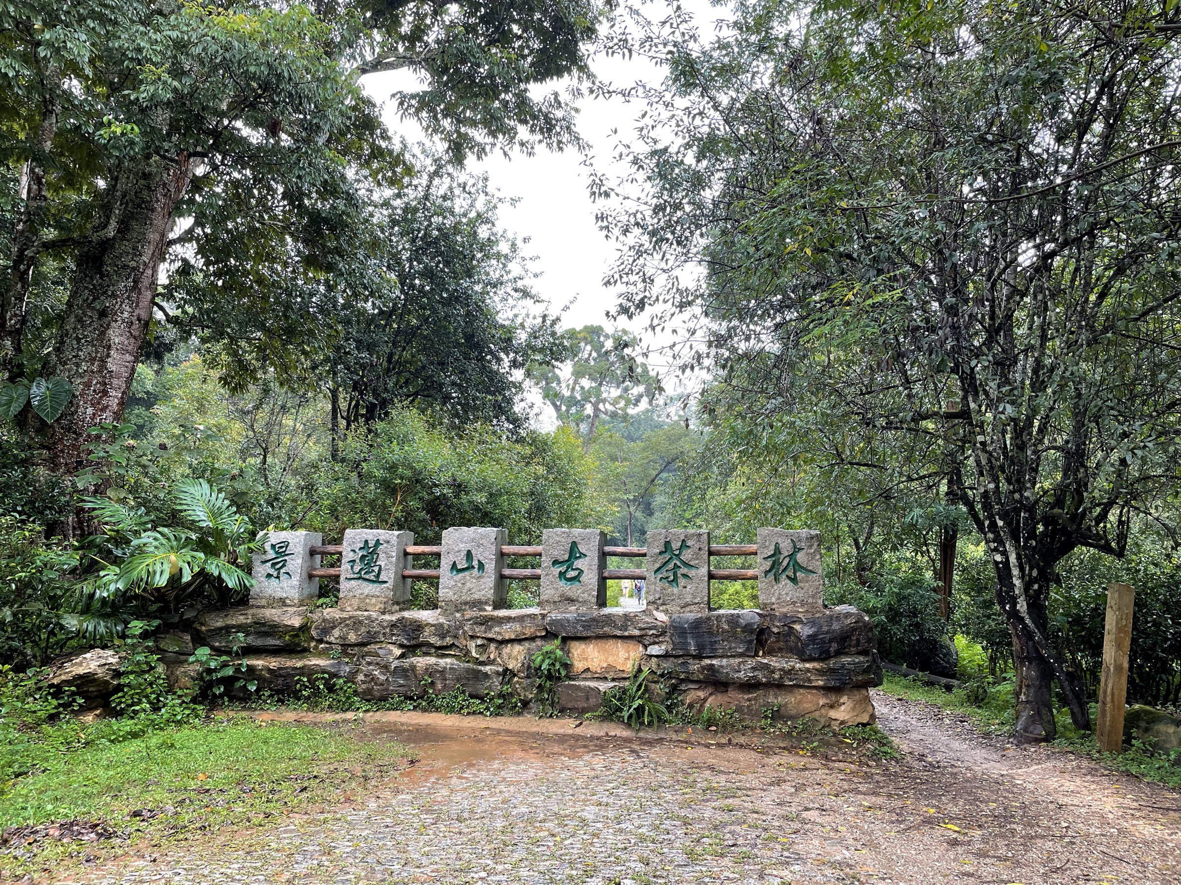
4. Ailao Shan Tea-King Trail (茶王古道), Jinshan, Xinping (新平)
Snapshot
Itinerary
From the west gate of the Jinshan Primeval Forest scenic area in Jiasa town, a signed forest path crosses the access road and enters the buffer zone of the Ailao Shan National Nature Reserve. The trail climbs north-west through mid-montane evergreen broadleaf forest dominated by stone oaks (Lithocarpus), Castanopsis and Schima, with a dense understorey of bamboo and tree ferns. After approximately 4 km the path reaches a remnant of the Tea-Horse Road (茶马古道) — a stone-set former trade segment used for the historical movement of Pu’er tea from the Mekong valley to inland Yunnan — and continues to climb on switchbacks to a ridge crest with ancient tea trees, including the named “Tea King” (茶王) specimen, the turn-around point of the day. Return is by the same line, with an optional short loop through the 1.7 km marked Jinshan Primeval Forest interpretive walk close to the trailhead.
Why it is essential
The Tea-King Trail is currently the principal legally-walkable mid-montane forest day-walk inside the Ailao Shan National Nature Reserve open zone, and it transects the exact subtropical evergreen broadleaf forest type for which Ailao Shan is internationally important. It complements the terrace walks below by exposing walkers to the source ecosystem of the Hani water-supply system. The intersection with the Tea-Horse Road segment links the natural and historical importance of the range in one route.
Equipment
- Sturdy boots
- Trekking poles strongly recommended on the muddy descent
- Extra warm insulated layer (a 1–2 kg insulated jacket is not excessive in winter)
- Waterproof shell
- Headtorch (the day is long enough that finishing in dusk is possible)
- Paper map or downloaded offline OSM as navigation backup
- 2.5 L water and food for a long day
- Leech socks and DEET in summer
- Registered local guide (mandatory under current Xinping county rules)
Hazards and notes
A registered local guide is required per Xinping county management rules; the trail is not waymarked to the standard expected in protected areas elsewhere. There is no mobile phone signal beyond the trailhead. Fog can close in within minutes, and temperature can drop below 0 °C at the upper ridge in winter even when Jiasa is at 18 °C — the same hypothermia mechanism that killed the four geological surveyors in November 2021 in a different sector of the reserve. The Xinping county government has publicly warned that unauthorised entry into the reserve core is punishable by 100–5,000 RMB fines; the open-zone Tea-King Trail is the route most regularly approved for guided walks. Leech protection is essential in monsoon season. The Ailao Shan reserve has been the subject of repeated official warnings in 2024–2025 against social-media-driven unguided “adventure” tourism.
GPX / route file
| Source | URL | Format | Notes |
|---|---|---|---|
| OpenStreetMap — Jinshan / Ailao Shan paths | openstreetmap.org | OSM data (export GPX) | ODbL 1.0; partial coverage only; no route relation observed |
| Ailao Shan National Nature Reserve | — | — | No official GPX published |
No verified open GPX was located in this pass. No licence-compatible image was confirmed for the Tea-King Trail at the time of writing; the Wikimedia Commons “Ailao Mountains” category remains very thin for the Xinping forest side.
Sources
- Yunnan Deep Tour — Complete One-Day Hiking Guide to the Ailao Mountain Tea King Trail
- Yunnan Deep Tour — Ailao Mountain, Xinping: An Unspoiled Sanctuary
- Yunnan Exploration — Damoyan Peak of Ailaoshan Mountain Range in Xinping
- Global Times — Tourist surge in ‘mysterious and primitive’ Ailao Mountains sparks safety warnings (2024)
- CGTN — Cause of mysterious deaths of 4 Chinese geologists revealed (2021)
5. Shimen Gorge (石门峡), Gasa, Xinping (新平)
Snapshot
Itinerary
From the scenic-area gate the path drops to the riverbed of Shimen Stream (石门河), a tributary cutting the eastern flank of Ailao Shan, and follows it upstream through a narrow gneiss-and-marble gorge. Within the first kilometre the route passes Jinsha Lake (金沙湖, a pool tinted by mineral suspension), the Shimen pinch from which the gorge takes its name, Mingyue Pool (明月潭, a circular plunge pool), the Meteor Spring (流星泉) and the gorge head at Pearl Waterfall (珍珠瀑布). The walked surface alternates between stone steps, narrow boardwalk, and short rope-assisted ladders over wet stone — well within hiking grade, but slick. Return is by the same line.
Why it is essential
Shimen Gorge offers the only easy, infrastructure-supported walk that exposes the wet eastern flank of Ailao Shan, the geological transition between the high-grade gneiss core of the range and the sedimentary cover further east. It is one of the few day-walks here that is suitable for less experienced or older walkers and is the standard counterpart to the longer Tea-King Trail in the same district. A combo ticket (~60 RMB) is sold linking Shimen Gorge, the Tea-Horse Ancient Road segment and the Jinshan Primeval Forest interpretive walk; this is the cleanest single-ticket combination for a full Xinping-side day on the mountain.
Equipment
- Trail shoes with good grip
- Light waterproof shell (constant spray from the waterfalls)
- 1.5 L water and snacks
- Scenic-area ticket (~30–40 RMB single, ~60 RMB combo)
- DEET-based repellent in monsoon (leech presence reported)
Hazards and notes
The boardwalk sections are slick year-round and have been reported to develop algae after monsoon rain. The gorge can flash-flood after heavy upstream rain; the scenic area is closed by management when river levels exceed a posted threshold. The lower gorge is humid and warm. As a managed scenic area, hours are restricted (typically last entry 16:00 in winter, 17:00 in summer); check with the Xinping county tourism office before travel.
GPX / route file
| Source | URL | Format | Notes |
|---|---|---|---|
| OpenStreetMap — Shimen Gorge area | openstreetmap.org | OSM data (export GPX) | ODbL 1.0; geometry may be incomplete |
| Shimen Gorge scenic-area office | — | — | No official GPX published |
No verified open GPX was located in this pass. No licence-compatible image was confirmed for Shimen Gorge in this pass.
Sources
- Yunnan Exploration — Shimen Gorge in Xinping County, Yuxi
- Yunnan Deep Tour — 6 Scenic Areas in Ailao Mountain: Features and Highlights
- Trip.com — Recommended Hiking in Shimen Gorge Scenic Area
External links
| Source | URL |
|---|---|
| UNESCO World Heritage Centre — Cultural Landscape of Honghe Hani Rice Terraces (ref. 1111) | whc.unesco.org |
| FAO GIAHS — Hani Rice Terraces System (PDF) | fao.org |
| Ramsar Convention — Honghe Hani Rice Terraces inscribed on UNESCO list | ramsar.org |
| Wikipedia — Ailao Mountains | en.wikipedia.org |
| Wikipedia — Honghe Hani Rice Terraces | en.wikipedia.org |
| ForestGEO — Ailaoshan research plot | forestgeo.si.edu |
| One Earth — Yunnan Plateau Subtropical Evergreen Forests | oneearth.org |
| CGTN — Cause of mysterious deaths of 4 Chinese geologists revealed (2021) | news.cgtn.com |
| Global Times — Tourist surge in Ailao Mountains sparks safety warnings (2024) | globaltimes.cn |
| China Discovery — Yuanyang travel pages | chinadiscovery.com |
| Yunnan Exploration — Yuanyang and Xinping pages | yunnanexploration.com |
| Yunnan Deep Tour — Xinping / Ailao Mountain articles | yunnandeeptour.com |
| Wikimedia Commons — Category:Hani Terraces | commons.wikimedia.org |
| Wikimedia Commons — Category:Ailao Mountains | commons.wikimedia.org |
| OpenStreetMap (ODbL 1.0) | openstreetmap.org |