Regional overview
The Wuliang Mountains (无量山, Wúliàng Shān) run roughly 270 km north–south through west-central Yunnan, taking over from the southern end of the Cangshan around Nanjian and reaching down through Jingdong (景东 / Jǐngdōng), Zhenyuan and the northern parts of Lancang and Pu’er prefectures. The range sits between two of mainland Southeast Asia’s great river systems — the Lancang (Mekong) on the west and the Babian–Honghe (Red River) drainage on the east — and runs parallel to the Ailao Mountains to the east, the two ranges often described together as the “Ailao–Wuliang” complex. Geologically Wuliang is an NNW–SSE anticlinorium of sericitic slate, sandy slate and schist, cut by faults and intruded by Triassic granitoids; crest elevations climb from a 2,500 m ridgeline to a high point variously cited as 3,306 m (Maotou Shan / 猫头山) or 3,371–3,376 m (general Wuliang Xueshan summit), depending on which named feature is being measured.
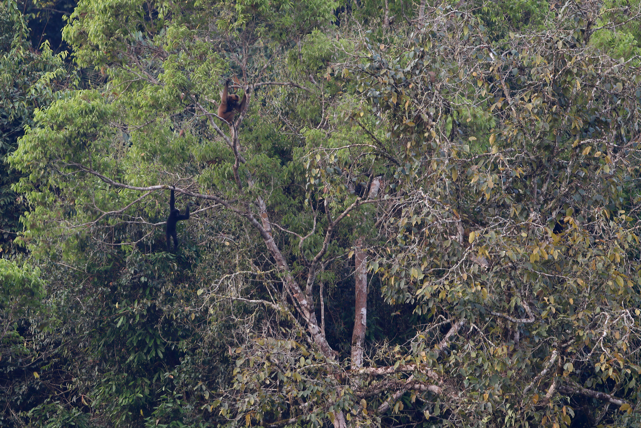
The range is biologically extraordinary. Wuliangshan National Nature Reserve, established in 1986 and later expanded to national level, protects mid-montane evergreen broadleaf forest, mossy forest and rhododendron dwarf forest above 2,700 m. It holds the largest known population in China of the critically endangered western black-crested gibbon (Nomascus concolor), with the central-Yunnan subspecies N. concolor jingdongensis endemic to the mountain. The most recent surveys count roughly 104 family groups — about 90 in Jingdong, 11 in Zhenyuan and 3 in Nanjian — making the Dazhaizi (大寨子) field station on the western slope the only place in China where wild western black-crested gibbons are routinely habituated to human observers.
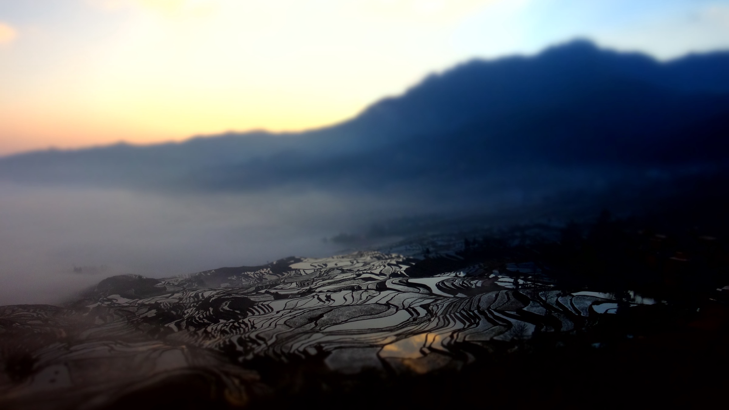
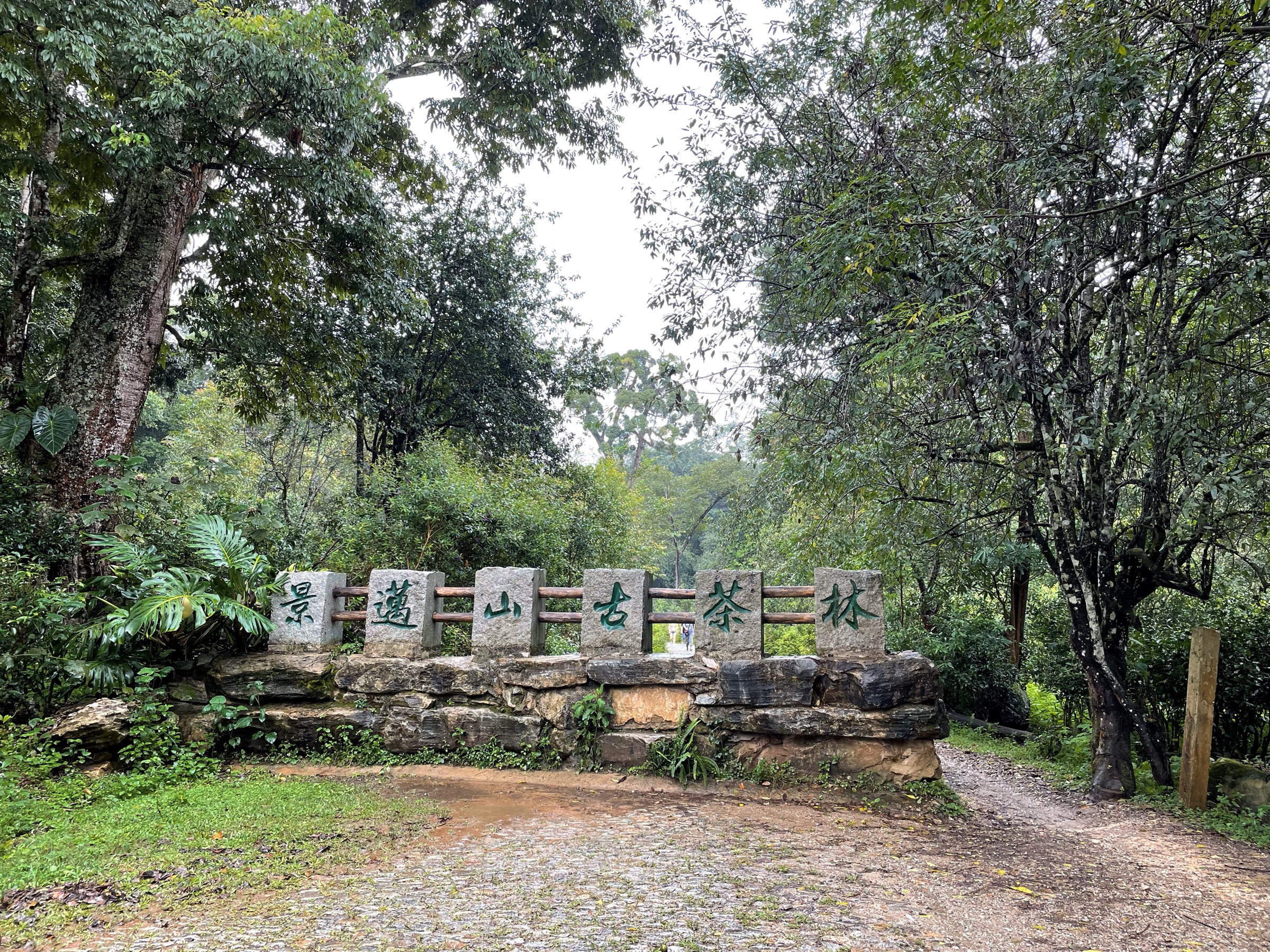
Wuliang is also a foundational landscape of Yunnan tea culture. The range’s mid-elevation forest zone, between roughly 1,400 m and 1,900 m, holds extensive ancient tea-tree communities cultivated for many centuries by Bulang (布朗 / Blang), Dai (傣), Hani (哈尼), Yi (彝), Lahu (拉祜) and Wa (佤) communities. The southern foothills merge into the Lancang and Pu’er tea districts and include Jingmai Mountain (景迈山 / Jǐngmài Shān) in Lancang Lahu Autonomous County, inscribed on the UNESCO World Heritage List in September 2023 as the “Cultural Landscape of Old Tea Forests of the Jingmai Mountain in Pu’er” — China’s 57th World Heritage Site and the first cultural property anywhere in the world dedicated to tea. The inscribed area covers five ancient tea forests, nine traditional Bulang and Dai villages and three protective forests, embodying an “understorey tea cultivation” tradition reaching back to roughly the 10th century. The cultivated old-tea forest is biologically distinct from primary forest — the canopy is thinned and managed, but the multi-layered structure is retained — and contains some 32,000 mu (≈2,130 ha) of old tea forest with more than 3.2 million old tea trees.
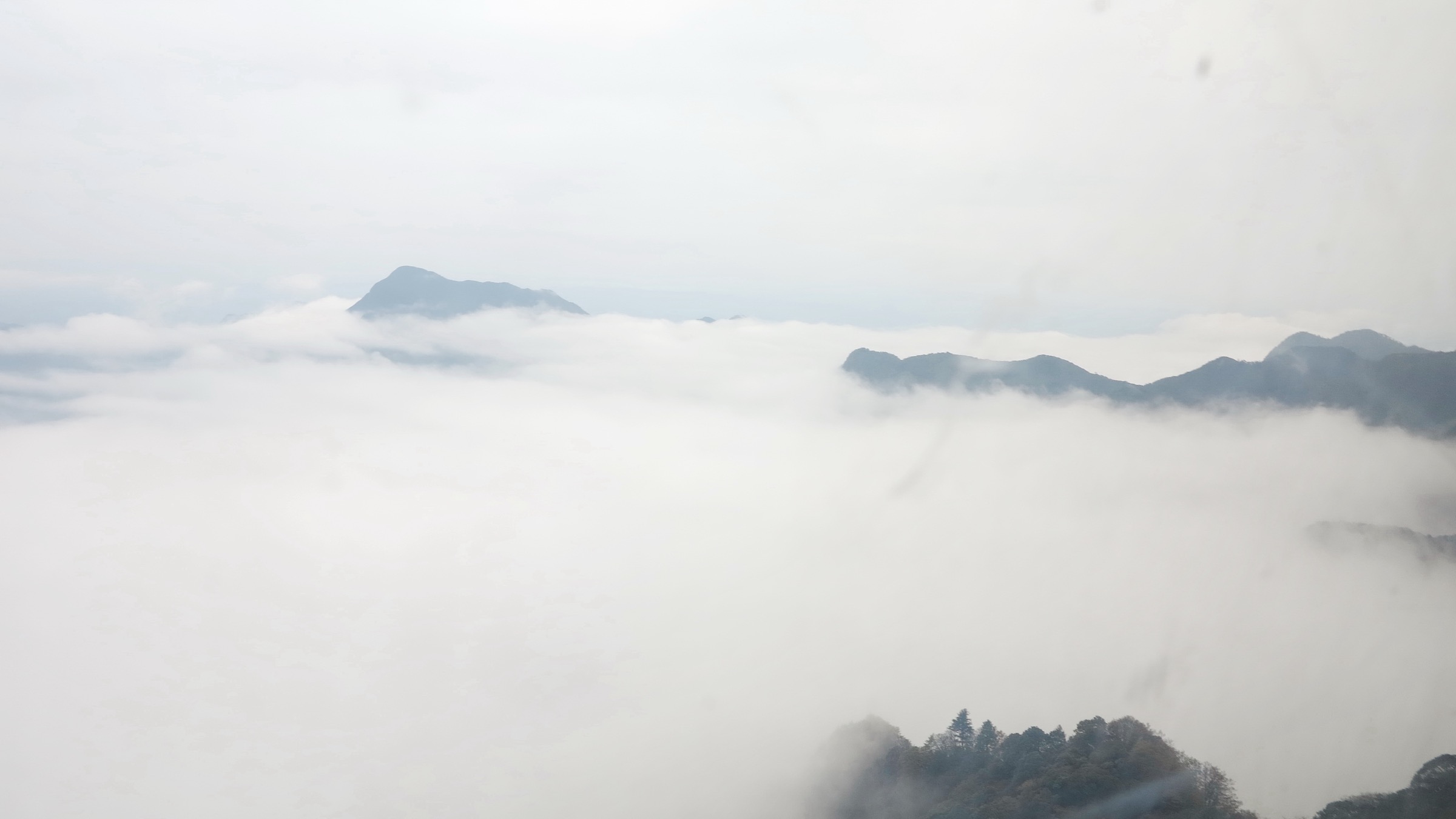
Walking in Wuliang is mostly low- to mid-altitude, in a subtropical mountain climate dominated by the southwest monsoon from May to October, which brings heavy rain, leeches and frequent landslides on forest tracks. December to February is the foggy dry season with cool nights at elevation and superb cloud-sea views; March to April is the spring-tea harvest and the busiest tourism period at Jingmai and Mengku (勐库 / Měngkù). Most walks are non-technical forest tracks, village paths or temple-circuit pavements; only off-trail summit lines on the higher Wuliang crest approach alpinism, and they are not normal day-hike fare. Access is by air to Pu’er Simao (KOW) or Lincang (LNJ), or by long road journeys from Kunming (8–11 h) and Dali (3–5 h to the northern Wuliang). Two access constraints recur across this region: most nature-reserve interior tracks (including the gibbon-monitoring trail at Dazhaizi) require advance arrangement with the reserve administration and an accompanying staff guide; and the Jingmai UNESCO core area is entered through an official visitor centre with a managed ticket.
Selection rationale
The Wuliang range stretches too far north–south for any single trailhead cluster to represent it. The five walks below span the range from Weishan in the north to Lancang and Lincang in the south, and cover the four characters that define the region: the UNESCO tea-culture landscape (Jingmai), the western black-crested gibbon habitat and primary forest (Dazhaizi), the high alpine ridge of Wuliang Xueshan, the Daoist-pilgrimage tradition at the range’s northern flank (Weibao Shan), and the parallel ancient tea-forest landscape of Da Xueshan above Bingdao on the western Wuliang frontier. Together they cover tea forest, primary forest, alpine ridge, sacred-mountain pilgrimage and conservation-research access — each route is non-technical, feasible in a single day for fit walkers, and recognised in Chinese-language guidebooks, Yunnan provincial tourism resources or peer-reviewed conservation literature. Lingbaoshan (Nanjian), Sakura Valley (Nanjian) and the Mengku Dongbanshan / Xibanshan tea-plantation walks are credible alternatives if any of the five drop out on field verification.
Summary table
| # | Hike | Sub-region | Route type | Distance | Gain | Max elevation | Difficulty |
|---|---|---|---|---|---|---|---|
| 1 | Jingmai Mountain — Dapingzhang & Wengji loop | Lancang, Pu’er | Loop | 7–9 km | 250–350 m | ~1,650 m | Easy |
| 2 | Dazhaizi gibbon-monitoring trail, Wuliangshan NNR | Jingdong, Pu’er | Out-and-back (guided) | 6–8 km | 300–500 m | ~2,600 m | Moderate |
| 3 | Wuliang Xueshan summit ridge (Maotou Shan / Bijia Shan) | Jingdong, Pu’er | Out-and-back | 10–14 km | 700–1,000 m | 3,306–3,376 m | Strenuous |
| 4 | Weibao Shan (巍宝山) Daoist temple circuit | Weishan, Dali | Loop | 6–10 km | 400–600 m | ~2,509 m | Easy–moderate |
| 5 | Da Xueshan ancient tea-forest walk above Bingdao | Shuangjiang, Lincang | Out-and-back | 8–12 km | 500–700 m | 2,200–2,500 m | Moderate |
All distance, ascent and elevation figures are research estimates; none has been confirmed against an official trail-database GPX. Treat them as planning approximations pending field verification.
1. Jingmai Mountain — Dapingzhang Ancient Tea Forest and Wengji Village loop
Snapshot
Itinerary
The walk leaves the visitor centre at Jingmai Dazhai (景迈大寨) and follows the maintained scenic-area track south-east through the Dapingzhang (大平掌) ancient tea forest, described in Chinese tourism sources as the only ancient tea forest in the UNESCO core zone fully opened to public visitation. The trail is broad, partly stone-paved and partly compacted earth, threading between camellia trees that range from waist-high mature plants to gnarled multi-stemmed specimens up to 10–12 m tall. Numbered “ancient tree” markers identify the oldest individuals, including the so-called Sacred Tea Tree, described locally as around 1,800 years old. The understorey is open, the canopy is thinned only enough to allow tea growth, and the path winds beneath Camellia sinensis var. assamica mixed with native broadleaf trees, palms, ferns and lianas — the visual signature of the “understorey tea cultivation” model recognised by the UNESCO inscription.
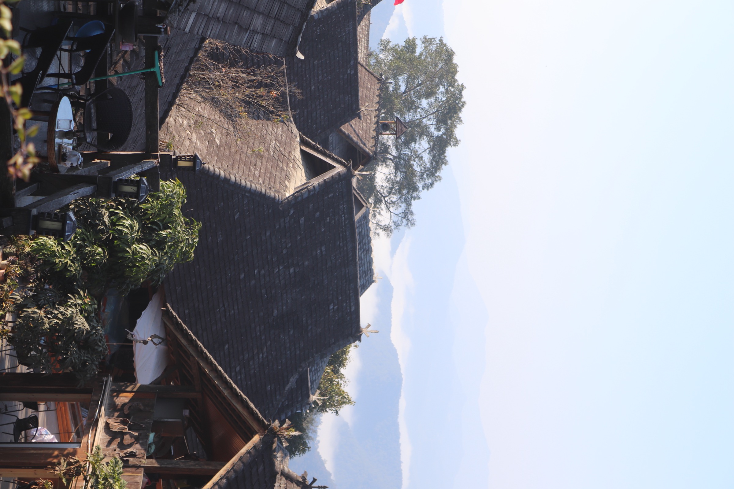
From Dapingzhang the route continues south through forest tracks to Wengji (翁基), a thousand-year-old Bulang village arranged around a hilltop Theravada Buddhist temple, with stilted wooden houses on a steep south-facing slope and a sacred ancient tree (described locally as around 2,500 years old) in the village core. A short detour leads to neighbouring Wengwa (翁洼). Returning west, the loop crosses to Mangjing (芒景), the principal Bulang settlement on the mountain, passing the Princess Banyan (公主榕 / Gōngzhǔ Róng) — a vast strangler-fig complex straddling the road at the junction of Upper and Lower Mangjing, mythologised as the resting place of a Dai princess — and the Queen Bee Tree (蜂王树 / Fēngwáng Shù), a tall emergent giant honey-bee nesting tree of cultural and ecological importance. From Mangjing the loop returns north through tea-forest tracks to Jingmai Dazhai. A longer variant adds Nuogang (糯岗), a Dai village with cluster rice-barns and a stilted-house core, as a northern arm.
Why it is essential
Jingmai is the UNESCO World Heritage core of the Wuliang–Lancang tea landscape and the headline draw of the southern Wuliang region. Inscribed in 2023 under criteria (iii) and (v), it is the world’s first cultural property dedicated to tea, recognised for a sustained, low-impact, indigenous “understorey tea cultivation” tradition combining Bulang and Dai agro-cultural management with a near-intact forest canopy. The walk is the only way to perceive how the canopy, undergrowth and village fabric integrate into a single living system — and unlike most “tea-mountain” routes elsewhere in Yunnan, the Jingmai trail offers public, marked access to the ancient tea forest itself.
Equipment
- Hiking shoes and weatherproof shell
- Sun hat and 1.5–2 L water
- Trail food and light first aid
- Tick and leech protection in monsoon (May–October)
- Head net or insect repellent in late spring
- Small umbrella (sun-and-shower weather is typical)
- Cash for village teahouses; card coverage is patchy on the mountain
Hazards and notes
The principal hazards are leeches and biting insects in the wet season, muddy and slippery forest tracks after rain, and the occasional aggressive village dog. Mobile coverage is good in the villages and patchy in the forest. The UNESCO core zone is managed: entry is through the Jingmai Mountain Tea Forest Cultural Scenic Area, an entrance ticket applies (variable; confirm at the gate), and visitors are expected to remain on marked trails. Leaving the path damages the tea-forest understorey and is not tolerated by the heritage management body. Drone flying is restricted in parts of the core zone; check before launching. Do not pluck tea leaves from individual farmers’ trees without permission.
GPX / KML links
| Source | URL | Format | Notes |
|---|---|---|---|
| OpenStreetMap (Jingmai Mountain area) | openstreetmap.org | OSM data (export GPX) | ODbL 1.0; village-to-village footways partially mapped, manual GPX construction required |
| Official scenic-area GPX | — | — | None located |
No official GPX has been confirmed. OSM coverage of Jingmai’s village-to-village footways is partial; expect to construct a GPX from Overpass extraction of highway=path|track|footway within the scenic-area boundary, cross-checked against the OpenTopoMap rendering.
Sources
- UNESCO World Heritage Centre — Cultural Landscape of Old Tea Forests of the Jingmai Mountain in Pu’er (list entry 1665)
- Xinhua — Old tea forests in China’s Pu’er listed as world heritage site (18 Sept 2023)
- China Discovery — Jingmai Mountain Tea Culture, Attractions and Travel Tips
- Wikimedia Commons — Category:Jingmai Mountain
2. Dazhaizi (大寨子) Gibbon-Monitoring Trail, Wuliangshan National Nature Reserve
Snapshot
Itinerary
The route is not a published trail; it is the working observation transect used by the Wuliangshan reserve’s primate research team, visited under guided arrangement. Visitors arrive at Dazhaizi the previous afternoon, typically lodge at a buffer-zone guesthouse, and leave on foot before dawn (often 04:30–05:00) accompanied by reserve staff or trained local monitors. The track climbs through mid-montane evergreen broadleaf forest dominated by Lithocarpus, Castanopsis, Schima and Machilus, with a mossy understorey and occasional clearings opened by fallen trees, gaining altitude toward gibbon home ranges that lie predominantly between 2,000 m and 2,600 m. Peer-reviewed surveys record that 92% of gibbon groups in the reserve vocalise within this band. The party stops at known calling trees and listens for the male–female duet that begins shortly after first light; with luck, the habituated study group descends through the canopy within visible range. Researchers have noted home ranges of around 129 ha per habituated group, with daily movements following ridges and gully-side fruiting trees. Return is along the same line, normally back at the station by mid-morning before the gibbons cease activity for their daytime rest.
Why it is essential
Wuliang Mountain holds the largest known wild population of the critically endangered western black-crested gibbon (Nomascus concolor), and Dazhaizi is the only site in China where habituated groups can be observed at close range by non-researchers. The walk is the single most important wildlife experience in the Wuliang range and one of very few opportunities anywhere in mainland Asia to see a wild crested gibbon in primary forest. It also samples the rare mid-elevation primary evergreen-broadleaf forest that gives the Wuliangshan reserve its biodiversity significance.
Equipment
- Sturdy boots and gaiters (highly recommended)
- Warm midlayer and weatherproof shell
- Headtorch (mandatory for the pre-dawn approach)
- Warm hat and gloves December–February
- Binoculars (8×42 or similar)
- Insect repellent; leech socks or repellent in monsoon
- 1.5–2 L water, trail food, basic first aid
- Telephoto lens useful but not essential — gibbons are habituated but the forest is dense
Hazards and notes
The hike is steep, frequently wet underfoot, and serious leech and tick territory from April to October. The pre-dawn start adds objective risk of slips on muddy roots. Access is not free-roaming: the reserve administration controls entry, and visitors must arrange the trip through the Yunnan Wuliang Mountain National Nature Reserve management or recognised local operators in Jingdong town. Visitor numbers per group are limited to minimise disturbance to the gibbons; loud noise, flash photography and any pursuit of animals are prohibited. Pygmy slow loris, several macaque species and clouded leopard are also present in the reserve; encounters with the last are extremely unlikely. Mobile coverage is absent in the forest. The reserve entry fee is reported locally at around CNY 50, with separate guide-and-vehicle costs (around CNY 300 per vehicle).
GPX / KML links
| Source | URL | Format | Notes |
|---|---|---|---|
| OpenStreetMap (Dazhaizi area) | openstreetmap.org | OSM data (export GPX) | ODbL 1.0; reserve interior is sparsely mapped |
| Official reserve management route | — | — | None located — gibbon-group locations are semi-sensitive information |
No GPX file is available; the monitoring trail is not publicly mapped, and reserve management treats gibbon-group locations as semi-sensitive information.
Sources
- Fan, P.F. & Jiang, X.L. — The Critically Endangered black crested gibbon Nomascus concolor on Wuliang Mountain (Oryx, CUP)
- Population recovery of the critically endangered western black crested gibbon in Mt. Wuliang, Yunnan (PMC8920850)
- Landscape and conservation genetics of western black crested gibbons in China (PMC11650964)
- Xinhua — Group of Western Black Crested Gibbons spotted in China’s Yunnan (2 Feb 2023)
- Yunnan Adventure Travel — Pu’er Mt. Wuliangshan Nature Reserve
3. Wuliang Xueshan (无量雪山) Summit Ridge — Maotou Shan / Bijia Shan
Snapshot
Itinerary
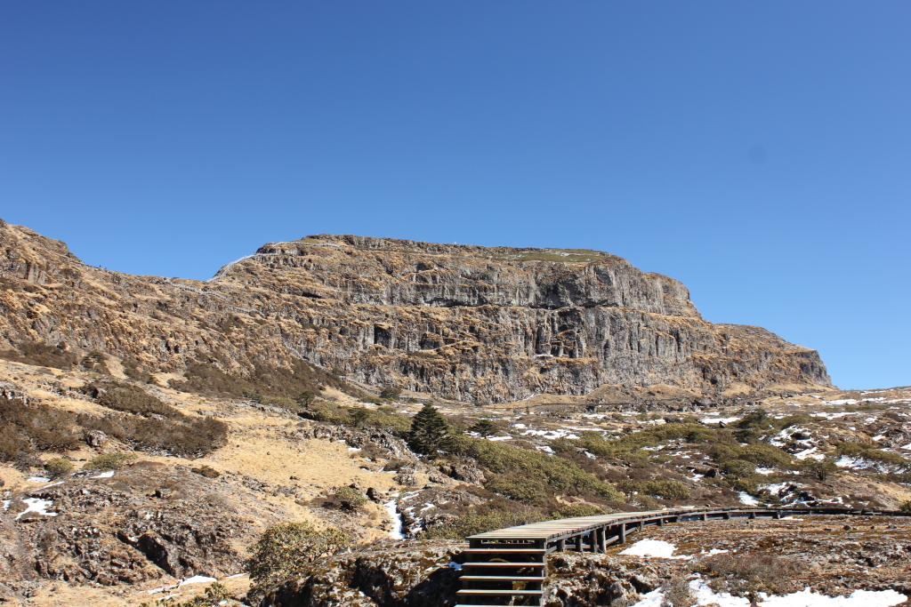
The Wuliang Xueshan crest forms the central spine of the range east of Jingdong town. The summit zone is reached by forestry tracks climbing from village trailheads on either flank; the most commonly cited approach starts from the western slope above Jingdong county town and follows a graded forestry road for several kilometres before transitioning to a footpath that climbs through evergreen broadleaf forest (1,800–2,500 m), mid-montane mossy forest (2,500–2,700 m) and finally the rhododendron dwarf forest belt above 2,700 m that is characteristic of the upper Wuliang. The ridgeline at around 3,000–3,300 m is broad, with localised stands of Rhododendron spp., grass clearings and frost-shattered slate outcrops. The high point is variously cited as Maotou Shan (猫头山) at 3,306 m or as “the highest point of Wuliangshan” at 3,371–3,376 m — the discrepancy almost certainly reflects two named features on the same crest. On a clear day the ridge gives views west to the Lancang valley and east toward the Ailao range.
Why it is essential
This is the only summit-style walk in the Wuliang range. It samples the full elevational gradient that defines the Wuliangshan reserve’s biodiversity — evergreen broadleaf forest, mossy forest, rhododendron dwarf forest — and provides the regional panoramic view across the Lancang–Honghe interfluve. No serious portrait of the Wuliang range is complete without it.
Equipment
- Sturdy boots and gaiters
- Warm midlayer (the summit zone can fall below freezing November–March)
- Weatherproof shell, hat and gloves
- Headtorch and navigation backup (the upper ridge is foggy and the path is faint in places)
- 2 L water, trail food, basic first aid
- Emergency shelter / bivvy bag advisable in winter
- Microspikes occasionally useful in mid-winter for icy upper sections; verify locally
Hazards and notes
Distance, ascent and the summit elevation all need field confirmation; published Chinese tourism descriptions are vague and the route is rarely documented in English. The upper ridge is exposed to weather, with frequent fog year-round; navigation in cloud is non-trivial because side-ridges branch from the crest and many footpaths are forestry and game tracks rather than waymarked trails. Wuliangshan National Nature Reserve restrictions apply to large parts of the upper mountain — verify with the Jingdong county forestry / reserve office whether the chosen line crosses core-zone boundaries (which would require permission). Mobile coverage is absent above 2,500 m. Expect leeches and ticks below 2,500 m in monsoon.
GPX / KML links
| Source | URL | Format | Notes |
|---|---|---|---|
| OpenStreetMap (Wuliang crest, Jingdong) | openstreetmap.org | OSM data (export GPX) | ODbL 1.0; ridge path only partially traced |
| Official trail GPX | — | — | None located |
| Wikiloc / user GPX | — | — | None located in English |
Sources
- Encyclopædia Britannica — Wuliang Mountains
- Wikipedia — Wuliangshan (town, Nanjian)
- Identification of metamorphic rocks in Wuliangshan Mountains using ASTER data (Arabian J. Geosciences, Springer)
- Yunnan Exploration — Wuliang Mountain in Yunnan
4. Weibao Shan (巍宝山) Daoist Temple Circuit
Snapshot
Itinerary
Weibao Shan (巍宝山 / Wēibǎo Shān) rises immediately south-east of Weishan ancient town at the northern foot of the Wuliang range. It is one of the fourteen sacred Daoist mountains of Yunnan, with around twenty surviving Daoist temples scattered across pine-and-broadleaf forest, most of them in their present form from the Ming and Qing dynasties and collectively designated nationally significant in 1987. Three commonly walked circuits all start from the main mountain gate at the foot of the eastern slope.
The easy version (2–3 h) climbs by stone steps to Changchun Cave (长春洞), the Nanzhao Tuzhu Temple (南诏土主庙) — historically marked as the ancestral shrine of the founders of the Nanzhao kingdom — Wenchang Palace (文昌宫), Lingguan Hall (灵官殿), Qingxia Palace (青霞宫) and back to the gate. The intermediate version (4–5 h) extends to the Jade Emperor Pavilion (玉皇阁), Sanhuang Hall (三皇殿), Guanyin Hall (观音殿) and Kuixing Pavilion (魁星阁). The full circuit (5–6 h) adds the Prince’s Palace (太子殿) and Doumu Pavilion (斗姆阁) at the southern end, returning by a forest ridge path. Notable mural sites include Wenchang Palace (Ming–Qing-period Daoist paintings) and Changchun Cave (established 1715: a hexagonal three-storey pavilion arranged on a Bagua plan, with carved coiled-dragon caisson ceilings and over 200 documented temple artworks). The forest cover is dense old-growth Yunnan pine and oak with a rhododendron understorey.
Why it is essential
This is the major sacred-mountain pilgrimage walk of the northern Wuliang region and one of the most important Daoist temple complexes in southwest China. Weibao Shan is also tied to the foundation legend of the Nanzhao kingdom (7th–10th centuries), and the temple architecture, murals and forested setting are widely regarded as among the best-preserved Ming–Qing Daoist landscapes in Yunnan. As a cultural counterpart to the natural-history walks elsewhere in this catalogue, it represents the human history of the range.
Equipment
- Comfortable shoes (smooth stone steps can be slippery in damp weather)
- Light shell and warm layer for winter mornings
- Water and sun protection
- Small umbrella in summer
- No technical gear required
Hazards and notes
A site entrance fee applies (locally cited at CNY 40); opening hours roughly 08:00–17:00. Some side paths are unmaintained; stick to the main stone-paved circuit if walking alone. Mobile coverage is good throughout. Photography of temple murals is restricted in several halls — check posted signs. Drones are not permitted within the temple area without permission. Dogs are generally not allowed inside the temple precincts.
GPX / KML links
| Source | URL | Format | Notes |
|---|---|---|---|
| Wikiloc — Weibao Mountain Trail | wikiloc.com | User-uploaded GPX | Single user-uploaded track; licence and accuracy per uploader — verify before re-use |
| OpenStreetMap (Weibao Shan area) | openstreetmap.org | OSM data (export GPX) | ODbL 1.0; mapping of internal temple paths is partial |
| Official scenic-area route file | — | — | None located |
A single Wikiloc user-uploaded GPX for Weibao Mountain is available; it is the only crowd-sourced track confirmed for any of the five hikes in this catalogue. Accuracy and licence terms are uploader-specific and should be verified before download or republication.
Sources
- FYSK: Daoist Culture Centre Database — Mt. Weibao Daoist Temple (Weishan, Yunnan)
- Lonely Planet — Wēibǎo Shān
- Yunnan Exploration — Dali Weibao Mountain Travel
- Yunnan-roads — Weibaoshan sacred Taoist mountain
5. Da Xueshan (大雪山) Ancient Tea Forest Walk above Mengku / Bingdao
Snapshot
Itinerary
The walk begins in Bingdao Lao Zhai (冰岛老寨), the old core village of Bingdao (冰岛 / Bīngdǎo) at around 1,600–1,900 m, the famed origin of Bingdao Pu’er and one of the most prized tea villages in Lincang. The route climbs through cultivated tea terraces — many “Gushu” (古树) trees of 100–300 years and older, trunk diameters typically between 0.30 m and 0.60 m — onto the lower flanks of Da Xueshan (大雪山 / Dà Xuěshān, literally “Great Snow Mountain”, and not to be confused with the much higher Da Xueshan ranges further north). The ancient tea-tree belt is widely reported in academic and tea-trade sources to span 2,200–2,750 m on the upper slopes of Da Xueshan, with one of China’s highest-altitude and densest wild ancient-tea communities, over 12,000 mu (≈800 ha) in extent. A turnaround at around 2,200–2,500 m gives a feasible day from the village; reaching the upper trees at 2,700+ m requires either a long day or a vehicle ride to an upper trailhead. The walk crosses Lahu, Wa, Bulang and Dai villages and traverses subtropical mid-mountain forest with the same canopy-and-understorey logic as Jingmai, but at substantially higher elevation and in a wilder, less-managed setting.
Why it is essential
Da Xueshan complements Jingmai as the second great ancient tea-forest landscape of the Wuliang region, but on the western (Lincang) flank rather than the southern. It demonstrates the higher-elevation variant of the same understorey tea-cultivation tradition, includes the celebrated Bingdao terroir, and crosses several ethnic-minority villages — together a strong representative of the Lincang side of the Wuliang range that is not covered by the Jingmai walk.
Equipment
- Sturdy boots; gaiters or leech socks in monsoon
- Warm midlayer (the upper forest can be cold and damp even in dry season)
- Weatherproof shell and hat
- Headtorch and 2 L water
- Trail food, basic first aid
- Cash for village teahouses and local guides
Hazards and notes
Access to the upper wild ancient-tree zone is informally controlled by the surrounding villages, and during the spring picking season (March–April) entry is often restricted to authorised pickers; verify with the Mengku town office or the receiving Bingdao village authority before attempting the upper section. Roads to Bingdao are described in multiple sources as twisting gravel tracks — 4WD may be necessary in wet weather. Mobile coverage is patchy in the upper forest. Expect leeches, ticks and biting flies in monsoon. The walk crosses small forest streams with no formal water-treatment facility — purify any water taken from streams.
GPX / KML links
| Source | URL | Format | Notes |
|---|---|---|---|
| OpenStreetMap (Mengku / Bingdao area) | openstreetmap.org | OSM data (export GPX) | ODbL 1.0; village lanes and forest tracks only partially mapped |
| Official Shuangjiang county tourism GPX | — | — | None located |
Sources
- Teasenz — Mengku Tea Region: A Complete Guide
- Yunnan Exploration — Lincang Ancient Tea Plantations in Mengku Snow Mountain
- Yunnan Adventure Travel — Bingdao Ancient Tea Garden
- puerh.fr — Da Xue Shan, its terroirs and its teas
External links
| Source | URL |
|---|---|
| UNESCO World Heritage Centre — Cultural Landscape of Old Tea Forests of the Jingmai Mountain in Pu’er | whc.unesco.org |
| Encyclopædia Britannica — Wuliang Mountains | britannica.com |
| FYSK Daoist Culture Centre Database — Mt. Weibao Daoist Temple | en.daoinfo.org |
| Yunnan Exploration — Wuliang Mountain | yunnanexploration.com |
| Yunnan Adventure Travel — Pu’er Mt. Wuliangshan Nature Reserve | yunnanadventure.com |
| China Discovery — Jingmai Mountain | chinadiscovery.com |
| Crimson Lotus Tea — Jingmai Mountain and Mangjing Village | crimsonlotustea.com |
| Population recovery of Nomascus concolor in Mt. Wuliang (PMC8920850) | pmc.ncbi.nlm.nih.gov |
| Wikiloc — Weibao Mountain Trail | wikiloc.com |
| Wikimedia Commons — Category:Jingmai Mountain | commons.wikimedia.org |
| Wikimedia Commons — Category:Nomascus concolor | commons.wikimedia.org |
| OpenStreetMap (ODbL 1.0) | openstreetmap.org |