Regional overview
The Yunnan / Guizhou Highlands are a high karst and plateau landscape of limestone towers, waterfalls, terraced basins, seasonal snow mountains, sacred forest peaks, and humid subtropical valleys. This entry deliberately avoids the far northwestern Hengduan routes already treated separately and focuses on central/eastern Yunnan and Guizhou: Fanjingshan, Jiaozi Snow Mountain, Shilin Stone Forest, Puzhehei, and Huangguoshu.
Day hiking here is often highly managed. Famous routes may be stone steps, boardwalks, scenic-area loops, shuttle-assisted viewpoints, or short steep climbs rather than wilderness footpaths. The best hikes are nevertheless regionally essential because they reveal the highland’s major landforms: sacred quartzite/karst peaks, seasonal snow and alpine lakes, stone forest karst, lake-and-tower wetlands, and plateau waterfalls.
The main hiking seasons are spring and autumn. Summer brings heavy rain, heat, humidity, slippery stone, high water in waterfall areas, and thunderstorms. Winter can bring ice or snow on Jiaozi and cold wind on Fanjingshan. Tickets, time slots, cableways, and internal shuttles should be checked before travel.
Selection rationale
The five hikes balance the region’s strongest landscapes: Fanjingshan’s sacred summit towers, Jiaozi Snow Mountain’s high-altitude boardwalk and seasonal snow, Shilin’s World Heritage stone forest, Puzhehei’s karst lake viewpoints, and Huangguoshu’s waterfall-and-cave walking circuit. Route statistics are strongest for Shilin and Jiaozi; Puzhehei and Huangguoshu need manual GPS follow-up.
Summary table
| # | Hike | Country | Route type | Distance | Gain | Max elevation | Difficulty |
|---|---|---|---|---|---|---|---|
| 1 | Fanjingshan: Mushroom Stone, Old Golden Summit and Red Clouds Golden Summit | China | Cableway-assisted summit circuit / stair route | Approx. 3-5 km from upper cableway; 9.5 km / 8,000-step full ascent variant | Approx. 400-700 m from upper station; full ascent unresolved | Approx. 2,494 m if Old Golden Summit included; Red Clouds Golden Summit approx. 2,236-2,336 m depending source | Hard |
| 2 | Jiaozi Snow Mountain: Cableway station to Heavenly Pond and summit overlook | China | Lift-assisted out-and-back / loop | 7.2 km Wikiloc summit track; 7-9 km scenic loop estimate | cableway saves about 350 m | 4,223-4,247 m depending source | Hard because of altitude |
| 3 | Shilin Stone Forest Loop | China | Loop | 11.1 km | 358 m | low plateau karst | Moderate |
| 4 | Puzhehei: Qinglong Mountain and lakeside karst walk | China | Loop / out-and-back viewpoint walk | Approx. 6-10 km | Approx. 150-300 m | Approx. 1,500 m | Moderate |
| 5 | Huangguoshu Waterfall and Tianxingqiao karst circuit | China | Scenic-area loop / shuttle-assisted walking circuit | Approx. 5-7 km walked depending open sections | Minor to moderate | Approx. 900-1,000 m plateau setting; route high point unresolved | Easy-moderate |
1. Fanjingshan: Mushroom Stone, Old Golden Summit and Red Clouds Golden Summit
Snapshot
Itinerary
The normal day route enters through the East Gate / Heiwan River side, uses the scenic shuttle and cableway, then climbs through the upper forest and boardwalk/stair system to Mushroom Stone and Old Golden Summit. The route then returns towards Cheng’en Temple / Pudu Square and climbs the steep one-way stair system of Red Clouds Golden Summit if access and queue controls allow.
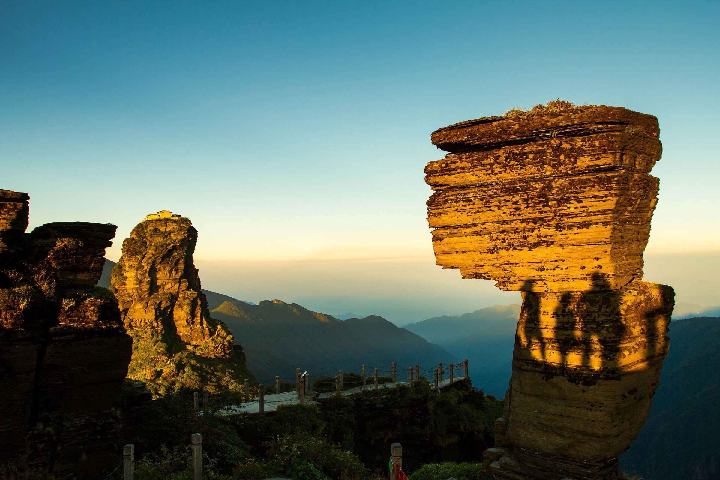
Red Clouds Golden Summit is a narrow rock tower split by a cleft and linked by a bridge, with temples on the summit. The ascent and descent stairs are steep, exposed, and tightly managed in crowded periods.
Why it is essential
Fanjingshan is Guizhou’s most famous sacred mountain and a UNESCO World Heritage site. The hike combines subtropical forest, unusual summit rocks, Buddhist cultural sites, and one of China’s most recognisable peak temples.
Equipment
Mountain hiking equipment: grippy shoes, warm layer, rain shell, water, snacks, sun protection, gloves/hat in winter, and traction if ice is reported. A headtorch is sensible for delays.
Hazards and notes
Fog can remove visibility. The Red Clouds Golden Summit stairs are steep and exposed; access may be restricted by queues, weather, or ticketing controls. Do not rely on being able to climb the summit tower without a current queue number or staff approval.
GPX / KML links
| Source | URL | Format / access | Reuse status |
|---|---|---|---|
| OpenStreetMap search: Fanjingshan | openstreetmap.org | Map/search | OSM data is ODbL; geometry cross-check only |
| Waymarked Trails hiking map: Fanjingshan area | hiking.waymarkedtrails.org | OSM-derived map | OSM/Waymarked terms apply; source-map only; no route relation selected |
External links
- China Discovery — Fanjingshan hiking route
- Asia Odyssey Travel — Fanjing Mountain summit route and Red Clouds Golden Summit
- China Highlights — Fanjing Mountain Red Clouds Golden Summit
- Tsem Rinpoche — Fan Jing Shan step and ascent context
2. Jiaozi Snow Mountain: Cableway Station to Heavenly Pond and Summit Overlook
Snapshot
Itinerary
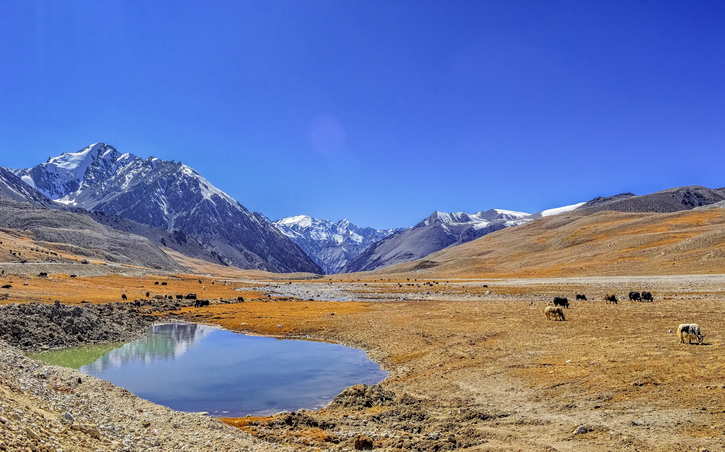
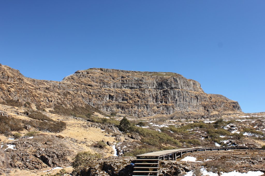
From the visitor centre area at about 3,140 m, most walkers use the internal bus and cableway before starting the upper mountain walk. Boardwalks and stairways lead through seasonal flower slopes, waterfall and lake viewpoints, Heavenly Pond around 4,150 m, and the summit-overlook area if open.
Two upper route choices are described by GoKunming: a more scenic path with named viewpoints and a more direct, steeper line towards the summit overlook. The exact loop should be chosen according to weather, oxygen/altitude response, and current boardwalk closures.
Why it is essential
Jiaozi Snow Mountain is the key high-altitude day walk of central Yunnan, giving the entry a seasonal snow, alpine lake, rhododendron, and high-boardwalk route outside the Hengduan far northwest.
Equipment
Mountain hiking equipment: sturdy shoes/boots, waterproof and windproof layers, warm layer, gloves/hat, sun protection, sunglasses, water, food, and offline map. Carry microspikes in winter or when ice is reported.
Hazards and notes
Altitude sickness, cold wind, ice, lightning, and sudden weather are the main hazards. Turn around if altitude symptoms worsen. Boardwalks protect fragile vegetation; do not leave them.
GPX / KML links
| Source | URL | Format / access | Reuse status |
|---|---|---|---|
| Wikiloc: Kunming Jiaozi Snow Mountain Northwest Slope Summit | wikiloc.com | Route page / GPS track | Wikiloc terms apply; source geometry found; file reuse terms not confirmed |
| OpenStreetMap search: Jiaozi Snow Mountain | openstreetmap.org | Map/search | OSM data is ODbL; geometry cross-check only |
External links
- GoKunming — Getting Away: Jiaozi Snow Mountain
- GoKunming — Hiking among the clouds on Yunnan’s Jiaozi Snow Mountain
- Kunming government — Jiaozi Snow Mountain winter scenery and elevation
- TravelChinaGuide — Jiaozi Snow Mountain
- Wikiloc — Jiaozi Snow Mountain Northwest Slope Summit
3. Shilin Stone Forest Loop
Snapshot
Itinerary
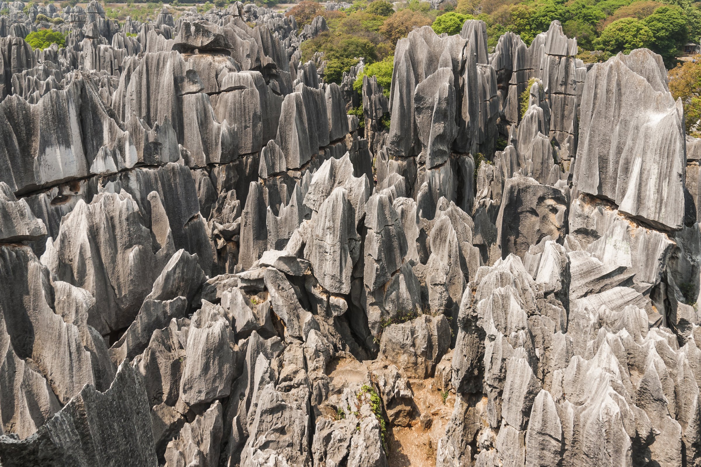
The loop explores the Major and Minor Stone Forest walking areas on constructed paths among limestone pinnacles, narrow rock corridors, viewpoints, ponds, and Yi cultural landscape. The AllTrails route gives a longer walking circuit than the shortest tourist loop and is suitable for a half-day hiking-style visit.
Why it is essential
Shilin is part of the South China Karst World Heritage landscape and is the most famous stone forest in Yunnan. It gives the highlands entry its defining limestone-pinnacle day walk.
Equipment
Standard hiking equipment: grippy shoes, water, sun protection, rain layer, and offline map. A hat is useful because many sections are exposed.
Hazards and notes
Stone paving can be slippery after rain. Crowding, confusing paths, and hot exposed sections are common. Stay on marked paths to protect the karst landscape and avoid falls into narrow rock gaps.
GPX / KML links
| Source | URL | Format / access | Reuse status |
|---|---|---|---|
| AllTrails: Shilin Stone Forest | alltrails.com | Route page / app map | AllTrails terms apply; GPX export terms not verified; source-map and statistics used |
| OpenStreetMap search: Shilin Stone Forest | openstreetmap.org | Map/search | OSM data is ODbL; geometry cross-check only |
External links
4. Puzhehei: Qinglong Mountain and Lakeside Karst Walk
Snapshot
Itinerary
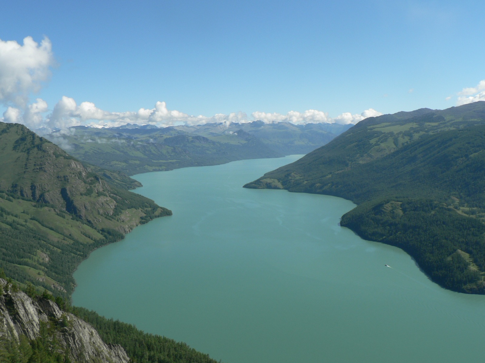
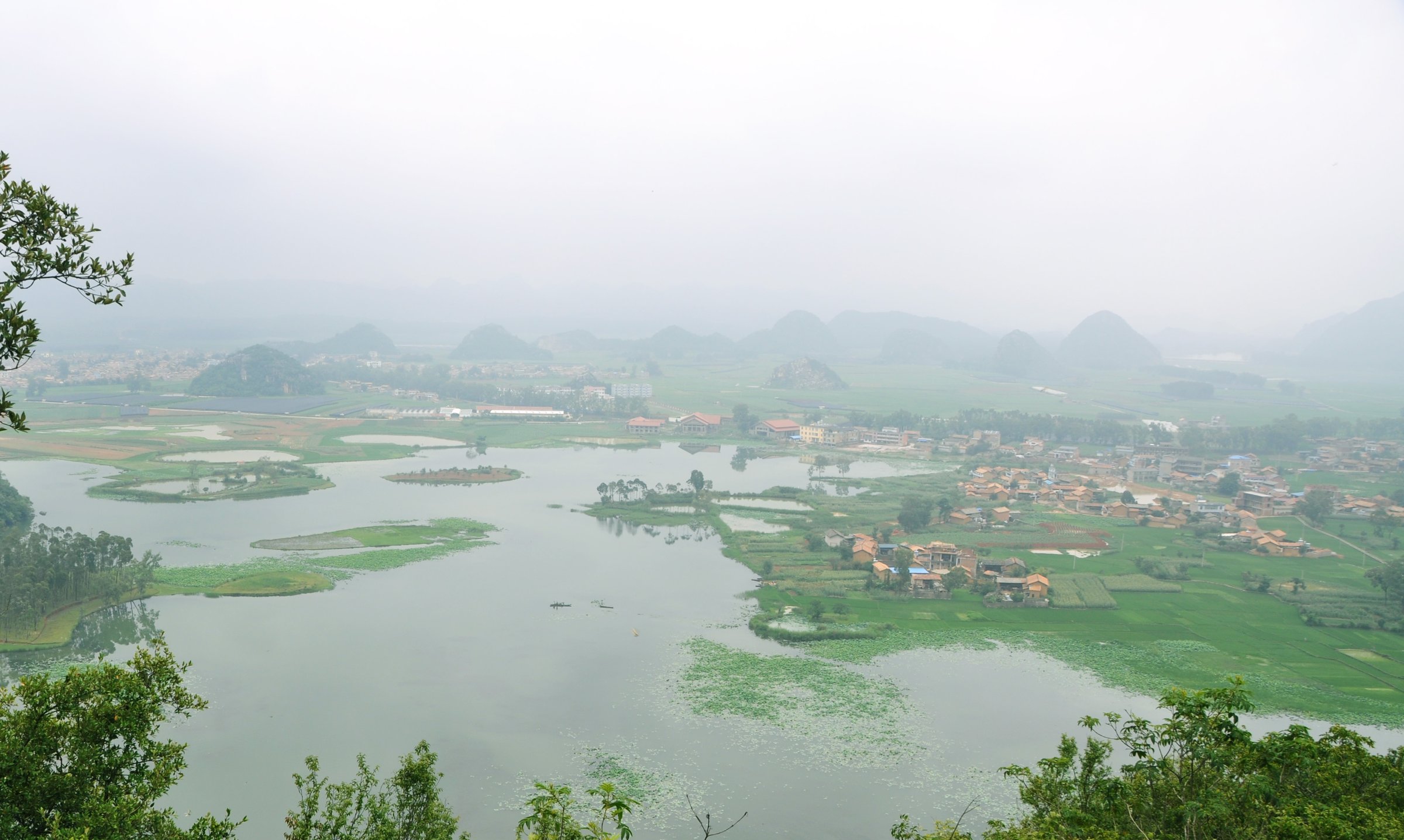
From Puzhehei village or the lakeside access area, the route climbs Qinglong Mountain for the classic view over karst towers, lakes, wetlands, and villages. It then descends to link lakeside tracks, village lanes, bridges, and low karst paths before returning to the start. Boats are often used by visitors, but the catalogue route is a walking-first circuit with optional scenic transport.
Why it is essential
Puzhehei represents the lower, water-rich Yunnan karst highlands: limestone towers rising from lakes, wetlands, lotus ponds, and village landscapes. Qinglong Mountain is the key walking viewpoint over the basin.
Equipment
Standard hiking equipment: walking shoes, water, sun protection, rain layer, insect protection, and offline map. In hot months, start early.
Hazards and notes
Wet stone, mud, summer heat, thunderstorms, boat/vehicle traffic around the scenic area, and confusing village paths are the main issues. Respect private farmland and wetland protection rules.
GPX / KML links
| Source | URL | Format / access | Reuse status |
|---|---|---|---|
| OpenStreetMap search: Puzhehei Qinglong Mountain | openstreetmap.org | Map/search | OSM data is ODbL; geometry cross-check only |
| Waymarked Trails hiking map: Puzhehei area | hiking.waymarkedtrails.org | OSM-derived map | OSM/Waymarked terms apply; source-map only; no route relation selected |
External links
5. Huangguoshu Waterfall and Tianxingqiao Karst Circuit
Snapshot
Itinerary
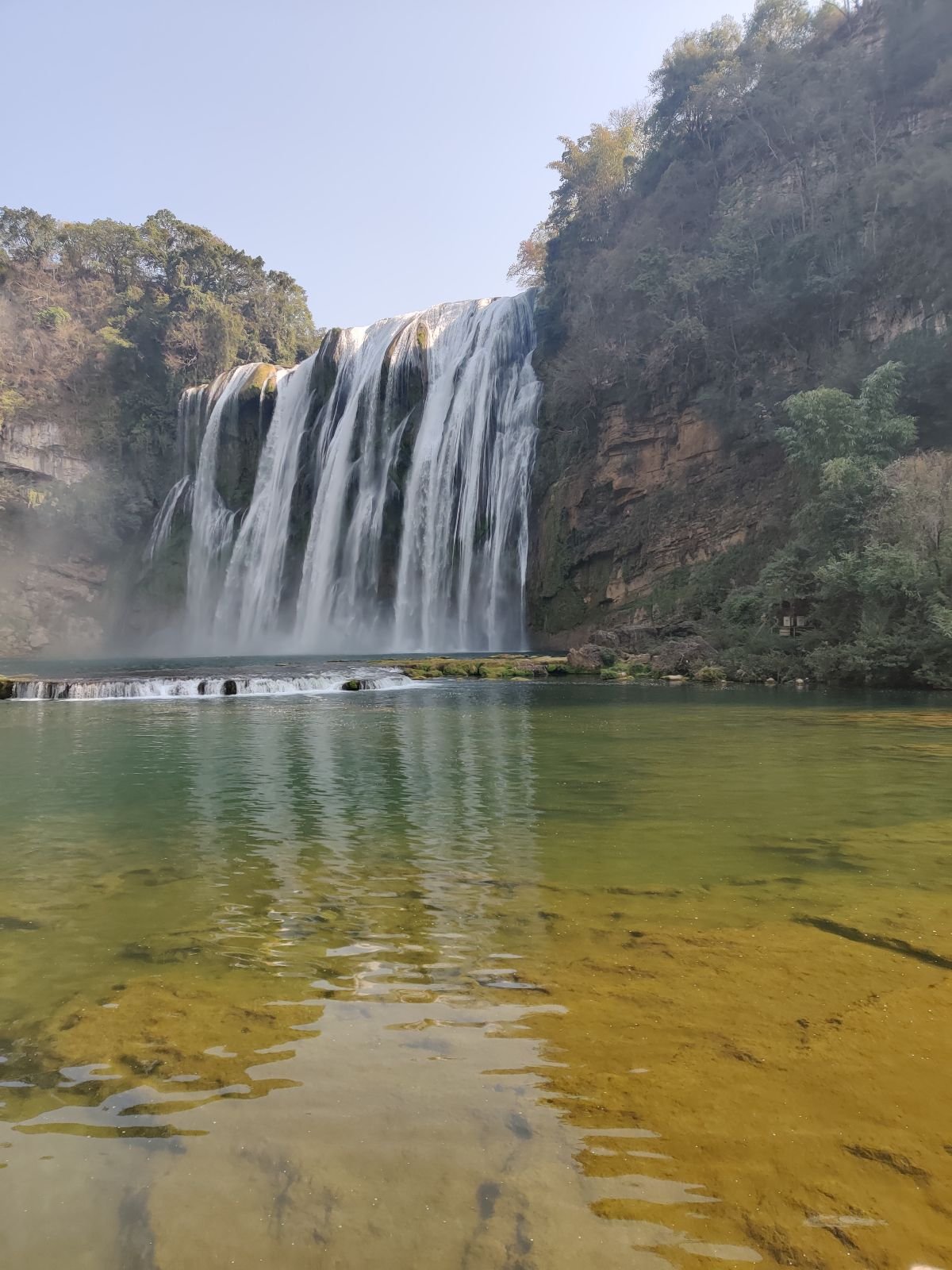
The walking circuit uses the scenic-area paths around Huangguoshu Waterfall, including viewpoints facing the main fall, the Water-Curtain Cave path if open, and linked walking sections at Tianxingqiao and Doupotang depending time and shuttle routing. The route is a plateau waterfall and karst walk rather than a summit hike.
Why it is essential
Huangguoshu is Guizhou’s most famous waterfall landscape and an essential walking route in the Yunnan-Guizhou Plateau. It represents the region’s high-rainfall karst hydrology: large waterfalls, caves, pools, and limestone channels.
Equipment
Standard hiking equipment: grippy shoes, waterproof layer or poncho, water, sun protection, and a dry bag for electronics. Trekking poles are optional but can help on wet steps.
Hazards and notes
Spray-soaked paths, slippery stairs, high-water closures, crowding, and low visibility inside cave/waterfall sections are the main hazards. Do not enter closed Water-Curtain Cave sections during high flow.
GPX / KML links
| Source | URL | Format / access | Reuse status |
|---|---|---|---|
| OpenStreetMap search: Huangguoshu Waterfall | openstreetmap.org | Map/search | OSM data is ODbL; geometry cross-check only |
| Waymarked Trails hiking map: Huangguoshu area | hiking.waymarkedtrails.org | OSM-derived map | OSM/Waymarked terms apply; source-map only; no route relation selected |
External links
External links
| Source | URL |
|---|---|
| China Discovery — Fanjingshan hiking | chinadiscovery.com |
| Asia Odyssey Travel — Fanjing Mountain | asiaodysseytravel.com |
| China Highlights — Fanjing Mountain | chinahighlights.com |
| GoKunming — Getting Away: Jiaozi Snow Mountain | gokunming.com |
| GoKunming — Hiking among the clouds on Yunnan’s Jiaozi Snow Mountain | gokunming.com |
| Kunming government — Jiaozi Snow Mountain | en.www.km.gov.cn |
| TravelChinaGuide — Jiaozi Snow Mountain | travelchinaguide.com |
| Wikiloc — Jiaozi Snow Mountain Northwest Slope Summit | wikiloc.com |
| AllTrails — Shilin Stone Forest | alltrails.com |
| UNESCO World Heritage Centre — South China Karst | whc.unesco.org |