Regional overview
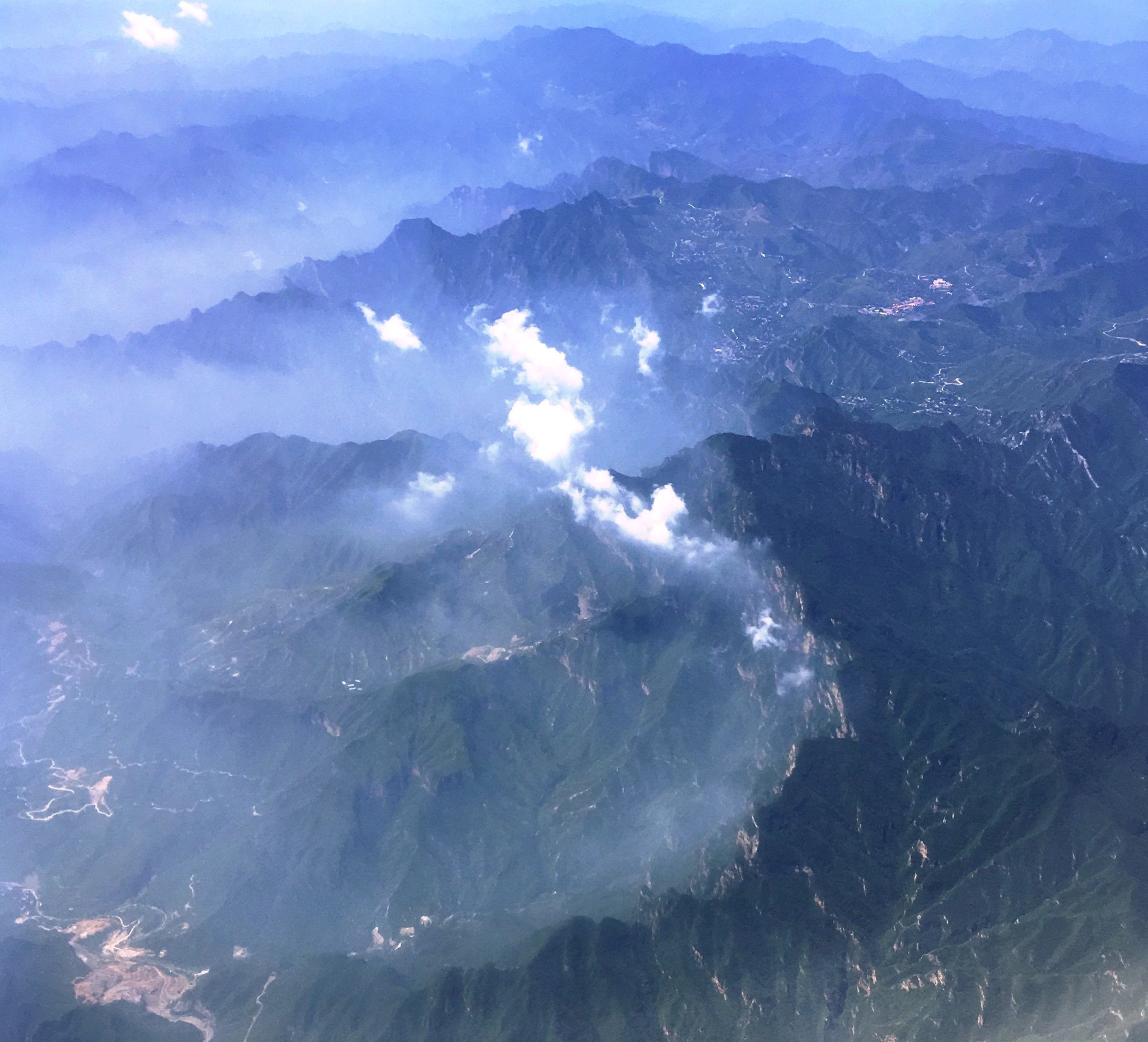
Northern and western Beijing hold the highest and most varied mountain day hikes in the municipality: Lingshan / Dongling Mountain at 2,303 m, flower meadows on Baihua Mountain, forest and gorge walking at Yunmengshan, pilgrimage paths on Miaofengshan, and newer official high-meadow trails in Yanqing such as Fenghuangtuo. The walking character ranges from managed scenic-area stairs to long, rough ridge loops used by local hiking clubs.
Access varies sharply by season. High peaks can be cold, windy and foggy even when central Beijing is hot; some forest parks close or restrict trails in winter, fire-risk periods, storms or maintenance. Route files are inconsistent, so source-map links are recorded where GPX/KML reuse was not verified.
Selection rationale
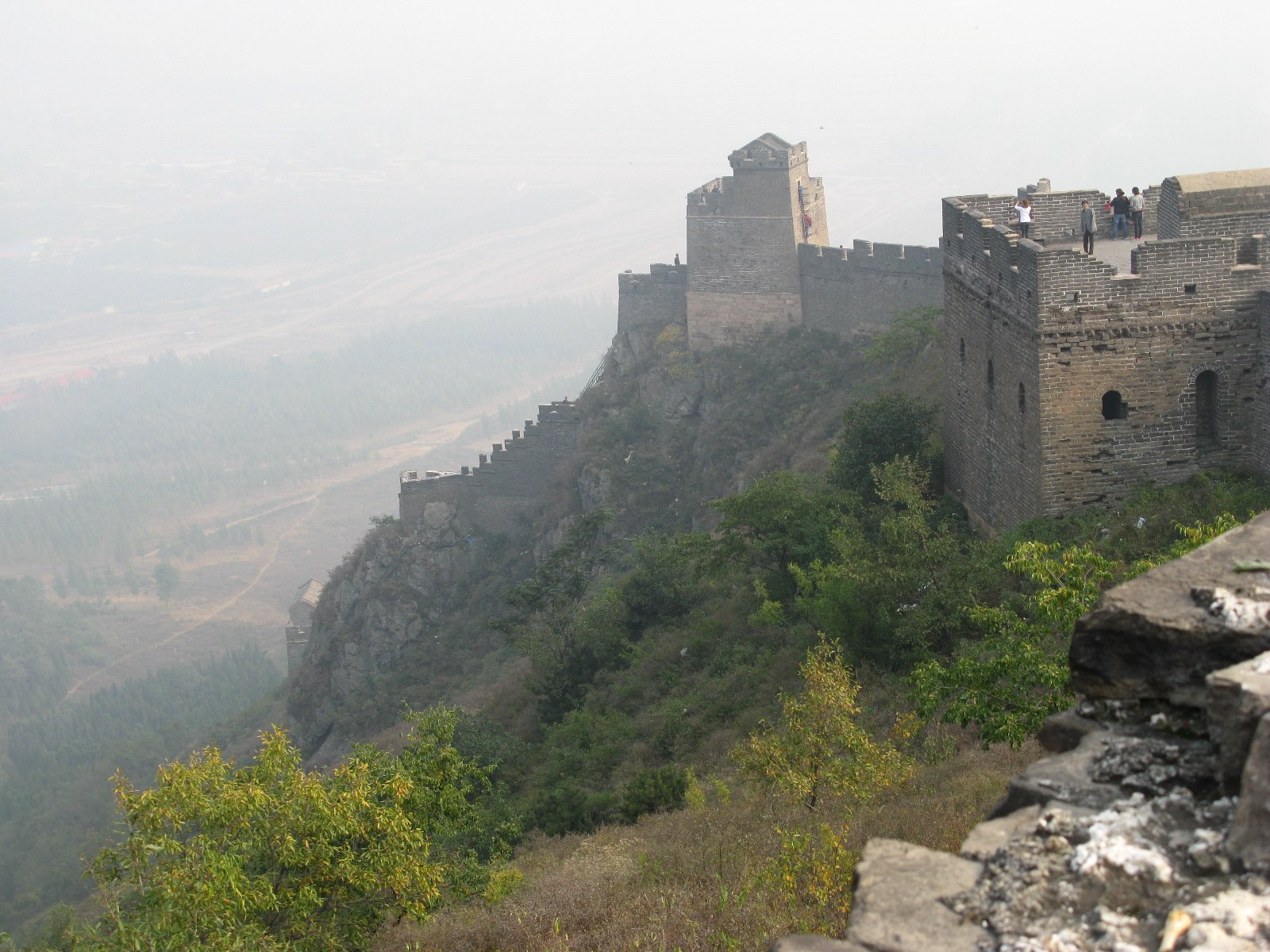
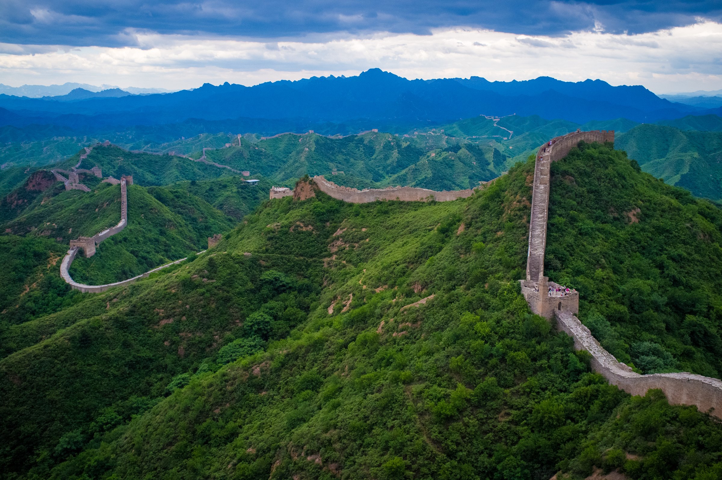
The five hikes below balance the highest summit, a botanical meadow mountain, a forest-gorge classic, a cultural pilgrimage ridge, and a current municipal high-meadow trail. They avoid the better-known Great Wall hikes already covered in the Yanshan Great Wall regional entries.
Summary table
| # | Hike | Country | Route type | Distance | Gain | Max elevation | Difficulty |
|---|---|---|---|---|---|---|---|
| 1 | Dongling / Lingshan Summit via Lingshan Ancient Trail | China | Out-and-back / summit trail | 8 km from 2026 Beijing gov source | 2,303 m | Hard | |
| 2 | Baihua Mountain Meadow and Main Peak Walk | China | Out-and-back | 4.3 km from AllTrails; longer meadow variants possible | 217 m | 1,989 m on AllTrails; official peaks higher | Moderate |
| 3 | Yunmengshan National Forest Park and Yunmeng Gorge | China | Point-to-point / loop variants | Approx. 8-12 km; exact route unresolved | 1,414 m | Moderate-hard | |
| 4 | Miaofengshan Super Loop / Pilgrimage Ridge | China | Loop | 16 km | 1,000 m-plus | 1,291 m | Hard |
| 5 | Fenghuangtuo Sky Grassland Trail | China | Loop / route variants | 8.5 km full trail; 5 km beginner route | Moderate |
1. Dongling / Lingshan Summit via Lingshan Ancient Trail
Snapshot
Itinerary
Use the current open Lingshan / Dongling Mountain trailhead and follow the high trail toward Beijing’s highest summit. The 2026 Beijing municipal source describes the 8 km Lingshan Ancient Trail as leading directly to the summit of Dongling Mountain, with high-altitude meadow scenery.
Why it is essential
This is the highest point in Beijing Municipality and the flagship high-mountain objective of the northern Beijing region.
Equipment
Boots, warm layer, waterproof/windproof shell, food, 2 litres of water, sun protection, headlamp, offline map and emergency layer. Carry winter traction if snow or ice is possible.
Hazards and notes
Weather can be severe at 2,300 m. Scenic-area gates and shuttle/road access may change. Earlier Beijing tourism pages use both Lingshan and Linshan spellings and list 2,302 or 2,303 m; this entry records the discrepancy.
GPX / KML links
| Source | URL | Format / access | Reuse status |
|---|---|---|---|
| Wikiloc: lingshan hills peak beijing | wikiloc.com | Route page / GPS track via Wikiloc | Wikiloc terms apply; source-map only |
| OpenStreetMap search: Lingshan Beijing | openstreetmap.org | Map/search | OSM data is ODbL; geometry cross-check only |
External links
- Beijing municipal government — high-meadow trails (2026-06-01)
- Visit Beijing — Lingshan / Linshan highest mountain
- Visit Beijing — Dongling Mountain
- Wikiloc — lingshan hills peak beijing
2. Baihua Mountain Meadow and Main Peak Walk

Snapshot
Itinerary
Follow the scenic-area trail toward Baihua Mountain’s high meadow and main peak viewpoints. The short AllTrails route is a stair-heavy out-and-back; longer variants continue toward marshy grassland and Baicaopan-side viewpoints if open.
Why it is essential
Baihua Mountain is the region’s classic flower meadow and botanical mountain, giving a gentler but high-elevation alternative to Lingshan.
Equipment
Walking shoes with grip, water, sun protection, rain shell, warm layer, and insect protection in summer.
Hazards and notes
Steps can be slippery, and summer thunderstorms are common. The AllTrails page has an odd “Guizhou” slug despite identifying the trail as near Beijing; location and route data were cross-checked against Beijing tourism pages.
GPX / KML links
| Source | URL | Format / access | Reuse status |
|---|---|---|---|
| AllTrails: Baihua Mountain Natural Scenic Area | alltrails.com | Route page / GPS track via AllTrails | AllTrails terms apply; source-map only |
| OpenStreetMap search: Baihua Mountain Beijing | openstreetmap.org | Map/search | OSM data is ODbL; geometry cross-check only |
External links
- AllTrails — Baihua Mountain Natural Scenic Area
- Visit Beijing — Baihua Mountain high-summer page
- TravelChinaGuide — Baihua Mountain
- Beijing municipal government — high-meadow trails (2026-06-01)
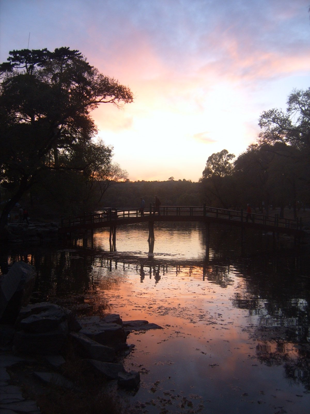
3. Yunmengshan National Forest Park and Yunmeng Gorge
Snapshot
Itinerary
The classic route starts near Shuidaoyu Bridge north of the park entrance, follows the stream into Yunmengshan, passes named gorge and waterfall features, and links toward Yunmeng Gorge. Easier scenic-area versions stay within Yunmeng Mountain National Forest Park paths.
Why it is essential
Yunmengshan is one of Beijing’s best-known forest mountain areas, promoted as “Little Huangshan” for steep ravines, forest, clouds, rocks and waterfalls.
Equipment
Boots or trail shoes, water, food, rain shell, sun protection, offline map, headlamp and trekking poles for wet gorge paths.
Hazards and notes
Gorge routes can be slippery and confusing at forks. Fire-risk or winter closure can affect access. Exact legal route line and trail status need current park confirmation before GPX publication.
GPX / KML links
| Source | URL | Format / access | Reuse status |
|---|---|---|---|
| AllTrails: Yunmeng Mountain Great Wall Loop | alltrails.com | Route page / GPS track via AllTrails | AllTrails terms apply; this is a nearby loop and may not match the gorge itinerary |
| OpenStreetMap search: Yunmengshan Beijing | openstreetmap.org | Map/search | OSM data is ODbL; geometry cross-check only |
External links
- Visit Beijing — Yunmeng Mountain National Forest Park main page
- Visit Beijing — Yunmeng Mountain access/opening
- Visit Beijing — Yunmeng Mountain-Yunmeng Gorge classic route
- AllTrails — Yunmeng Mountain Great Wall Loop
4. Miaofengshan Super Loop / Pilgrimage Ridge
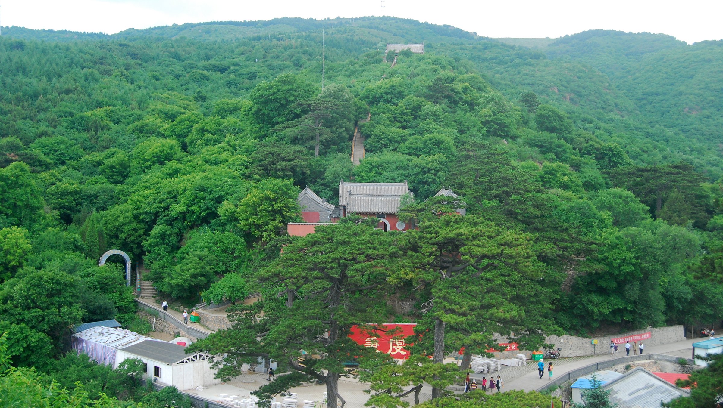
Snapshot
Itinerary
Start near Miaofengshan Temple and follow a ridge version of the old pilgrimage landscape, climbing onto plateau and Vulture Rock ridge terrain before descending by the temple side and paved steps. Beijing Hikers describes one steep scramble on the last hill and treats this as a mini version of the popular Three Peaks track.
Why it is essential
Miaofengshan is the region’s best blend of athletic ridge walking and cultural history, with old pilgrimage paths leading toward one of northern China’s famous temple mountains.
Equipment
Boots, 2 litres of water, food, sun protection, wind/rain layer, gloves for the scramble, offline map and headlamp.
Hazards and notes
This is a strenuous local-hiker route, not a simple scenic-area stroll. Heat, ridge exposure, loose ground and the scramble are the key hazards. Beijing Hikers page says the route is not currently scheduled; arrange current legal access if doing it independently.
GPX / KML links
| Source | URL | Format / access | Reuse status |
|---|---|---|---|
| Beijing Hikers: Miaofengshan Super Loop | beijinghikers.com | Route source page / guide map context | Beijing Hikers terms; no reusable GPX licence found; source-map only |
| OpenStreetMap search: Miaofengshan | openstreetmap.org | Map/search | OSM data is ODbL; geometry cross-check only |
External links
- Beijing Hikers — Miaofengshan Super Loop
- Visit Beijing — Miaofeng Mountain elevation and scenic context
- Tour Beijing — Miaofeng Mountain pilgrimage path
5. Fenghuangtuo Sky Grassland Trail
Snapshot
Itinerary
Follow the signed Fenghuangtuo trail through forest, springs and Ming Dynasty beacon-tower remains to the “Sky Grassland” summit meadow. The Beijing municipal source describes a full 8.5 km trail and a shorter 5 km beginner/family option.
Why it is essential
Fenghuangtuo adds a current, officially promoted high-meadow hike to the northern Beijing set, complementing older scenic-area classics with a modern trail identity.
Equipment
Walking shoes, water, sun protection, wind/rain layer, snacks and an offline map.
Hazards and notes
Exact gain, trailhead coordinates and full route map were not verified in this pass. Confirm the official trailhead, open routes and weather before leaving Yanqing town.
GPX / KML links
| Source | URL | Format / access | Reuse status |
|---|---|---|---|
| Beijing municipal government: high-meadow trails | english.beijing.gov.cn | Official source page / route description | No route-file licence found; route context only |
| OpenStreetMap search: Fenghuangtuo Yanqing | openstreetmap.org | Map/search | OSM data is ODbL; geometry cross-check only |
External links
- Beijing municipal government — Fenghuangtuo Hiking Trail (2026-06-01)
- Beijing municipal government — autumn mountain-trail article with Yanqing trail examples
External links
| Source | URL |
|---|---|
| Beijing municipal government — high-meadow trails (2026-06-01) | english.beijing.gov.cn |
| Beijing municipal government — autumn mountain-trail article (Yanqing examples) | english.beijing.gov.cn |
| Visit Beijing — Lingshan / Linshan highest mountain | english.visitbeijing.com.cn |
| Visit Beijing — Dongling Mountain | english.visitbeijing.com.cn |
| Visit Beijing — Baihua Mountain high-summer page | english.visitbeijing.com.cn |
| Visit Beijing — Yunmeng Mountain National Forest Park | english.visitbeijing.com.cn |
| Visit Beijing — Yunmeng Mountain access/opening | english.visitbeijing.com.cn |
| Visit Beijing — Yunmeng Mountain-Yunmeng Gorge classic route | english.visitbeijing.com.cn |
| TravelChinaGuide — Baihua Mountain | travelchinaguide.com |
| Beijing Hikers — Miaofengshan Super Loop | beijinghikers.com |
| Tour Beijing — Miaofeng Mountain pilgrimage path | m.tour-beijing.com |
| AllTrails — Baihua Mountain Natural Scenic Area | alltrails.com |
| AllTrails — Yunmeng Mountain Great Wall Loop | alltrails.com |
| Wikiloc — lingshan hills peak beijing | wikiloc.com |