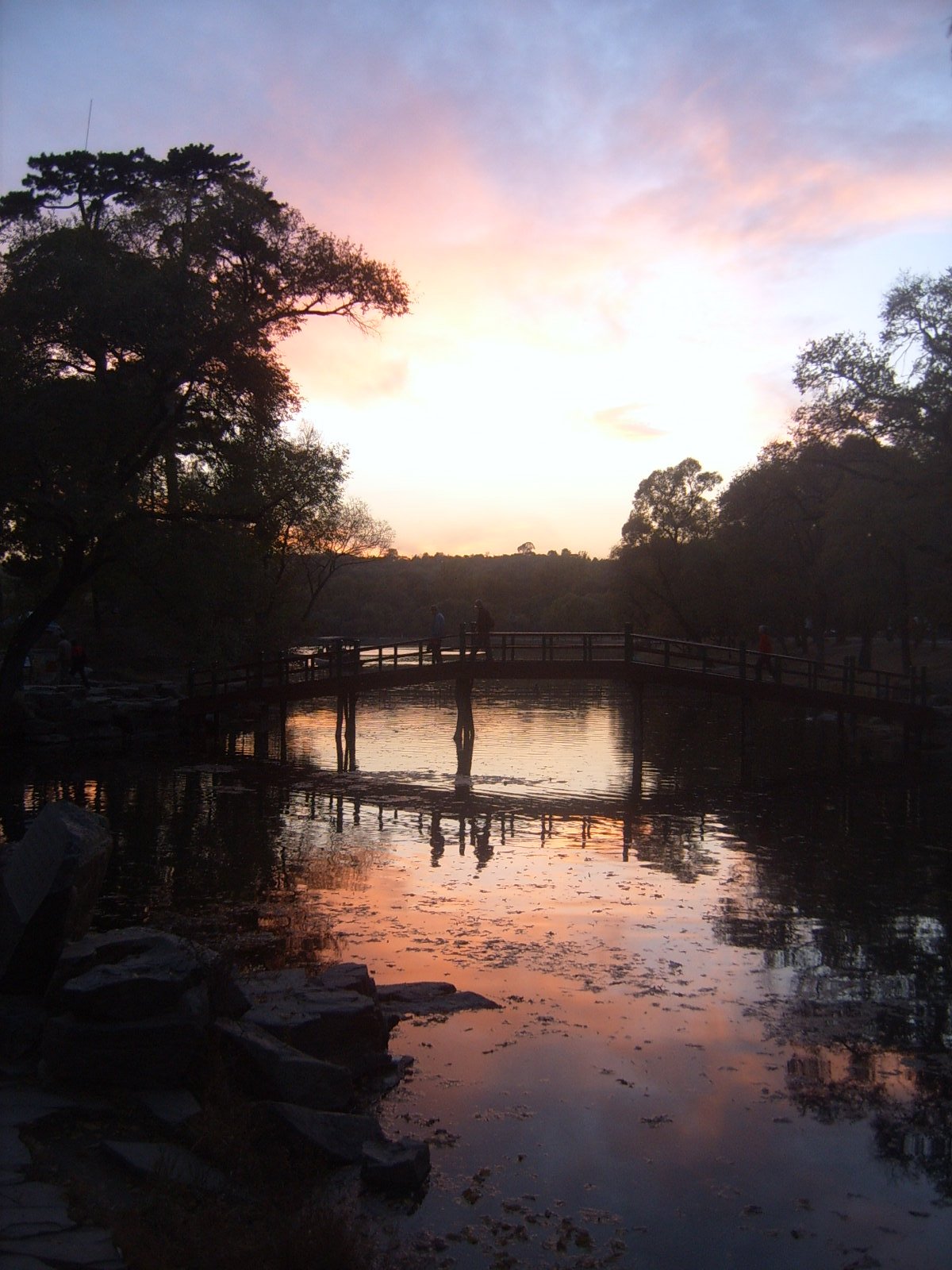
Regional overview
The Jiankou-Mutianyu region is the most dramatic Great Wall hiking area north of Beijing: broken wild wall and limestone ridges at Jiankou, restored visitor infrastructure at Mutianyu, and nearby Huairou wall-and-reservoir routes such as Huanghuacheng. Its hiking character ranges from managed stair walking to exposed, loose, unofficial ridge travel.
This entry is deliberately access-conscious. Current web checks found strong warnings that the classic Jiankou-to-Mutianyu link has been blocked at the Mutianyu boundary since August 2025, with Beijing Hikers and Great Wall Hiking both reporting that they no longer operate the route as before. The route remains historically essential, but it is not presented as a currently open independent hike.
Selection rationale
The five hikes below represent the region without treating restricted wild-wall access as normal. They include the famous but closure-marked Jiankou-Mutianyu traverse, the reliable Mutianyu restored-wall walk, a Dajiaolou-focused route within Mutianyu, the nearby Huanghuacheng lakeside wall, and the Lianhuachi-Mutianyu connector as a candidate route whose access needs local confirmation.
Summary table
| # | Hike | Country | Route type | Distance | Gain | Max elevation | Difficulty | Photo status |
|---|---|---|---|---|---|---|---|---|
| 1 | Jiankou to Mutianyu via Zhengbei Tower and Ox Horn Edge | China | Point-to-point | 5.3 km on AllTrails; 12 km for longer guide-route variants | 457 m on AllTrails | 1,009 m | Hard | Commons photo verified |
| 2 | Mutianyu Restored Great Wall Full Ridge Walk | China | Out-and-back | 7.2-7.6 km | 619 m | 748 m | Hard | Commons photo verified |
| 3 | Dajiaolou / Great Corner Tower from Mutianyu | China | Out-and-back | 3.2 km | 314 m | Hard | Commons Mutianyu photo verified | |
| 4 | Huanghuacheng Lakeside Great Wall Trail | China | Point-to-point | 3.5 km | 392 m | 553 m | Moderate | Commons photo verified |
| 5 | Lianhuachi to Mutianyu Connector | China | Point-to-point / out-and-back variants | Approx. 3.2 km wall section plus access | Moderate-hard | No specific photo found |
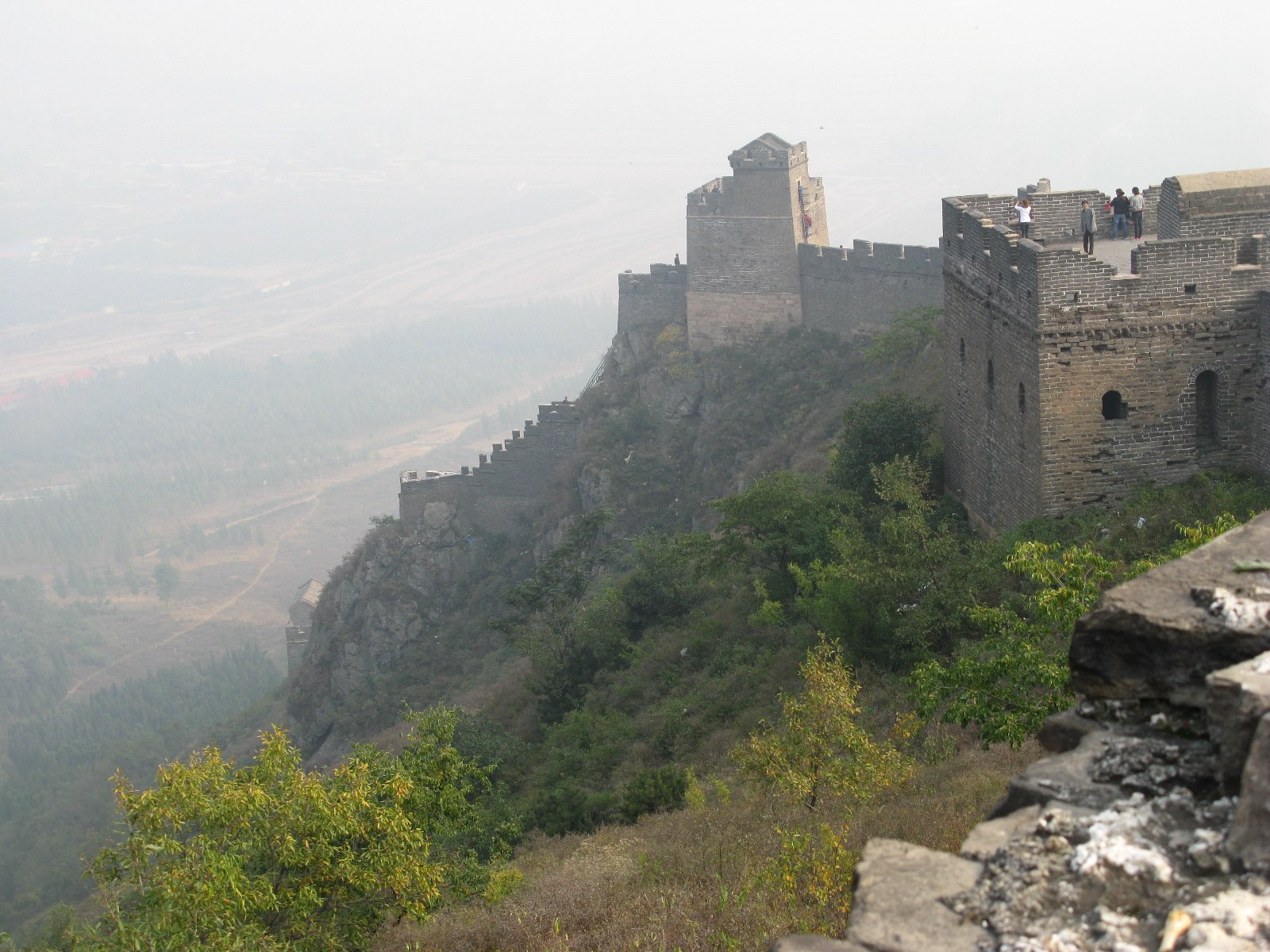
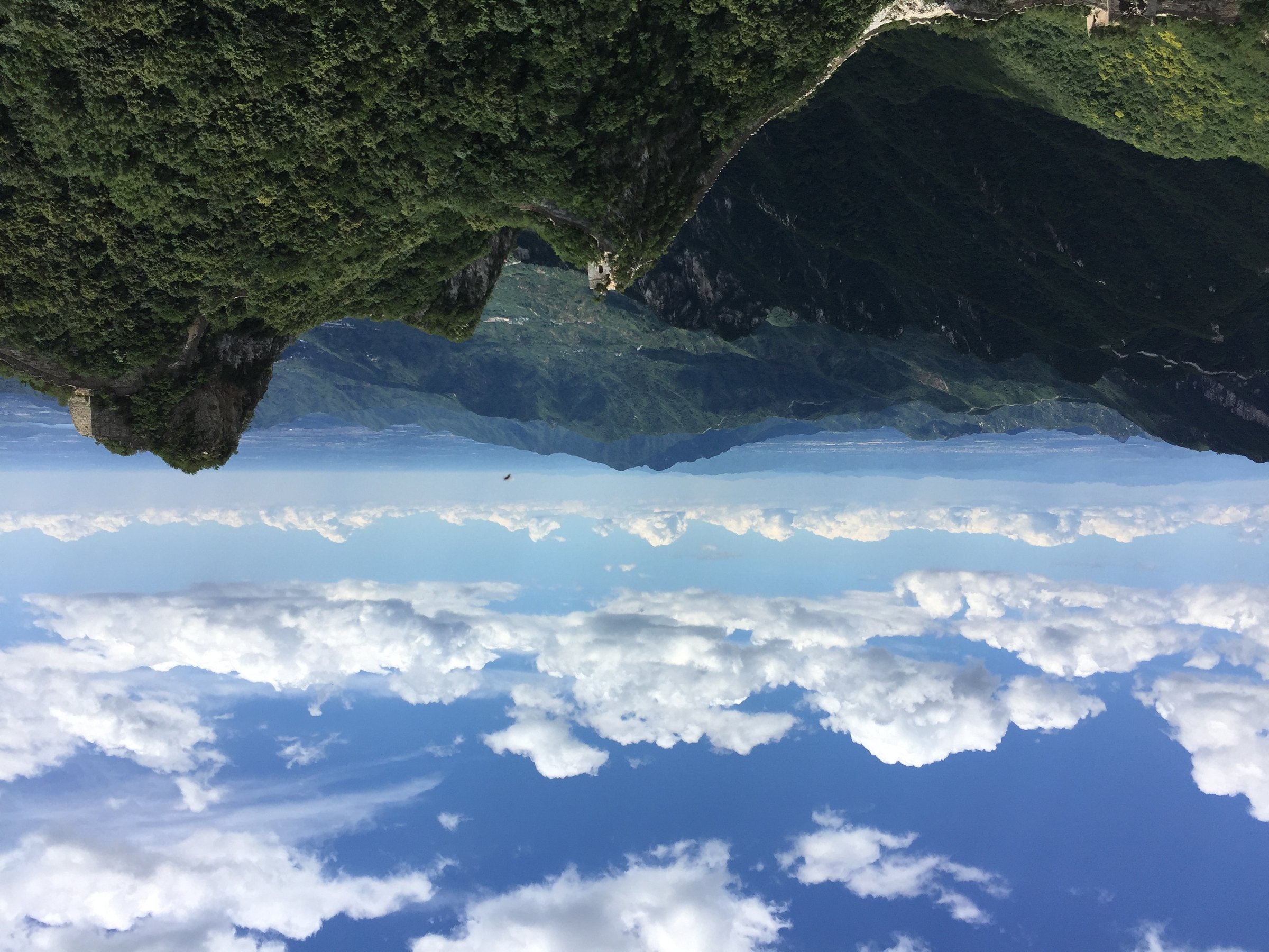
1. Jiankou to Mutianyu via Zhengbei Tower and Ox Horn Edge
Snapshot
Itinerary
The classic line climbs from the Jiankou side to Zhengbei Tower, follows broken wall east toward Ox Horn Edge, and then drops into the restored Mutianyu section. It is famous because the scenery changes from wild, steep, damaged wall to one of Beijing’s best maintained visitor sections.
Why it is essential
This is the region’s signature hike and one of the best-known Great Wall day routes. It stays in the catalogue because of its historical and guidebook importance, but it is currently a closure-marked route rather than a recommendation for independent use.
Equipment
Helmet is advisable on broken wild wall; boots, gloves, long trousers, 2 litres of water, food, sun protection, wind/rain layer, offline navigation, and a guide if access is legally open.
Hazards and notes
As of web checks in 2026, Great Wall Hiking reports a barrier wall erected at the Tower 23 boundary on 13 August 2025, and Beijing Hikers explains why they stopped doing the route. Loose masonry, exposed drops, scrambling, heat, ice and access enforcement are serious issues. Do not bypass barriers.
GPX / KML links
| Source | URL | Format | Licence / terms | Reuse status |
|---|---|---|---|---|
| AllTrails: Jiankou to Mutianyu | alltrails.com | Route page / GPS track via AllTrails | AllTrails terms apply | Source-map only; route status closed/restricted |
| OpenStreetMap search: Jiankou Mutianyu Great Wall | openstreetmap.org | Map/search | OSM data is ODbL | Geometry cross-check only |
External links
- Great Wall Hiking — permanent closure note
- Beijing Hikers — why they are not doing Jiankou-Mutianyu anymore
- TravelChinaGuide — Jiankou-Mutianyu guide-route
- TravelChinaGuide — Jiankou Great Wall overview
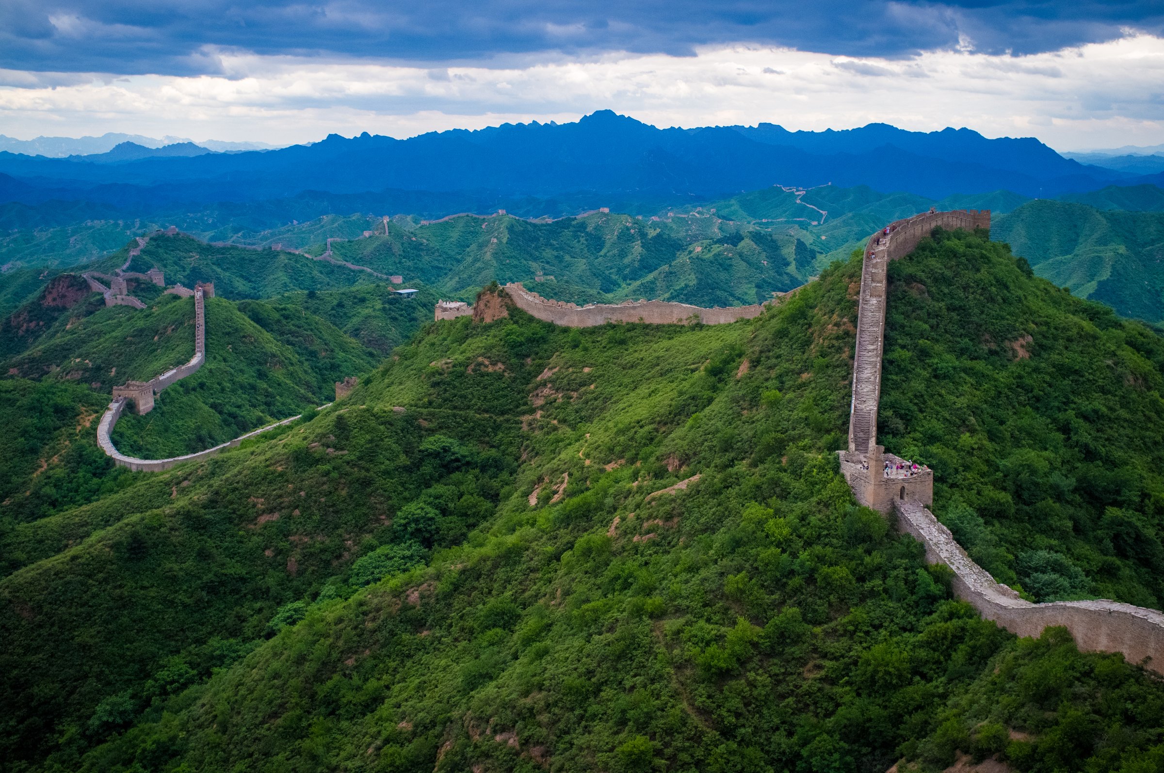
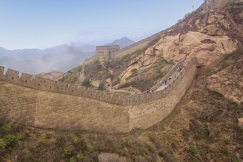
2. Mutianyu Restored Great Wall Full Ridge Walk
Snapshot
Itinerary
Enter the Mutianyu scenic area, climb or use the internal transport to the wall, and walk the main restored section between the eastern towers, Zhengguan Pass, the central towers, and the steep western high point near Tower 20. Strong walkers can complete a full out-and-back over the main tower sequence; shorter visits use the cable car or chairlift/toboggan system.
Why it is essential
Mutianyu is the reliable core hike of the region: famous, accessible, visually strong, and far less access-sensitive than Jiankou.
Equipment
Walking shoes with grip, water, sun protection, warm/wind layer, rain shell, and microspikes if winter ice is forecast.
Hazards and notes
The wall is restored but the stairs are steep and can be slick. Dogs are not allowed on the AllTrails route. Weather warnings can close the scenic area.
GPX / KML links
| Source | URL | Format | Licence / terms | Reuse status |
|---|---|---|---|---|
| AllTrails: The Great Wall at Mutianyu | alltrails.com | Route page / GPS track via AllTrails | AllTrails terms apply | Source-map only; reuse unclear |
| OpenStreetMap search: Mutianyu Great Wall | openstreetmap.org | Map/search | OSM data is ODbL | Geometry cross-check only |
External links
- AllTrails — Mutianyu route statistics
- Beijing municipal tourism — Mutianyu access
- TravelChinaGuide — Mutianyu Great Wall facts and access
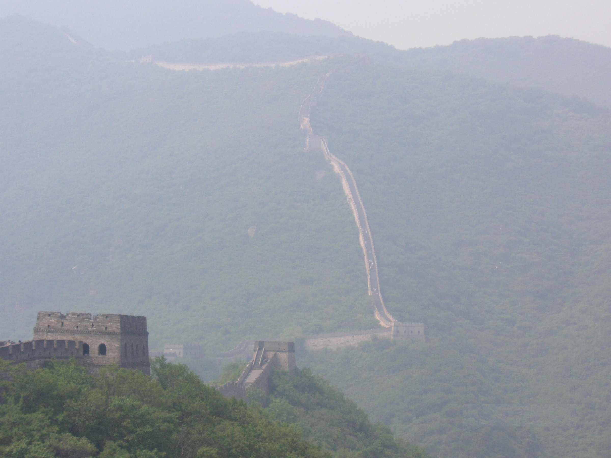
3. Dajiaolou / Great Corner Tower from Mutianyu
Snapshot
Itinerary
Focus the visit on the eastern end of Mutianyu and Dajiaolou, the Great Corner Tower, a strategically important tower where branch walls meet. Depending entry and lift choices, the walk can be a short but steep tower-focused route rather than a full Mutianyu traverse.
Why it is essential
Dajiaolou is one of Mutianyu’s named architectural highlights and gives a compact route for hikers who want a focused historic objective rather than the whole wall.
Equipment
Walking shoes with grip, water, sun protection, and warm/wind layer in cold seasons.
Hazards and notes
The route overlaps the managed scenic area but includes steep stairs. Check whether the specific eastern tower access is open on the day; closures can be tower-specific.
GPX / KML links
| Source | URL | Format | Licence / terms | Reuse status |
|---|---|---|---|---|
| AllTrails: Great Wall Mutianyu park listing | alltrails.com | Park route listing including Dajiaolou | AllTrails terms apply | Source-map only; individual route download/reuse unclear |
| OpenStreetMap search: Dajiaolou Mutianyu | openstreetmap.org | Map/search | OSM data is ODbL | Geometry cross-check only |
External links
- AllTrails — Great Wall Mutianyu route list including Dajiaolou
- Visit Beijing — Dajiaolou as a Mutianyu highlight
- China Daily — Dajiaolou description
4. Huanghuacheng Lakeside Great Wall Trail
Snapshot
Itinerary
Walk a short, steep section of Great Wall above the Huanghuacheng reservoir, where wall, ridge and water scenery meet. Depending current scenic-area controls, the line may use restored trail, wall steps and lakeside connectors rather than a long wild-wall traverse.
Why it is essential
Huanghuacheng gives the Jiankou-Mutianyu catalogue a different Great Wall landscape: ridge wall dropping toward water, with less of the high-volume visitor infrastructure of Mutianyu.
Equipment
Hiking shoes, water, sun protection, wind/rain layer, and caution on steep stone.
Hazards and notes
AllTrails flags no shade. Great Wall Forum notes nearby restored and private-property access complexities. Follow ticketed/scenic-area rules and avoid closed wild-wall continuations.
GPX / KML links
| Source | URL | Format | Licence / terms | Reuse status |
|---|---|---|---|---|
| AllTrails: Great Wall Huanghuacheng Trail | alltrails.com | Route page / GPS track via AllTrails | AllTrails terms apply | Source-map only; reuse unclear |
| OpenStreetMap search: Huanghuacheng Great Wall | openstreetmap.org | Map/search | OSM data is ODbL | Geometry cross-check only |
External links
5. Lianhuachi to Mutianyu Connector
Snapshot
Itinerary
Approach the wall on the Lianhuachi side and follow the wall/woodland gap toward Mutianyu, finishing into the more formal Mutianyu visitor area or returning before the boundary if access is unclear. Great Wall Forum notes a gap where walkers must follow a trail through woods rather than continuous wall.
Why it is essential
This connector represents the less-publicized eastern side of Mutianyu and offers a possible non-Jiankou wild-wall context for experienced hikers, provided current access is lawful and locally confirmed.
Equipment
Boots, long trousers, water, offline map, sun protection, wind/rain layer, and a conservative plan for reversing if gates or barriers are encountered.
Hazards and notes
Access legality and route condition are unresolved. Do not enter closed wall, private land, or scenic-area boundaries without permission. This is a candidate route until a current legal route source or local authority confirms access.
Photos
Photo status: No licence-compatible image found in this pass.
GPX / KML links
| Source | URL | Format | Licence / terms | Reuse status |
|---|---|---|---|---|
| OpenStreetMap search: Lianhuachi Mutianyu | openstreetmap.org | Map/search | OSM data is ODbL | Geometry cross-check only |
| Great Wall Forum: Lianhuachi | greatwallforum.com | Source page / access notes | No route-file licence found | Source-map/context only |
External links
- Great Wall Forum — Lianhuachi to Mutianyu distance and route character
- Great Wall Forum — Mutianyu area context
External links
| Source | URL |
|---|---|
| Great Wall Hiking — closure report | greatwallhiking.com |
| Beijing Hikers — closure/context post | beijinghikers.com |
| AllTrails — Mutianyu route | alltrails.com |
| AllTrails — Huanghuacheng route | alltrails.com |
| AllTrails — Great Wall Mutianyu park listing | alltrails.com |
| TravelChinaGuide — Jiankou | travelchinaguide.com |
| TravelChinaGuide — Mutianyu | travelchinaguide.com |
| Beijing municipal tourism — Mutianyu page | english.beijing.gov.cn |
| Great Wall Forum — Lianhuachi location | greatwallforum.com |