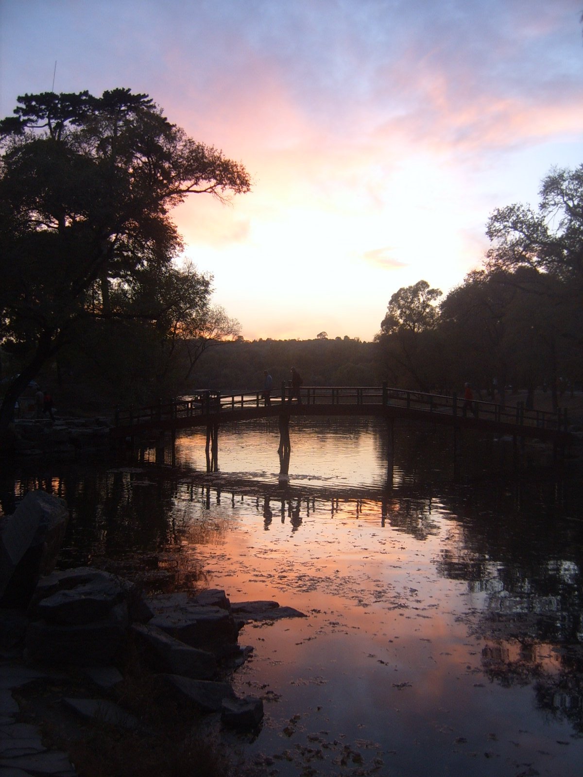
Regional overview
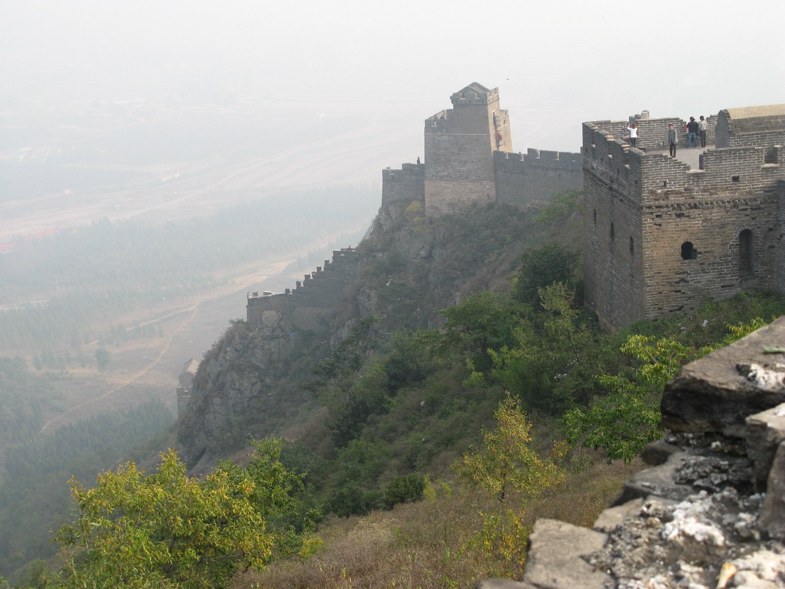
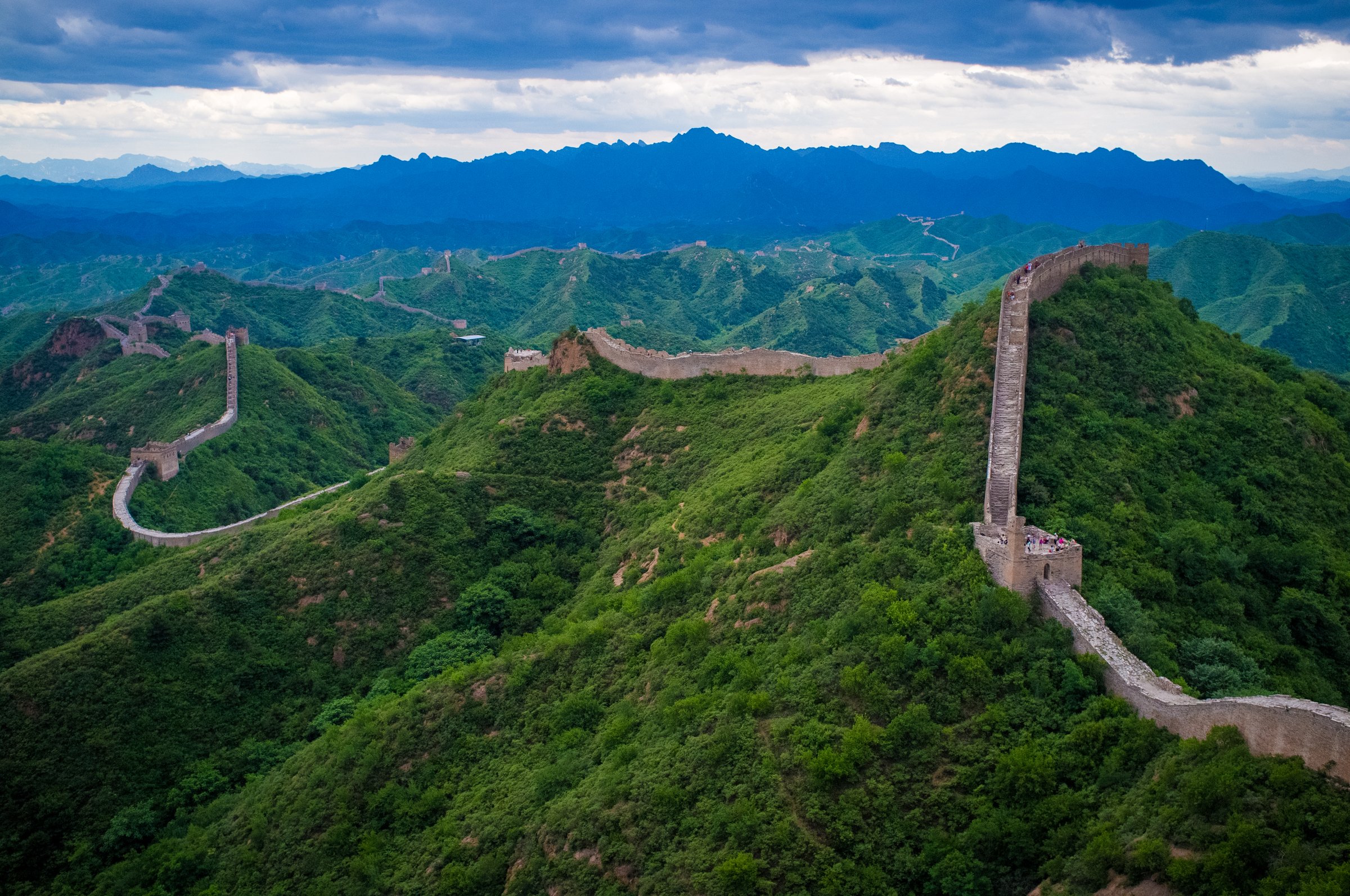
The Jinshanling-Gubeikou sector is one of the best day-hiking areas of the Ming Great Wall. It sits on Yanshan ridges between northeast Beijing and Hebei, where restored wall, unrestored “wild” wall, farm tracks, military exclusion zones, and ticketed scenic areas all meet. The hiking character is exposed ridge walking on stone steps and broken masonry, with short forest and village bypasses where the wall itself is closed.
This is a route-planning-sensitive region. Current web checks found good support for the classic Gubeikou-Panlongshan-Jinshanling traverse, but also repeated warnings about the military-zone detour near the 24-Eye Tower and changing storm/closure conditions after 2025. Every through-route here should be reconfirmed locally before travel.
Selection rationale
These five hikes cover the essential forms of the region: the classic long traverse, a restored Jinshanling ridge day, the Panlongshan 24-Eye Tower route, the rougher Wohushan / Crouching Tiger section, and the reverse/eastern traverse variant listed by a route database. Because this region is compact, several hikes overlap the same wall system but differ by access point, restoration level, exposure, and verification quality.
Summary table
| # | Hike | Country | Route type | Distance | Gain | Max elevation | Difficulty | Photo status |
|---|---|---|---|---|---|---|---|---|
| 1 | Gubeikou to Jinshanling Great Wall Traverse | China | Point-to-point | 13.4 km | 726 m | 581 m | Moderate-hard | Commons photo verified |
| 2 | Jinshanling Scenic-Area Ridge Walk | China | Out-and-back / traverse variants | Up to 10.5 km on wall | Approx. | Moderate | Commons photo verified | |
| 3 | Gubeikou Panlongshan to 24-Eye Tower | China | Out-and-back / partial loop | 8.2 km | 343 m | 470 m | Moderate | Commons photo verified |
| 4 | Gubeikou Wohushan / Crouching Tiger Mountain Great Wall | China | Out-and-back | Approx. 4.8 km wall section; walking total unresolved | Approx. 665 m | Moderate-hard | No specific photo found | |
| 5 | Jinshanling East Gate to Gubeikou Variant | China | Point-to-point | 11.1 km | 472 m | Moderate | Commons photo verified |
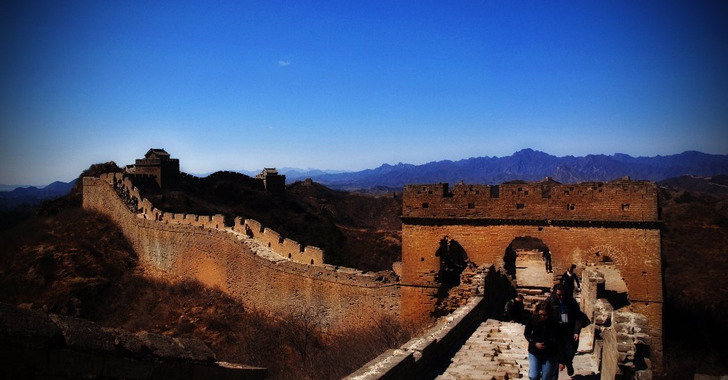
1. Gubeikou to Jinshanling Great Wall Traverse

Snapshot
Itinerary
Start on the unrestored Panlongshan side of Gubeikou and climb eastwards over rough wall and ridge paths toward the General Tower and 24-Eye Tower. The wall beyond the 24-Eye Tower enters or borders a military area, so walkers must leave the wall and follow the signed/established valley detour before rejoining toward Jinshanling. The final section changes character, becoming more restored and formal as it approaches the Jinshanling scenic area.
Why it is essential
This is the region’s classic one-day traverse: wild wall, military detour, restored Jinshanling towers, and long Yanshan ridge views in one route.
Equipment
Hiking shoes or boots with grip, sun hat, wind layer, rain shell, 1.5-2.5 litres of water, food, offline map, power bank, and traction if winter ice is possible.
Hazards and notes
Do not continue through the military zone. Expect loose bricks, broken parapets, steep stone steps, limited shade, and confusing exit rules. Web checks found both 2025 closure warnings and 2026 traveller reports describing the traverse as possible via the detour; verify with Jinshanling/Gubeikou staff or a local operator shortly before travel.
GPX / KML links
| Source | URL | Format / access | Reuse status |
|---|---|---|---|
| AllTrails: Gubeikou - Jinshanling Great Wall | alltrails.com | Route page / GPS track via AllTrails | AllTrails terms apply; source-map only, reuse unclear |
| OpenStreetMap search: Gubeikou Jinshanling Great Wall | openstreetmap.org | Map/search | OSM data is ODbL; geometry cross-check only |
External links
- AllTrails — Gubeikou - Jinshanling Great Wall
- TravelChinaGuide — Gubeikou to Jinshanling route and military-area bypass
- Top China Travel — Gubeikou-Jinshanling hiking route and 24-Eye Tower bypass
- China Roads — Gubeikou section overview
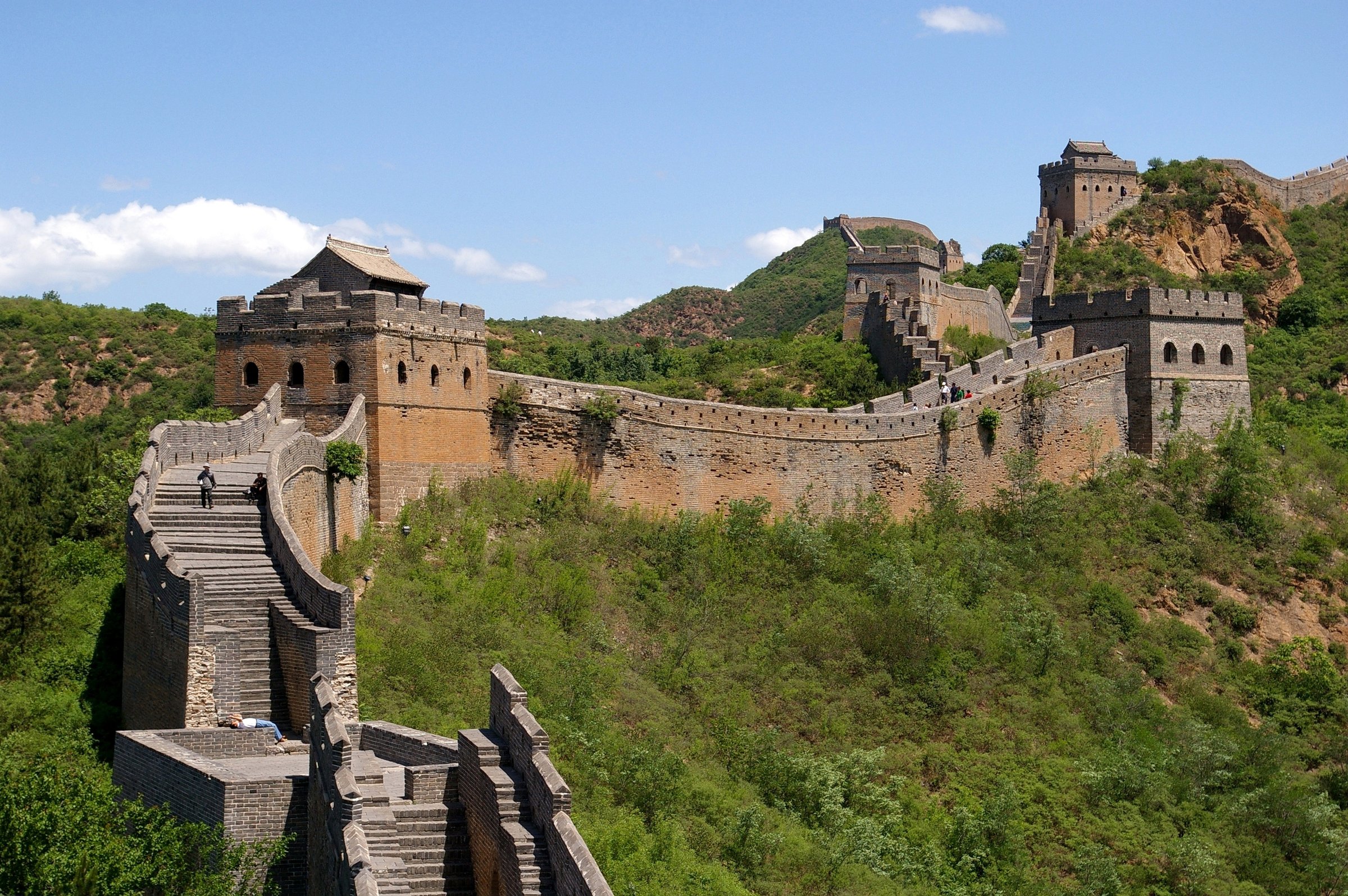
2. Jinshanling Scenic-Area Ridge Walk
Snapshot
Itinerary
Enter the Jinshanling scenic area and walk along the restored and semi-restored wall between the major passes and towers. The full historic section is listed by Beijing tourism sources as 10.5 km long, with 67 watchtowers and several passes; most visitors make a shorter ridge walk between the main gate area and east or west viewpoints, returning by the same gate, another gate, or the cable car if operating.
Why it is essential
Jinshanling is the most visually iconic and best-supported hike in the region. It gives sustained Great Wall ridge walking without the access uncertainty of the wild-wall through-routes.
Equipment
Comfortable hiking shoes, water, sun protection, wind/rain shell, warm layer in shoulder seasons, and cash/mobile payment for tickets or cable-car options.
Hazards and notes
Steps are steep and uneven even on restored sections. Scenic-area gates, cable cars and some towers can close during storms, high wind, snow or maintenance. Do not cross closure barriers toward Simatai or Gubeikou.
GPX / KML links
| Source | URL | Format / access | Reuse status |
|---|---|---|---|
| OpenStreetMap search: Jinshanling Great Wall | openstreetmap.org | Map/search | OSM data is ODbL; geometry cross-check only |
| Wikiloc search: Jinshanling Great Wall | wikiloc.com | Route-search page | Wikiloc terms apply; candidate source maps only, select current public track later |
External links
- Visit Beijing — Jinshanling section length and towers
- China Highlights — Jinshanling section practical guide
3. Gubeikou Panlongshan to 24-Eye Tower
Snapshot
Itinerary
From Gubeikou, climb onto the Panlongshan section and follow the wall toward the General Tower and the higher 24-Eye Tower. This route turns around or descends before the off-limits military area, avoiding the longer Jinshanling commitment.
Why it is essential
It is the best short-form Gubeikou hike: unrestored wall, historic towers, and the key closure landmark without needing a through-traverse.
Equipment
Hiking shoes, water, sun protection, wind/rain layer, offline map, and gloves if using hands on rough masonry.
Hazards and notes
The wall is unrestored and rough. The route near 24-Eye Tower is blocked toward Jinshanling because of the military area. Do not attempt to force a continuation along the wall.
GPX / KML links
| Source | URL | Format / access | Reuse status |
|---|---|---|---|
| Wikiloc: Great Wall Gubeikou - 24 eyes tower | wikiloc.com | Route page / GPS track via Wikiloc | Wikiloc terms apply; source-map only, GPX download availability and reuse terms require account/terms check |
| OpenStreetMap search: Panlongshan Great Wall | openstreetmap.org | Map/search | OSM data is ODbL; geometry cross-check only |
External links
- Wikiloc — Great Wall Gubeikou - 24 eyes tower (uploaded September 2025)
- Opie — Panlongshan section and 24-Eye Tower military-zone block
- China Roads — Gubeikou / Panlongshan overview
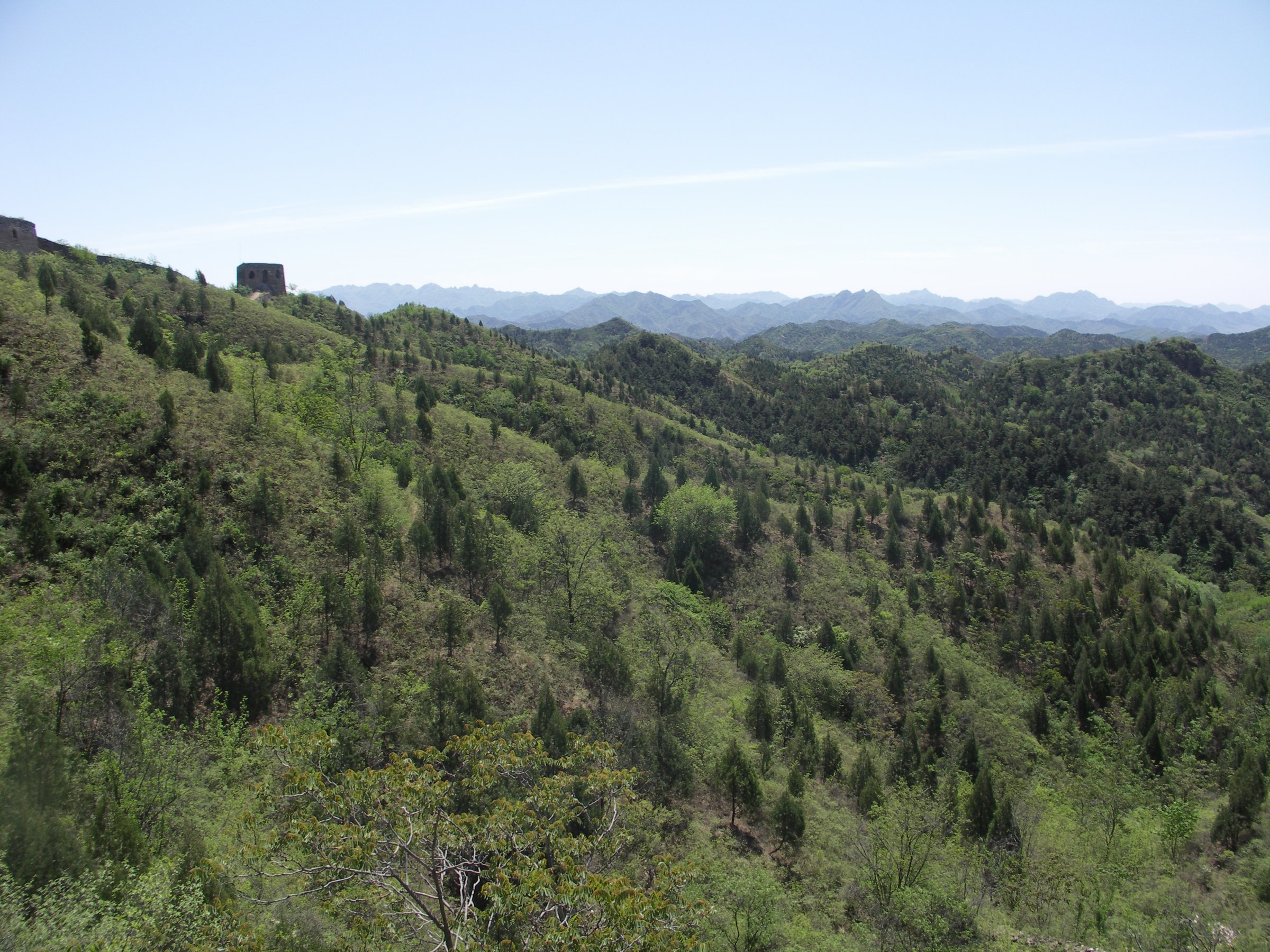
4. Gubeikou Wohushan / Crouching Tiger Mountain Great Wall
Snapshot
Itinerary
From the Gubeikou bridge area, enter the Wohushan side west of the river and climb the unrestored wall toward higher towers and views over the Gubeikou pass. Unlike Panlongshan, this side does not naturally continue to Jinshanling; sources describe it as a separate branch requiring an out-and-back.
Why it is essential
Wohushan gives the wilder, less-restored side of Gubeikou and a different view of the pass. It is important for understanding Gubeikou as a paired defensive landscape rather than a single eastbound traverse.
Equipment
Boots or grippy trail shoes, long trousers, water, sun protection, wind/rain shell, offline map, and a conservative turnaround time.
Hazards and notes
The wall is unrestored, with deteriorated masonry and possible brush. Exact public-ticket status, route length, and exit points need current local confirmation.
GPX / KML links
| Source | URL | Format / access | Reuse status |
|---|---|---|---|
| OpenStreetMap search: Wohushan Great Wall | openstreetmap.org | Map/search | OSM data is ODbL; geometry cross-check only |
| Great Wall Forum: Wohushan | greatwallforum.com | Source page / access notes | No route-file licence found; access and location context only |
External links
- Great Wall Forum — Wohushan location and access notes
- China Roads — Wohushan length and Gubeikou branch description
- Visit Beijing — Gubeikou sections and Crouching Tiger Hill altitude
5. Jinshanling East Gate to Gubeikou Variant
Snapshot
Itinerary
This route uses the Jinshanling East Gate as the start and works west toward Gubeikou, combining the restored Jinshanling ridge with the rougher Panlongshan section and the same military-zone bypass. It is useful when transport or ticketing makes Jinshanling the easier start.
Why it is essential
It is the key reverse traverse variant and has a separate route-database record, making it valuable for planners comparing line direction, distance and access.
Equipment
Same as the main traverse: boots or grippy shoes, 1.5-2.5 litres of water, sun protection, wind/rain layer, snacks, offline map and transport backup.
Hazards and notes
The same military-zone restriction applies. Some recent reports mention locked or changed gates at Jinshanling East Gate; verify the exact open exit/start gate before committing.
GPX / KML links
| Source | URL | Format / access | Reuse status |
|---|---|---|---|
| AllTrails: Great Wall of China, Jinshanling East Gate to Gubeikou | alltrails.com | Route page / GPS track via AllTrails | AllTrails terms apply; source-map only, reuse unclear |
| OpenStreetMap search: Jinshanling East Gate Gubeikou | openstreetmap.org | Map/search | OSM data is ODbL; geometry cross-check only |
External links
- AllTrails — Great Wall of China, Jinshanling East Gate to Gubeikou
- TravelChinaGuide — Gubeikou-Jinshanling route and military-area bypass
Missing data / follow-up work
- Confirm current opening of the Gubeikou-Panlongshan to Jinshanling detour within one week of publication; access reports changed after 2025 storms and military-zone enforcement.
- Obtain official GPX/KML only if a scenic-area authority or licensed route provider publishes one. Current entries are route pages/source maps only.
- Recheck Jinshanling East Gate start/exit rules and ticket requirements before using Hike 5 as a standalone recommendation.
External links
| Source | URL |
|---|---|
| TravelChinaGuide — Gubeikou Great Wall | travelchinaguide.com |
| Visit Beijing — Jinshanling Great Wall | english.visitbeijing.com.cn |
| Visit Beijing — Gubeikou sections and Crouching Tiger Hill altitude | english.visitbeijing.com.cn |
| China Highlights — Jinshanling section practical guide | chinahighlights.com |
| Top China Travel — Gubeikou-Jinshanling hiking route and 24-Eye Tower bypass | topchinatravel.com |
| China Roads — Gubeikou section overview | china-roads.com |
| Opie — Panlongshan section and 24-Eye Tower military-zone block | opie-etc.com |
| Great Wall Forum — Wohushan location and access notes | greatwallforum.com |
| AllTrails — Gubeikou-Jinshanling | alltrails.com |
| AllTrails — Jinshanling East Gate-Gubeikou | alltrails.com |
| Wikiloc — Great Wall Gubeikou - 24 eyes tower | wikiloc.com |