Regional overview
Eastern Yanshan around Qinhuangdao is where mountains, Great Wall passes and the Bohai Sea meet. The walking character is unusually varied: steep wall climbs above Shanhaiguan, coastal cultural walking at Laolongtou, granite mountain scenery at Zushan, wild-wall valleys around Banchangyu and Dongjiakou, and lower historic summits such as Jieshi Mountain.
This is not a mature GPX-rich hiking region in English-language sources. The most reliable source material is a combination of official/tourism attraction pages, Great Wall specialist pages, OSM map checks and a few route pages. Several route statistics remain approximate.
Selection rationale
The five hikes below represent the region’s core identities: the “first mountain” of the Great Wall at Jiaoshan, the sea-end of the wall at Laolongtou, the high eastern Yanshan summit of Zushan, the wilder Qinhuangdao wall at Banchangyu, and the historic sea-view summit of Jieshi Mountain.
Summary table
| # | Hike | Country | Route type | Distance | Gain | Max elevation | Difficulty |
|---|---|---|---|---|---|---|---|
| 1 | Jiaoshan Great Wall Ridge Climb | China | Out-and-back / short traverse | Approx. 4-6 km | Approx. | Approx. 519 m | Moderate-hard |
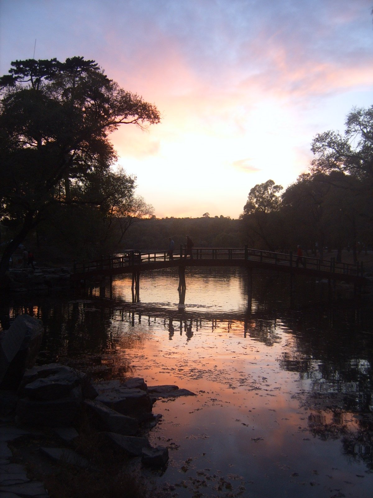
| 2 | Shanhaiguan First Pass to Laolongtou Coastal Wall Walk | China | Point-to-point urban/cultural walk | Approx. 6-8 km | Low | Low | Easy-moderate |
| 3 | Zushan Tiannv Peak Scenic Hike | China | Summit / loop variants | Approx. 6-12 km | 1,428 m | Moderate-hard | |
| 4 | Banchangyu Great Wall Local Loop / Day Section | China | Loop / out-and-back variants | Approx. 6-10 km day section; full wall system longer | Up to approx. 850 m terrain | Hard | |
| 5 | Jieshi Mountain / Changli Sea-View Summit | China | Out-and-back / stair loop | Approx. 5-8 km | Approx. | 695 m | Moderate |
1. Jiaoshan Great Wall Ridge Climb
Snapshot
Itinerary
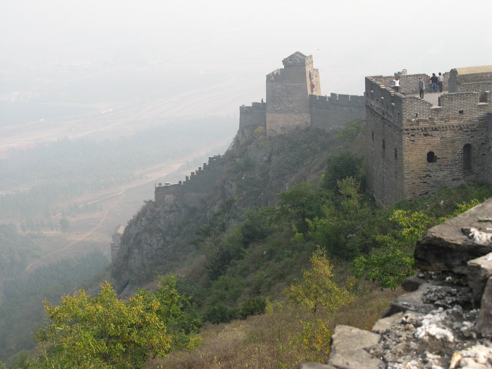
Enter Jiaoshan Great Wall and climb the steep wall above Shanhaiguan toward the higher ridge viewpoints. The route gives expanding views over Shanhaiguan, Yansai Lake, Longevity Mountain and the coastal plain before returning the same way unless a current scenic-area map confirms an open loop.
Why it is essential
Jiaoshan is commonly promoted as the first mountain climbed by the Great Wall after leaving the sea, making it the natural mountain hike of Shanhaiguan.
Equipment
Hiking shoes, water, sun protection, wind/rain layer, and traction in icy conditions.
Hazards and notes
Wall steps are steep and exposed. Exact open sections and loop options need current scenic-area confirmation; do not continue onto closed wild-wall branches.
GPX / KML links
| Source | URL | Format / access | Reuse status |
|---|---|---|---|
| OpenStreetMap search: Jiaoshan Great Wall | openstreetmap.org | Map/search | OSM data is ODbL; geometry cross-check only |
| Top China Travel: Jiaoshan hiking route | topchinatravel.com | Source page / route guide | No route-file licence found; context and itinerary only |
External links
2. Shanhaiguan First Pass to Laolongtou Coastal Wall Walk
Snapshot
Itinerary
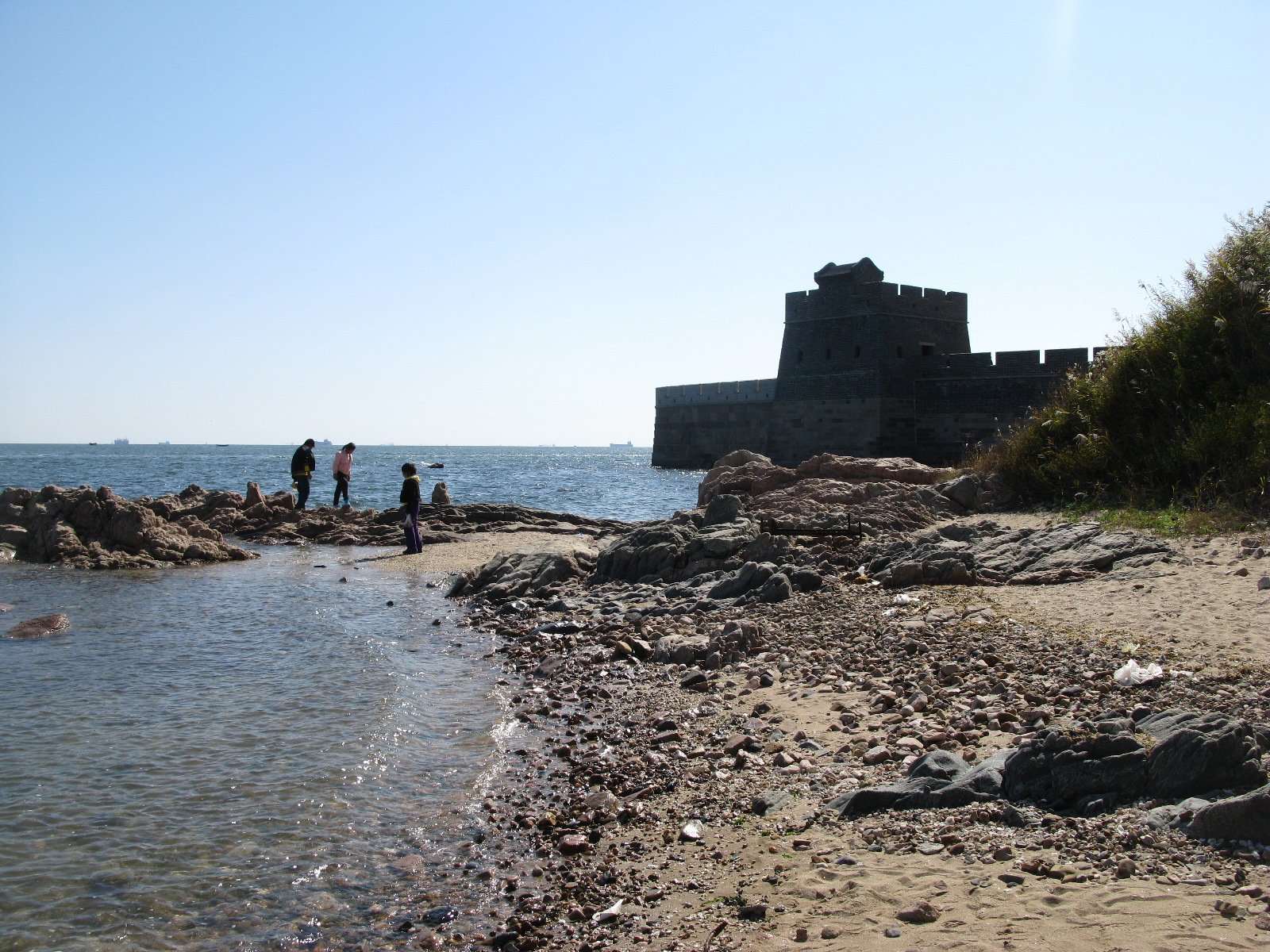
Start at Shanhaiguan Pass, the “First Pass Under Heaven”, and walk through the old-city/fortress context toward Laolongtou, the Old Dragon Head, where the Great Wall reaches the Bohai Sea. The route is more cultural walk than mountain hike, but it is the indispensable sea-end companion to the Jiaoshan climb.
Why it is essential
The eastern end of the Ming Great Wall is the defining landscape of Qinhuangdao. No Eastern Yanshan catalogue is complete without the pass-to-sea sequence.
Equipment
Comfortable walking shoes, water, sun/wind protection and rain shell.
Hazards and notes
Much of the walk is urban or on managed scenic-area surfaces. Traffic crossings, heat, coastal wind and ticketed-site opening hours are the main practical concerns.
GPX / KML links
| Source | URL | Format / access | Reuse status |
|---|---|---|---|
| OpenStreetMap search: Shanhaiguan to Laolongtou | openstreetmap.org | Map/search | OSM data is ODbL; geometry cross-check only |
| TravelChinaGuide: Shanhaiguan Great Wall | travelchinaguide.com | Source page | No route-file licence found; attraction/access context only |
External links
3. Zushan Tiannv Peak Scenic Hike
Snapshot
Itinerary
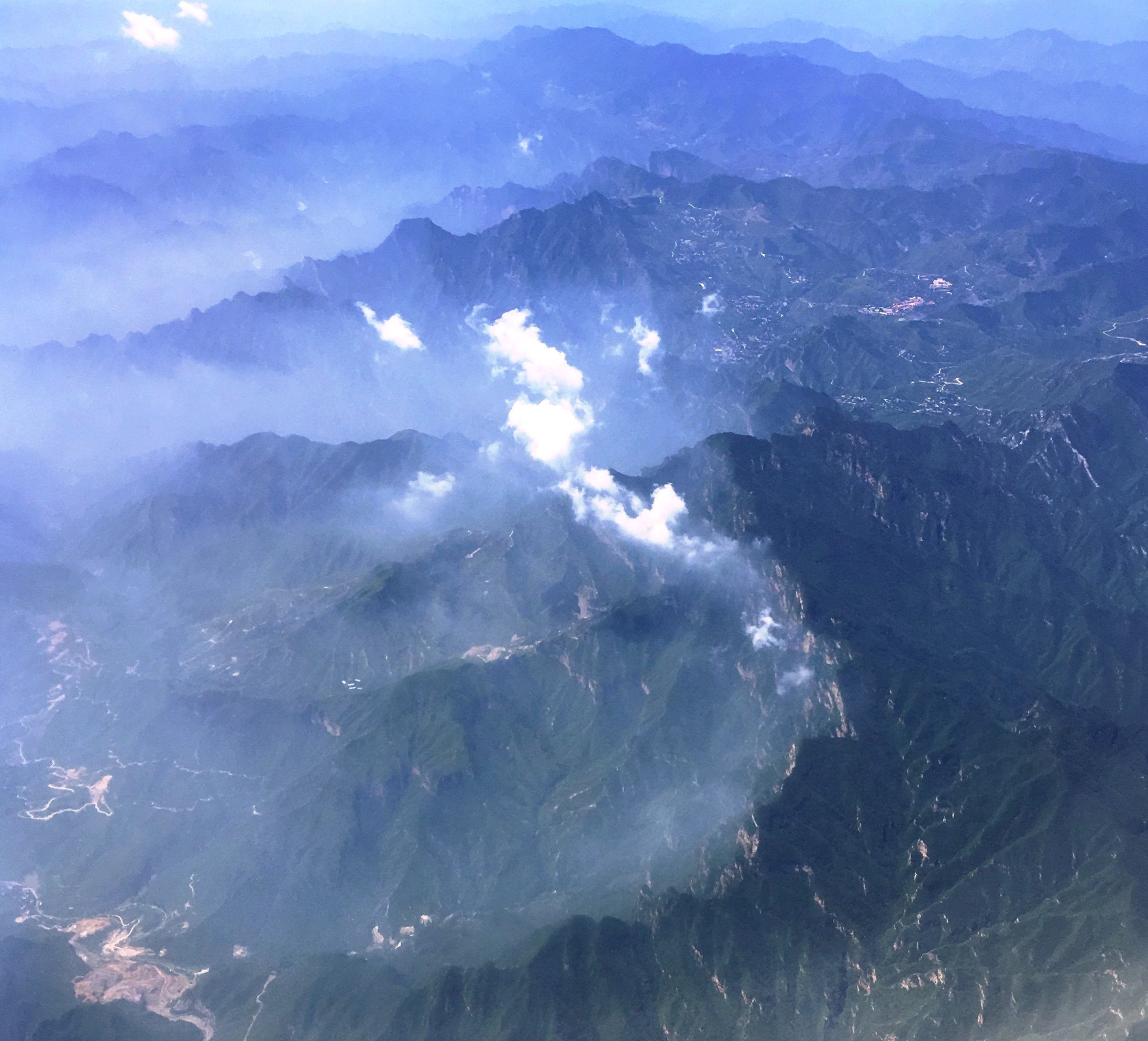
Use the current Zushan scenic-area entrance and internal transport rules to reach the walking zone, then climb or loop toward Tiannv Peak and the sea/cloud viewpoints. Sources describe Zushan as the “ancestor” mountain of the local eastern Yanshan branches, with views toward the sea, Great Wall and northern mountains.
Why it is essential
Zushan is the region’s most substantial mountain hike and the main high-elevation counterweight to the Great Wall and coastal walks.
Equipment
Mountain walking shoes, water, food, warm layer, rain shell, sun protection, offline map and headlamp for a full-day route.
Hazards and notes
Exact trail statistics and open shuttle/path combinations need current scenic-area confirmation. High wind, fog, thunderstorms, icy winter paths and late return transport are planning risks.
GPX / KML links
| Source | URL | Format / access | Reuse status |
|---|---|---|---|
| OpenStreetMap search: Zushan Qinhuangdao | openstreetmap.org | Map/search | OSM data is ODbL; geometry cross-check only |
| Visit Beijing: Zushan / Tiannv Town | visitbeijing.com.cn | Source page | No route-file licence found; elevation and access context only |
External links
- Visit Beijing — Zushan / Tiannv Town elevation
- Trip.com — Zushan route-duration and attraction data
- Shanhaiguan Great Wall tourism page — Zushan overview
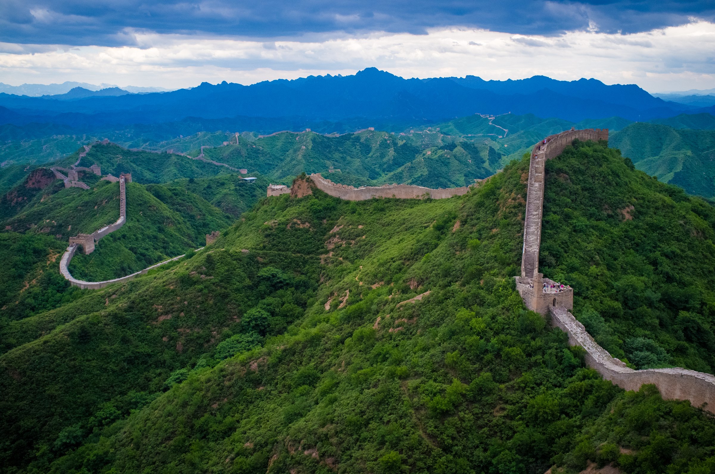
4. Banchangyu Great Wall Local Loop / Day Section
Snapshot
Itinerary
Use Banchangyu as the start and walk a legal, locally confirmed section of the wall and valley rather than attempting the full Banchangyu-Dongjiakou multi-day line. The day objective is to sample the restored Banchangyu wall, dramatic stone formations and nearby towers, returning before the route becomes a longer through-hike.
Why it is essential
Banchangyu represents Qinhuangdao’s wilder Great Wall landscapes away from Shanhaiguan crowds, with older wall lines, steep terrain and strong historic context.
Equipment
Boots, water, food, sun protection, rain shell, offline map, gloves and a guide or local confirmation if leaving the restored scenic area.
Hazards and notes
Unrestored wall can be loose, overgrown and exposed. The full Banchangyu-Dongjiakou route is described by TravelChinaGuide as a two-day hike and is outside this day-hike entry unless a shorter section is selected. Access and route legality require current local confirmation.
GPX / KML links
| Source | URL | Format / access | Reuse status |
|---|---|---|---|
| OpenStreetMap search: Banchangyu Great Wall | openstreetmap.org | Map/search | OSM data is ODbL; geometry cross-check only |
| TravelChinaGuide: Banchangyu Great Wall | travelchinaguide.com | Source page | No route-file licence found; attraction and wall-length context only |
External links
- TravelChinaGuide — Banchangyu Great Wall facts
- TravelChinaGuide — Banchangyu-Dongjiakou two-day route
- Great Wall Forum — Banchangyu terrain and wall context
- Top China Travel — Dongjiakou wall context
5. Jieshi Mountain / Changli Sea-View Summit
Snapshot
Itinerary
Climb the Jieshi Mountain scenic-area steps and paths to the Sendai summit area, with views over Changli, vineyards and the Bohai coast. Depending open paths, return by the same line or a local scenic loop.
Why it is essential
Jieshi Mountain is a culturally important low Yanshan summit associated with imperial sea-view traditions and the Changli landscape. It broadens the Qinhuangdao entry beyond the Great Wall.
Equipment
Walking shoes, water, sun protection, rain shell and traction if icy.
Hazards and notes
The climb is lower and more managed than Zushan, but steps can be slick. Exact distance and ascent need a current scenic-area route map before final cartography.
GPX / KML links
| Source | URL | Format / access | Reuse status |
|---|---|---|---|
| OpenStreetMap search: Jieshi Mountain Changli | openstreetmap.org | Map/search | OSM data is ODbL; geometry cross-check only |
| Trip.com: Jieshi Mountain | trip.com | Source page | No route-file licence found; elevation and attraction context only |
External links
- Trip.com — Jieshi Mountain elevation and attraction notes
- MDPI Sustainability — Jieshi Mountain ecosystem case study
- China Daily — Changli / Jieshi regional context
External links
| Source | URL |
|---|---|
| TravelChinaGuide — Qinhuangdao guide | travelchinaguide.com |
| TravelChinaGuide — Shanhaiguan Great Wall | travelchinaguide.com |
| TravelChinaGuide — Laolongtou Great Wall | travelchinaguide.com |
| TravelChinaGuide — Banchangyu Great Wall | travelchinaguide.com |
| TravelChinaGuide — Banchangyu-Dongjiakou route | travelchinaguide.com |
| Top China Travel — Jiaoshan hiking route | topchinatravel.com |
| Top China Travel — Dongjiakou Great Wall | topchinatravel.com |
| Visit Beijing — Zushan / Tiannv Town | english.visitbeijing.com.cn |
| Trip.com — Zushan attraction page | trip.com |
| Trip.com — Jieshi Mountain | trip.com |
| Shanhaiguan Great Wall tourism — Zushan overview | greatwall-shanhaiguan.com |
| Great Wall Forum — Banchangyu | greatwallforum.com |
| MDPI Sustainability — Jieshi Mountain case study | mdpi.com |
| China Daily — Changli / Jieshi context | chinadaily.com.cn |