Regional overview
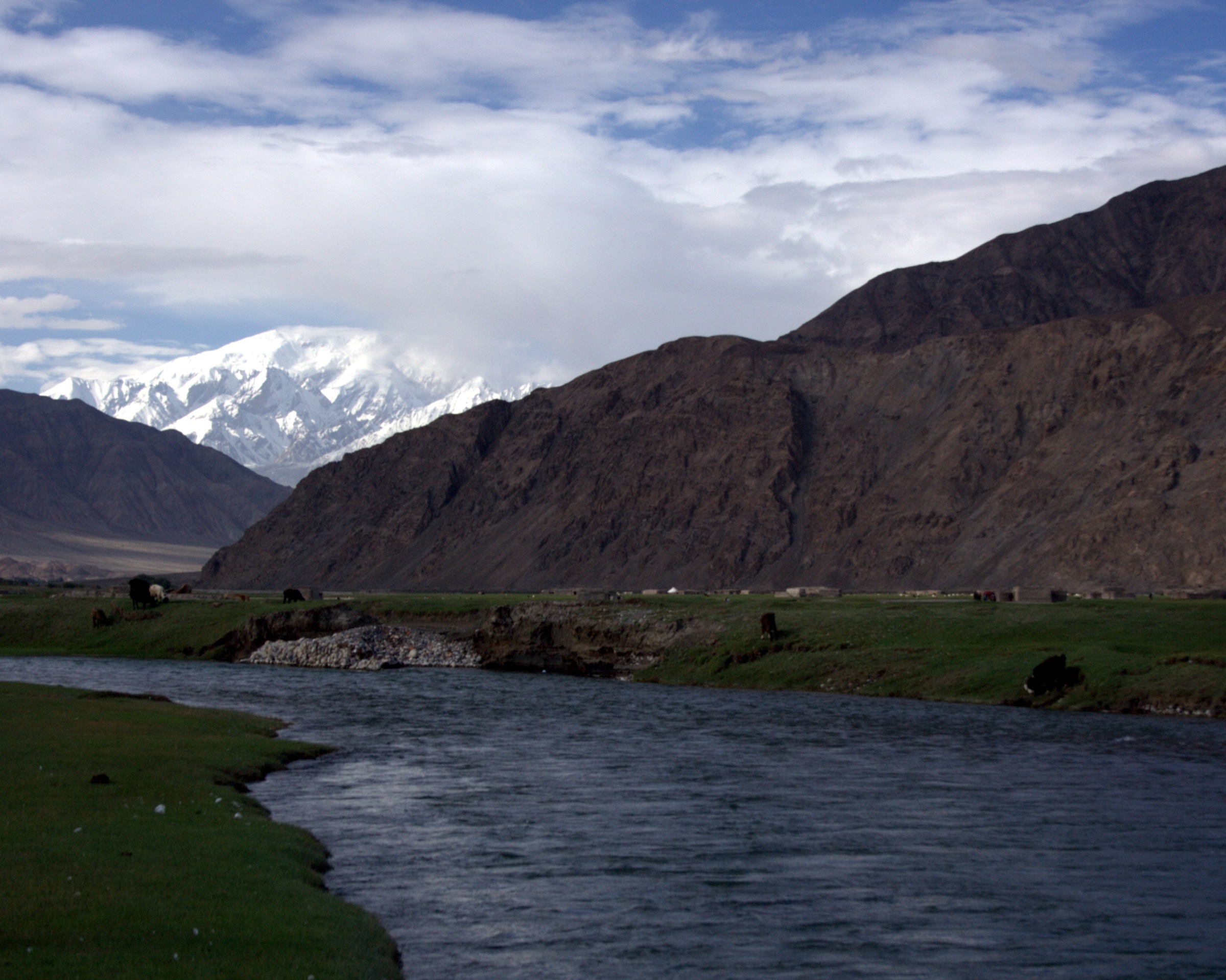
The western half of Hotan Prefecture sits between the Taklamakan Desert and the Karakoram / Western Kunlun frontier. The administrative scope here covers Hotan City and Hotan County, Lop (Luopu) County, Moyu / Karakax County, and Pishan / Guma County. Oases line the southern desert edge fed by two named jade rivers: the Yurungkash (White Jade River, 504 km) draining the central Kunlun north of Hotan City, and the Karakax (Black Jade River, 808 km) rising from Tuanjie Peak (6,644 m) and skirting Pishan and Moyu before joining the Yurungkash to form the Hotan River. Mountains rise from oasis level around 1,300–1,400 m to glaciated frontier crests above 5,000–6,000 m within roughly 150 km.
For a day-hike catalogue, the western Hotan side is dominated by developed scenic-area boardwalks at the foot of the Kunlun and along the desert-oasis transition, not by backcountry mountain trails. The strongest verified walking clusters are at Wuluwati Reservoir Scenic Area in the Karakax gorge, Larikun National Wetland Park on the lower Karakax, and the Hotan Desert-Poplar Eco Scenic Area on the city’s eastern edge. Pishan County adds the Tajik Folk Culture Park and the Sanju walnut garden and petroglyph circuit, both of which sit on the lower approaches to historic Karakoram caravan routes. The famous Sanju Ancient Trail (110 km, max 5,030 m) and Keriyang Ancient Road (130 km, sustained 4,000–5,000 m) are multi-day expedition routes and are excluded from this day-hike set; the same applies to the G219 Mazar / Kudi pass corridor, which lies administratively in Kashgar Prefecture rather than Hotan.
Border-zone permits (边境通行证) are required for any travel south toward the Karakoram / Aksai Chin frontier, including the Sanju trailhead at Konqer (Kangkeer) township and the inner Pishan valleys. Permits are processed only at county PSB offices or above and are usually arranged by a licensed Xinjiang travel agency. The lowland oases and the scenic-area boardwalks are normally accessible without a frontier permit but remain subject to standard Xinjiang travel documentation rules.
Selection rationale
The five entries below cover the region’s accessible walking characters: Kunlun-foot reservoir gorge, oasis-edge wetland, desert-poplar boardwalk, Tajik high-valley culture park, and a Karakoram-foreland heritage walk. The Wuluwati, Larikun, and Hotan Desert-Poplar entries have the strongest source base. The Tajik Folk Park and Sanju walnut–petroglyph entries are included as Pishan-side candidates that represent the region’s frontier and Silk Road character, even though their trail data is thin and they may require permits in practice.
Summary table
| # | Hike | Country | Route type | Distance | Gain | Max elevation | Difficulty |
|---|---|---|---|---|---|---|---|
| 1 | Wuluwati Reservoir Gorge Boardwalk | China | Loop / linked boardwalks in scenic area | Multiple short sections; total unresolved | Minor | Approx. 1,900 m | Easy-moderate |
| 2 | Larikun National Wetland Park Boardwalks | China | Loop / linked wetland boardwalks | Unresolved | Negligible | Approx. 1,300 m | Easy |
| 3 | Hotan Desert-Poplar Eco Boardwalk | China | Loop boardwalk over dune, lake and poplar grove | Unresolved | Negligible | Approx. 1,400 m | Easy |
| 4 | Tajik Folk Culture Park Trails (Pishan) | China | Linked short walks in scenic park | Approx. 2-5 km cumulative | Minor | Approx. 2,500 m park average | Easy-moderate |
| 5 | Sanju Walnut Garden and Petroglyphs Walk | China | Cultural / heritage walks at two linked sites | Under 1 km at each site | Minor | Approx. 1,800-2,000 m | Easy |
1. Wuluwati Reservoir Gorge Boardwalk
Snapshot
Itinerary
The route uses the developed boardwalks of the Wuluwati Reservoir Scenic Area, which sits on the Karakax River at the southern edge of Langru township. Sub-features documented by the scenic area include the main dam, the Yulong Dam waterfall, the Suolong suspension bridge, Karakax gorge boardwalks, the so-called Kunlun Eighteen Bends, Elephant Trunk Mountain inside the scenic area, and a red-willow river beach. The published material describes the walking offer as a set of linked sections rather than a single circuit.
The exact route geometry and total boardwalk length are not published in a downloadable form. Treat this as a managed scenic-area visit, follow the on-site map, and combine the gorge and dam-area boardwalks for a half-day walk.
Why it is essential
Wuluwati is the strongest verified walking destination on the western Hotan side: a real Kunlun-foot gorge in a developed scenic area, on one of the two jade rivers that define Hotan Prefecture’s geography.
Equipment
Standard hiking equipment: hiking shoes, sun protection, water, wind layer, and warm layer if a cold front is forecast. Trekking poles are useful on uneven boardwalk steps.
Hazards and notes
Boardwalk edges above the gorge are exposed in places. Summer thunderstorms can bring rapid weather changes and slippery surfaces. Confirm whether any cableway or shuttle within the area is in operation, and check the current ticket and opening hours.
GPX / KML links
| Source | URL | Format / access | Reuse status |
|---|---|---|---|
| OpenStreetMap search: Wuluwati Reservoir | openstreetmap.org | Source map | OSM data is ODbL; landmark cross-check only |
| Baidu Baike: Wuluwati Scenic Area | baike.baidu.com | Encyclopaedia entry | Site terms apply; no route-file licence found; scenic-area sub-features, elevation, and access notes used |
| Ctrip: Wuluwati | ctrip.com | Travel/scenic-area page | Site terms apply; visitor context used |
External links
2. Larikun National Wetland Park Boardwalks
Snapshot
Itinerary
The route follows the linked boardwalks of the Larikun National Wetland Park, which combines reservoir wetland, reed marsh, and desert-margin landscape on the lower Karakax River. Official sources describe a designated National Wetland Park established in December 2018, upgraded to a national 4A scenic area in 2020, with 96 recorded bird species and 25 mammal species. The exact boardwalk geometry is not published.
Treat this as a managed wetland visit, follow the signed boardwalks, and stay clear of bird-roosting and breeding areas.
Why it is essential
Larikun is the only wetland-character walking destination of this scale on the western Hotan side and represents the desert-oasis transition that defines the lower Karakax River.
Equipment
Easy hiking equipment: comfortable walking shoes, sun protection, water, insect-repellent, binoculars for birdwatching, and a wind/dust layer for spring sandstorm risk.
Hazards and notes
Heat and sun exposure are the main risks in summer. Stay on boardwalks; some wetland margins are unstable. Permission and respect for breeding-season closures is the operator’s responsibility on site.
GPX / KML links
| Source | URL | Format / access | Reuse status |
|---|---|---|---|
| OpenStreetMap search: Larikun National Wetland Park | openstreetmap.org | Source map | OSM data is ODbL; landmark cross-check only |
| Moyu County Government — Larikun page | myx.gov.cn | Government page | Site terms apply; scenic-area context, size, and ecology used |
| LoongWander: Lalikun National Wetland Park | loongwander.com | Travel/scenic-area page | Site terms apply; visitor context used |
External links
- Moyu County Government — Larikun page
- LoongWander — Lalikun National Wetland Park
- Trip.com — Larikun National Wetland Park
3. Hotan Desert-Poplar Eco Boardwalk
Snapshot
Itinerary
The route follows the linked boardwalk of the Hotan Desert-Poplar Eco Scenic Area, which combines a 140,000 m² lake with around 3 million m² of sand and groves of Populus euphratica (desert poplar). Sub-features include the lake, dune ridges, the poplar grove, and a camel-riding area.
The walking route is a developed boardwalk loop; exact distance and elevation are not published on official sources. Combine the lake circuit, dune section, and poplar grove for a 2-3 hour visit.
Why it is essential
The desert poplar boardwalk represents the city-edge desert-oasis landscape that gives Hotan its distinctive character and offers the most accessible desert ecology walk of the western Hotan side.
Equipment
Easy hiking equipment: comfortable shoes for sand and boardwalk, sun protection, plenty of water, wind/dust layer in spring, warm layer for autumn mornings.
Hazards and notes
Sand-blown boardwalks can be slippery. Summer heat is severe; visit early morning or late afternoon. Spring sandstorms can close the area at short notice.
GPX / KML links
| Source | URL | Format / access | Reuse status |
|---|---|---|---|
| OpenStreetMap search: Hotan Desert Poplar Scenic Area | openstreetmap.org | Source map | OSM data is ODbL; landmark cross-check only |
| VisitBeijing: Hotan Damo Huyang | visitbeijing.com.cn | Travel/scenic-area page | Site terms apply; size, sub-feature and visitor context used |
| Ctrip: Damo Huyang Scenic Area | ctrip.com | Travel/scenic-area page | Site terms apply; visitor context used |
External links
- VisitBeijing — Hotan Damo Huyang Scenic Area
- Qunar — Damo Huyang trip notes
- Ctrip — Damo Huyang Scenic Area
4. Tajik Folk Culture Park Trails (Pishan)
Snapshot
Itinerary
The route uses the linked short walks of the Tajik Folk Culture Park, an A-rated cultural-and-natural park developed around the Kang’azi Tajik community in southern Pishan. Documented features include a high-pasture viewing area, the “Yixiantian” (one-line sky) gorge, the Akshok reservoir, and ancient petroglyphs. Park material describes three signed routes and 18 viewpoints; the exact geometry is not published.
Walking is light: short interpretive paths between viewing points rather than a single ridge or summit circuit.
Why it is essential
This is the only documented Pishan-side cultural and walking park that combines Tajik high-valley ethnographic content with low-altitude trails close to the Karakoram foothills.
Equipment
Mountain hiking equipment: sturdy shoes, sun protection, wind layer, warm layer for evening, food and water.
Hazards and notes
The park sits close to the Karakoram frontier and access checks should be expected. Confirm border-zone permit status before travel. Weather can change quickly at 2,500 m; respect local cultural and grazing practices.
GPX / KML links
| Source | URL | Format / access | Reuse status |
|---|---|---|---|
| OpenStreetMap search: Tajik Folk Park Pishan | openstreetmap.org | Source map | OSM data is ODbL; landmark cross-check only |
| VisitBeijing: Tajik Folk Culture Park | visitbeijing.com.cn | Travel/scenic-area page | Site terms apply; sub-feature and visitor context used |
External links
5. Sanju Walnut Garden and Petroglyphs Walk
Snapshot
Itinerary
The route combines two short cultural walks. The first is the Sanju walnut garden at Seyitla village, an AA-rated heritage orchard documented as a long-standing local walnut grove with interpretive paths. The second is the Sanju petroglyph panel at Wulaqi village in Konqer township, around 20 km south. The petroglyph panel is roughly 3 m long and 1.3 m high, depicting hunting and pastoral scenes, attributed to the Song dynasty and listed as an autonomous-region cultural heritage site since 1962.
Walking on foot is minor at each site; the experience is built around the cultural content and the drive through the Karakoram foreland.
Why it is essential
The Sanju corridor links the lower Pishan oasis to the historic Sanju Pass caravan route to Ladakh. As a day-walk pair this entry stands in for that historic Silk Road landscape without committing to the multi-day, permit-heavy Sanju Ancient Trail.
Equipment
Standard hiking equipment: comfortable shoes, sun protection, water and food. Carry copies of any frontier-zone permits if travel continues south of Konqer.
Hazards and notes
The continuation road south of Konqer enters a permit-controlled frontier zone and is not part of this day-walk. Heat and dust are the main on-site issues. Respect petroglyph site protection signage; do not touch or trace the carvings.
GPX / KML links
| Source | URL | Format / access | Reuse status |
|---|---|---|---|
| OpenStreetMap search: Sanju township Pishan | openstreetmap.org | Source map | OSM data is ODbL; landmark cross-check only |
| WorldTravelNew: Pishan circuit | worldtravelnew.com | Travel feature | Site terms apply; itinerary, distance and access context used |
| Sohu: Pishan four-day plan | sohu.com | Travel feature | Site terms apply; visitor context used |
External links
Missing data / follow-up work
- No GPX or KML files were located for any of the five routes. All listed routes are scenic-area boardwalks or cultural-park walks where the operator does not publish track files.
- Boardwalk distances and elevation gains are not published for Wuluwati, Larikun, the Hotan Desert-Poplar area, or the Tajik Folk Park.
- Frontier-zone permit rules for the inner Pishan valleys, including the Tajik Folk Park and any continuation south of Konqer, should be confirmed with a licensed Xinjiang travel agency before travel.
- The Sanju Ancient Trail (110 km, max 5,030 m) and the Keriyang Ancient Road (130 km, sustained 4,000-5,000 m) are deliberately excluded as multi-day expedition routes, not day-hikes.
- The G219 Mazar / Kudi pass corridor is administratively in Kashgar Prefecture (Kargilik / Yecheng) and is excluded from this Hotan article’s scope.
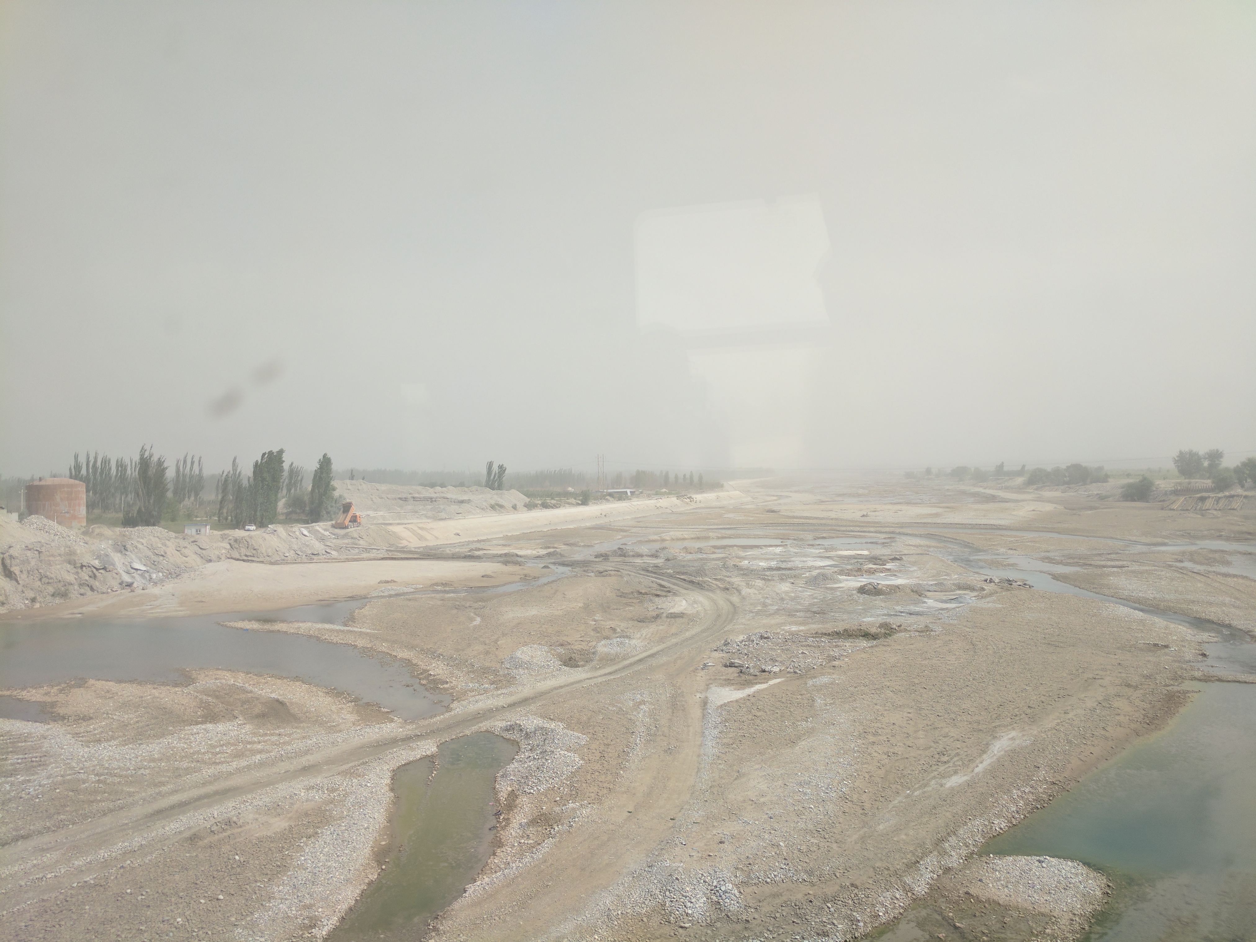
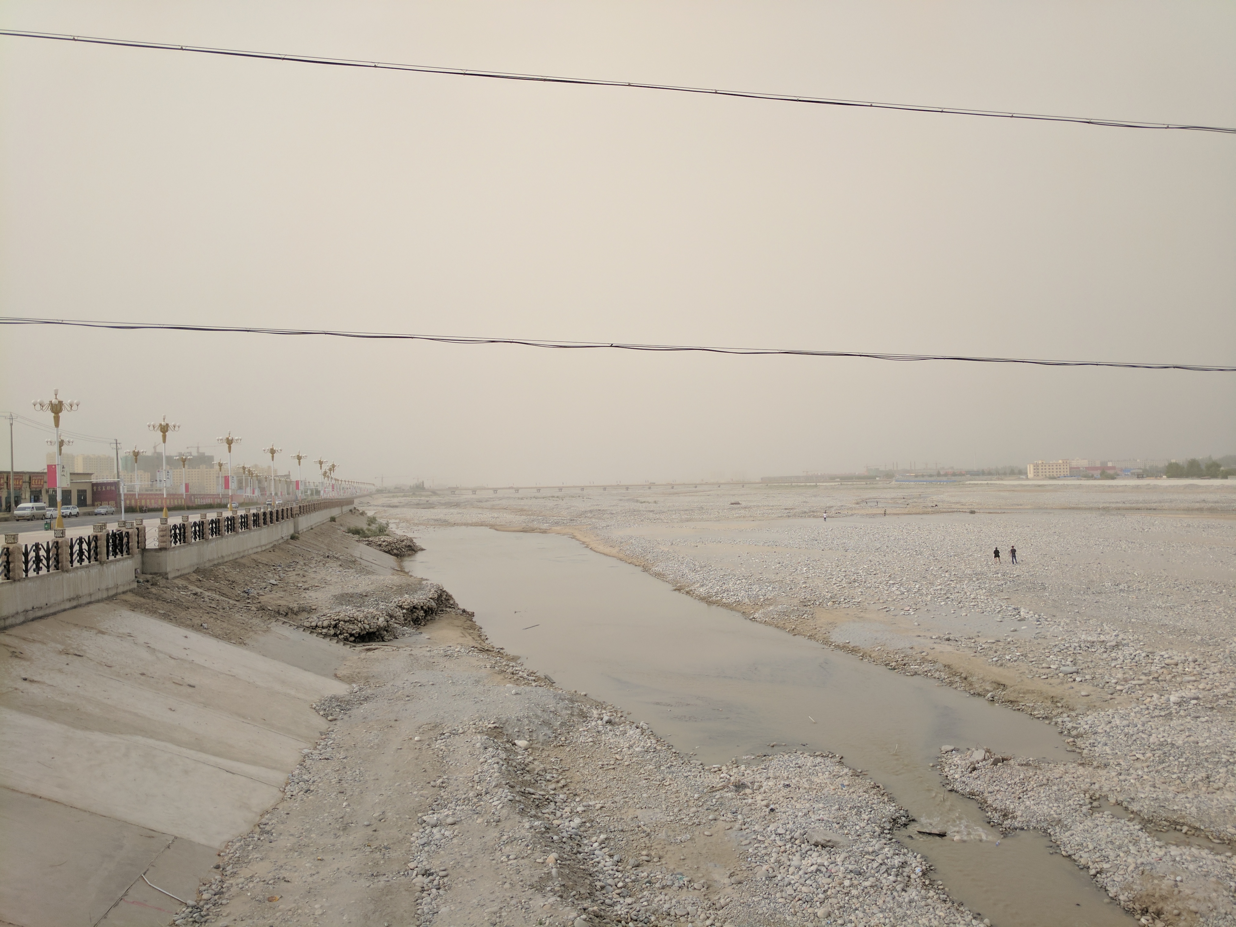
- No high-resolution licence-compatible photo was located for several individual sub-sites; the article reuses two Karakax / Yurungkash river images that depict the wider regional landscape.
External links
| Source | URL |
|---|---|
| Baidu Baike — Wuluwati Reservoir Scenic Area | baike.baidu.com |
| LookXJ — Wuluwati feature | lookxj.com |
| Moyu County Government — Larikun page | myx.gov.cn |
| LoongWander — Lalikun National Wetland Park | loongwander.com |
| VisitBeijing — Hotan Damo Huyang | visitbeijing.com.cn |
| VisitBeijing — Tajik Folk Culture Park | visitbeijing.com.cn |
| WorldTravelNew — Pishan circuit | worldtravelnew.com |
| Wikipedia — Karakash River | en.wikipedia.org |
| Wikipedia — Yurungkash River | en.wikipedia.org |
| Wikipedia — Pishan County | en.wikipedia.org |
| Wikipedia — Karakax County | en.wikipedia.org |
| Wikipedia — Sanju Pass | en.wikipedia.org |
| Wikipedia — Mazar Pass | en.wikipedia.org |
| Xinjiang travel regulations for foreigners (2026) | journeybeyondhorizon.com |