Regional overview
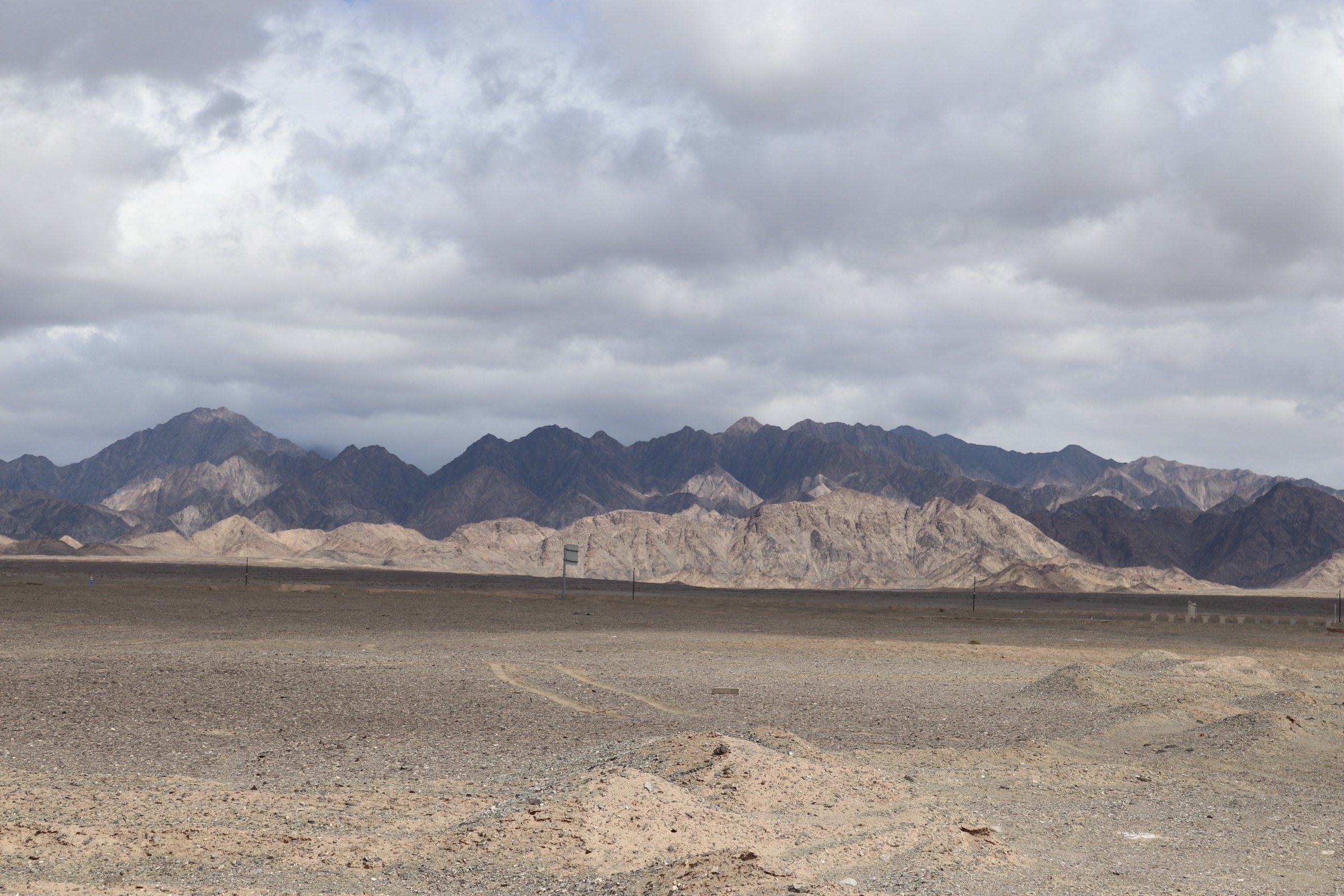
The Altyn-Tagh (Altun Shan, 阿尔金山) is the long, broadly east–west range that walls off the southern edge of the Tarim Basin from the Qaidam Basin and the wider Tibetan Plateau. It runs some 730 km from the Pamir junction in south-western Xinjiang east to the desert margin at Dunhuang in Gansu, forming the northernmost member of the wider Kunlun system. Crest elevations average 4,500–5,000 m, with the highest summit, Sulamutag (Sulamu Tagh, ~6,295 m), in the central Xinjiang section. The northern flank drops abruptly to the gravel plains of the southern Tarim and the dunes of the Kumtag and Lop Nor margins; the southern flank descends to the salt pans of the western Qaidam and to a string of small lake basins at 2,700–3,500 m around Aksai and Lenghu.
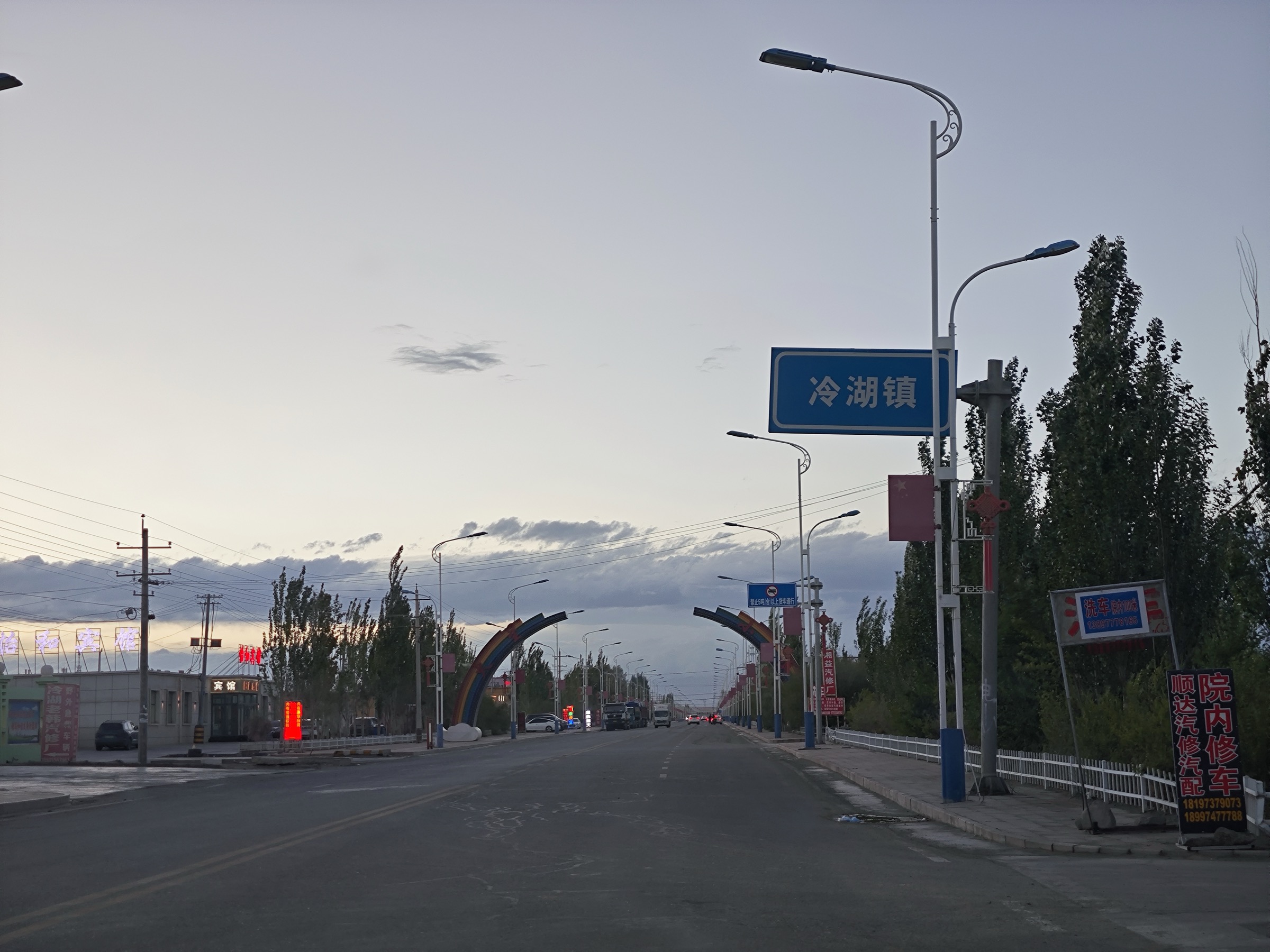
Three points of practical access exist for the walker. Dunhuang (敦煌, Gansu, 1,140 m), the oasis at the range’s eastern terminus, gives access to the entire cluster of Han-dynasty frontier sites — Yangguan (阳关), Yumenguan (玉门关) and the Hecang Fortress (河仓城) granary — set on the desert plain immediately north of the easternmost ridges. Aksai Kazakh Autonomous County (阿克塞哈萨克族自治县, Gansu, 3,030 m at the modern town of Hongliuwan / 红柳湾), south of the main divide, gives access to the Sugan Lake (苏干湖) basin and to the abandoned old town of Boluo Zhuanjing (博罗转井), 35 km south of the modern county seat. Lenghu (冷湖, formerly Qinghai’s third-tier city Lenghu, now part of Mangnai City, 2,750 m), on the western Qaidam side of the divide, is the staging point for the so-called Mars Camp tourism site and the wider Lenghu Old Town and oil-field landscapes. The central Xinjiang section of the range is occupied by the Altun Shan National Nature Reserve (阿尔金山国家级自然保护区) — at 45,000 km² one of the world’s largest protected areas — which is closed to all unaccompanied foot traffic and admits visitors only under scientific permit issued by the reserve administration in Korla and Ruoqiang.
Walking infrastructure across the range is shaped by this regime. Inside the closed reserve there is no public access, no signage and no permitted walking. Outside the reserve, in the Dunhuang, Aksai and Lenghu sectors, the available walking lines are short, mostly roadside or museum-precinct walks. The Yangguan and Yumenguan sites are formally developed scenic areas with timed entry tickets and a fixed circuit; the Sugan Lake and Boluo Zhuanjing visits are unsanctioned but de facto open; the Lenghu Mars Camp is a privately operated themed-tourism site with its own ticketing. There are no waymarked European-style trails, no published park GPX and no developed long-distance routes in any sector of the eastern Altyn-Tagh.
Operating reality is dominated by aridity, heat and dust in the Dunhuang sector, and by altitude and wind in the Aksai and Lenghu sectors. Summer daytime temperatures at the Dunhuang heritage sites regularly exceed 38 °C; the walks here should be done at dawn or in the early evening. The Aksai and Lenghu walks sit between 2,750 and 3,500 m and require less acclimatisation than the Bayan Har or eastern Kunlun catalogues but remain exposed to sustained wind and to sandstorm closures from late March to mid-May. The G215 corridor — the principal road through Aksai and on to Lenghu — is open year-round but the section over the Daban Shan (大坂山) sub-range from Aksai to Lenghu is regularly closed by ground blizzard in winter. There is no mobile signal on most of the connecting roads.
Selection rationale
Five walks are selected to span the three accessible sectors of the eastern Altyn-Tagh: two formally developed heritage circuits at Dunhuang (Yangguan and Yumenguan / Hecang / Han Wall), one lakeshore-and-basin walk at Aksai (Sugan Lake), one cultural-heritage walk at Aksai’s abandoned old town (Boluo Zhuanjing), and one roadside walk at the Lenghu Mars Camp on the Qaidam side. All five are accessible by paved road and none requires high-altitude acclimatisation in the strict sense. The closed Altun Shan National Nature Reserve is deliberately excluded — entry to its interior is by scientific permit only and is not granted for hiking. The Xinjiang slopes north of the reserve (Ruoqiang and Qiemo counties) are covered in the separate Central Kunlun catalogue and are not duplicated here.
Three of the five walks are route verified (the two Dunhuang heritage circuits and the Lenghu Mars Camp); two are honest candidate-only entries (Sugan Lake basin and Boluo Zhuanjing) — real, accessible and well-photographed locations where the walking line is not formally signposted and where on-the-ground details vary between trip reports.
Summary table
| # | Hike | Country | Route type | Distance | Gain | Max elevation | Difficulty |
|---|---|---|---|---|---|---|---|
| 1 | Yangguan — beacon tower and Han Wall loop | China | Scenic-area loop with museum spur | ~3–4 km | ~80–120 m | ~1,260 m | Easy |
| 2 | Yumenguan, Hecang Fortress and Han Great Wall | China | Three-site driving circuit with foot spurs | ~4–6 km combined | <60 m | ~1,160 m | Easy |
| 3 | Sugan Lake basin lakeshore walk | China | Open lakeshore out-and-back | ~4–8 km | <60 m | ~2,810 m | Easy; high altitude |
| 4 | Boluo Zhuanjing — abandoned old town of Aksai | China | Streetside loop in abandoned settlement | ~2–4 km | <40 m | ~3,400 m | Easy |
| 5 | Lenghu — Mars Camp Yardang roadside walk | China | Themed scenic-area circuit | ~2–4 km | <40 m | ~2,820 m | Easy |
No official park GPX has been located for any of the five walks. The Dunhuang Cultural Tourism Bureau, the Aksai county tourism portal and the Mangnai municipal tourism office publish descriptive material but no GPX or KML downloads. The Lenghu Mars Camp operator publishes a site plan but no machine-readable route file. OpenStreetMap geometry exists for the access roads and the principal monuments but not for the foot lines off the road. On-site GPS capture is the only way to record an accurate route line.
1. Yangguan — beacon tower and Han Wall loop — 阳关
Snapshot
Itinerary
Yangguan (阳关, “Yang Pass” — the southern Silk Road frontier post established in 121 BC by Emperor Wu of the Han) sits on a low rise above the desert plain 75 km south-west of Dunhuang. The modern scenic area is built around the surviving beacon-tower mound (阳关烽燧, the principal authentic Han-period structure on site) and a museum-and-reconstruction complex that recreates a Han-period frontier garrison. The walking circuit begins at the scenic-area gate next to the modern museum building; a graded sand path leads east through a low reconstructed gate and along a 600 m interpretive avenue to the foot of the beacon-tower mound. A flagged stair climbs the mound — about 30 m of ascent — to the platform at the foot of the tower, the highest point on site and the canonical viewpoint over the surrounding gravel plain and the silver line of the Han Great Wall fragments to the north.
From the platform a graded circular path returns west via the so-called Silk Road interpretive trail, with brief stops at the reconstructed wagon-station, the surveillance camp and the reconstructed grain-distribution camp. An optional spur leads 300 m south to a small viewing platform giving the wider Gobi-margin panorama back toward the Altyn-Tagh foothills. A site-operated electric cart links the gate, the mound and the southern viewing platform — taking the cart shortens the foot circuit to about 1.5 km but bypasses much of the interpretive material. Return to the gate is via the museum, which holds the recovered Han-period artefacts from the site.
Why it is essential
Yangguan is one of the two westernmost surviving Han-dynasty frontier posts and a UNESCO Silk Roads component site. The beacon-tower mound is the most photographed location at the eastern foot of the Altyn-Tagh and the canonical first stop on any Dunhuang-area heritage walk. The combination of authentic Han-period structure, well-presented museum and open desert-margin panorama makes it the single most rewarding short walk in the eastern range.
Equipment
- Standard walking shoes — sand on the paths is fine and gets into boots
- Sun protection — UV at midday is severe and there is no shade
- Water — at least 1 litre per person; site water fountains may be seasonal
- Hat
- Wind layer — wind on the mound is constant
- Small daypack for water and museum tickets
Hazards and notes
Summer daytime heat at Yangguan is the principal hazard; temperatures above 38 °C are routine in July and August and direct sun on the open mound is unrelenting. Visit at dawn (the gate opens at 07:00 in peak season) or after 17:00. Sandstorm closures occur in March–April; check status at the Dunhuang Cultural Tourism Bureau before driving out. Drone use over the heritage site is restricted and requires advance permission. Climbing the beacon-tower ruin itself is prohibited; the mound platform is the highest authorised point.
External links
- Wikipedia — Yangguan
- UNESCO — Silk Roads: the Routes Network of Chang’an–Tianshan Corridor
- Wikipedia — Dunhuang
2. Yumenguan, Hecang Fortress and the Han Great Wall — 玉门关 · 河仓城 · 汉长城
Snapshot
Itinerary
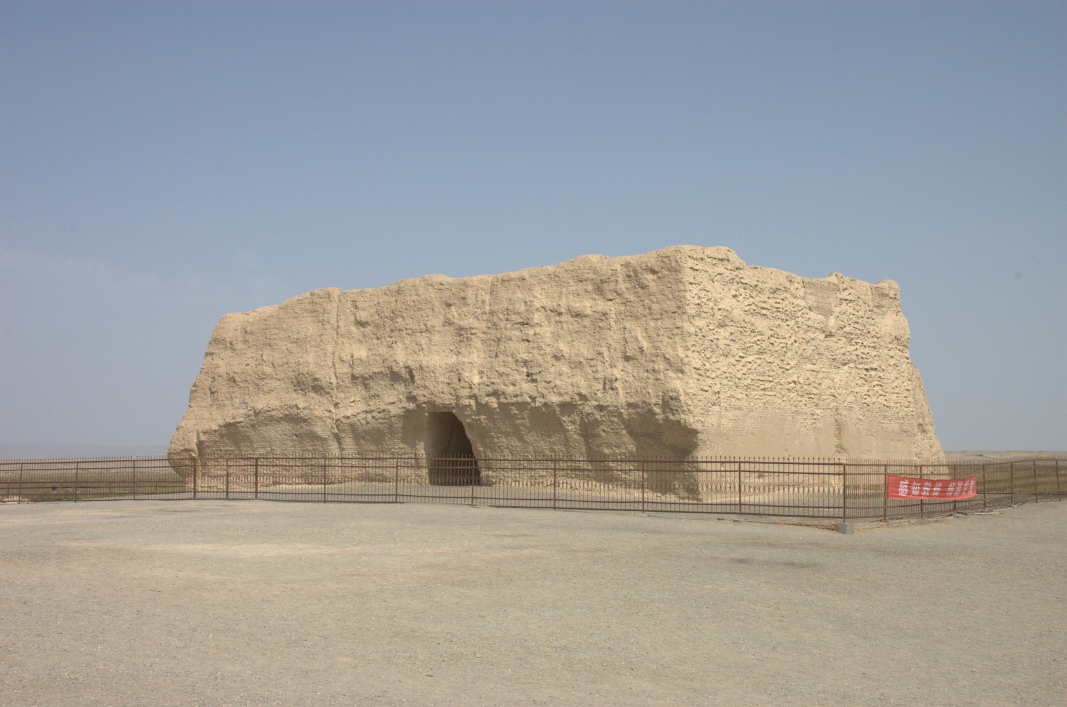
The Yumenguan (玉门关, “Jade Gate Pass”) scenic area covers three dispersed Han-period sites on the desert plain north-west of Dunhuang, all part of the same UNESCO Silk Roads component listing and covered by a single combined entrance ticket. The walking circuit is driven between the three stops but each has a short foot spur of its own. The first stop, Yumenguan proper / Xiao Fangpan Cheng (小方盘城, “Small Square Fortress”), is the authentic mud-brick gateway tower preserved on its original site since the 1st century BC — the famous Jade Gate of the Silk Road, the western frontier of the Han empire and the canonical waypoint in classical Chinese poetry. A 400 m boardwalk circuit and a fenced viewing platform allow visitors to walk the perimeter of the tower without entering it; the structure itself is not climbed.
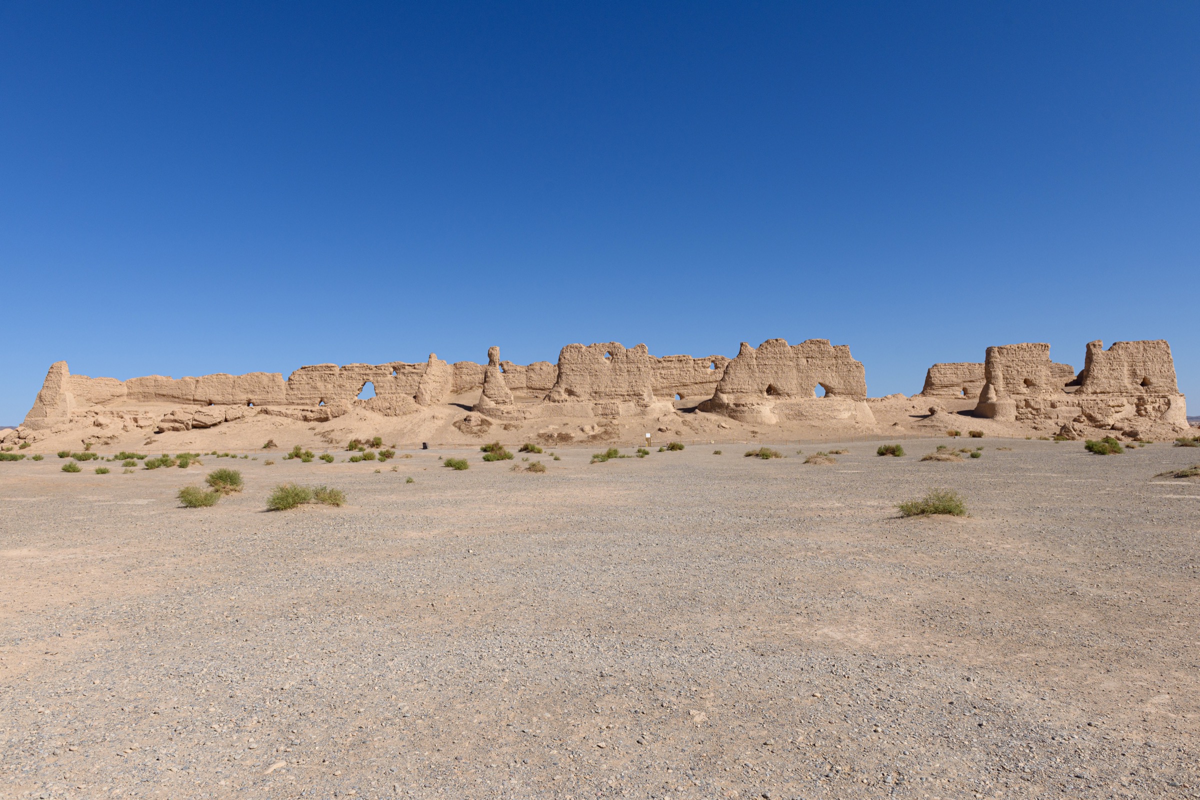
A short drive of about 8 km north-east brings the second stop, the Han Great Wall fragment at the Dangguche (当谷燧) beacon-tower site — the best-preserved surviving section of the original Han-period rammed-earth wall, where 2 m of wall and a 4 m beacon-tower stump still stand on a low ridge above the gravel plain. A 600 m boardwalk runs parallel to the wall, with interpretive panels in Chinese and English describing the construction technique (reed-and-tamarisk wattle with rammed clay) and the wall’s place in the Han frontier system.
A further 11 km drive north-east brings the third stop, Hecang Fortress / Da Fangpan Cheng (大方盘城, “Big Square Fortress”), the principal Han-period granary depot for the western frontier. The standing walls of three long parallel storerooms — each about 130 m long and 17 m wide — are the most architecturally complete Han-period structures in the catalogue. A 500 m foot circuit runs around the perimeter; entry to the interior is not permitted. From the south-eastern corner, a low ridge gives a wider view across the plain toward the line of the Han Wall to the south.
Why it is essential
The Yumenguan cluster is the westernmost authentic Han-dynasty frontier surviving in China on its original site, a UNESCO Silk Roads component listing and the only place in the catalogue where original Han-period mud-brick architecture survives above ground in continuous wall sections rather than as foundation remains. The combination of the Jade Gate itself, the standing wall and the surviving granary depot makes the cluster the most complete frontier-archaeology day-walk in the eastern Altyn-Tagh.
Equipment
- Standard walking shoes
- Sun protection — UV at midday is severe and there is no shade between sites
- Hat
- Water — at least 1.5 litres per person; no water at the wall fragment or the granary
- Wind layer — wind on the open plain is constant
- Camera with a longer lens for the wall fragment and the granary architecture
Hazards and notes
Summer daytime heat is the principal hazard; visit at dawn or after 16:00 in July and August. Sandstorms in March–May routinely close the access road; check the Dunhuang Cultural Tourism Bureau before driving. Drone use is restricted at all three sites and requires advance permission from the scenic-area administration. Climbing the Han Wall, the beacon tower or the granary walls is prohibited. The combined ticket includes the inter-site shuttle bus in peak season — confirm timetables on arrival as off-season service is reduced.
External links
- Wikipedia — Yumen Pass
- Wikipedia — Han Great Wall
- Wikipedia — Hecang Fortress
- UNESCO — Silk Roads: the Routes Network of Chang’an–Tianshan Corridor
3. Sugan Lake basin lakeshore walk — 大苏干湖
Snapshot
Itinerary
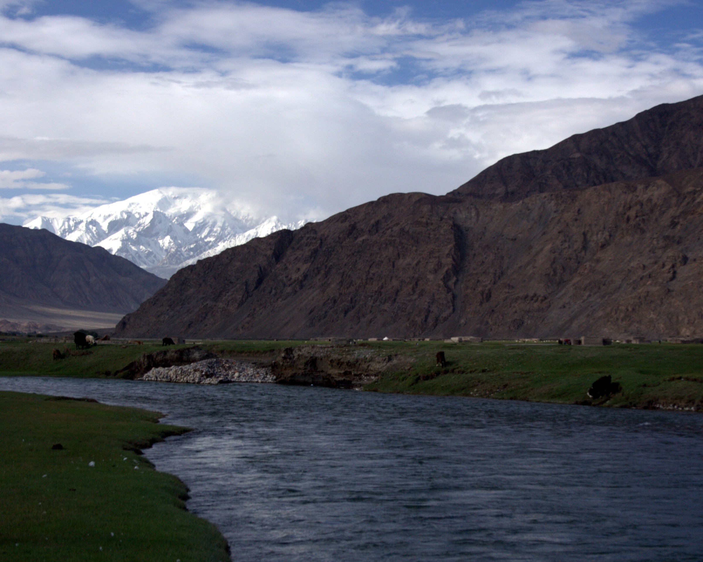
The Sugan Lake basin holds two large salt-and-freshwater lakes — Da Sugan Hu (大苏干湖, the larger and saltier) and Xiao Sugan Hu (小苏干湖, the smaller and brackish-freshwater) — set in a wide structural depression between the main Altyn-Tagh divide to the north and the Daban Shan sub-range to the south. The lakes are a designated provincial wetland and a major staging point for migratory bar-headed geese, ruddy shelduck and black-necked cranes; the basin’s official status as a protected area is informal but operational. The walking line begins where the unpaved access road from Aksai township first touches the northern shore of Da Sugan Hu, follows the open turf-and-gravel strand west for 2–4 km depending on turnaround, and returns along the same line. The shore is unfenced and the strand is level and easy to walk; small ephemeral inlets are easily passed in summer.
The view north from the lakeshore takes in the south face of the main Altyn-Tagh divide — the snow-line in late summer sits around 5,000 m on the highest ridges, with isolated permanent snow on the upper bowls. The view south is over the broader basin to the Daban Shan and the road toward Lenghu. There is no signed trailhead, no waymarking and no published walking route; the walk is a free-form lakeshore wander rather than a defined route.
Why it is essential
Sugan Lake is the most accessible large-lake landscape on the southern flank of the Altyn-Tagh and the only walking destination in the Aksai sector with an established image-archive presence on Wikimedia Commons. The combination of open lakeshore, migratory waterbird interest and direct view of the main divide makes the basin the canonical day-walk for visitors basing in Aksai township.
Equipment
- Sturdy walking shoes — wet ground at the inlets
- Trekking poles useful on uneven turf
- Windproof shell — lakeshore wind is constant
- Warm mid-layer regardless of season
- Sun protection — strong UV with reflection from water
- Water and full day’s food; no water sources off the shore
- Binoculars for waterbirds
- Navigation backup; no mobile signal in the basin
Hazards and notes
Altitude exposure is moderate but real — three hours above 2,800 m can provoke acute mountain sickness in unacclimatised walkers, particularly those arriving directly from Dunhuang (1,140 m) by morning bus. Weather changes rapidly; afternoon hail and thunderstorms occur in July and August, and sandstorms close the basin from late March to mid-May. The lake water is heavily mineralised in Da Sugan Hu and is not potable. The bird-staging shore is a sensitive habitat — keep at least 200 m from active flocks and do not approach with drones. The wider Altun Shan reserve boundary lies several tens of kilometres north of the lake; the lakeshore itself is outside the closed reserve but should not be extended inland toward the divide without local guidance.
External links
4. Boluo Zhuanjing — abandoned old town of Aksai — 博罗转井
Snapshot
Itinerary
Boluo Zhuanjing (博罗转井, Bólúo Zhuǎnjǐng) is the abandoned former county seat of Aksai Kazakh Autonomous County — a small purpose-built town in the foothills of the Altyn-Tagh that served as the administrative centre between 1954 and 1998, when the entire population (about 8,500 at peak) was relocated to the new county seat at Hongliuwan (红柳湾, 30 km north on the Dunhuang side) because of water shortages and an inadequate transport position. The town was officially decommissioned and left as it stood: concrete-and-brick blocks, the empty county-government building, two empty schools, a hospital, a cinema, the empty mosque and the empty Orthodox church, all rapidly weathering in the dry mountain air. The walking line follows the main street north–south through the centre of the town (about 1.5 km), then loops east through the residential blocks to the cinema and west to the former government compound, returning to the entry via the school yard.
The town was used as a film location for the 2014 feature film The Crossing (《九层妖塔》) by Lu Chuan, and the resulting set dressing — a small steam locomotive on a short rail spur, a pseudo-1950s shopfront row and an artificial barricade — remains in place at the southern end of the town. The walk gives both the genuine 1950s-1980s Chinese-frontier town remains and the film-set additions, and is the most photographed abandoned town in north-western China after the Tianshan oil-town of Karamay’s Asbestos and the Qinghai oil-town remains at Lenghu.
There is no formal trail and no signage in English. Local visitors do informally walk the main street and the central blocks; some areas of unstable masonry are roped off. Photography is unrestricted.
Why it is essential
Boluo Zhuanjing is the only intact mid-20th-century abandoned Chinese-frontier town in the wider Altyn-Tagh region accessible to foot traffic, and the most striking surviving Cold War-era landscape on the Aksai side of the range. The combination of mosque, Orthodox church, government compound and weathered apartment blocks at 3,400 m gives an unusual cultural-landscape walk found nowhere else in the catalogue.
Equipment
- Sturdy walking shoes — rubble and broken glass in places
- Trekking poles useful in the residential blocks
- Wind layer — wind on the open street is constant
- Warm mid-layer regardless of season
- Sun protection
- Water and snacks; no facilities on site
- Headlamp if entering any building (not recommended)
- Mask if doing extended interior photography — fine dust is pervasive
Hazards and notes
Building stability is the principal hazard. Most of the structures are roofless or partly collapsed; do not enter any of the apartment blocks, the school or the cinema. Fallen masonry is common in the side streets after rain or wind. The site has no facilities — no water, no toilets, no mobile signal — and the nearest help is at Hongliuwan, 35 km north. The G215 to the site is exposed to ground blizzard in winter and to sandstorm in spring. Drone use over the site is informally tolerated but should be checked with the Aksai county tourism bureau in advance. Respect any new ticketing or perimeter fencing — site status changes from year to year.
External links
5. Lenghu — Mars Camp Yardang roadside walk — 冷湖火星营地
Snapshot
Itinerary
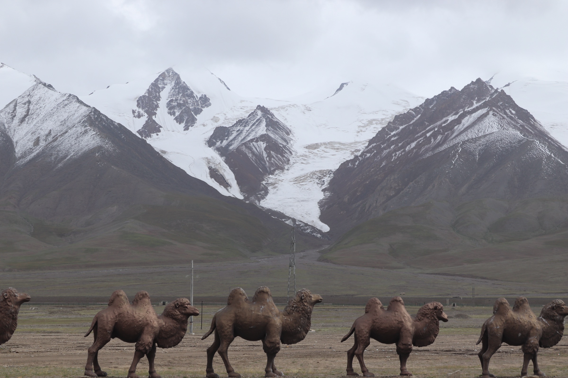
The Lenghu Mars Camp (冷湖火星营地) is a privately operated themed-tourism site set in the yardang country on the western edge of the Qaidam basin, about 70 km north-west of Lenghu town. The site exploits the strong visual resemblance of the wind-eroded yardang ridges and clay plains to a Martian landscape — and a genuine NASA-and-CAS analogue-Mars research lineage in the area — to present a walking-and-photography circuit through the natural yardang landscape with themed installations (a mock Mars lander, a small dome habitat, interpretive panels on Mars geology and on the Lenghu astronomical observatory). The walking circuit begins at the visitor centre, follows a graded path north through the principal yardang ridge, climbs a short stair to a viewing platform on the highest ridge (about 2,820 m), and loops south past the themed installations and back to the centre. Total foot distance is 2–4 km depending on which spurs are walked.
The genuine astronomical context is significant — the Lenghu Town Astronomical Observatory, on a low peak 50 km south-east of the camp, is the highest seeing-quality professional observatory site in China and a deliberately chosen Mars analogue site for the Chinese Mars exploration programme. The camp’s interpretive material draws on this work and is bilingual in Chinese and English at the visitor centre but Chinese-only on the trail panels.
The site is officially closed at night for stargazing tour participants only — the dark-sky protection regime around Lenghu is one of the strictest in China, and casual visitors should respect lighting restrictions on any extended visit.
Why it is essential
The Lenghu Mars Camp is the most accessible developed walking circuit on the Qaidam side of the Altyn-Tagh and the only sanctioned walk in the catalogue that gives both the genuine yardang desert landscape and a developed interpretive frame. It is the natural complement to the Aksai-sector walks and a logical northern terminus on any Dunhuang–Aksai–Lenghu trip.
Equipment
- Standard walking shoes — fine dust on the paths is pervasive
- Wind layer — wind on the open yardang ridges is constant
- Warm mid-layer regardless of season
- Sun protection — UV at 2,800 m is strong and there is no shade
- Hat
- Water — at least 1.5 litres per person; some facilities at the visitor centre but no reliable refills on the circuit
- Camera; tripod for any extended visit
- Mask in spring sandstorm conditions
Hazards and notes
Wind and dust are the principal hazards. Sandstorm closures can occur with little warning between March and May; check status with the camp operator before driving from Lenghu town. The access road from G215 to the camp is gravel for the last 20 km and may be impassable to ordinary cars after heavy rain. Drone use on site requires advance permission. The camp’s themed installations are private property — climbing or entering the mock lander or dome habitat is prohibited. The wider dark-sky protection regime around Lenghu prohibits any white-light photography after dusk on the access road.
External links
Missing data / follow-up work
- No official GPX or KML has been located for any of the five walks. The Dunhuang Cultural Tourism Bureau, the Aksai county tourism portal and the Mangnai municipal tourism office publish descriptive material only. On-site GPS capture is the only route to reliable route geometry.
- Hike 1 (Yangguan): the scenic-area opening hours and the cart-shuttle timetable change seasonally; confirm at the Dunhuang Cultural Tourism Bureau before travel.
- Hike 2 (Yumenguan cluster): the inter-site shuttle bus service runs only in peak season; out-of-season visitors will require a private vehicle to cover the ~50 km between the three sites.
- Hike 3 (Sugan Lake): the lakeshore turn-off from the access road is unsigned and turnaround points vary between trip reports. Local guides from Aksai (Hongliuwan) should be consulted for current safe extent and for the location of active waterbird flocks.
- Hike 4 (Boluo Zhuanjing): site status changes from year to year — recent visitor reports describe occasional ad-hoc ticket collection at the entry and ongoing perimeter changes around unstable buildings. Confirm in Hongliuwan before driving out.
- Hike 5 (Lenghu Mars Camp): the site operator’s ticketing and opening arrangements change year-on-year; confirm directly with the operator before driving from Lenghu town.
- No licence-compatible image has been located for Hike 4 (Boluo Zhuanjing). Wikimedia Commons has no current photographs of the abandoned town under a reusable licence.
- Permit reality at the Altun Shan reserve boundary: all walks in this catalogue lie outside the closed Altun Shan National Nature Reserve, but the boundary lies a relatively short distance north of the Aksai sector. Do not extend any walk inland from the named sites toward the divide without local guidance — reserve enforcement is real and unaccompanied entry is prohibited.
- The classic Altun Shan three-rivers traverses and the Yusupalik / Sulamutag approach lines are not included as they fall inside the closed reserve and are inaccessible to civilian foot traffic.