Regional overview
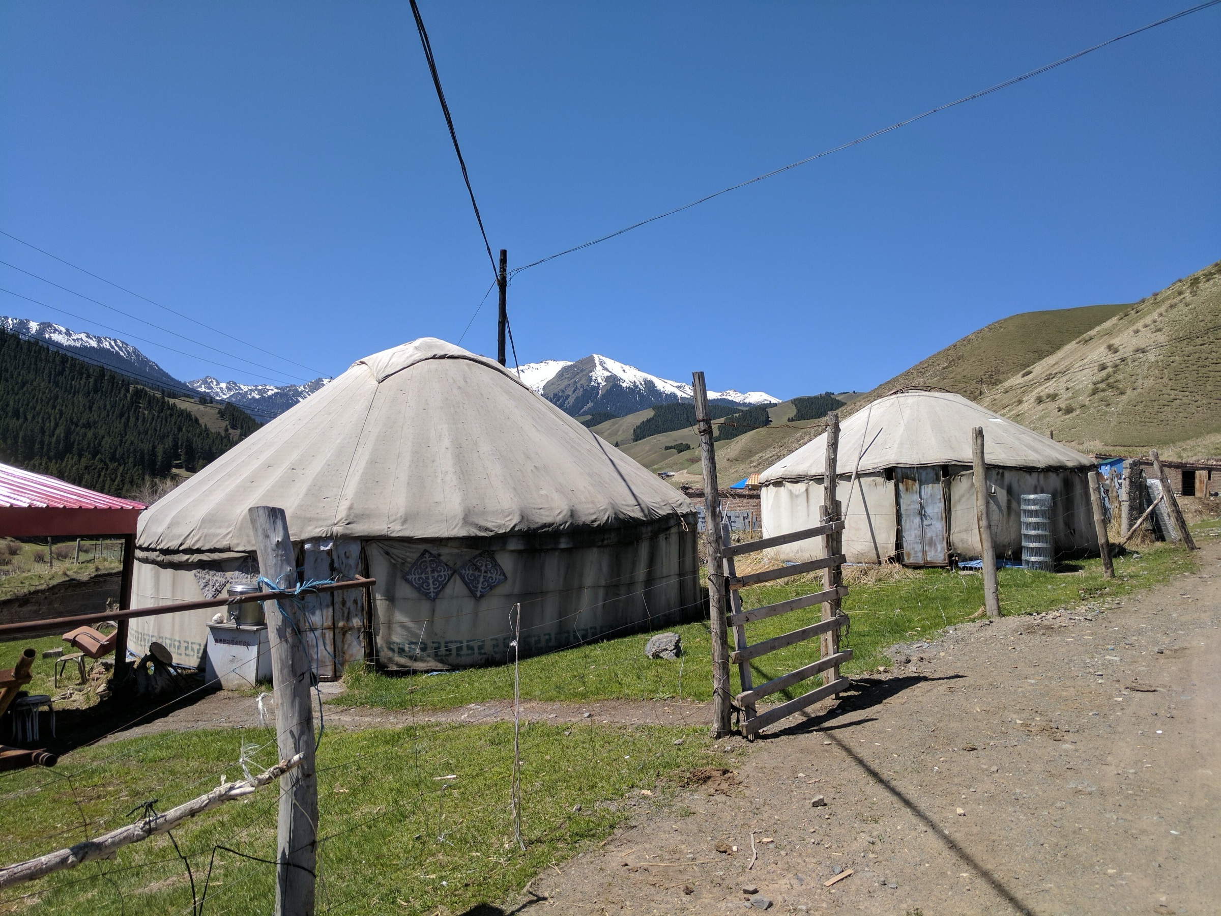
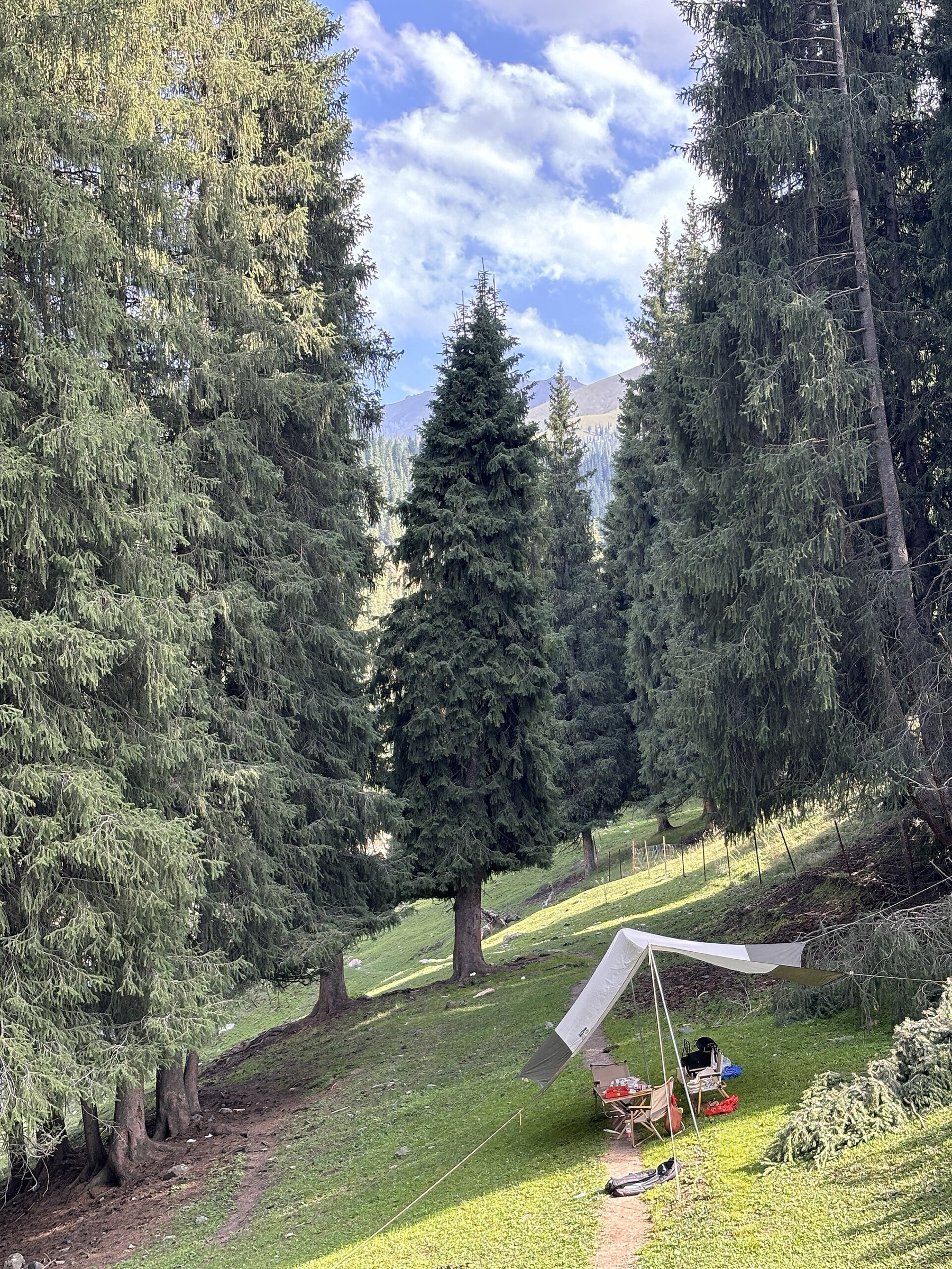
Urumqi Nanshan is the accessible north-slope Tian Shan country south of Urumqi, including the Southern Pasture / Nanshan Pasture valleys, West and East Baiyanggou, Juhuatai, Miaoergou, Banfanggou, Shuixigou and the Tianshan Grand Canyon / Zhaobi Mountain area. The landscape is typical of the wetter north side of the Tian Shan: spruce forest, high grassland, Kazakh pastoral settlements, short waterfalls, canyon roads and views towards higher snow mountains.
This region is closer to Urumqi than the Bogda/Tianchi or Ili areas, so many walks are day trips from the city. The access style is mixed: some routes are ticketed scenic-area walks with shuttle buses, while others are local valley paths, pasture tracks or GPS-recorded outdoor routes. Public transport exists to some settlements and scenic areas, but many trailheads are easiest by chartered car, taxi or local tour vehicle.
The main hiking season is May to October, with wildflower conditions in late spring and early summer and autumn colour in September-October. Winter walking is possible in some valleys and forest parks, but ice, snow, cold and road conditions raise the seriousness. Summer thunderstorms, muddy pasture tracks, route-finding across grazing land, and unclear access boundaries are recurring planning issues.
Selection rationale
The selection balances the best-known managed scenic-area route at Tianshan Grand Canyon, the classic West Baiyanggou waterfall walk, the harder Juhuatai-Baiyanggou traverse, and two more local forest/valley walks that represent Nanshan’s everyday hiking culture. Route-file evidence is uneven: Wikiloc gives usable GPS summaries for West Baiyanggou-area routes, while Miaoergou and Shagou remain candidate routes requiring stronger route geometry.
Summary table
| # | Hike | Country | Route type | Distance | Gain | Max elevation | Difficulty |
|---|---|---|---|---|---|---|---|
| 1 | Tianshan Grand Canyon: Zhaobi Mountain, Swan Lake and Qiaoya Grassland | China | Shuttle-assisted scenic-area walk | Approx. 5-8 km walking | Around 2,000 m area average; exact high point unresolved | Moderate | |
| 2 | West Baiyanggou to Shenbulake Waterfall | China | Out-and-back | Approx. 10 km return if walked from parking area | nearby Wikiloc route +231 m | Approx. 2,000-2,250 m | Moderate |
| 3 | Juhuatai to West Baiyanggou traverse | China | Point-to-point / traverse | 10-16.9 km depending source/variant | 1,331-1,516 m on Wikiloc variants | Hard | |
| 4 | Miaoergou forest and icefall walk | China | Out-and-back / local loop variants | 2-13 km variants reported | Easy-hard depending variant and snow | ||
| 5 | Shagou / Banfanggou valley hike | China | Out-and-back / local loop variants | Moderate |
1. Tianshan Grand Canyon — Zhaobi Mountain, Swan Lake and Qiaoya Grassland
Snapshot
Itinerary
The standard day uses the scenic-area gate and shuttle system to reach the Zhaobi Mountain / reservoir and waterfall area, then continues towards Swan Lake and the higher grassland stops such as Qiaoya Grassland or the Tianmen walking/horse route if open. Some visitor routes describe a short Swan Lake boardwalk loop, while other local route notes describe a roughly 5 km walk between the folk-village area and Zhaobi Mountain.
This is a managed scenic-area hiking day rather than an open wilderness traverse. Walking distances depend on where the current shuttle stops, which side walks are open, and whether the Tianmen or Qiaoya side trip is done on foot.
Why it is essential
Tianshan Grand Canyon is the most important protected/scenic walking area in the Urumqi Nanshan region and gives a compact sample of spruce forest, canyon, reservoir, meadow and high-pasture scenery close to the city.
Equipment
- Grippy walking shoes or boots
- Weatherproof and warm layers
- Water and food
- Sun protection
- Map/GPS backup
- Trekking poles for longer walking variants
Hazards and notes
- Scenic-area shuttle rules, tickets and walking permissions may change.
- Boardwalks can be slippery; higher meadows are exposed to storms and cold wind.
- Avoid unsanctioned shortcuts across pasture or closed forest areas.
GPX / KML links
| Source | URL | Format / access | Reuse status |
|---|---|---|---|
| OpenStreetMap: Tianshan Grand Canyon Urumqi search | openstreetmap.org | Map / search | OSM data is ODbL |
| LoongWander: Tianshan Grand Canyon scenic-area route | loongwander.com | Guide page | Site terms apply; no route-file licence found |
| Urumqi Bendibao: Tianshan Grand Canyon self-drive/walk route | wlmq.bendibao.com | Guide page | Site terms apply; no route-file licence found |
External links
- China Daily Xinjiang — Tianshan Grand Canyon
- LoongWander — Tianshan Grand Canyon scenic-area route
- Urumqi Bendibao — Tianshan Grand Canyon route notes
- Tianshan.net — Tianshan Grand Canyon walking road
2. West Baiyanggou to Shenbulake Waterfall
Snapshot
Itinerary
From the West Baiyanggou visitor/parking area, follow the valley route towards Shenbulake Waterfall, passing grassland, spruce slopes, yurts and stream scenery. A local hiking article states that the parking area to the waterfall is about 5 km one way and that a shuttle may cover this section for visitors who do not walk it.
Wikiloc separately records a nearby “Nanshan Pasture-Urumqi” hiking route near Xibaiyanggoucun at 3.52 km with 231 m of gain and a 2,274 m maximum elevation. That GPS page is useful as a local geometry check but may not represent the full waterfall out-and-back.
Why it is essential
West Baiyanggou is the best-known Nanshan Pasture valley walk and combines the region’s signature elements: grassland, spruce forest, Kazakh pastoral scenery and a waterfall objective.
Equipment
- Hiking shoes or boots
- Weatherproof and warm layers
- Water and food
- Sun protection
- Map/GPS
- Trekking poles if continuing beyond tourist paths
Hazards and notes
- Horse traffic, shuttle vehicles, muddy pasture tracks and wet stones near the waterfall require care.
- The waterfall height varies by source and was not used as a core statistic.
- Confirm whether walking beside the shuttle road is currently permitted.
GPX / KML links
| Source | URL | Format / access | Reuse status |
|---|---|---|---|
| Wikiloc: Nanshan Pasture-Urumqi | wikiloc.com | Route page / GPS track via Wikiloc | Wikiloc terms apply; nearby source-map, not confirmed as the full waterfall route |
| Wikiloc: Xibaiyanggoucun route index | wikiloc.com | Route-index page | Wikiloc terms apply; source-map for nearby Baiyanggou routes |
| OpenStreetMap: West Baiyanggou search | openstreetmap.org | Map / search | OSM data is ODbL |
External links
- Sina — Baiyanggou parking to Shenbulake Waterfall
- Wikiloc — Nanshan Pasture-Urumqi
- China Xian Tour — Nanshan Pasture / West Baiyanggou
3. Juhuatai to West Baiyanggou Traverse
Snapshot
Itinerary
The traverse links Juhuatai, a high grassland/terrace area in the Nanshan system, with West Baiyanggou. A long-standing local hiking description identifies the Juhuatai-Baiyanggou crossing as an important South Tian Shan outdoor route and describes crossing grassland and hill country before descending towards the more developed Baiyanggou scenic area.
More recent Wikiloc index data for Xibaiyanggoucun lists two relevant routes: “West Baiyanggou traverse” at 16.85 km with 1,516 m of ascent and “Nanshan Pasture Baiyanggou loop” at 14.56 km with 1,331 m of ascent. Those tracks confirm the area supports harder GPS-recorded routes, but exact trail lines and public access need field verification.
Why it is essential
This is the strongest classic-hiking traverse in the Urumqi Nanshan selection. It moves beyond short scenic paths into the open meadow, ridge and valley terrain that local outdoor groups associate with Nanshan.
Equipment
- Sturdy boots and trekking poles
- Waterproof/windproof and warm layers
- Map/GPS with offline backup
- Headtorch
- Food and extra water
- Sun protection and basic first-aid kit
Hazards and notes
- Navigation, private/pasture fences, weather exposure, livestock/horse traffic and long ascent are the main issues.
- Do not start without confirmed exit transport.
- In poor visibility, the open grassland and multiple tracks can be confusing.
GPX / KML links
| Source | URL | Format / access | Reuse status |
|---|---|---|---|
| Wikiloc: Xibaiyanggoucun route index | wikiloc.com | Route-index page with listed GPS tracks | Wikiloc terms apply; source-map for traverse and loop variants |
| Sina blog: Juhuatai-Baiyanggou traverse description | blog.sina.com.cn | Route description | Site terms apply; no route-file licence found |
| OpenStreetMap: Juhuatai Baiyanggou search | openstreetmap.org | Map / search | OSM data is ODbL |
External links
- Wikiloc — Xibaiyanggoucun route index
- Sina blog — Juhuatai-Baiyanggou traverse description
- Urumqi Nanshan planning PDF
4. Miaoergou Forest and Icefall Walk
Snapshot
Itinerary
Miaoergou is one of the recognised Nanshan scenic/forest areas and appears in Urumqi Nanshan planning and local tourism references. Local winter coverage reports that mature scenic-area access allows walking groups to do routes from 2 km to 13 km, including icefall and snow scenery.
The publishable day-hike route is not yet fixed. A conservative version would choose a signed forest/icefall out-and-back from the current access point, returning the same way before committing to longer valley or ridge variants.
Why it is essential
Miaoergou represents the forest-park and winter-walking side of Urumqi Nanshan, balancing the summer-pasture emphasis of Baiyanggou and Juhuatai.
Equipment
- Summer: standard hiking equipment
- Winter: insulated boots, warm layers, waterproof shell, gloves and hat
- Microspikes or other traction if icy
- Hot drink, headtorch and navigation backup
Hazards and notes
- This route remains candidate-only because exact public trail geometry was not verified.
- Winter icefall areas can have falling ice, slippery surfaces and cold exposure.
- Current scenic-area access and permitted walking lines need local confirmation.
GPX / KML links
| Source | URL | Format / access | Reuse status |
|---|---|---|---|
| OpenStreetMap: Miaoergou Urumqi search | openstreetmap.org | Map / search | OSM data is ODbL |
| Huyangnet local winter-walking report | huyangnet.cn | News / report page | Site terms apply; no route-file licence found |
External links
- Huyangnet — Miaoergou winter hiking report
- Urumqi Nanshan planning PDF (Miaoergou)
- Urumqi Bendibao — spring-route article
5. Shagou / Banfanggou Valley Hike
Snapshot
Itinerary
Shagou is a local Nanshan valley walking area associated with Banfanggou. A local article describes it as a free Nanshan scenic-area walk about 50 km, roughly one hour, from Urumqi. A 2bulu GPS page exists for “Urumqi Nanshan Shagou hiking”, indicating recorded walking geometry is available for later manual checking.
The route should remain a candidate until the GPS file can be downloaded, inspected, and checked against current legal access and land-use boundaries.
Why it is essential
Shagou adds a less formal local-valley hike to a selection otherwise dominated by ticketed scenic areas and better-known tourist valleys. It helps represent how Urumqi residents use Nanshan for ordinary day walking.
Equipment
- Boots
- Weatherproof and warm layers
- Water and food
- Offline map/GPS
- Headtorch and trekking poles
Hazards and notes
- Route-finding, private/pasture boundaries, unstable weather and unclear access are the main issues.
- Do not rely on an old GPS track without local confirmation.
GPX / KML links
| Source | URL | Format / access | Reuse status |
|---|---|---|---|
| 2bulu: Urumqi Nanshan Shagou hiking | 2bulu.com | GPS route page / track download source | 2bulu terms apply; licence not verified; inspect file before reuse |
| OpenStreetMap: Shagou Banfanggou Urumqi search | openstreetmap.org | Map / search | OSM data is ODbL |
| Sina local article: Nanshan Shagou | k.sina.com.cn | Local route / attraction article | Site terms apply; no route-file licence found |
External links
Missing data and follow-up
- Official GPX/KML not found for any Nanshan hike.
- Tianshan Grand Canyon walking-only distances and elevation profiles need current scenic-area map verification.
- Juhuatai-Baiyanggou route requires inspection of individual GPS tracks and local access checks before publication.
- Miaoergou and Shagou remain candidate routes pending stronger trailhead, distance, elevation and access verification.
- Public transport details from Urumqi require current local timetable confirmation.
- No specific licence-compatible images were verified for Tianshan Grand Canyon, Miaoergou or Shagou in this pass.
External links
| Source | URL |
|---|---|
| China Daily Xinjiang — Tianshan Grand Canyon | xinjiang.chinadaily.com.cn |
| LoongWander — Tianshan Grand Canyon | loongwander.com |
| Urumqi Bendibao — Tianshan Grand Canyon route notes | wlmq.bendibao.com |
| Tianshan.net — Tianshan Grand Canyon walking road | ts.cn |
| China Discovery — Nanshan Pasture | chinadiscovery.com |
| China Xian Tour — Nanshan Pasture | chinaxiantour.com |
| Sina — Nanshan Pasture / Baiyanggou walking notes | k.sina.com.cn |
| Sina blog — Juhuatai-Baiyanggou traverse | blog.sina.com.cn |
| Huyangnet — Miaoergou winter walking report | huyangnet.cn |
| Sina — Nanshan Shagou | k.sina.com.cn |
| Wikiloc — Nanshan Pasture-Urumqi | wikiloc.com |
| Wikiloc — Xibaiyanggoucun route index | wikiloc.com |
| 2bulu — Urumqi Nanshan Shagou route page | 2bulu.com |
| Urumqi Nanshan planning PDF | baigongbao.com |