Regional overview
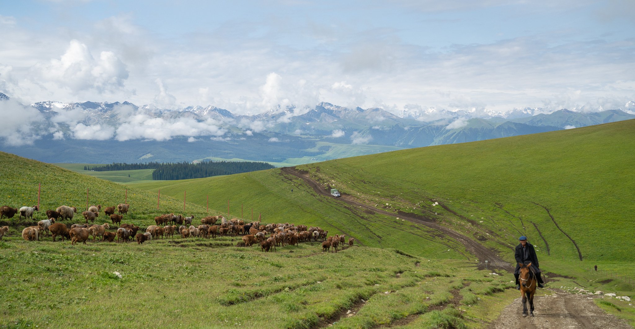
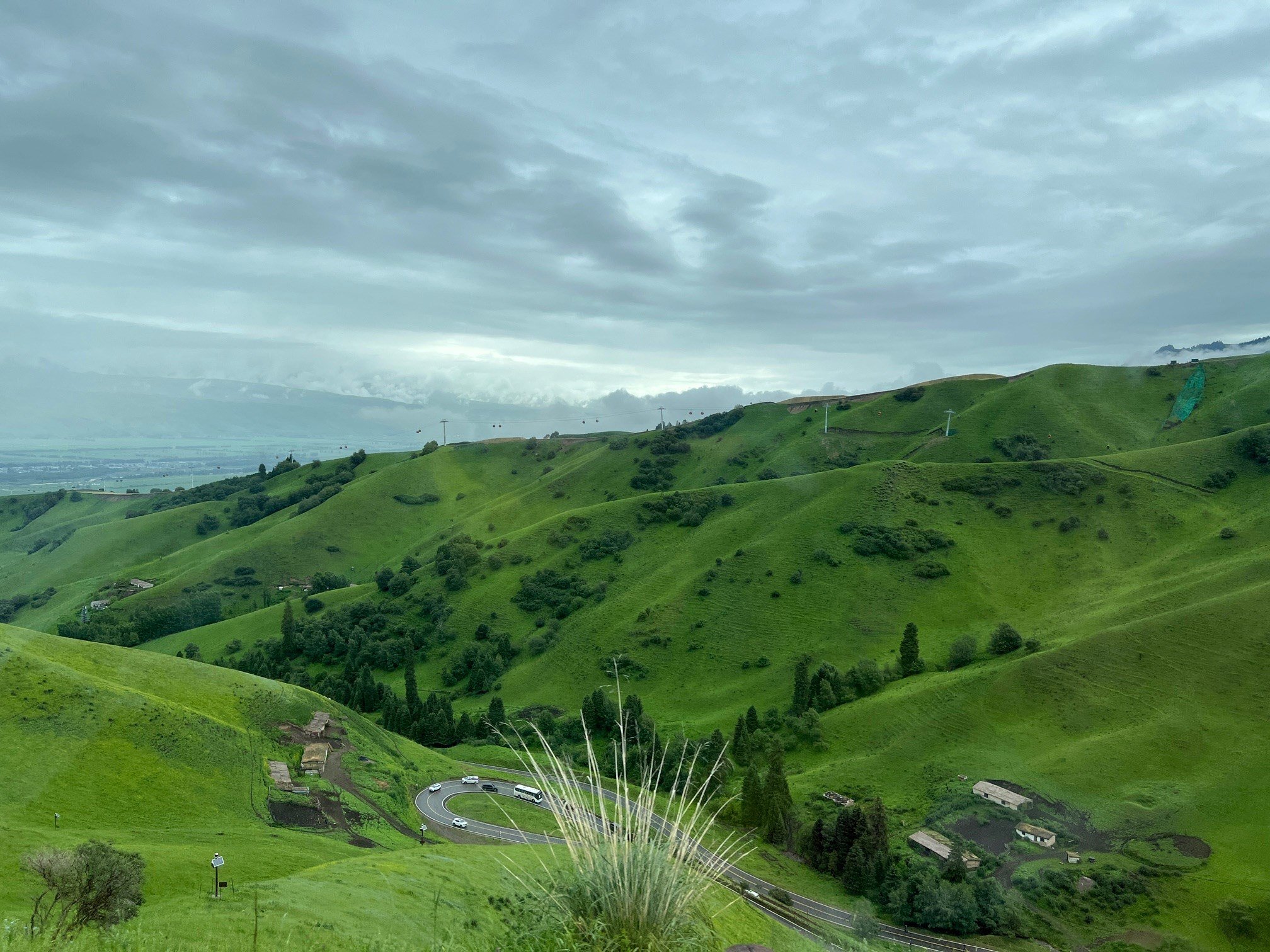
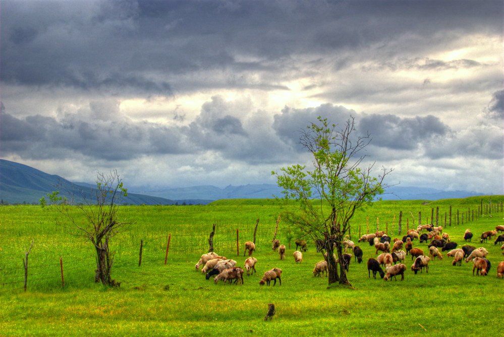
The Ili Tian Shan around Nalati, Kalajun, Qiongkushitai and Tangbula is one of the most meadow-rich parts of Xinjiang: rolling alpine grasslands, spruce forest belts, Kazakh pastoral villages, river canyons, high flower meadows and snow-mountain backdrops. Kalajun-Kuerdening is one of the four components of the UNESCO Xinjiang Tianshan World Heritage property, while Nalati is a major 5A grassland scenic area at the eastern end of the Ili valley.
Walking here ranges from managed scenic-area boardwalks and shuttle-assisted viewpoints to real grassland traverses between Kalajun and Qiongkushitai. Many routes cross grazing landscapes rather than continuously waymarked mountain trails. Horses, scenic buses, cable cars and boats are common parts of access logistics, but the best routes still reward walkers with open ridge and meadow travel.
The main hiking season is May to October, with peak wildflowers from late spring to midsummer and strong autumn colour in forested valleys. Weather can change quickly; high meadows are exposed, and some routes have poor mobile signal. Local access rules, scenic-area tickets, shuttle routes, grazing restrictions and guide/horse arrangements should be checked close to departure.
Selection rationale
The five hikes below cover the core Ili Tian Shan walking characters: the classic Flower Terrace-Qiongkushitai grassland traverse, a Kalajun small loop linking flower meadows and viewpoints, the managed Koksu Grand Canyon walk, the Nalati Sky Grassland-Xuelian Valley route, and Tangbula Fairy Lake as the neighbouring alpine-lake meadow objective. Kalajun has the strongest hiking-specific route evidence; Nalati and Koksu are mostly scenic-area walking routes with unresolved GPS-grade distance data.
Summary table
| # | Hike | Country | Route type | Distance | Gain | Max elevation | Difficulty |
|---|---|---|---|---|---|---|---|
| 1 | Kalajun Flower Terrace to Qiongkushitai Village Traverse | China | Point-to-point traverse | 19–20.3 km | Approx. 500–601 m by guide/GPS sources | above 2,000 m for much of route | Hard |
| 2 | Kalajun Small Loop: Flower Terrace, Five-Flower Meadow and Falcon Terrace | China | Loop / scenic-area circuit | 13.0 km | 916 m | Moderate-hard | |
| 3 | Koksu Grand Canyon: Crocodile Bay and Nine Curves walk | China | Shuttle/boat-assisted viewpoint walks | Approx. 3–6 km walking | Easy-moderate | ||
| 4 | Nalati Sky Grassland, Tianjie Platform and Xuelian Valley | China | Shuttle-assisted out-and-back / linked scenic walk | Approx. 4–8 km walking | 2,200–3,000 m depending source/variant | Moderate | |
| 5 | Tangbula Fairy Lake | China | Out-and-back | Approx. 3–5 km walking | Approx. 400 m by travel source | About 2,500 m | Moderate |
1. Kalajun Flower Terrace to Qiongkushitai Village Traverse
Snapshot
Itinerary
From Flower Terrace in East Kalajun, the route crosses open alpine meadow and rolling grassland towards Qiongkushitai. The line passes flower meadows, grazing areas and high viewpoints before descending towards the Kazakh wooden-house village. It may be walked in either direction, but scenic-area access and exit logistics determine the practical start.
China Discovery identifies Flower Terrace to Qiongkushitai as a challenging 19 km hike that usually needs about 7 hours. A Qiongkushitai travel guide describes the classic route as about 15-20 km, 5-7 hours and roughly 500 m of cumulative climbing. Wikiloc lists a “Kalajun” route near Qiongkushitai at 20.31 km and +601 m.
Why it is essential
This is the signature day traverse of the Nalati-Kalajun region: a real grassland walk between a World Heritage meadow scenic area and a historic Kazakh pastoral village associated with the Wusun Ancient Road.
Equipment
- Sturdy boots
- Trekking poles
- Weatherproof layer and warm layer
- Sun protection
- Food
- At least 1.5–2 litres of water
- Offline GPS/map
- Headtorch
- Power bank
Hazards and notes
- Navigation across open meadow can be confusing in fog or storm
- Sudden storms, low cloud and weak signal
- Livestock/horse traffic
- Confirm whether independent walking is allowed through the relevant scenic-area gates and whether a guide or horse support is needed
GPX / KML links
| Source | URL | Format / access | Reuse status |
|---|---|---|---|
| Wikiloc: Qiongkushitai Muyecun hiking route index | wikiloc.com | Route-index page with “Kalajun” GPS listing | Wikiloc terms apply; individual GPX should be inspected before reuse |
| OpenStreetMap: Flower Terrace to Qiongkushitai search | openstreetmap.org | Map/search | OSM data is ODbL; geometry cross-check only |
| China Discovery: Karajun Grassland | chinadiscovery.com | Attraction guide | Site terms apply; distance/time/access cross-check only |
External links
- China Discovery — Karajun Grassland, Flower Terrace-Qiongkushitai hike
- Wikiloc — Qiongkushitai Muyecun hiking route index
- Qiongkushitai travel guide
- UNESCO World Heritage Centre — Xinjiang Tianshan
2. Kalajun Small Loop: Flower Terrace, Five-Flower Meadow and Falcon Terrace
Snapshot
Itinerary
The walking circuit focuses on East Kalajun’s core meadow viewpoints. From Flower Terrace, continue through the Five-Flower Meadow area and higher rolling grassland, then link towards Falcon Terrace above the Kurdai Forest Canyon before returning by path, shuttle or a variant line. China Discovery describes Flower Terrace as the flower-meadow highlight and Falcon Terrace as the traditional Kazakh falcon-training viewpoint over the forest canyon.
Wikiloc’s “Karakorum Small Loop” near Qiongkushitai records 12.99 km and +916 m. The exact match between that GPS line and the scenic-area visitor route needs inspection before publication geometry is derived.
Why it is essential
This route gives the best compact Kalajun day without requiring a point-to-point exit at Qiongkushitai. It links the area’s flower meadows, rolling landforms and canyon viewpoint in one substantial walk.
Equipment
- Boots or robust trail shoes
- Trekking poles
- Weatherproof layer and warm layer
- Sun protection
- Water, food
- Offline map/GPS
Hazards and notes
- The open grassland can be confusing in fog or storm
- Scenic shuttle and cable-car operations may affect start/finish options
- Stay on permitted paths to avoid damaging meadow vegetation
GPX / KML links
| Source | URL | Format / access | Reuse status |
|---|---|---|---|
| Wikiloc: Qiongkushitai Muyecun hiking route index | wikiloc.com | Route-index page with “Karakorum Small Loop” GPS listing | Wikiloc terms apply; individual GPX should be inspected before reuse |
| OpenStreetMap: Kalajun Flower Terrace Falcon Terrace search | openstreetmap.org | Map/search | OSM data is ODbL; geometry cross-check only |
| China Discovery: Karajun Grassland | chinadiscovery.com | Attraction guide | Site terms apply; landmark and access cross-check only |
External links
- China Discovery — Karajun Grassland attractions and hiking note
- Wikiloc — Qiongkushitai Muyecun hiking route index
- China Educational Tours — Kalajun Grassland overview
3. Koksu Grand Canyon: Crocodile Bay and Nine Curves Walk
Snapshot
Itinerary
The day links the main Kuokesu Grand Canyon viewpoints and short walks. Crocodile Bay is a steep canyon overlook named for the crocodile-like landform in the valley; China Discovery gives the bay valley dimensions as about 1,600 m north-south, 1,400 m east-west and about 360 m deep. The Nine Curves and Eighteen Bends viewpoint looks over a 5,600 m meandering section of the Kuokesu River.
Walking is likely to be in short viewpoint and boardwalk segments, connected by scenic-area boats, cable car or shuttle vehicles. No continuous public GPX route was verified.
Why it is essential
Koksu Grand Canyon adds the canyon-and-river character that distinguishes Kalajun from purely open grassland routes. It is the best accessible contrast to Flower Terrace and Qiongkushitai.
Equipment
- Grippy shoes
- Warm layer
- Rain/wind layer
- Water, snacks
- Sun protection
- Extra warmth for windy canyon viewpoints
Hazards and notes
- Viewpoint edges, boats/cable-car timing, crowds and storm exposure are the main issues
- Do not approach cliff edges for photographs
- Confirm whether the scenic-area transport sequence is operating before committing to a day plan
GPX / KML links
| Source | URL | Format / access | Reuse status |
|---|---|---|---|
| OpenStreetMap: Kuokesu Grand Canyon search | openstreetmap.org | Map/search | OSM data is ODbL; geometry cross-check only |
| China Discovery: Karajun / Kuokesu Grand Canyon | chinadiscovery.com | Attraction guide | Site terms apply; landmark dimensions and access cross-check only |
External links
- China Discovery — Kuokesu Grand Canyon, Crocodile Bay and Nine Curves
- China Educational Tours — Kalajun Grassland and Kuokesu Canyon overview
- UNESCO World Heritage Centre — Xinjiang Tianshan
4. Nalati Sky Grassland, Tianjie Platform and Xuelian Valley
Snapshot
Itinerary
Use the Nalati scenic-area shuttle to reach Sky Grassland / Summer Ranch. Walk the open meadow and viewing-platform paths around Tianjie Platform, where China Educational Tours describes a plank road rising to a high point with views over both the Heavenly Grassland and River Valley Grassland. If current transport and weather allow, continue by shuttle and walking sections towards Xuelian Valley / Snow Lotus Valley.
The route is a managed scenic-area walking day. Nalati is too large to cross entirely on foot in a single visitor day, and China Discovery states that tourist buses are needed for Sky Grassland, Xuelian Valley, Hegu Grassland and Panlong Valley.
Why it is essential
Nalati is the defining grassland scenic area of the eastern Ili valley, and Sky Grassland is its classic walking/viewpoint route. It balances the more rugged Kalajun traverses with a more accessible alpine-meadow experience.
Equipment
- Comfortable hiking shoes
- Warm layer
- Rain/wind shell
- Water, snacks
- Sun protection
- Navigation backup
- Extra warmth because even summer evenings can be cold
Hazards and notes
- Altitude figures differ between sources and need local confirmation for the exact Xuelian Valley stop
- Scenic buses, tickets, private-car permissions and weather closures determine the route
- Camping is reported by China Discovery as not allowed inside Nalati scenic area
GPX / KML links
| Source | URL | Format / access | Reuse status |
|---|---|---|---|
| OpenStreetMap: Nalati Sky Grassland search | openstreetmap.org | Map/search | OSM data is ODbL; geometry cross-check only |
| China Discovery: Nalati Grassland | chinadiscovery.com | Attraction guide | Site terms apply; access, shuttle and seasonal cross-check only |
| China Educational Tours: Nalati Grassland | chinaeducationaltours.com | Attraction guide | Site terms apply; landmark and elevation cross-check only |
External links
5. Tangbula Fairy Lake
Snapshot
Itinerary
From the Tangbula roadside or current local access point, climb through meadow and pasture terrain towards Fairy Lake, an alpine lake below the Kuorke snow-mountain area. The route is often described as a horse-trekking objective, but a fit adult walking ascent of about one hour with roughly 400 m of gain is cited by a recent travel guide.
The exact trailhead, route line and legal access rules were not verified with an official GPX. Local conditions and whether walking or horse access is preferred should be confirmed before starting.
Why it is essential
Tangbula Fairy Lake adds an alpine-lake objective to the Ili Tian Shan selection, complementing Nalati’s open meadows and Kalajun’s grassland-canyon traverses.
Equipment
- Hiking shoes/boots
- Waterproof/windproof layer
- Warm layer
- Water, food
- Sun protection
- Trekking poles
- Offline map/GPS
Hazards and notes
- The route has unresolved legal/access details and may cross grazing land
- Weather, mud, stream crossings and horse traffic are possible
- Avoid camping or off-track travel unless current local rules explicitly allow it
GPX / KML links
| Source | URL | Format / access | Reuse status |
|---|---|---|---|
| OpenStreetMap: Tangbula Fairy Lake search | openstreetmap.org | Map/search | OSM data is ODbL; geometry cross-check only |
| China Educational Tours: Tangbula Fairy Lake | chinaeducationaltours.com | Attraction guide | Site terms apply; elevation and location cross-check only |
| Player Travel: Tangbula Hundred-Mile Gallery / Fairy Lake | player-travel.com | Travel guide | Site terms apply; approximate walking time/gain cross-check only |
External links
- China Educational Tours — Tangbula Fairy Lake
- Go Western China — Tangbula Fairy Lake guide
- Player Travel — Tangbula Hundred-Mile Gallery / Fairy Lake walking note
Missing data and follow-up
- Official GPX/KML not found for Kalajun, Nalati, Koksu or Tangbula in this pass.
- Individual Wikiloc tracks for Kalajun/Qiongkushitai should be downloaded and inspected before deriving any route geometry.
- Nalati Sky Grassland and Xuelian Valley walking-only distances and maximum elevation need current scenic-area map confirmation.
- Koksu Grand Canyon walking-only distance is unresolved because boats, cable cars and shuttles form part of the normal visit.
- Tangbula Fairy Lake trailhead, access permissions and GPX geometry require local confirmation.
- More specific licence-compatible photos are still needed for Qiongkushitai and Koksu Grand Canyon.
External links
| Source | URL |
|---|---|
| UNESCO World Heritage Centre — Xinjiang Tianshan | whc.unesco.org |
| China Discovery — Karajun Grassland | chinadiscovery.com |
| China Discovery — Nalati Grassland | chinadiscovery.com |
| China Educational Tours — Kalajun Grassland | chinaeducationaltours.com |
| China Educational Tours — Nalati Grassland | chinaeducationaltours.com |
| China Educational Tours — Qiongkushitai | chinaeducationaltours.com |
| China Educational Tours — Tangbula Fairy Lake | chinaeducationaltours.com |
| Qiongkushitai travel guide | apple-trip.com |
| Go Western China — Tangbula Fairy Lake | gowesternchina.com |
| Player Travel — Tangbula Hundred-Mile Gallery / Fairy Lake | player-travel.com |
| Wikiloc — Qiongkushitai Muyecun hiking route index | wikiloc.com |