Regional overview
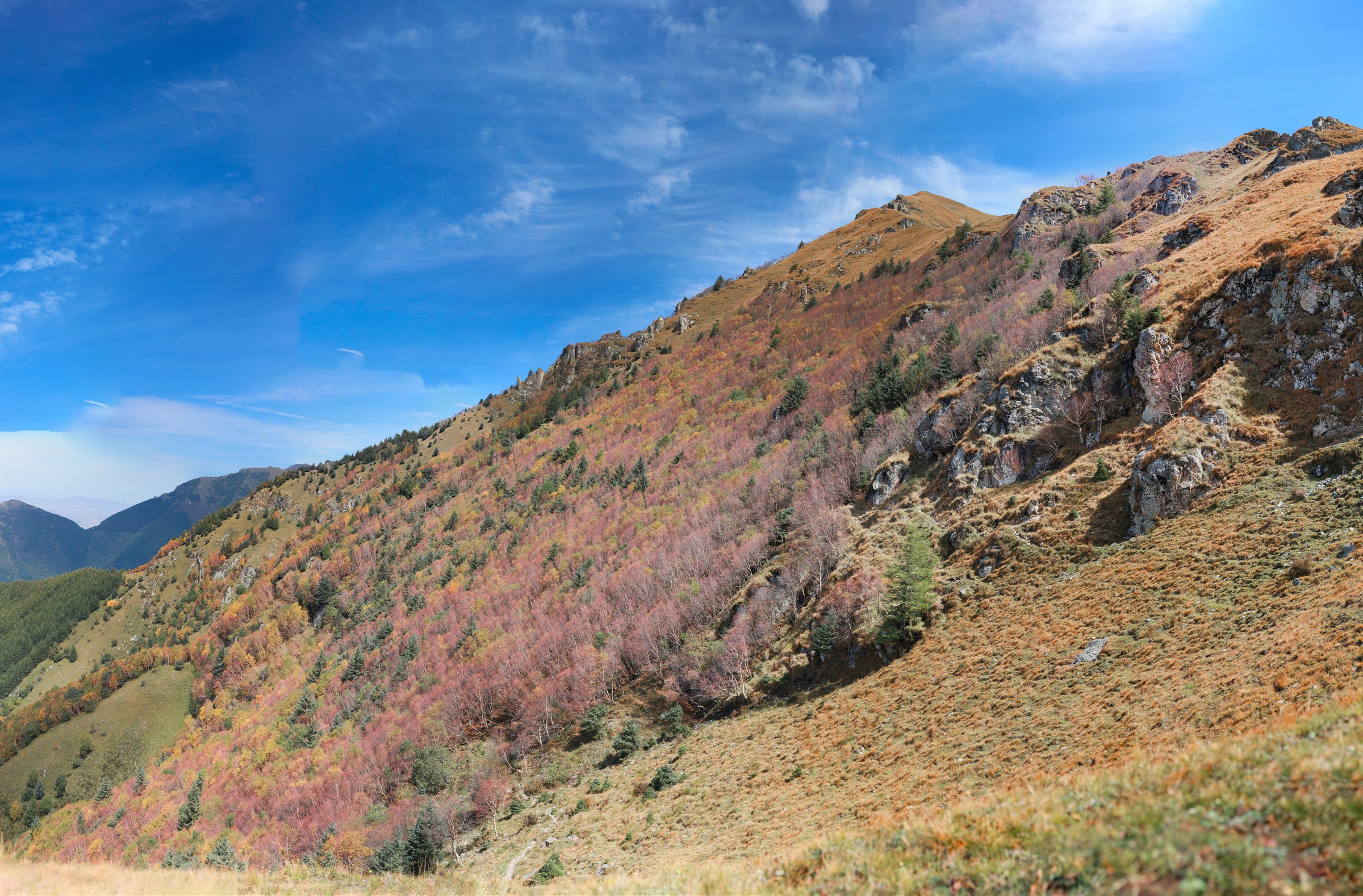
The Baishi Mountain / Laiyuan region sits at the northern end of the Taihang chain in western Hebei, around Laiyuan County, Baoding. The core landscape is Baishishan National Geopark: white marble and dolomite peak forest, cliff plank roads, glass walkways, waterfalls, springs, and nearby unrepaired Great Wall ridges.
Hiking here is usually managed scenic-area walking rather than wilderness trekking. Baishishan has cable cars, shuttle roads, stone steps, cliff paths, rest points, and ticket controls. Shipuxia Falls and Jumayuan Springs form lower-water features of the geopark. Wulonggou Great Wall, northeast of Laiyuan, is a more primitive wall-and-ridge objective and needs extra caution because it is unrepaired.
The main season is late spring to autumn. Winter and early spring can bring snow or ice on cliff paths and stairs. Summer thunderstorms can make glass walkways, stone steps, and canyon paths unsafe.
Selection rationale
The five hikes below cover the region’s essential walking spectrum: the main Baishishan high plank-road loop, a longer Baishishan circuit, the Shipuxia waterfall gorge, the Jumayuan spring group, and the Wulonggou Great Wall ridge. Route statistics are strong for the three AllTrails routes and weak for Jumayuan and Wulonggou, which are included with unresolved data because they are important regional components.
Summary table
| # | Hike | Country | Route type | Distance | Gain | Max elevation | Difficulty |
|---|---|---|---|---|---|---|---|
| 1 | Baishi Mountain high plank-road loop | China | Loop | 8.2 km | 687 m | 2,007 m | Hard |
| 2 | Baishishan full scenic loop | China | Loop | 12.1 km | 1,156 m | 2,002 m | Hard |
| 3 | Shipuxia Falls | China | Out-and-back | 4.8 km | 375 m | 1,329 m | Moderate |
| 4 | Jumayuan Springs lower geopark walk | China | Short loop / out-and-back | Approx. 2-4 km | Minor | Easy-moderate | |
| 5 | Wulonggou Great Wall ridge section | China | Out-and-back / ridge traverse | Approx. 4-8 km selected section | Moderate-hard |
1. Baishi Mountain High Plank-Road Loop
Snapshot
Itinerary
The route uses the managed Baishishan high path system: cliff plank roads, stairways, peak viewpoints, and glass skywalk sections across the marble peak forest. AllTrails describes the route as a loop, and official/Beijing tourism material identifies Baishi Mountain as a 54 sq km geopark area with white-stone peak scenery, cliff paths, and a 2,096 m high point.
Why it is essential
This is the signature day hike of Laiyuan and one of the northern Taihang’s most recognisable scenic-area mountain walks.
Equipment
Mountain hiking equipment: grippy hiking shoes, wind/rain layer, warm layer, water, snacks, sun protection, and poles if allowed. Carry extra warmth outside midsummer.
Hazards and notes
Exposure is managed by railings, plank roads, and scenic-area controls, but stairs, glass walkways, and cliff paths remain serious in ice, rain, high wind, or lightning. Check cableway and shuttle times before starting.
GPX / KML links
| Source | URL | Format / access | Reuse status |
|---|---|---|---|
| AllTrails: Baishi Mountain | alltrails.com | Route page / app map | AllTrails terms apply; GPX export terms not verified; source-map and statistics used |
| OpenStreetMap search: Baishi Mountain | openstreetmap.org | Map/search | OSM data is ODbL; geometry cross-check only |
External links
2. Baishishan Full Scenic Loop
Snapshot
Itinerary
This longer Baishishan loop links more of the scenic area’s stair and cliff-path network than the shorter high route. It is a full mountain day by managed scenic-area standards, with repeated ascents and descents around peak-forest viewpoints, cliff walkways, and rest areas.
Why it is essential
The full loop is the best catalogue option for fit walkers who want Baishishan as a real day hike rather than a short cableway-assisted visit.
Equipment
Mountain hiking equipment: sturdy shoes, water, food, rain/wind layer, warm layer, sun protection, navigation, and headtorch for delays.
Hazards and notes
The almost 1,200 m of cumulative ascent makes this much more strenuous than many visitors expect. Crowding and one-way scenic-area controls may alter the feasible route. Start early enough to finish before last shuttle/cableway operations.
GPX / KML links
| Source | URL | Format / access | Reuse status |
|---|---|---|---|
| AllTrails: Baishishan | alltrails.com | Route page / app map | AllTrails terms apply; GPX export terms not verified; source-map and statistics used |
| OpenStreetMap search: Baishishan | openstreetmap.org | Map/search | OSM data is ODbL; geometry cross-check only |
External links
- AllTrails — Baishishan
- Visit Beijing — Baishishan Geopark
- BH2255 — Laiyuan Baishi Mountain scenic area guide
3. Shipuxia Falls
Snapshot
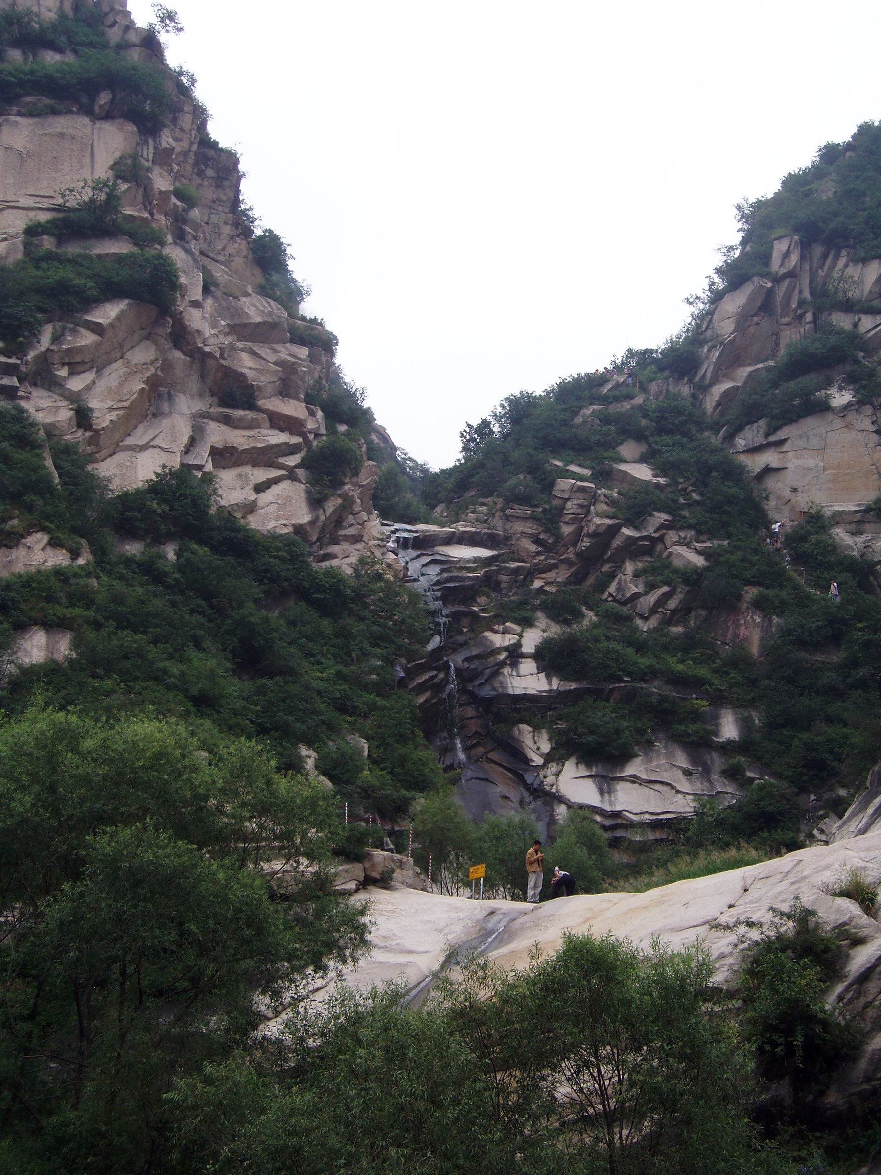
Itinerary
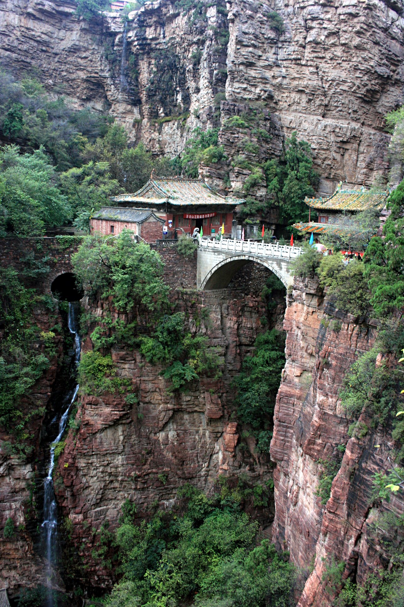
The trail follows Shipuxia, one of the Baishishan Geopark’s named components, through a waterfall gorge below the high peak-forest area. AllTrails maps it as a 4.8 km out-and-back with moderate ascent. Visit Beijing identifies Shipuxia Canyon as part of Baishishan Geopark together with Mount Baishishan and Jumayuan Springs.
Why it is essential
Shipuxia adds the geopark’s waterfall and gorge landscape, balancing the exposed high plank roads of Baishishan.
Equipment
Standard hiking equipment: grippy shoes, rain layer, water, sun protection, and poles if descending wet stone steps.
Hazards and notes
Wet rock, slippery steps, high water after rain, and thunderstorm risk are the main issues. Check whether the gorge section is open before combining it with the high Baishishan loop.
GPX / KML links
| Source | URL | Format / access | Reuse status |
|---|---|---|---|
| AllTrails: Shipuxia Falls | alltrails.com | Route page / app map | AllTrails terms apply; GPX export terms not verified; source-map and statistics used |
| OpenStreetMap search: Shipuxia | openstreetmap.org | Map/search | OSM data is ODbL; geometry cross-check only |
External links
- AllTrails — Shipuxia Falls
- Visit Beijing — Baishishan Geopark
- BH2255 — Laiyuan Baishi Mountain scenic area guide
4. Jumayuan Springs Lower Geopark Walk
Snapshot
Itinerary
Jumayuan Springs is listed with Mount Baishishan and Shipuxia Canyon as one of the major Baishishan Geopark components. The catalogue walk should use signed paths around the spring group and lower geopark features rather than unofficial shortcuts. Exact path distance and gain were not found in this pass.
Why it is essential
This route represents the water-source and lower-geopark side of Laiyuan, providing an easier alternative to Baishishan’s high cliff routes.
Equipment
Standard hiking equipment: walking shoes, water, sun protection, and a weather layer.
Hazards and notes
The route needs manual confirmation from a current scenic-area map. Do not publish exact statistics until the path geometry is verified.
GPX / KML links
| Source | URL | Format / access | Reuse status |
|---|---|---|---|
| OpenStreetMap search: Jumayuan Springs | openstreetmap.org | Map/search | OSM data is ODbL; geometry cross-check only |
| Visit Beijing: Baishishan Geopark | english.visitbeijing.com.cn | Attraction guide | Site terms apply; no route-file licence found; confirms Jumayuan Springs as geopark component |
External links
5. Wulonggou Great Wall Ridge Section
Snapshot
Itinerary
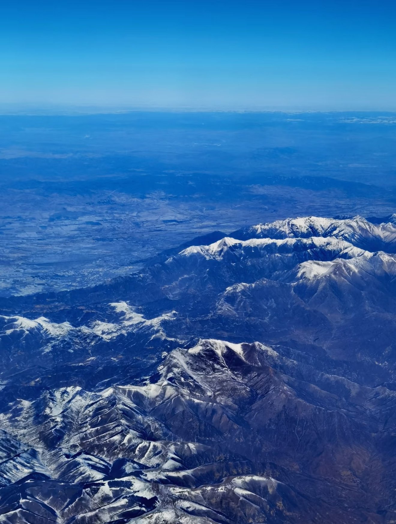
The hike follows a selected section of the unrepaired Wulonggou Great Wall near Wulonggou Village. TravelChinaGuide identifies the Laiyuan County wall section as 150 km long, with more than 300 watchtowers and many battle terraces/beacon towers, but this is the historic wall length, not a day-hike distance. A catalogue route should be manually finalised around a safe, legal, and non-destructive ridge section.
Why it is essential
Wulonggou brings the Laiyuan area’s unrepaired Great Wall landscape into the selection, contrasting with Baishishan’s managed cliff paths.
Equipment
Mountain hiking equipment: sturdy boots, wind/rain layer, water, food, sun protection, gloves for rough stone if needed, and navigation. Trekking poles may help on loose sand/stone.
Hazards and notes
This is not a restored tourist wall. Loose masonry, missing steps, exposure, sand, damaged towers, and access uncertainty are serious issues. Avoid climbing fragile structures. Current local permission and safe entry/exit must be confirmed before publication.
GPX / KML links
| Source | URL | Format / access | Reuse status |
|---|---|---|---|
| OpenStreetMap search: Wulonggou Great Wall | openstreetmap.org | Map/search | OSM data is ODbL; geometry cross-check only |
| TravelChinaGuide: Wulonggou Great Wall | travelchinaguide.com | Guide page | Site terms apply; no route-file licence found; historic wall and access reference only |
External links
External links
| Source | URL |
|---|---|
| AllTrails — Baishi Mountain | alltrails.com |
| AllTrails — Baishishan | alltrails.com |
| AllTrails — Shipuxia Falls | alltrails.com |
| Visit Beijing — Baishi Mountain | english.visitbeijing.com.cn |
| Visit Beijing — Baishishan Geopark | english.visitbeijing.com.cn |
| BH2255 — Laiyuan Baishi Mountain scenic area guide | bh2255.com |
| TravelChinaGuide — Wulonggou Great Wall | travelchinaguide.com |
| Chinatripedia — Wulonggou Great Wall | chinatripedia.com |