Regional overview
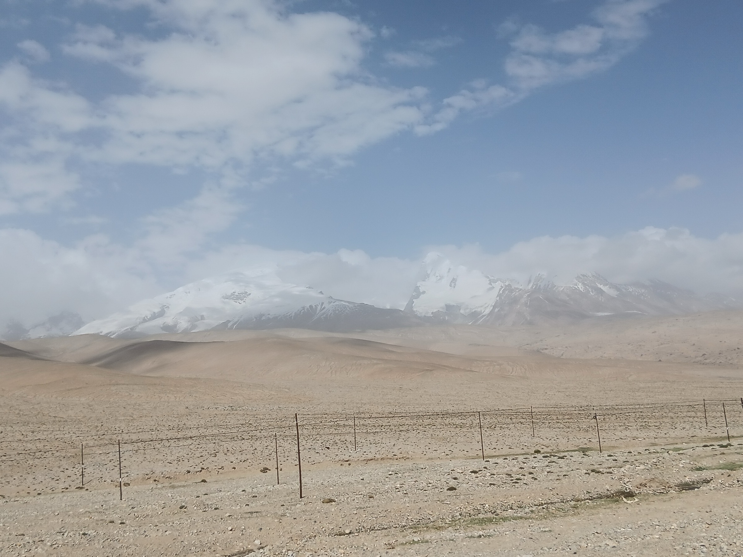
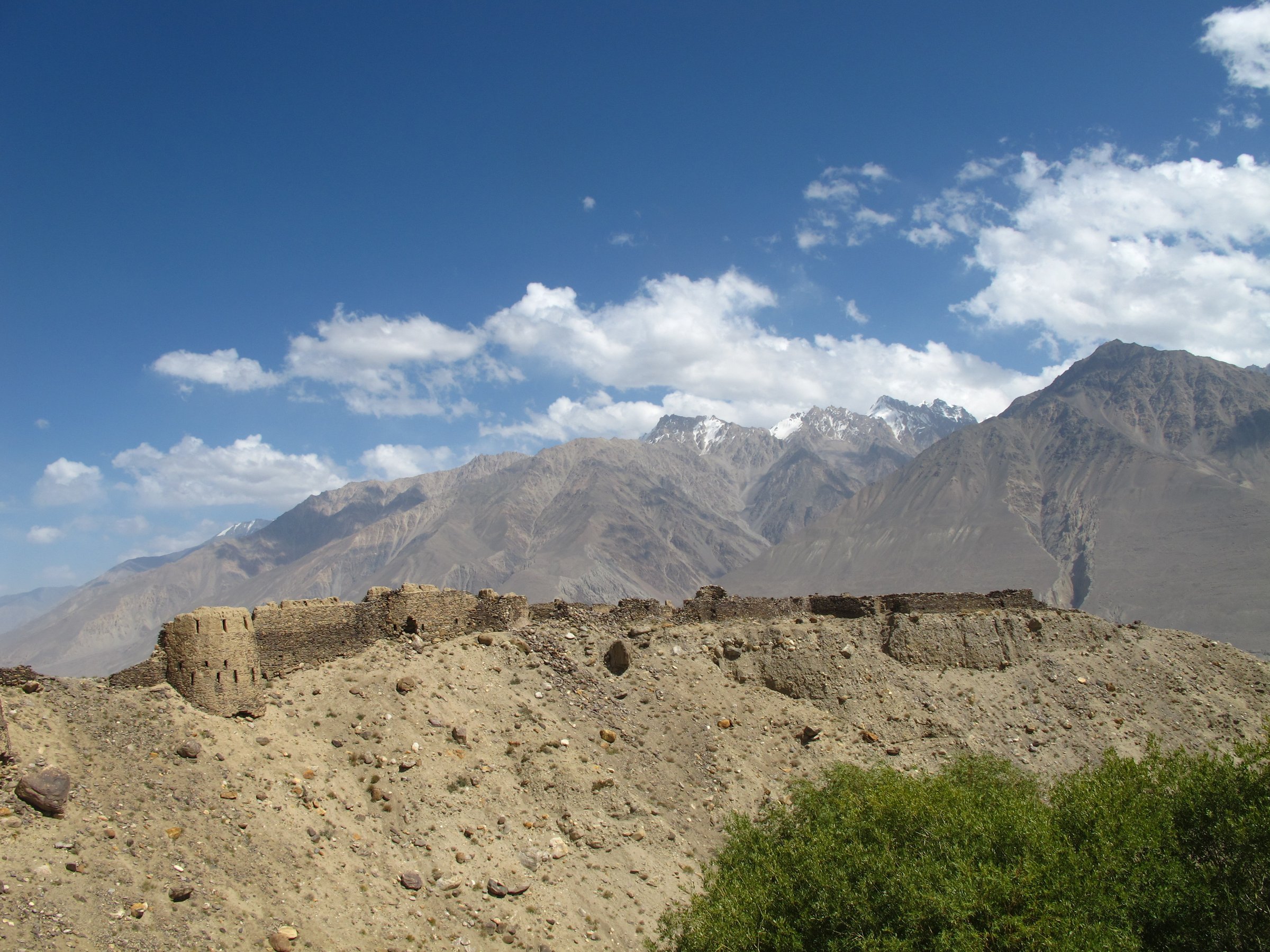
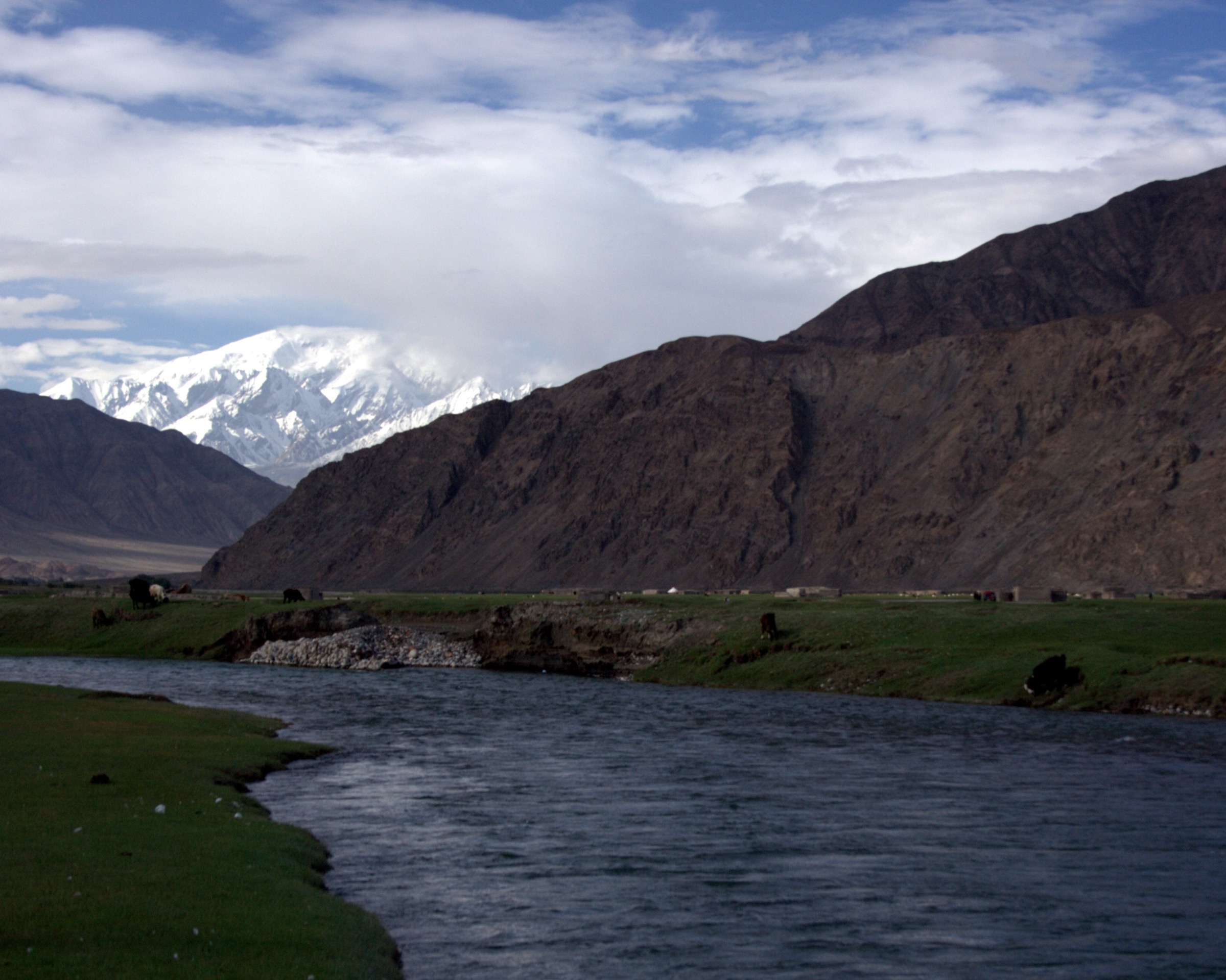
The Tashkurgan / Pamir Plateau region is the accessible centre of China’s far-western Pamir landscape: a high, dry borderland of stone forts, river wetlands, Tajik villages, glacial reservoirs, road passes, and broad views towards the Pamir, Kunlun, and Karakoram ranges. The practical walking base is Tashkurgan town, with the Pamir Tourism Area immediately beside it and road-accessed scenic points around Waqia, Bandir, and the Tashkurgan River valley.
This is not an open-access European-style hiking region. Much of the surrounding country is border-controlled, protected, undeveloped, or seasonally hazardous. A notice issued by the Tashkurgan Tajik Autonomous County Culture, Sports, Radio, Television and Tourism Bureau on 2 May 2026 prohibits unauthorised hiking, camping, crossing, mountaineering, and similar outdoor activity in listed old-road, mountain, reservoir, protected-area, no-man’s-land, and border-control zones, including the Tasha Ancient Trail county section, Yinta Ancient Trail county section, Bandir Blue Lake surrounding mountains, Xiabandi Reservoir surrounding mountains, undeveloped/unopened mountains, natural-reserve core and buffer areas, and border-control areas.
The five walks below therefore prioritise staffed scenic areas, boardwalks, official viewpoints, and short legal viewpoint walks. Distances are approximate where no official GPS route is published. Independent off-trail exploration in the surrounding mountains should not be inferred from these entries.
Selection rationale
The selection covers the region’s essential public walking surfaces: Stone City and Golden Grassland, the Pamir Tourism Area’s Tajik cultural zone, the Taheman/Alar wetland landscape, the Panlong Ancient Road viewpoint system, and the Bandir Blue Lake official parking/viewpoint area. These are not all wilderness hikes; they are the safest day-walk candidates in a controlled high-altitude frontier region.
Summary table
| # | Hike | Country | Route type | Distance | Gain | Max elevation | Difficulty |
|---|---|---|---|---|---|---|---|
| 1 | Stone City and Golden Grassland wetland boardwalk | China | Loop / out-and-back scenic-area walk | Approx. 3-5 km | Approx. 80-150 m | Approx. 3,150 m | Easy-moderate at altitude |
| 2 | Tajik Folk Custom Village and Pamir Tourism Area cultural walk | China | Loop / point-to-point scenic-area walk | Approx. 2-4 km | Minor | Approx. 3,100 m | Easy |
| 3 | Taheman / Alar wetland viewpoint walk | China | Out-and-back / viewpoint walk | Approx. 2-5 km | Minor | Approx. 3,100-3,300 m | Easy-moderate |
| 4 | Panlong Ancient Road — Longji Mountain / Wanglong Pavilion viewpoint walk | China | Short out-and-back / road-viewpoint walk | Approx. 1-3 km on legal viewpoint paths | Approx. 50-150 m | Approx. 4,100-4,200 m | Moderate (altitude) |
| 5 | Bandir Blue Lake official parking and lakeside view walk | China | Short out-and-back / viewpoint walk | Approx. 1-3 km, official area only | Minor | Approx. 3,050 m | Easy-moderate |
1. Stone City and Golden Grassland Wetland Boardwalk
Snapshot
Itinerary
The route links the Stone City ruins with the Golden Grassland wetland below the fort. From the visitor area, the path climbs through or around the stone fort remains to viewpoints over the Tashkurgan River wetlands, then descends or returns by signed scenic-area boardwalks and platforms across the wetland edge.
The Pamir Tourism Area is officially described as a 3.1 sq km scenic area made up of Stone City, Golden Grassland, Tajik Folk Custom Village, service facilities, and tourism shopping areas. No licence-clear GPX route was found, so the route should be treated as a scenic-area pedestrian itinerary rather than an independently defined trail.
Why it is essential
This is the core Tashkurgan walk: a Silk Road fort above a high Pamir wetland, with Tajik cultural context and open views towards the surrounding mountains.
Equipment
- Comfortable walking shoes
- Windproof layer and warm layer
- Water
- Sun protection
- Phone / map
- Extra layer outside midsummer (wind and temperature changes are sharp at altitude)
Hazards and notes
- Stay on official scenic-area paths and boardwalks.
- Wetland areas are sensitive, and the wider county has current restrictions on unauthorised mountain and old-road hiking.
- Altitude can affect even short walks.
GPX / KML links
| Source | URL | Format / access | Reuse status |
|---|---|---|---|
| OpenStreetMap: Stone City Tashkurgan search | openstreetmap.org | Map / search | OSM data is ODbL |
| Xinjiang Culture and Tourism Department: Pamir Tourism Area | wlt.xinjiang.gov.cn | Official scenic-area page | Site terms apply; no route-file licence found |
External links
- Xinjiang Culture and Tourism Department — Pamir Tourism Area
- China Daily Xinjiang — Pamir Tourism Area overview
- Tashkurgan county 2 May 2026 outdoor-activity restriction notice
2. Tajik Folk Custom Village and Pamir Tourism Area Cultural Walk
Snapshot
Itinerary
This lower-level cultural walk stays within the Pamir Tourism Area, linking the visitor/service zone, Stone City surroundings, and the Tajik Folk Custom Village / Caiyun Renjia cultural area where open visitor facilities allow a short, low-gradient walk.
The walk is included to represent the inhabited Tajik cultural landscape rather than a mountain objective. Exact route statistics are unresolved because the official sources verify the scenic-area components but not a downloadable pedestrian track.
Why it is essential
Tashkurgan’s walking identity is cultural as well as scenic. This route adds Tajik architecture, folk displays, and Silk Road context to the wetland and fort landscape.
Equipment
- Comfortable walking shoes
- Sun protection
- Water
- Windproof layer
- Modest clothing for village / cultural spaces
Hazards and notes
- Respect private and cultural spaces.
- Confirm current ticketing, opening hours, and any performance or access schedules.
- This is a developed-area walk and should not be extended into unauthorised mountains or protected wetland zones.
GPX / KML links
| Source | URL | Format / access | Reuse status |
|---|---|---|---|
| OpenStreetMap: Pamir Tourism Area Tashkurgan search | openstreetmap.org | Map / search | OSM data is ODbL |
| China Daily Xinjiang: Pamir Tourism Area | xinjiang.chinadaily.com.cn | Scenic-area overview | Site terms apply; no route-file licence found |
External links
- Xinjiang Culture and Tourism Department — Pamir Tourism Area
- China Daily Xinjiang — Pamir Tourism Area overview
- Tashkurgan county 2 May 2026 outdoor-activity restriction notice
3. Taheman / Alar Wetland Viewpoint Walk
Snapshot
Itinerary
This candidate walk uses legal wetland-edge paths, boardwalks, or viewpoints around the Taheman / Alar wetland landscape, avoiding reed beds, grazing land, and restricted mountain slopes. The objective is broad Pamir wetland scenery with views to the surrounding snow peaks and the Tashkurgan River system.
The exact pedestrian route requires local confirmation. Sources verify the importance of Golden Grassland / Alar wetland in the Pamir Tourism Area and nearby Pamir sightseeing routes, but no official route file or precise trail statistics were found.
Why it is essential
Wetlands are one of the defining contrasts of the Tashkurgan plateau: water, grass, yaks, and Tajik settlement set against dry high mountains.
Equipment
- Walking shoes
- Warm / windproof layer
- Water
- Sun protection
- Binoculars if birdwatching
- Keep to established tracks to protect wetland margins
Hazards and notes
- This is a candidate only until the legal route and access point are confirmed.
- Do not enter wetland restoration areas, private pasture, natural-reserve restricted zones, or unmarked mountain terrain.
GPX / KML links
| Source | URL | Format / access | Reuse status |
|---|---|---|---|
| OpenStreetMap: Taheman Wetland Tashkurgan search | openstreetmap.org | Map / search | OSM data is ODbL |
| Pamir Tourism Area source page | wlt.xinjiang.gov.cn | Official scenic-area page | Site terms apply; no route-file licence found |
External links
- Xinjiang Culture and Tourism Department — Pamir Tourism Area
- China Daily Xinjiang — Pamir Tourism Area overview
- Tashkurgan county 2 May 2026 outdoor-activity restriction notice
4. Panlong Ancient Road — Longji Mountain / Wanglong Pavilion Viewpoint Walk
Snapshot
Itinerary
The route is a short legal viewpoint walk from a current parking or pullout area on Panlong Ancient Road to a signed boardwalk or lookout over the road’s switchbacks. Sources describe Panlong Ancient Road / Waqia Road as about 30 km long, with more than 600 curves and a rise from roughly 3,000 m to 4,100-4,200 m.
This entry includes only the official viewpoint walking element. It does not include off-road ridge climbing, drone-service viewpoints requiring unsafe parking, or unauthorised mountain walking.
Why it is essential
Panlong Ancient Road is one of the most recognisable modern Pamir Plateau viewpoints near Tashkurgan. A short viewpoint walk gives a ridge-and-road landscape that contrasts with the wetland and cultural walks in town.
Equipment
- Sturdy shoes
- Warm windproof layer
- Sun protection
- Water
- Motion-sickness medication if driving the road
Hazards and notes
- Altitude is the main physical issue.
- Traffic, narrow road edges, snow, ice, and unsafe informal stopping are serious hazards.
- Walk only from legal parking or signed paths.
- Current county restrictions prohibit unauthorised activity in undeveloped mountain areas.
GPX / KML links
| Source | URL | Format / access | Reuse status |
|---|---|---|---|
| OpenStreetMap: Panlong Ancient Road search | openstreetmap.org | Map / search | OSM data is ODbL |
| China Dragon Travel: Panlong Ancient Road guide | chinadragontravel.com | Travel guide / route notes | Site terms apply; no route-file licence found |
External links
- China Dragon Travel — Panlong Ancient Road guide
- Tashkurgan county 2 May 2026 outdoor-activity restriction notice
5. Bandir Blue Lake Official Parking and Lakeside View Walk
Snapshot
Itinerary
The candidate route is deliberately limited to the official parking area, lakeside viewing space, and any open signed path or safe legal viewpoint immediately associated with Bandir Blue Lake / Xiabandi Reservoir. Travel sources identify the lake at about 3,050 m and describe official parking, toilets, and roadside viewpoints.
The surrounding mountains are not included. The 2 May 2026 county notice specifically lists Bandir Blue Lake surrounding mountains and Xiabandi Reservoir surrounding mountains among areas where unauthorised hiking, camping, crossing, and related outdoor activities are prohibited.
Why it is essential
Bandir Blue Lake is one of the region’s most visually distinct glacial-water landscapes: a bright reservoir set among pale Pamir and Kunlun rock, usually visited together with Panlong Ancient Road.
Equipment
- Walking shoes
- Windproof layer
- Sun protection
- Water
- Warm clothing if wind rises
Hazards and notes
- This is a candidate only because legal pedestrian boundaries and route statistics were not verified.
- Stay in the official visitor / parking area and do not enter the surrounding mountains, reservoir slopes, or closed viewpoints.
GPX / KML links
| Source | URL | Format / access | Reuse status |
|---|---|---|---|
| OpenStreetMap: Bandir Blue Lake search | openstreetmap.org | Map / search | OSM data is ODbL |
| China Dragon Travel: Bandir Blue Lake guide | chinadragontravel.com | Travel guide / access notes | Site terms apply; no route-file licence found |
External links
- China Dragon Travel — Bandir Blue Lake guide
- Tashkurgan county 2 May 2026 outdoor-activity restriction notice
Missing data and follow-up
- No official GPX/KML files found for any of the five walks.
- Exact Stone City / Golden Grassland pedestrian route distance should be checked against the current scenic-area map.
- Taheman / Alar wetland and Bandir Blue Lake walks require local confirmation of legal pedestrian boundaries.
- Current Tashkurgan county restrictions must be checked again before publication or travel; this article reflects sources found on 4 June 2026.
- Exact licence-compatible photos for Stone City, Golden Grassland, Taheman wetland, and Bandir Blue Lake remain unresolved beyond broad Tashkurgan/Kunlun images.
External links
| Source | URL |
|---|---|
| Xinjiang Culture and Tourism Department — Pamir Tourism Area | wlt.xinjiang.gov.cn |
| China Daily Xinjiang — Pamir Tourism Area | xinjiang.chinadaily.com.cn |
| Tashkurgan county 2 May 2026 outdoor-activity restriction notice | finance.sina.com.cn |
| China Dragon Travel — Panlong Ancient Road guide | chinadragontravel.com |
| China Dragon Travel — Bandir Blue Lake guide | chinadragontravel.com |