Regional overview
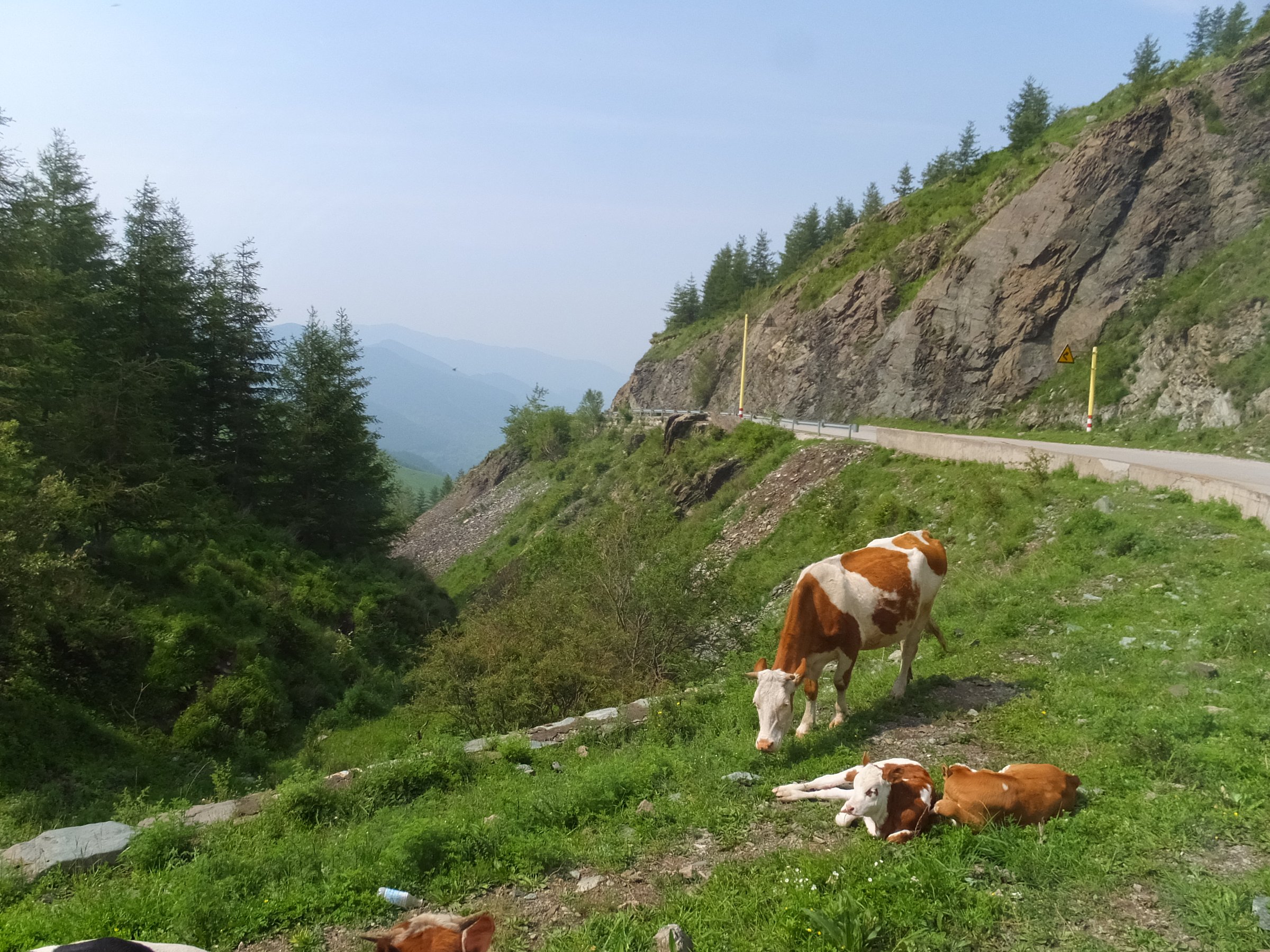
The western Luliang Mountains drop into the Shanxi-Shaanxi Yellow River gorge, where the range gives way to loess tablelands, ravines, river bends, ancient ferry towns, and cliff villages. The walking character is less alpine than the high Luliang spine: many routes are heritage walks, gorge-rim viewpoints, loess-ravine tracks, and short scenic-area paths.
The main hiking centres in this pass are Laoniuwan, Xunzhen, Qikou and Lijiashan, Yonghe Qiankun Bay, and Hukou Waterfall. These places represent the western Shanxi edge of the Luliang system: Great Wall / Yellow River contact, loess erosion landforms, cave-dwelling villages, river-port history, and the most famous waterfall on the Yellow River.
Spring and autumn are the most comfortable seasons. Summer can be hot and storm-prone, with flash-flood and landslide risk in ravines. Winter may bring ice, wind, and closed scenic-area sections. Route data is uneven; several entries rely on guide pages, source maps, or a single user-recorded route and are therefore marked cautiously.
Selection rationale
These five hikes were selected to cover the region’s essential landscapes: the Great Wall meeting the Yellow River at Laoniuwan, loess-gully walking around Xunzhen, Qikou and Lijiashan’s river-port and cave-village heritage, the large meander landscape of Qiankun Bay, and Hukou Waterfall. Only the Xunzhen and Hukou routes have clear trail-database statistics; the others need local map confirmation before publication.
Summary table
| # | Hike | Country | Route type | Distance | Gain | Max elevation | Difficulty |
|---|---|---|---|---|---|---|---|
| 1 | Laoniuwan Great Wall and Yellow River bend rim walk | China | Scenic-area out-and-back / loop candidate | Approx. 3-6 km | Easy-moderate | ||
| 2 | Xunzhen Loess Plateau line | China | Point-to-point | 11.3 km | 335 m | 1,118 m | Moderate |
| 3 | Qikou Ancient Town to Lijiashan cave-village walk | China | Out-and-back / linear access walk | Approx. 12 km return, plus village lanes | Approx. 803 m on Lijiashan loop source | Moderate | |
| 4 | Qiankun Bay Yellow River viewpoint and plank-road walk | China | Scenic-area walk / loop candidate | Approx. 3-6 km | Easy-moderate | ||
| 5 | Hukou Waterfall Shanxi-side gorge viewpoints | China | Out-and-back | 0.5 km | 18 m | 458 m cited by AllTrails app | Easy |
1. Laoniuwan Great Wall and Yellow River Bend Rim Walk
Snapshot
Itinerary
The practical day-hike version starts from the Laoniuwan village / scenic-area access point and follows the managed viewpoints around the old fort, Great Wall remains, cliff edge, and Yellow River bend. The walk should remain inside permitted scenic-area paths and avoid any unstable or closed Great Wall sections.
Why it is essential
Laoniuwan is one of western Shanxi’s defining river landscapes. China’s State Council news site describes Laoniuwan Village as being at the confluence of the Great Wall and the Yellow River, and as the northern starting landscape for Shanxi’s Yellow River No. 1 Tourist Highway.
Equipment
Standard hiking equipment, grippy shoes, sun protection, water, wind layer, and a navigation backup if walking beyond the developed viewpoints.
Hazards and notes
Cliff edges, eroded loess slopes, old masonry, road traffic, and scenic-area closures are the main issues. Unrestored Great Wall sections should not be treated as a free-hiking route without local permission.
GPX / KML links
| Source | URL | Format / access | Reuse status |
|---|---|---|---|
| OpenStreetMap search: Laoniuwan, Shanxi | openstreetmap.org | Source map | OSM data is ODbL; geometry cross-check only |
| Wikiloc Laoniuwan regional route | wikiloc.com | Driving route source, not hiking GPX | Wikiloc terms apply; useful location context only, not a day-hike route |
External links
- China State Council / Xinhua — Yellow River No. 1 Tourist Highway and Laoniuwan context
- Wikiloc — Laoniuwan regional route
2. Xunzhen Loess Plateau Line
Snapshot
Itinerary
The recorded Wikiloc route follows a point-to-point line through eroded loess plateau terrain north of Xunzhen. The description identifies the route character as loess plateau gullies and erosion landforms, with a five-hour outing. Because the route is user-recorded and not an official trail, the exact access rights and current path condition require local confirmation.
Why it is essential
This is the clearest sourced walking route in this pass for the western Shanxi loess landscape itself. It gives a different character from the managed river viewpoints: gully crossings, loess shoulders, and open plateau terrain above the Yellow River corridor.
Equipment
Standard hiking equipment, sturdy shoes, sun protection, wind layer, extra water, and GPS navigation. Trekking poles are useful on loose loess slopes.
Hazards and notes
Loess gullies can be unstable, especially after rain. Avoid storm days, check for private farmland or construction, and do not enter deeply incised ravines without a reliable exit plan.
GPX / KML links
| Source | URL | Format / access | Reuse status |
|---|---|---|---|
| Wikiloc: Loess Plateau of the line | wikiloc.com | Source map / downloadable route via Wikiloc account | Wikiloc terms apply; licence not clearly stated; usable as source-map reference only |
External links
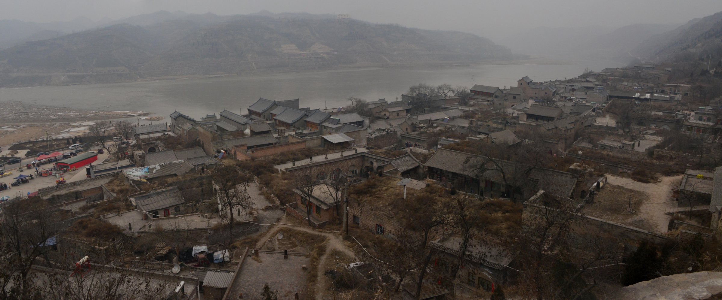
3. Qikou Ancient Town to Lijiashan Cave-Village Walk
Snapshot
Itinerary
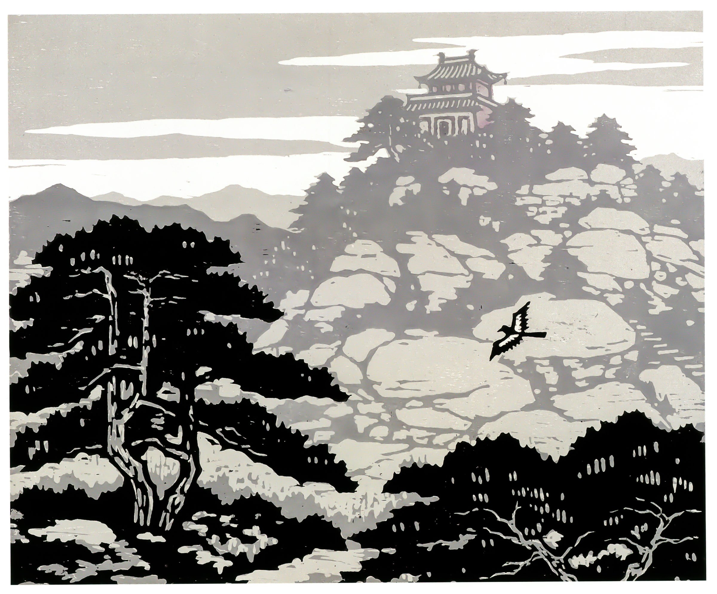
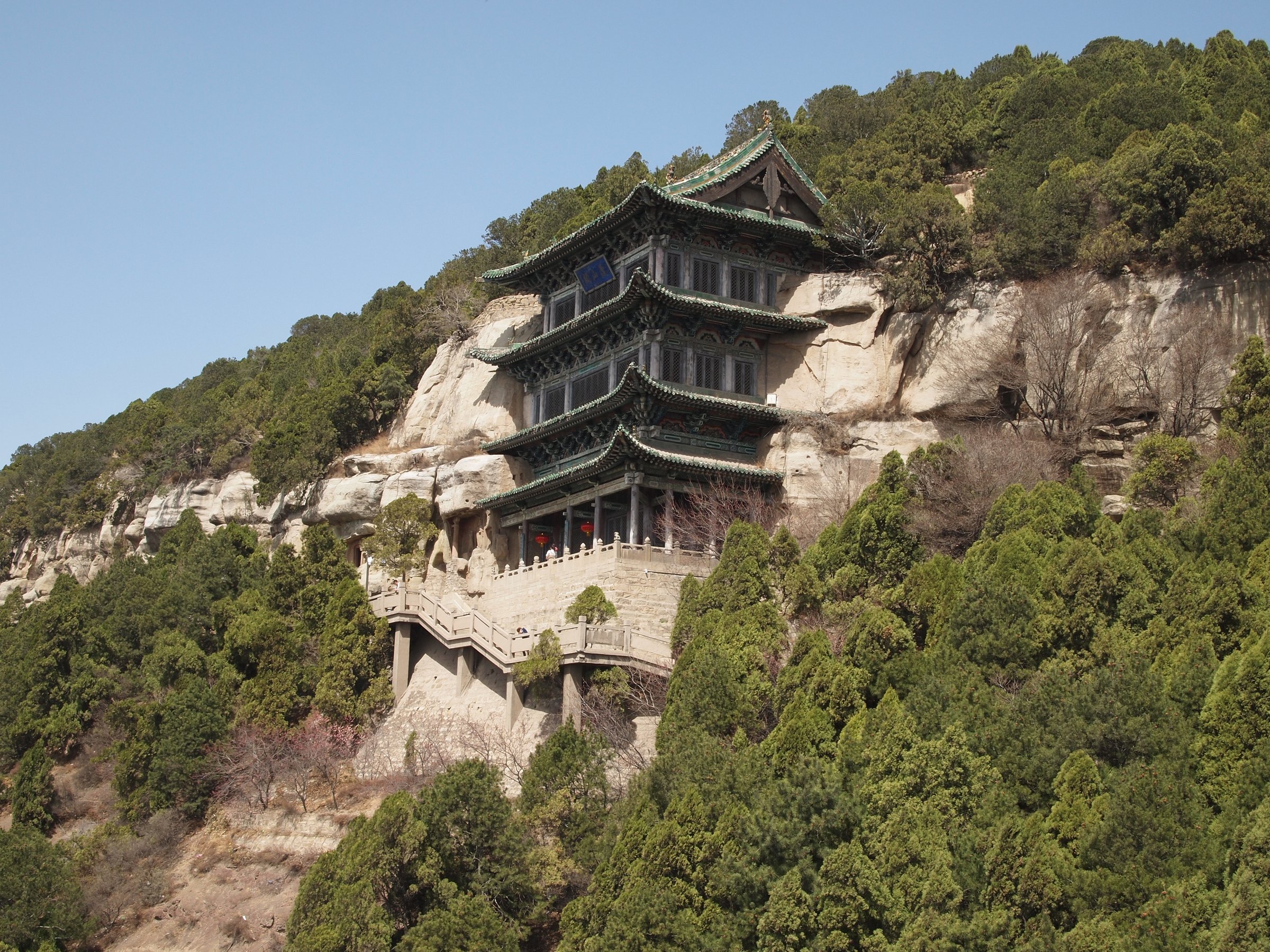
From Qikou, cross the Qiushui River bridge by the bus station and follow the river-side approach toward Lijiashan. Tour-Beijing describes the village as 5-6 km from Qikou and notes a walking approach before a zigzag road climbs to the old cave-dwelling village. In Lijiashan, the walk continues through the west and east sides of the terraced cave houses before returning to Qikou, or a vehicle can be arranged for one direction.
Why it is essential
Qikou and Lijiashan are the region’s clearest heritage walking combination: a Yellow River port town, loess-slope settlement, cave dwellings, and views over ravined hills. The route links the river-trade history of Qikou with the upland settlement pattern of western Luliang.
Equipment
Standard hiking equipment, comfortable shoes, water, sun protection, and a warm layer outside summer.
Hazards and notes
Road walking, local traffic, heat, loose surfaces, and old village steps are the main issues. The route should respect residents, courtyard privacy, and any local heritage-area controls.
GPX / KML links
| Source | URL | Format / access | Reuse status |
|---|---|---|---|
| Tour-Beijing Lijiashan guide map and walking notes | tour-beijing.com | Source map / guide page | Website terms apply; no GPX licence found; route description only |
| Wikiloc: Lijiashan village internal loop | wikiloc.com | Walking route source | Wikiloc terms apply; useful for village-loop stats |
| OpenStreetMap search: Qikou to Lijiashan | openstreetmap.org | Source map | OSM data is ODbL; geometry cross-check only |
External links
- Tour-Beijing — Lijiashan walking approach and transport
- Tour-Beijing — Qikou Ancient Town context
- Wikiloc — Lijiashan village loop
4. Qiankun Bay Yellow River Viewpoint and Plank-Road Walk
Snapshot
Itinerary
The day-hike version uses the managed Qiankun Bay scenic-area circulation: arrive at the main scenic area, use the permitted walking paths and viewpoint links around the large Yellow River bend, and include any open Yellow River plank-road section. The official scenic-area page identifies Qiankun Bay as part of the Shanxi-Shaanxi Gorge and lists seven bays, villages, Mt. Geshan, the geological museum, and guide-map / traffic-route resources.
Why it is essential
Qiankun Bay is the region’s signature meander landscape. The official scenic-area site describes the Yellow River section through Yonghe County and identifies the scenic area as a canyon-type “snaky landform” group on the Yellow River.
Equipment
Standard hiking equipment, sun protection, water, comfortable shoes for paved and stepped scenic paths, and a wind layer.
Hazards and notes
Cliff-edge viewpoints, summer heat, storms, shuttle schedules, and scenic-area closures are the main considerations. Route statistics are not publication-ready.
GPX / KML links
| Source | URL | Format / access | Reuse status |
|---|---|---|---|
| Official Qiankun Bay guide map page | yhqiankunwan.cn | Official source page / guide-map link | Site terms not clear for route reuse; use as source-map reference only |
| OpenStreetMap search: Qiankun Bay, Yonghe | openstreetmap.org | Source map | OSM data is ODbL; geometry cross-check only |
External links
- Qiankun Bay Scenic Area — official page
- China Daily government site — Qiankun Bay 5A visitor context
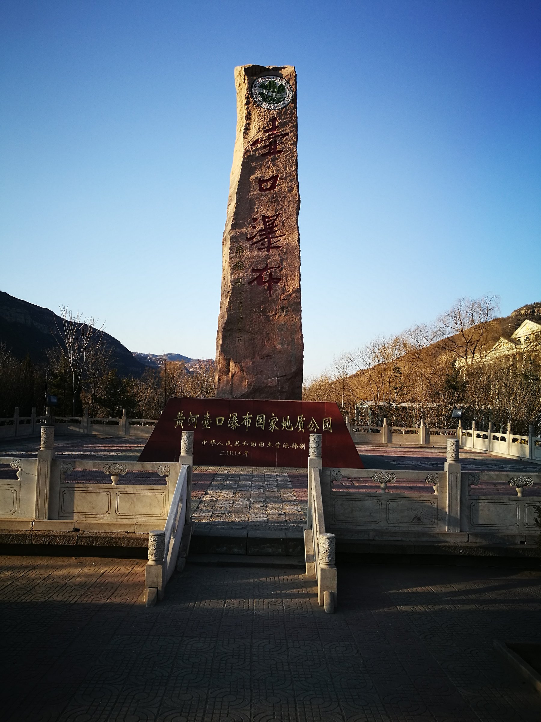
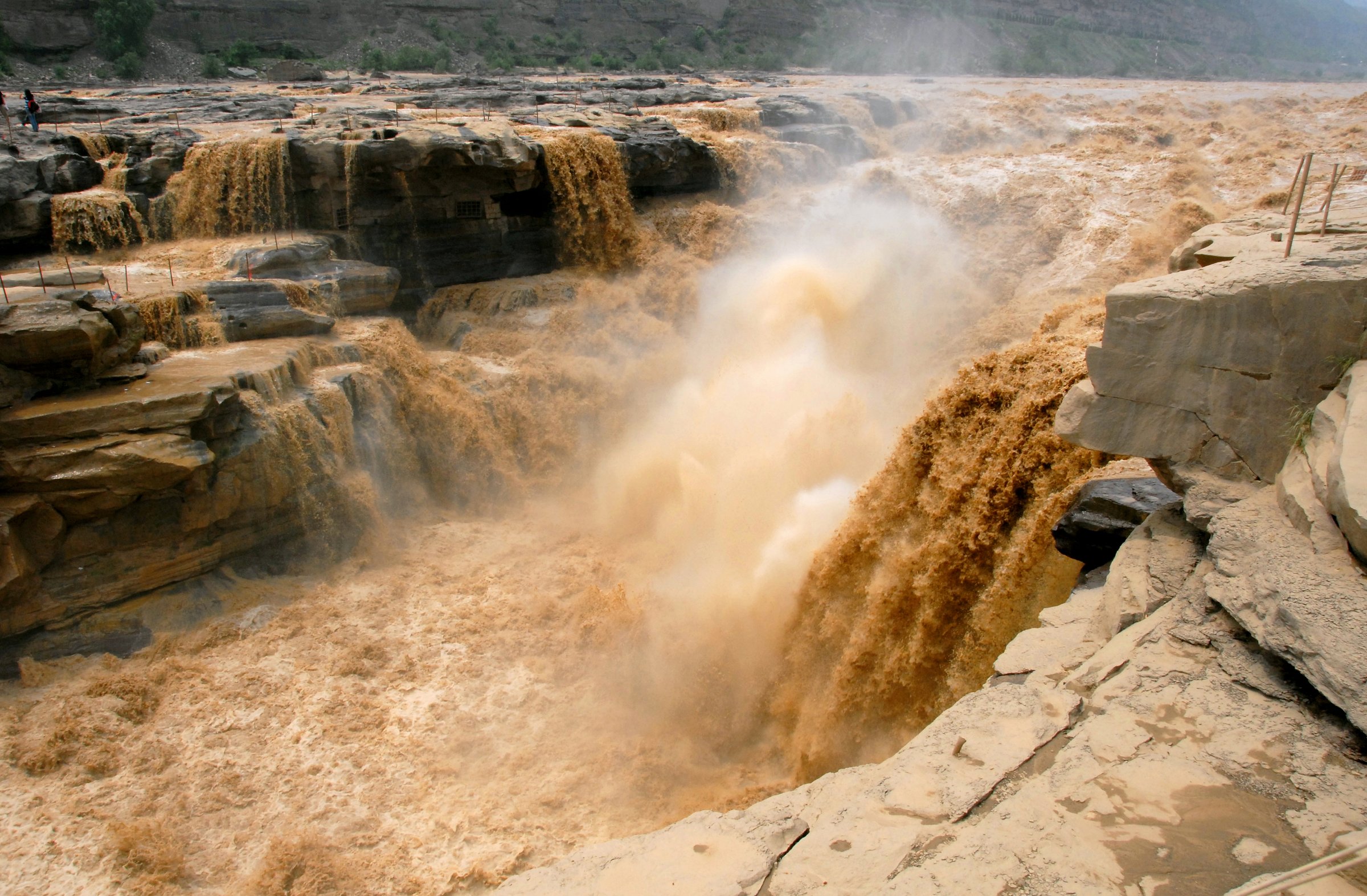
5. Hukou Waterfall Shanxi-Side Gorge Viewpoints
Snapshot
Itinerary
The route follows the developed Shanxi-side visitor path to the Hukou Waterfall viewpoints and returns the same way. AllTrails lists it as a 0.3 mile / 0.5 km out-and-back trail near Linfen, Shanxi, with a short, easy walking time. The walk is short but visually central to the Yellow River gorge sequence.
Why it is essential
Hukou is the most famous waterfall on the Yellow River and one of western Shanxi’s key river landscapes. It gives the region a dramatic gorge-and-water counterpoint to the loess and heritage-town walks.
Equipment
Comfortable walking shoes, waterproof layer for spray, sun protection, and warm clothing in cold or windy weather.
Hazards and notes
Spray, wet paving, crowding, cliff barriers, river-level changes, and scenic-area controls are the main issues. This is a short scenic walk rather than a full mountain hike.
GPX / KML links
| Source | URL | Format / access | Reuse status |
|---|---|---|---|
| AllTrails: Hukou Waterfall | alltrails.com | Source map / trail page | AllTrails terms apply; downloadable GPX availability may require account; source-map reference only |
| OpenStreetMap search: Hukou Waterfall Shanxi | openstreetmap.org | Source map | OSM data is ODbL; geometry cross-check only |
External links
External links
| Source | URL |
|---|---|
| China State Council / Xinhua — Yellow River No. 1 Tourist Highway | english.www.gov.cn |
| Qiankun Bay Scenic Area — official page | yhqiankunwan.cn |
| China Daily — Qiankun Bay visitor context | govt.chinadaily.com.cn |
| Tour-Beijing — Qikou Ancient Town | tour-beijing.com |
| Tour-Beijing — Lijiashan Village | tour-beijing.com |
| Wikiloc — Xunzhen Loess Plateau route | wikiloc.com |
| Wikiloc — Lijiashan village loop | wikiloc.com |
| Wikiloc — Laoniuwan regional route | wikiloc.com |
| AllTrails — Hukou Waterfall | alltrails.com |