Regional overview
Wutai Shan is a high, cold, temple-filled mountain landscape in northern Shanxi. It is best understood as a cluster of five open “terrace” summits around Taihuai, rather than as one single peak. UNESCO describes the cultural landscape as a sacred Buddhist mountain with five flat peaks, historic monasteries, forests, grassland, and living pilgrimage traditions.
The walking character is a mix of managed scenic-area visits, stone-step temple approaches, high meadow ridges, rough pilgrim tracks, and road-linked summit access. The highest point, North Terrace / Yedou Peak, reaches about 3,061 m, making Wutai Shan the highest mountain area in northern China. Many routes can be shortened by scenic-area buses or local vehicles, but the outer terraces are serious mountain walks in poor weather.
The normal hiking season is late spring to early autumn. Summer brings flowers, grassland, cloud, and thunderstorms; autumn is often clearer but colder. Snow, ice, strong wind, fog, and very low temperatures are possible outside summer, and some sources note that North Terrace can see snow from September to April.
Selection rationale
These five hikes cover the core Wutai experiences: the accessible Dailuoding “small pilgrimage”, the East Terrace sunrise hill, the high North Terrace summit, the North-Central-West terrace traverse, and the South Terrace flower/summit walk. The full five-terrace pilgrimage is normally a multi-day route, so the catalogue splits it into feasible day-hike sections.
Summary table
| # | Hike | Country | Route type | Distance | Gain | Max elevation | Difficulty |
|---|---|---|---|---|---|---|---|
| 1 | Dailuoding Wisdom Path and Taihuai temple loop | China | Loop / temple approach | Approx. 2-6 km depending temple loop | Approx. 150-350 m | Approx. 1,925 m | Easy-moderate |
| 2 | Hongmenyan to East Terrace / Wanghai Peak | China | Out-and-back | Approx. 6 km return | Approx. 300 m | 2,795-2,799 m | Moderate |
| 3 | Hongmenyan, East Terrace and North Terrace / Yedou Peak | China | Point-to-point / vehicle-assisted return | Approx. 17 km to North Terrace from Hongmenyan via East Terrace | Approx. 700-900 m | 3,061 m | Hard |
| 4 | North, Central and West Terraces traverse to Shiziwo | China | Point-to-point traverse | Approx. 23.5 km from North Terrace via Central and West to Shiziwo | Approx. 600-1,000 m | 3,061 m | Hard |
| 5 | South Terrace / Jinxiu Peak from Fomudong side | China | Loop or one-way variants | 12.9-15.3 km depending source/variant | 621-839 m depending source | 2,471-2,485 m | Hard |
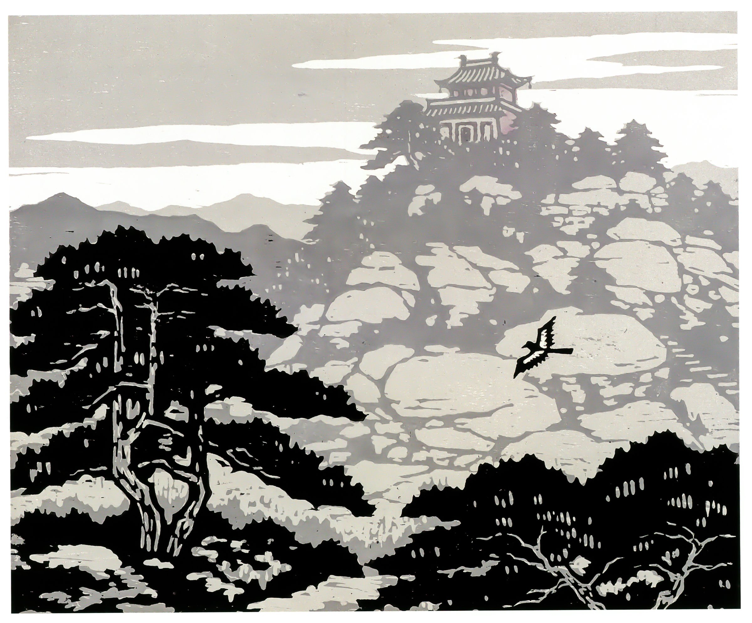
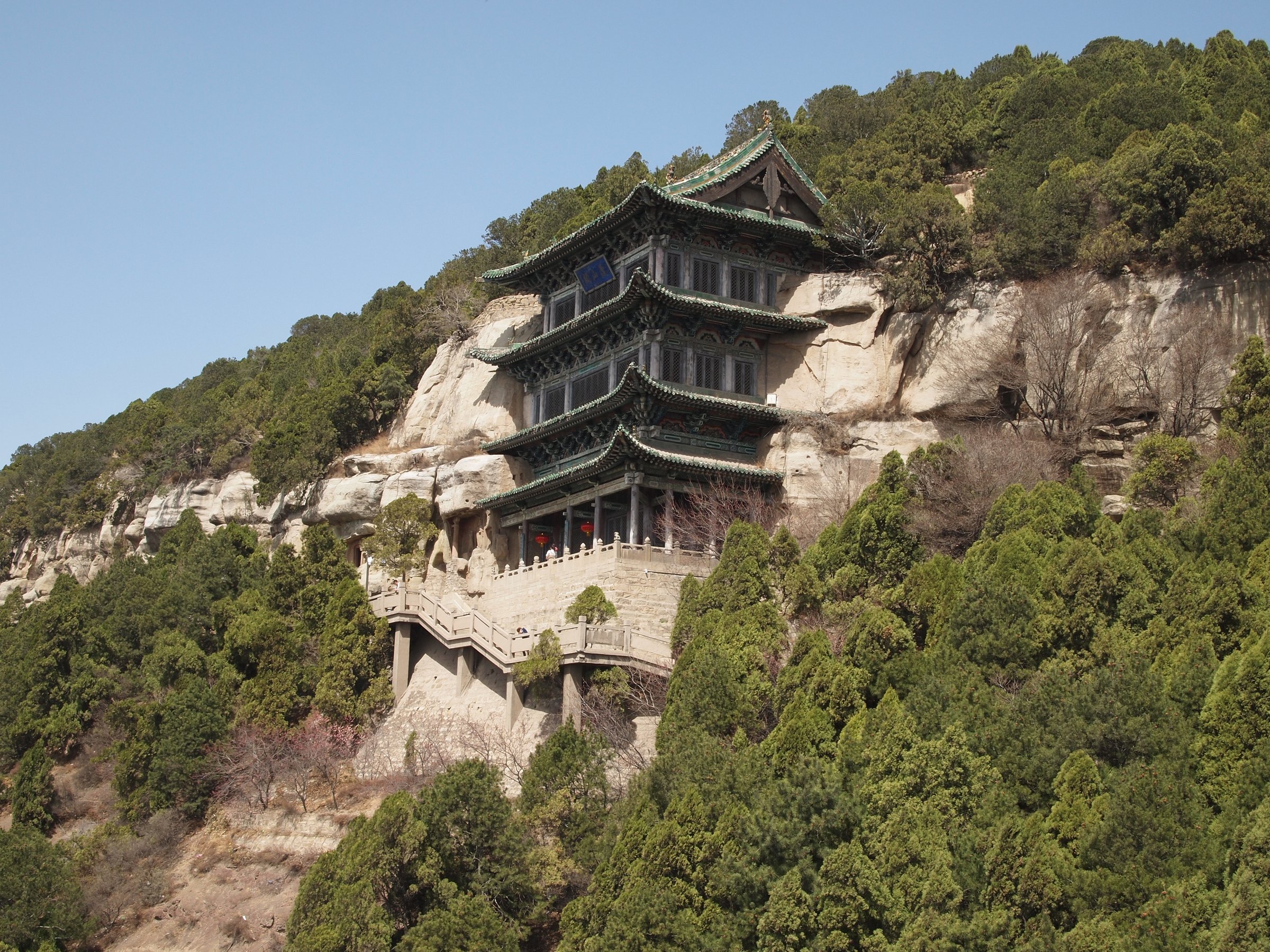
1. Dailuoding Wisdom Path and Taihuai Temple Loop
Snapshot
Itinerary
The walk starts in the Taihuai temple area and climbs the stone-step Wisdom Path to Dailuoding. China Highlights describes the ascent as 1,080 steps and notes that the descent can follow the gentler Horse Trail to make a small circuit. A longer version links Dailuoding with nearby core temples such as Xiantong Temple, Tayuan Temple, Shuxiang Temple, Pusa Ding, or Guanghua Temple before returning through Taihuai.
This is the most accessible Wutai pilgrimage walk and is the standard short option when the high terraces are affected by weather or time constraints.
Why it is essential
Dailuoding is treated as a compact substitute for visiting the five outer terraces. It gives the catalogue a culturally important, feasible day walk that stays in the central temple landscape while still involving a real climb.
Equipment
Standard hiking equipment, comfortable shoes with good grip, warm layer, rain shell, water, and sun protection. Carry traction in icy periods.
Hazards and notes
Stone steps can be slippery in rain, snow, or freeze-thaw conditions. The route is crowded during pilgrimage and holiday periods. Temple etiquette, photography restrictions, and current scenic-area rules should be observed.
GPX / KML links
| Source | URL | Format / access | Reuse status |
|---|---|---|---|
| OpenStreetMap search: Dailuoding Wutai Shan | openstreetmap.org | Map/search | OSM data is ODbL; geometry cross-check only |
| China Discovery Dailuoding walking option | chinadiscovery.com | Source page | Site terms apply; no GPX licence found; route description only |
External links
- UNESCO World Heritage Centre — Mount Wutai
- China Discovery — Mount Wutai hiking guide
- China Highlights — Wutai Mountain guide
2. Hongmenyan to East Terrace / Wanghai Peak
Snapshot
Itinerary
From Hongmenyan, the route climbs open grassland to East Terrace / Wanghai Peak. The summit is associated with sunrise and cloud-sea views. The return follows the same path to Hongmenyan, unless the walk is extended westwards towards the North Terrace.
This entry covers the short East Terrace out-and-back only. The full East-to-North traverse is catalogued separately because it is much longer and more exposed.
Why it is essential
East Terrace is one of the five named Wutai terraces and the classic sunrise peak. It is the shortest practical high-terrace day hike in the region.
Equipment
Mountain hiking equipment: sturdy shoes or boots, warm layer, windproof shell, hat/gloves outside midsummer, headtorch for sunrise starts, water, food, and navigation backup.
Hazards and notes
Fog, high wind, cold dawn temperatures, thunderstorms, and sudden weather changes are the main hazards. Early vehicles and scenic-area access rules need local confirmation.
GPX / KML links
| Source | URL | Format / access | Reuse status |
|---|---|---|---|
| OpenStreetMap search: Hongmenyan Wutai East Terrace | openstreetmap.org | Map/search | OSM data is ODbL; geometry cross-check only |
| Waymarked Trails: Wutai Shan area | hiking.waymarkedtrails.org | OSM-derived map | OSM / Waymarked terms apply; source-map only; no selected relation verified |
External links
- China Discovery — East Terrace access and distances
- China Xian Tour — East Terrace elevation and Wutai facts
- PeakVisor — Shanxi peak list
3. Hongmenyan, East Terrace and North Terrace / Yedou Peak
Snapshot
Itinerary
Start at Hongmenyan and climb first to East Terrace. From East Terrace the route continues across open high country towards North Terrace / Yedou Peak, the “Ridge of North China”. China Discovery gives the East-to-North walking section as about 14 km / 3.5 hours. The traverse ends at North Terrace, where descent or return usually depends on scenic-area vehicle arrangements or a prearranged pickup.
Why it is essential
This route links Wutai’s best-known sunrise peak with its highest summit. It is the strongest single-day high-mountain objective in the Wutai Shan region.
Equipment
Mountain hiking equipment: sturdy boots, trekking poles, warm layer, windproof/waterproof shell, hat/gloves, headtorch, food, water, phone power bank, and offline navigation. Microspikes may be needed in icy or snowy periods.
Hazards and notes
The route is exposed to wind, fog, lightning, cold, and snow. Do not rely on last-minute scenic vehicles without confirming current operations. Visibility can collapse quickly on the open plateau.
GPX / KML links
| Source | URL | Format / access | Reuse status |
|---|---|---|---|
| China Discovery section description | chinadiscovery.com | Source page | Site terms apply; no GPX licence found; section distances only |
| OpenStreetMap search: Wutai North Terrace Yedou Peak | openstreetmap.org | Map/search | OSM data is ODbL; geometry cross-check only |
External links
- China Discovery — East-to-North route section
- UNESCO World Heritage Centre — Mount Wutai landscape context
- PeakVisor — Shanxi peak list
4. North, Central and West Terraces Traverse to Shiziwo

Snapshot
Itinerary
From North Terrace, the route crosses the high Wutai plateau to Central Terrace / Cuiyan Peak. It then continues to West Terrace / Guayue Peak and descends towards Shiziwo. China Discovery describes these as standard pilgrimage sections and gives the North-Central, Central-West, and West-Shiziwo distances separately.
This is a demanding day even though individual sections are not technically difficult. It should be started early and only in stable weather.
Why it is essential
The route covers the heart of the five-terrace pilgrimage without requiring the whole multi-day circuit. It combines Wutai’s highest ground, high meadow walking, temples, and broad plateau views.
Equipment
Mountain hiking equipment, including sturdy boots, trekking poles, windproof/waterproof shell, warm layers, hat/gloves, water, food, navigation backup, headtorch, and emergency insulation.
Hazards and notes
Exposure, fog, snow patches, road/vehicle dependence, and long distance are the main issues. The route is not suitable for poor visibility unless guided or confidently navigated.
GPX / KML links
| Source | URL | Format / access | Reuse status |
|---|---|---|---|
| China Discovery five-terrace section distances | chinadiscovery.com | Source page | Site terms apply; no GPX licence found; route-section description only |
| Wikiloc: Shanxi Wutai Shan full pilgrimage source page | wikiloc.com | Route page / GPS track via Wikiloc | Wikiloc terms apply; source-map only; multi-terrace track, not isolated to this day section |
External links
- China Discovery — 2-day and 3-day Wutai hiking sections
- Wikiloc — Shanxi Wutai Shan source route page
- UNESCO World Heritage Centre — Mount Wutai
5. South Terrace / Jinxiu Peak from Fomudong Side
Snapshot
Itinerary
The South Terrace walk climbs from the Fomudong or South Terrace approach side through villages, forested slopes, and open upper ground to Jinxiu Peak. China Discovery notes that South Terrace is more isolated from the other four terraces and is especially known for wildflowers. Descent depends on the selected route: AllTrails records a loop, while Wikiloc records a one-way South Mountain route after the other four terraces.
Why it is essential
South Terrace completes the five-terrace set and adds a lower, flower-rich, culturally important summit with a different character from the linked northern plateau.
Equipment
Mountain hiking equipment: boots, poles, warm and waterproof layers, sun protection, water, food, offline map, and headtorch.
Hazards and notes
Route variants differ, and the start/finish require local confirmation. Wildflower season attracts visitors. Snow, mud, and fog can make the upper route harder than the numbers suggest.
GPX / KML links
| Source | URL | Format / access | Reuse status |
|---|---|---|---|
| Wikiloc: Wutaishan, the 5th Nan Shan, South mountain | wikiloc.com | Route page / GPS track via Wikiloc | Wikiloc terms apply; source-map only; one-way variant |
| AllTrails: Wutaishan South Peak | alltrails.com | Route page / app route | AllTrails terms apply; source-map only; AllTrails reports 15.3 km loop |
External links
- AllTrails — Wutaishan South Peak route statistics
- Wikiloc — South Mountain route statistics
- China Discovery — South Terrace access notes
- World Trails Network — Wutai pilgrimage overview
External links
| Source | URL |
|---|---|
| UNESCO World Heritage Centre — Mount Wutai | whc.unesco.org |
| China Discovery — Mount Wutai hiking guide | chinadiscovery.com |
| China Highlights — Wutai Mountain guide | chinahighlights.com |
| China Xian Tour — Wutai Mountain guide | chinaxiantour.com |
| World Trails Network — Mount Wutai pilgrimage trail | worldtrailsnetwork.org |
| PeakVisor — Shanxi peak list | peakvisor.com |
| Wikiloc — Shanxi Wutai Shan | wikiloc.com |
| Wikiloc — Wutaishan, the 5th Nan Shan, South mountain | wikiloc.com |
| AllTrails — Wutaishan South Peak | alltrails.com |