Regional overview
The central Luliang Mountains form the high forested spine between the Yellow River drainage to the west and the Fen River basin to the east. The region includes Guandi Mountain, Pangquangou National Nature Reserve, North Wudang Mountain, and lower cultural mountains around Jiaocheng. Compared with Wutai Shan and Mianshan, public route data is much thinner.
The walking character is a mix of managed nature-reserve routes, forest valleys, waterfall gullies, high meadows, fire-watch and watershed tracks, Taoist summit stairs, and cultural temple walks. Pangquangou is especially important for forest ecology and brown-eared pheasant habitat; Guandi Mountain is the highest part of the Luliang range, with PeakVisor listing Guan Di Shan at 2,831 m.
Summer and early autumn are the most practical seasons. Forest roads, reserve controls, rain, landslides, winter snow, and wildlife-protection rules can affect access. Where route statistics are not clearly published, this entry marks them as unresolved.
Selection rationale
The selection balances central Luliang’s main hiking identities: Pangquangou forest ecology, a documented Badao Valley landscape route, a higher watershed / meadow route, the Guandi Mountain high-point candidate, and the Taoist North Wudang summit. Because official GPX data was not found, most routes remain partly verified or candidate-only.
Summary table
| # | Hike | Country | Route type | Distance | Gain | Max elevation | Difficulty | Photo status |
|---|---|---|---|---|---|---|---|---|
| 1 | Pangquangou Badao Valley forest landscape route | China | Valley out-and-back / managed route | 7.5 km cited route | Moderate | No licence-compatible image found | ||
| 2 | Pangquangou Dashagou and Longquan Waterfall route | China | Valley out-and-back | Approx. 4-7 km | Moderate | No licence-compatible image found | ||
| 3 | Pangquangou to Dalumao watershed / fire watchtower | China | Out-and-back / traverse candidate | Approx. 8-12 km | Moderate-hard | No licence-compatible image found | ||
| 4 | Guandi Mountain / Xiaowen Shan high-point approach | China | Summit candidate | 2,831 m / 2,830 m cited | Hard | No licence-compatible image found | ||
| 5 | North Wudang Mountain / Xianglu Peak temple-summit walk | China | Out-and-back / scenic-area climb | Approx. 5-8 km | 1,985-2,254 m depending source | Moderate-hard | No exact open photo found |
1. Pangquangou Badao Valley Forest Landscape Route
Snapshot
Itinerary
The Badao Valley route follows a managed forest landscape line through Pangquangou. BH2255 lists a 7.5 km forest landscape tour and names features including Lion Sunset, Tianmen Ruiqi, Great Wall Cliff, Literary Rock, Stone Pot, Wild Boar Ridge, Fengdong Stone, and primeval forest. The return follows the same valley or current scenic-area circulation route.
Why it is essential
This is the clearest documented walking route in Pangquangou and represents the central Luliang forest landscape: larch, valley scenery, rocks, and reserve ecology.
Equipment
Standard hiking equipment, grippy shoes, rain shell, water, sun protection, and insect/tick protection in warm months.
Hazards and notes
Reserve rules, wildlife habitat protection, storm closures, and forest-fire restrictions should be checked. Elevation gain and exact start coordinates remain unresolved.
Photos
Photo status: No licence-compatible image found in this pass.
| Image | Source | Author | Licence | Reuse notes | Attribution |
|---|---|---|---|---|---|
| Unresolved | Unresolved | Unresolved | Unresolved | Follow-up needed | Unresolved |
GPX / KML links
| Source | URL | Format | Licence / terms | Reuse status |
|---|---|---|---|---|
| BH2255 Pangquangou guide | bh2255.com | Source page | Site terms apply; no GPX licence found | Route description and 7.5 km figure only |
| OpenStreetMap search: Pangquangou | openstreetmap.org | Map/search | OSM data is ODbL | Geometry cross-check only |
External links
2. Pangquangou Dashagou and Longquan Waterfall Route
Snapshot
Itinerary
BH2255 describes Dashagou as a route for seeing brown-eared pheasant breeding areas, macaques, cliff carvings, Longquan Waterfall, ancient tree pagoda, Sandie Waterfall, and “Three Pillars to the Sky”. The practical day-hike version follows the permitted valley route to the waterfall viewpoints and returns the same way.
Why it is essential
Dashagou gives a more wildlife-and-waterfall-focused Pangquangou walk than Badao Valley and highlights the reserve’s role as habitat for the brown-eared pheasant.
Equipment
Standard hiking equipment, rain shell, water, insect/tick protection, and footwear suitable for wet paths.
Hazards and notes
Wildlife areas may have restrictions. Do not leave permitted paths or disturb animals. Waterfall and cliff routes can be slippery after rain.
Photos
Photo status: No licence-compatible image found in this pass.
| Image | Source | Author | Licence | Reuse notes | Attribution |
|---|---|---|---|---|---|
| Unresolved | Unresolved | Unresolved | Unresolved | Follow-up needed | Unresolved |
GPX / KML links
| Source | URL | Format | Licence / terms | Reuse status |
|---|---|---|---|---|
| BH2255 Pangquangou guide | bh2255.com | Source page | Site terms apply; no GPX licence found | Route feature list only |
| OpenStreetMap search: Longquan Waterfall Pangquangou | openstreetmap.org | Map/search | OSM data is ODbL | Geometry cross-check only |
External links
3. Pangquangou to Dalumao Watershed / Fire Watchtower
Snapshot
Itinerary
BH2255 lists a Pangquangou to Dalumao watershed route that crosses a green corridor, climbs to a fire watchtower, visits the Wenyu River source / watershed area, and overlooks features including Bijia Shenghui, Sleeping Beauty, Lovers’ Tree, Ladder to Heaven, and Baicao Slope. The route should be treated as a candidate until current access and exact geometry are verified.
Why it is essential
This route reaches the watershed character of the central Luliang Mountains and connects Pangquangou’s forest valley with broader high-country views.
Equipment
Mountain hiking equipment, boots, trekking poles, rain/wind shell, warm layer, food, water, offline navigation, and headtorch.
Hazards and notes
Access may be controlled by reserve management. Do not use fire roads or watchtower tracks without permission. Weather, fog, and navigation uncertainty increase seriousness.
Photos
Photo status: No licence-compatible image found in this pass.
| Image | Source | Author | Licence | Reuse notes | Attribution |
|---|---|---|---|---|---|
| Unresolved | Unresolved | Unresolved | Unresolved | Follow-up needed | Unresolved |
GPX / KML links
| Source | URL | Format | Licence / terms | Reuse status |
|---|---|---|---|---|
| BH2255 Pangquangou guide | bh2255.com | Source page | Site terms apply; no GPX licence found | Route feature list only |
| OpenStreetMap search: Guandi Mountain Pangquangou | openstreetmap.org | Map/search | OSM data is ODbL | Geometry cross-check only |
External links
4. Guandi Mountain / Xiaowen Shan High-Point Approach
Snapshot
Itinerary
This entry is retained as a high-point candidate rather than a publishable route. Guandi Mountain is the main summit area of the Luliang range and is associated with Pangquangou / Guandi Mountain National Forest Park. The exact legal walking route, trailhead, reserve permissions, and summit access were not verified in this pass.
Why it is essential
Guandi Mountain is the geographic high point of the central Luliang Mountains and should be represented in the regional catalogue once a legal, non-technical day route is confirmed.
Equipment
Full mountain hiking equipment, offline navigation, headtorch, warm/waterproof layers, sufficient food and water, and permission/guide arrangements if required.
Hazards and notes
Do not attempt a summit route without confirming protected-area permissions, road access, and current trail conditions. Wildlife habitat and forestry controls may limit access.
Photos
Photo status: No licence-compatible image found in this pass.
| Image | Source | Author | Licence | Reuse notes | Attribution |
|---|---|---|---|---|---|
| Unresolved | Unresolved | Unresolved | Unresolved | Follow-up needed | Unresolved |
GPX / KML links
| Source | URL | Format | Licence / terms | Reuse status |
|---|---|---|---|---|
| PeakVisor: Shanxi peak list | peakvisor.com | Peak/source page | Site terms apply | Elevation cross-check only |
| OpenStreetMap search: Guan Di Shan Shanxi | openstreetmap.org | Map/search | OSM data is ODbL | Geometry cross-check only |
External links
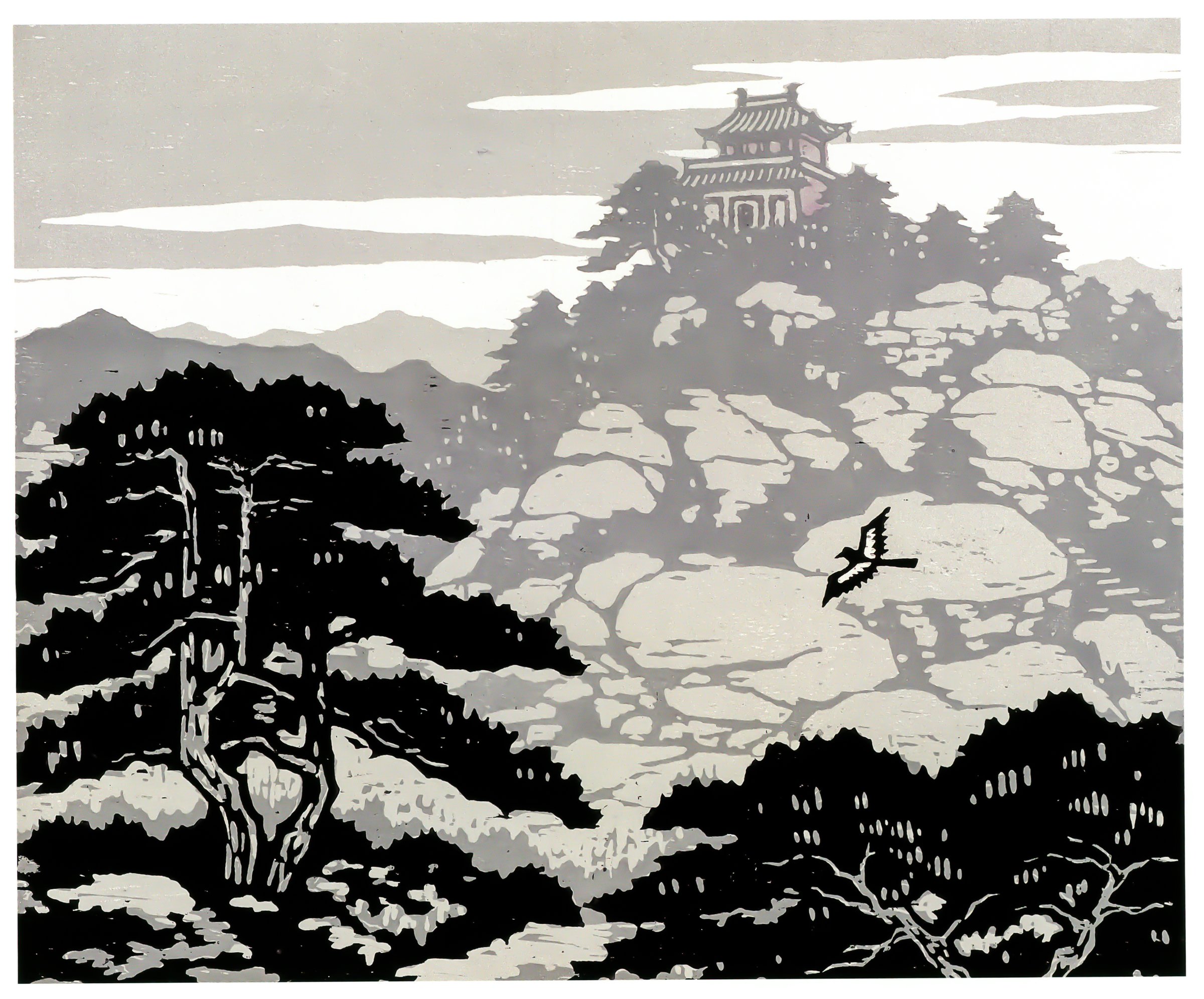
5. North Wudang Mountain / Xianglu Peak Temple-Summit Walk
Snapshot
Itinerary
The route climbs the managed North Wudang Mountain scenic-area path through Taoist temple sites, pine-covered slopes, cliffs, and summit viewpoints. Search results and travel summaries describe the area as a Taoist mountain in Fangshan County, with 72 peaks, 36 cliffs, and 24 gullies. Exact walking distance, gain, and whether cableway construction affects the route need confirmation.
Why it is essential
North Wudang is the central Luliang region’s best-known Taoist mountain and provides a more vertical temple-summit walk than Pangquangou’s forest-valley routes.
Equipment
Standard to mountain hiking equipment: sturdy shoes, water, sun protection, rain shell, warm layer, and traction if icy.
Hazards and notes
Route statistics and max elevation conflict between sources. Cableway and road developments may change the walked route. Confirm current scenic-area opening, weather, and transport before departure.
Photos
Photo status: No exact licence-compatible photograph of North Wudang Mountain was verified in this pass. A Commons woodcut exists but is not a route photo.
| Image | Source | Author | Licence | Reuse notes | Attribution |
|---|---|---|---|---|---|
| Unresolved | Unresolved | Unresolved | Unresolved | Follow-up needed | Unresolved |
GPX / KML links
| Source | URL | Format | Licence / terms | Reuse status |
|---|---|---|---|---|
| OpenStreetMap search: North Wudang Shanxi | openstreetmap.org | Map/search | OSM data is ODbL | Geometry cross-check only |
| Meet99 North Wudang map page | meet99.com | Source/map page | Site terms apply; no GPX licence found | Scenic-area context only |
External links
External links
| Source | URL |
|---|---|
| BH2255 — Pangquangou National Nature Reserve guide | bh2255.com |
| China Daily Shanxi — Pangquangou reserve context | shanxi.chinadaily.com.cn |
| GDUFS — Pangquangou Nature Reserve overview | english.gdufs.edu.cn |
| Guandi Mountain National Forest Park overview | en.ydia.com |
| PeakVisor — Shanxi mountain list | peakvisor.com |
| Meet99 — North Wudang map page | meet99.com |
| cntravelnav — North Wudang guide | cntravelnav.com |