Regional overview
The Chilean access regions for the Northern Patagonian Icefield sit mainly along the Carretera Austral in Aysén, from the wet forests of Queulat and Puyuhuapi south through Cerro Castillo, Puerto Río Tranquilo, Valle Exploradores, Lago General Carrera, Valle Leones, Cochrane and Parque Nacional Patagonia. The walking character is fragmented rather than concentrated in one trail town: day hikes depend on road conditions, ferries or boats, park ticketing, private land, local operators and fast-changing weather.
The landscape ranges from temperate rainforest and hanging glaciers to turquoise alpine lakes, volcanic and granitic peaks, glacial valleys, moraine, braided rivers, steppe, lenga forest and high lake circuits. Some routes give direct views of glaciers flowing from the Northern Patagonian Icefield; others are gateway hikes that explain the surrounding Aysén mountain environment and are practical day-hike anchors for travellers moving along the Carretera Austral.
Access rules are especially important in this region. CONAF has restricted or closed frontal access to Glaciar Exploradores because of glacier instability, leaving only safer lateral or viewpoint use where authorised. Valle Leones access is operator- and private-land dependent. Seasonal closures, bridge works, heavy rain, river levels, snow and road disruption can change feasibility quickly.
Selection rationale
The selection covers five essential day-hiking experiences across the access corridor: Queulat’s hanging glacier viewpoint, the iconic Laguna Cerro Castillo day route, the legal viewpoint-style Exploradores route, the Leones valley approach to Lago/Glaciar Leones as a candidate icefield-edge day route, and the Lagunas Altas loop in Parque Nacional Patagonia as the strongest southern Aysén mountain-lake circuit within the broader access region. Pure glacier walking, icefield crossings and multi-day Cerro Castillo / Laguna San Rafael expeditions are excluded.
Summary table
| # | Hike | Country | Route type | Distance | Gain | Max elevation | Difficulty |
|---|---|---|---|---|---|---|---|
| 1 | Mirador Ventisquero Colgante, Queulat National Park | Chile | Out-and-back | 6.0 km | 298 m | 356 m | Moderate |
| 2 | Laguna Cerro Castillo viewpoint | Chile | Out-and-back | 13.4–14.0 km | 1,125 m | 1,429 m | Hard |
| 3 | Mirador Inferior / Mirador Glaciar Exploradores | Chile | Out-and-back viewpoint | 4.8 km; official short mirador route may be 0.5 km | 250 m | 216 m | Moderate |
| 4 | Lago / Glaciar Leones valley access | Chile | Out-and-back or operator-linked candidate | ca. 19 km return to lake edge; 20.5 km one-way Wikiloc candidate | ca. 240 m on Wikiloc candidate; exact day route unresolved | ca. 329 m on Wikiloc candidate | Moderate–hard |
| 5 | Lagunas Altas Loop, Patagonia National Park / Valle Chacabuco | Chile | Loop | 20.8 km | 955 m | 1,188 m | Hard |
1. Mirador Ventisquero Colgante, Queulat National Park
Snapshot
Itinerary
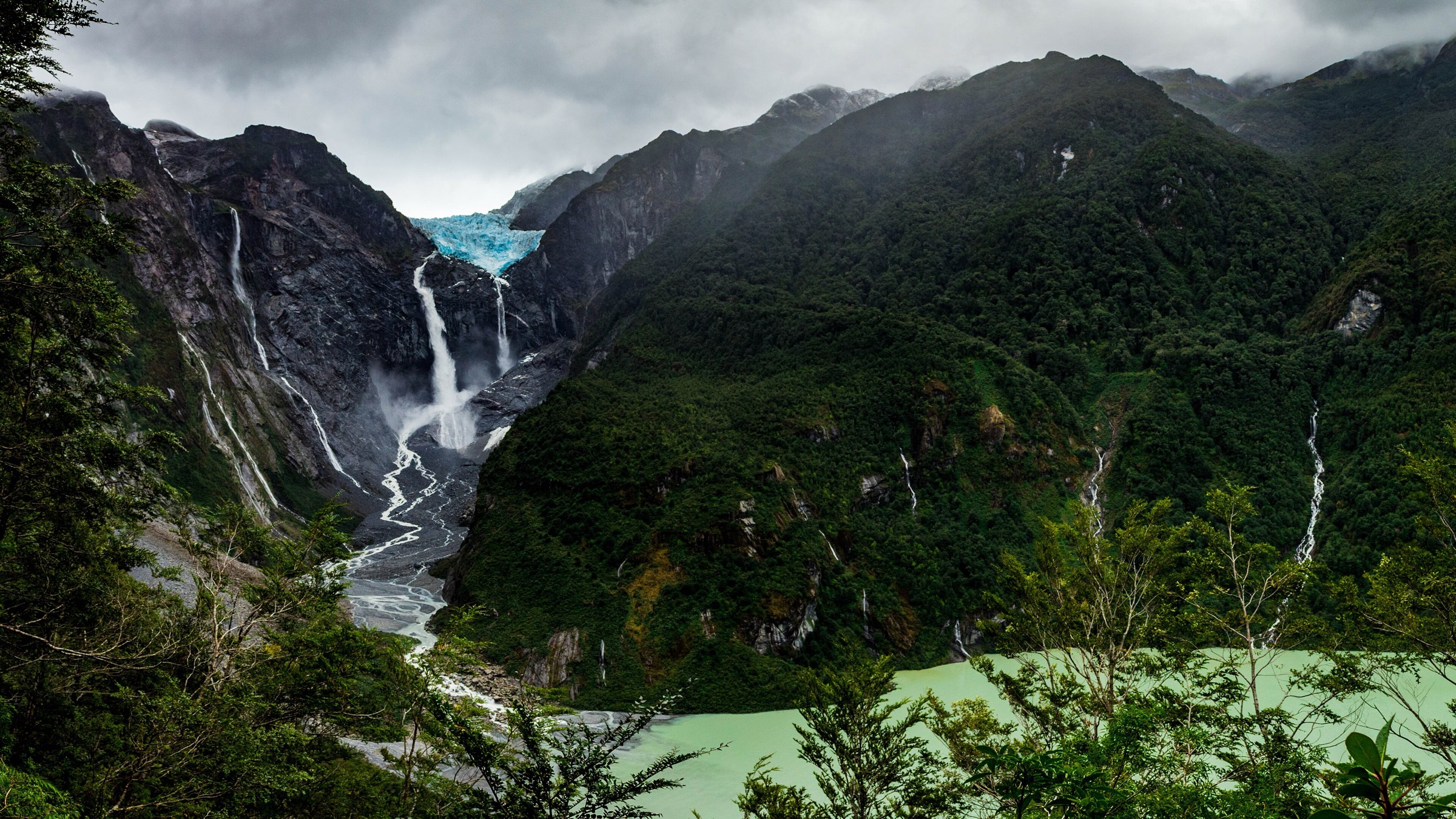
The route starts in the Ventisquero Colgante sector of Parque Nacional Queulat and climbs through wet evergreen forest toward the main viewpoint over the hanging glacier, its waterfalls and the glacial lagoon below. The landscape is dense, humid and steep-sided, with slippery roots, bridges or improved structures depending on the current managed alignment.
AllTrails records a 6.0 km out-and-back with 298 m of ascent. CONAF reported the reopening of the La Morrena / former Ventisquero Colgante and Laguna Témpanos trails after major infrastructure works, but recent closure and reopening notices make a same-season check essential before publication.
Why it is essential
Ventisquero Colgante is one of the emblematic day-hike viewpoints of the Carretera Austral. It represents the wet northern Aysén glacier-forest environment and gives a short, legally managed glacier-view hike before the rougher icefield access zones farther south.
Equipment
- Waterproof hiking footwear
- Rain jacket and warm layer
- Water and food
- Insect protection in warm wet weather
- Waterproof bag for electronics
- Trekking poles help on wet roots and steps
Hazards and notes
- Rain, mud and slippery bridges
- Falling branches and stream levels
- Closure for infrastructure or weather
- Use only CONAF-authorised open trails; view the hanging glacier from signed viewpoints and do not enter closed moraine or lagoon margins
GPX / KML links
| Source | URL | Format / access | Reuse status |
|---|---|---|---|
| AllTrails: Mirador Ventisquero Colgante | alltrails.com | Source map / downloadable route via AllTrails account | AllTrails terms apply; direct GPX not retrieved |
| CONAF Queulat reopening notice | conaf.cl | Official access/status source | Government page; route-file reuse terms not stated |
| OpenStreetMap search: Ventisquero Colgante Queulat | openstreetmap.org | Map geometry cross-check | OSM data is ODbL |
External links
- CONAF — Parque Nacional Queulat
- CONAF — Queulat trails reopening notice
- AllTrails — Mirador Ventisquero Colgante
2. Laguna Cerro Castillo viewpoint
Snapshot
Itinerary
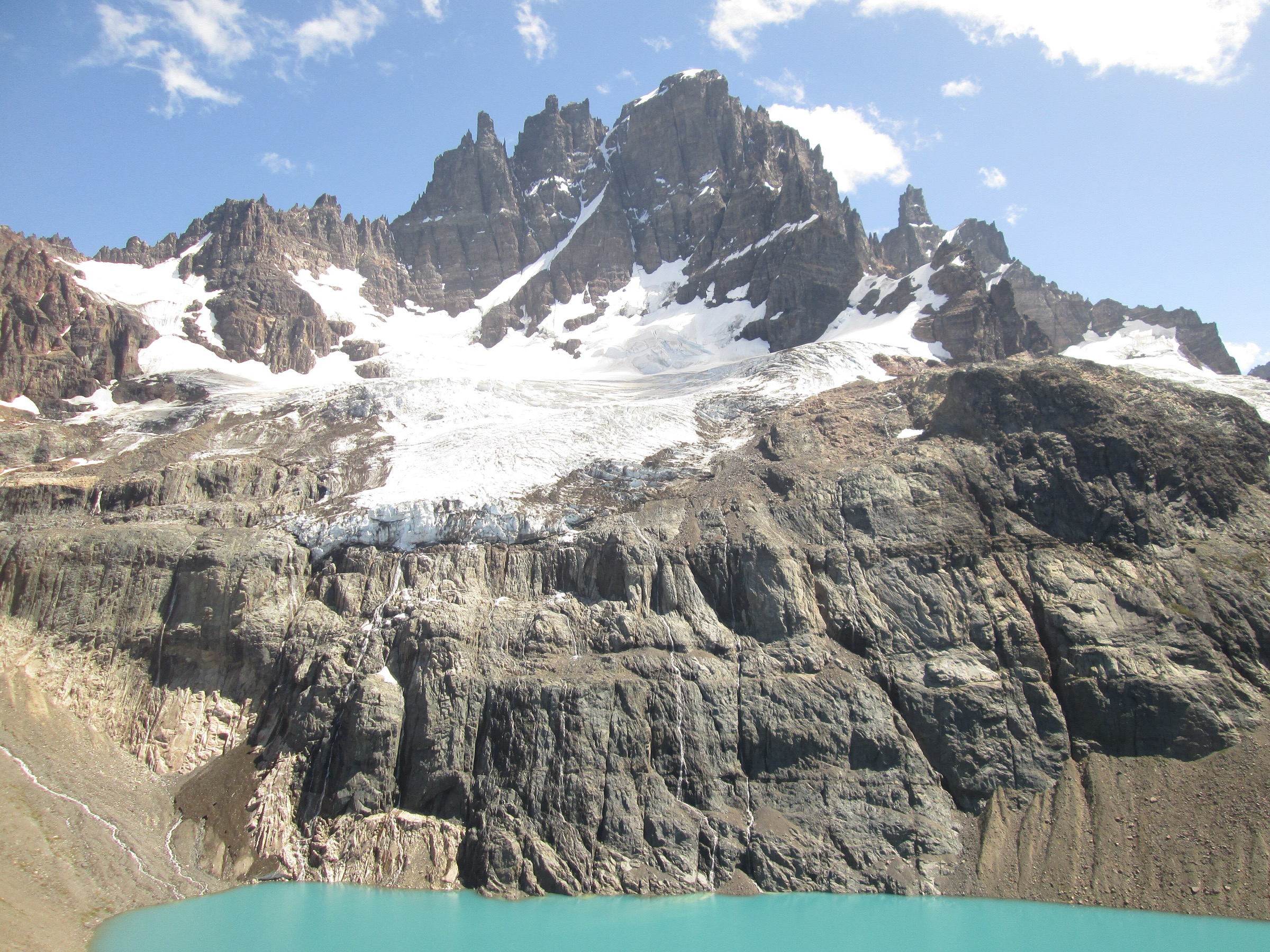
The day route climbs from the Villa Cerro Castillo side through lower forest and open mountain slopes to the turquoise Laguna Cerro Castillo viewpoint beneath the jagged Cerro Castillo massif and its small glaciers. It is the day-hike version of the scenery that also appears on the longer multi-day Cerro Castillo traverse.
CONAF lists the Sendero Mirador Laguna Castillo as 14 km with an 8-hour total duration and medium walking difficulty. AllTrails records 13.4 km out-and-back with 1,125 m of ascent and a maximum elevation of 1,429 m. The route is steep and demanding, especially on descent.
Why it is essential
Laguna Cerro Castillo is one of the most famous day hikes on the Carretera Austral and the signature mountain objective of central Aysén. It balances the glacier-access routes with a high alpine lake, forest, moraine and peak viewpoint.
Equipment
- Mountain hiking boots or shoes
- Trekking poles
- Waterproof/windproof shell
- Warm layers, gloves and hat
- Sun protection
- 2 litres or more of water
- Food
- Offline map/GPS and headtorch
Hazards and notes
- Snow, ice, mud and steep eroded path
- High wind and rapid weather changes
- CONAF notes hantavirus precautions for the sector; avoid contact with rodents and keep food secure
- Entrance hours, ticketing and last-start rules should be checked locally before walking
GPX / KML links
| Source | URL | Format / access | Reuse status |
|---|---|---|---|
| AllTrails: Laguna Cerro Castillo | alltrails.com | Source map / downloadable route via AllTrails account | AllTrails terms apply; direct GPX not retrieved |
| CONAF Cerro Castillo page | conaf.cl | Official trail stats/status source | Government page; route-file reuse terms not stated |
| OpenStreetMap search: Laguna Cerro Castillo | openstreetmap.org | Map geometry cross-check | OSM data is ODbL |
External links
- CONAF — Parque Nacional Cerro Castillo
- Ruta de los Parques — Cerro Castillo National Park
- AllTrails — Laguna Cerro Castillo
3. Mirador Inferior / Mirador Glaciar Exploradores
Snapshot
Itinerary
The legal catalogue version is a viewpoint walk in the Sector Exploradores of Parque Nacional Laguna San Rafael. The longer AllTrails Mirador Inferior route records 4.8 km out-and-back with 250 m of ascent, while CONAF’s park page lists a short enabled Sendero Mirador Glaciar of 500 m and about 40 minutes. Both should be treated as viewpoint access, not as a glacier-front or ice-walking route.
CONAF has reported that it is no longer possible to walk on Glaciar Exploradores because of visitor-safety risk from glacier instability, and a December 2, 2025 CONAF notice states that frontal access will not be enabled, with only a safer lateral operation authorised for the season. This entry therefore excludes all ice trekking and closed glacier-front approaches.
Why it is essential
Exploradores is one of the most accessible named outlets of the Northern Patagonian Icefield from the Carretera Austral. Even with ice access restricted, the viewpoint route remains important because it shows the changing risk profile of Patagonia’s retreating glacier margins.
Equipment
- Waterproof hiking footwear
- Rain shell and warm layer
- Gloves and hat
- Water and food
- Offline map/GPS
- Trekking poles for muddy or rooty sections
- Do not carry or use glacier equipment unless on a legally authorised guided activity
Hazards and notes
- Glacier instability is the central hazard
- Do not enter closed frontal access routes or old ice-trek alignments
- Heavy rain, mud, falling branches and stream levels can affect access
- Road conditions in Valle Exploradores can change
- PasesParques/CONAF information should be checked immediately before travel
GPX / KML links
| Source | URL | Format / access | Reuse status |
|---|---|---|---|
| AllTrails: Mirador Inferior Glaciar Exploradores | alltrails.com | Source map / downloadable route via AllTrails account | AllTrails terms apply; source map must be checked against current authorised trail |
| CONAF Laguna San Rafael page | conaf.cl | Official status/trail source | Government page; route-file reuse terms not stated |
| CONAF Exploradores frontal-access closure notice | conaf.cl | Official safety/access notice | Closure/status source |
External links
- CONAF — Parque Nacional Laguna San Rafael
- CONAF — Exploradores frontal-access closure notice
- Pases Parques — Laguna San Rafael
- AllTrails — Mirador Inferior Glaciar Exploradores
4. Lago / Glaciar Leones valley access
Snapshot
Itinerary
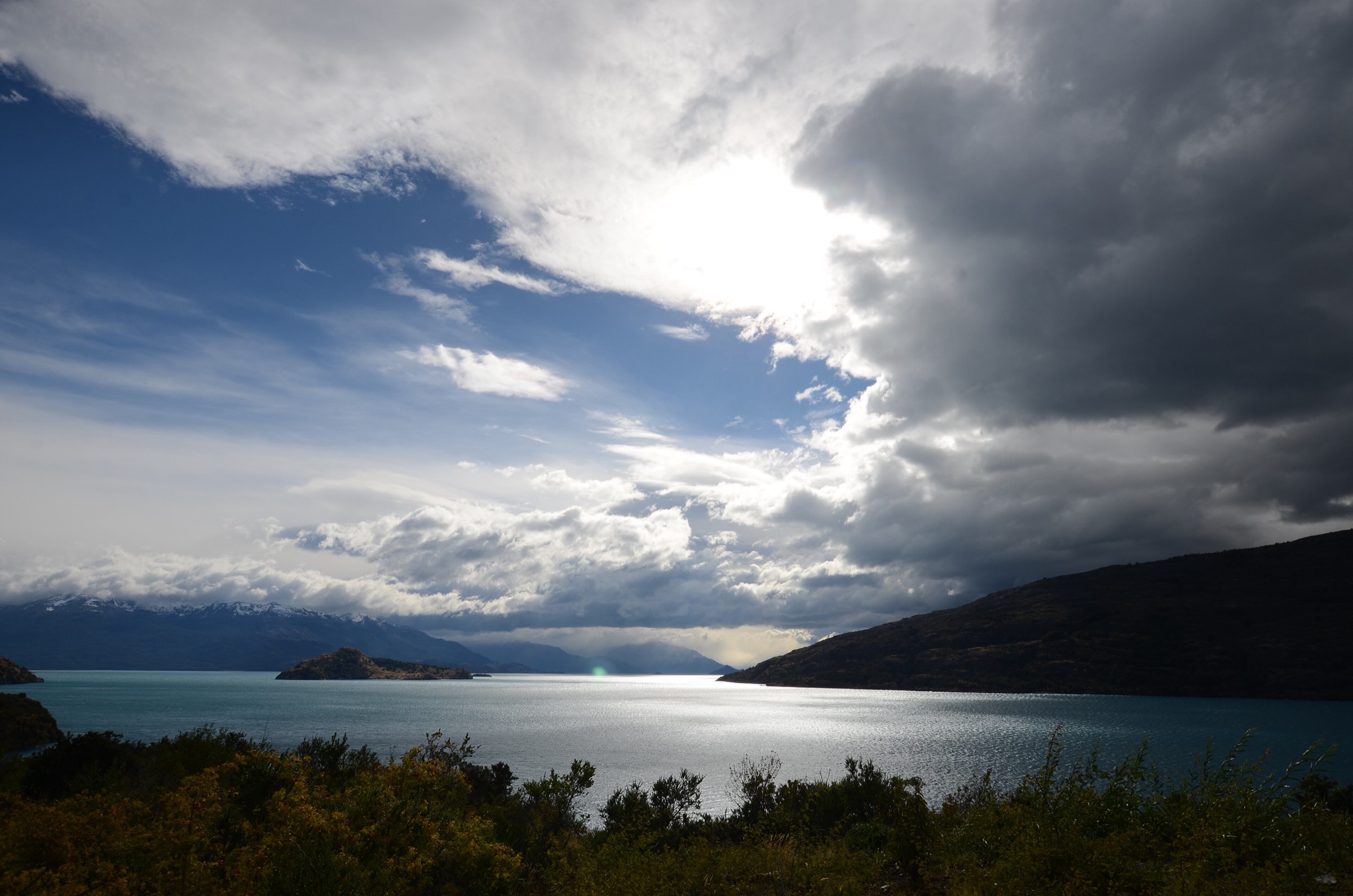
The Leones route follows the Río Leones valley toward Lago Leones, where the Glaciar Leones system descends from the Northern Patagonian Icefield. Public descriptions refer to walking through lenga and coigüe forest, following the river, reaching Pampa de Ratón and continuing to the lake edge with glacier views. Fundación Glaciares Chilenos describes a 9.5 km walk to the eastern edge of the lake. A Wikiloc candidate route named Glaciar Leones records 20.5 km one way, 239 m of gain and a maximum elevation of 329 m.
The exact legal day-hike form is unresolved because access crosses private/local operator terrain and may combine walking with navigation on Lago Leones. This route should be published only after confirming the current authorised access model and whether the selected line is a return hike, one-way operator route or boat-assisted itinerary.
Why it is essential
Glaciar Leones is one of the clearest day-access windows toward the eastern margin of the Northern Patagonian Icefield. It belongs in the catalogue as a high-priority candidate, but not as a fully verified independent hike until access and route geometry are confirmed.
Equipment
- Waterproof hiking boots
- Rain shell, warm layer and spare dry layer
- Gloves and hat
- Sun protection
- Water and food
- Offline map/GPS and headtorch
- Trekking poles
- For boat-assisted versions, carry dry bags and additional insulation for waiting time near the lake
Hazards and notes
- Private access and operator/permission requirements
- River crossings and muddy forest
- Remoteness and poor communications
- Boat availability and high wind on Lago Leones
- Do not assume independent access is legal; do not approach glacier fronts or unstable moraine without an authorised guide and current safety clearance
GPX / KML links
| Source | URL | Format / access | Reuse status |
|---|---|---|---|
| Wikiloc: Glaciar Leones | wikiloc.com | Source route / GPX via Wikiloc account | Wikiloc terms apply; candidate source-map only; legal reuse and access unresolved |
| Fundación Glaciares Chilenos: Glaciar Leones | glaciareschilenos.org | Descriptive access source | Website terms not assessed for route geometry reuse |
| Aysén tourism: Glaciar Los Leones | aysen.com | Tourism description | Route-file terms not stated; context only |
External links
- Aysén tourism — Glaciar Los Leones
- Fundación Glaciares Chilenos — Glaciar Leones
- Wikiloc — Glaciar Leones
5. Lagunas Altas Loop, Patagonia National Park / Valle Chacabuco
Snapshot
Itinerary
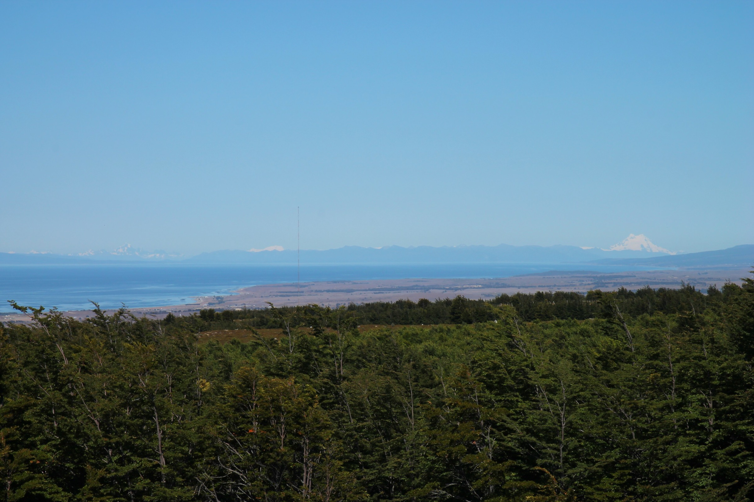
The Lagunas Altas loop climbs from the Chacabuco Valley into high rolling terrain with a sequence of lakes, open steppe, forest patches and broad views across Parque Nacional Patagonia. The route is not a glacier-front hike, but it gives one of the strongest long day walks in the southern Aysén access corridor, with distant mountain views toward the greater icefield region and Monte San Lorenzo area in clear weather.
AllTrails records a 20.8 km loop with 955 m of ascent and a maximum elevation of 1,188 m. Ruta de los Parques lists the Lagunas Altas Trail as one of the key hikes in the Chacabuco Valley, with access from Route X-83 and the Casa de Piedra / West Winds sector.
Why it is essential
Lagunas Altas gives the region a high-quality non-glacier mountain-lake circuit: long, varied, legally established and representative of the Aysén steppe-to-mountain transition south of the main icefield outlets.
Equipment
- Mountain hiking footwear
- Windproof/waterproof shell
- Warm layers, gloves and hat
- Sun protection
- Food and 2 litres or more of water
- Offline map/GPS and headtorch
- Trekking poles
- Carry extra layers because wind exposure is substantial
Hazards and notes
- Long, exposed loop
- Wind, sudden storms and snow patches
- Route-finding errors and dehydration
- Limited transport
- Confirm park entry, campsite/parking access and any seasonal restrictions through official park channels before walking
GPX / KML links
| Source | URL | Format / access | Reuse status |
|---|---|---|---|
| AllTrails: Circuito Lagunas Altas | alltrails.com | Source map / downloadable route via AllTrails account | AllTrails terms apply; direct GPX not retrieved |
| Ruta de los Parques: Patagonia National Park | rutadelosparques.org | Official/conservation route context | Route-file terms not stated |
| OpenStreetMap search: Lagunas Altas Valle Chacabuco | openstreetmap.org | Map geometry cross-check | OSM data is ODbL |
External links
- Ruta de los Parques — Patagonia National Park
- AllTrails — Circuito Lagunas Altas
- Andeshandbook — Circuito Lagunas Altas
Missing data and follow-up
- Check CONAF/PasesParques live status for Queulat, Cerro Castillo and Laguna San Rafael immediately before publication; closures and entry windows change quickly.
- Field-confirm which Exploradores viewpoint alignment is currently authorised and whether the longer AllTrails Mirador Inferior line matches legal public access.
- Resolve Lago / Glaciar Leones access: private road permission, operator requirements, boat-assisted variants, exact distance and whether a return day hike is legal without a guide.
- Select file-level Commons images and record exact authors/licences before final layout.
- Download or recreate GPX only after checking source terms and validating that no closed glacier-front or private-land sections are included.
External links
| Source | URL |
|---|---|
| CONAF — Parque Nacional Queulat | conaf.cl |
| CONAF — Parque Nacional Cerro Castillo | conaf.cl |
| CONAF — Parque Nacional Laguna San Rafael | conaf.cl |
| CONAF — Exploradores frontal-access closure notice | conaf.cl |
| Pases Parques — Laguna San Rafael | parques.pasesparques.cl |
| Ruta de los Parques — Cerro Castillo National Park | rutadelosparques.org |
| Ruta de los Parques — Patagonia National Park | rutadelosparques.org |
| Aysén tourism — Glaciar Los Leones | aysen.com |
| Fundación Glaciares Chilenos — Glaciar Leones | glaciareschilenos.org |
| Andeshandbook — Circuito Lagunas Altas | andeshandbook.org |
| AllTrails — Mirador Ventisquero Colgante | alltrails.com |
| AllTrails — Laguna Cerro Castillo | alltrails.com |
| AllTrails — Mirador Inferior Glaciar Exploradores | alltrails.com |
| AllTrails — Circuito Lagunas Altas | alltrails.com |
| AllTrails Aysén route pages | alltrails.com |
| Wikiloc — Glaciar Leones | wikiloc.com |