Regional overview
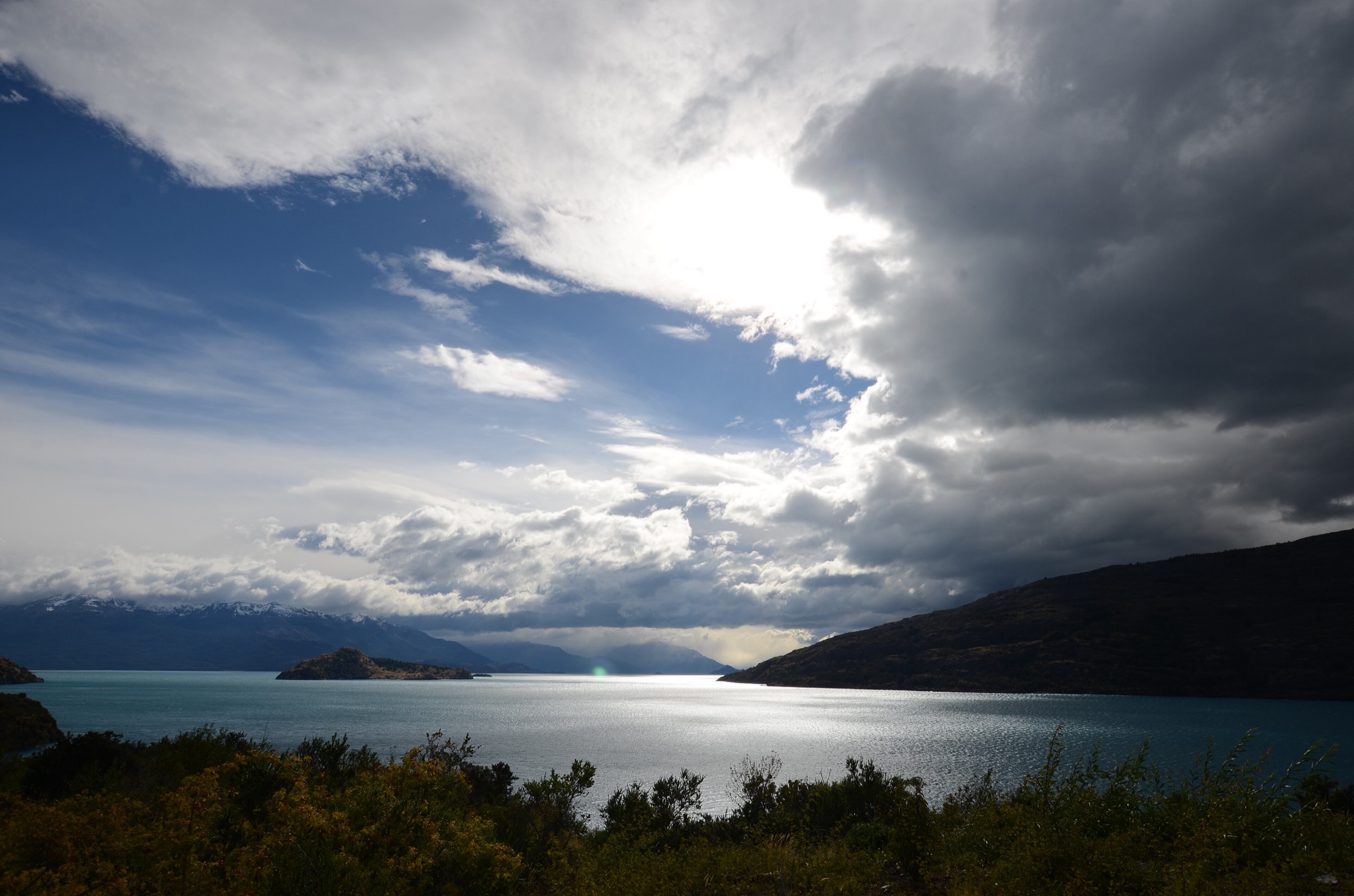
The Cordillera Darwin and the southern Chilean fjords form one of the least accessible mountain landscapes in the global catalogue. The range is largely protected by Parque Nacional Alberto de Agostini and is reached by sea through the Beagle Channel, Almirantazgo Fjord, Pia Fjord, Ainsworth Bay and neighbouring channels. Normal independent trailheads are rare. Many landings are controlled by expedition vessels, weather windows, park rules and guide decisions.
For practical day hiking, the region has two different faces. Around Puerto Williams and Isla Navarino, walkers can reach marked or semi-marked subantarctic forest and mountain trails such as Cerro Bandera and the first stage of the Dientes de Navarino. In the true Cordillera Darwin fjords, the best-known walks are short guided landings to viewpoints, moraines, forest trails or heritage sites at Wulaia Bay, Pia Glacier and Ainsworth / Marinelli Glacier.
The main season is late spring to early autumn, but even summer trips face rain, sleet, mud, wind, low cloud, cold beaches, exposed ridges and boat cancellation. Registration, guide control and legal access matter more here than in most mountain regions. Some nearby Chilean Tierra del Fuego protected areas, including Yendegaia and Karukinka, have restricted or seasonal access; these are noted as context rather than used as the core selection where current public access is unresolved.
Selection rationale
The selection combines the most usable Navarino mountain day hikes with the most representative fjord landings tied to the Cordillera Darwin and southern-channel landscape. Cerro Bandera and Laguna del Salto provide genuine trail walking from Puerto Williams; Wulaia Bay gives a heritage and fjord-view hike; Pia Glacier and Ainsworth / Marinelli Glacier provide the clearest boat-access day-walk encounters with the Cordillera Darwin glacier margin. Routes that are multi-day, trackless expedition travel or currently not open to the public are excluded.
Summary table
| # | Hike | Country | Route type | Distance | Gain | Max elevation | Difficulty |
|---|---|---|---|---|---|---|---|
| 1 | Cerro Bandera from Puerto Williams | Chile | Out-and-back | 4.5-10.0 km depending start/source | Approx. 540-600 m, inferred from viewpoint elevation and start | 543 m at flag viewpoint in Andeshandbook source; summit higher unresolved | Hard |
| 2 | Dientes de Navarino: Puerto Williams to Laguna del Salto | Chile | Point-to-point stage / long out-and-back day variant | 8.0 km one way; 16 km return if used as day hike | 715 m one way | Hard | |
| 3 | Wulaia Bay Summit / viewpoint | Chile | Boat-access out-and-back | 2.6-3.7 km depending viewpoint/summit variant | Moderate | ||
| 4 | Pia Glacier viewpoint landing | Chile | Boat-access guided viewpoint hike | Short guided landing; distance unresolved | Moderate, access-controlled | ||
| 5 | Ainsworth Bay / Marinelli Glacier moraine and forest landing | Chile | Boat-access guided landing hike | Short guided landing; distance unresolved | Easy-moderate, access-controlled |
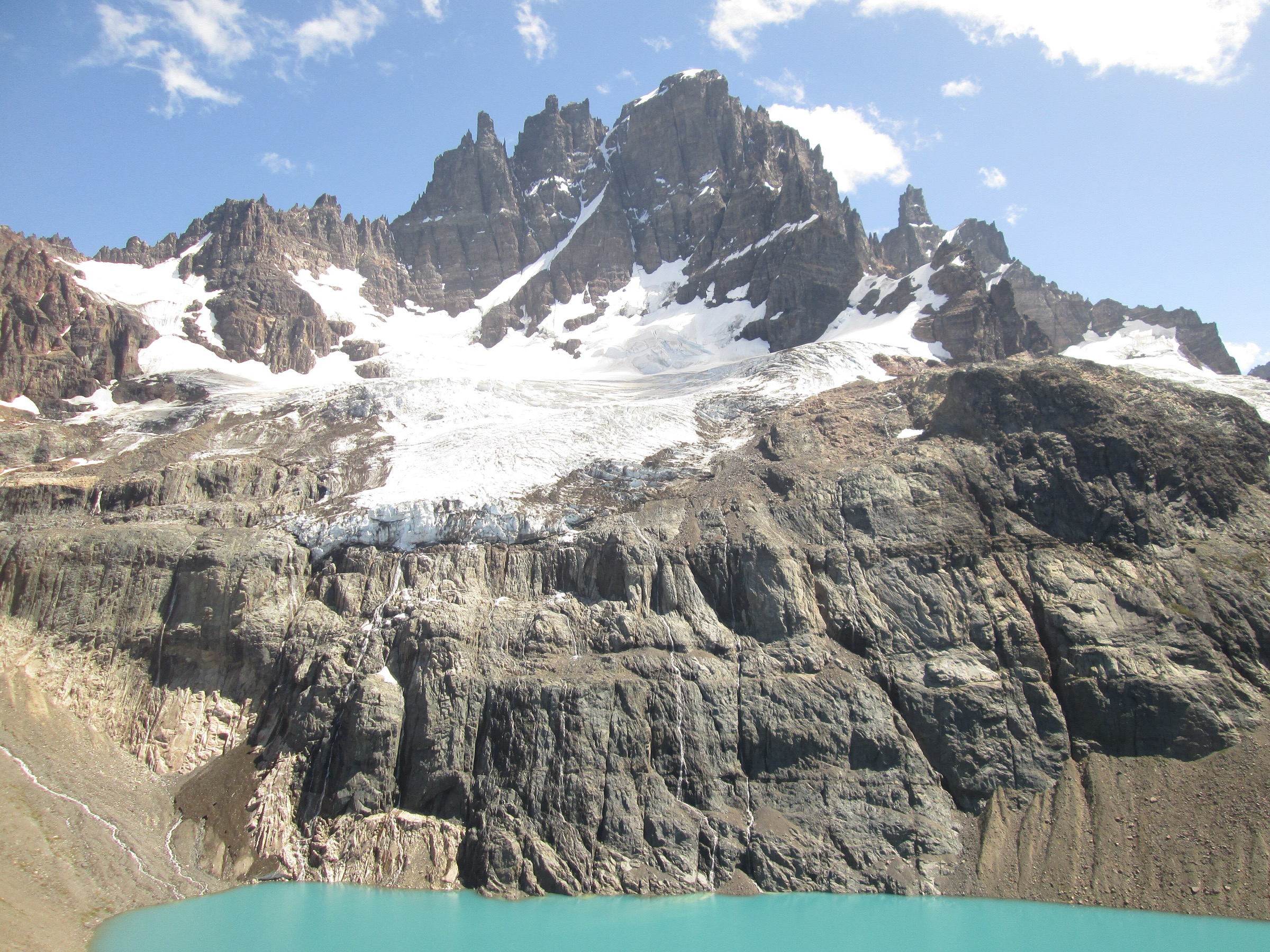
1. Cerro Bandera from Puerto Williams
Snapshot
Itinerary
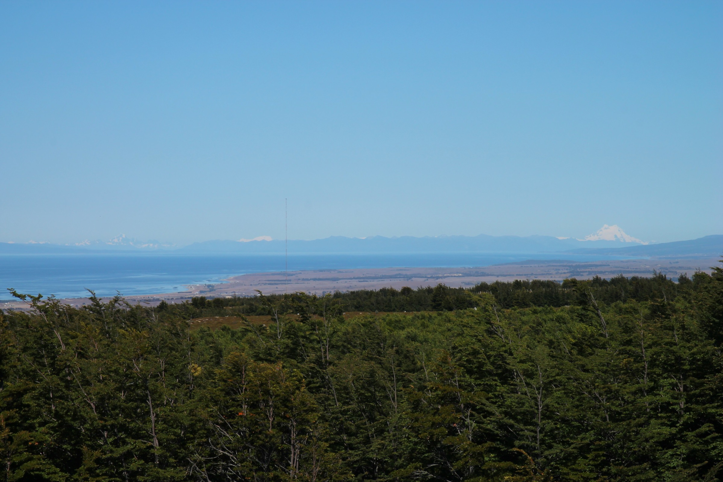
The route climbs from Puerto Williams or the nearby Dientes de Navarino access into lenga and coigue forest, then rises above the trees toward the flag viewpoint known as Cerro Bandera. The view opens across the Beagle Channel toward Ushuaia and the Argentine Fuegian mountains, with the jagged Dientes de Navarino rising behind. The path is also the first, most accessible section of the longer Dientes de Navarino circuit.
Sources vary in distance because some describe the shorter hill walk from a trail access point while AllTrails records a longer 10 km route. Andeshandbook notes the flag viewpoint around 543 m after about two hours from Puerto Williams and distinguishes the viewpoint from the true summit area. The route is normally marked, but snow, wind and mud can still complicate the upper section.
Why it is essential
Cerro Bandera is the essential introductory mountain hike for the Chilean far south. It gives the most accessible high view over Puerto Williams, the Beagle Channel, the Dientes de Navarino and, in clear conditions, the wider Cordillera Darwin / Fuegian mountain horizon.
Equipment
Mountain hiking equipment: sturdy footwear, waterproof/windproof shell, warm layer, gloves and hat, food, water, offline map/GPS and trekking poles. Gaiters are useful in mud or snow.
Hazards and notes
Wind, mud, snow patches, forest blowdown and fading side tracks are common. If continuing beyond the flag viewpoint, navigation becomes more serious and may enter the Dientes de Navarino route. Check local trail registration expectations in Puerto Williams, especially if extending beyond Cerro Bandera.
GPX / KML links
| Source | URL | Format / access | Reuse status |
|---|---|---|---|
| AllTrails: Cerro Bandera | alltrails.com | Source map / downloadable route via AllTrails account | AllTrails terms apply; direct GPX not retrieved; source-map reference only |
| Andeshandbook: Cerro Bandera | andeshandbook.org | Guide/source route page | Andeshandbook terms apply; source route context; reuse unresolved |
| Magallanes tourism dossier | patagonia-chile.com | Tourism PDF | Reuse terms not stated; distance/difficulty context only |
| OpenStreetMap search: Cerro Bandera Puerto Williams | openstreetmap.org | Map geometry cross-check | OSM data is ODbL; geometry cross-check target only |
External links
- AllTrails — Cerro Bandera
- Andeshandbook — Cerro Bandera
- Filmagallanes — Cerro Bandera
- Patagonia Chile / Magallanes tourism dossier
2. Dientes de Navarino: Puerto Williams to Laguna del Salto
Snapshot
Itinerary
This route is the first stage of the Dientes de Navarino circuit. It climbs from Puerto Williams through subantarctic forest toward Cerro Bandera, then continues beyond the main viewpoint into wilder, more exposed terrain. The route traverses wind-scoured slopes and descends steeply toward Laguna del Salto, the first major lake camp of the circuit.
AllTrails records the Puerto Williams - Laguna del Salto stage as 8 km point-to-point with 715 m of ascent and a 3.5-4 hour estimate. Bienes Nacionales publishes the Dientes de Navarino heritage route as a formal route PDF, and Chile Travel identifies Laguna del Salto as one of the circuit’s key landmarks. For a day-hike catalogue, this should be treated as a demanding out-and-back to the lake only for fit walkers in stable weather.
Why it is essential
Laguna del Salto is the closest practical way to sample the high Dientes de Navarino landscape without committing to the full multi-day circuit. It extends Cerro Bandera into a real mountain day with forest, exposed slopes, alpine lake scenery and the raw weather character of the far south.
Equipment
Mountain hiking equipment: waterproof boots, gaiters, trekking poles, waterproof/windproof shell, warm layers, gloves and hat, food, water, headtorch, offline map/GPS and navigation backup. Carry emergency insulation because the return is long and exposed.
Hazards and notes
The descent to Laguna del Salto is steep and can be loose, muddy, snowy or difficult to follow. Weather can change quickly and strong wind is a major hazard. Do not treat this as an easy extension from Cerro Bandera. Dogs are not allowed according to AllTrails. Multi-day circuit hikers should register with local authorities; day hikers extending beyond Cerro Bandera should confirm current local registration expectations.
GPX / KML links
| Source | URL | Format / access | Reuse status |
|---|---|---|---|
| AllTrails: Dientes de Navarino - Puerto Williams to Laguna del Salto | alltrails.com | Source map / downloadable route via AllTrails account | AllTrails terms apply; direct GPX not retrieved; source-map reference only |
| Bienes Nacionales: Ruta Patrimonial Dientes de Navarino | rutas.bienes.cl | Official heritage-route PDF | Government route-publication terms not fully resolved; official source route context; coordinate reuse unresolved |
| OpenStreetMap search: Laguna del Salto Navarino | openstreetmap.org | Map geometry cross-check | OSM data is ODbL; geometry cross-check target only |
External links
- AllTrails — Dientes de Navarino: Puerto Williams - Laguna del Salto
- Bienes Nacionales — Ruta Patrimonial Dientes de Navarino
- Chile Travel — Dientes de Navarino
- Swoop Patagonia — Dientes de Navarino overview
3. Wulaia Bay Summit / viewpoint
Snapshot
Itinerary
The walk starts at Wulaia Bay, a historic landing on the western side of Isla Navarino. Short trail variants climb through wet Magellanic forest to viewpoints above the bay and Murray Channel. AllTrails lists a 3.7 km Wulaia Bay Summit route and a 2.6 km Wulaia Bay Viewpoint route, both moderate. Expedition-cruise descriptions mention a choice of hikes of increasing difficulty leading through forest to panoramic viewpoints.
The route is access-controlled by boat operations and weather. The bay is also culturally important as a Yaghan / Yamana heritage site and a place associated with FitzRoy, Darwin and later mission history. The walking route should therefore be treated as both a natural and cultural heritage landing.
Why it is essential
Wulaia Bay is the essential southern fjord heritage hike. It combines channel views, subantarctic forest and one of the most important cultural landscapes of the far south in a compact boat-access walk.
Equipment
Waterproof hiking shoes or boots, waterproof/windproof shell, warm layer, gloves and hat, and a small daypack. Trekking poles may help in mud. Follow vessel/guide requirements for lifejackets and landing procedure.
Hazards and notes
Access is by authorised vessel only. Trails can be muddy, rooty, steep and slippery. Do not disturb heritage remains or leave marked routes. Landings may be cancelled or shortened by wind, swell, rain or park/guide decisions.
GPX / KML links
| Source | URL | Format / access | Reuse status |
|---|---|---|---|
| AllTrails: Wulaia Bay Summit | alltrails.com | Source map / downloadable route via AllTrails account | AllTrails terms apply; direct GPX not retrieved; source-map reference only |
| AllTrails: Wulaia Bay Viewpoint | alltrails.com | Source map / downloadable route via AllTrails account | AllTrails terms apply; source-map reference only |
| Bienes Nacionales: Ruta Patrimonial Caleta Wulaia | rutas.bienes.cl | Official heritage-route PDF | Government route-publication terms not fully resolved; official cultural/route context; direct coordinate reuse unresolved |
External links
- AllTrails — Wulaia Bay Summit
- AllTrails — Wulaia Bay Viewpoint
- Bienes Nacionales — Ruta Patrimonial Caleta Wulaia
- Australis — Darwin’s Route from Punta Arenas (Wulaia Bay hike descriptions)
4. Pia Glacier viewpoint landing
Snapshot
Itinerary
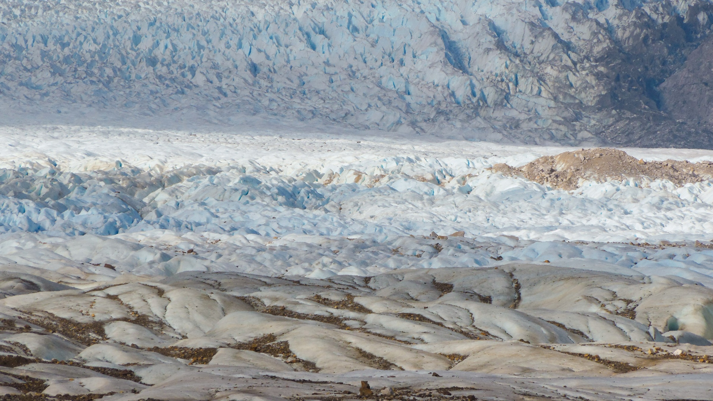
The Pia Glacier landing is reached by vessel through the Beagle Channel and Pia Fjord. Public expedition descriptions state that passengers disembark near the glacier and hike through remote forest or onto nearby slopes/viewpoints for a close view of the glacier descending from the Cordillera Darwin toward the fjord. Exact trail distance, elevation gain and route file were not found in legally reusable sources during this pass.
This entry therefore treats Pia as a candidate essential day-hike landing rather than a fully verified independent route. It belongs in the catalogue because it is one of the clearest non-technical ways for walkers to see a Cordillera Darwin tidewater/glacial fjord setting from land.
Why it is essential
Pia Glacier is one of the defining glacier landings on the southern Beagle Channel routes. It provides a direct walking encounter with the Cordillera Darwin’s ice-and-fjord landscape where ordinary public trail infrastructure does not exist.
Equipment
Waterproof boots or landing shoes as required by the vessel, waterproof/windproof shell, warm layers, gloves and hat, and camera protection from rain. Follow all vessel and guide instructions for zodiac landings.
Hazards and notes
Access is entirely vessel- and guide-controlled. Ice, swell, wind, cold rain, slippery rocks, wet forest and unstable glacier margins are the main hazards. Do not approach the glacier beyond marked/authorised viewpoints.
GPX / KML links
| Source | URL | Format / access | Reuse status |
|---|---|---|---|
| Swoop Patagonia: Pia Glacier | swoop-patagonia.com | Landmark/access source | Site terms apply; no route file; context only |
| Australis route information: Pia Fjord / Pia Glacier landing | mp.australis.com | Operator itinerary PDF | Operator terms apply; no GPX; landing context only |
| OpenStreetMap search: Pia Glacier Chile | openstreetmap.org | Map geometry cross-check | OSM data is ODbL; geometry cross-check target only |
External links
- Swoop Patagonia — Pia Glacier
- Australis — Darwin’s Route from Ushuaia (Pia Fjord / Pia Glacier landing)
- CONAF — Parque Nacional Alberto de Agostini
5. Ainsworth Bay / Marinelli Glacier moraine and forest landing
Snapshot
Itinerary
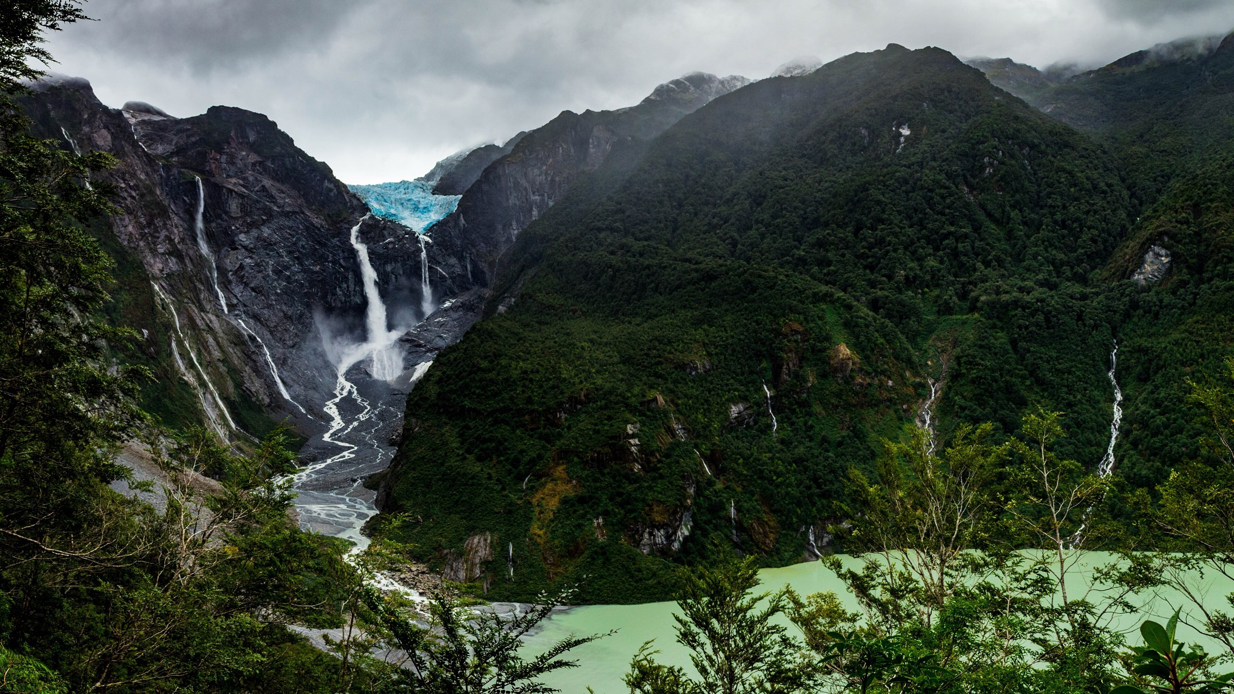
Ainsworth Bay is reached by vessel in the Almirantazgo Fjord, near the retreating Marinelli Glacier on the northern edge of the Cordillera Darwin system. Public expedition descriptions mention guided hikes through subantarctic Magellanic forest, peat bog and waterfall terrain, or a more challenging moraine route that interprets land newly exposed by glacier retreat. CONAF identifies Alberto de Agostini National Park as built around the Cordillera Darwin, virgin forests, glaciers and navigable bays and channels.
Exact walking distance, elevation gain and an official route file were not found. This entry is therefore a candidate essential landing walk, suitable for catalogue inclusion only with clear access-control and missing-stat caveats.
Why it is essential
Ainsworth / Marinelli is one of the most important accessible glacier-retreat landscapes on the Cordillera Darwin fjord margin. It shows how forest, peatland and moraine recolonise terrain exposed by ice retreat, and it gives a land-based perspective in a region otherwise seen mainly from boats.
Equipment
Waterproof landing footwear or boots as required by the vessel, waterproof/windproof shell, warm layers, gloves and hat. Trekking poles may be useful for the moraine option if allowed by the operator.
Hazards and notes
The landing is controlled by vessel crew and guides. Slippery rock, wet forest, cold wind, rain, bogs, loose moraine and proximity to glacier-influenced terrain are key hazards. Do not approach glacier ice or unstable slopes outside the authorised route.
GPX / KML links
| Source | URL | Format / access | Reuse status |
|---|---|---|---|
| CONAF: Parque Nacional Alberto de Agostini | conaf.cl | Official park context | Government site; no route file found; official protected-area context only |
| Australis route information: Ainsworth Bay / Marinelli Glacier | mp.australis.com | Operator itinerary PDF | Operator terms apply; no GPX; landing context only |
| OpenStreetMap search: Ainsworth Bay Marinelli Glacier | openstreetmap.org | Map geometry cross-check | OSM data is ODbL; geometry cross-check target only |
External links
- CONAF — Parque Nacional Alberto de Agostini
- Australis — Darwin’s Route from Punta Arenas (Ainsworth Bay / Marinelli Glacier)
- Wikipedia — Marinelli Glacier background
External links
| Source | URL |
|---|---|
| CONAF — Parque Nacional Alberto de Agostini | conaf.cl |
| Ruta de los Parques — Yendegaia National Park context | rutadelosparques.org |
| Chile Travel — Dientes de Navarino | chile.travel |
| AllTrails — Puerto Williams trails overview | alltrails.com |
| AllTrails — Cerro Bandera | alltrails.com |
| AllTrails — Dientes de Navarino: Puerto Williams to Laguna del Salto | alltrails.com |
| AllTrails — Wulaia Bay Summit | alltrails.com |
| Bienes Nacionales — Ruta Patrimonial Dientes de Navarino | rutas.bienes.cl |
| Bienes Nacionales — Ruta Patrimonial Caleta Wulaia | rutas.bienes.cl |
| WCS Chile — Karukinka access context | chile.wcs.org |
| Swoop Patagonia — Pia Glacier | swoop-patagonia.com |
| Australis — Darwin’s Route from Punta Arenas | mp.australis.com |
| Australis — Darwin’s Route from Ushuaia | mp.australis.com |
| Australis — Darwin’s Route from Punta Arenas (Ainsworth Bay) | mp.australis.com |
| Wikipedia — Marinelli Glacier | en.wikipedia.org |