Regional overview
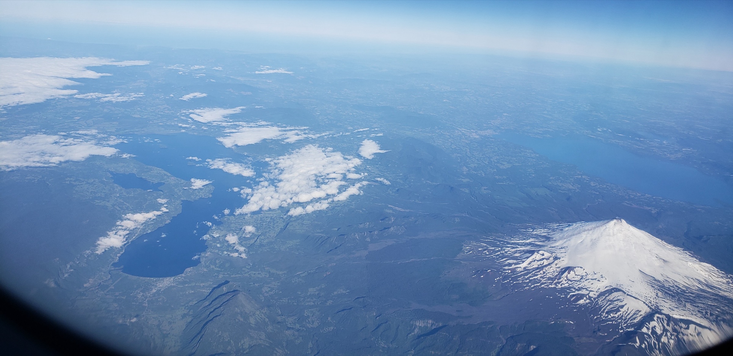
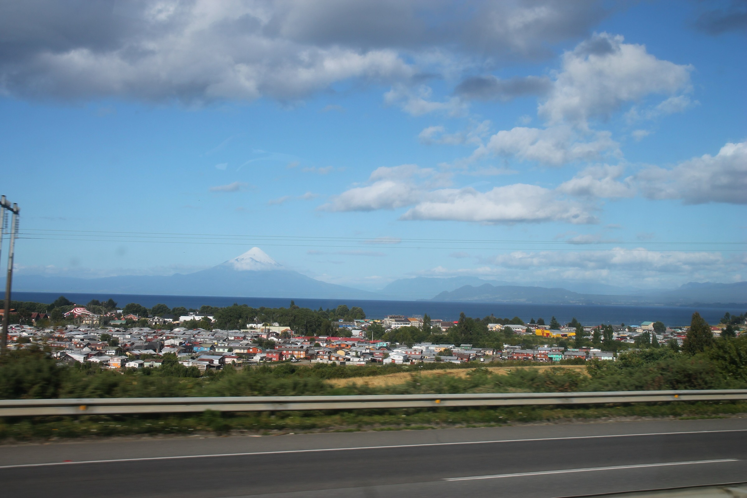
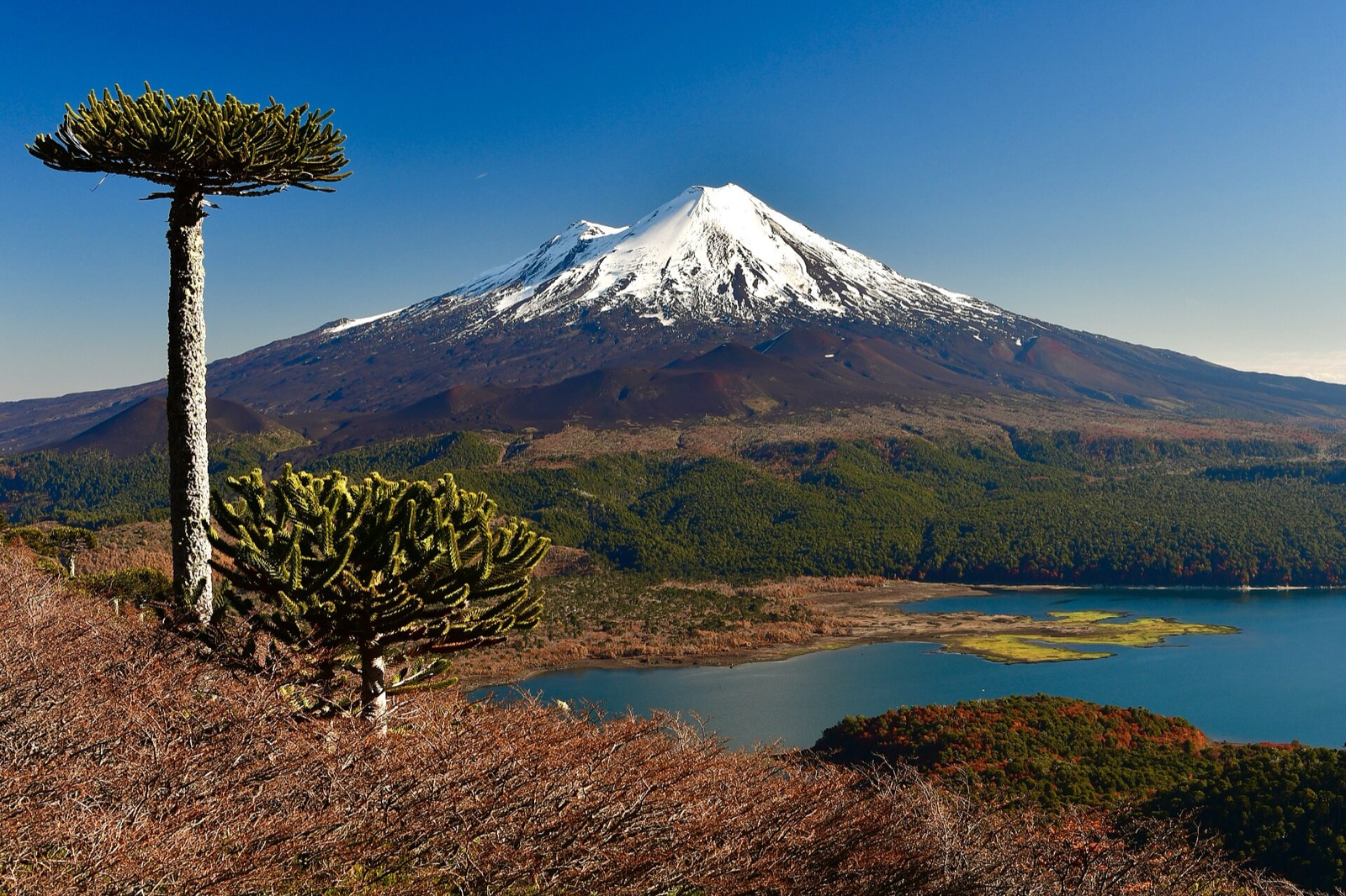
The Chilean Lake District from Araucanía into Los Lagos is a volcanic, forested and lake-filled Andes landscape: active cones such as Villarrica, Llaima, Osorno and Chaitén sit above araucaria forest, Valdivian temperate rainforest, lava fields, crater routes, glacier viewpoints and blue-green lakes. Day hiking ranges from heavily managed national-park trails to guided volcano ascents requiring snow equipment and current volcanic-risk checks.
The main hiking bases are Pucón/Villarrica for Villarrica and Huerquehue, Melipeuco/Curacautín for Conguillío, Puerto Varas/Ensenada/Petrohué for Vicente Pérez Rosales and, farther south in Los Lagos, Chaitén for Pumalín. Weather is wetter and less predictable than in central Chile. Rain, mud, snow, volcanic alerts, ash, forest blowdown, road closures and CONAF/Pases Parques access rules shape the season.
The five entries below are day-hike compatible under normal conditions, except Volcán Villarrica, which is included because it is an internationally famous guided day ascent but is not a casual walk.
Selection rationale
The selection balances the iconic active-volcano summit of Villarrica, the lake-and-araucaria circuit of Huerquehue, the Llaima/Conguillío viewpoint of Sierra Nevada, the Osorno/Paso Desolación volcanic traverse in Vicente Pérez Rosales, and the post-2008 Chaitén crater trail in Pumalín.
Summary table
| # | Hike | Route type | Distance | Elevation gain | Max elevation | Difficulty |
|---|---|---|---|---|---|---|
| 1 | Volcán Villarrica / Rukapillán summit from ski sector | Out-and-back / guided ascent | 9.0 km (AllTrails); local sources ~5 km | 1,400 m | 2,847–2,850 m | Hard / guided |
| 2 | Sendero Los Lagos, Huerquehue National Park | Loop / lollipop variants | 13.2 km; 13–16 km variants | 783 m; variants 730–1,080 m | Moderate–hard | |
| 3 | Sendero Sierra Nevada, Conguillío National Park | Out-and-back | 11.2–12.1 km return | 610 m | Moderate–hard | |
| 4 | Paso Desolación / La Picada, Vicente Pérez Rosales | Point-to-point / shuttle | 17.5 km | Hard | ||
| 5 | Volcán Chaitén crater trail, Pumalín | Out-and-back | 5.0 km | 624 m | Hard short climb |
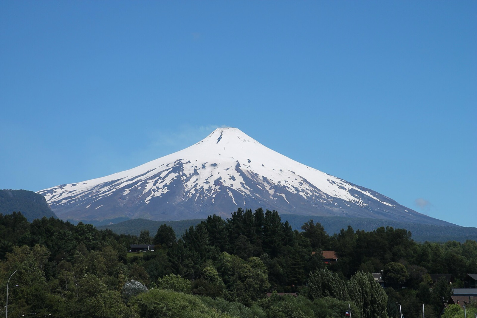
1. Volcán Villarrica / Rukapillán summit from ski sector
Snapshot
Itinerary
The standard guided route starts from the ski-sector access above Pucón and climbs open volcanic/snow slopes toward the active crater rim. In clear weather the ascent gives views over Villarrica, Caburgua, Calafquén and the surrounding volcanoes. The descent normally returns by the same general line, with snow conditions determining technique and speed.
Why it is essential
Villarrica is the signature active-volcano ascent of the Chilean Lake District. It is internationally recognised, visually dominant from Pucón and one of the most accessible guided crater climbs in South America.
Equipment
- Guided volcano kit as required by current operators and conditions: boots, crampons or traction, ice axe, helmet, gloves, warm/windproof shell, eye protection, sun protection, food, water and emergency layers
- Gas/ash precautions depend on current volcanic conditions and guide/authority instructions
Hazards and notes
- Villarrica is active. SERNAGEOMIN/SENAPRED restrictions, crater exclusion radii, gas, ballistic ejecta, avalanches, ice, poor visibility, wind and falls are real hazards
- DAEM/official local guidance states that certified guide use is required for the ascent
- Do not publish or promote a crater visit without checking the current volcanic alert and access perimeter
GPX / KML links
| Source | URL | Format | Notes |
|---|---|---|---|
| AllTrails: Villarrica Volcano (Rukapillán) | alltrails.com | Route page / app map | AllTrails terms apply; source-map reference only |
| CONAF: Parque Nacional Villarrica | conaf.cl | Official park context | No route file in this pass |
| SERNAGEOMIN volcanic hazard information | sernageomin.cl | Official volcanic-risk source | Hazard/status source only |
External links
- CONAF — Parque Nacional Villarrica
- DAEM Villarrica — Rutas y accesos al Parque Nacional Villarrica
- AllTrails — Volcán Villarrica
- SERNAGEOMIN
2. Sendero Los Lagos, Huerquehue National Park
Snapshot
Itinerary
The route starts near Lago Tinquilco and climbs steeply through temperate forest toward waterfalls and the upper Huerquehue lake plateau. The classic circuit visits Lago Chico, Laguna Verde and Lago Toro, with longer variants adding Laguna Los Patos and Laguna Huerquehue. Araucaria, coigüe, lake views and glimpses toward Villarrica define the walk.
Why it is essential
Los Lagos is the core day hike of Huerquehue: the archetypal Araucanía lake-and-araucaria route, reachable from Pucón without climbing an active volcano.
Equipment
- Hiking shoes/boots, rain shell, warm layer, water, food, sun protection, offline map/GPS and trekking poles for the steep descent
- In winter or shoulder season, carry traction if snow/ice is present
Hazards and notes
- Mud, roots, steep zigzags, snow, winter closures and uncertain water quality are the main issues
- Check Huerquehue/CONAF trail status and entry requirements before going
GPX / KML links
| Source | URL | Format | Notes |
|---|---|---|---|
| AllTrails: Huerquehue Lakes Trail | alltrails.com | Route page / app map | AllTrails terms apply; source-map reference only |
| Huerquehue National Park: Los Lagos | parquenacionalhuerquehue.cl | Park trail page | Route-file terms not stated; official context |
External links
- Parque Nacional Huerquehue — Sendero Los Lagos
- Parque Nacional Huerquehue — official site
- AllTrails — Sendero Los Lagos de Huerquehue
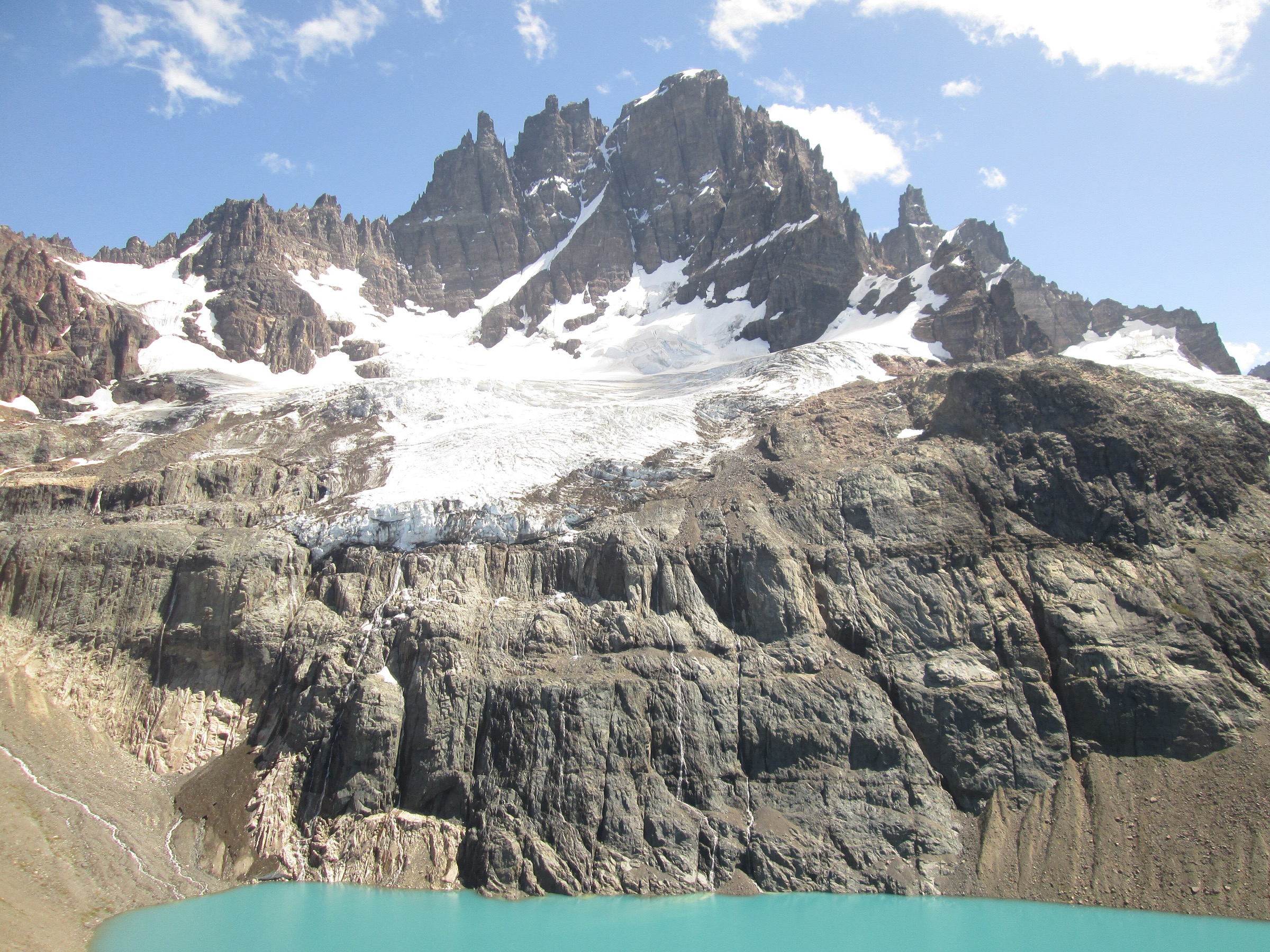
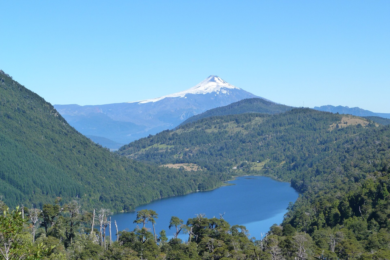
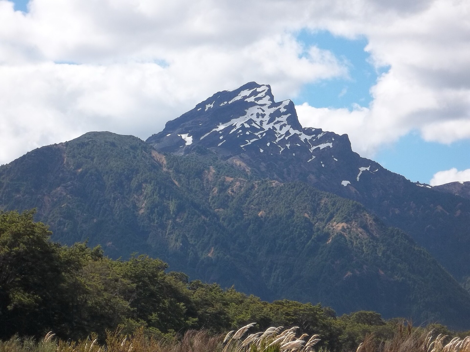
3. Sendero Sierra Nevada, Conguillío National Park
Snapshot
Itinerary
The Sierra Nevada trail climbs from the Conguillío sector through forest and increasingly open viewpoints over Lago Conguillío, Volcán Llaima and the Sierra Nevada volcanic ridge. CONAF lists the route as difficult, with winter risk from avalanches and falling trees.
Why it is essential
This is the defining day hike of Conguillío, showing the park’s central contrast: araucaria forest, lake basin, Llaima’s lava landscape and the higher Sierra Nevada wall.
Equipment
- Hiking boots/shoes, rain/wind shell, warm layer, sun protection, water, food, offline map/GPS and poles
- Add winter equipment and local advice if snow is present
Hazards and notes
- CONAF notes avalanche and falling-tree risk in July–August, plus possible wildlife/wasp issues
- Weather can hide Llaima and the lake views, so start early and check ranger guidance
GPX / KML links
| Source | URL | Format | Notes |
|---|---|---|---|
| AllTrails: Sendero Sierra Nevada | alltrails.com | Route page / app map | AllTrails terms apply; source-map reference only |
| CONAF: Parque Nacional Conguillío | conaf.cl | Official trail stats/context | No route file in this pass |
External links
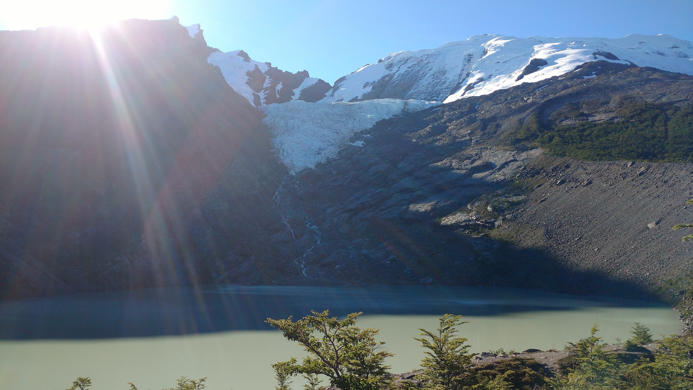
4. Paso Desolación / La Picada, Vicente Pérez Rosales
Snapshot
Itinerary
The Paso Desolación / La Picada route crosses the volcanic terrain between the Osorno side and the Lago Todos los Santos/Petrohué landscape. Andeshandbook describes La Picada as one of the most interesting trekking routes in Vicente Pérez Rosales, with views toward the southeast/east face of Volcán Osorno, Cerro La Picada, Paso Desolación and the lakes Todos los Santos, Rupanco and Llanquihue.
Why it is essential
This is the strongest Volcán Osorno day route in the catalogue: a real volcanic traverse rather than only a short crater or waterfall walk, and a key Lake District viewpoint route.
Equipment
- Mountain hiking footwear, wind/rain shell, warm layer, sun protection, water, food, offline map/GPS and headtorch
- Carry extra water on exposed volcanic sections
Hazards and notes
- Routefinding, volcanic sand/scoria, wind, fog, sun exposure, snow patches and shuttle timing are the main issues
- Confirm whether the intended point-to-point route is open and how to return from Petrohué/La Picada before starting
GPX / KML links
| Source | URL | Format | Notes |
|---|---|---|---|
| Andeshandbook: La Picada | andeshandbook.org | Guide route / track tab | Andeshandbook terms apply; route context only |
| CONAF plan-management inventory, Vicente Pérez Rosales | conaf.cl | Official trail inventory | Government document; trail-length context only |
| OpenStreetMap search: Paso Desolación | openstreetmap.org | Map/search | OSM data is ODbL; geometry cross-check only |
External links
- Andeshandbook — La Picada
- CONAF — Plan de manejo, Parque Nacional Vicente Pérez Rosales
- Parques Nacionales de Chile — Vicente Pérez Rosales
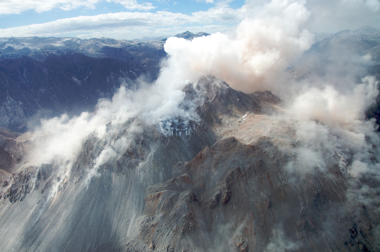
5. Volcán Chaitén crater trail, Pumalín
Snapshot
Itinerary
The trail climbs steeply through recovering forest and volcanic terrain to the rim/viewpoint of Volcán Chaitén, whose 2008 eruption reshaped the surrounding landscape. The route is short but steep, with increasingly open views toward Pumalín and the Chaitén volcanic area.
Why it is essential
Chaitén is the Lake District’s clearest recent-eruption day hike: a compact but powerful route through a landscape still visibly recovering from a major volcanic event.
Equipment
- Hiking shoes/boots with grip, rain shell, warm layer, water, snacks, sun protection, offline map/GPS and poles for the steep descent
Hazards and notes
- Mud, erosion, steep steps, rain, wind and possible trail closures are the main concerns
- As with all volcanic sites, check current park and geological/access information before walking
GPX / KML links
| Source | URL | Format | Notes |
|---|---|---|---|
| AllTrails: Chaitén Volcano | alltrails.com | Route page / app map | AllTrails terms apply; source-map reference only |
| Ruta de los Parques: Pumalín Douglas Tompkins National Park | rutadelosparques.org | Park context | No route file in this pass |
External links
External links
| Source | URL |
|---|---|
| CONAF — Parque Nacional Villarrica | conaf.cl |
| DAEM Villarrica — Rutas y accesos | daemvillarrica.cl |
| SERNAGEOMIN | sernageomin.cl |
| Parque Nacional Huerquehue — Sendero Los Lagos | parquenacionalhuerquehue.cl |
| Parque Nacional Huerquehue — official site | parquenacionalhuerquehue.cl |
| CONAF — Parque Nacional Conguillío | conaf.cl |
| Andeshandbook — La Picada | andeshandbook.org |
| CONAF — Plan de manejo, Vicente Pérez Rosales | conaf.cl |
| Parques Nacionales de Chile — Vicente Pérez Rosales | parquesnacionalesdechile.cl |
| Ruta de los Parques — Pumalín Douglas Tompkins | rutadelosparques.org |
| AllTrails — Volcán Villarrica | alltrails.com |
| AllTrails — Sendero Los Lagos de Huerquehue | alltrails.com |
| AllTrails — Sendero Sierra Nevada | alltrails.com |
| AllTrails — Volcán Chaitén | alltrails.com |