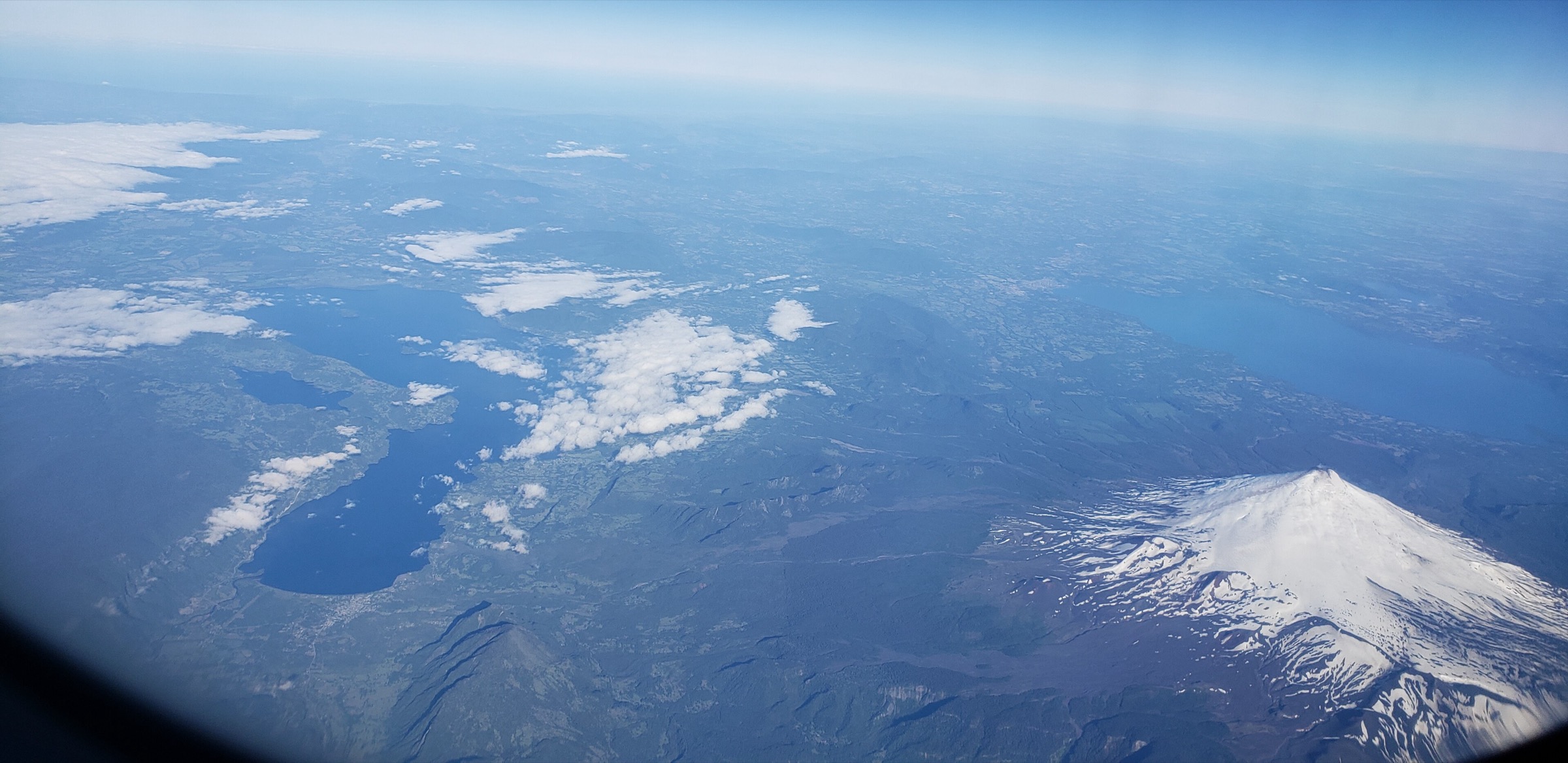
Regional overview
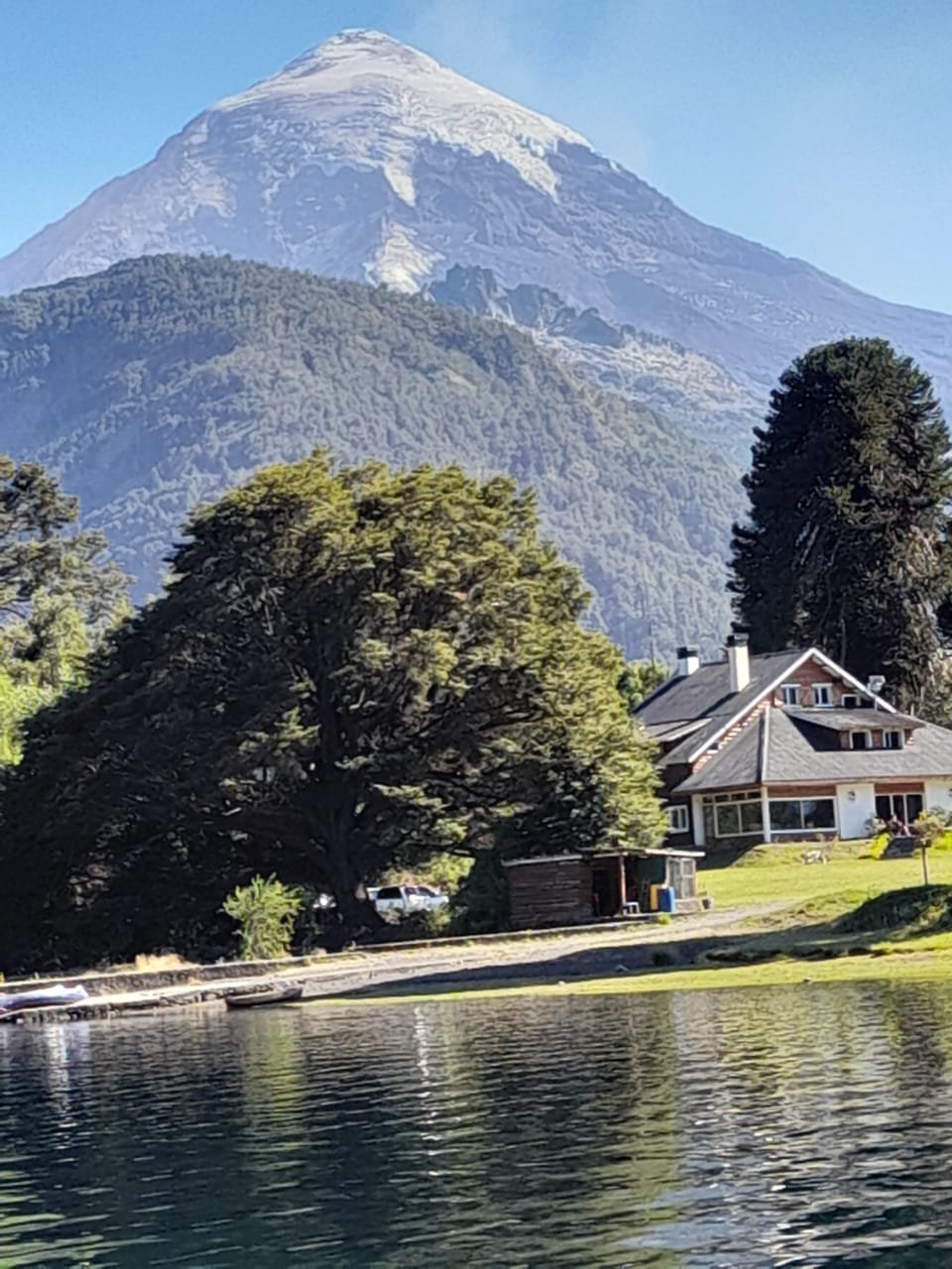
The Lanín-Villarrica-Osorno volcanic region links the Araucanía, Los Ríos, Los Lagos, and Neuquén lake districts: araucaria and coigüe forest, black volcanic sand, lava fields, snow cones, deep blue lakes, and active or recently active volcanoes. The main hiking bases are Pucón, Villarrica, Curarrehue/Puesco, Coñaripe, Puerto Varas, Ensenada, Petrohué, and Junín de los Andes.
The walking character is mixed. Some routes are normal forest-and-lake hikes; others are high volcanic routes with snow, rockfall, gas, lahar, or winter avalanche hazards. Volcán Villarrica and Volcán Lanín are not casual walks: crater or summit routes require current official conditions, registration, and suitable mountain equipment. The catalogue therefore separates non-technical day routes from mountain routes that are only day-hike compatible in favourable conditions.
The usual main season is late spring to early autumn. Winter and early spring can bring snow to Huerquehue, Villarrica, Lanín, and Osorno, and CONAF specifically flags snow, avalanche, volcanic, puma, hantavirus-vector, and insect risks on several trails. On the Chilean side, park entry is normally managed through Pases Parques/CONAF; on the Argentine side, Lanín access is controlled by Administración de Parques Nacionales.
Selection rationale
The five selected routes cover the region’s essential volcanic and lake-country character: the active Villarrica crater route, Huerquehue’s classic araucaria-and-lakes walk, a high Villarrica/Puesco lakes route with Lanín views, the Osorno crater/summit-sector trail, and the Lanín Tromen/base approach. Volcán Lanín’s full ascent is treated cautiously because it is normally a mountaineering objective rather than a standard day hike.
Summary table
| # | Hike | Country | Route type | Distance | Gain | Max elevation | Difficulty |
|---|---|---|---|---|---|---|---|
| 1 | Volcán Villarrica / Rukapillán crater route from Rucapillán sector | Chile | Out-and-back / guided mountain route | 6.6 km official out-and-back to crater trail; 9.0 km AllTrails full route | 1,400 m on AllTrails | ca. 2,847 m | Hard / technical equipment |
| 2 | Sendero Los Lagos, Parque Nacional Huerquehue | Chile | Out-and-back / loop variants | 10.8 km official one-way trail; 13.2 km AllTrails loop | 783 m on AllTrails | Moderate-hard | |
| 3 | Lagos Andinos: Laguna Escondida, Huinfiuca and Laguna Verde | Chile | Out-and-back | 11.4 km official out-and-back; 17.2 km AllTrails extended variant | 585 m on AllTrails | Hard | |
| 4 | Cráter Rojo / Volcán Osorno upper lava-field walk | Chile | Loop / summit-sector variant | 3.1 km Cráter Rojo loop; 7.4 km longer Osorno source route | 137-879 m depending on variant | Osorno summit 2,652 m | Moderate-hard |
| 5 | Volcán Lanín Tromen base approach | Argentina / Chile border | Out-and-back candidate | Official base-route distance unresolved; full normal-route source is 22.7 km | Official base-route gain unresolved | Base approach unresolved; Lanín summit 3,776 m | Hard / mountain candidate |
1. Volcán Villarrica / Rukapillán crater route from Rucapillán sector
Snapshot
Itinerary
The route begins in the Rucapillán/Camino al Volcán sector and climbs open volcanic slopes toward the active Villarrica crater. Under normal guided conditions the ascent follows snow or ash slopes, with views over Lago Villarrica, Huerquehue, Quetrupillán, Lanín, and the wider Araucanía lakes. The descent may use snow travel or the ascent line depending on conditions and operator protocol.
Why it is essential
Villarrica is the emblematic active volcano of the Chilean Lake District and one of the region’s internationally recognised guided mountain day routes. It is included because of its landscape and cultural importance, but it is not a simple hiking trail.
Equipment
- Mountain hiking and volcanic-route equipment: sturdy boots, helmet, ice axe, crampons or traction as required, gloves, goggles or sunglasses, waterproof shell, warm layers, headtorch, food, water, and navigation backup.
- A certified guide and/or official authorisation is required for many visitors; Chile Travel and Pucón tourism guidance state that crater ascents should be undertaken with certified guides and suitable technical equipment.
- Mask or eye protection may be required when volcanic gas is present.
Hazards and notes
Villarrica is active. CONAF lists rockfall, lahar risk in case of eruption, puma/hantavirus-vector risk, and insect bites for the crater trail. SERNAGEOMIN/RNVV and SENAPRED alert status must be checked immediately before departure. Strong wind, ice, snow, poor visibility, volcanic gas, and rockfall can make the route unsuitable. The 3.3 km CONAF trail length appears to be one way, while the AllTrails public route records a longer out-and-back geometry.
GPX / KML links
| Source | URL | Format / access | Reuse status |
|---|---|---|---|
| AllTrails: Villarrica Volcano (Rukapillán) | alltrails.com | Source route / GPX via AllTrails account | AllTrails terms apply; geometry checked as public route source; direct reuse unresolved |
| CONAF Parque Nacional Villarrica | conaf.cl | Official trail listing | CONAF website terms not evaluated for route-file reuse; official trail length and hazards checked; no GPX found |
External links
- CONAF — Parque Nacional Villarrica
- Chile Travel — Volcán Villarrica
- RNVV / SERNAGEOMIN — alert system
- AllTrails — Villarrica Volcano (Rukapillán)
2. Sendero Los Lagos, Parque Nacional Huerquehue
Snapshot
Itinerary
The trail leaves the Tinquilco side of Huerquehue and climbs through temperate forest toward a chain of small Andean lakes set among araucaria. Depending on the variant, it visits viewpoints, waterfalls, Lago Chico, Lago Verde, and Lago Toro before returning to the start or completing a loop used by many public route sources.
Why it is essential
Sendero Los Lagos is the classic Huerquehue day hike and one of the most representative walks in the araucaria forest zone north-east of Pucón.
Equipment
- Standard to mountain hiking equipment: hiking boots, waterproof layer, warm layer, food, water, sun protection, and map/GPS.
- Trekking poles are useful on the climb and descent.
Hazards and notes
CONAF identifies snow accumulation from June to September. Dogs and exotic animals are prohibited in the park, and visitors must remain on marked trails. Entry and current conditions should be checked through CONAF/Pases Parques. CONAF also notes that Quinchol and San Sebastián are closed until 15 December 2026; Los Lagos remains separately listed as an enabled trail in the checked source.
GPX / KML links
| Source | URL | Format / access | Reuse status |
|---|---|---|---|
| AllTrails: Huerquehue Lakes Trail | alltrails.com | Source route / GPX via AllTrails account | AllTrails terms apply; stats checked; direct reuse unresolved |
| CONAF Parque Nacional Huerquehue | conaf.cl | Official trail listing | CONAF website terms not evaluated for route-file reuse; official length/hazards checked; no GPX found |
External links
3. Lagos Andinos: Laguna Escondida, Huinfiuca and Laguna Verde
Snapshot
Itinerary
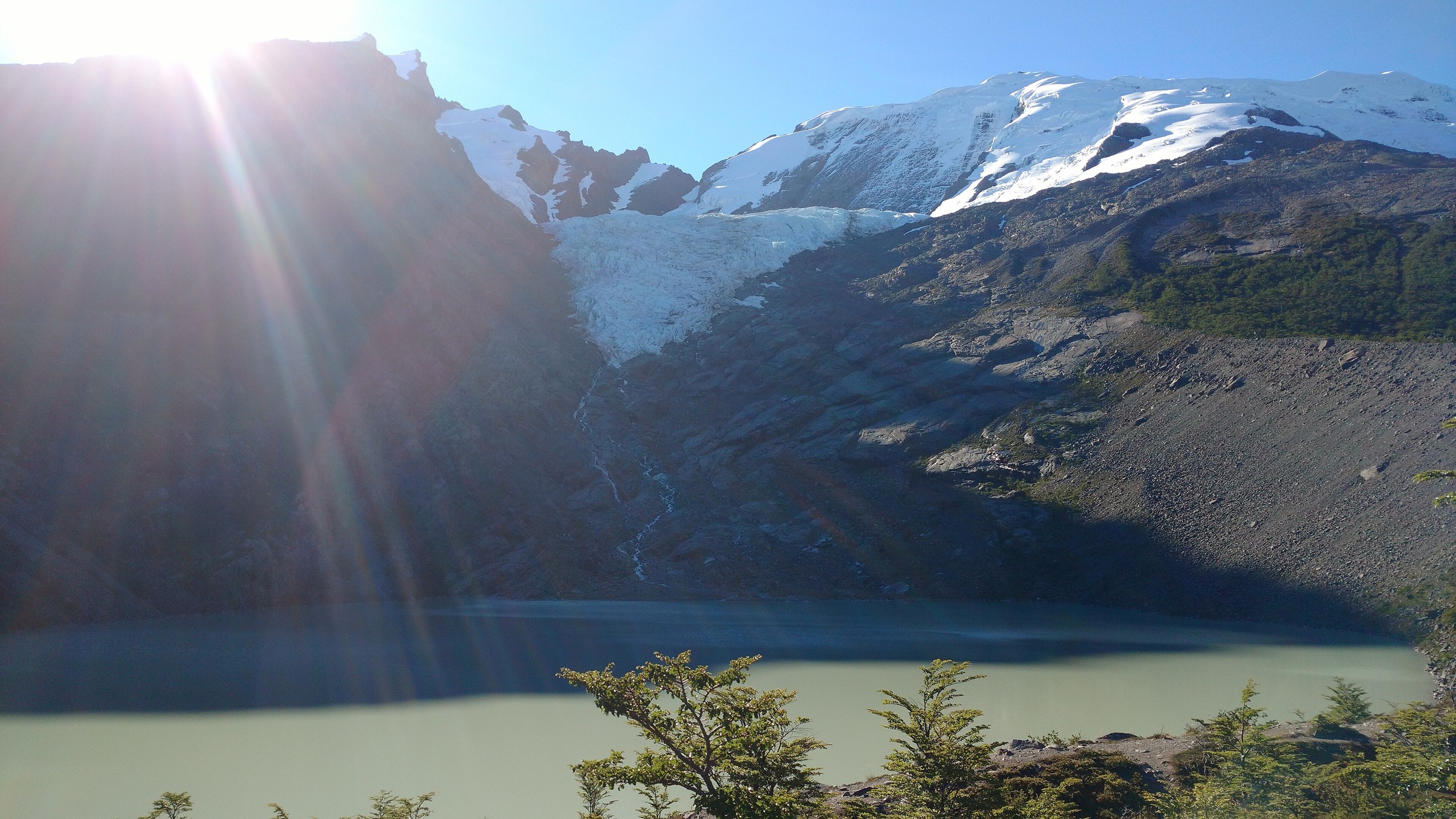
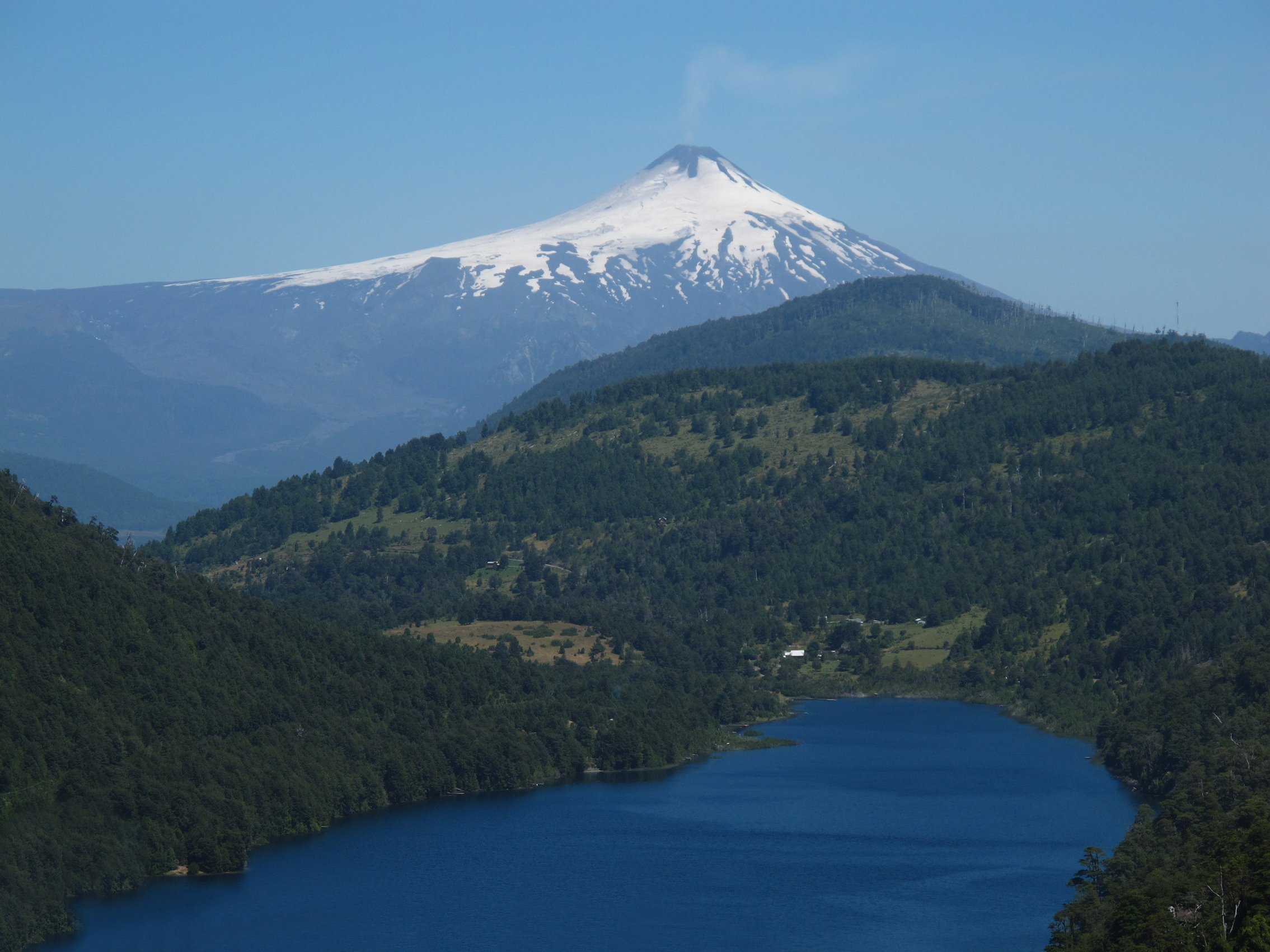
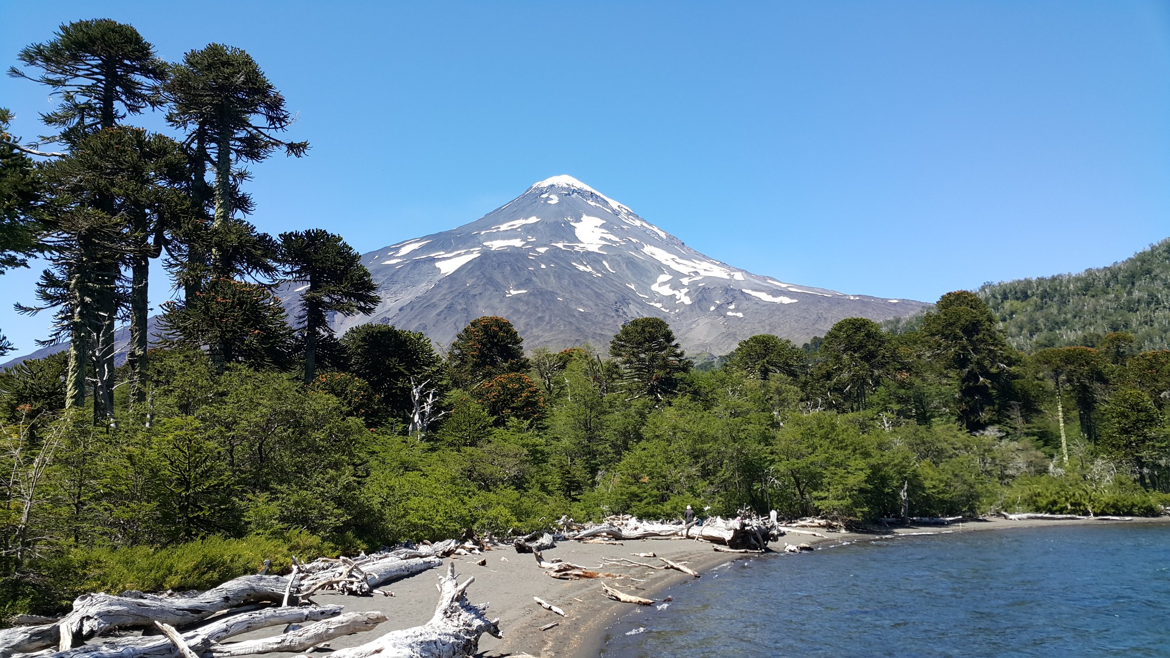
From the Puesco/Lanín side of Parque Nacional Villarrica, the route crosses forest and volcanic terrain to a group of high Andean lakes including Laguna Escondida, Laguna Huinfiuca, and Laguna Verde. It gives a quieter counterpoint to the Pucón-side volcano routes and a strong visual connection to the Lanín-Quetrupillán-Villarrica volcanic chain.
Why it is essential
This hike represents the eastern Villarrica/Lanín border terrain: araucaria forest, volcanic basins, and high lake country near the Mamuil Malal corridor.
Equipment
- Mountain hiking equipment: sturdy boots, waterproof and warm layers, navigation backup, food, water, and headtorch for a long return.
- Trekking poles and snow traction may be needed outside settled summer conditions.
Hazards and notes
CONAF marks the route as demanding and lists possible encounters with puma or hantavirus-vector rodents, plus insect bites. The distance varies between official and route-database sources because the official listing appears to describe a one-way trail while the public route includes an extended out-and-back sequence.
GPX / KML links
| Source | URL | Format / access | Reuse status |
|---|---|---|---|
| AllTrails: Andean Lakes — Hidden Lagoon / Huinfiuca / Green Lagoon | alltrails.com | Source route / GPX via AllTrails account | AllTrails terms apply; stats checked; direct reuse unresolved |
| CONAF Parque Nacional Villarrica | conaf.cl | Official trail listing | CONAF website terms not evaluated for route-file reuse; official trail listing checked; no GPX found |
External links
4. Cráter Rojo / Volcán Osorno upper lava-field walk
Snapshot
Itinerary
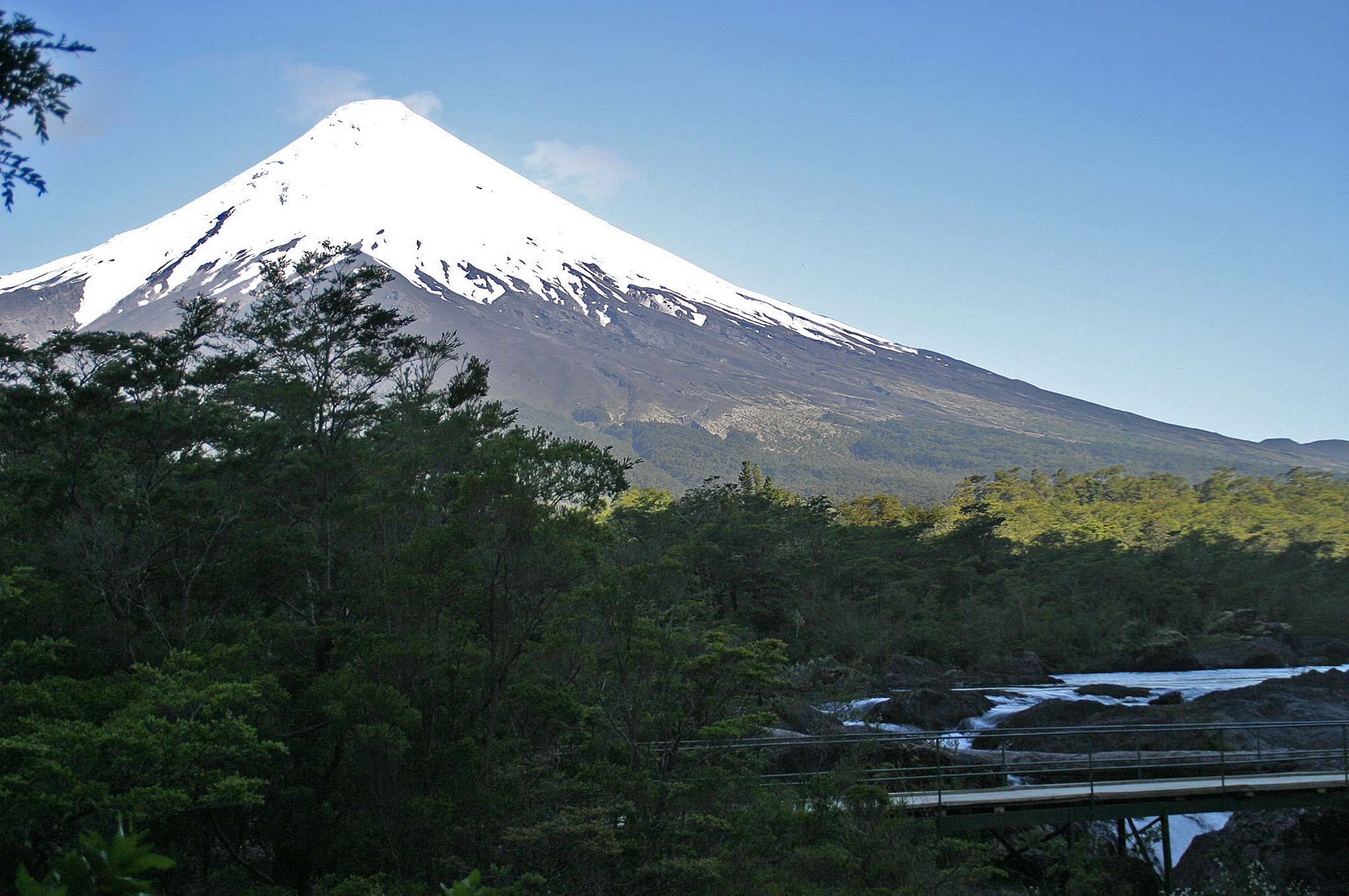
The Cráter Rojo route explores the upper volcanic slopes of Osorno from the ski-road sector, crossing open scoria and lava-field terrain to red crater features and viewpoints over Lago Llanquihue, Todos los Santos, Calbuco, and the surrounding Andes. The longer public Osorno source route continues higher into more serious snow/volcanic terrain and should not be treated as a casual extension.
Why it is essential
Osorno is the iconic symmetrical cone above Llanquihue and Todos los Santos. The Cráter Rojo/upper lava-field walk gives a feasible day-hike experience of that volcanic landscape without requiring a roped summit ascent.
Equipment
- Mountain hiking equipment for the upper volcano: sturdy boots, windproof shell, warm layer, sun protection, water, food, and navigation.
- Snow traction may be required outside dry summer conditions; summit attempts require mountaineering assessment.
Hazards and notes
CONAF announced access to the summit of Volcán Osorno as open in April 2025, but this does not remove the need to check current park, snow, wind, and volcanic conditions. The Cráter Rojo loop and the longer Osorno route are different difficulty levels; the catalogue uses the shorter loop as the principal day-hike option and lists the longer route only as a source-route variant.
GPX / KML links
| Source | URL | Format / access | Reuse status |
|---|---|---|---|
| AllTrails: Cráter Rojo Volcán Osorno | alltrails.com | Source route / GPX via AllTrails account | AllTrails terms apply; stats checked; direct reuse unresolved |
| AllTrails: Osorno Volcano | alltrails.com | Source route / GPX via AllTrails account | AllTrails terms apply; longer variant checked; direct reuse unresolved |
| CONAF Osorno summit-access notice | conaf.cl | Official access notice | CONAF website terms not evaluated for route-file reuse; access context checked; no GPX found |
External links
- CONAF — Osorno summit-access notice
- AllTrails — Cráter Rojo Volcán Osorno
- AllTrails — Osorno Volcano
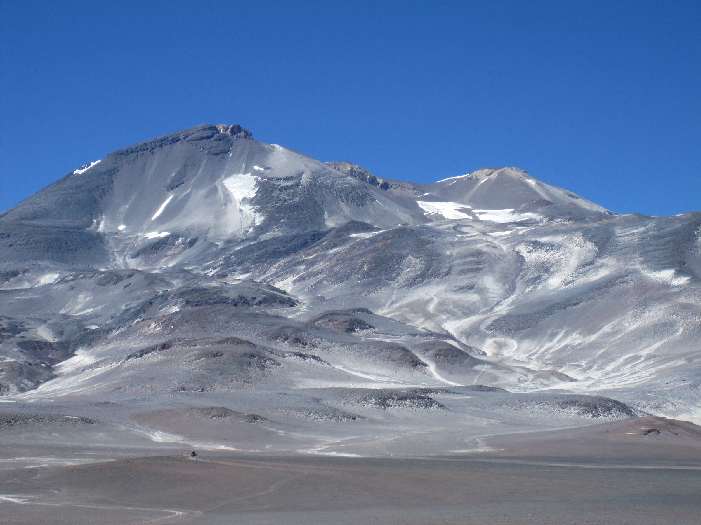
5. Volcán Lanín Tromen base approach
Snapshot
Itinerary
The checked official Lanín material describes access from the Lago Tromen information-centre area to the route leading toward the base of Volcán Lanín. The full normal route continues toward high refuges and the summit, but that ascent is normally planned as a regulated mountain objective rather than a standard day hike. For the catalogue, only the lower approach/base-route concept is retained, pending better official distance and elevation data.
Why it is essential
Lanín is the defining volcano of the Argentine side of this volcanic chain and a major Mapuche and protected-area landmark. A base approach represents the mountain in the day-hike catalogue without presenting the full summit climb as a normal day walk.
Equipment
- Mountain hiking equipment for the base approach: boots, windproof/waterproof layers, warm layer, food, water, sun protection, map/GPS, and headtorch.
- Full summit attempts require a separate mountaineering equipment list, registration, and APN/guide compliance; crampons, ice axe, helmet, and emergency equipment may be required.
Hazards and notes
The full Volcán Lanín ascent is outside normal day-hike scope for most walkers and should not be conflated with the base approach. Official route stats for a base-only day hike were not found in this pass. The route should remain a candidate until Administración de Parques Nacionales, a local mountain office, or a legally reusable track confirms distance, gain, permitted limits, and current access rules.
GPX / KML links
| Source | URL | Format / access | Reuse status |
|---|---|---|---|
| AllTrails: Lanín Volcano Normal Route Argentina | alltrails.com | Source route / GPX via AllTrails account | AllTrails terms apply; full summit route checked only as context; not reused for base-only day-hike geometry |
| Argentina.gob.ar Parque Nacional Lanín activities | argentina.gob.ar | Official activity context | Argentina.gob.ar terms not evaluated for route-file reuse; confirms base-route activity context; no GPX or stats found |
External links
- Argentina.gob.ar — Parque Nacional Lanín
- Argentina.gob.ar — Lanín activities
- AllTrails — Lanín Volcano Normal Route Argentina
External links
| Source | URL |
|---|---|
| CONAF — Parque Nacional Villarrica | conaf.cl |
| CONAF — Parque Nacional Huerquehue | conaf.cl |
| CONAF — Osorno summit-access notice | conaf.cl |
| Chile Travel — Volcán Villarrica | chile.travel |
| RNVV / SERNAGEOMIN — volcanic alerts | rnvv.sernageomin.cl |
| Argentina.gob.ar — Parque Nacional Lanín | argentina.gob.ar |
| AllTrails — Villarrica Volcano (Rukapillán) | alltrails.com |
| AllTrails — Huerquehue Lakes Trail | alltrails.com |
| AllTrails — Andean Lakes route | alltrails.com |
| AllTrails — Cráter Rojo Volcán Osorno | alltrails.com |
| AllTrails — Osorno Volcano | alltrails.com |
| AllTrails — Lanín Volcano Normal Route Argentina | alltrails.com |