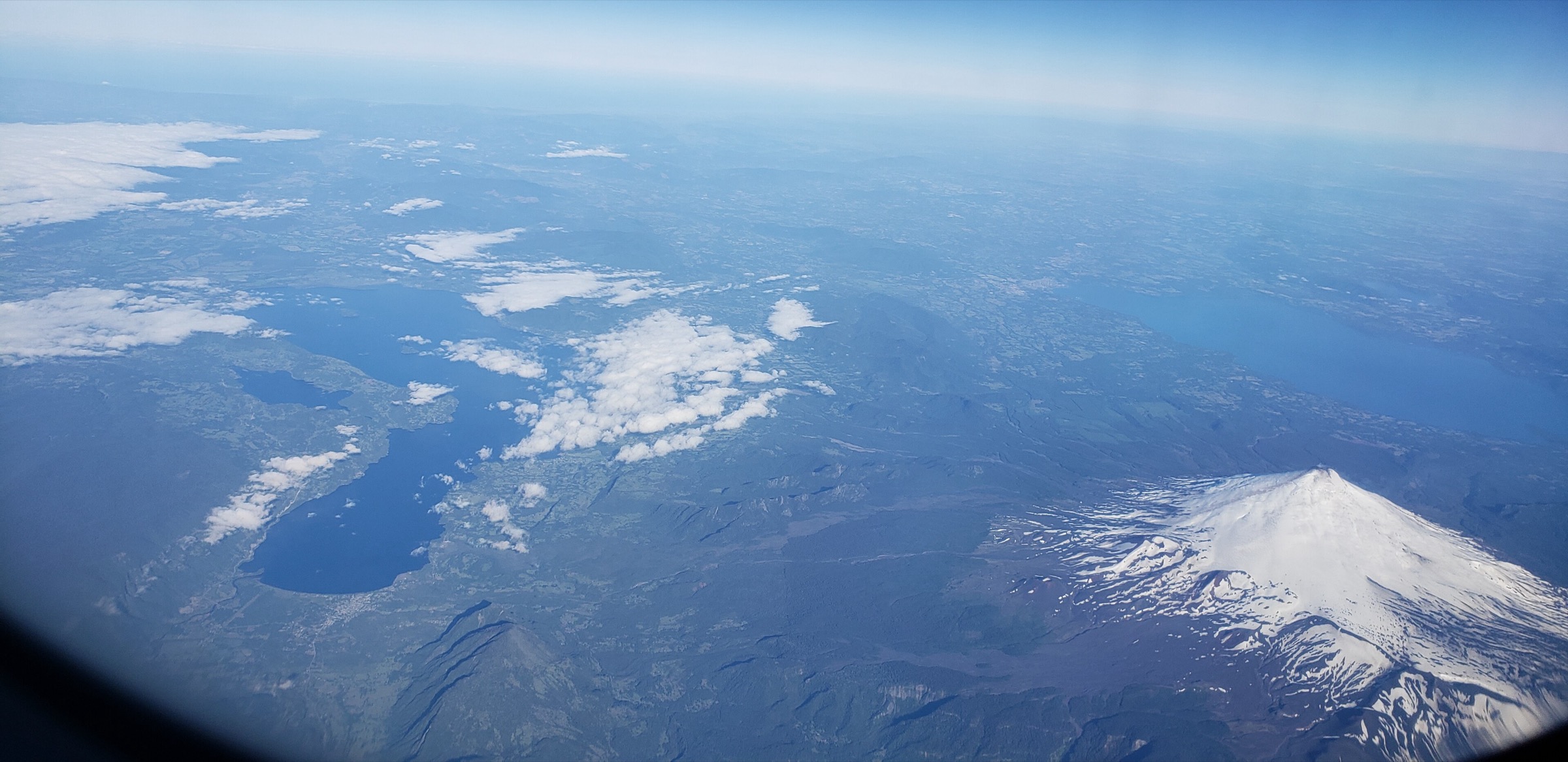
Regional overview
The Southern Patagonian Icefield margins form a broken chain of access valleys, lakes, boat crossings and frontier settlements around one of the largest temperate ice masses on earth. This catalogue entry deliberately avoids duplicating the main trail-town selections already covered for El Chalten / Fitz Roy, Los Glaciares / El Calafate and Torres del Paine. Instead it focuses on the lesser, but still essential, day-hike portals around Lago del Desierto and Villa O’Higgins, where the icefield is approached through wet forest, moraine, frontier paths and glacial lake country.
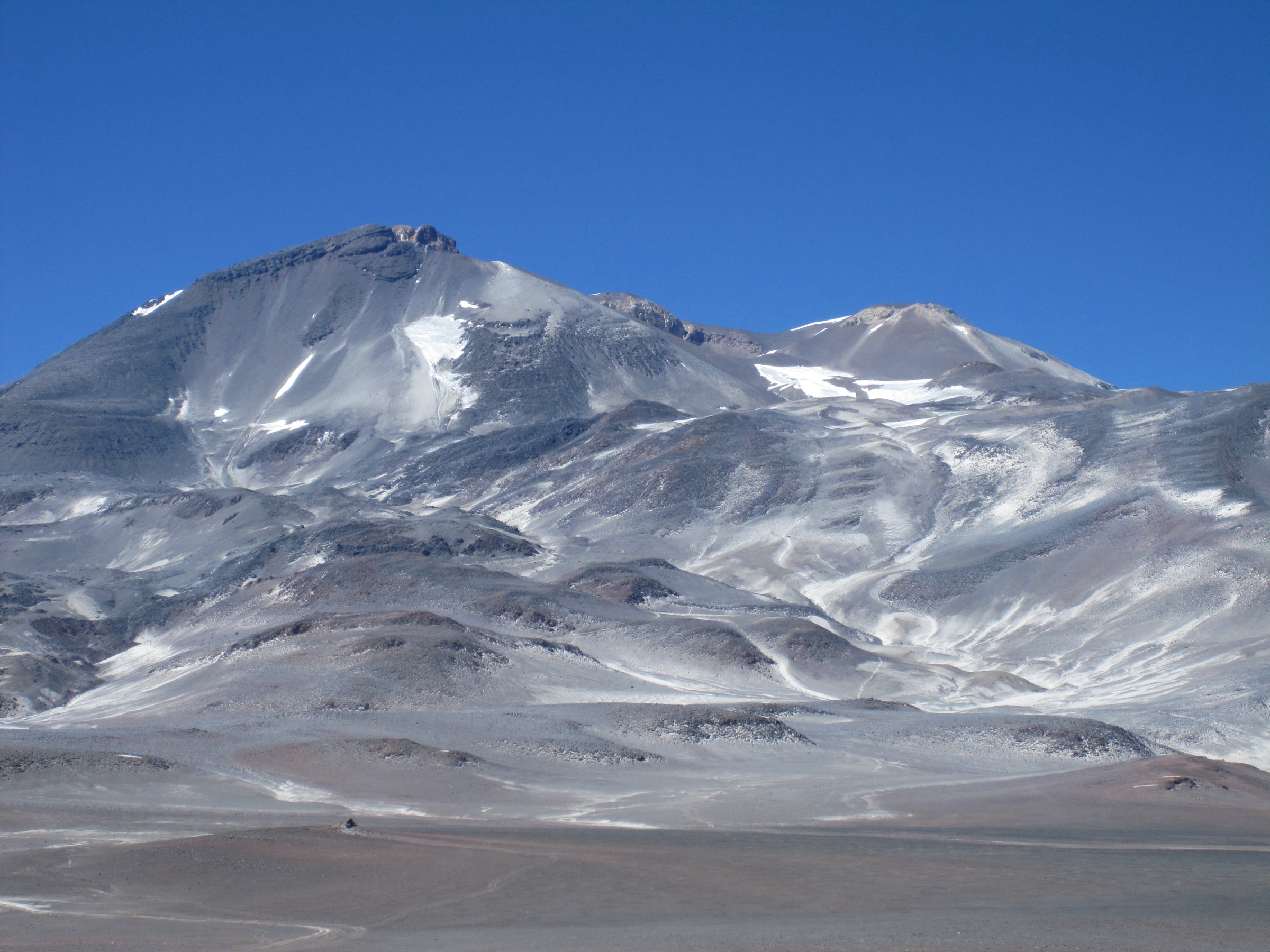
The walking character is logistically uneven. On the Argentine side, Lago del Desierto gives short, fee-controlled glacier-view hikes from road or boat access north of El Chalten. On the Chilean side, Villa O’Higgins sits at the end of the Carretera Austral and the beginning of the southern icefield access landscape, with marked local trails in Parque Glaciar Mosco and rougher guided routes toward nearby glaciers. The cross-border corridor between Candelario Mancilla and Lago del Desierto is as much a historic travel route as a hike.
The main season is normally late spring to early autumn. Weather is the controlling factor: strong wind, heavy rain, cold snaps, lingering snow, saturated ground, river crossings and boat cancellations can turn short-looking routes into committing days. Several routes cross private land, municipal protected areas or border-control zones, so current permissions, fees, registration and boat timetables must be checked before walking.
Selection rationale
The selection balances the two short glacier-access hikes at Lago del Desierto, two Villa O’Higgins / Rio Mosco viewpoints that represent the Chilean icefield-margin trail network, and the Candelario Mancilla - Lago del Desierto foot crossing as the culturally important binational hiking link between the two sides. More technical routes such as the Huemul Circuit, Paso del Viento and glacier travel on the icefield are excluded because they are multi-day, require mountaineering judgement or exceed normal day-hike scope.
Summary table
| # | Hike | Country | Route type | Distance | Gain | Max elevation | Difficulty |
|---|---|---|---|---|---|---|---|
| 1 | Glaciar Huemul / Laguna Huemul, Lago del Desierto | Argentina | Out-and-back | 3.1 km on AllTrails; official tourism map lists 2 km | 211 m | Moderate | |
| 2 | Gran Glaciar Vespignani viewpoint trails | Argentina | Boat-access loop / viewpoint variants | 2.6 km source loop | 150 m | Moderate | |
| 3 | Parque Glaciar Mosco - Mirador del Valle / La Dormilona | Chile | Out-and-back | 10.2 km official park-map route | 1,007 m | Medium-hard | |
| 4 | Sendero Altavista, Villa O’Higgins | Chile | Out-and-back / ridge traverse variant | Approx. 18 km depending on turnaround | Moderate-hard | ||
| 5 | Candelario Mancilla to Lago del Desierto border trail | Chile / Argentina | Point-to-point / public-transport traverse | Approx. 20–22 km depending on boat and border variant | Hard by logistics |
1. Glaciar Huemul / Laguna Huemul, Lago del Desierto
Snapshot
Itinerary
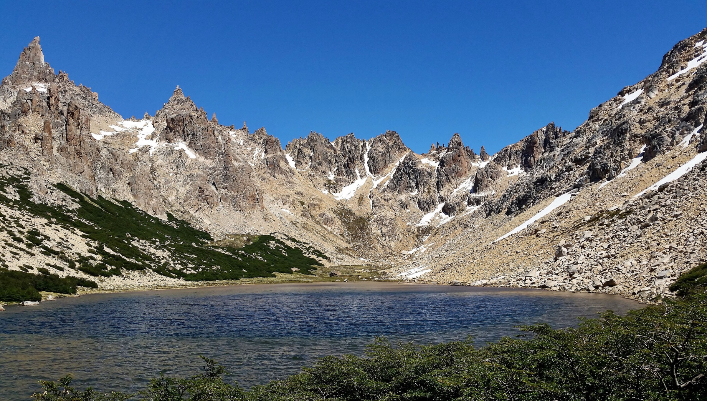
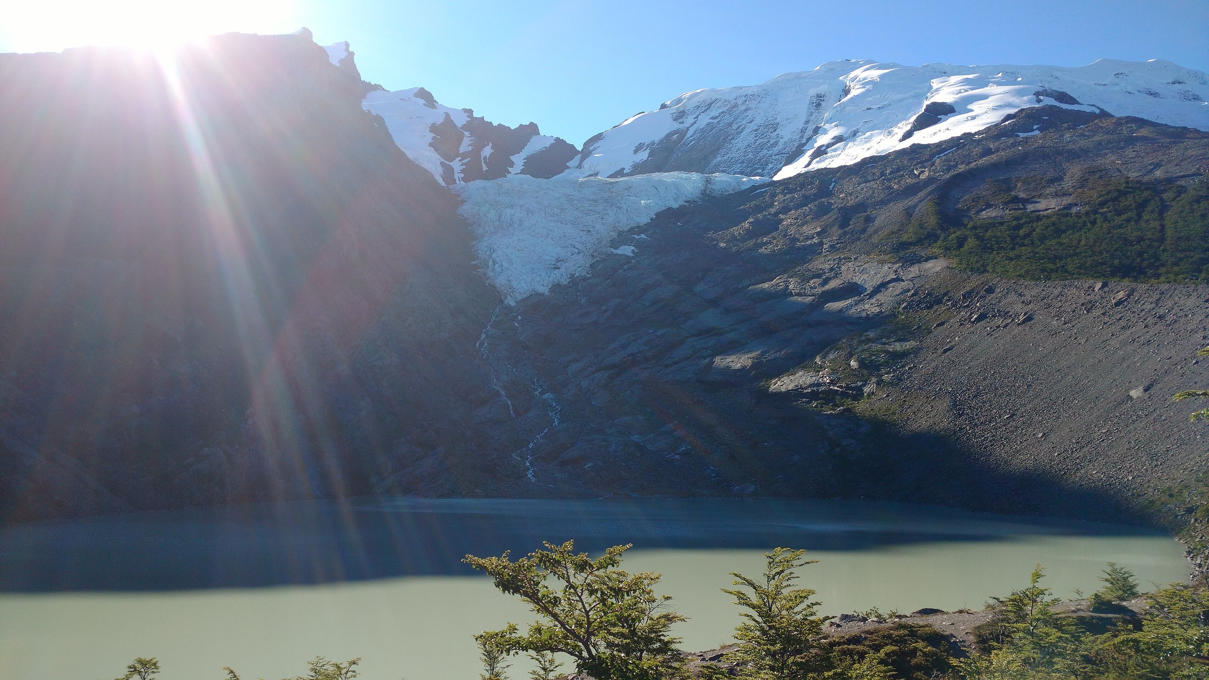
The route starts from the southern Lago del Desierto visitor area, north of El Chalten on the scenic road through the Rio de las Vueltas valley. The path climbs through humid forest from near the lake shore to Laguna Huemul, where Glaciar Huemul descends from the surrounding cirque. Views open back toward Lago del Desierto, the Cordon del Bosque and, in clear weather, the northern face of the Fitz Roy / Chalten area.
AllTrails records the trail as 3.1 km out-and-back with 211 m of ascent. The official El Chalten tourism map lists Glaciar Huemul as a 2 km, 1-hour walk, so the practical distance depends on whether the mapped route includes the full approach, viewpoint wanderings and the exact start point. Access is fee-controlled through the local reserve/private access area; this should be confirmed on arrival.
Why it is essential
Glaciar Huemul is the most accessible short glacier-view hike on the Argentine side of the Lago del Desierto icefield-margin corridor. It gives a compact introduction to the forest, lake and hanging-glacier landscape north of El Chalten without requiring a full mountain day.
Equipment
- Hiking shoes or light boots
- Waterproof/windproof layer
- Warm layer
- Water, snacks
- Sun protection
- Offline map/GPS
- Trekking poles useful on wet or muddy steps
- Microspikes may be needed in winter or after freeze-thaw conditions
Hazards and notes
- The path can be wet, muddy and slippery
- Do not approach unstable glacier ice or closed moraine areas
- The road to Lago del Desierto is exposed to weather disruption and can be affected by washouts, snow or traffic restrictions
- Entrance fees and opening hours are locally controlled and were not fully verified for 2026
GPX / KML links
| Source | URL | Format / access | Reuse status |
|---|---|---|---|
| AllTrails: Glaciar Huemul | alltrails.com | Source map / downloadable route via AllTrails account | AllTrails terms apply; source-map reference only |
| El Chalten official map / guide | elchalten.tur.ar | Official map PDF | Route-file reuse terms not stated; official distance/time context only |
| OpenStreetMap search: Glaciar Huemul Lago del Desierto | openstreetmap.org | Map geometry cross-check | OSM data is ODbL; geometry cross-check target only |
External links
- Turismo Chalten — scenic route and Lago del Desierto area
- Turismo Chalten map / guide
- AllTrails — Glaciar Huemul
2. Gran Glaciar Vespignani viewpoint trails
Snapshot
Itinerary
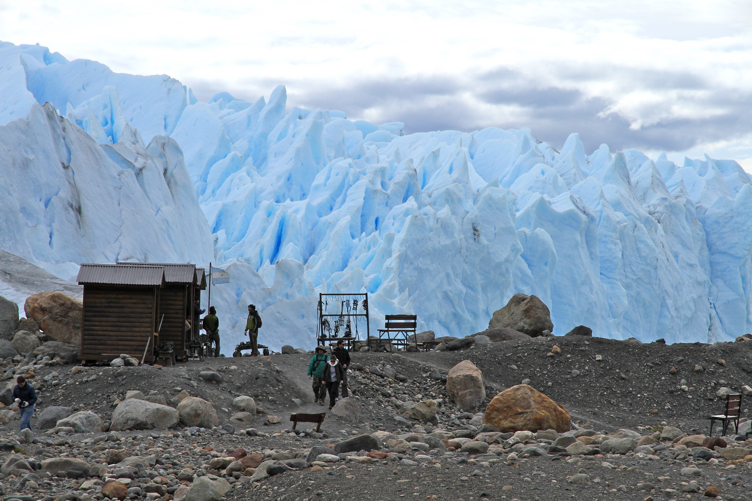
The route begins only after a boat crossing on Lago del Desierto. From the Vespignani landing, short trails lead through forest and moraine-influenced terrain to viewpoints over Gran Glaciar Vespignani and the surrounding peaks. AllTrails records a 2.6 km loop with about 150 m of ascent. Public descriptions of the excursion mention several variants: an easy interpretive trail near the shore, an intermediate viewpoint trail and a more demanding option toward the glacier-foot viewpoint.
Because the area is accessed by boat and local operator scheduling, this is best catalogued as a boat-access day hike rather than an independent trailhead route. The walking component is short, but the full outing is a day activity from El Chalten once road and navigation time are included.
Why it is essential
Vespignani is the strongest boat-access glacier-view hike on Lago del Desierto. It complements Glaciar Huemul by reaching the opposite shore and showing the lake as a glacier corridor rather than just a road-end viewpoint.
Equipment
- Hiking shoes or boots
- Waterproof/windproof shell
- Warm layer
- Gloves and hat in cool weather
- Water, snacks
- Sun protection
- Dry bag for boat spray
- Carry enough insulation for wind or delays at the lake
Hazards and notes
- Boat cancellation, wind, cold rain and muddy forest sections are the main practical hazards
- Stay on authorised paths and follow operator instructions
- The exact variant walked may depend on guide choice, weather, group ability and current local restrictions
GPX / KML links
| Source | URL | Format / access | Reuse status |
|---|---|---|---|
| AllTrails: Gran Glaciar Vespignani | alltrails.com | Source map / downloadable route via AllTrails account | AllTrails terms apply; source-map reference only |
| Exploradores Lago del Desierto / operator information | exploradoreslagodeldesierto.com | Operator access source | Operator terms apply; access/logistics reference only |
| OpenStreetMap search: Glaciar Vespignani Lago del Desierto | openstreetmap.org | Map geometry cross-check | OSM data is ODbL; geometry cross-check target only |
External links
- AllTrails — Gran Glaciar Vespignani
- Exploradores Lago del Desierto
- Connect Patagonia — Vespignani Glacier overview
3. Parque Glaciar Mosco - Mirador del Valle / La Dormilona
Snapshot
Itinerary
The route starts in Parque Glaciar Mosco, a municipal/CONAF-linked trail area immediately above Villa O’Higgins. The trail climbs from the forested lower slopes above town toward the Rio Mosco valley viewpoints. The official park-map material lists the Mirador del Valle route as 10.2 km with a maximum elevation of 1,007 m and medium-high difficulty, recommending a local guide for the longer upper route.
Shorter signed viewpoints such as Mirador La Bandera and Mirador del Valle give a progressive view over Villa O’Higgins, the Rio Mayer, Rio Mosco, Lago O’Higgins / San Martin and the surrounding glaciated ranges. The more committing upper line toward La Dormilona and the Mosco glacier access country moves into exposed mountain terrain and should only be followed where current local guidance confirms the route is open and safe.
Why it is essential
Parque Glaciar Mosco is the core walking gateway from Villa O’Higgins into the Chilean side of the Southern Patagonian Icefield margin. It is the most coherent marked local trail network for understanding the position of the village between the Rio Mosco valley, Lago O’Higgins and the icefield-edge mountains.
Equipment
- Sturdy boots
- Trekking poles
- Waterproof/windproof shell
- Warm layers
- Gloves and hat outside midsummer
- Food, water
- Headtorch
- Offline map/GPS and navigation backup
- Local guide recommended for the longer upper route
Hazards and notes
- Expect steep forest, mud, wind, cold rain and possible snow on higher sections
- The park map asks visitors to stay on official trails, avoid fire and carry out all rubbish
- The longer Rio Mosco / glacier route enters huemul habitat and should not be improvised from old tracks
- Current route condition and registration requirements should be checked at Villa O’Higgins before departure
GPX / KML links
| Source | URL | Format / access | Reuse status |
|---|---|---|---|
| Parque Glaciar Mosco map PDF | turismovillaohiggins.cl | Official/local map PDF | Reuse terms not stated; route context only; no GPX found |
| Parque Glaciar Mosco English map PDF | glaciarmosco.cl | Official/local map PDF | Reuse terms not stated; route context only; no GPX found |
| Bienes Nacionales Topoguia Mosco | rutas.bienes.cl | Official heritage-route topoguide PDF | Government route-publication terms not fully resolved; direct coordinate reuse unresolved |
| OpenStreetMap search: Parque Glaciar Mosco | openstreetmap.org | Map geometry cross-check | OSM data is ODbL; geometry cross-check target only |
External links
- Turismo Villa O’Higgins — Que hacer
- Parque Glaciar Mosco map
- Bienes Nacionales — Topoguia Mosco
- Ruta de los Parques — Villa O’Higgins
4. Sendero Altavista, Villa O’Higgins
Snapshot
Itinerary
The Altavista trail is reached south of Villa O’Higgins on the road toward Bahia Bahamonde, crossing the Augusto Grosse suspension bridge over the Rio Mayer near its outlet to Lago O’Higgins / San Martin. The path follows the northern slope of Cerro Altavista and gives broad views over Lagos Ciervo and Cisnes, the Mayer and Mosco river valleys and the setting of Villa O’Higgins between mountains and water.
The official Villa O’Higgins tourism page describes the access and viewpoint character but does not publish a complete route-stat table. Secondary hiking reports describe an approximately 18 km round trip to the last main viewpoint, taking about five hours for fit walkers. Because the exact official alignment, elevation gain and current maintenance status were not fully verified, this route is retained as a candidate essential day hike with follow-up required.
Why it is essential
Altavista is the principal non-glacier viewpoint walk on the Villa O’Higgins side of the southern icefield margin. It explains the hydrology and settlement geography of the area: Rio Mayer, Rio Mosco, Lago O’Higgins and the glaciated ranges around the end of the Carretera Austral.
Equipment
- Hiking shoes or boots
- Waterproof layer
- Warm layer
- Sun protection
- Water, food
- Offline map/GPS
- Trekking poles
- Extra water if the ridge is dry and wind-exposed
Hazards and notes
- The route data remains incomplete
- Confirm the current trailhead, bridge condition, waymarking and land-access rules in Villa O’Higgins before walking
- Wind, rain, muddy forest, wet roots and fading tread may complicate navigation
GPX / KML links
| Source | URL | Format / access | Reuse status |
|---|---|---|---|
| Turismo Villa O’Higgins, Altavista description | turismovillaohiggins.cl | Official/local tourism route description | Route-file terms not stated; context only; no GPX found |
| Wikiloc search: Sendero Alta Vista Villa O’Higgins | wikiloc.com | User-uploaded source routes | Wikiloc/user terms apply; verify before reuse |
| OpenStreetMap search: Sendero Altavista Villa O’Higgins | openstreetmap.org | Map geometry cross-check | OSM data is ODbL; geometry cross-check target only |
External links
- Turismo Villa O’Higgins — Que hacer
- Ruta de los Parques — Villa O’Higgins
- Laidback Trip — Altavista trail report
- Wikiloc search — Sendero Alta Vista Villa O’Higgins
5. Candelario Mancilla to Lago del Desierto border trail
Snapshot
Itinerary
The route is the foot link between the end of the Carretera Austral at Villa O’Higgins and the Argentine Lago del Desierto / El Chalten side. Travellers first cross Lago O’Higgins / San Martin by boat to Candelario Mancilla, complete Chilean border formalities, and follow the track and trail toward the Argentine side of the frontier near the north end of Lago del Desierto. From there, the day may continue by boat down Lago del Desierto or by walking the lake-shore route, depending on schedules and conditions.
Sources describe this as part of the binational Villa O’Higgins - El Chalten corridor rather than a conventional recreational loop. It is included because it is the essential legal walking passage across the Southern Patagonian Icefield margin between Chile and Argentina. Exact route statistics vary by source and by whether cyclists use road sections, hikers take the footpath, and boats replace one or both lake-shore sections.
Why it is essential
This is the classic cross-border hiking link between the Chilean and Argentine icefield-margin landscapes. It combines frontier history, remote settlement, lake navigation and foot travel in a way that no short viewpoint trail can replicate.
Equipment
- Waterproof boots
- Waterproof/windproof shell
- Warm layers
- Gloves and hat
- Food for a long day
- Water treatment or sufficient water
- Headtorch
- Offline map/GPS
- Passport and border documents
- Cash/card as required for boat operators
- Dry bag for documents
Hazards and notes
- Do not attempt without confirmed boat tickets, border-opening information and contingency plans
- Weather can cancel boats and strand walkers
- Navigation, mud, fallen trees, river/stream crossings and long stretches without services are possible
- Carry a passport and comply with both Chilean and Argentine border procedures
- This entry is not a GPX substitute
GPX / KML links
| Source | URL | Format / access | Reuse status |
|---|---|---|---|
| Wikiexplora: Candelario Mancilla - Lago del Desierto | wikiexplora.com | Source route / guide page | Wikiexplora terms unresolved; verify before route-file reuse |
| Ruta de los Parques, Villa O’Higgins | rutadelosparques.org | Official/regional tourism context | Route-file terms not stated; context only |
| Bicycle Patagonia, Villa O’Higgins to El Chalten crossing | bicyclepatagonia.com | Route logistics source | Site terms apply; useful logistics reference, not a verified hiking GPX |
| OpenStreetMap search: Candelario Mancilla Lago del Desierto | openstreetmap.org | Map geometry cross-check | OSM data is ODbL; geometry cross-check target only |
External links
- Ruta de los Parques — Villa O’Higgins
- Wikiexplora — Candelario Mancilla - Lago del Desierto
- Bicycle Patagonia — Villa O’Higgins - El Chalten crossing
- Turismo Villa O’Higgins
Missing data and follow-up
- Maximum elevation for Glaciar Huemul and Vespignani was not found in official sources.
- No official GPX/KML downloads were found for any route in this pass.
- Altavista elevation gain, maximum elevation and official route length need local confirmation.
- Candelario Mancilla - Lago del Desierto route statistics vary with boat choices, border formalities and whether the Lago del Desierto shore section is walked.
- Photo sourcing remains mostly at Commons search/category level; individual licence-compatible image files still need final selection and attribution.
- Boat schedules, entrance fees, border opening hours and local access rules must be checked immediately before publication or travel.
External links
| Source | URL |
|---|---|
| Turismo Chalten | elchalten.tur.ar |
| Turismo Chalten — map / guide | elchalten.tur.ar |
| Turismo Villa O’Higgins | turismovillaohiggins.cl |
| Parque Glaciar Mosco map | turismovillaohiggins.cl |
| Bienes Nacionales — Topoguia Mosco | rutas.bienes.cl |
| Ruta de los Parques — Villa O’Higgins | rutadelosparques.org |
| Wikiexplora — Candelario Mancilla - Lago del Desierto | wikiexplora.com |
| Bicycle Patagonia — Villa O’Higgins - El Chalten crossing | bicyclepatagonia.com |
| AllTrails — Glaciar Huemul | alltrails.com |
| AllTrails — Gran Glaciar Vespignani | alltrails.com |
| Exploradores Lago del Desierto | exploradoreslagodeldesierto.com |
| Connect Patagonia — Vespignani Glacier overview | connectpatagonia.com |
| Laidback Trip — Altavista trail report | laidbacktrip.com |