Regional overview
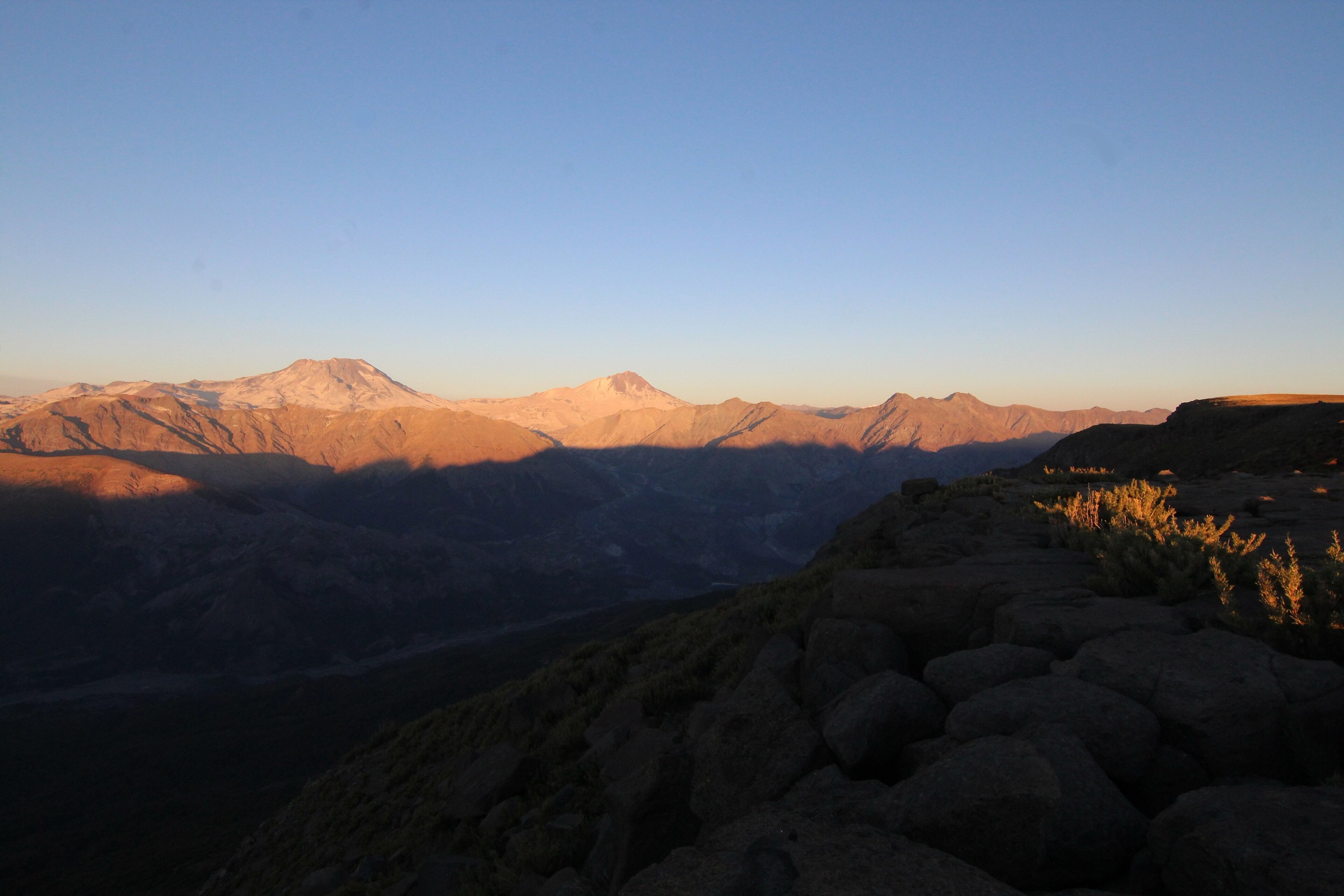
The Farellones, La Parva and El Plomo sector is Santiago’s nearest high-Andes walking ground: a steep road from the city reaches the ski villages, while the Santuario de la Naturaleza Yerba Loca opens the long valleys below Cerro El Plomo, Cerro La Paloma and the La Parva-Pintor ridge. The walking character is dry, high, sunny and exposed. Many trailheads begin between about 1,850 m and 3,000 m, so altitude, wind, dust, sun, winter snow and access logistics matter more than forest distance.
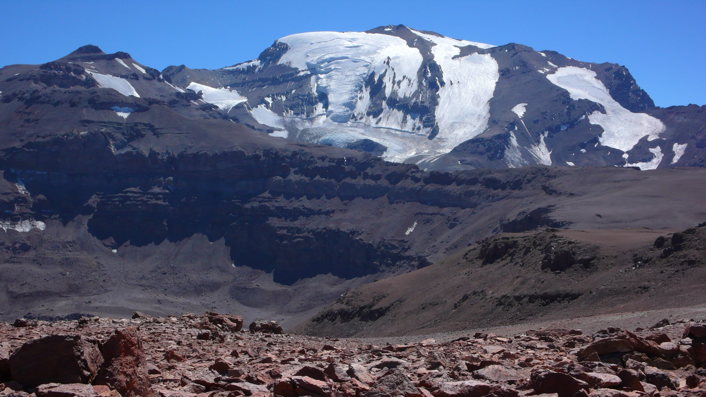
This is also a culturally important mountain landscape. Cerro El Plomo is famous for the Inca child mummy found near the summit, but the summit itself is not treated here as an ordinary day hike: public route data and local mountain practice describe it as a long, high, multi-day or very strenuous mountaineering objective. The catalogue therefore uses day-compatible routes that interpret the same landscape: the La Parva-Pintor ridge, Laguna Piuquenes, Piedra Numerada, the Yerba Loca valley and the restored Refugio Alemán.
Access rules are changeable. La Parva lift/road use, Yerba Loca online reservations, park opening hours, bike-park traffic, winter chain requirements, mining-road restrictions and snow conditions should be checked before publication. The most reliable season for high dry hiking is late spring to autumn; winter versions require snow travel judgement.
Selection rationale
The five selected hikes balance a high summit, a ski-area summit, a classic approach toward El Plomo, a long Yerba Loca valley objective and a historic mountain hut walk. Cerro El Plomo summit is deliberately excluded from the core five because it exceeds normal day-hike limits for most walkers and has stronger mountaineering logistics.
Summary table
| # | Hike | Country | Route type | Distance | Gain | Max elevation | Difficulty |
|---|---|---|---|---|---|---|---|
| 1 | Cerro Pintor from La Parva | Chile | Out-and-back / loop variants | 14.5 km on AllTrails; 14.9 km Wikiloc loop variant | 1,293 m on AllTrails; 1,286 m Wikiloc loop | 4,180 m summit; 4,243 m on one Wikiloc loop track | Hard |
| 2 | Cerro La Parva summit from La Parva | Chile | Out-and-back | 10.8 km | 1,066 m | 4,047 m summit reference | Hard |
| 3 | Laguna Piuquenes and Piedra Numerada from La Parva | Chile | Out-and-back / lift-assisted / one-way source variant | 20.8 km return estimate; 10.38 km one-way Wikiloc source | 997 m one-way source; return gain unresolved | 3,579 m on Wikiloc source | Hard by distance/altitude if walked return |
| 4 | Yerba Loca valley to Casa Piedra Carvajal / La Paloma approach | Chile | Out-and-back | ca. 24.1 km return to Casa Piedra Carvajal; full glacier route 29 km and normally 2 days | ca. 1,281 m to Piedra Carvajal source segment | ca. 3,280 m at Casa Piedra Carvajal | Hard long day |
| 5 | Refugio Alemán de La Parva from Yerba Loca | Chile | Out-and-back | 9.5-9.8 km | 528-530 m | Approx. 2,400-2,500 m; exact max unresolved | Moderate |
1. Cerro Pintor from La Parva
Snapshot
Itinerary
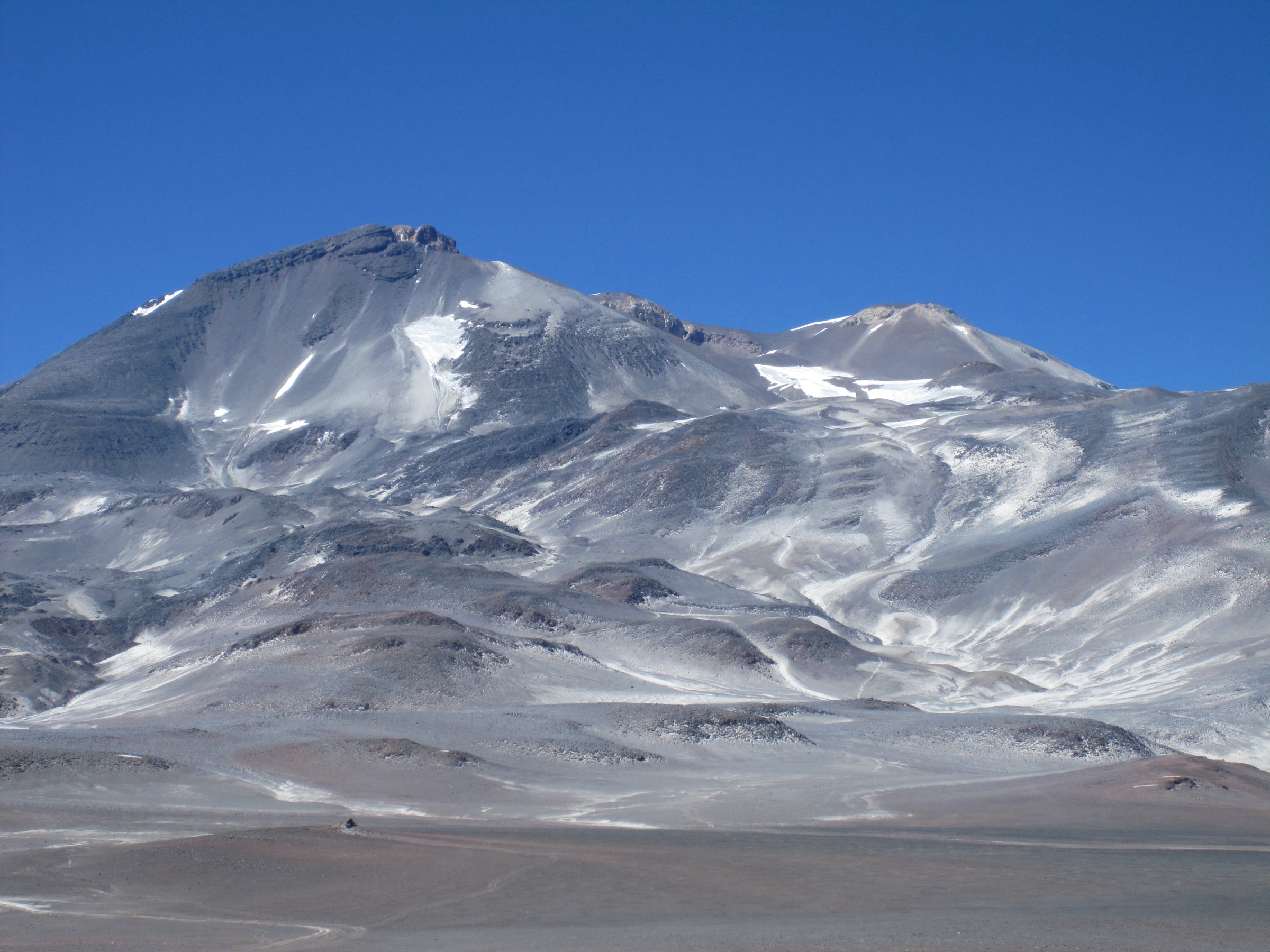
From La Parva, the route climbs the ski-area slopes or service-road variants toward the Las Águilas/Piuquenes sector, then reaches the Falsa Parva ridge. Andeshandbook describes the route continuing from Falsa Parva along the marked crest toward Cerro La Parva and the col below Cerro Pintor, then over broad, lunar-looking slopes to the 4,180 m summit. The descent returns by the same line or by a loop that also tags Cerro La Parva.
Why it is essential
Cerro Pintor is the classic non-technical high summit above Santiago. It gives a day-hike-scale taste of the El Plomo group, with immediate views over the La Parva ridge, Cerro El Plomo, the central Andes and the Santiago basin.
Equipment
Mountain hiking footwear, warm and windproof layers, gloves, hat, sunglasses, sunscreen, 2 litres or more of water, food, headtorch, offline map/GPS and trekking poles. After snow, traction and winter mountain judgement may be required.
Hazards and notes
The route is dry, high and exposed, with loose volcanic/gravel slopes, strong UV, wind and altitude effects. In summer, dust and heat can be significant; in winter, ski operations, snow and avalanche terrain alter the route. Check La Parva access rules and whether the Las Águilas lift/road is available before planning around it.
GPX / KML links
| Source | URL | Format / access | Reuse status |
|---|---|---|---|
| AllTrails: Cerro Pintor | alltrails.com | Source map / downloadable route via AllTrails account | AllTrails terms apply; source-map reference only |
| Wikiloc: La Parva - Cerro Pintor - Cerro La Parva | wikiloc.com | Source route / GPX via Wikiloc account | Wikiloc terms apply; stats verified; direct reuse unresolved |
| Andeshandbook: Cerro Pintor, ruta normal desde La Parva | andeshandbook.org | Guide route / track tab | Andeshandbook terms apply; primary local route description; track reuse unresolved |
External links
- Andeshandbook — Cerro Pintor normal route from La Parva
- AllTrails — Cerro Pintor
- Wikiloc — La Parva - Cerro Pintor - Cerro La Parva
2. Cerro La Parva summit from La Parva
Snapshot
Itinerary
This summit walk climbs directly from La Parva through ski-area and ridge terrain to the rounded Cerro La Parva summit. It can be treated as a shorter high-altitude alternative to Cerro Pintor, or combined with Pintor by very fit parties. The upper ridge gives close views of Falsa Parva, Pintor, Leonera and El Plomo.
Why it is essential
Cerro La Parva is the named mountain above the ski village and one of the most accessible 4,000 m day summits near Santiago. It is an efficient way to experience the altitude and skyline of the Plomo group without committing to the longer Pintor or El Plomo routes.
Equipment
Sturdy footwear, warm/windproof layers, sun protection, water, food, GPS/offline map and headtorch. Trekking poles are useful on loose slopes. In snow, carry appropriate traction and know how to assess avalanche/ice conditions.
Hazards and notes
Altitude, wind, loose ground and ski-area vehicle/lift operations are the main issues. The route may cross or follow resort service roads; confirm summer pedestrian access with La Parva if using upper gates or lift infrastructure.
GPX / KML links
| Source | URL | Format / access | Reuse status |
|---|---|---|---|
| AllTrails: Cerro La Parva | alltrails.com | Source map / downloadable route via AllTrails account | AllTrails terms apply; source-map reference only |
| Andeshandbook: Cerro La Parva mountain page | andeshandbook.org | Mountain/route context | Andeshandbook terms apply; summit context; route-file status unresolved |
External links
3. Laguna Piuquenes and Piedra Numerada from La Parva
Snapshot
Itinerary
The approach begins in La Parva and climbs through ski pistes, service roads or the Las Águilas lift/road corridor to Laguna Piuquenes / Portezuelo Franciscano. Wikiexplora notes that the upper Las Águilas station is only a short walk below the lagoon sector, while Andeshandbook treats Piedra Numerada as the classic first approach stage toward El Plomo. From Laguna Piuquenes, the route continues east across high open terrain toward the Piedra Numerada meadow.
Why it is essential
This is the canonical walking approach into the El Plomo amphitheatre without climbing El Plomo itself. It connects La Parva, Laguna Piuquenes and the historic Piedra Numerada camp used by generations of Santiago mountaineers.
Equipment
Mountain footwear, warm/windproof layers, sun protection, water, food, navigation and headtorch. If using lift or upper road access, carry enough layers for a high-altitude start and possible delays. In snow, this becomes a winter mountain route.
Hazards and notes
Bike-park traffic, resort operations, confusing ski-road junctions, altitude, strong sun and loose ground are the main concerns. Wikiexplora describes upper road/lift arrangements that can vary by year and should be treated as access context rather than guaranteed rights.
GPX / KML links
| Source | URL | Format / access | Reuse status |
|---|---|---|---|
| Wikiloc: La Parva - Piedra Numerada | wikiloc.com | Source route / GPX via Wikiloc account | Wikiloc terms apply; source stats verified; direct reuse unresolved |
| Andeshandbook: Piedra Numerada | andeshandbook.org | Guide route / track tab | Andeshandbook terms apply; route context; track reuse unresolved |
| Wikiexplora: Access to Piedra Numerada from La Parva | wikiexplora.com | Access map/source page | Wiki/site terms not fully assessed; access context only |
External links
- Wikiloc — La Parva - Piedra Numerada
- Andeshandbook — Piedra Numerada
- Wikiexplora — Acceso a Piedra Numerada desde La Parva
4. Yerba Loca valley to Casa Piedra Carvajal / La Paloma approach
Snapshot
Itinerary
From Villa Paulina, the trail follows the Yerba Loca valley upstream through open Andean vegetation, camps and river-side terrain. The day objective used here is Casa Piedra Carvajal, the traditional stone shelter/meadow area below the La Paloma and El Altar glacier basin. Andeshandbook lists the full Glaciar La Paloma route as 29 km and a normal two-day itinerary, so the glacier mirador should not be published as a standard day hike unless a local editor confirms the exact one-day variant.
Why it is essential
This is the defining valley walk of Yerba Loca and the most direct day-compatible way to understand the El Plomo/La Paloma high-mountain setting from inside the sanctuary.
Equipment
Sturdy boots, windproof shell, warm layers, sun protection, water treatment or enough water, food, headtorch, navigation and trekking poles. Carry extra insulation because the valley is long and remote by Santiago standards.
Hazards and notes
Altitude, distance, dehydration, mineral-rich or unreliable water, river crossings/side streams, late return, sudden weather and winter snow are the main hazards. Andeshandbook warns against drinking from Los Sulfatos water and notes that the full glacier route is normally staged over two days. Stay within Yerba Loca rules and registered access windows.
GPX / KML links
| Source | URL | Format / access | Reuse status |
|---|---|---|---|
| AllTrails: La Paloma Glacier, Visitor Center - Piedra Carvajal | alltrails.com | Source map / downloadable route via AllTrails account | AllTrails terms apply; source-map reference only |
| AllTrails: La Paloma Glacier | alltrails.com | Longer source map | AllTrails terms apply; useful cross-check; full route exceeds normal day-hike scope |
| Andeshandbook: Glaciar La Paloma | andeshandbook.org | Guide route / track tab | Andeshandbook terms apply; primary route description; track reuse unresolved |
External links
- Andeshandbook — Glaciar La Paloma
- Yerba Loca — Estado del parque
- Yerba Loca — Parque information
- AllTrails — La Paloma Glacier: Visitor Center to Piedra Carvajal
5. Refugio Alemán de La Parva from Yerba Loca
Snapshot
Itinerary
The route leaves the Yerba Loca lower sector and climbs a clear, signed trail toward the restored Refugio Alemán de La Parva. Andeshandbook identifies the hut as a 1937 German Andean Club project, later abandoned and restored, making it one of the strongest historic walking objectives in the sanctuary.
Why it is essential
Refugio Alemán provides the region’s accessible cultural/historical hike: a short but real mountain walk linking Santiago’s early Andean club history with the modern Yerba Loca protected area.
Equipment
Hiking shoes or light boots, wind/rain layer, sun protection, water, snacks and an offline map. Add warm layers in winter or if weather is unstable.
Hazards and notes
The route is simpler than the high objectives, but still begins in a mountain sanctuary. Check park opening status, online reservation requirements and winter snow before going. The hut may be open as a structure but should not be assumed to provide services.
GPX / KML links
| Source | URL | Format / access | Reuse status |
|---|---|---|---|
| AllTrails: Refugio Alemán | alltrails.com | Source map / downloadable route via AllTrails account | AllTrails terms apply; source-map reference only |
| Andeshandbook: Refugio Alemán de La Parva | andeshandbook.org | Guide route / track tab | Andeshandbook terms apply; primary local route description; track reuse unresolved |
External links
- Andeshandbook — Refugio Alemán de La Parva
- AllTrails — Refugio Alemán
- Club Alemán Andino — Refugio Alemán La Parva
- Yerba Loca — Actividades
External links
| Source | URL |
|---|---|
| Andeshandbook — Cerro Pintor normal route from La Parva | andeshandbook.org |
| Andeshandbook — Cerro La Parva | andeshandbook.org |
| Andeshandbook — Piedra Numerada | andeshandbook.org |
| Andeshandbook — Glaciar La Paloma | andeshandbook.org |
| Andeshandbook — Refugio Alemán de La Parva | andeshandbook.org |
| AllTrails — Cerro Pintor | alltrails.com |
| AllTrails — Cerro La Parva | alltrails.com |
| AllTrails — La Paloma Glacier: Visitor Center to Piedra Carvajal | alltrails.com |
| AllTrails — La Paloma Glacier | alltrails.com |
| AllTrails — Refugio Alemán | alltrails.com |
| Wikiloc — La Parva - Cerro Pintor - Cerro La Parva | wikiloc.com |
| Wikiloc — La Parva - Piedra Numerada | wikiloc.com |
| Wikiexplora — Acceso a Piedra Numerada desde La Parva | wikiexplora.com |
| Yerba Loca — Estado del parque | yerbaloca.cl |
| Yerba Loca — Parque information | yerbaloca.cl |
| Yerba Loca — Actividades | yerbaloca.cl |
| Club Alemán Andino — Refugio Alemán La Parva | dav.cl |