Regional overview
This region links several forested Central European uplands on and near the German-Czech border: the Harz in northern Germany, the Bavarian Forest / Šumava border mountains, the Ore Mountains / Erzgebirge-Krušné hory, and the higher Sudetic ranges of Krkonoše and Jeseníky. The terrain is generally non-alpine but can still be serious in bad weather: rounded summits, spruce and mixed forests, peat bogs, boulder fields, glacial valleys, waterfalls, exposed plateau paths, and long forest ascents.
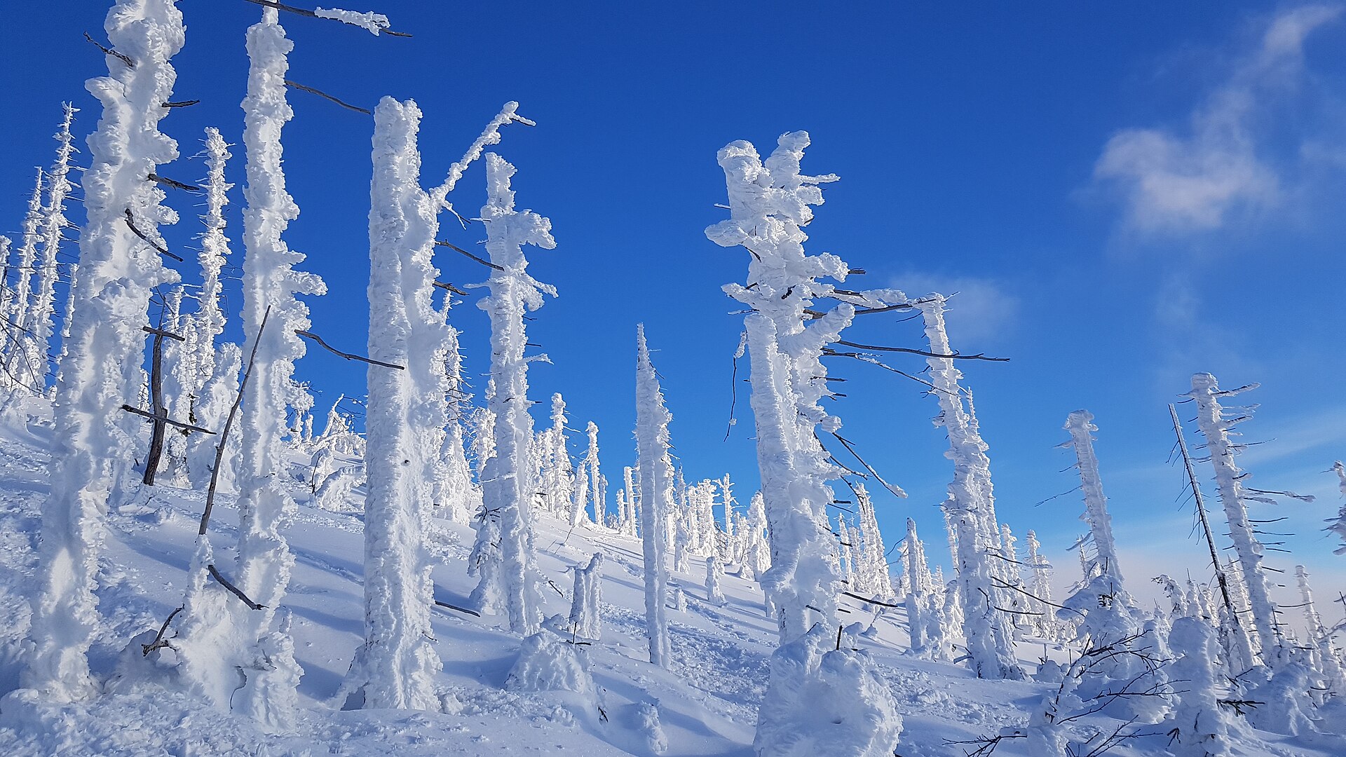
The main hiking centres represented here are Torfhaus and the Brocken in the Harz, Waldhäuser/Fredenbrücke and Lusen in the Bavarian Forest National Park, Oberwiesenthal and Boží Dar around the Fichtelberg-Klínovec high plateau, Pec pod Sněžkou in Krkonoše, and Karlova Studánka / Ovčárna below Praděd in Hrubý Jeseník. The season is usually May to October for ordinary hiking, but snow, ice, wind and low cloud can persist or return outside midsummer, especially on Brocken, Sněžka and Praděd.
A recurring safety issue is that these mountains feel accessible but have harsh summit weather. Harz National Park describes the Brocken summit climate as alpine-like, with frequent fog and a low timberline caused by severe conditions. In Krkonoše, the route through Obří důl is winter-serious, with icy upper sections and avalanche danger noted on route descriptions.
Selection rationale
The five hikes were selected to cover the region’s main walking characters: an iconic German summit and literary trail in the Harz; a Bavarian Forest National Park boulder summit; a cross-border Ore Mountains double-summit route; the classic ascent of Sněžka, the highest Czech mountain; and the waterfall-and-summit route to Praděd in Jeseníky. Each route is a recognised classic or a strongly representative day hike, with route statistics and at least one route source checked online.
Summary table
| # | Hike | Country | Route type | Distance | Gain | Max elevation | Difficulty |
|---|---|---|---|---|---|---|---|
| 1 | Goetheweg from Torfhaus to Brocken | Germany | Out-and-back / one-way option | 16 km out-and-back; 8.8 km one-way | ~330–341 m | 1,141–1,142 m | Medium |
| 2 | Lusen via Teufelsloch and Himmelsleiter | Germany | Loop | 11.9–12 km | 550 m | 1,371–1,373 m | Medium |
| 3 | Oberwiesenthal–Klínovec–Boží Dar–Fichtelberg loop | Germany / Czechia | Loop | 15.17 km | 620 m | 1,246 m | Medium |
| 4 | Sněžka via Obří důl from Pec pod Sněžkou | Czechia / Poland border | Loop / ascent-descent variant | 11.6–14.2 km depending on variant | 770–840 m | 1,598–1,603 m | Medium–demanding |
| 5 | Praděd through the Bílá Opava Valley | Czechia | There-and-back / looped descent variant | 17 km | 641 m | 1,491 m | Medium–demanding |
1. Goetheweg from Torfhaus to Brocken
Snapshot
Itinerary
The route starts at Torfhaus, beside the National Park Visitor Centre area, and follows the Goetheweg across the high moor landscape below the Brocken. It passes the Great Torfhaus Moor on boardwalks and paths, then continues by the Abbegraben watercourse and through spruce forest toward Quitschenberg and Eckersprung. From there the route reaches the former inner-German border area and continues near the Brocken Railway before joining the Brockenstraße for the final approach to the summit plateau. The Brocken summit area includes the railway station, the Brockenhaus visitor centre, the transmitter, and a summit walkway. The standard day-hike returns by the same route to Torfhaus. A one-way version can be combined with the Brocken Railway or other marked Harz routes, but that changes the logistics and statistics.
Why it is essential
This is the classic western approach to the Brocken, the highest summit in the Harz and one of Germany’s most culturally recognisable mountains. It combines high moor, national-park forest, railway history, Goethe associations, and the open, often windswept Brocken summit.
Equipment
Mountain hiking equipment is recommended: sturdy walking shoes or boots, waterproof and windproof layer, warm layer, map or GPS, food and water. In winter or icy conditions, traction devices and trekking poles may be necessary.
Hazards and notes
The trail is not technically difficult, but the Brocken is weather-sensitive. Fog, high wind, snow and ice can occur outside deep summer. Moor areas are protected; walkers should remain on marked paths and boardwalks. Summit facilities and railway options should be checked separately if relying on them for descent.
GPX / KML links
| Source | URL | Format | Notes |
|---|---|---|---|
| Braunlage / Harz tourism route page | braunlage.de | GPX; PDF also linked | Page shows master-data licence as attribution/share-alike; route-file terms need confirmation. Use as source route. Replace later with own GPX. |
| Komoot route by BUND e.V. | komoot.com | GPX download after sign-in | Komoot terms apply. Use as reference route. Replace later with own GPX. |
| Outdooractive route | outdooractive.com | Route source / possible GPX via platform | Outdooractive terms apply. Use as secondary route reference. Replace later with own GPX. |
Further reading
- Harz National Park — Goethe Trail PDF
- Braunlage tourism — Routes to the Brocken – Goetheweg
- Outdooractive — From Torfhaus via the Goetheweg to the Brocken
2. Lusen via Teufelsloch and Himmelsleiter
Snapshot
Itinerary
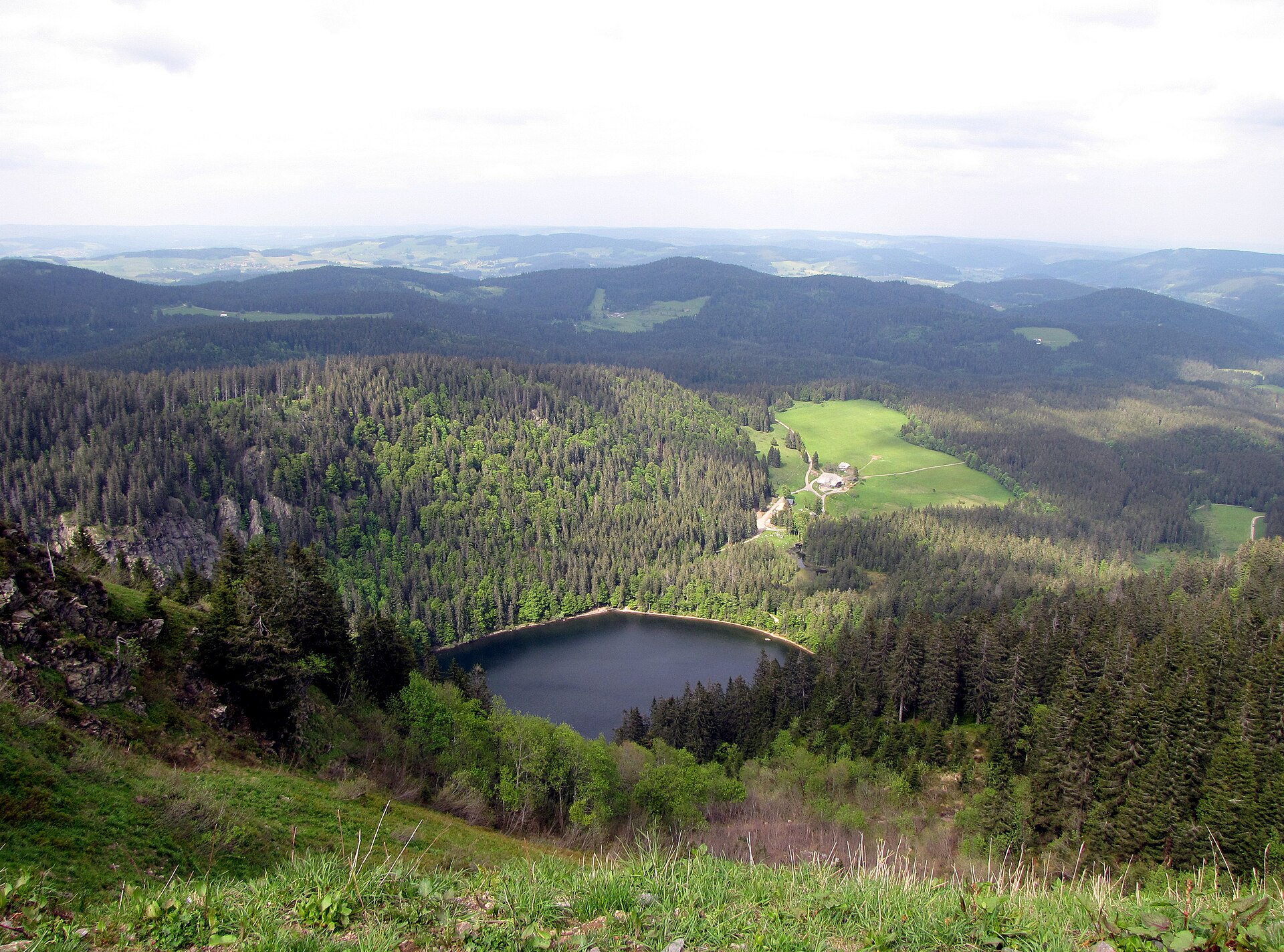
The route starts at Fredenbrücke and follows the Kleine Ohe upstream toward Martinsklause. It then climbs through Teufelsloch, a boulder-filled valley section, before reaching the Glasarche area and the steeper summit approach. The final ascent uses the Himmelsleiter, a direct line of stone steps and boulders leading to the open Lusen summit. After the summit, the route descends towards Lusenschutzhaus and continues by marked paths and boardwalks over Waldhäuserriegel and Waldhäuser Ausblick before returning to Martinsklause and Fredenbrücke. The route is waymarked with several Bavarian Forest National Park symbols, including Ranne, Luchs, Grünes Dreieck and Zaunkönig.
Why it is essential
Lusen is one of the most characteristic Bavarian Forest National Park summits: a forested approach, mountain stream, granite boulder fields, and a treeless summit with wide views. The Himmelsleiter gives the hike a distinctive final climb without making it a technical mountain route.
Equipment
Mountain hiking equipment: sturdy boots, waterproof layer, warm layer, food and water, map/GPS, trekking poles recommended. The official route advice explicitly calls for sturdy footwear and basic safety equipment.
Hazards and notes
The route has steep and rocky passages, especially through Teufelsloch and on the Himmelsleiter. The national park warns of falling trees and deadwood, and advises leaving the forest in strong wind. The Fredenbrücke car park is not cleared in winter. Refreshment at Lusenschutzhaus is seasonal.
GPX / KML links
| Source | URL | Format | Notes |
|---|---|---|---|
| Bavarian Forest National Park / Destination One route page | pages.destination.one | GPX control visible on route page | Terms not fully visible in parsed source. Route file available. Replace later with own GPX. |
| Outdooractive, responsible content: Nationalparkverwaltung Bayerischer Wald | outdooractive.com | GPX, KML, FIT controls | Outdooractive terms apply; national park is listed as verified partner. Use as route source. Replace later with own GPX. |
Further reading
- Bavarian Forest National Park / Destination One — Lusen route page
- Outdooractive — To Lusen via Teufelsloch and Himmelsleiter
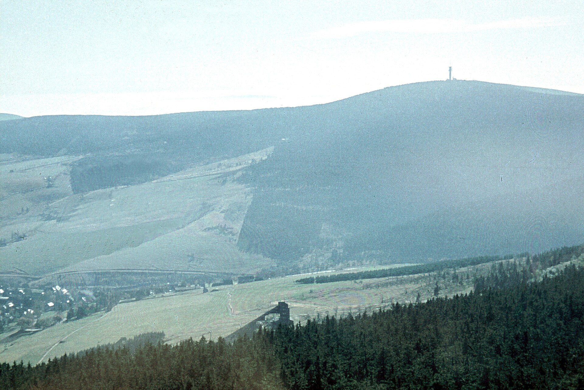
3. Oberwiesenthal–Klínovec–Boží Dar–Fichtelberg loop
Snapshot
Itinerary
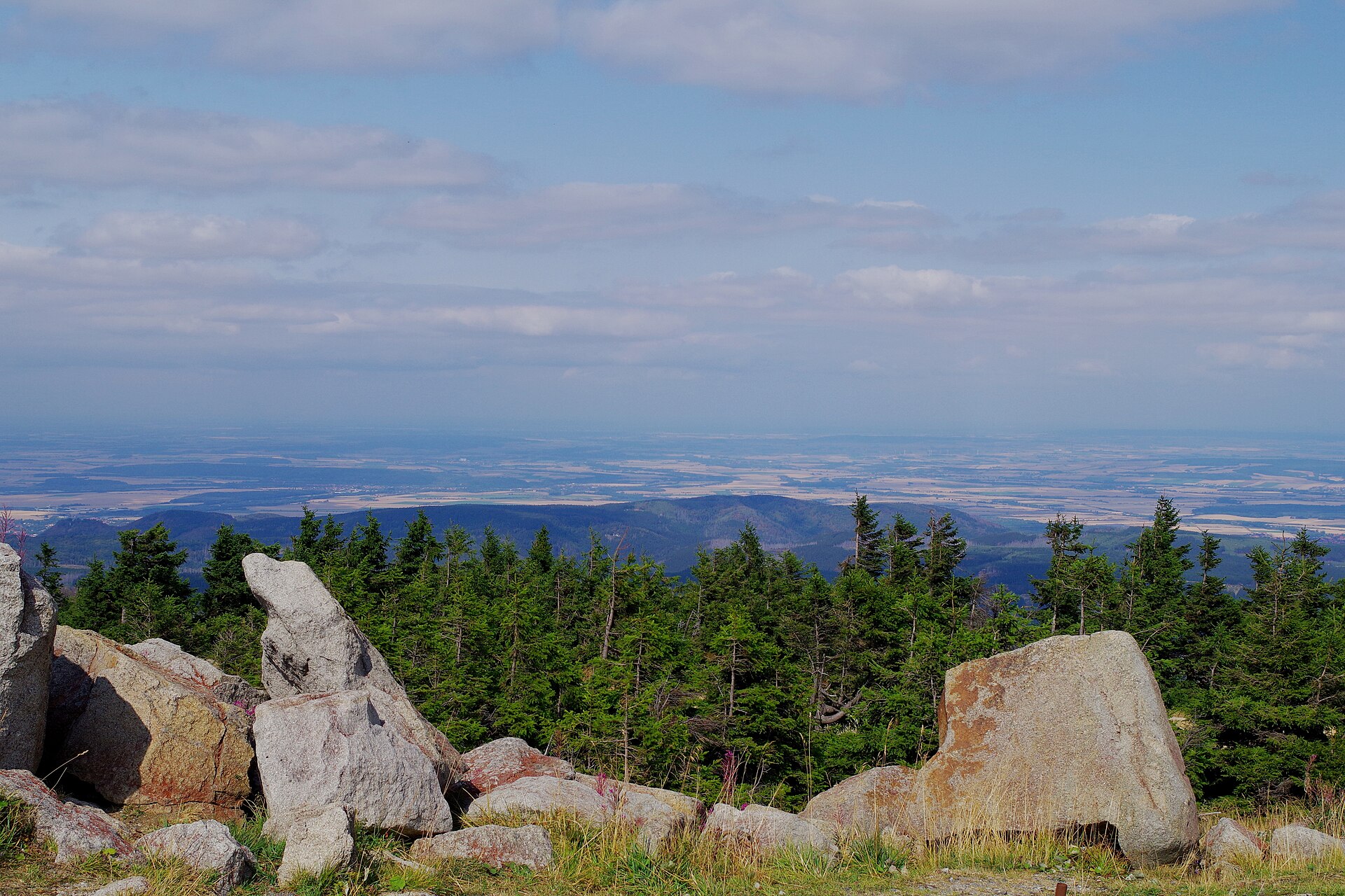
The route starts in Oberwiesenthal and climbs across the border toward Klínovec / Keilberg, the highest summit of the Ore Mountains. It then continues via Boží Dar / Gottesgab before returning toward the Fichtelberg side of the ridge. The route reaches the Kleiner Fichtelberg and Fichtelberg summit area before descending back to Oberwiesenthal. This is a compact cross-border highland circuit linking the two emblematic summits of the central Ore Mountains: Klínovec on the Czech side and Fichtelberg on the German side.
Why it is essential
The route represents the Ore Mountains particularly well: a settled border highland, broad open summits, forest and meadow paths, winter-sports infrastructure, and historic German-Czech place names. It also links the two highest mountains of the range in a feasible day hike.
Equipment
Standard to mountain hiking equipment: sturdy walking shoes, weatherproof layer, warm layer, water, food, navigation, sun protection. In winter, snow traction, poles and local avalanche/weather information may be necessary depending on conditions.
Hazards and notes
The route crosses an international border, although normal Schengen conditions usually apply. Weather can change quickly on the plateau. In poor visibility, navigation can be harder on the broad highland terrain. Winter variants may overlap ski areas and winter trails; check local route status.
GPX / KML links
| Source | URL | Format | Notes |
|---|---|---|---|
| Bergfex route: Oberwiesenthal, Keilberg, Bozi Dar, Fichtelberg | bergfex.com | GPX, KML | No clear route-file licence found in parsed page. Route file available. Replace later with own GPX. |
| Komoot route from Boží Dar to Fichtelberg | komoot.com | GPX download after sign-in | Komoot terms apply. Secondary route source. Replace later with own GPX. |
Further reading
- Bergfex — Oberwiesenthal, Keilberg, Bozi Dar, Fichtelberg
- Bergfex German route page
- Komoot — Boží Dar to Fichtelberg
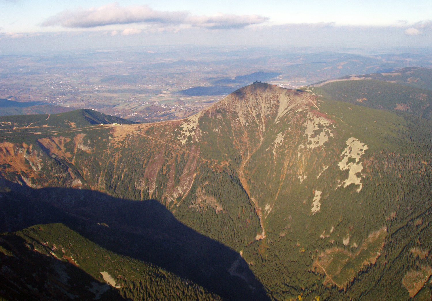
4. Sněžka via Obří důl from Pec pod Sněžkou
Snapshot
Itinerary
The classic ascent starts in Pec pod Sněžkou and enters Obří důl, the glacial valley below Sněžka. The route follows the valley upward past historic mining features and the water-supply works before climbing above the forest to Obří sedlo on the Czech-Polish border. From the saddle, the final summit path climbs steeply to Sněžka. The descent varies by source and chosen conditions. Common options include returning toward Pec by Růžová hora, using the cable car for part of the descent, or making a longer circuit via Luční bouda and the Úpská rašelina bog area. Distance therefore varies substantially between published route descriptions.
Why it is essential
Sněžka is the highest mountain in Czechia and the symbolic summit of Krkonoše. The Obří důl approach is one of the classic routes because it climbs through the range’s most dramatic glacial valley before reaching the open border ridge and summit.
Equipment
Mountain hiking equipment: sturdy boots, windproof/waterproof layer, warm layer, navigation, water and food. Outside high summer, traction devices and poles may be needed. In winter, the route can become serious and may require winter mountain equipment and local advice.
Hazards and notes
The upper route is exposed to wind, ice and poor visibility. Krkonoše tourism warns that the upper sections are often icy in winter, and Outdooractive/KOMPASS notes winter closure of the Obří důl route because of avalanche danger. In summer, summit crowding is common. National-park rules require walkers to stay on authorised paths.
GPX / KML links
| Source | URL | Format | Notes |
|---|---|---|---|
| Krkonoše official tourism route page | krkonose.eu | Official source page with GPX download | Route-file licence not clearly stated in parsed source. GPX available. Replace later with own GPX. Confirm downloaded file matches intended summer walking variant. |
| Outdooractive / KOMPASS route via Obří důl | outdooractive.cz | GPS data appears tied to premium access | Outdooractive/KOMPASS terms apply. Secondary route reference. Replace later with own GPX. |
Further reading
- Krkonoše official tourism — From Pec pod Sněžkou to Sněžka
- Outdooractive/KOMPASS — Sněžka přes údolí Obří důl
- VisitCzechia — Past Obří důl to Mount Sněžka
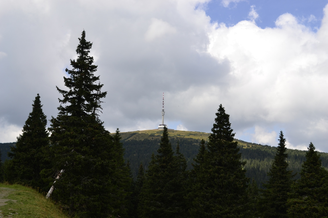
5. Praděd through the Bílá Opava Valley
Snapshot
Itinerary
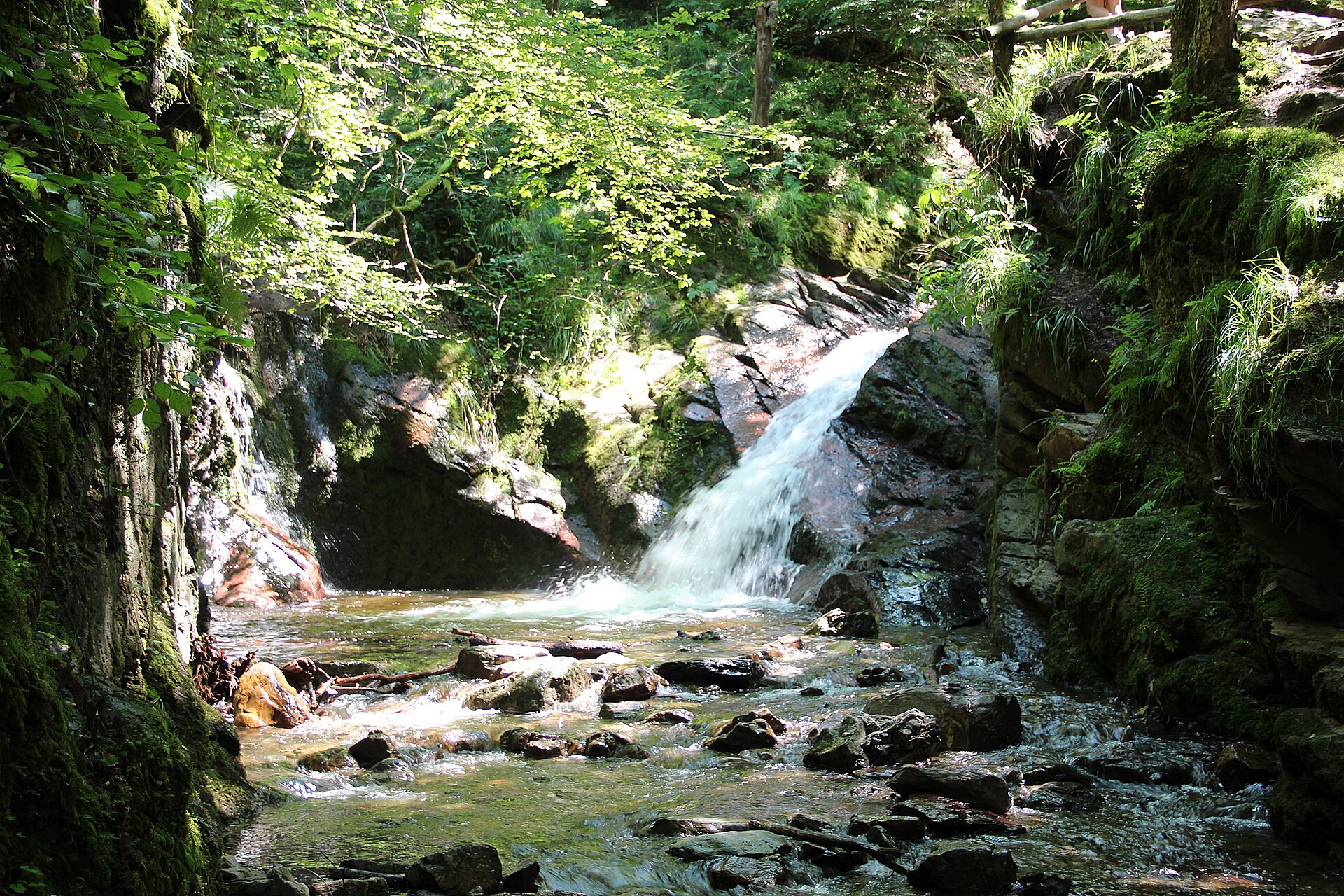
The route starts in Karlova Studánka and enters the Bílá Opava Valley. It follows the nature-trail corridor beside cascades, waterfalls and gneiss canyon scenery. At Na Paloučku, the route splits between a harder yellow route closer to the waterfalls and an easier blue route. The harder option is best used uphill. Above the waterfalls, the route continues toward Barborka and then follows the road section toward Praděd. The summit is the highest point of Hrubý Jeseník and is marked by the television tower and observation facilities. For the return, the official description adjusts the route via Ovčárna and uses the easier blue trail down rather than descending the hardest waterfall section.
Why it is essential
This hike combines two of the most recognisable Jeseníky features in one day: the Bílá Opava waterfall gorge and Praděd, the highest summit of the range. It is more varied than the simple road approach from Ovčárna and gives a strong sense of the range’s forest, gorge and high-summit character.
Equipment
Mountain hiking equipment: sturdy boots with good grip, waterproof layer, warm layer, food and water, navigation, and trekking poles if comfortable on steep ground. In wet or cold conditions, extra caution is needed on ladders, rocks, roots and footbridges.
Hazards and notes
The harder waterfall trail includes slippery rocks, narrow paths, ladders, footbridges and cliff-side sections. The official route page strongly discourages descending the yellow waterfall trail and recommends the blue trail for the return. The route is within protected natural areas; staying on approved tourist signs is required. Weather should be checked before departure.
GPX / KML links
| Source | URL | Format | Notes |
|---|---|---|---|
| Hrubý Jeseník official-style route page | hrubyjesenik.cz | Source-map route; no GPX visible in parsed page | No GPX visible in parsed source. Use as official route/stat source. Replace later with own GPX. |
| Outdooractive route to Praděd via Bílá Opava | outdooractive.com | GPX, KML, FIT controls | Outdooractive terms apply. Route file available through platform. Replace later with own GPX. |
Further reading
- HrubýJeseník.cz — To Praděd through the Bílá Opava Valley
- Outdooractive — Hiking in the Jeseníky Mountains to reach the peak of Praděd
Further reading
| Source | URL |
|---|---|
| Harz National Park — The Goethe Trail to the Brocken Summit PDF | nationalpark-harz.de |
| Braunlage / Harz tourism — Routes to the Brocken – Goetheweg | braunlage.de |
| Outdooractive — From Torfhaus via the Goetheweg to the Brocken | outdooractive.com |
| Bavarian Forest National Park / Destination One — Lusen summit | pages.destination.one |
| Outdooractive — To Lusen via Teufelsloch and Himmelsleiter | outdooractive.com |
| Bergfex — Oberwiesenthal, Keilberg, Bozi Dar, Fichtelberg, Oberwiesental | bergfex.com |
| Krkonoše official tourism — From Pec pod Sněžkou to Sněžka | krkonose.eu |
| Outdooractive/KOMPASS — Sněžka přes údolí Obří důl | outdooractive.cz |
| VisitCzechia — Past Obří důl to Mount Sněžka | visitczechia.com |
| HrubýJeseník.cz — To Praděd through the Bílá Opava Valley | hrubyjesenik.cz |
| Outdooractive — Hiking in the Jeseníky Mountains to reach the peak of Praděd | outdooractive.com |