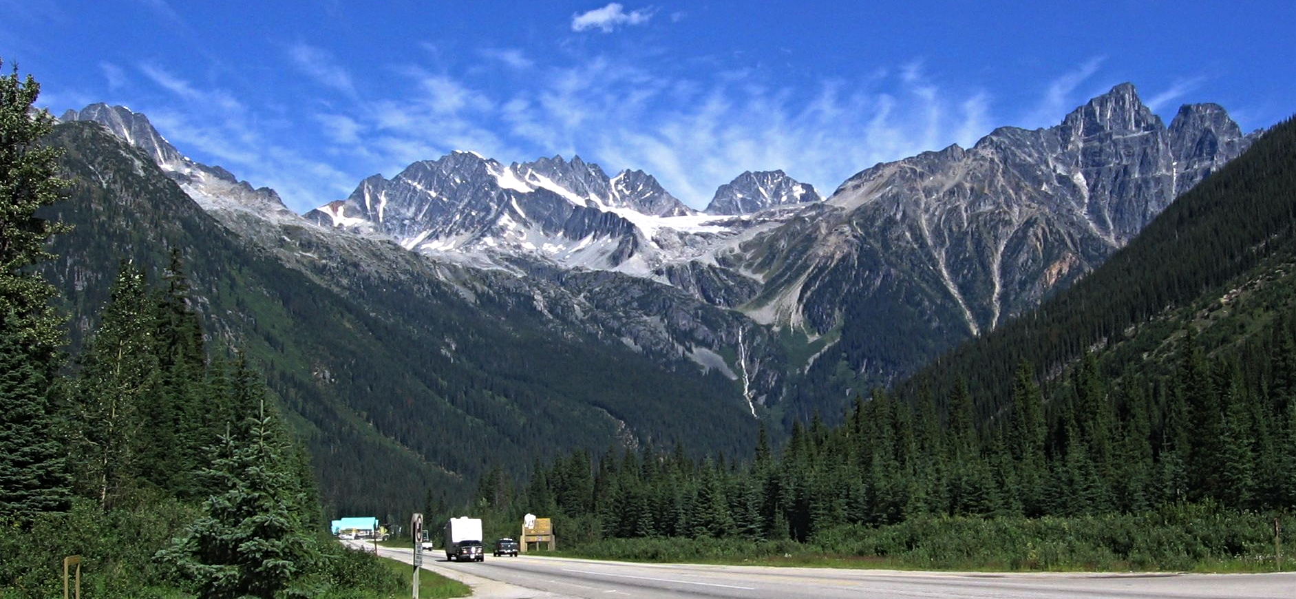
Regional overview
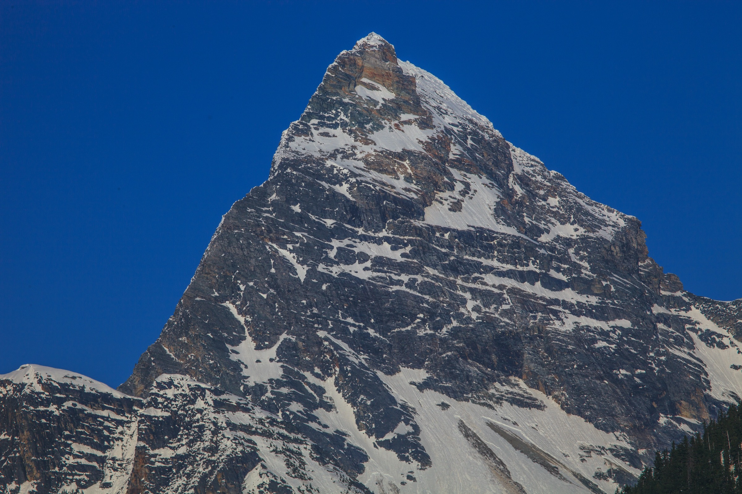
Rogers Pass sits at 1,330 m on the Trans-Canada Highway in the heart of the northern Selkirk Mountains, inside Glacier National Park of Canada in British Columbia. The terrain is steep, glaciated and wet: warm Pacific air dumps roughly 14 m of snow at the pass each winter and feeds dense interior temperate rainforest of western redcedar and western hemlock at valley bottoms, transitioning sharply through Engelmann spruce and subalpine fir into open alpine meadows and tundra above about 1,900 m. Mount Sir Donald (3,284 m) — the “Matterhorn of the Selkirks” — anchors a skyline that also includes the Hermit Range, the Asulkan and Illecillewaet glaciers, and the Bonney–Dawson icefield.
Almost every classic day-hike radiates from a very small corridor. The Illecillewaet day-use area and historic campground, on the site of the former Glacier House, sits 3.4 km off Highway 1 and serves four of the five routes below. The Balu Pass trailhead leaves the highway at the pass summit itself, less than 4 km away. From this compact base a fit walker can reach five very different essential landscapes — glacier terminus, glaciated arête, alpine ridge, bear-country pass, and high-meadow viewpoint — in successive days without ever moving the vehicle more than a few kilometres.
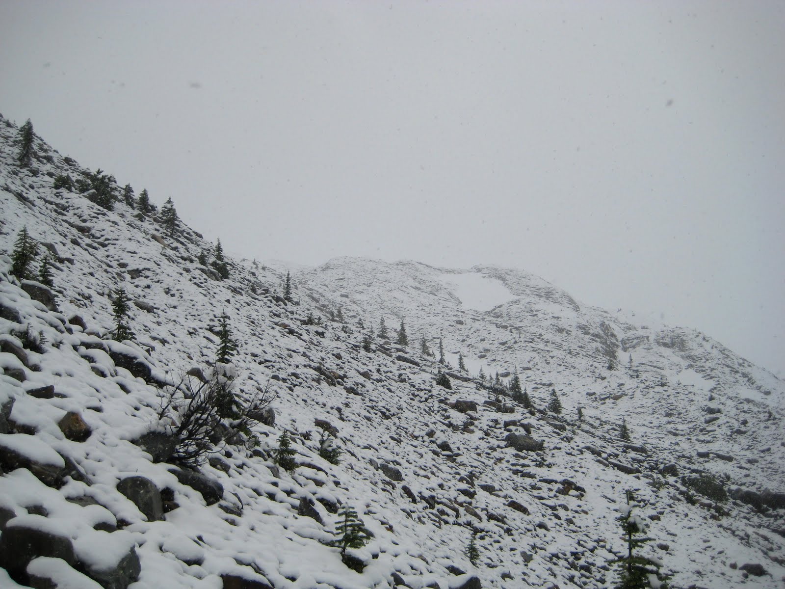
The hiking season is short and intense. Frontcountry trails generally open from mid-June, but the upper alpine traverses (Abbott Ridge, Glacier Crest, the head of the Asulkan Valley) usually only become reliably snow-free between mid-July and mid-September, and seasonal footbridges over Asulkan Brook and the Illecillewaet River are removed in late September. Avalanche-path runout, lingering steep snowfields above 2,000 m, swollen creeks, sudden Pacific weather and very active grizzly habitat are routine hazards; the park enforces a mandatory minimum group size of four on Balu Pass between 15 July and 30 September because of grizzly density. The Winter Permit System governs ski touring November–April but does not affect summer day-hiking. As of June 2026, Parks Canada’s published trail-conditions bulletin lists no caribou-recovery closures on any of the standard frontcountry day-hikes; caribou-related closures in the park are typically remote backcountry zones, and visitors should still check current bulletins before each trip.
Access is essentially highway-only. Trans-Canada Highway 1 runs through the park and serves every trailhead; the nearest service towns are Revelstoke (72 km west) and Golden (80 km east). There is no scheduled public transport to Rogers Pass — most BC inter-city bus services on Highway 1 ceased after 2018 — so private vehicle, organised shuttle from Revelstoke or Golden, or taxi is the practical option. A Parks Canada day pass is required to stop at trailheads.
Selection rationale
The five entries below cover the recognised “essential” frontcountry day-hikes named by Parks Canada and corroborated by every major regional guidebook (Kane, Daffern, Copeland), Tourism Revelstoke and the Alpine Club of Canada. They were chosen for variety: the historic Asulkan Valley climb to the Alpine Club cabin in the heart of the icefield amphitheatre; Abbott Ridge for the iconic alpine tundra viewpoint of Mount Sir Donald; Glacier Crest for the only arête route sandwiched between two named glaciers; Avalanche Crest for the short, steep meadow-and-ridge climb overlooking the Rogers Pass railway corridor; and Balu Pass for a true Selkirk pass crossing through the densest grizzly habitat in the southern Columbia Mountains. Perley Rock and the Hermit Trail were strong alternates but were dropped to avoid five near-identical “steep climb from Illecillewaet” routes.
Summary table
| # | Hike | Country | Route type | Distance | Gain | Max elevation | Difficulty |
|---|---|---|---|---|---|---|---|
| 1 | Asulkan Valley (to Asulkan Cabin) | Canada | Out-and-back | 13–16 km | 870 m | 2,100 m | Strenuous |
| 2 | Abbott Ridge | Canada | Out-and-back | 13–16 km | 1,030 m | 2,365 m | Strenuous |
| 3 | Glacier Crest | Canada | Out-and-back | 11–13 km | 960–1,005 m | 2,300 m | Strenuous |
| 4 | Avalanche Crest | Canada | Out-and-back | 10.2 km | 795 m | 2,070 m | Strenuous |
| 5 | Balu Pass | Canada | Out-and-back | 12.8 km | 780 m | 2,100 m | Moderate–Strenuous |
1. Asulkan Valley (to Asulkan Cabin)
Snapshot
Itinerary
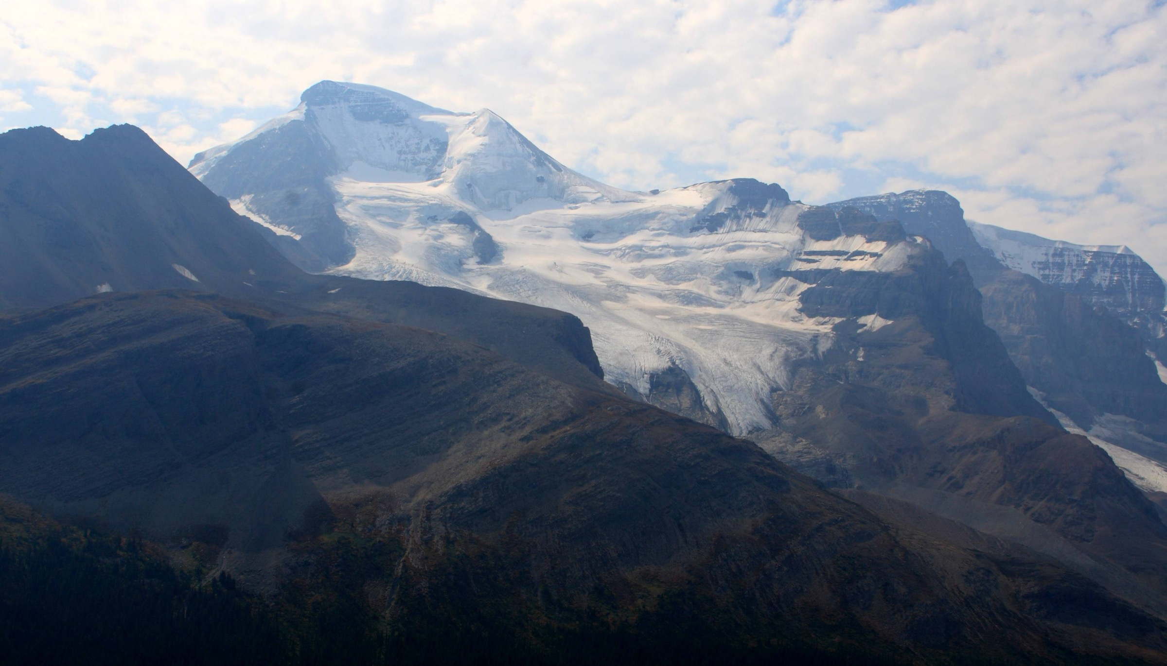
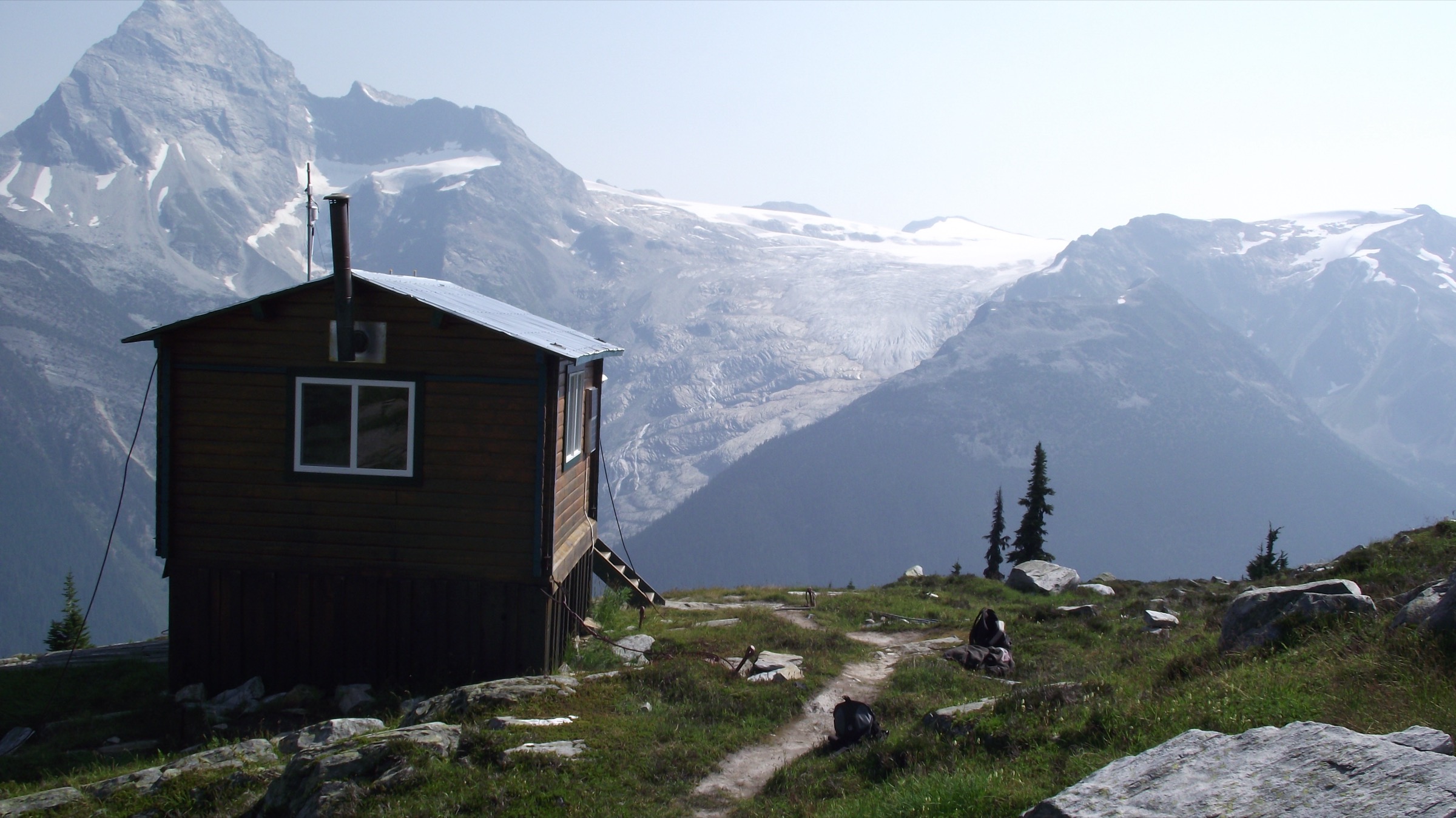
From the Illecillewaet day-use area the trail crosses the Illecillewaet River on a seasonal bridge and follows the south bank westward, briefly sharing tread with the Meeting of the Waters and Glacier Crest paths before forking south up the Asulkan Brook valley. The first 4 km roll gently through old-growth interior rainforest with frequent waterfall views off the valley walls. After the second footbridge the gradient stiffens and the trail breaks out of forest into avalanche-path meadows below Mount Abbott and the Rampart Ridge. The middle section traverses open slopes with views back to Mount Sir Donald and ahead to the seracs of the Asulkan Glacier. The final 1.5–2 km — known locally as the Mousetrap — climbs a steep lateral moraine on loose, rocky tread, gaining roughly 300 m to the Asulkan Cabin perched on the col below Young Peak. The cabin is privately operated by the Alpine Club of Canada and is not open to day visitors, but the col itself offers a 360-degree view over the Asulkan icefield, Mount Jupiter, Sapphire Col and the Dawson Range. Return is by the same route.
Why it is essential
The Asulkan Valley is the historic centrepiece of Canadian alpinism: Glacier House (1886–1925), at the trail’s foot, was the cradle of mountaineering in North America. The hike compresses every Selkirk landscape — temperate rainforest, waterfalls, avalanche meadows, lateral moraine and glaciated cirque — into a single day, and is consistently listed as one of the park’s three signature day-hikes by both Parks Canada and the Alpine Club of Canada.
Equipment
Standard mountain hiking equipment; sturdy boots; trekking poles strongly recommended for the Mousetrap descent; bear spray (mandatory practice in this valley); microspikes useful in early season for the upper moraine snow tongue.
Hazards and notes
Active grizzly habitat — make noise and carry bear spray. The Mousetrap is exposed to rockfall from the moraine wall above; helmets are sometimes recommended in early season. Several creek crossings depend on seasonal bridges that Parks Canada removes in late September. Steep snow can linger on the moraine well into July. The Asulkan Cabin is closed to non-booked visitors. Dogs permitted on-leash. No caribou closure currently in effect on this trail (June 2026 Parks Canada bulletin).
GPX / KML links
| Source | URL |
|---|---|
| OpenStreetMap (Asulkan Valley Trail) | openstreetmap.org |
| Trailforks: Asulkan Valley Trail | trailforks.com |
| Parks Canada — Day hikes, Glacier National Park | parks.canada.ca |
2. Abbott Ridge
Snapshot
Itinerary
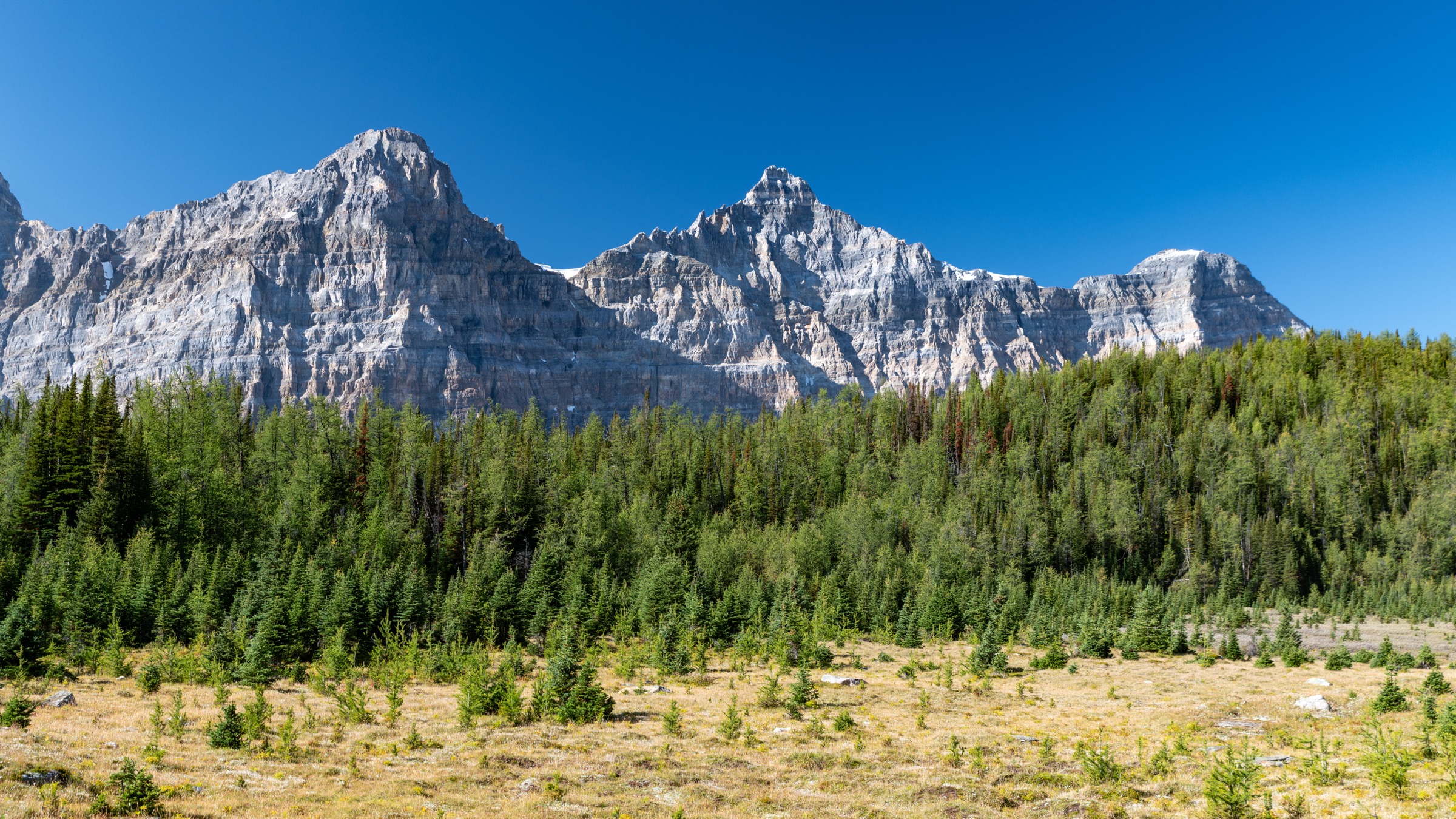
The trail leaves the Illecillewaet trailhead and climbs immediately and steeply north through closed subalpine forest, switchbacking up the flank of Mount Abbott. After roughly 2.2 km and 425 m of gain it reaches Marion Lake, a small tarn at about 1,700 m that serves as the obvious rest point. Above the lake the path continues to switchback through dwarf-fir krummholz, breaks treeline near 2,100 m, and emerges onto open alpine tundra dotted with arnica, mountain heather and Indian paintbrush. The upper section follows the broadening south shoulder of Abbott Ridge, passing the official Parks Canada cairn at the trail’s end. From here, panoramic views open across the Illecillewaet valley to Mount Sir Donald, Eagle Peak, Uto Peak and the Vaux glacier system, with Rogers Pass and the Hermit Range visible to the north. Strong parties sometimes continue a short distance further along the ridge crest toward the foot of Mount Abbott itself; beyond the official cairn the terrain becomes scrambling and is not maintained. Return is by the same route.
Why it is essential
Abbott Ridge offers what most guidebooks call the finest alpine tundra viewpoint accessible from Rogers Pass without mountaineering kit. The Mount Sir Donald aspect — the “Matterhorn of the Selkirks” — seen from the upper ridge is the single most photographed mountain view in the park and one of the iconic skylines of the Columbia Mountains.
Equipment
Mountain hiking equipment; sturdy boots; trekking poles for the descent; extra warm and weatherproof layers (the ridge is exposed and Pacific fronts arrive fast); plenty of water (none reliable above Marion Lake); bear spray; microspikes useful early or late season.
Hazards and notes
Very steep, sustained climb with limited shade on the lower switchbacks. The upper ridge is fully exposed to lightning and Pacific weather fronts that arrive with little warning. Snow patches frequently persist on the upper switchbacks into early August. Marion Lake and the upper meadows are bear habitat. Dogs permitted on-leash. No caribou closure currently in effect (June 2026).
GPX / KML links
| Source | URL |
|---|---|
| OpenStreetMap (Abbott Ridge Trail) | openstreetmap.org |
| The Mountaineers: Abbott Ridge | mountaineers.org |
| Parks Canada — Day hikes, Glacier National Park | parks.canada.ca |
3. Glacier Crest
Snapshot
Itinerary
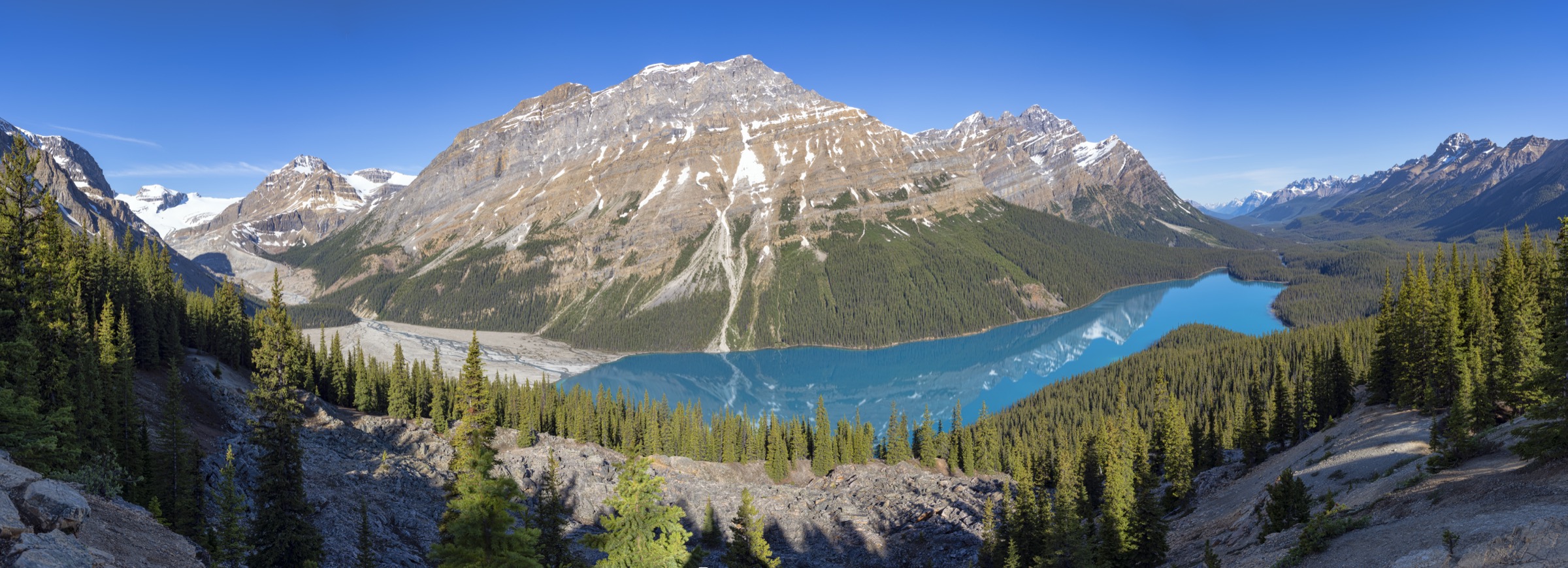
From the Illecillewaet trailhead the route shares tread with the Asulkan Valley path for the first 1.2 km, crosses Asulkan Brook, then forks left (south-east) at a signed junction and climbs steadily through dense subalpine forest on a well-built but relentless switchback ladder. Treeline is reached at roughly 1,950 m, after which the route follows a defined boot-beaten path up an increasingly narrow rock ridge — the eponymous Glacier Crest — a glacially carved arête sandwiched between the Illecillewaet Glacier to the east and the Asulkan Glacier to the west. The final 200 m of gain are on loose blocky rock with steep drop-offs on both flanks; a fall line on either side leads onto glacier ice and is unforgiving. The crest itself is a broad, knife-edged platform with arguably the most dramatic close-glacier panorama in the park: the Illecillewaet Névé, Lookout Mountain, the Asulkan icefield and Mount Sir Donald all in a single sightline. Return is by the same route; the descent on loose rock demands care.
Why it is essential
Glacier Crest is the only Rogers Pass day-hike that places the walker directly between two named glaciers on a glacially sculpted arête. Parks Canada describes it as the park’s “arête ridge between two glacier valleys” and it is universally cited alongside Abbott Ridge and Asulkan as the trio that defines the Rogers Pass hiking experience.
Equipment
Mountain hiking equipment; sturdy boots with good edging; trekking poles for the descent; bear spray; extra warm and windproof layers (the arête is fully exposed); a helmet is occasionally suggested for rockfall on the upper ridge.
Hazards and notes
The upper ridge is steep, loose and exposed; a slip toward the Asulkan side leads onto glacier ice. Strong winds are common. Snow patches on the upper ridge can persist into August and significantly increase the seriousness. Lightning exposure is severe. Bear habitat throughout the lower forest. Dogs permitted on-leash. No caribou closure currently in effect (June 2026).
GPX / KML links
| Source | URL |
|---|---|
| OpenStreetMap (Glacier Crest Trail) | openstreetmap.org |
| Trailforks: Glacier Crest Trail | trailforks.com |
| SummitPost: Glacier Crest | summitpost.org |
4. Avalanche Crest
Snapshot
Itinerary
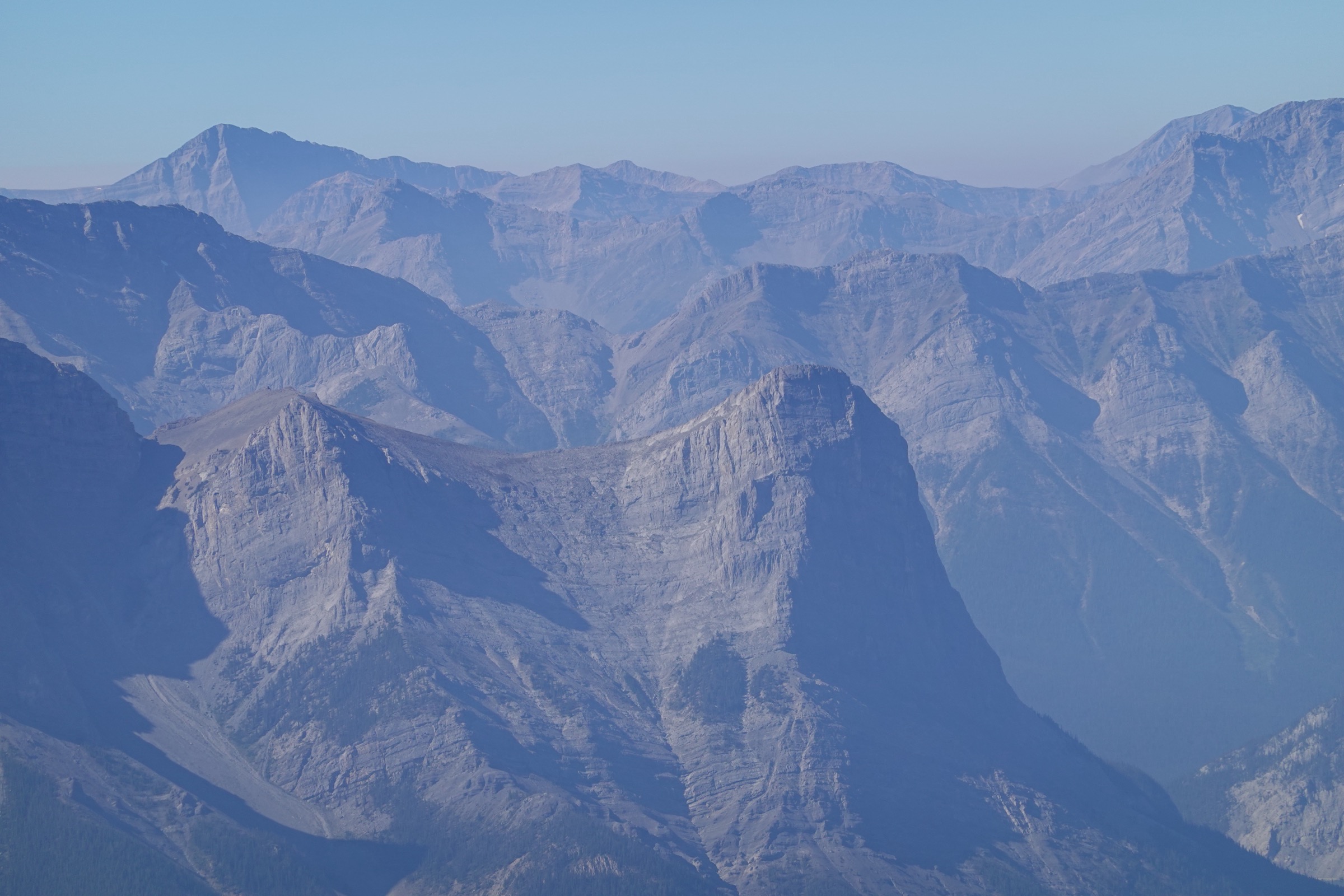
The trail leaves the Illecillewaet area on a wide, gentle approach for the first kilometre before turning hard uphill north toward the Avalanche Mountain–Eagle Peak ridge. The middle section climbs steeply through old-growth cedar and hemlock, then through a dramatic series of avalanche paths choked with slide alder and wildflowers in summer. Above approximately 1,800 m the angle eases, the forest opens, and the trail reaches a broad alpine bench below the crest itself. The official viewpoint is marked by a Parks Canada cairn on the open ridge at roughly 2,050–2,070 m, with the Rogers Pass village, Hermit Range, Mount Tupper, Mount Macdonald and the Illecillewaet valley laid out below. Continuing beyond the cairn toward Avalanche Mountain proper enters scrambling and exposed glaciated terrain and is not part of the marked day-hike. Return is by the same route.
Why it is essential
Avalanche Crest gives the most direct overhead view of the Rogers Pass village and the historic railway corridor — the site of the catastrophic 1910 Rogers Pass avalanche, which killed 58 workers and led to the construction of the Connaught Tunnel — and is widely cited by Parks Canada as “one of the best scenic trails in the park”. It complements the Asulkan-side hikes by looking north over the Hermit Range rather than south at the Illecillewaet icefield.
Equipment
Mountain hiking equipment; sturdy boots; trekking poles; bear spray; weatherproof layer (the upper ridge is fully exposed); microspikes useful in early season for steep snowfield crossings on the upper trail.
Hazards and notes
The trail crosses major avalanche paths — in early season these can hold steep, hard snow that has caused serious accidents. Lightning exposure on the upper ridge is significant. Dense bear habitat through the lower section. Do not continue past the official cairn toward Avalanche Mountain without mountaineering equipment and experience. Dogs permitted on-leash. No caribou closure currently in effect (June 2026).
GPX / KML links
| Source | URL |
|---|---|
| OpenStreetMap (Avalanche Crest Trail) | openstreetmap.org |
| Trailforks: Avalanche Crest Trail | trailforks.com |
| Parks Canada — Day hikes, Glacier National Park | parks.canada.ca |
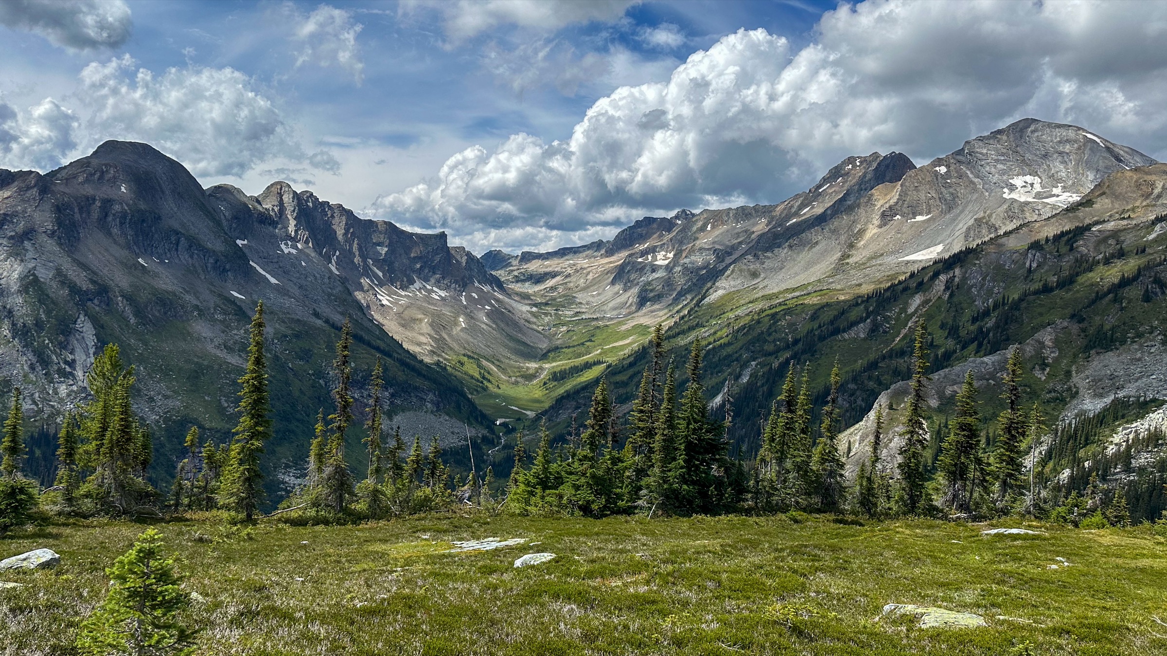
5. Balu Pass
Snapshot
Itinerary
The trail begins on the north side of the Trans-Canada Highway at Rogers Pass and follows Connaught Creek westward up a broad, U-shaped glacial valley. The first 3 km cross a series of major avalanche paths beneath the south face of Mount Cheops, alternating between regenerating forest and meadows of cow parsnip, lupine, valerian and hellebore — classic high-quality grizzly forage. The middle section climbs steadily on rock-stepped switchbacks through subalpine fir, with views opening to Ursus Major and Ursus Minor above. The upper kilometre breaks out into broad alpine tundra and reaches Balu Pass at roughly 2,100 m, a true pass between the Connaught and Cougar drainages, with a wide panorama over the Bonney Range to the south-west and the Hermit Range to the east. The route ends at the pass; the onward Cougar Valley descent leads into committed backcountry and is not part of the day-hike. Return is by the same route.
Why it is essential
Balu Pass is the prototypical Selkirk pass hike — gentle valley gradient, dramatic avalanche-path meadows, and a genuine pass crossing into a wilder drainage. Its name derives from the Hindi baloo (bear), and the route is recognised by Parks Canada as among the densest grizzly habitat anywhere in the southern Columbia Mountains. Parks Canada makes group hiking mandatory here in summer, which itself reflects how representative the trail is of Selkirk wildlife character.
Equipment
Mountain hiking equipment; sturdy boots; bear spray (mandatory practice); audible group noise; trekking poles; warm and weatherproof layers for the pass. No dogs permitted.
Hazards and notes
Mandatory minimum group size of four adults between 15 July and 30 September; at times Parks Canada raises this to six. No dogs allowed at any time. The trail closes intermittently when grizzlies are radio-collared in the immediate corridor — always check the current Parks Canada bulletin before departure. Avalanche-path runout is a real concern in spring; in late summer the same paths are wildflower meadows but also concentrated bear feeding zones. Several creek crossings depend on seasonal bridge installation. No caribou closure currently in effect (June 2026).
GPX / KML links
| Source | URL |
|---|---|
| OpenStreetMap (Balu Pass Trail) | openstreetmap.org |
| Parks Canada — Balu Pass bulletin | parks.canada.ca |
| Tourism Revelstoke — Glacier National Park | seerevelstoke.com |
External links
| Source | URL |
|---|---|
| Parks Canada — Glacier National Park | parks.canada.ca |
| Parks Canada — Day hikes, Glacier National Park | parks.canada.ca |
| Parks Canada — Hiking landing | parks.canada.ca |
| Parks Canada — Trail conditions | parks.canada.ca |
| Parks Canada — High-country itineraries | parks.canada.ca |
| Parks Canada — Hours of operation | parks.canada.ca |
| Parks Canada — Getting here / directions | parks.canada.ca |
| Parks Canada — Caribou in Glacier National Park | parks.canada.ca |
| Parks Canada — Ski touring and Winter Permit System | parks.canada.ca |
| Parks Canada — Huts and cabins | parks.canada.ca |
| Parks Canada — Rogers Pass backcountry access app | pc.gc.ca |
| Parks Canada — Balu Pass bulletin | parks.canada.ca |
| Alpine Club of Canada — Asulkan Cabin | alpineclubofcanada.ca |
| Alpine Club of Canada — Sapphire Col Hut | alpineclubofcanada.ca |
| Tourism Revelstoke — Glacier National Park | seerevelstoke.com |
| Trailforks — Rogers Pass / Glacier National Park | trailforks.com |
| The Mountaineers — Abbott Ridge | mountaineers.org |
| SummitPost — Glacier Crest | summitpost.org |
| OpenStreetMap (trail geometry source) | openstreetmap.org |
| Wikipedia — Rogers Pass (British Columbia) | en.wikipedia.org |
| Wikipedia — 1910 Rogers Pass avalanche | en.wikipedia.org |
| Wikipedia — Glacier National Park (Canada) | en.wikipedia.org |
| Wikipedia — Illecillewaet Glacier | en.wikipedia.org |
| Wikimedia Commons — Selkirk Mountains category | commons.wikimedia.org |
| Wikimedia Commons — Mount Sir Donald category | commons.wikimedia.org |
| Wikimedia Commons — Rogers Pass category | commons.wikimedia.org |
| Wikimedia Commons — Illecillewaet Glacier category | commons.wikimedia.org |