Regional overview
Kananaskis Country (K-Country) is a 4,000+ km² mosaic of Alberta provincial parks, wildland areas and public-land recreation zones occupying the eastern slopes of the Canadian Rockies south of the Trans-Canada Highway. It stretches from the foothills above Calgary west to the Continental Divide and the boundary of Banff National Park, and south through Spray Valley Provincial Park, Peter Lougheed Provincial Park, the vast Elbow–Sheep Wildland and the Highwood watershed. The complex was created in 1977 as Alberta’s flagship provincial alternative to the federal mountain parks, intentionally absorbing higher-volume Calgary day-use traffic while preserving wilder backcountry to the south.
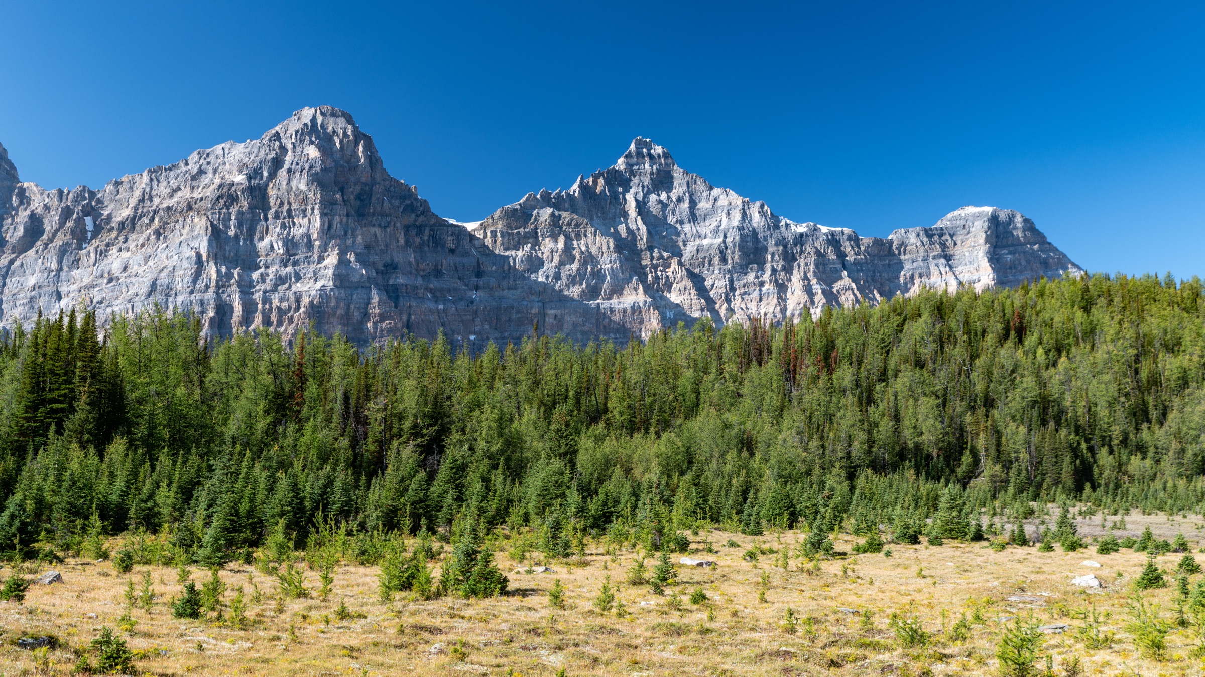
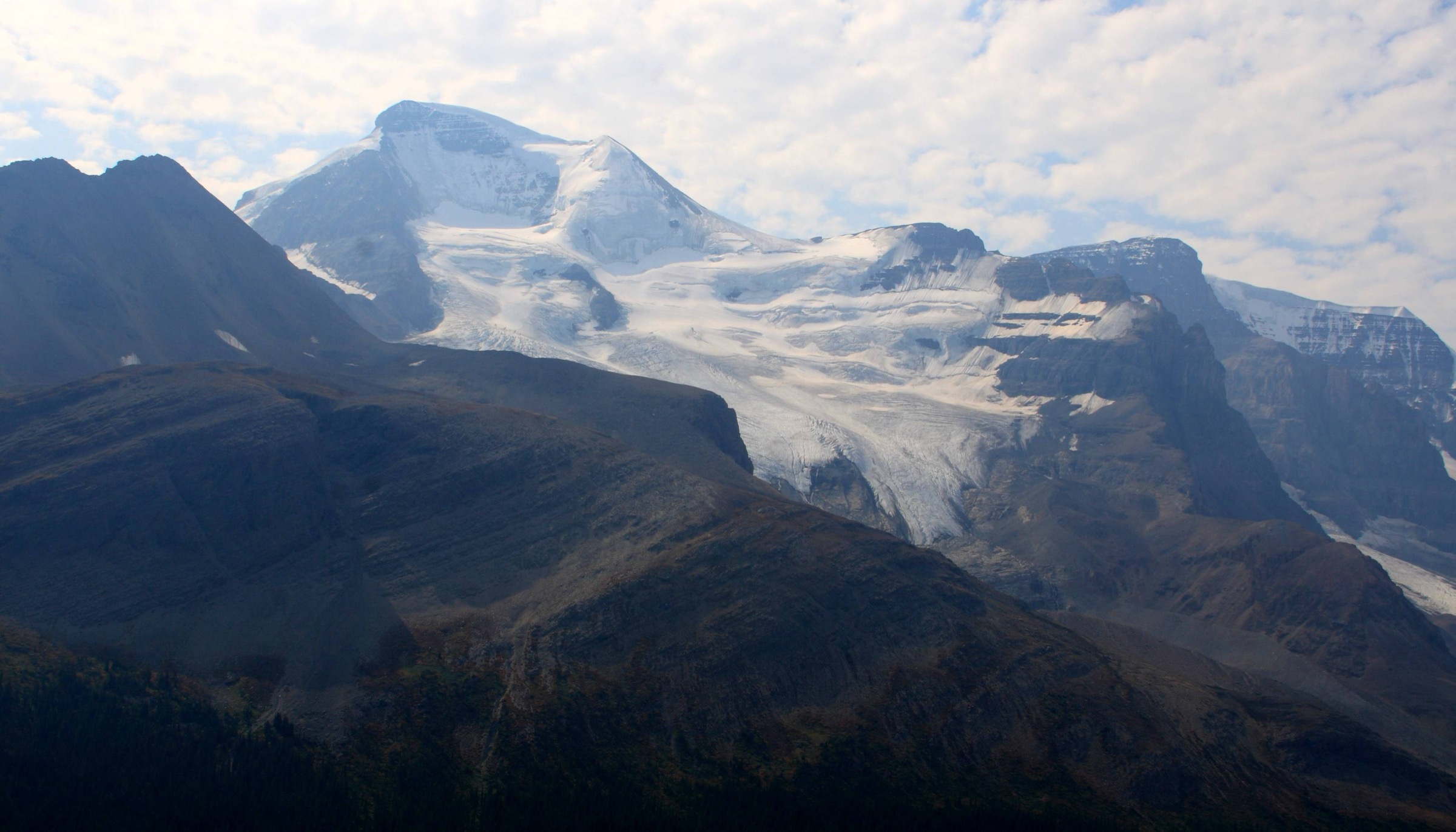
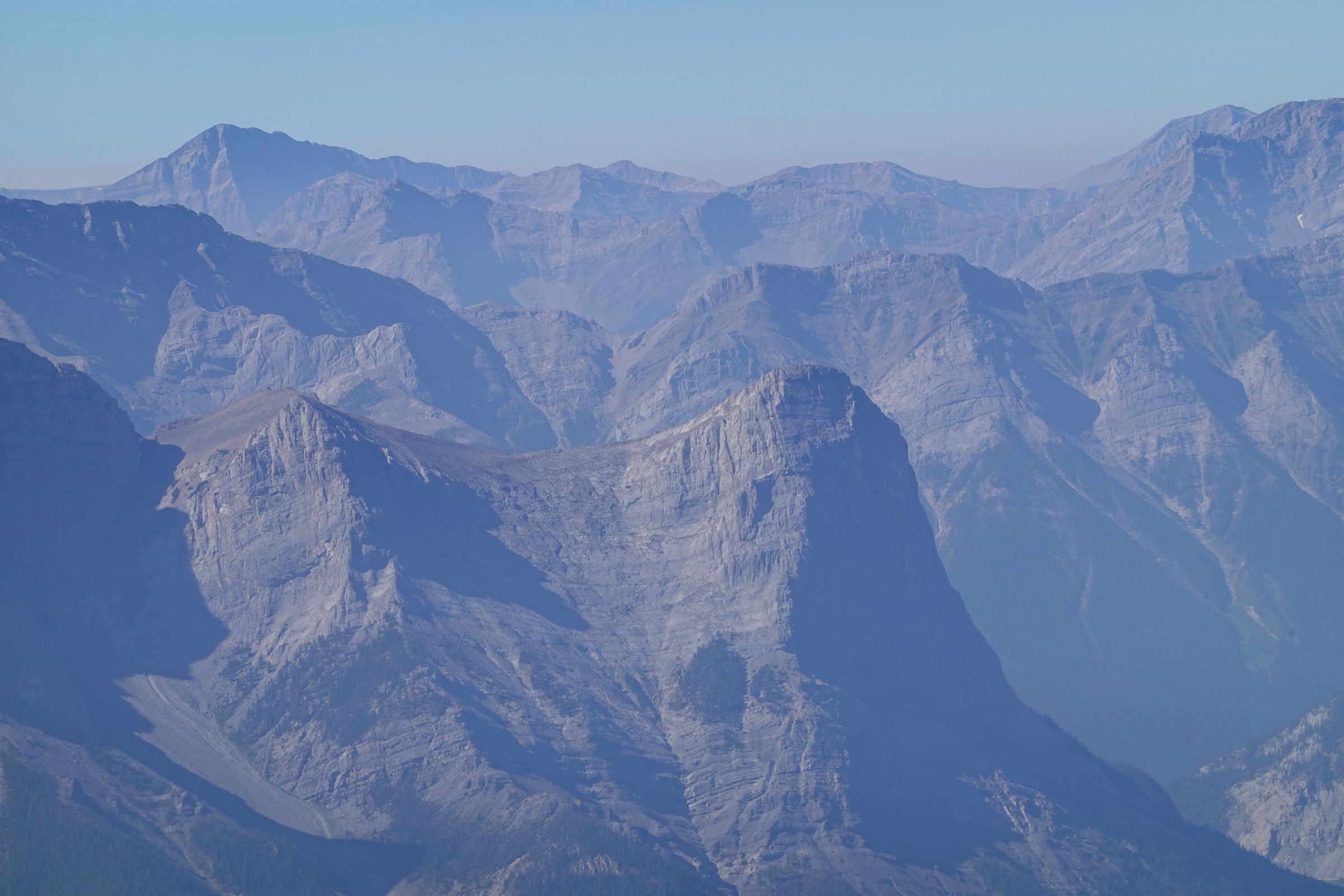
Terrain divides into two distinct belts. The Front Ranges — Mount Yamnuska (Mount John Laurie), Heart Mountain, the Three Sisters and the Canmore peaks (Ha Ling, EEOR) — are steep, dry, west-dipping limestone slabs cut by the McConnell Thrust, with quick access from Highway 1 and short approaches. Behind them, the Main Ranges around Spray Lakes, the Kananaskis Lakes and Highwood Pass present glaciated cirques, alpine larch basins and high tarns. Highwood Pass on Highway 40, at 2,206 m, is the highest paved road pass in Canada and gives walk-up access to true alpine terrain — but Highway 40 south of Kananaskis Lakes Trail closes annually from 1 December to 14 June for wildlife and snow management.
Two access realities shape every visit. First, the Kananaskis Conservation Pass (introduced 2021) is required for any vehicle parked on provincial-park or public-land sites inside the K-Country boundary; it is plate-registered, costs CAD 15 per day or CAD 90 per year (annual pass covers up to three vehicles at one address), and is enforced. The pass is not required in the Ghost, McLean Creek or Fisher Creek areas, in Canmore townsite, or for visitors arriving without a vehicle. Second, K-Country is grizzly country — at peak, biologists count more than sixteen grizzlies in the Kananaskis Valley alone. Trail-specific seasonal bear closures (Rawson Lake / Sarrail Ridge, Upper Kananaskis Lake Circuit, sections of the Highwood) are routine; check the Alberta Parks trail-report pages on the day you leave.
The hiking season runs from late June, when Highwood Pass opens, to mid-October, when the larches drop and the upper trails ice over. July and August are the most reliable months for high ridges; late September brings golden larch in the Highwood Pass cirques. Standard hazards are bear encounters, electrical storms on exposed ridges, loose scree on the Front Range scrambles, and rapid snow returns at and above 2,400 m.
Selection rationale
The five hikes below were chosen to span the geography (a Front Range chains-and-ledges classic, a Canmore staircase, a Spray Valley horseshoe traverse, a Highwood Pass interpretive alpine loop and a Peter Lougheed lake / ridge combo), the difficulty band (easy interpretive to demanding scramble-grade ridge), and the operational realities (one all-season trail, one open only after Highwood Pass clears, one with a recurring bear closure to plan around). Together they give a visitor a representative cross-section of K-Country without overlapping Banff National Park, Highway 1A foothill walks, or Canmore-municipal trails.
Summary table
| # | Hike | Country | Route type | Distance | Gain | Max elevation | Difficulty |
|---|---|---|---|---|---|---|---|
| 1 | Ha Ling Peak | Canada | Out-and-back | 7.8 km | 810 m | 2,407 m | Strenuous |
| 2 | Mount Yamnuska (chains traverse) | Canada | Loop | 10–11 km | 880–900 m | 2,240 m | Difficult |
| 3 | Tent Ridge Horseshoe | Canada | Loop | 10.6 km | 780 m | 2,545 m | Difficult |
| 4 | Ptarmigan Cirque Interpretive | Canada | Loop | 4.5 km | 210 m | 2,400 m | Easy–moderate |
| 5 | Rawson Lake + Sarrail Ridge | Canada | Out-and-back | 7.8 km / 11.3–12 km | 300 m / 670 m | 2,560 m | Easy to lake; strenuous to ridge |
1. Ha Ling Peak
Snapshot
Itinerary
The trail leaves the Ha Ling / Goat Creek parking area on Highway 742, crosses Goat Creek on the footbridge and climbs through dense subalpine spruce-fir on the rebuilt 2018–2019 staircased trail. The first 3 km gain steadily by switchbacks under the east face of Ha Ling, emerging from trees as the angle eases. At about 3.5 km the trail reaches the broad scree saddle between Ha Ling Peak (north) and Miner’s Peak (south), where Alberta Parks signage marks the end of the maintained route. The final 400 m turns north, climbing loose rubble and slabs along the ridge edge to the summit cairn at 2,407 m. Views drop almost vertically down the famously sheer northwest face into Canmore and the Bow Valley; the Three Sisters, Mount Lawrence Grassi and the Spray Lakes Reservoir are all visible. Descent retraces the ascent — the upper scree is the trickiest section and where most ankle injuries occur.
Why it is essential
The shortest summit-style hike in K-Country with a true alpine 2,400 m top, and the most iconic skyline mountain seen from Canmore. The cliff drop on the summit ridge is one of the most photographed mountain vistas in the Bow Valley.
Equipment
- Sturdy boots with grippy soles (scree on descent)
- Trekking poles strongly recommended
- Wind shell
- 2 L water
- Sun protection — the upper face is unshaded and high-UV
- Bear spray
- Helmet sensible on busy weekends for the upper rubble section
Hazards and notes
The final 400 m is loose rock; rockfall onto and from other parties is the main risk. The peak catches afternoon thunderstorms; turn around early if cells build. Bow Valley Wildland is grizzly habitat — carry bear spray. As of June 2026 Alberta Parks reports the Special K Trail (an alternate access) is closed due to collapsing bridges; vehicle access is from the south via Highway 742. Kananaskis Conservation Pass required for parking.
GPX / KML links
| Source | URL | Format | Notes |
|---|---|---|---|
| OpenStreetMap | openstreetmap.org | OSM data (export GPX) | ODbL 1.0; reusable with attribution |
| Alberta Parks trail report | albertaparks.ca | Source page | HTML descriptive; no GPX |
| Trailforks — Ha Ling Trail | trailforks.com | GPX (account) | Trailforks ToS |
Sources
- Alberta Parks — Ha Ling trail report
- Trailforks — Ha Ling Trail (Bow Valley Wildland PP)
- 10Adventures — Ha Ling Peak hike
- Wikipedia — Ha Ling Peak
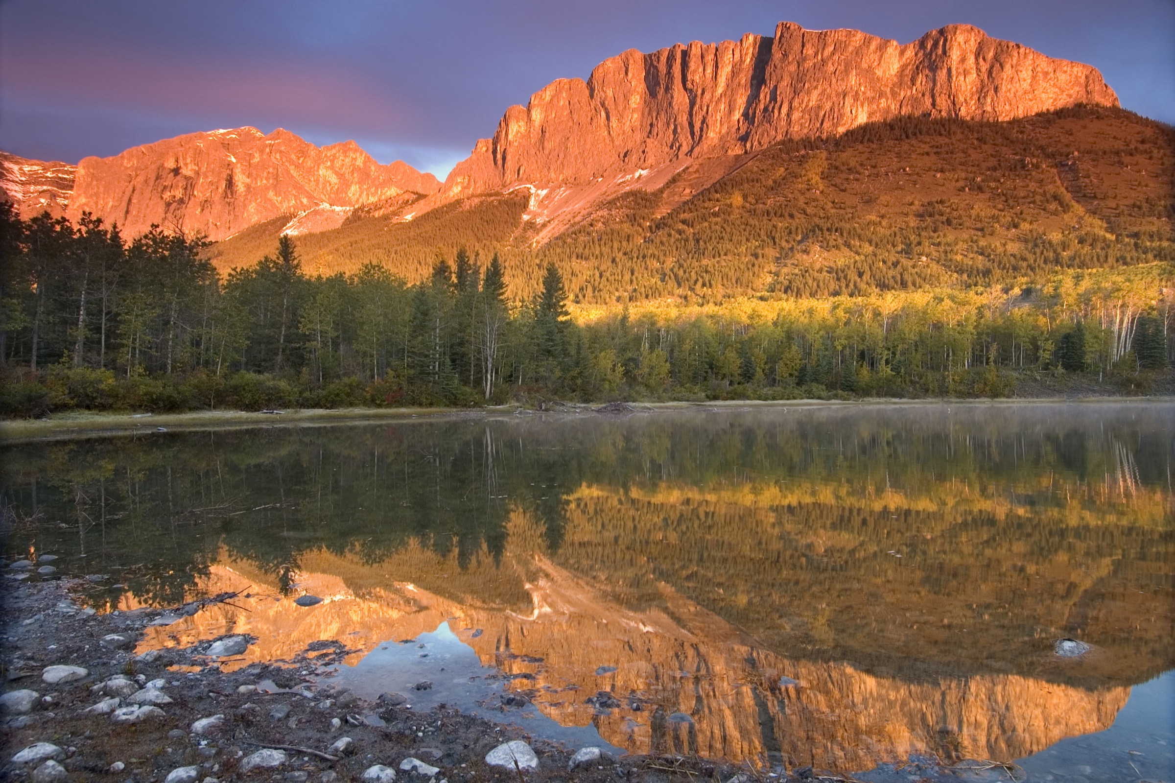
2. Mount Yamnuska (Mount John Laurie / Îyâmnathka)
Snapshot
Itinerary
From the Yamnuska parking lot the trail climbs through aspen and pine forest to the col below Raven’s End at roughly 1,750 m, then traverses west along the base of the south face. The route to the East End of the cliff (Raven’s End viewpoint) is straightforward; the summit route continues along a narrowing ledge system to the chimney — a short steep step — and onto the chains section, a 30 m exposed ledge equipped with fixed chains where a slip falls a long way. Beyond the chains the trail breaks onto the summit dome and reaches the cairn at 2,240 m, on the very last summit of the Front Ranges before the prairie. The standard descent loops west and drops the West Col, a steep scree run that returns to the approach trail below Raven’s End — avoiding a reverse of the chains.
Why it is essential
Yamnuska is the iconic Front Range mountain seen from the Trans-Canada — the abrupt limestone wall that announces the Rockies for everyone driving west from Calgary. It is the only K-Country standard day-hike that combines fixed-chain protection with an objective summit at 2,240 m and ends with a scree-run descent.
Equipment
- Sturdy boots
- Helmet recommended for the chains and chimney
- Gloves for the chains
- Trekking poles for the West Col descent
- Bear spray
- 2 L water (no water on route after the lower forest)
Hazards and notes
The chains section is genuinely exposed; do not attempt in wet, snowy or icy conditions or with high wind. Rockfall risk on the chains traverse — keep one party at a time on the chains. Black and grizzly bears use the lower aspen meadows; carry spray and make noise. The land at the trailhead is Stoney Nakoda Nation; the upper mountain is Bow Valley Wildland Provincial Park — Kananaskis Conservation Pass required at the Alberta Parks lot. The East Ridge trail was rebuilt and improved in 2022, so older guidebook descriptions of the lower approach may be out of date.
GPX / KML links
| Source | URL | Format | Notes |
|---|---|---|---|
| OpenStreetMap | openstreetmap.org | OSM data (export GPX) | ODbL 1.0; reusable with attribution |
| AllTrails community traces | alltrails.com | GPX (account) | AllTrails ToS — personal use only |
Sources
- Hike Bike Travel — Yamnuska chains-section guide
- Travel Banff Canada — Mount Yamnuska Hike
- Wikipedia — Mount John Laurie
- Out & Across — Mount Yamnuska Hike
3. Tent Ridge Horseshoe
Snapshot
Itinerary
The route starts on the unsigned forest road off the spur south of Mount Shark Road. After about 1.5 km the clockwise variant turns south up the east arm of the horseshoe, breaking out of forest onto open grass and scree above 2,200 m. The east ridge rises steadily to the high point (~2,545 m) at the apex of the horseshoe with a 360° view over Spray Lakes Reservoir, Mount Smuts, Mount Shark, the Spray Mountains and into the Banff park boundary. From the apex the route descends the west arm, narrow in places and with steep drops, before re-entering forest and returning to the trailhead via a short connector. The clockwise direction puts the most exposed downclimb on the easier side.
Why it is essential
The most spectacular standalone ridge horseshoe accessible without overnight gear in K-Country. The three-summit traverse delivers continuous panoramic views over Spray Valley and the Banff park boundary that no lake or cirque hike can offer. It is the obvious answer to “one big ridge day in K-Country, not Banff.”
Equipment
- Sturdy boots with good edging
- Helmet recommended (loose ridge rock)
- Trekking poles
- Wind layer (the ridge is fully exposed)
- 2.5 L water (no reliable water above treeline)
- Bear spray
Hazards and notes
Significant exposure between the summits — not appropriate for hikers uncomfortable with steep drops. Storms build fast on the ridge; descend immediately if cells form. Grizzlies use the forested approach — bear spray, group travel and noise are standard. The trail is unofficial and unsigned; Alberta Parks does not maintain or formally publish it. Some sources describe it as a designated hiking route in Spray Valley PP, but it is not an interpretive trail. Kananaskis Conservation Pass required.
GPX / KML links
| Source | URL | Format | Notes |
|---|---|---|---|
| AllTrails community traces | alltrails.com | GPX (account) | AllTrails ToS — personal use only |
| Wikiloc community traces | wikiloc.com | GPX | Per-uploader licence (often CC BY-SA) |
| OpenStreetMap (partial — trail is unofficial) | openstreetmap.org | OSM data (export GPX) | ODbL 1.0; coverage is partial |
Sources
- Hike Bike Travel — Tent Ridge Horseshoe Loop guide
- Travel Banff Canada — Tent Ridge Horseshoe Trail
- The Banff Blog — Tent Ridge Hike
- Bob Spirko — Tent Ridge trip report
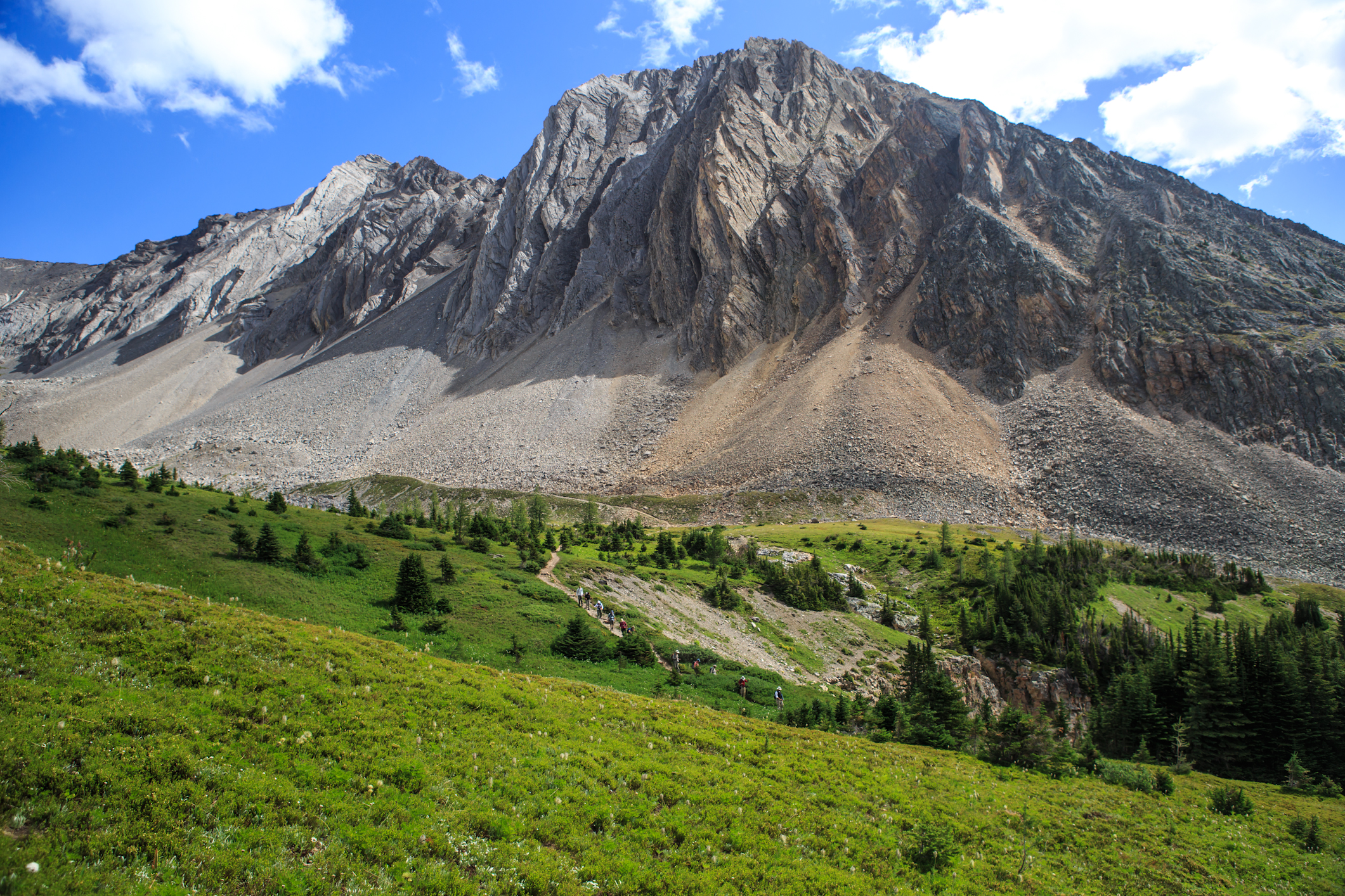
4. Ptarmigan Cirque Interpretive
Snapshot
Itinerary
The trail starts opposite the Highwood Meadows day-use parking on the east side of Highway 40. It crosses the highway and climbs through subalpine spruce-fir for the first kilometre on a graded interpretive path with numbered stops. Above treeline the trail enters Ptarmigan Cirque proper, a glacial basin between Mount Arethusa and Mount Rae, and loops anticlockwise around alpine meadows, larch stands and small waterfalls before rejoining the descent leg. The high point is roughly 2,400 m on the back side of the cirque, with views straight up to the headwall of Mount Rae.
Why it is essential
The shortest serious-alpine experience in K-Country — the trailhead is already above 2,200 m, so 45 minutes of climbing puts you in a true glacial cirque without the long approach of comparable Banff alpine walks. It is also the canonical larch-season day in K-Country.
Equipment
- Trail-running shoes or light boots
- Wind layer (the cirque is exposed and noticeably colder than the parking lot)
- Water
- Snack
- Bear spray
Hazards and notes
Highway 40 south of Kananaskis Lakes Trail (i.e. the entire Highwood Pass section) is closed 1 December to 14 June every year; the trail is inaccessible by car outside that window. Storms break very quickly at this elevation; turn back at the treeline if thunder is audible. Grizzlies use the cirque; the trail has been bear-closed in past summers. Stay on the marked trail — Alberta Parks emphasises this strongly because the alpine vegetation is slow to recover from off-trail trampling. Kananaskis Conservation Pass required.
GPX / KML links
| Source | URL | Format | Notes |
|---|---|---|---|
| OpenStreetMap | openstreetmap.org | OSM data (export GPX) | ODbL 1.0; reusable with attribution |
| Alberta Parks trail report | albertaparks.ca | Source page | HTML descriptive; no GPX |
Sources
- Alberta Parks — Ptarmigan Cirque trail report
- Wikipedia — Ptarmigan Cirque
- Wikipedia — Highwood Pass
- Hike Bike Travel — Ptarmigan Cirque
- Travel Alberta — Ptarmigan Cirque Trail
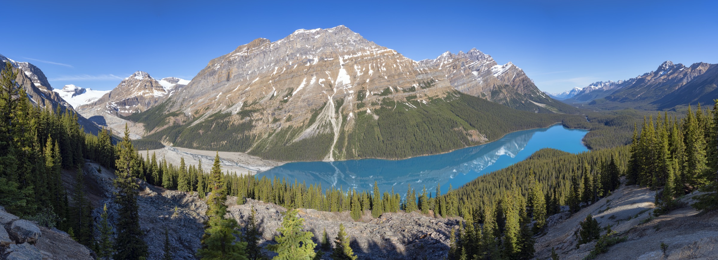
5. Rawson Lake and Sarrail Ridge
Snapshot
Itinerary
The trail starts at the Upper Lake day-use area, follows the lakeshore briefly, then turns south at a signed junction and climbs gradually through subalpine forest along Rawson Creek for ~3.5 km. The grade is moderate and well graded; arrival at Rawson Lake (1,985 m) is sudden, with the lake cupped beneath the 800 m-high north face of Mount Sarrail. For the ridge extension, follow the climber’s path that breaks south-west from the lakeshore and climbs steeply up the open scree slope above the lake. The path is unmaintained, alternating dirt, loose rubble and occasional snow patches into late summer, and gains ~355 m in roughly 1 km to the ridge crest at about 2,560 m. The ridge gives the standout view of the Kananaskis Lakes, the Opal Range and back into the Spray Mountains. Return is the same way.
Why it is essential
The cleanest single-objective in Peter Lougheed Provincial Park: an alpine lake under a 3,000 m peak with the option to extend onto one of the best low-effort ridge viewpoints in K-Country. Workable for mixed-ability groups (turn around at the lake) or strong hikers (continue to the ridge).
Equipment
- Boots with good edging for the ridge scree
- Trekking poles
- Bear spray
- Water filter or 2 L carried (Rawson Creek and the lake are present but treat before drinking)
- Wind layer for the ridge
Hazards and notes
As of mid-June 2026, Alberta Parks has the Rawson Lake Trail and basin (including Sarrail Ridge) closed due to multiple grizzlies in the area. Closures recur most summers — check the Alberta Parks trail report on the day. The ridge path is steep, loose, and prone to rockfall onto parties below — climb single-file. Cornices and snow patches can persist on the ridge into July. Kananaskis Conservation Pass required.
GPX / KML links
| Source | URL | Format | Notes |
|---|---|---|---|
| OpenStreetMap | openstreetmap.org | OSM data (export GPX) | ODbL 1.0; Sarrail Ridge spur partial |
| AllTrails community traces | alltrails.com | GPX (account) | AllTrails ToS — personal use only |
Sources
- AllTrails — Peter Lougheed PP top trails
- Hike Bike Travel — Rawson Lake
- The Banff Blog — Sarrail Ridge via Rawson Lake
- 10Adventures — Sarrail Ridge via Rawson Lake
- Alberta Parks — Peter Lougheed PP overview and current advisories
- CBC News — 2026 grizzly closures, K-Country
External links
| Source | URL |
|---|---|
| Alberta Parks — Kananaskis Country | albertaparks.ca |
| Alberta Parks — Peter Lougheed Provincial Park | albertaparks.ca |
| Alberta Parks — Bow Valley Provincial Park | albertaparks.ca |
| Alberta Parks — Kananaskis trail reports (all areas) | albertaparks.ca |
| Government of Alberta — Kananaskis Conservation Pass | alberta.ca |
| Friends of Kananaskis Country — Conservation Pass briefing | kananaskis.org |
| Wikipedia — Kananaskis | en.wikipedia.org |
| Wikipedia — Highwood Pass (road closure dates) | en.wikipedia.org |
| OpenStreetMap (base data, ODbL) | openstreetmap.org |
| Waymarked Trails (Hiking layer over OSM) | hiking.waymarkedtrails.org |
| Biosphere Institute of the Bow Valley — bear reports | biosphereinstitute.org |
| CBC News — 2026 Kananaskis bear activity and closures | cbc.ca |