Regional overview
The Icefields Parkway (Highway 93N) runs 232 km between Lake Louise and Jasper, threading the spine of the Canadian Rockies between the Continental Divide and the Columbia Icefield. It crosses two national parks — Banff (south of Sunwapta Pass) and Jasper (north of it) — and is widely regarded as one of the great mountain drives in North America. Day-hikes off the Parkway give walkers direct access to high cirques, glacier viewpoints, alpine passes and meltwater lakes without long approaches: most trailheads are within a few hundred metres of the highway.
The hiking corridor is high and snowbound for most of the year. Reliable conditions for the alpine routes typically run from late June or early July to mid-October; passes and ridges above 2,000 m often hold snow into July and can refreeze by mid-September. The Parkway itself stays open year-round but winter driving conditions are serious, services are minimal, and most alpine trails are inaccessible from mid-October through early summer. There is no fuel between Saskatchewan River Crossing and the Icefield Centre / Jasper, and cell coverage is intermittent at best.
The corridor sits inside grizzly habitat: bear spray, group travel and noise are standard practice, and Parks Canada imposes seasonal restrictions or closures (sometimes a minimum group size of four) on trails when bear activity is high. Caribou habitat closures apply to some shoulder-season backcountry routes. The 2024 Jasper wildfire burned heavily in the Jasper townsite area and near several trails on the Jasper side; the Parkway itself reopened quickly, and as of June 2026 the Parkway-corridor trails listed below are open, though some Jasper-area trails further north (Valley of the Five Lakes reopened May 2026; Geraldine Lakes remains seasonally affected) are still recovering.
Around the Icefield Centre, the toe of the Athabasca Glacier and the glacier surface itself are an active, crevassed ice mass; walking onto the ice unguided has killed visitors. Only the marked Toe of the Athabasca Glacier / Forefield Trail counts as a legitimate hike. The Bow Glacier Falls trail at Bow Lake remains closed through at least 2026 following the 2025 rockslide that killed two hikers; it is deliberately not listed here.
A national park pass is required (Banff or Jasper); 19 June – 7 September 2026 admission is free under the federal Canada Strong Pass initiative.
Selection rationale
These five routes spread the length of the Parkway (two south of Saskatchewan River Crossing, two in the Sunwapta Pass / Columbia Icefield area, one straddling the Banff–Jasper boundary) and cover the corridor’s defining landscapes: a classic subalpine-to-cirque lake hike (Helen Lake), the most iconic glacial-lake viewpoint extended into a real hike (Bow Summit / Peyto), a short ridge with a direct icefield panorama (Parker Ridge), the corridor’s signature alpine pass with the best Athabasca Glacier view (Wilcox Pass), and a longer pass walk into open meadows on the Banff–Jasper boundary (Nigel Pass). All are documented by Parks Canada and feasible as a day-hike for fit walkers.
Summary table
| # | Hike | Country | Route type | Distance | Gain | Max elevation | Difficulty |
|---|---|---|---|---|---|---|---|
| 1 | Helen Lake | Canada | Out-and-back | 11.8 km | ~530 m | 2,420 m | Moderate |
| 2 | Bow Summit & Peyto Lake | Canada | Out-and-back | ~6.6 km | ~245 m | 2,330 m | Moderate |
| 3 | Parker Ridge | Canada | Out-and-back | 5.4 km | ~250 m | 2,255 m | Easy–moderate |
| 4 | Wilcox Pass | Canada | Out-and-back | 8 km | ~390 m | 2,375 m | Moderate |
| 5 | Nigel Pass | Canada | Out-and-back | 14.4 km | ~365 m | 2,210 m | Moderate |
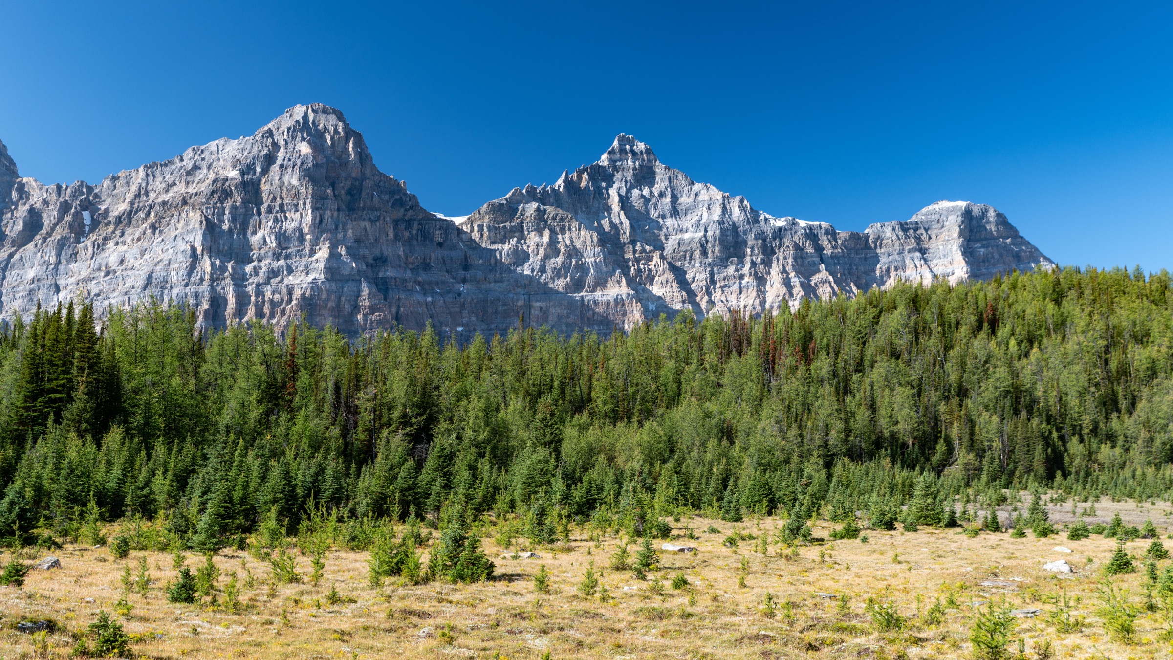
1. Helen Lake
Snapshot
Itinerary
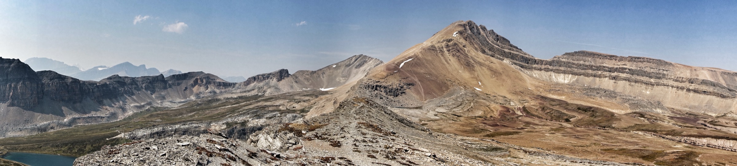
From the highway pull-off the trail climbs steadily west-northeast through subalpine forest of Engelmann spruce and subalpine fir, gaining roughly 400 m in the first 3 km. The grade eases as the path breaks into open larch and meadow country with views back across the Bow Valley to Crowfoot Mountain and the Crowfoot Glacier. The trail traverses a long open hillside and crosses several small streams before swinging north into the wide alpine basin beneath Cirque Peak. A final gentle climb across heather and boulder meadows leads to Helen Lake (~2,420 m), set in a glacially scoured cirque with Cirque Peak rising directly behind. Strong walkers sometimes continue over Dolomite Pass or scramble Cirque Peak (an additional ~450 m of rough, loose ground to ~2,993 m) — the scramble is outside the scope of a standard day-hike. Return by the same route.
Why it is essential
Helen Lake is the most accessible classic alpine-cirque hike on the southern Parkway: a sustained but moderate climb that delivers larch meadows, marmot and pika colonies, a glacier view across the valley, and a true cirque lake in a single day. It is widely cited in Banff trail guides as one of the corridor’s best mid-length hikes.
Equipment
- Hiking boots
- Weatherproof and warm layer
- 2 L water
- Sun protection
- Trekking poles useful for the descent
- Microspikes useful early/late season
- Bear spray and audible noise (active grizzly habitat — sows with cubs frequent the meadows)
Hazards and notes
Grizzly bears are regularly reported on this trail and Parks Canada has imposed seasonal group-of-four travel restrictions on Helen Lake in past years; check the current Banff trail-conditions and area-closures pages before going. Weather is fully exposed once above treeline; afternoon thunderstorms develop quickly. There is no reliable water above the first creek crossings. Dogs must be leashed. No permit required for the day-hike.
GPX / KML links
| Source | URL | Format | Notes |
|---|---|---|---|
| OpenStreetMap | openstreetmap.org | OSM data (export GPX) | ODbL 1.0; reusable with attribution |
| AllTrails community track | alltrails.com | GPX (account) | AllTrails ToS — personal use only |
| Parks Canada — Icefields Parkway trails (Banff) | parks.canada.ca | Source page | No published GPX |
Sources
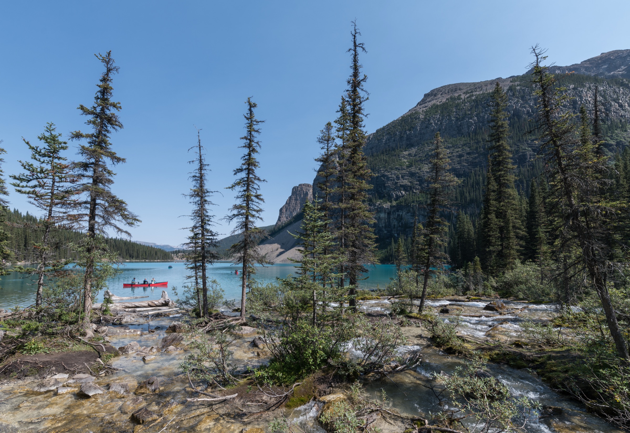
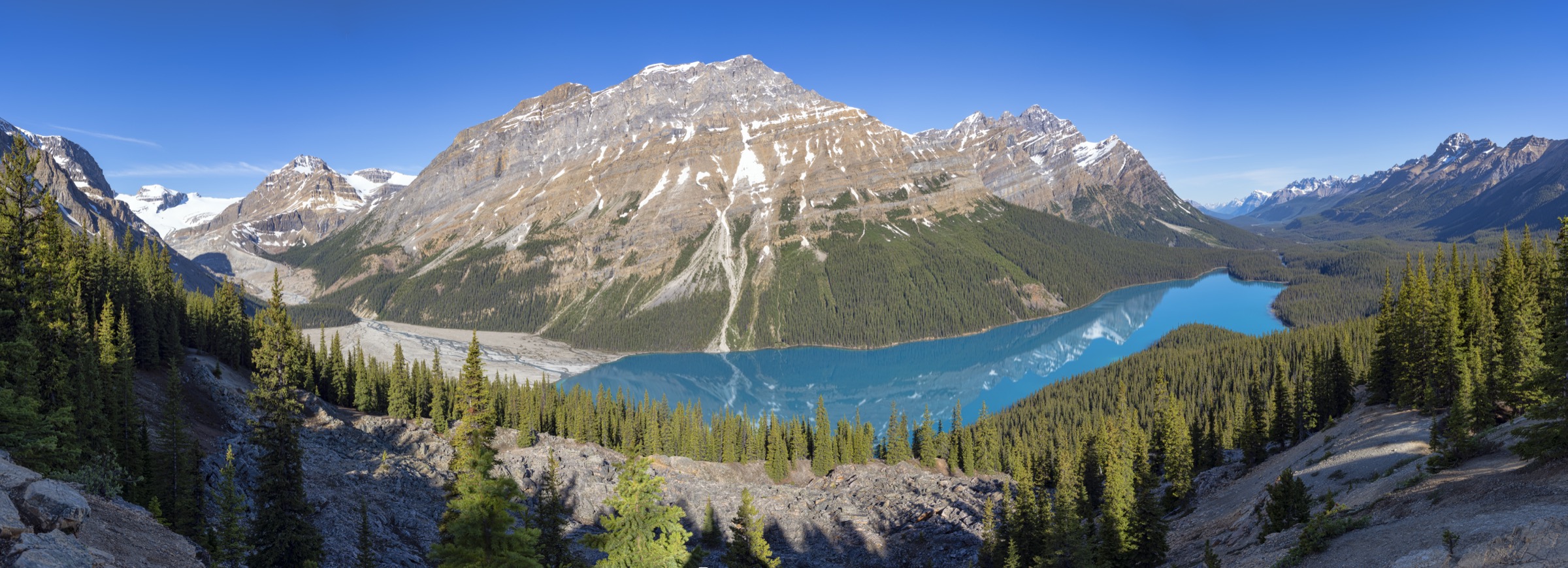
2. Bow Summit & Peyto Lake

Snapshot
Itinerary
From the upper parking lot a paved interpretive trail (recently rebuilt) climbs gently for roughly 1 km to the well-known Peyto Lake Lower Viewpoint, which overlooks the wolf-head silhouette of Peyto Lake far below. Most visitors turn around here. To continue, follow the signed trail uphill behind the viewpoint platform; the path becomes a forest track climbing steadily through subalpine fir and spruce. After roughly 1.5 km the trail breaks out into open alpine meadows on the broad shoulder of Bow Summit. A loop of informal social paths and a maintained track lead to higher viewpoints with panoramic views over Peyto Lake, Caldron Peak, Mistaya Mountain and the Wapta Icefield, and across the Bow Valley to Crowfoot Mountain. Return via the same route.
Why it is essential
Peyto Lake is one of the most photographed lakes in the Canadian Rockies, but the Lower Viewpoint is a 15-minute paved walk usually packed with tour-bus visitors. The continuation onto the Bow Summit shoulder converts the iconic view into a genuine half-day alpine hike, with a far wider panorama and a fraction of the crowds. It is the corridor’s signature glacier-lake viewpoint in its serious form.
Equipment
- Hiking shoes or light boots
- Wind shell for the exposed upper shoulder
- 1 L water
- Sun protection
- Bear spray (grizzly territory)
Hazards and notes
The upper meadows are exposed to weather and lightning. The slopes above Peyto Lake are avalanche terrain in winter and spring; Parks Canada and avalanche.ca advise against the upper trail outside summer. Stay on hardened paths to protect fragile alpine vegetation, which has been heavily damaged by visitor numbers at the Lower Viewpoint. Dogs must be leashed. No permit required.
GPX / KML links
| Source | URL | Format | Notes |
|---|---|---|---|
| OpenStreetMap | openstreetmap.org | OSM data (export GPX) | ODbL 1.0; reusable with attribution |
| AllTrails community track | alltrails.com | GPX (account) | AllTrails ToS — personal use only |
| Parks Canada — Icefields Parkway trails (Banff) | parks.canada.ca | Source page | No published GPX |
Sources
- Parks Canada — Trails on the Icefields Parkway (Banff)
- peytolake.ca — Hike to Bow Summit at Peyto Lake
3. Parker Ridge
Snapshot
Itinerary
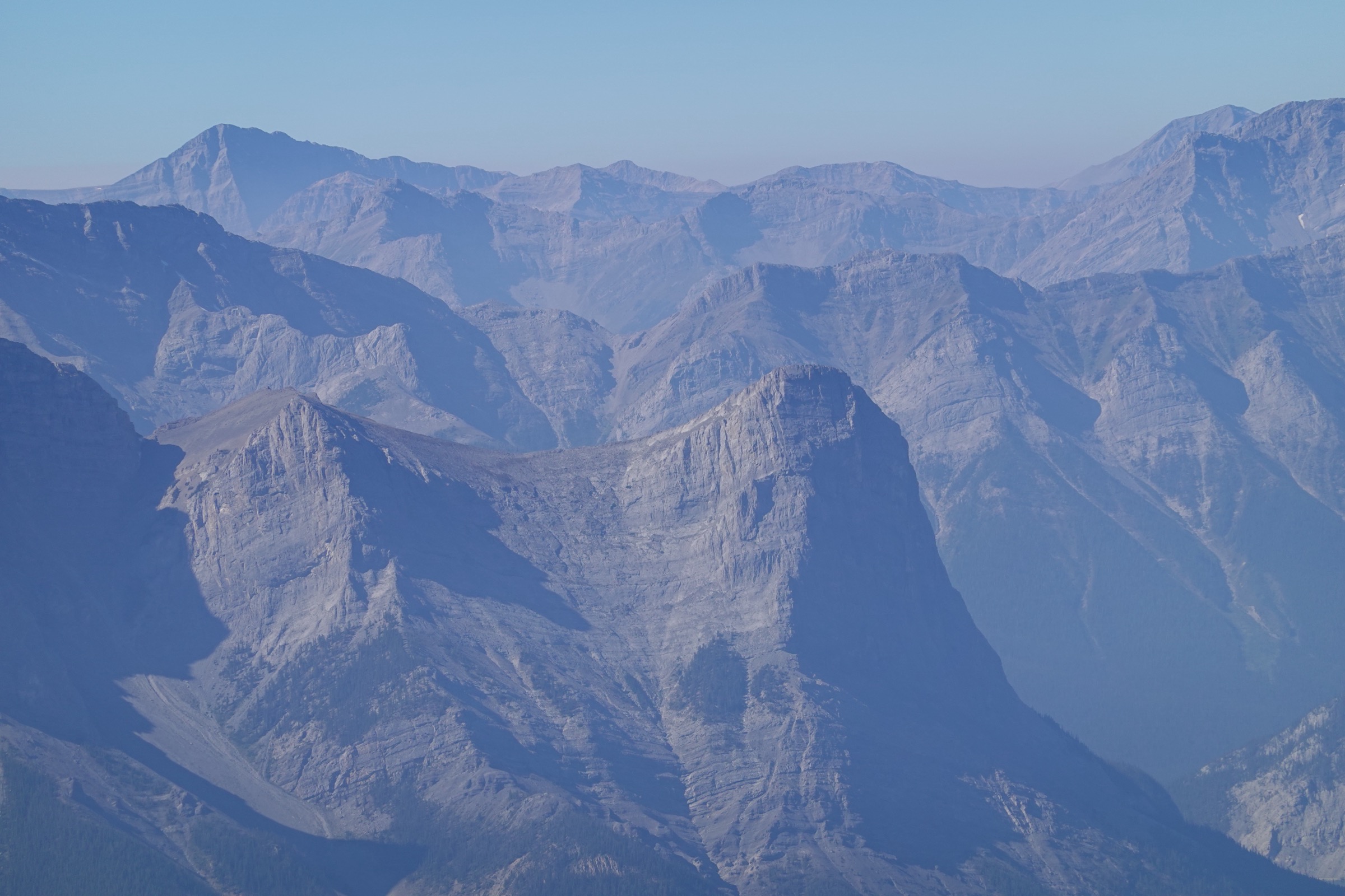
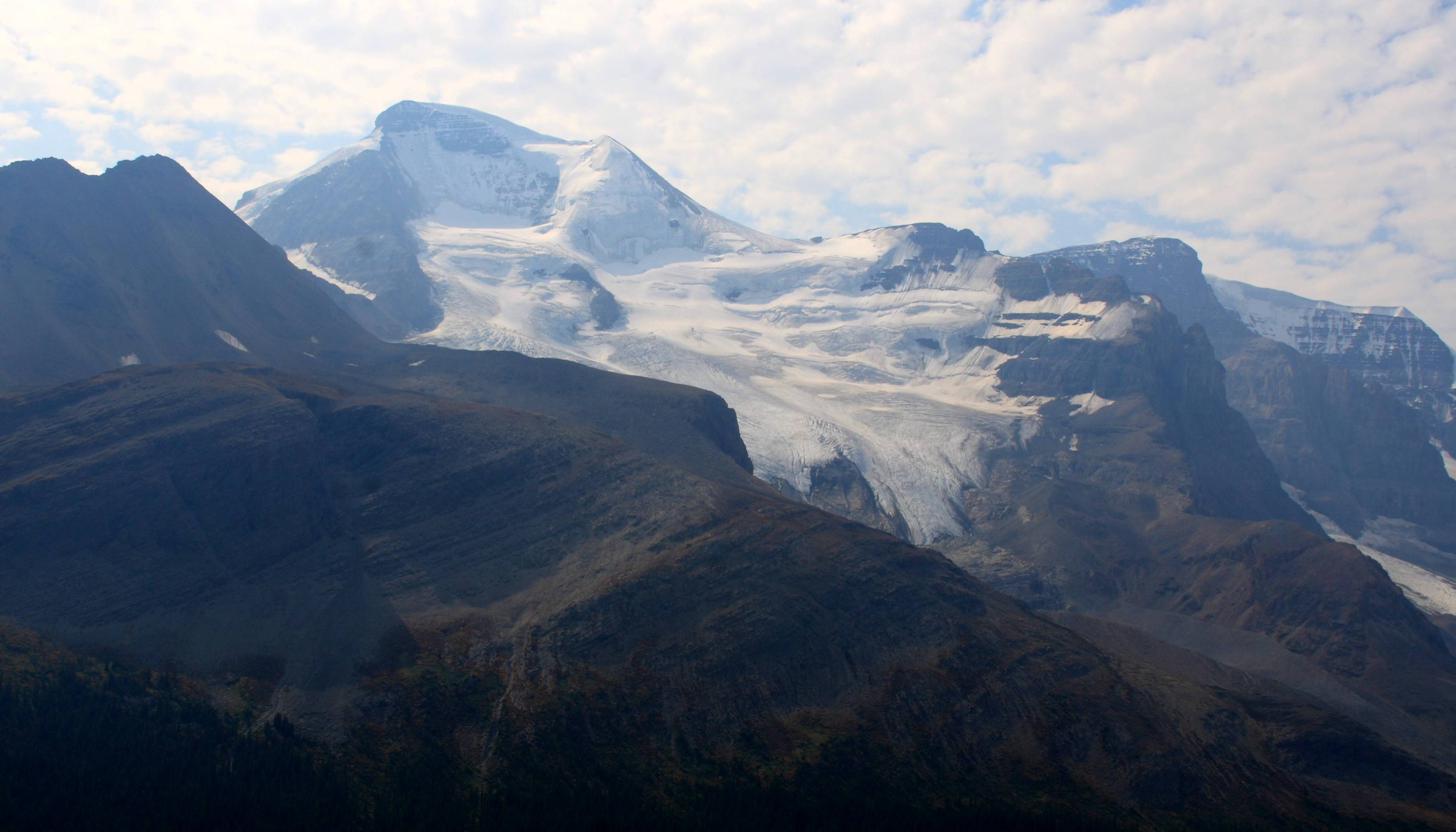
The trail leaves the highway and climbs in well-graded switchbacks up the east-facing slope of Parker Ridge. The lower section is a thin band of subalpine fir and spruce; the trees thin out quickly and the route enters open alpine tundra after roughly 1 km. Continue on the maintained path — there are signed appeals to stay on the trail to protect fragile vegetation that takes decades to recover — to the crest of the ridge at roughly 2,255 m. From the crest the view opens dramatically south onto the Saskatchewan Glacier (the largest outflow of the Columbia Icefield) descending into the North Saskatchewan River valley. An informal path runs south along the ridge for several hundred metres to better viewpoints. Return by the same switchbacks.
Why it is essential
Parker Ridge delivers a direct, full-frontal view of the Saskatchewan Glacier for relatively little effort, and is the best short ridge-walk on the Parkway. It is the standard introduction to the high alpine of the Columbia Icefield region and is on virtually every Parks Canada and tourism shortlist for the corridor.
Equipment
- Hiking shoes or boots
- Wind shell and warm layer (the ridge is fully exposed and often much colder than the highway)
- 1 L water
- Microspikes useful in June and from late September
- Bear spray
Hazards and notes
The ridge is exposed to wind, lightning and rapidly changing weather. The trail crosses sensitive alpine tundra — stay on the path. Caribou and bighorn sheep use the wider area; Parks Canada applies dog and seasonal-access rules to protect caribou habitat in the broader Sunwapta Pass area, but dogs on leash are permitted on Parker Ridge itself (confirm at the trailhead before departure). The descent on snow can be icy and slick; several injuries occur each year. No permit required.
GPX / KML links
| Source | URL | Format | Notes |
|---|---|---|---|
| OpenStreetMap | openstreetmap.org | OSM data (export GPX) | ODbL 1.0; reusable with attribution |
| AllTrails community track | alltrails.com | GPX (account) | AllTrails ToS — personal use only |
| Parks Canada — Icefields Parkway trails (Banff) | parks.canada.ca | Source page | No published GPX |
Sources
4. Wilcox Pass
Snapshot
Itinerary
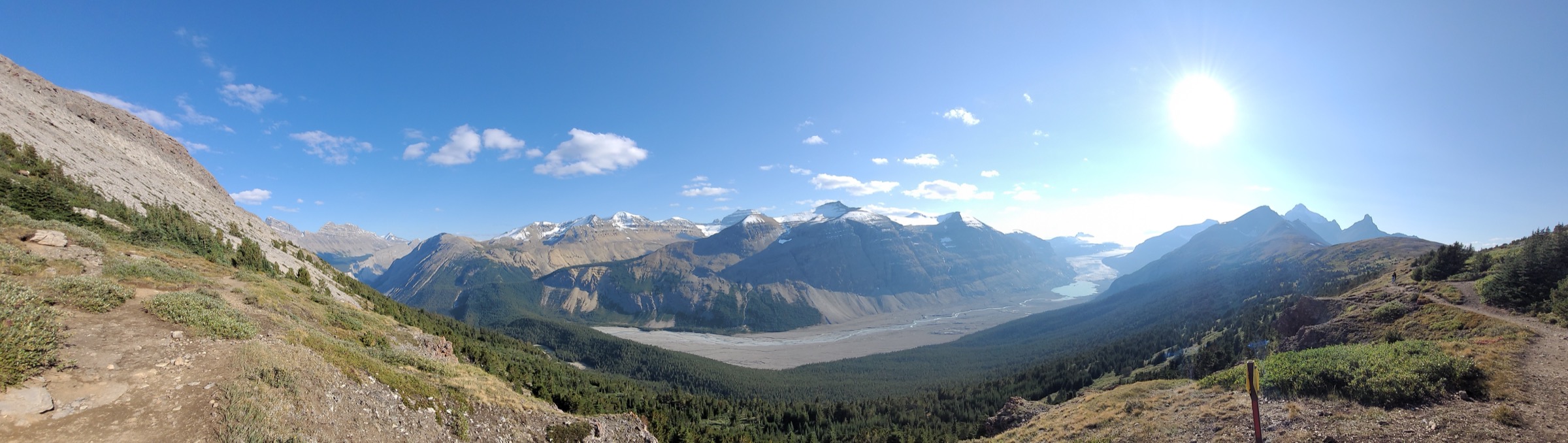
From the small parking area, the trail climbs steeply for roughly 1.5 km through old-growth subalpine fir and Engelmann spruce, gaining most of the day’s elevation in this opening section. The forest gives way to open alpine meadow and a broad shelf high above the Sunwapta Valley, where a pair of red chairs (Parks Canada’s “Red Chair” programme) sits at the first viewpoint, directly opposite Mount Athabasca, Mount Andromeda, the Athabasca Glacier and the southeastern edge of the Columbia Icefield. From here a cairned and partly braided route continues gently north across rolling tundra to the broad saddle of Wilcox Pass at ~2,375 m. Bighorn sheep are commonly seen on this section. The pass itself is broad and indistinct; many walkers continue a short distance to a cairned high point with views north toward Tangle Ridge. Return by the same route. Through-walking to Tangle Creek (~11 km point-to-point) is possible but requires a vehicle shuttle.
Why it is essential
Wilcox Pass is the corridor’s signature alpine pass walk and gives the best direct view of the Athabasca Glacier — better in many respects than the parking lot at the glacier toe — without setting foot on dangerous ice. It is consistently named the iconic day-hike of the Jasper side of the Parkway, and it sees abundant bighorn sheep at close range.
Equipment
- Hiking boots
- Warm layer and wind shell (the pass is fully exposed and frequently 10 °C colder than the highway)
- Trekking poles helpful on the steep initial climb
- 1.5 L water
- Bear spray
- Navigation backup: the route is cairned across open tundra and easy to lose in cloud
Hazards and notes
Weather changes fast; the pass is fully exposed to wind and lightning. The route is faint in places once above the meadows; cairns help but can be misleading in low visibility. Caribou habitat closures exist in the wider Sunwapta Pass area in some seasons — check Parks Canada’s Jasper trail-conditions page. Dogs must be leashed. The Athabasca Glacier itself, or any unguided travel onto ice, is extremely dangerous (crevasses, fatalities recorded); do not confuse the Forefield Trail or a guided Ice Walk with Wilcox Pass.
GPX / KML links
| Source | URL | Format | Notes |
|---|---|---|---|
| OpenStreetMap | openstreetmap.org | OSM data (export GPX) | ODbL 1.0; reusable with attribution |
| Komoot community track | komoot.com | GPX (account) | Komoot ToS — personal use only |
| Parks Canada — Discover the Icefields Parkway (Jasper) | parks.canada.ca | Source page | No published GPX |
Sources
5. Nigel Pass
Snapshot
Itinerary
The hike starts on a gated dirt service road that descends gently for the first kilometre to a bridge over Nigel Creek. The trail then climbs gently and consistently up the Nigel Creek valley on the true left bank, alternating between open subalpine forest and meadow with regular views back south toward Parker Ridge and Mount Athabasca. After roughly 5 km the valley opens into wide alpine meadows beneath Nigel Peak, and the route swings northeast on a moraine bench. The final kilometre crosses open tundra to the broad cairned saddle of Nigel Pass at ~2,210 m, which marks the Banff–Jasper park boundary and the rim of the Brazeau River drainage. The view north drops sharply into the upper Brazeau, with Brazeau Lake’s headwall and Cataract Peak visible on a clear day. Many walkers continue a short distance along the ridge for better views before returning the same way. The pass is the trailhead for the multi-day Brazeau Loop into Jasper backcountry — do not continue without a backcountry permit.
Why it is essential
Nigel Pass is the corridor’s classic open-meadow pass walk, longer and quieter than Wilcox or Parker Ridge but easier underfoot than Helen Lake. It crosses the watershed between the North Saskatchewan and Brazeau drainages, giving a genuine sense of crossing into a new mountain world on the Jasper side, and is the standard “longer day” option among the Parkway day-hikes.
Equipment
- Hiking boots
- Warm layer and wind shell (the pass is fully exposed)
- 2 L water
- Bear spray and group travel (this drainage sees regular grizzly activity)
- Microspikes useful early/late season; snow lingers in the upper meadows into July
Hazards and notes
The trail crosses several small creeks that can be high in early-summer melt. The upper meadows are fully exposed to weather and lightning. Active grizzly habitat; Parks Canada may impose group-size or seasonal restrictions — check current Banff trail-conditions before departure. The route is well-trodden but cairned for the final section. Dogs must be leashed. Day-hiking to the pass requires no permit; continuing into the Brazeau Loop does.
GPX / KML links
| Source | URL | Format | Notes |
|---|---|---|---|
| OpenStreetMap | openstreetmap.org | OSM data (export GPX) | ODbL 1.0; reusable with attribution |
| 10Adventures — Nigel Pass | 10adventures.com | Route map | Proprietary; reference only |
| Parks Canada — Icefields Parkway trails (Banff) | parks.canada.ca | Source page | No published GPX |
Sources
- Parks Canada — Trails on the Icefields Parkway (Banff)
- Parks Canada — Discover the Icefields Parkway (Jasper)
External links
| Source | URL |
|---|---|
| Parks Canada — Trails on the Icefields Parkway (Banff) | parks.canada.ca |
| Parks Canada — Discover the Icefields Parkway (Jasper) | parks.canada.ca |
| Parks Canada — Banff trail conditions | parks.canada.ca |
| Parks Canada — Jasper trail conditions | parks.canada.ca |
| Parks Canada — What’s open in Jasper | parks.canada.ca |
| Parks Canada — Jasper wildfire 2024 | parks.canada.ca |
| Parks Canada — Banff bulletins (closures) | parks.canada.ca |
| BanffBound — Helen Lake | banffbound.com |
| peytolake.ca — Hike to Bow Summit | peytolake.ca |
| Hike Jasper — Wilcox Pass | hikejasper.com |
| OpenStreetMap (ODbL 1.0) | openstreetmap.org |
| AllTrails — Banff trails | alltrails.com |
| AllTrails — Jasper trails | alltrails.com |