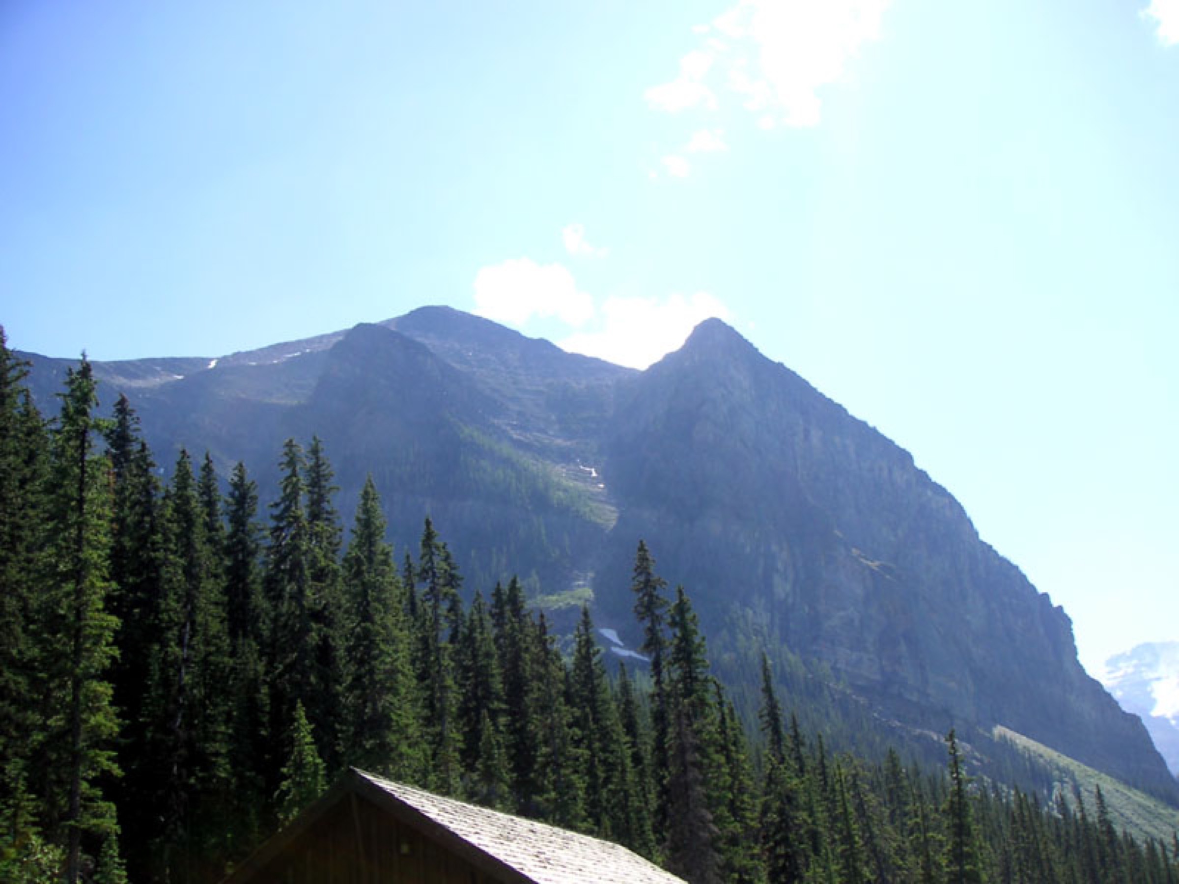
Regional overview
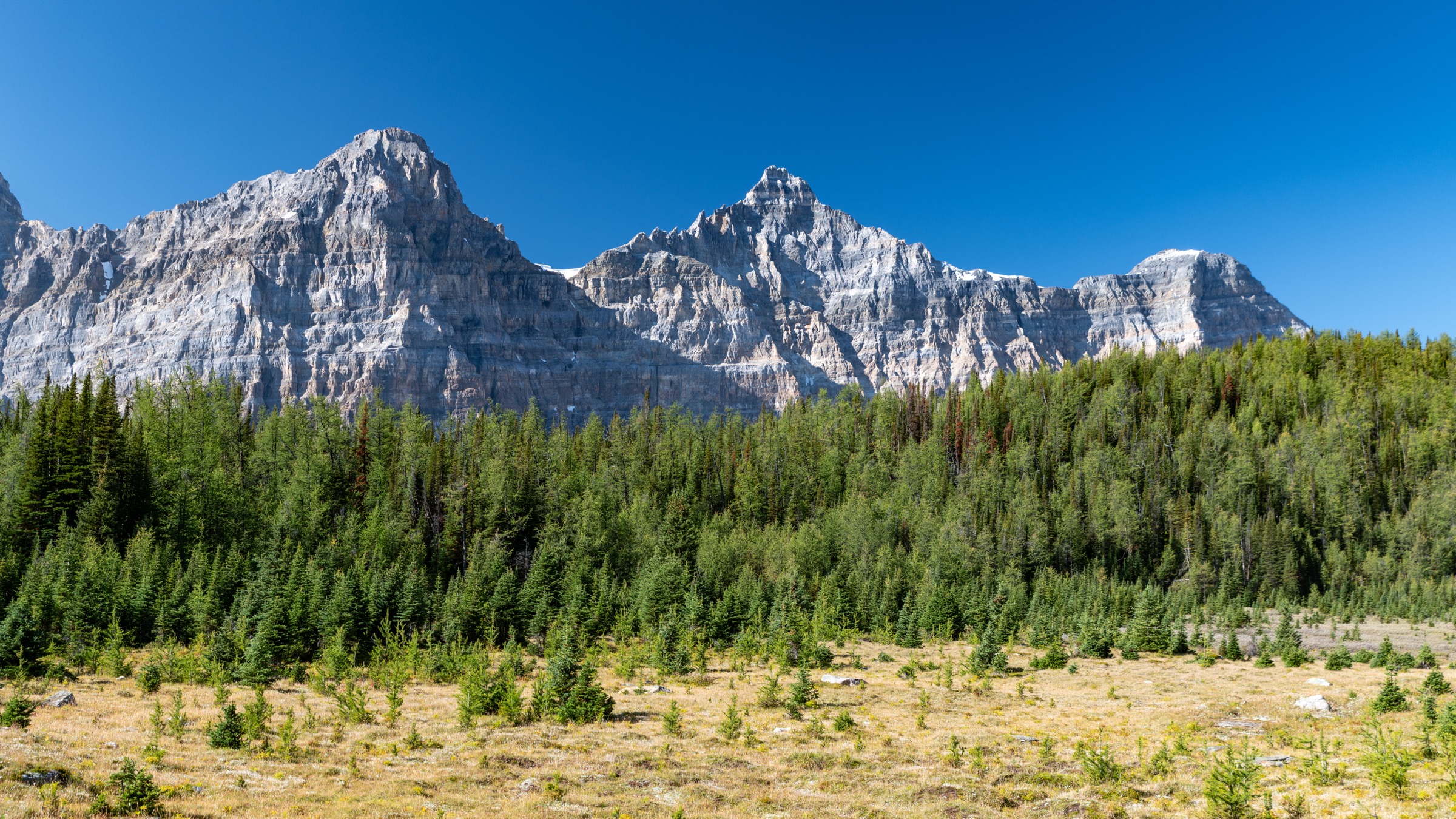
The Lake Louise and Moraine Lake cluster sits on the eastern flank of the Continental Divide in the Main Ranges of the Canadian Rockies, inside Banff National Park. The two lakes are eleven kilometres apart by road but share a single hiking arena: the basin of glaciated quartzite and limestone peaks formed by Mount Victoria, Mount Lefroy, Mount Temple and the Wenkchemna (Ten Peaks) wall. Trailheads sit between 1,731 m (Lake Louise lakeshore) and 1,884 m (Moraine Lake), and the canonical alpine objectives — Plain of Six Glaciers, Big Beehive, Sentinel Pass, Fairview — top out between 2,135 m and 2,744 m, well above treeline in larch and alpine-tundra terrain.
The hiking season runs from mid-July to early October. Snow lingers on the higher trails (Sentinel Pass, Big Beehive switchbacks, Saddleback) into late June or early July, and the final week of September into the first week of October is “larch season” — when Larix lyallii turns gold across Larch Valley and the Saddleback shoulder, and the area receives the heaviest backcountry day-use of the year. Snow returns reliably by mid-October.
Access is the defining logistical issue. Moraine Lake Road has been closed to private vehicles year-round since June 2023; in 2026 the Parks Canada shuttle operates roughly 1 June – 12 October between the Lake Louise Park & Ride (1 Whitehorn Road) and Moraine Lake, with reservations released 15 April 2026 plus a rolling two-day window. Cycling the 12 km road is permitted. The Lake Louise lakeshore parking is paid (CAD 42 per day, 15 May – 13 October) and routinely fills before 06:00; the free Park & Ride with Parks Canada connector shuttle is the recommended approach. Roam Transit Route 8X links Banff townsite to Lake Louise year-round. A Banff Park Pass is required (CAD 12.25 adult daily, CAD 83.50 annual), although 19 June – 7 September 2026 admission is free under the federal Canada Strong Pass initiative.
Grizzly bears are present throughout. Parks Canada regularly imposes a mandatory minimum group size of four on the Moraine Lake cluster (Larch Valley, Sentinel Pass, Eiffel Lake, Paradise Valley) when bears are active in the drainage, typically late July through September; wardens enforce it at the trailhead and fines apply. Bear spray and group hiking are standard. Lightning storms build fast on exposed passes in afternoons; an early start is universal practice.
Selection rationale
The five hikes triangulate the canonical experience of the Lake Louise and Moraine Lake basins while accommodating the 2023–2026 access reality. Plain of Six Glaciers is the definitive tea-house walk under the Victoria Glacier headwall. Lake Agnes & Big Beehive pairs the oldest backcountry tea house in Canada with the best aerial viewpoint over Lake Louise. Sentinel Pass via Larch Valley is the highest day-hike pass in the park and the canonical Moraine Lake larch route. Fairview Mountain is the area’s standout non-technical summit, with an unmatched panorama over both basins and Paradise Valley. Paradise Valley to the Giant Steps rounds out the set with a long forest and meadow walk into the third — and quietest — of the great Lake Louise valleys.
Summary table
| # | Hike | Country | Route type | Distance | Gain | Max elevation | Difficulty |
|---|---|---|---|---|---|---|---|
| 1 | Plain of Six Glaciers | Canada | Out-and-back | 13.8–14.6 km | 570–600 m | 2,210 m | Moderate |
| 2 | Lake Agnes & Big Beehive | Canada | Loop | 10.5–11.5 km | 520–650 m | 2,270 m | Moderate |
| 3 | Sentinel Pass via Larch Valley | Canada | Out-and-back | 11.2–11.6 km | 720–820 m | 2,611 m | Moderate–difficult |
| 4 | Fairview Mountain via Saddleback | Canada | Out-and-back | 10.4–10.8 km | 1,000–1,015 m | 2,744 m | Difficult |
| 5 | Paradise Valley & the Giant Steps | Canada | Loop | 18–20 km | 640–700 m | 2,200 m | Moderate–difficult |
1. Plain of Six Glaciers
Snapshot
Itinerary
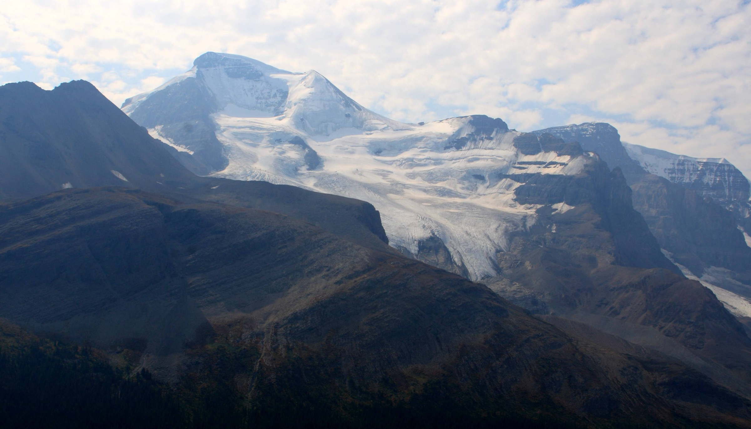
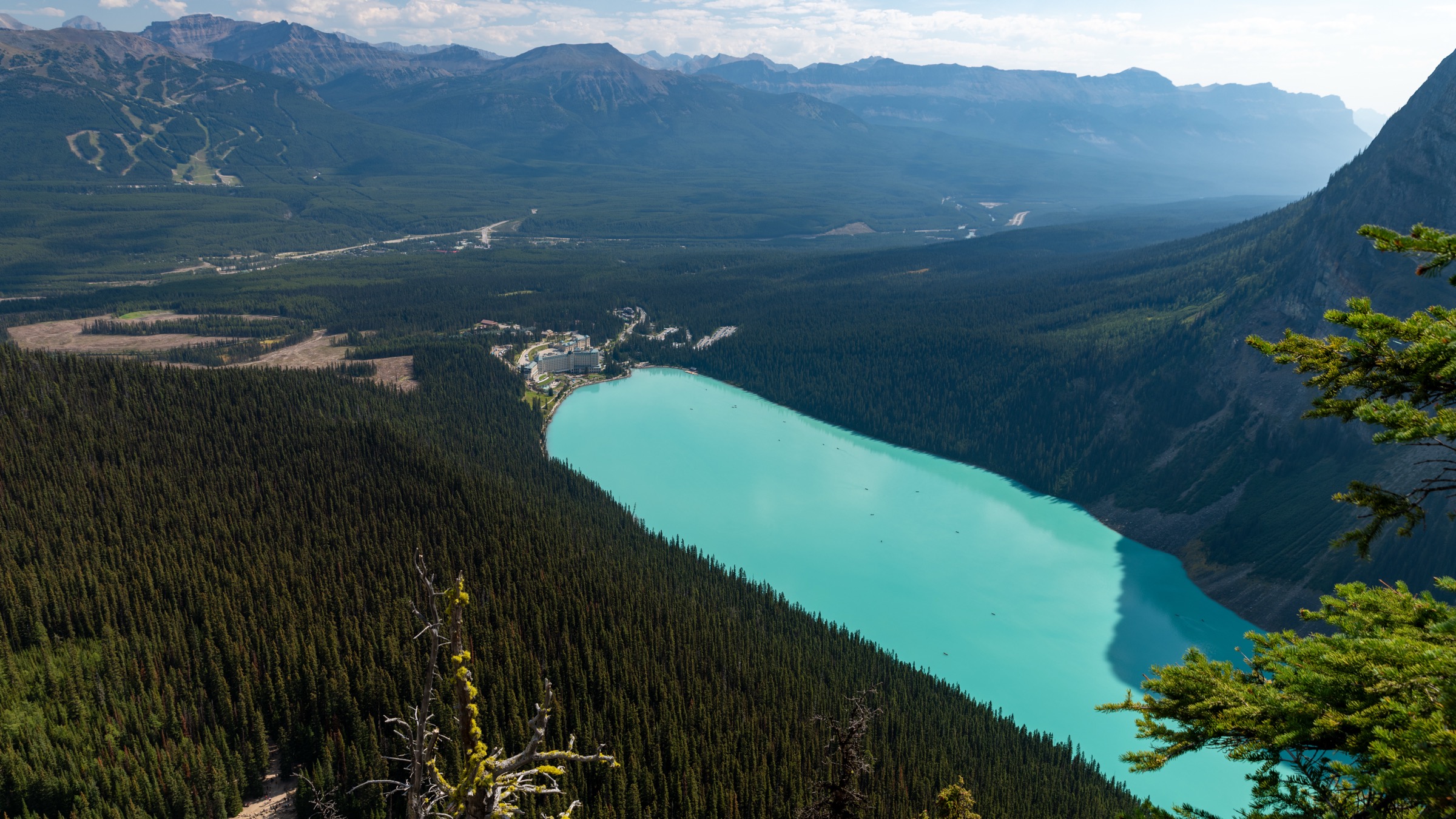
The trail begins at the northwest corner of Lake Louise, contouring the north shore for 2 km on a paved promenade past the canoe dock. Past the lake’s far end it crosses the broad outwash flats below Mount Victoria, then climbs in a steady forested switchback ramp on the south flank of the valley. At about 3.8 km the trail meets the Highline / Big Beehive junction; the Plain of Six Glaciers route continues straight, climbing more steeply across open shale and avalanche slopes with growing views back over Lake Louise. The Plain of Six Glaciers Teahouse, built in 1927 by the Canadian Pacific Railway and accessible only on foot, sits at 2,135 m at about 5.8 km. From the teahouse a marked spur continues 1.3 km up lateral moraine ridges to a viewpoint at roughly 2,210 m above the Lower Victoria Glacier — a hanging-ice amphitheatre under Abbot Pass between Mount Victoria (3,464 m) and Mount Lefroy (3,423 m). Return by the same route, or descend via the Highline Trail to Lake Agnes for a longer figure-of-eight day.
Why it is essential
The most efficient way to stand under a major Rockies icefall without technical skills. The route combines the iconic Lake Louise shoreline, an actively operating turn-of-the-century teahouse, and an alpine moraine viewpoint into a half-day outing reachable by transit. The recession of the Victoria, Lefroy and Aberdeen glaciers is visibly recorded in successive moraine ridges along the upper trail — a teaching landscape as well as a postcard one.
Equipment
- Stiff trail shoes or light boots
- Trekking poles useful for the moraine spur
- Layered insulation; cold air drains off the glacier even in August
- Rain shell
- 1.5–2 L water
- Cash or card for the teahouse (no power or running water)
- Bear spray
Hazards and notes
The upper viewpoint sits beneath active serac fall on Mount Lefroy — stay on the marked trail and do not approach the glacier toe. The route is signed closed mid-October to mid-June for avalanche exposure on the lower switchbacks. Black and grizzly bears use the valley; carry spray. The Lake Louise shoreline is severely crowded 10:00–16:00 in July and August; starting before 08:00 is standard. Combining with Lake Agnes via the Highline Trail extends the day to roughly 17 km with an additional 100 m of gain.
GPX / KML links
| Source | URL | Format | Notes |
|---|---|---|---|
| OpenStreetMap | openstreetmap.org | OSM data (export GPX) | ODbL 1.0; reusable with attribution |
| AllTrails community track | alltrails.com | GPX (account) | AllTrails ToS — personal use only |
| Parks Canada — Lake Louise day hikes | parks.canada.ca | Source page | Trail descriptions; no published GPX |
Sources
- Parks Canada — Day hikes in the Lake Louise area
- Banff & Lake Louise Tourism — Plain of Six Glaciers Teahouse Trail
- Plain of Six Glaciers Teahouse — operator
2. Lake Agnes & Big Beehive
Snapshot
Itinerary
From the Chateau, the signed Lake Agnes trail climbs steadily northwest through subalpine fir and Engelmann spruce. At about 2.7 km the path levels at the small, deep-green Mirror Lake beneath the cliff of the Big Beehive. A final set of switchbacks climbs past a waterfall and arrives at the historic Lake Agnes Teahouse (opened 1905) on the lake’s outlet at 2,135 m. For the loop, follow the north shore of Lake Agnes to its head, then climb the steep zig-zag onto the saddle above. Turning left (south), a short ridge through stunted larches leads to the wooden gazebo on the Big Beehive summit at roughly 2,270 m, with a near-vertical view straight down to Lake Louise. Descend the south side to meet the Plain of Six Glaciers Highline Trail and return along the lakeshore. The Little Beehive — a short out-and-back from the teahouse — is an easy optional addition.
Why it is essential
The Lake Agnes Teahouse is the oldest backcountry teahouse in Canada and the most popular short hike in Banff. The Big Beehive extension converts a tea-house stroll into a genuine alpine viewpoint, giving the best aerial perspective on Lake Louise, the Chateau and the Bow Valley. The full loop combines two classics — Lake Agnes and the Plain of Six Glaciers — into a single full day.
Equipment
- Sturdy footwear for the Big Beehive switchbacks
- Trekking poles useful for the loop descent
- Warm layer and shell
- 1.5–2 L water
- Cash for the teahouse (historically no card readers)
- Bear spray
Hazards and notes
The Big Beehive zig-zag is steep and holds snow into early July; Parks Canada often flags it as “not recommended” in early season. The Big Beehive summit drops away abruptly to the north and east — keep clear of the edge in wind or with children. The trail is heavily congested 10:00–15:00 in July and August; an early start is strongly advised. Dogs must be on leash. Standard bear precautions apply.
GPX / KML links
| Source | URL | Format | Notes |
|---|---|---|---|
| OpenStreetMap | openstreetmap.org | OSM data (export GPX) | ODbL 1.0; reusable with attribution |
| AllTrails community track | alltrails.com | GPX (account) | AllTrails ToS — personal use only |
| Parks Canada — Lake Louise day hikes | parks.canada.ca | Source page | No published GPX |
Sources
- Banff & Lake Louise Tourism — Lake Agnes Teahouse Trail
- Parks Canada — Day hikes in the Lake Louise area
- Parks Canada — Banff trail conditions
3. Sentinel Pass via Larch Valley

Snapshot
Itinerary
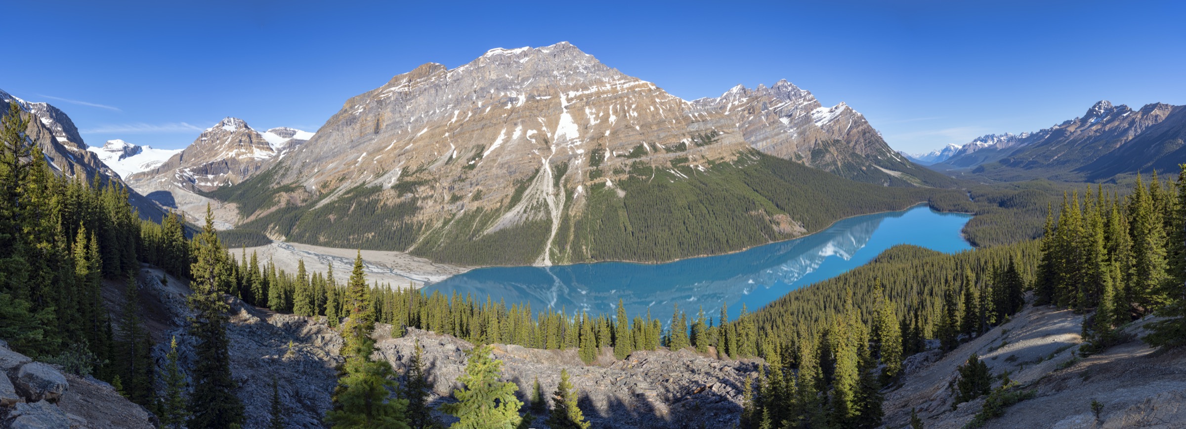
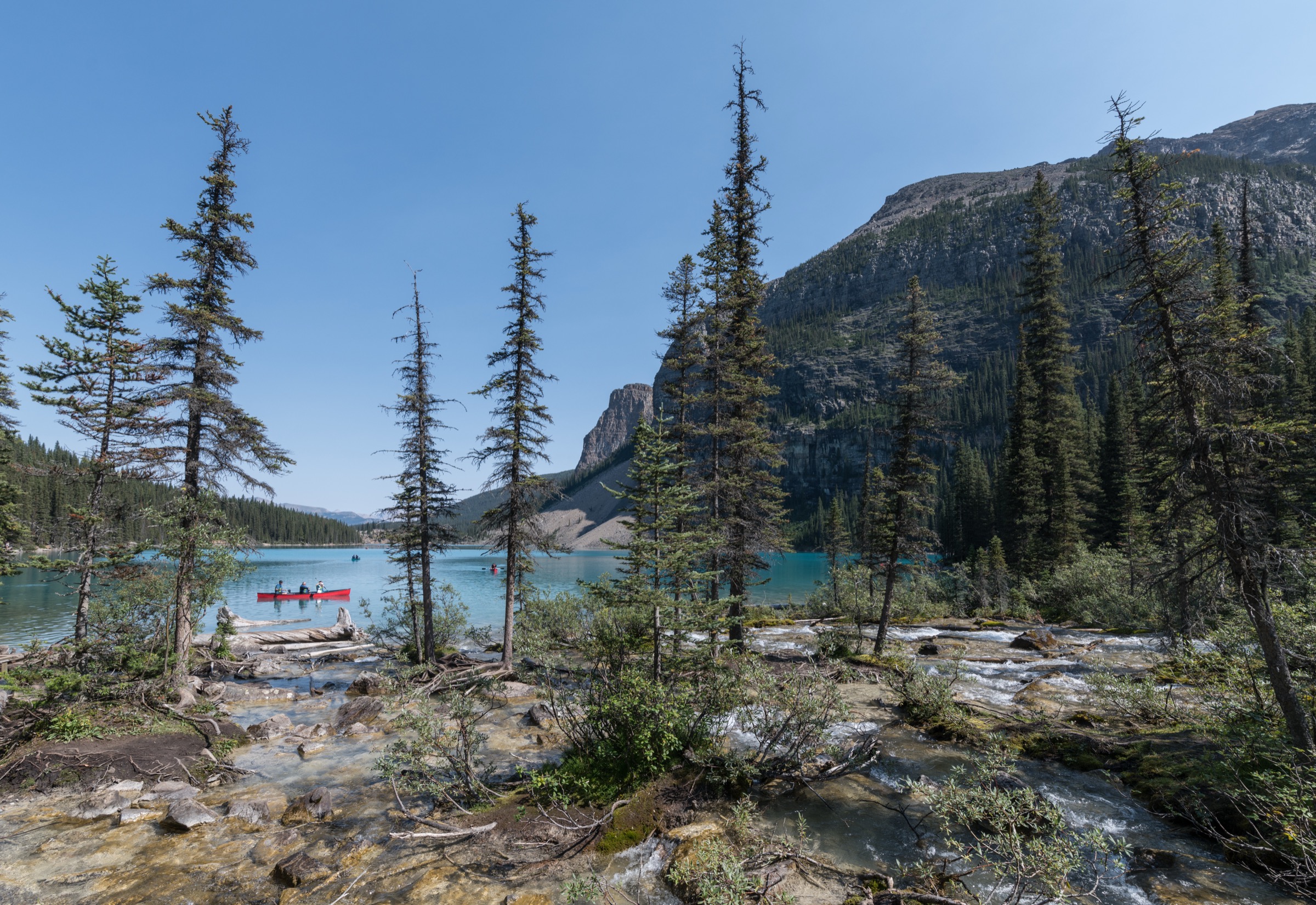
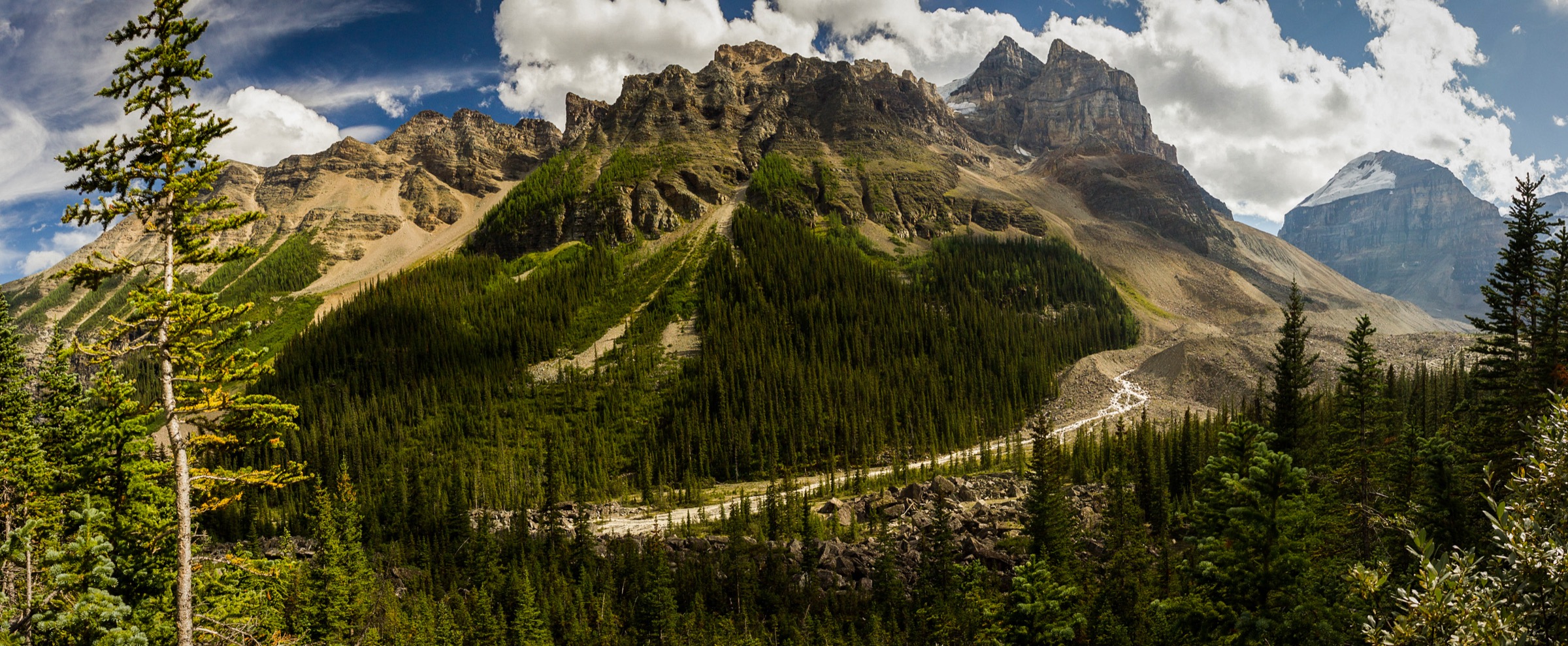
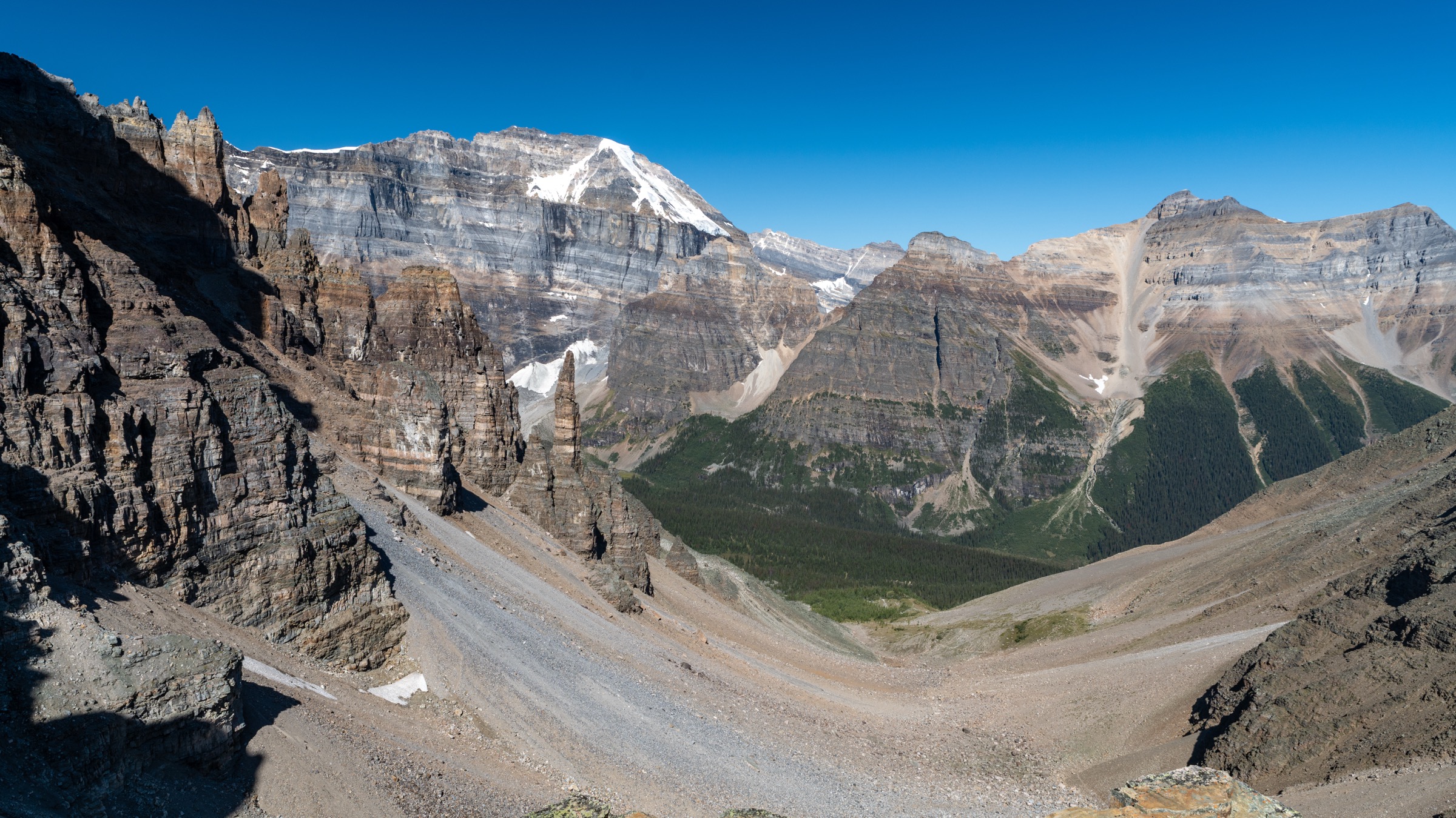
From the Moraine Lake lodge area the signed Larch Valley / Sentinel Pass trail climbs the lateral moraine in approximately ten switchbacks through spruce and subalpine fir, gaining around 350 m to a signed junction at 2,360 m. Bearing right (left goes to Eiffel Lake), the gradient eases and the path enters Larch Valley — a broad subalpine bench filled with Larix lyallii beneath Mount Fay, Mount Little, Mount Bowlen and the rest of the Ten Peaks rim. The next 2 km undulate gently past the upper Minnestimma Lakes and meadow tarns. Beyond the upper meadow the trail steepens sharply onto a scree ramp leading to Sentinel Pass at 2,611 m, the col between Pinnacle Mountain (3,067 m) and Mount Temple (3,544 m). From the pass the view extends north into Paradise Valley with the Horseshoe Glacier and Mount Aberdeen. Return is by the same route; the scree descent from the pass is the most demanding section.
Why it is essential
Sentinel Pass is the highest maintained day-hike pass in the park and delivers the most concentrated alpine experience available in a single day from a Banff trailhead: aquamarine lake, lateral moraine, larch parkland, glacier-rimmed cirque and a wind-cut col with a panorama in both directions. It is also the single hike most affected by the 2023 access reset — understanding how to actually reach the trailhead is part of the trip.
Equipment
- Sturdy boots (scree on the upper ramp)
- Trekking poles strongly recommended for the descent
- Warm layers and shell; the pass can be 10–15 °C colder than the lakeshore
- 2 L water minimum (no reliable source above the lower switchbacks)
- Bear spray (mandatory in practice)
- Pre-booked shuttle ticket
Hazards and notes
Moraine Lake Road is closed year-round to private vehicles. Use the Parks Canada shuttle (reservations open 15 April with a rolling 2-day window thereafter), commercial shuttles, or bicycle. Hotel guests of Moraine Lake Lodge may drive.
Parks Canada imposes a mandatory minimum group size of four on Larch Valley, Sentinel Pass, Eiffel Lake and Paradise Valley when grizzly bears are active in the drainage, typically late July through September. When the order is in force, wardens at the trailhead turn back smaller parties and fines apply for non-compliance. Check the trail report on the morning of the hike. Single hikers should expect to buddy up at the trailhead.
Sentinel Pass holds snow into mid-July most years and can receive fresh snow in any month. The upper ramp is exposed and accumulates afternoon thunderstorm risk. During larch season (late September) the route sees more than 1,000 walkers per day; the earliest shuttle (04:00 / 05:00 departures) is the standard tactic to be in Larch Valley for sunrise on the Ten Peaks.
GPX / KML links
| Source | URL | Format | Notes |
|---|---|---|---|
| OpenStreetMap | openstreetmap.org | OSM data (export GPX) | ODbL 1.0; reusable with attribution |
| AllTrails community track | alltrails.com | GPX (account) | ToS — personal use only |
| Parks Canada — Lake Louise day hikes | parks.canada.ca | Source page | No published GPX |
Sources
- Parks Canada — Moraine Lake shuttle and access
- Parks Canada — Lake Louise area day hikes
- Banff & Lake Louise Tourism — Moraine Lake Shuttle
4. Fairview Mountain via Saddleback Pass
Snapshot
Itinerary
From the lakeshore parking area south of the Chateau, the signed Saddleback / Fairview trail climbs steeply south-southwest through dense forest in a long series of switchbacks. The grade is unrelenting but the surface is good. After about 3.7 km the trail breaks out at Saddleback Pass (~2,330 m), a meadow saddle between Saddle Mountain and Fairview with views across to Mount Temple. For Fairview, take the climber’s trail right (north-west) up the broad east face of the mountain — a steep, rough route of loose scree and switchbacks gaining a further ~414 m in roughly 1.5 km to the airy summit at 2,744 m. The view is one of the most expansive in the area: directly across to Mount Victoria and the Six Glaciers, down to Lake Louise on one side and Paradise Valley with Mount Temple on the other. Return by the same route.
Why it is essential
Fairview is the most accessible “real” summit from Lake Louise and provides an unmatched 360° panorama taking in the Six Glaciers cirque, the lake itself, Paradise Valley, Sheol Valley and the Bow Range. It is the area’s standout summit hike that does not require glacier travel or scrambling skill, and Saddleback Pass is a superb shorter objective in larch season.
Equipment
- Sturdy boots (loose scree on the descent)
- Trekking poles strongly recommended
- Warm layer, wind shell, sun protection
- 2 L water (no reliable source above the lakeshore)
- Microspikes if snow lingers on the upper cone
- Bear spray
Hazards and notes
The summit cone is loose scree with significant exposure on the south and west; the route is non-technical but unsuitable in wind, lightning or wet snow. Early-season snow on the upper face routinely makes the summit push more serious; check Parks Canada trail conditions. The trail is steep throughout — not a beginner outing. Dogs must be on leash. Standard bear precautions apply.
GPX / KML links
| Source | URL | Format | Notes |
|---|---|---|---|
| OpenStreetMap | openstreetmap.org | OSM data (export GPX) | ODbL 1.0; reusable with attribution |
| AllTrails community track | alltrails.com | GPX (account) | ToS — personal use only |
| Parks Canada — Lake Louise day hikes | parks.canada.ca | Source page | No published GPX |
Sources
- Parks Canada — Day hikes in the Lake Louise area
- Wikipedia — Fairview Mountain (Alberta)
- 10Adventures — Mount Fairview Summit Hike
5. Paradise Valley & the Giant Steps
Snapshot
Itinerary
From the trailhead on Moraine Lake Road the path crosses Paradise Creek and climbs gently through pine forest. At about 1.3 km a junction marks the start of the Paradise Valley loop; most parties bear right (anti-clockwise) toward Lake Annette. The trail continues to climb gradually, reaching Lake Annette at ~5.8 km — a small alpine lake set directly beneath the 1,500 m north face of Mount Temple. Beyond Lake Annette the path traverses high above the valley floor (which is closed to hiking to preserve grizzly bear habitat) and eventually descends to the Giant Steps, a long flight of broad quartzite slabs over which Paradise Creek tumbles, around 9–10 km from the trailhead. The loop returns via the lower valley-floor trail (where open) to the junction and back out to the road. A pure out-and-back to the Giant Steps avoids the upper Lake Annette section but loses the Mount Temple north-face viewpoint. Shorter variants stop at Lake Annette and return.
Why it is essential
Paradise Valley is the third of the great Lake Louise valleys — alongside Louise itself and the Valley of the Ten Peaks — and is closed to vehicles and largely free of crowds. The hike provides the closest legitimate ground-level view of the immense north face of Mount Temple (3,544 m) and visits two distinctive features — Lake Annette and the Giant Steps cascades — within a single day. It is the long forest-and-valley counterpart to the basin’s lakeshore and high-pass classics.
Equipment
- Sturdy boots
- Trekking poles
- Warm layer, wind shell, headtorch for a long day
- 2.5 L water plus filter
- Bear spray (mandatory in practice — and a group of four if the Parks Canada order is in force)
- Bicycle as a useful tool to reach the trailhead from Lake Louise village down Moraine Lake Road
Hazards and notes
Paradise Valley is active grizzly country and Parks Canada frequently imposes a mandatory minimum group size of four; total Superintendent closures of the valley have also recurred in recent seasons (the trail was closed in late summer 2023 due to a bear feeding on a carcass). Always check the Paradise Valley bulletin on the Parks Canada Banff page before departure. The lower valley-floor trail may be closed seasonally to protect the wildlife corridor. The day is long with limited bail-out options; carry headtorch and full warm/wet kit. River crossings can be high in early summer. Dogs must be on leash.
GPX / KML links
| Source | URL | Format | Notes |
|---|---|---|---|
| OpenStreetMap | openstreetmap.org | OSM data (export GPX) | ODbL 1.0; reusable with attribution |
| AllTrails community track | alltrails.com | GPX (account) | ToS — personal use only |
| Parks Canada — Banff bulletins | parks.canada.ca | Source page | Closure status — check before departure |
Sources
- Parks Canada — Day hikes in the Lake Louise area
- Parks Canada — Paradise Valley Trails bulletin
- Banff & Lake Louise Tourism — 9 Bucket List Hikes in Banff
External links
| Source | URL |
|---|---|
| Parks Canada — Banff National Park hiking | parks.canada.ca |
| Parks Canada — Day hikes in the Lake Louise area | parks.canada.ca |
| Parks Canada — Visiting Lake Louise & Moraine Lake (transit, shuttle, Park & Ride) | parks.canada.ca |
| Parks Canada — Banff trail conditions | parks.canada.ca |
| Parks Canada — Banff bulletins (closures) | parks.canada.ca |
| Parks Canada — Banff fees | parks.canada.ca |
| Banff & Lake Louise Tourism | banfflakelouise.com |
| Banff & Lake Louise Tourism — Moraine Lake Shuttle | banfflakelouise.com |
| Plain of Six Glaciers Teahouse — operator | p6teahouse.com |
| Parks Canada Reservation Service | reservation.pc.gc.ca |
| Roam Transit — schedules & routes | roamtransit.com |
| OpenStreetMap (ODbL 1.0) | openstreetmap.org |
| AllTrails — Banff trails | alltrails.com |