Regional overview
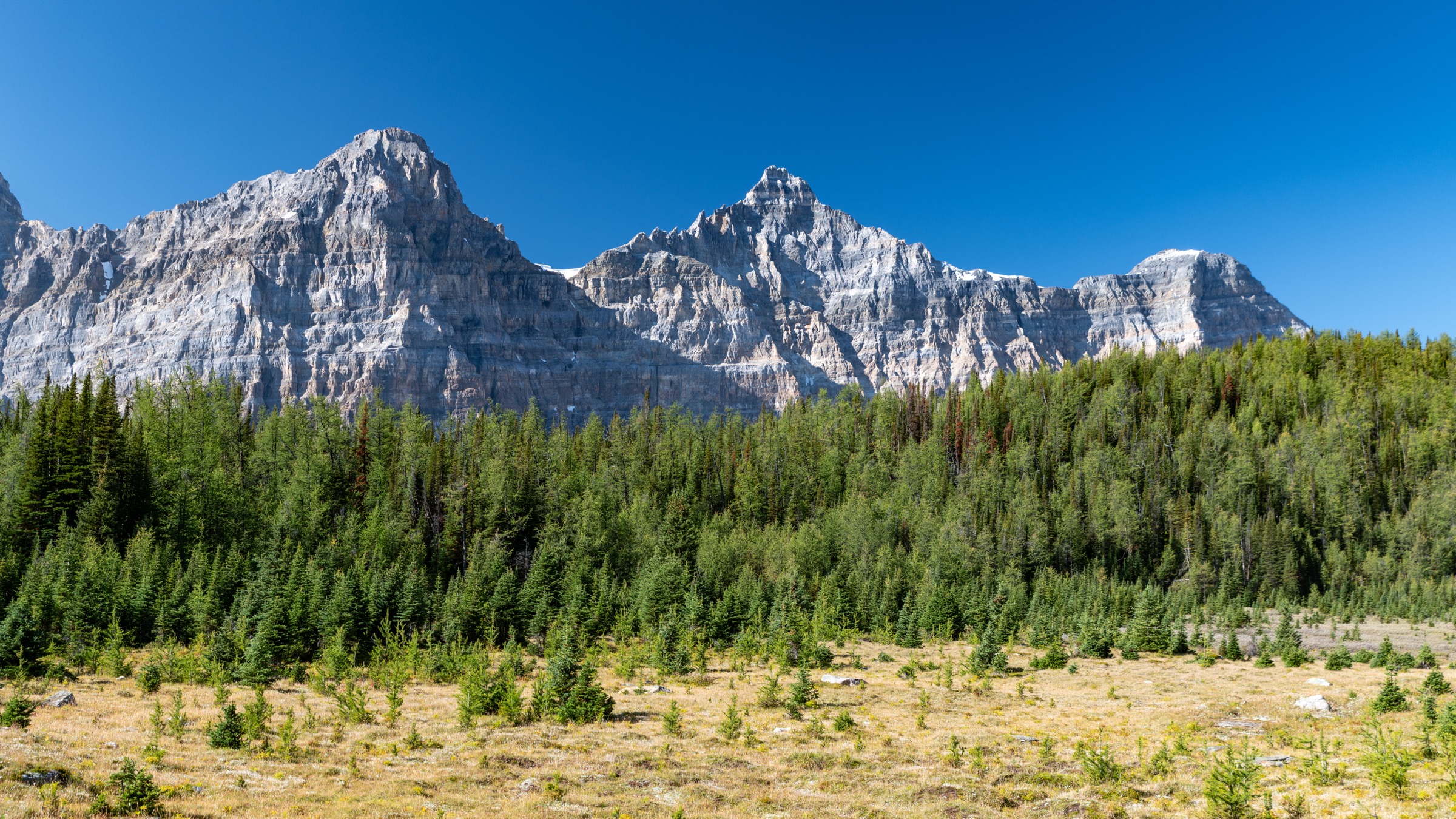
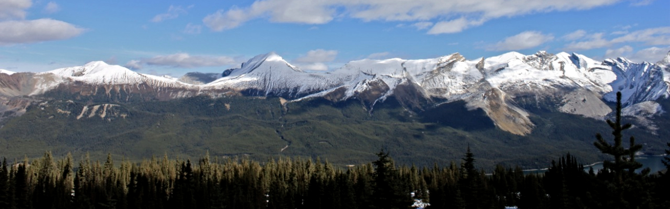
Jasper National Park covers roughly 11,000 km² of the Canadian Rockies in west-central Alberta and forms the northern half of the contiguous Canadian Rocky Mountain Parks UNESCO World Heritage Site. The landscape is built on Palaeozoic limestone and quartzite, sculpted by extensive Pleistocene and present-day glaciation. The southern park boundary at Sunwapta Pass abuts the Columbia Icefield, while the eastern Front Ranges around Miette and the Fiddle River show a more arid, fold-and-thrust character. Treeline sits at roughly 2,100–2,200 m, so even modest day hikes climb quickly into alpine meadows with extensive wildflower displays in July and early August.
The principal hiking centres are Jasper townsite, the Maligne Valley road corridor terminating at Maligne Lake (the longest natural lake in the Canadian Rockies), the Miette Hot Springs road at the eastern edge of the park, and the Icefields Parkway (Highway 93N) running south toward the Columbia Icefield. The Mount Edith Cavell road corridor — historically one of the most important alpine day-hike areas — remains closed for the 2026 season following damage from the 2024 Jasper Wildfire Complex; Parks Canada has not announced a reopening date. Maligne Canyon, the Tonquin–Astoria approach and several other trails are also still closed or partially restricted, and current trail conditions should always be checked on the Parks Canada “What’s open” page before departure.
Typical day-hike season runs from late June through late September, with peak alpine wildflower conditions in mid- to late July. Snowfields commonly linger on north-facing alpine cols and in shaded basins into early or mid-July. Mountain weather is highly variable, with afternoon thunderstorms common in summer, and valley temperatures can drop sharply at altitude. The park is core habitat for grizzly and black bears, and several upper-elevation areas are critical Southern Mountain caribou habitat — dogs are banned on the Bald Hills, Opal Hills and several other alpine trails for that reason. Bear spray is recommended on every backcountry day hike, and a valid Parks Canada day pass or annual Discovery Pass is required to enter the park.
Public transport within the park is limited. The Maligne Lake shuttle (operated seasonally by Pursuit / Maligne Lake Tours) runs from Jasper townsite to the lake during the boat-tour season, and SunDog Transportation operates scheduled services to Edmonton and seasonal Icefields Parkway connections. Most trailheads still effectively require a private vehicle.
Selection rationale
The five hikes below represent a balanced cross-section of Jasper’s confirmed-open day hiking in 2026: an iconic glacier-view pass (Wilcox Pass); a classic summit-ridge hike with the park’s signature lake panorama (Bald Hills); a steep but moderate Front-Range peak with a 360-degree summit (Sulphur Skyline); an alpine cirque-and-meadow loop with caribou-habitat character (Opal Hills); and a low-elevation, family-feasible lake circuit that is also an important symbol of the park’s wildfire recovery (Valley of the Five Lakes). Cavell Meadows and the Path of the Glacier, which would normally be a clear top-five candidate, are excluded because the Cavell Road corridor is closed for all of 2026.
Summary table
| # | Hike | Country | Route type | Distance | Gain | Max elevation | Difficulty |
|---|---|---|---|---|---|---|---|
| 1 | Wilcox Pass | Canada | Out-and-back | 8 km | 390 m | 2,375 m | Moderate |
| 2 | Bald Hills from Maligne Lake | Canada | Out-and-back (ridge ext.) | 10.4 km | 500 m | 2,170 m | Difficult |
| 3 | Sulphur Skyline from Miette Hot Springs | Canada | Out-and-back | 8.8 km | 700 m | 2,050 m | Difficult |
| 4 | Opal Hills Loop | Canada | Loop | 8.2 km | 460 m | 2,165 m | Difficult |
| 5 | Valley of the Five Lakes | Canada | Loop | 4.5–7.7 km | 80–110 m | 1,150 m | Easy-Moderate |
1. Wilcox Pass
Snapshot
Itinerary
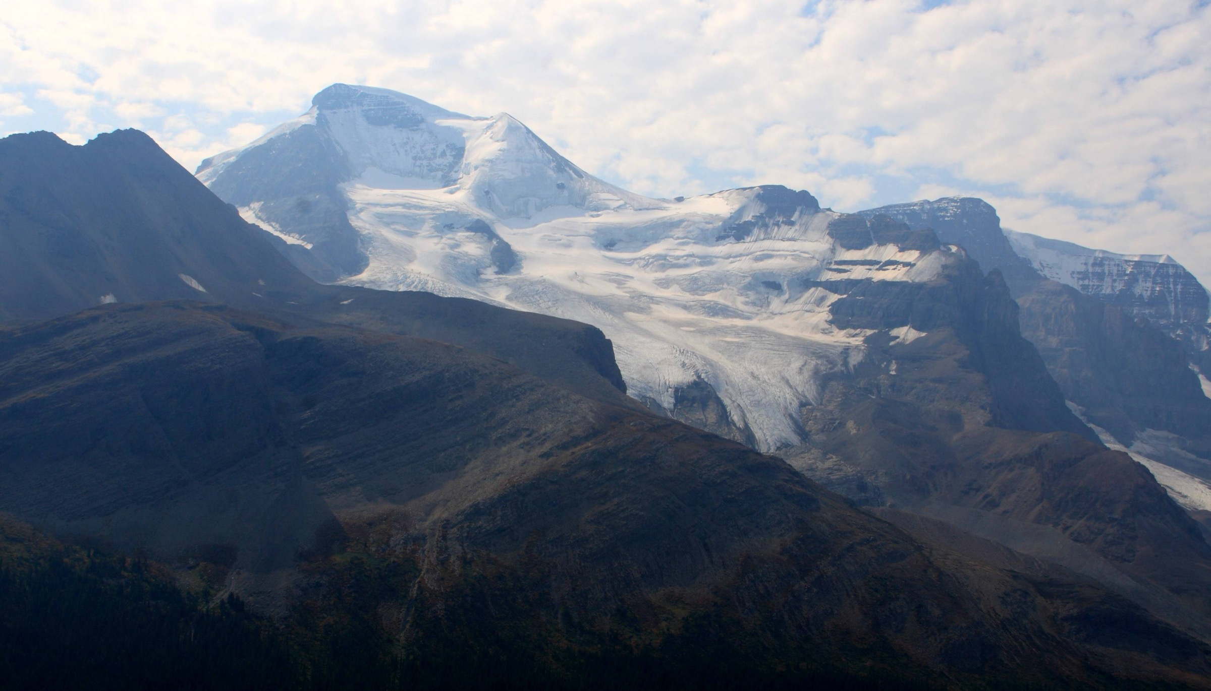
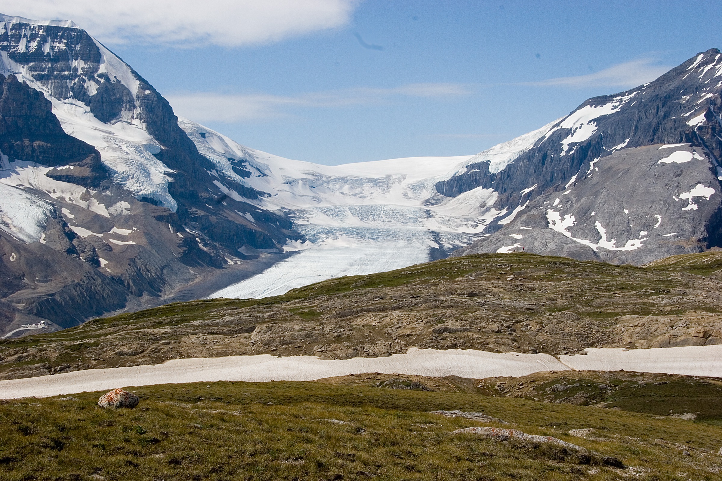
From the Wilcox Creek parking area on the east side of Highway 93N, the trail (Parks Canada Trail 50) climbs steeply through subalpine spruce and fir for the first kilometre, switchbacking up a forested rib above the parkway. The forest opens onto a sloping meadow shelf with sweeping views west across the Sunwapta Valley to Mount Athabasca (3,491 m), Mount Andromeda, the Athabasca Glacier and the toe of the Columbia Icefield. Parks Canada’s two red Adirondack “Red Chair” benches are reached at roughly 1.7 km from the trailhead.
Above the viewpoint the gradient eases as the trail crosses open alpine tundra, threading between low ridges and small tarns. Bighorn sheep frequently graze on these meadows. The trail continues north-east, gaining elevation gently, until it reaches the broad saddle of Wilcox Pass at approximately 2,375 m and 4 km from the trailhead, marked by a cairn. Strong walkers can extend onto the open slopes of Nigel Peak or the lower flanks of Mount Wilcox before retracing the route. Return is by the same trail.
Why it is essential
Wilcox Pass delivers the single most accessible panoramic view of the Columbia Icefield — the largest icefield in the Rocky Mountains south of the Arctic Circle — and of the Athabasca Glacier as it spills from it. The hike trades a relatively modest amount of climbing for genuinely alpine terrain above treeline, almost guaranteed bighorn-sheep encounters, and a historically significant route used by First Nations and early outfitters to bypass the Sunwapta River canyon, “rediscovered” by Walter Wilcox and R.L. Barrett in 1896.
Equipment
Standard hiking equipment plus mountain hiking layers: sturdy boots, weatherproof shell, warm mid-layer, hat and gloves outside high summer, sun protection, 1.5 to 2 litres of water (no reliable on-route water in late summer), map and GPS, headtorch on long days. Trekking poles are recommended for the steep initial climb. Carry bear spray. Microspikes are occasionally useful before mid-July if the upper meadows hold late snow.
Hazards and notes
The first kilometre is steep and can be muddy in early summer. Above the viewpoint the trail is exposed alpine tundra with no shelter from wind, lightning or sudden snow — afternoon thunderstorms develop rapidly over the Columbia Icefield. Caribou are present and group-size or off-trail travel restrictions may apply seasonally; stay on the trail. Dogs are permitted on-leash on this trail. Cell coverage is essentially absent. A valid Parks Canada pass is required.
GPX / KML links
| Source | URL |
|---|---|
| Wikiloc: Wilcox Pass | wikiloc.com |
| Komoot: Wilcox pass trail | komoot.com |
| Outdooractive: Wilcox Pass | outdooractive.com |
| OpenStreetMap: Wilcox Pass area | openstreetmap.org |
2. Bald Hills from Maligne Lake
Snapshot
Itinerary
From the trailhead at the end of Maligne Lake Road, the route follows a wide, decommissioned fire-access road that climbs steadily through lodgepole pine and Engelmann spruce. The road grade is monotonous but easy to follow; at roughly 2.7 km a marked “Bald Hills shortcut” footpath branches left, climbing more directly through the forest and reducing total distance for descent. The fire road ends at approximately 5.2 km at the site of the former fire lookout, where the trees give way to open subalpine grassland.
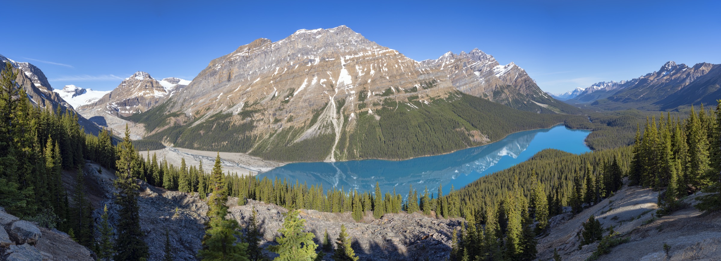
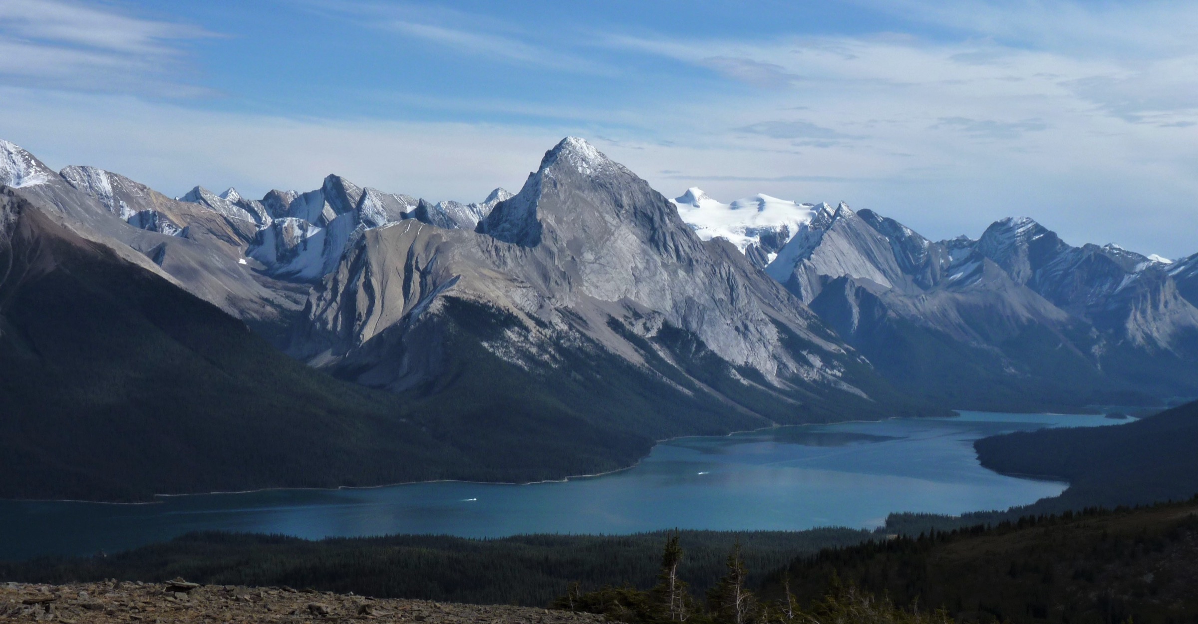
The lookout site itself, at around 2,170 m, provides a panoramic view south down the full 22.5 km length of Maligne Lake to the Maligne Mountain massif and Mount Unwin, with the Queen Elizabeth Ranges rising to the east and Samson Peak forming the eastern shore. Strong walkers can continue north-west along a beaten path onto the broad alpine ridge, traversing two or three of the rolling “bald” summits to a high point near 2,300 m before descending the same way or completing a loose loop back to the fire-road junction. Return is via the fire road or the shortcut path.
Why it is essential
This is the signature panoramic viewpoint over Maligne Lake — the largest natural lake in the Canadian Rockies and one of the most photographed in the park — and an unusually accessible above-treeline walk. The summit ridge passes through caribou habitat where the small Maligne caribou herd has historically ranged, and the open tundra produces strong late-July wildflower displays.
Equipment
Mountain hiking equipment: sturdy boots, weatherproof shell, warm mid-layer, hat and gloves, sun protection, at least 2 litres of water (no reliable water on the upper trail), trekking poles for descent, map and GPS, headtorch. Carry bear spray. Microspikes are useful before mid-July or for early-snow descents.
Hazards and notes
Dogs are prohibited on the Bald Hills trail because of critical caribou habitat — the closure is strictly enforced. The upper ridge is exposed to weather and lightning; retreat to treeline at the first sign of thunderstorms. Wildlife (grizzly bears, black bears, caribou, marmots) is regularly encountered. The fire-road grade is reliable but the shortcut path is steep, root-laced and slippery when wet. Maligne Lake Road is open for 2026, but conditions and any seasonal closures should be checked on the Parks Canada bulletin page before travel.
GPX / KML links
| Source | URL |
|---|---|
| Wikiloc: Bald Hills Trail | wikiloc.com |
| Trailforks: Bald Hills | trailforks.com |
| Gaia GPS: Bald Hills Trail Loop | gaiagps.com |
| OpenStreetMap: Bald Hills fire road and ridge | openstreetmap.org |
3. Sulphur Skyline from Miette Hot Springs
Snapshot
Itinerary
From the Miette Hot Springs parking area at approximately 1,350 m, the trail starts on a paved walkway behind the bathhouse and quickly switches to a wide, well-graded gravel path climbing through subalpine forest. The first 2.2 km ascend steadily across an open south-east-facing mountainside to Shuey Pass at roughly 1,815 m, where the trail forks: a left branch descends to Mystery Lake, while the marked right branch continues for the Sulphur Skyline summit.
Above the junction the trail switchbacks more steeply up the open south ridge, gradually losing the last of the tree cover. The final 600 m is a stony, eroded path on increasingly exposed rock with sections of loose scree, climbing to the summit cairn at 2,050 m. From the top there is a true 360-degree panorama over the Front Ranges — Utopia Mountain, Ashlar Ridge, the Fiddle River valley, the Miette Range and, on a clear day, the more glaciated Maligne and Jacques ranges to the west. Descent is by the same route; the steep upper section can be hard on knees.
Why it is essential
Sulphur Skyline is the iconic east-side Jasper summit hike: relatively short, no scrambling, no exposure beyond walking on a stony ridge, but with a payoff that rivals far longer routes. Pairing the descent with a soak in the adjacent Miette Hot Springs — the hottest mineral springs in the Canadian Rockies — has made it a standard “must-do” on Parks Canada and Tourism Jasper itineraries.
Equipment
Mountain hiking equipment: sturdy boots with good ankle support, weatherproof shell, warm layer (it can be cold and windy on the summit even in August), at least 2 litres of water (no reliable water on the upper trail), sun protection, trekking poles for the descent, map and GPS, headtorch. Carry bear spray.
Hazards and notes
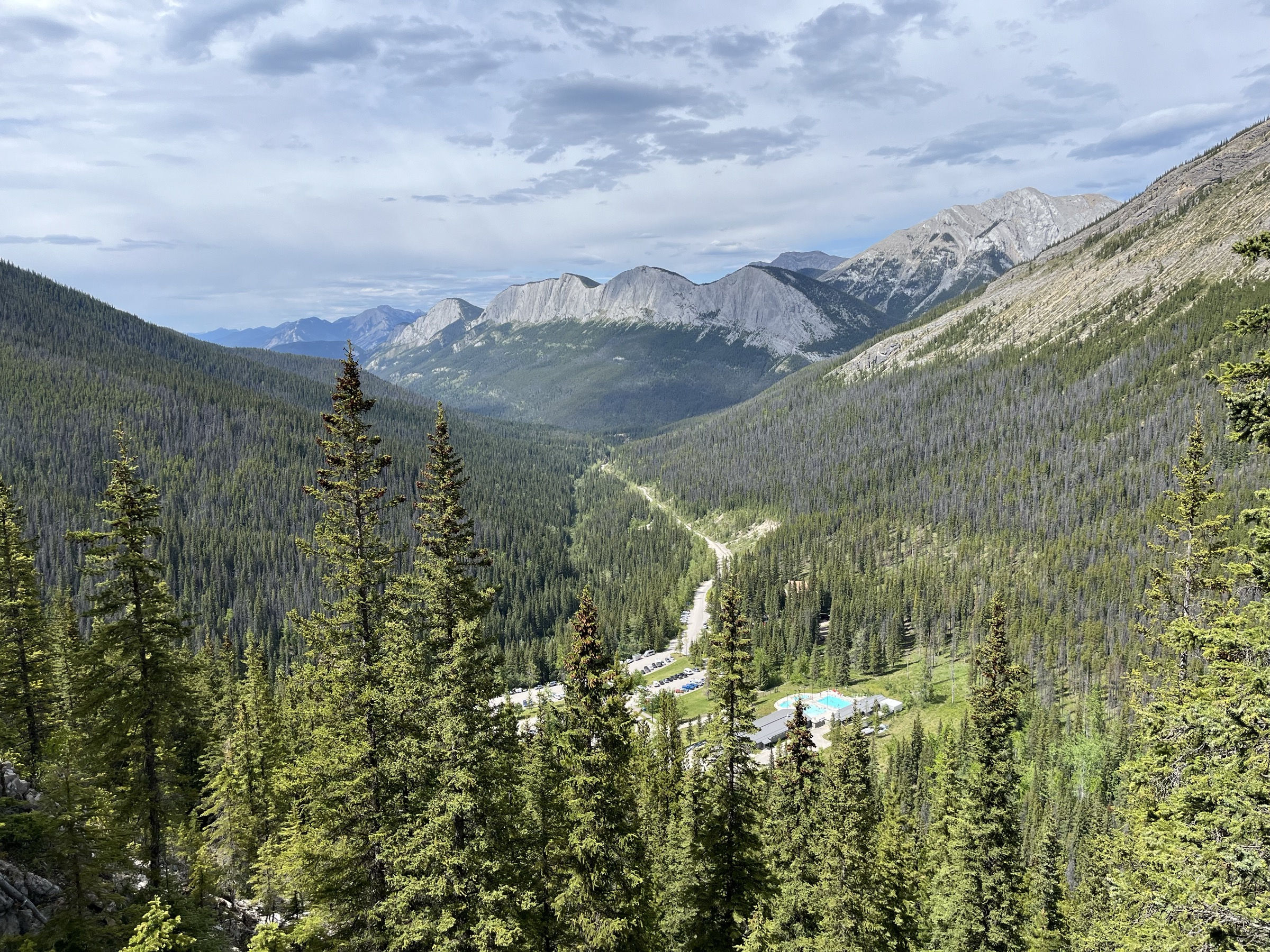
The east-facing slope is exposed to sun and storm; afternoon thunderstorms are common and the summit ridge offers no shelter — turn around at treeline if storms approach. The upper trail is steep, loose and eroded, and descent is the main injury risk. Black and grizzly bear sightings on the lower forested switchbacks are common. The Miette Hot Springs facility and the surrounding trailhead reopened after the 2024 wildfire; check Parks Canada bulletins for current conditions. Dogs are permitted on-leash. Park pass required.
GPX / KML links
| Source | URL |
|---|---|
| Wikiloc: Sulphur Skyline Trail, Jasper NP | wikiloc.com |
| Wikiloc: Sulphur Skyline Trail (alternate) | wikiloc.com |
| Hiking Project: Sulphur Skyline #30 | hikingproject.com |
| Gaia GPS: Sulphur Skyline | gaiagps.com |
4. Opal Hills Loop
Snapshot
Itinerary
From the upper Maligne Lake parking area, the trail (signed for Opal Hills) climbs steeply north-east through montane spruce and fir. The grade is sustained — the route gains the majority of its elevation in the first 3 km — and the path is rooty and rocky in places. At roughly 2.5 km the trail reaches the loop junction; the standard direction is counter-clockwise (right at the junction), which puts the steepest climbing first.
Above the junction the trees thin to open subalpine meadows in the bowl beneath Opal Peak and Sirdar Mountain. The trail traverses the basin, rising onto a grassy shoulder with the so-called “Maligne Lake viewpoint” — the high point of the loop, with a south-westerly view down onto Maligne Lake and across to the Bald Hills. The loop then descends north-west across alpine meadow, dropping back into forest and rejoining the ascent trail at the loop junction. Return is via the lower trail.
Why it is essential
Opal Hills is the steeper, less-trodden alternative to the Bald Hills and offers a more enclosed, cirque-style alpine experience: a high meadow basin rimmed by the Queen Elizabeth Ranges, with caribou and grizzly bear habitat character that few day hikes in the park retain. The contrast in viewpoint (looking south-west across the lake rather than south down its length) makes it a worthwhile counterpart to Bald Hills on a multi-day visit.
Equipment
Mountain hiking equipment: sturdy boots, weatherproof shell, warm mid-layer, hat and gloves, sun protection, at least 2 litres of water (limited on-route), trekking poles strongly recommended for the steep lower section, map and GPS, headtorch. Carry bear spray.
Hazards and notes
Dogs are prohibited because of critical caribou habitat. The lower ascent is steep and slippery when wet. Bear activity is common, and Parks Canada periodically posts area closures or group-size requirements — check trail conditions on the day. The upper meadow remains snow-patched and boggy into mid-July. The loop is exposed above treeline; storms come up quickly.
GPX / KML links
| Source | URL |
|---|---|
| Trailforks: Opal Hills | trailforks.com |
| AllTrails: Opal Hills Short Loop | alltrails.com |
| Trails Viewer: Maligne Lake / Opal Hills loop | trails-viewer.com |
5. Valley of the Five Lakes
Snapshot
Itinerary
From trailhead P15 on the east side of Highway 93N, the route begins on Wetland Way, a flat, gentle approach trail crossing Wabasso Creek on a footbridge and rebuilt boardwalk sections through a beaver-influenced wetland. After approximately 1 km the trail forks: the right branch reaches the lakes via the Emerald Loop (5.4 km total), the left branch via the longer Valley Loop (7.7 km total).
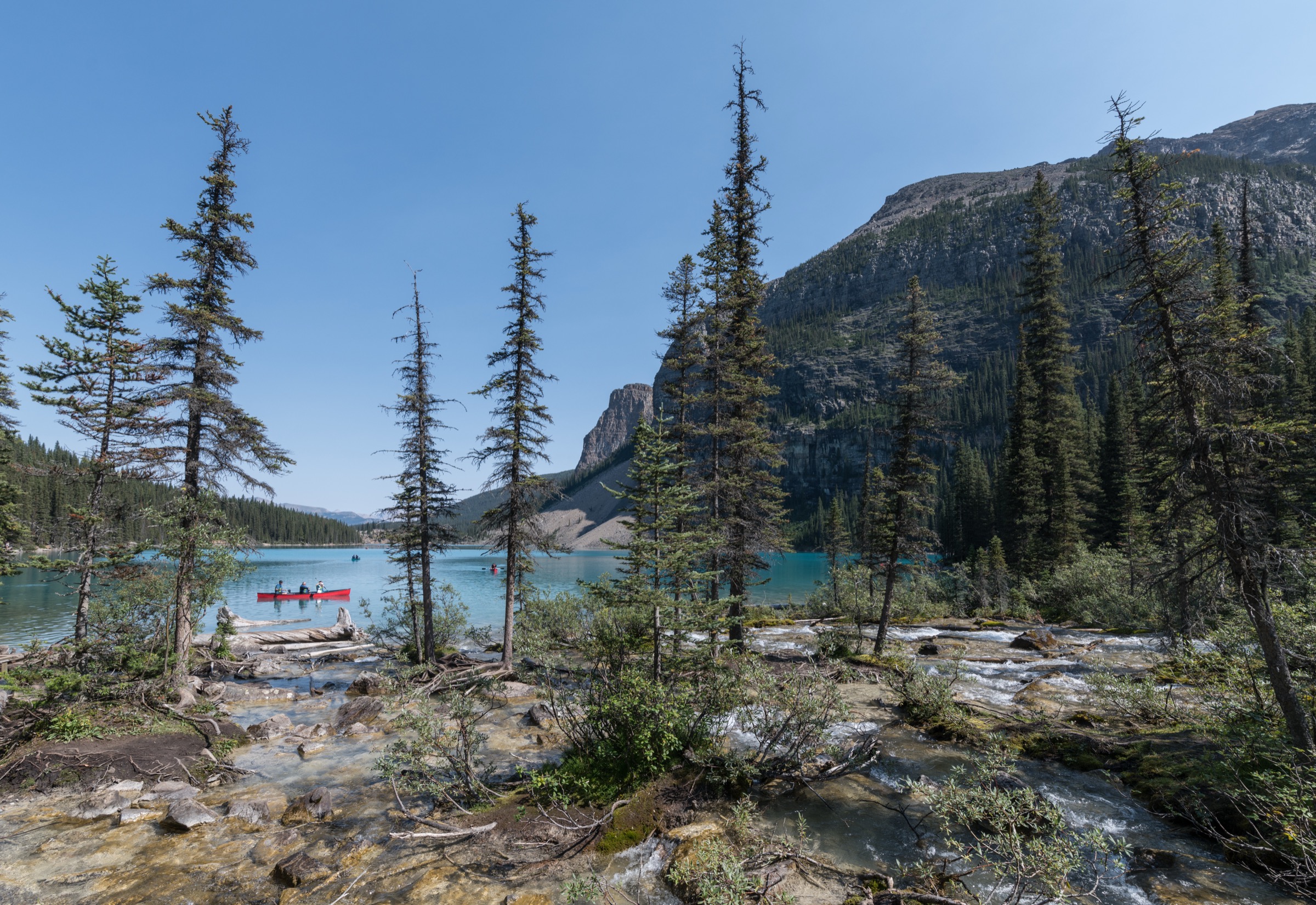
Both options give access to the chain of five small kettle lakes — numbered First through Fifth — strung along a low limestone ridge. The lakes show a striking range of colours (deep aquamarine to emerald green) caused by differences in depth, glacial silt and aquatic vegetation. Short ridge sections between the lakes provide elevated viewpoints; benches and rebuilt rest areas were installed during the 2025–2026 trail restoration. The route returns to the trailhead via Wetland Way.
Why it is essential
The Valley of the Five Lakes is the most-walked low-elevation circuit in Jasper, suitable for a wide range of fitness levels, and one of the only essential day-hike options that does not require a long drive on the Icefields Parkway or the Maligne Road. It is also a documented case study in post-wildfire trail recovery: severely damaged in the 2024 Jasper Wildfire Complex, the trail network was substantially rebuilt and reopened on 23 May 2026 with realigned sections, new ridgeline viewpoints and invasive-species cleaning stations.
Equipment
Standard hiking equipment: hiking shoes or light boots, weatherproof layer, warm layer, water, food, sun protection, map. Carry bear spray — black bears and occasionally grizzlies use the corridor. Insect repellent is recommended in the wetland section in early summer. Microspikes are useful in the spring shoulder season.
Hazards and notes
The trail passes through actively burned forest with standing dead trees; do not stop or linger directly beneath fire-damaged snags in windy conditions, and stay on the designated trail. Boot-cleaning stations are in place to limit invasive-species spread — please use them. Some adjacent meadows around Buffalo Prairie remain closed for restoration. Dogs are permitted on-leash. Swimming is not recommended (cold water, fragile shorelines). Park pass required.
GPX / KML links
| Source | URL |
|---|---|
| AllTrails: Valley of the Five Lakes loop | alltrails.com |
| AllTrails: Valley of the Five Lakes and First Lake Loop | alltrails.com |
| Hiking Project: Valley of the Five Lakes Trail | hikingproject.com |
| OpenStreetMap: local footpath network | openstreetmap.org |
External links
| Source | URL |
|---|---|
| Parks Canada — Jasper National Park | parks.canada.ca |
| Parks Canada — What’s open in Jasper | parks.canada.ca |
| Parks Canada — Jasper bulletins | parks.canada.ca |
| Parks Canada — Icefields Parkway day hikes | parks.canada.ca |
| Parks Canada — Maligne Lake area trails | parks.canada.ca |
| Parks Canada — Miette Hot Springs area trails | parks.canada.ca |
| Parks Canada — South of town trails | parks.canada.ca |
| Parks Canada — Mount Edith Cavell area (closed for the 2026 season) | parks.canada.ca |
| Parks Canada — Wildlife safety in Jasper | parks.canada.ca |
| Parks Canada — Bear spray (mountain national parks) | parks.canada.ca |
| Parks Canada — Jasper recovery | parks.canada.ca |
| Parks Canada — Dogs in sensitive habitat bulletin | parks.canada.ca |
| Tourism Jasper — Day Hikes overview | jasper.travel |
| Tourism Jasper — Bald Hills Day Hike | jasper.travel |
| Tourism Jasper — Sulphur Skyline Day Hike | jasper.travel |
| Tourism Jasper — Opal Hills Loop Trail | jasper.travel |
| HikeJasper — Day-hike quick reference | hikejasper.com |
| Wikipedia — Jasper National Park | en.wikipedia.org |
| Wikipedia — Maligne Lake | en.wikipedia.org |
| Wikipedia — Mount Wilcox (Alberta) | en.wikipedia.org |
| Wikipedia — Opal Hills | en.wikipedia.org |
| Wikipedia — Sunwapta Pass | en.wikipedia.org |
| Wikimedia Commons — Jasper National Park category | commons.wikimedia.org |
| Wikimedia Commons — Columbia Icefield category | commons.wikimedia.org |
| Trailforks — Jasper National Park trails | trailforks.com |
| AllTrails — Best trails in Jasper National Park | alltrails.com |