Regional overview
Yoho National Park (1,313 km²) and Kootenay National Park (1,406 km²) sit on the western side of the Continental Divide in British Columbia, sharing borders with Banff to the east and Jasper to the north. Together they form the western pair of the Canadian Rocky Mountain Parks UNESCO World Heritage Site. The two parks differ sharply in character. Yoho is compact and vertical: glacier-hung peaks rise straight out of the Yoho and Kicking Horse valleys, with classic hanging cirques (Hamilton Lake, Lake McArthur, Lake Oesa), the Iceline traverse beneath the Daly Glacier, and the strictly regulated Lake O’Hara alpine basin. Kootenay is long and linear, following the Vermilion and Kootenay rivers along Highway 93 South for about 100 km from Castle Junction to Radium Hot Springs; its hiking is anchored by the limestone-walled Rockwall, the Stanley Glacier basin, and the burn-scar valleys left by the 2003 and 2017 wildfires.
Most essential walking takes place between mid-July and late September. Lower trails (Wapta Falls, Marble Canyon, Emerald Lakeshore) are usable from late spring; upper alpine routes — the Iceline, the Lake O’Hara Alpine Circuit, Hamilton Lake, Stanley Glacier upper basin and Floe Lake — frequently hold snow into early or mid-July. Larch colour around Lake O’Hara typically peaks in the last week of September. Snow can fall in any month above 2,200 m.
Access requires planning. The Lake O’Hara basin is closed to private vehicles; visitor numbers are controlled by a Parks Canada shuttle bus reserved through a random-draw lottery (applications 2–23 March 2026 for the 19 June – 4 October operating season). Yoho Valley Road (for the Iceline and Takakkaw Falls) is closed to vehicles from mid-October to mid-June. Highway 93 South through Kootenay is open year-round but has limited services. A national park pass is required for all hikes in both parks; 19 June – 7 September 2026 admission is free under the federal Canada Strong Pass initiative.
Bears are present throughout. Several Kootenay backcountry trails — including Floe Lake, Numa Pass and Kindersley Pass — periodically carry a mandatory minimum group-size-of-four restriction due to grizzly activity; this is updated seasonally and must be checked on the Parks Canada bulletins page before departure. Bear spray and noise on the trail are standard practice.
Selection rationale
The five hikes below cover the canonical Yoho and Kootenay objectives that appear consistently in Parks Canada literature, the Canadian Rockies Trail Guide (Patton & Robinson), Gem Trek mapping and major trail databases. Three are in Yoho (Lake O’Hara Alpine Circuit, Iceline, Hamilton Lake) and two in Kootenay (Stanley Glacier, Floe Lake). The Yoho weighting reflects the unusually high concentration of essential alpine routes in that park’s compact area; Kootenay’s strongest day-hikes are well represented by Stanley Glacier (the park’s most popular trail) and Floe Lake (the iconic Rockwall objective). The set spans an iconic alpine circuit, a high glacier-balcony traverse, a steep cirque-lake climb, a moderate glacier basin and a strenuous turquoise-lake out-and-back, providing terrain and difficulty variety across the two parks.
Summary table
| # | Hike | Country | Route type | Distance | Gain | Max elevation | Difficulty |
|---|---|---|---|---|---|---|---|
| 1 | Lake O’Hara Alpine Circuit | Canada | Loop | ~12 km | 810–1,070 m | 2,703 m | Strenuous, exposed |
| 2 | Iceline Trail via Celeste Lake | Canada | Loop | 17.4 km | 970 m | 2,210 m | Strenuous |
| 3 | Hamilton Lake | Canada | Out-and-back | ~11 km | 850–915 m | 2,150 m | Strenuous |
| 4 | Stanley Glacier | Canada | Out-and-back | 8.8–10 km | 385–600 m | 2,150 m | Moderate |
| 5 | Floe Lake | Canada | Out-and-back | 21.6 km | 1,050–1,120 m | 2,040 m | Strenuous |
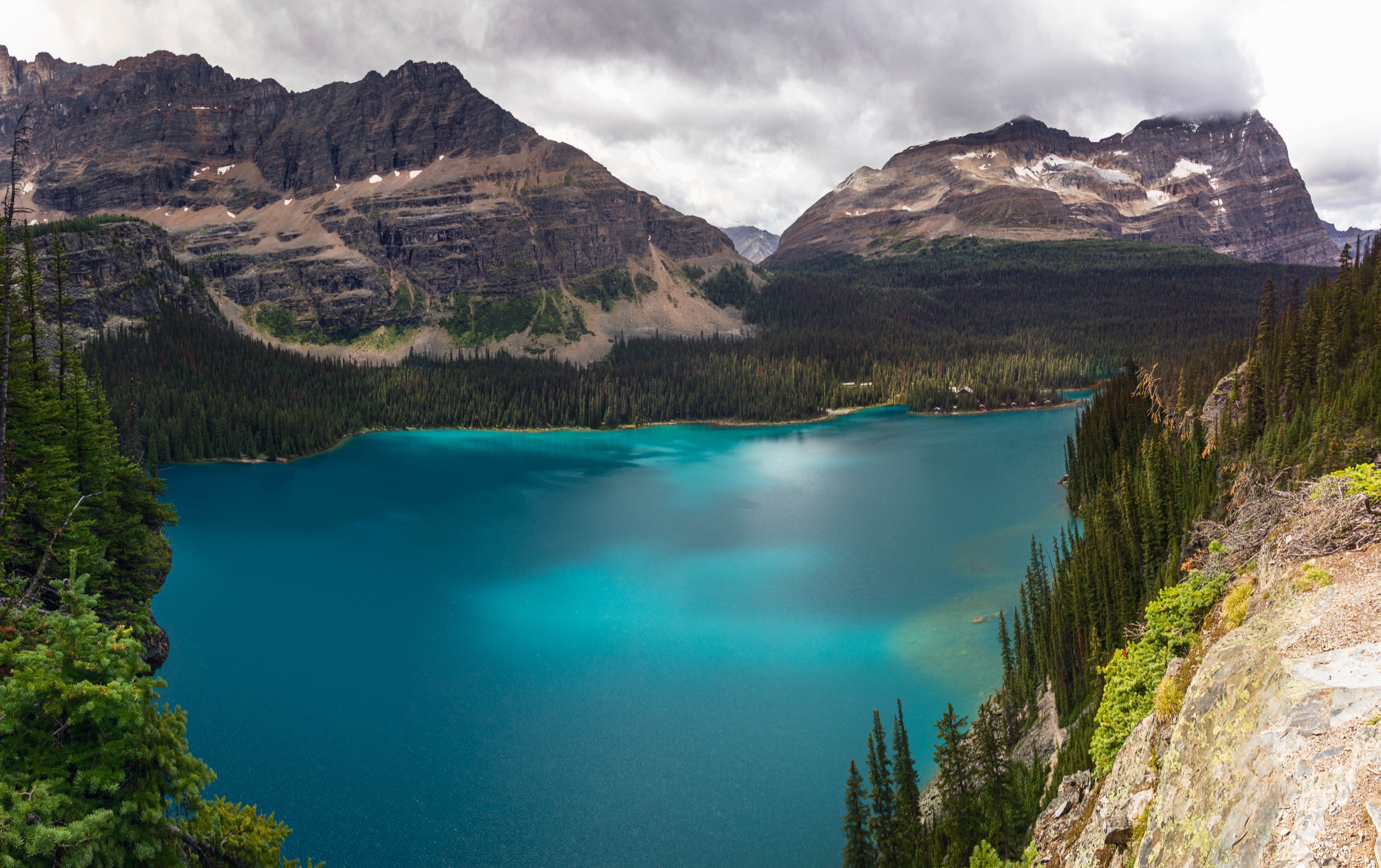
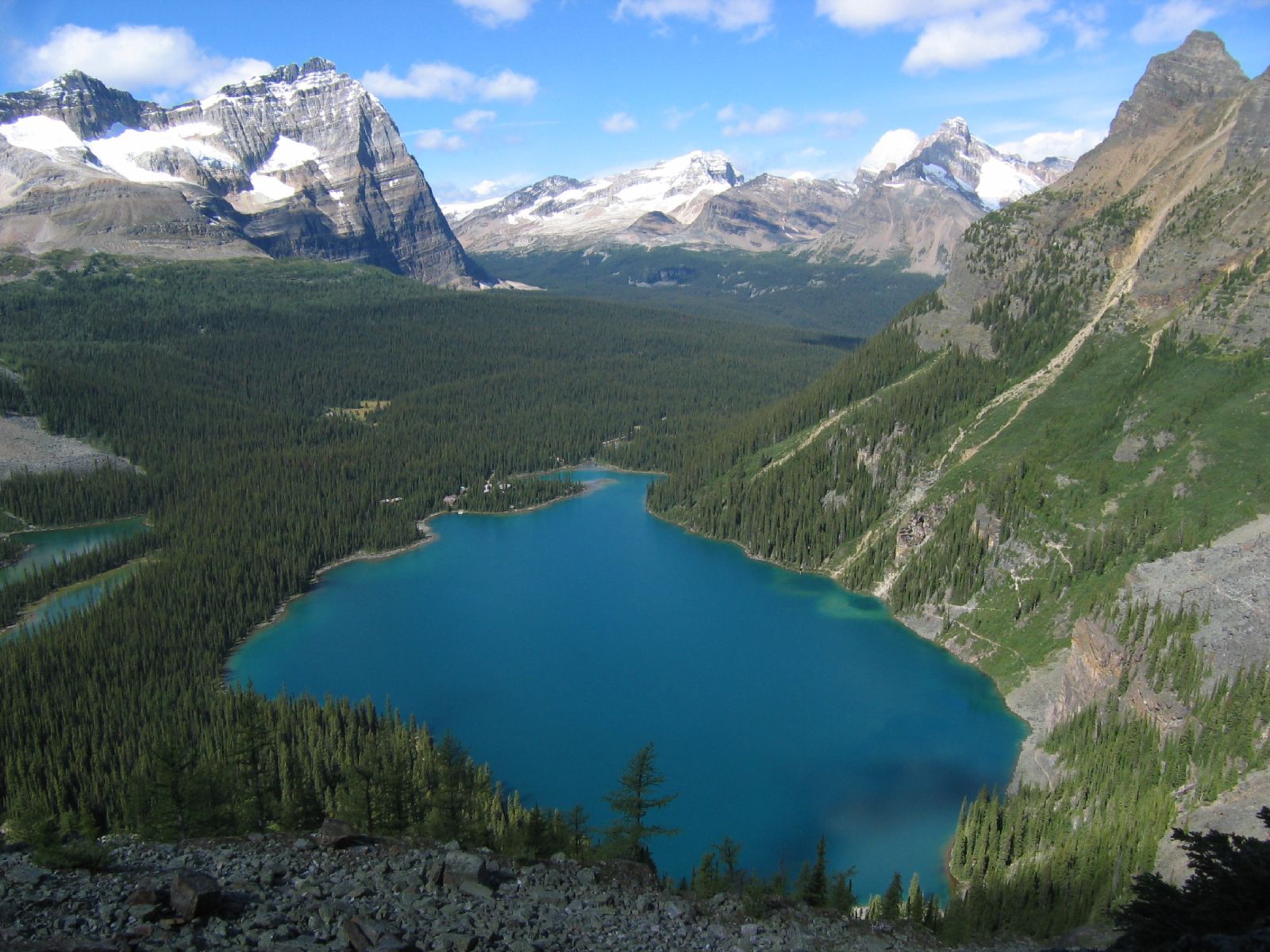
1. Lake O’Hara Alpine Circuit
Snapshot
Itinerary
The circuit links three alpine routes — Wiwaxy Gap / Huber Ledges, Yukness Ledges and All Soul’s Prospect — connected by shoreline and Opabin Plateau paths. Clockwise is the standard direction because it places the steepest gain on the ascent rather than the descent.
From Le Relais the route follows the Lake O’Hara shoreline trail north-east to the Wiwaxy Gap junction. The Wiwaxy route climbs sharply through forest, then onto open scree, gaining roughly 500 m in 1.5 km to reach Wiwaxy Gap (2,703 m) between Mount Huber and Wiwaxy Peaks — the high point of the circuit. From the gap, the Huber Ledges traverse cuts south-east across the steep north face of Mount Huber on a narrow cairned shelf with significant exposure, dropping ~300 m to Lake Oesa (2,267 m).
From Lake Oesa, the Yukness Ledges Alpine Route contours south-west across the west face of Yukness Mountain on a series of rocky benches with views down to Lake O’Hara. The route descends to the upper edge of the Opabin Plateau, joining the Opabin Highline path. The plateau is followed south past Hungabee Lake and Opabin Lake, then west to the start of the All Soul’s Prospect route. All Soul’s climbs over a broad shoulder of Mount Schäffer (2,475 m) for a final overview of the basin before descending to Schäffer Lake. From Schäffer Lake, the Big Larches trail returns north to Le Relais in time for the afternoon return bus.
Why it is essential
Widely regarded as the finest alpine day-route in the Canadian Rockies. The circuit links the basin’s signature lakes (O’Hara, Oesa, Hungabee, Opabin, Schäffer), crosses three of the Alpine Club of Canada / Lawrence Grassi-engineered alpine routes, and offers an unbroken sequence of views over the Cathedral, Huber, Lefroy, Glacier Peak and Hungabee massifs. The Lake O’Hara reservation system makes the circuit a once-or-twice-in-a-lifetime objective for most visitors.
Equipment
- Sturdy boots with grippy soles (scree, polished ledges)
- Trekking poles
- Warm layer, hat and gloves outside midsummer
- Headtorch
- 2 L water (limited reliable sources above Lake Oesa)
- Sun protection
- Navigation backup
- Bear spray
- Bus reservation confirmation (mandatory unless walking the 11 km access road)
Hazards and notes
Sustained exposure: the Wiwaxy Gap / Huber Ledges section traverses narrow scree ledges with significant drops; not suitable for hikers uncomfortable with exposure or unsteady on loose rock. Lingering snow on north-facing ledges into mid-July can make the route serious; check with the Le Relais volunteers on arrival. Alpine routes follow cairns rather than constructed tread; navigation can be difficult in cloud or whiteout. Sudden thunderstorms regularly trap parties on the high traverses — start early and turn back from the high routes in poor weather. Dogs are not permitted on the shuttle and are discouraged in the basin. Drones prohibited. The final return bus is typically 18:30 MDT; missing it means walking 11 km back to the parking area.
GPX / KML links
| Source | URL | Format | Notes |
|---|---|---|---|
| OpenStreetMap | openstreetmap.org | OSM data (export GPX) | ODbL 1.0; reusable with attribution |
| Parks Canada — Lake O’Hara trail descriptions | parks.canada.ca | Source page | Route descriptions; no published GPX |
Sources
- Parks Canada — Plan a trip to Lake O’Hara
- Parks Canada — Lake O’Hara trail descriptions
- Wikipedia — Lake O’Hara
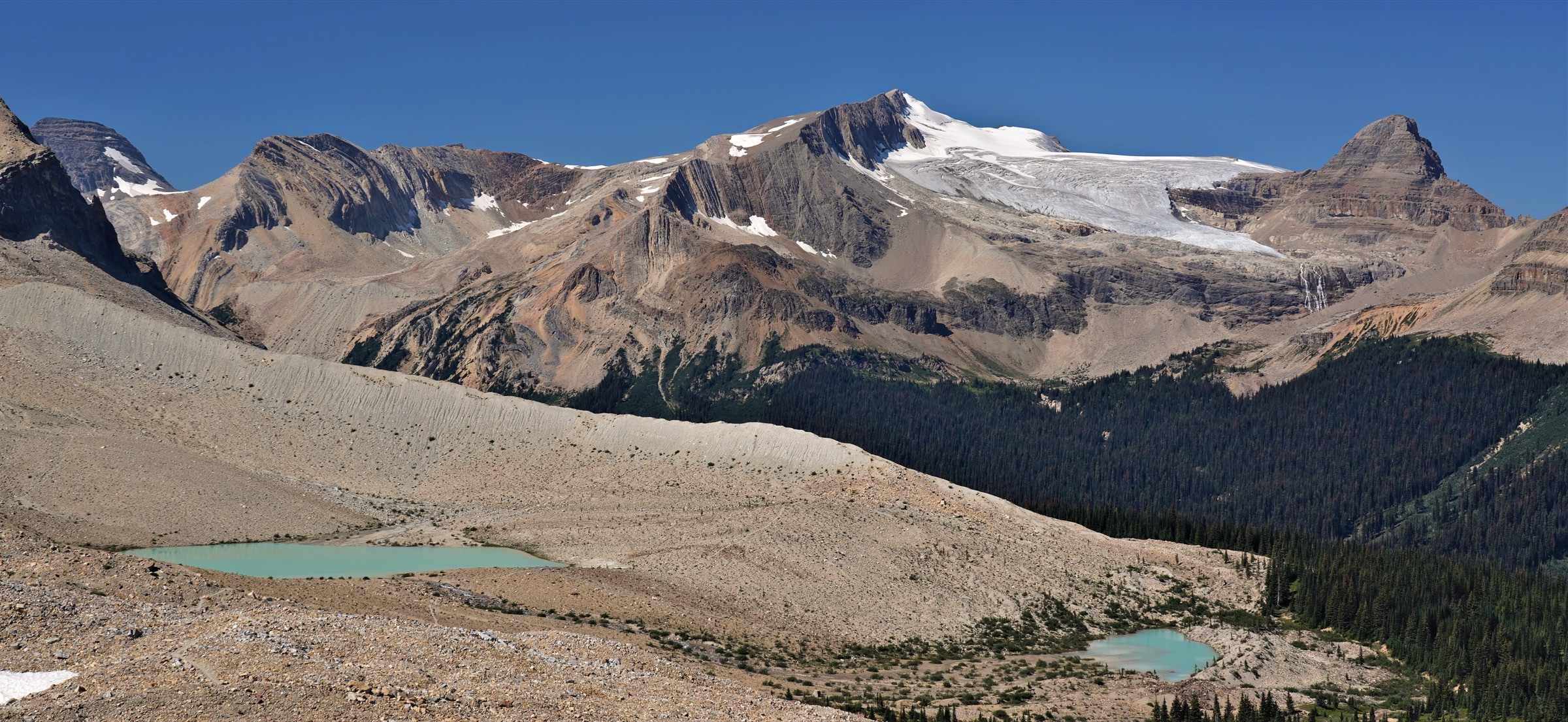
2. Iceline Trail via Celeste Lake
Snapshot
Itinerary
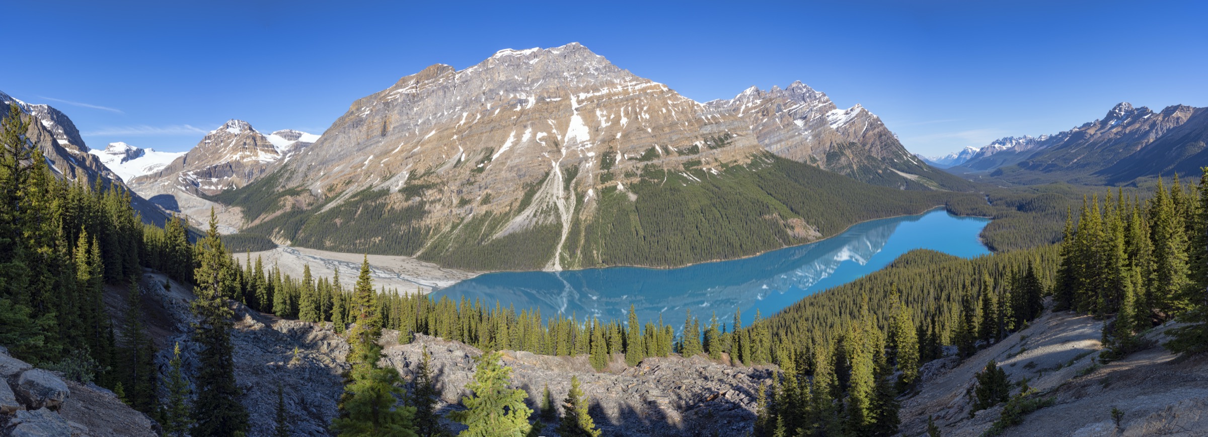
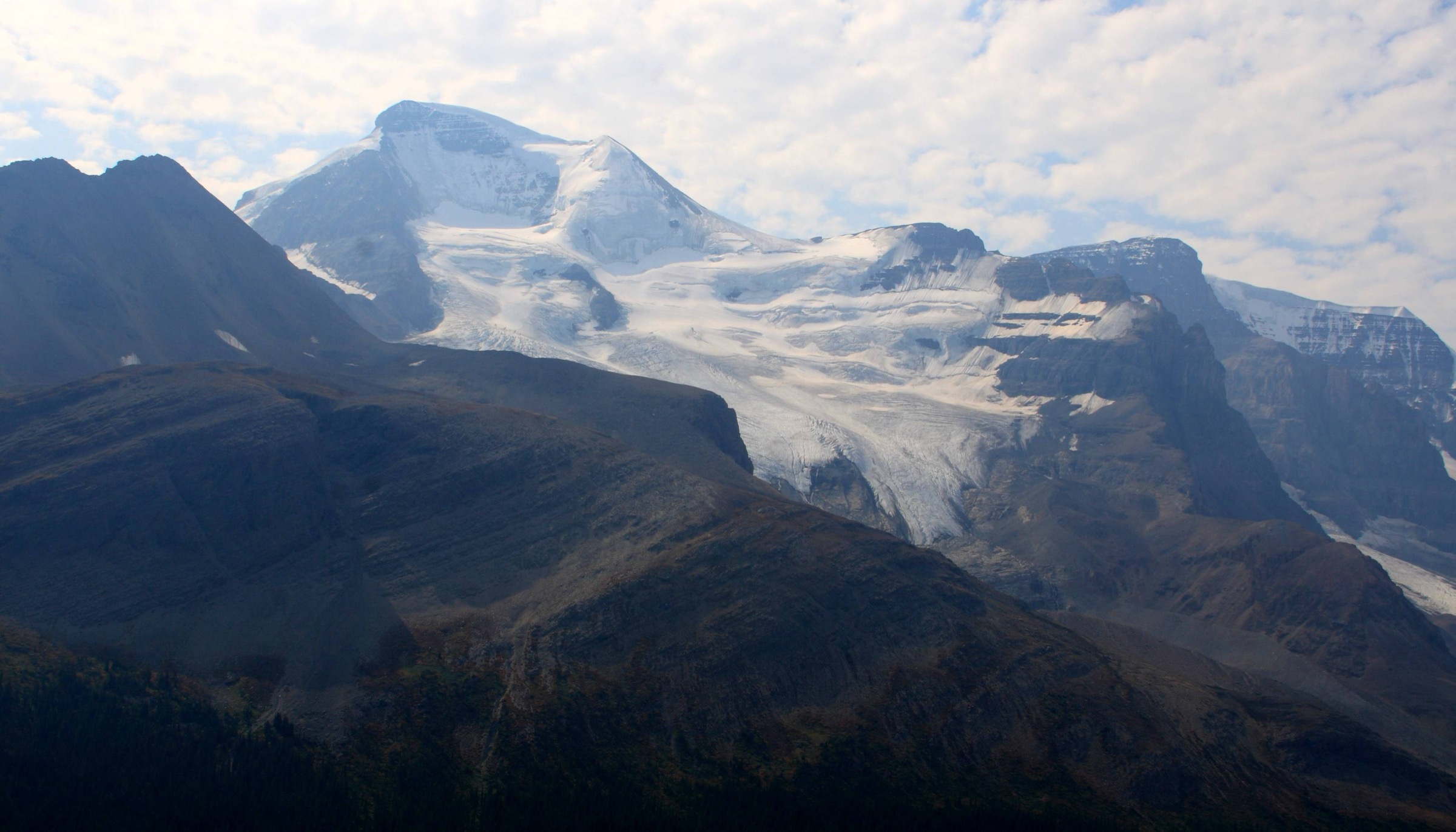
From the Whiskey Jack trailhead, the path climbs in steep switchbacks through fire-thinned subalpine forest, gaining ~300 m in the first 2 km to reach the junction with the Yoho Lake and Hidden Lakes trails. Bearing right onto the Iceline, the route continues climbing more gradually onto open lateral moraine deposited by the retreating Emerald Glacier. Over the next 4–5 km the trail traces the moraine bench beneath the Vice President, the President and Mount Whymper, passing meltwater tarns and crossing several glacier-fed streams. Views across Yoho Valley are dominated by Takakkaw Falls (373 m, one of the highest waterfalls in Canada) and the icefields of the Waputik Range.
For the Celeste Lake loop, descend west into the Little Yoho drainage via the Celeste Lake connector, joining the Little Yoho Valley trail above Laughing Falls. Follow the Little Yoho / Yoho Valley trail north-east, then turn south to descend past Twin Falls and Laughing Falls back to the Takakkaw Falls parking area, with a final ~3 km of valley-floor walking.
The longer Iceline via Little Yoho variant continues farther along the moraine before dropping to the Stanley Mitchell Hut and following the Little Yoho / Yoho Valley trails out — adding roughly 3 km and 120 m of gain.
Why it is essential
The Iceline is Yoho’s signature high-level traverse, marketed by Parks Canada as the park’s premier day hike. The route spends roughly 6 km in continuous alpine terrain at the foot of active glaciers, an unusual proposition for a non-technical Canadian Rockies trail. The combination of Takakkaw Falls, the ice front of the Emerald and Yoho glaciers, and the Little Yoho meadows makes it the most representative single-day route in the park.
Equipment
- Sturdy boots
- Trekking poles (strongly recommended on moraine)
- Warm layer, hat and gloves
- Full waterproofs (frequent afternoon storms)
- 2+ L water (glacial streams need treatment)
- Headtorch
- Microspikes useful before late July
- Bear spray
Hazards and notes
Snow lingers on the upper Iceline into early or mid-July in most years; the moraine sections become disorienting in whiteout. Stream crossings can run high in the afternoon during hot weather. The Yoho Valley has an active grizzly population: occasional short-notice closures of the connector trails (Iceline Connector, Yoho Lake) occur — verify on the Yoho bulletins page. Group-of-four restrictions are sometimes imposed seasonally on the Little Yoho variant. No dogs off-leash. Cell coverage is absent.
GPX / KML links
| Source | URL | Format | Notes |
|---|---|---|---|
| OpenStreetMap | openstreetmap.org | OSM data (export GPX) | ODbL 1.0; reusable with attribution |
| AllTrails community track | alltrails.com | GPX (account) | AllTrails ToS — personal use only |
| Parks Canada — Yoho day hikes | parks.canada.ca | Source page | No published GPX |
Sources
3. Hamilton Lake
Snapshot
Itinerary
The trail leaves the north end of the Emerald Lake parking area, sharing the first ~800 m with the Hamilton Falls short walk. A signed junction directs the Hamilton Lake route uphill to the right. From here the path climbs relentlessly through dense montane forest on roughly 45 switchbacks engineered into the steep east face of Mount Carnarvon and the Emerald–Hamilton ridge. The grade barely relents for nearly 4 km of forest hiking, with only occasional gaps in the canopy giving glimpses of Emerald Lake and the President Range.
At around 1,950 m the trail emerges onto avalanche slopes and subalpine meadow, traversing south-west into a hanging cirque ringed by the quartzite cliffs of Mount Carnarvon (3,040 m) and the unnamed satellite ridge of the Vice President. Hamilton Lake sits in the floor of this cirque at ~2,150 m, often holding icebergs into mid-summer. The return is by the same route — descent is hard on knees given the sustained gradient.
Why it is essential
Hamilton Lake is the classic Yoho cirque-lake objective accessible without a permit or shuttle reservation. It serves as the counterpoint to the Iceline (glacier balcony) and the Lake O’Hara basin (regulated alpine playground) by providing a self-contained, full-effort climb to one hanging tarn — the type of route the Canadian Rockies are best known for. The trail is listed by Parks Canada among Yoho’s headline “difficult” day hikes.
Equipment
- Sturdy boots
- Trekking poles (essential for the descent)
- Warm layer, hat and gloves outside midsummer
- Full waterproofs
- 2+ L water (no reliable source above the falls)
- Headtorch for long days
- Bear spray
Hazards and notes
Sustained steep gradient — the climb gains roughly 900 m in 5 km, harder than most Lake O’Hara trails. The cirque holds snow into mid-July; in early season the final approach across avalanche debris can be tricky. Black bear and occasional grizzly activity in the Emerald basin; check Yoho bulletins. Parking at Emerald Lake fills before 09:00 in peak season — arrive early. Dogs permitted on leash.
GPX / KML links
| Source | URL | Format | Notes |
|---|---|---|---|
| OpenStreetMap | openstreetmap.org | OSM data (export GPX) | ODbL 1.0; reusable with attribution |
| AllTrails community track | alltrails.com | GPX (account) | AllTrails ToS — personal use only |
| Parks Canada — Yoho day hikes | parks.canada.ca | Source page | No published GPX |
Sources
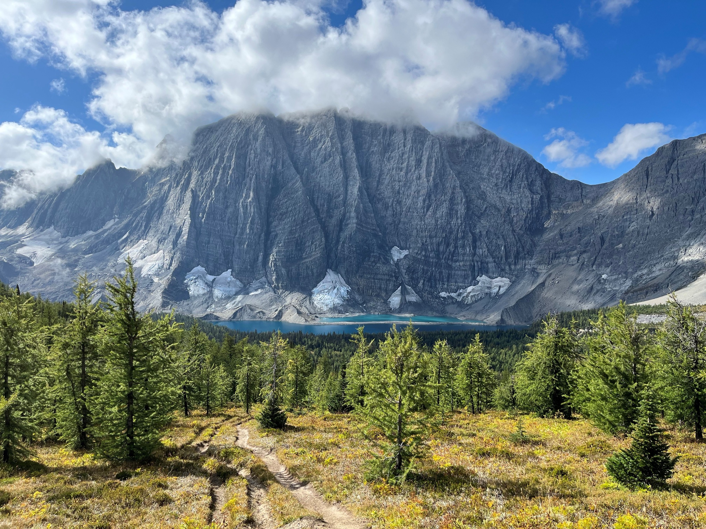
4. Stanley Glacier
Snapshot
Itinerary
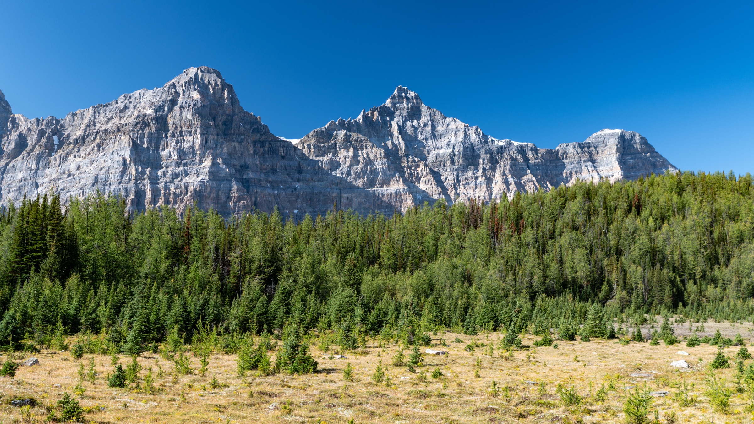
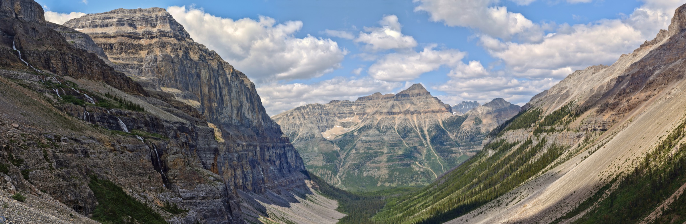
The trail starts on the east side of Highway 93 and immediately crosses the Vermilion River on a footbridge. The first 1.5 km climbs gently through the standing snags of the 2003 Kootenay wildfire, now a regenerating montane forest dense with fireweed, lodgepole pine saplings and wildflowers, with open views ahead to the Stanley Glacier hanging valley. The path then enters the lower glacial U-valley and climbs more steeply through subalpine forest, swinging east and gaining elevation in measured switchbacks.
By around 3.5 km the trail emerges onto open scree and meltwater meadows directly beneath the headwall. The Stanley Glacier hangs from a notch in the north face of Stanley Peak (3,155 m), feeding waterfalls that drop the full height of the cirque wall. The maintained trail terminates near a large boulder field at ~4.4 km, the standard viewpoint and turnaround.
Strong hikers can continue on an unmaintained route up the rough scree and over rock steps to the upper basin and the toe of the glacier itself, adding roughly 1–2 km and 200+ m of gain. This area also includes a restricted Burgess Shale fossil site (the Stanley Glacier locality), which may only be visited on a guided Parks Canada interpretive hike.
Why it is essential
The most popular day hike in Kootenay National Park and the park’s most accessible alpine glacier experience. The route condenses the Kootenay landscape — fire-scar regeneration, hanging glacier, classic limestone headwall, Burgess Shale geology — into a moderate half-day outing, making it the natural representative essential hike for the park.
Equipment
- Hiking boots
- Weatherproof and warm layer
- 2 L water
- Sun protection
- Navigation backup
- Trekking poles useful on the upper rough section
- Bear spray
Hazards and notes
Lingering snow patches on the upper basin into July; the boulder field can be slippery when wet. Rockfall potential from the cirque headwall — keep clear of the base of the cliffs. The 2003 burn zone provides little shade on the lower 1.5 km; carry extra water in hot weather. Black bear and grizzly activity routine in the Vermilion Valley; make noise on the forested switchbacks. The Burgess Shale fossil locality requires a Parks Canada-led guided trip and pre-booking; independent fossil collection is prohibited. Dogs permitted on leash. Highway 93 has limited mobile coverage.
GPX / KML links
| Source | URL | Format | Notes |
|---|---|---|---|
| OpenStreetMap | openstreetmap.org | OSM data (export GPX) | ODbL 1.0; reusable with attribution |
| AllTrails community track | alltrails.com | GPX (account) | AllTrails ToS — personal use only |
| Parks Canada — Stanley Glacier (Burgess Shale) | parks.canada.ca | Source page | No published GPX |
Sources
5. Floe Lake
Snapshot
Itinerary
The trail leaves the highway pull-off and immediately crosses the Vermilion River on a substantial footbridge. The first 3 km traverses the burn scars of the 2001 Tokumm and 2003 Kootenay wildfires — open standing snags and dense pink fireweed in summer — with limited shade and good views back across the Vermilion Valley to the Mitchell Range. The path follows Floe Creek’s gentle gradient for roughly 6 km, gradually steepening as it approaches the base of the Rockwall.
At about 7 km the trail enters the steep cirque headwall and begins the main climb on roughly 30 switchbacks, gaining ~500 m in the final 3 km. The forest transitions to subalpine larch and Engelmann spruce, with the limestone Rockwall (a near-vertical 900-metre cliff line running from Floe Peak to Mount Foster) increasingly dominant ahead. The trail crests at the lake outlet at 2,040 m. Floe Lake is a deep turquoise tarn directly beneath the Rockwall and the small Floe Glacier, with floating ice common in early summer. The Parks Canada warden cabin and backcountry campground sit at the outlet.
Day hikers turn around at the lake; the Rockwall Trail continues north over Numa Pass.
Why it is essential
Floe Lake is the most photographed location in Kootenay National Park and the iconic image of the Rockwall. As a day hike it is the southern alternative to the multi-day Rockwall traverse, providing the route’s signature view in a single (long) day. The fire-scar approach and intact alpine cirque also demonstrate the regenerating post-burn landscape that defines much of modern Kootenay hiking.
Equipment
- Sturdy boots
- Trekking poles
- Warm layer, full waterproofs
- Hat and gloves outside midsummer
- 2.5+ L water (no reliable treated source en route)
- Substantial food
- Headtorch (long day)
- Bear spray (mandatory in practice)
Hazards and notes
Long day for the distance and gain — many parties underestimate the return descent on tired legs. A mandatory minimum group size of four has applied seasonally on Floe Lake in recent years due to grizzly activity; verify on the Parks Canada Kootenay bulletins page on the morning of the hike. Burn-scar trees can fall in wind: avoid the lower trail in high winds. Limited water sources on the climb; Floe Creek itself is brushy and hard to access. Thunderstorms common on the exposed cirque headwall in the afternoon. Dogs permitted on leash but strongly discouraged given bear pressure. No camping without a reservation; the lake-side campground is wilderness-permit only.
GPX / KML links
| Source | URL | Format | Notes |
|---|---|---|---|
| OpenStreetMap | openstreetmap.org | OSM data (export GPX) | ODbL 1.0; reusable with attribution |
| AllTrails community track | alltrails.com | GPX (account) | AllTrails ToS — personal use only |
| Parks Canada — Kootenay day hikes | parks.canada.ca | Source page | No published GPX |
Sources
External links
| Source | URL |
|---|---|
| Parks Canada — Yoho National Park | parks.canada.ca |
| Parks Canada — Yoho day hikes | parks.canada.ca |
| Parks Canada — Lake O’Hara visit page | parks.canada.ca |
| Parks Canada — Lake O’Hara trail descriptions | parks.canada.ca |
| Parks Canada — Yoho bulletins | parks.canada.ca |
| Parks Canada — Kootenay National Park | parks.canada.ca |
| Parks Canada — Kootenay day hikes | parks.canada.ca |
| Parks Canada — Stanley Glacier (Burgess Shale) | parks.canada.ca |
| Parks Canada Reservation Service | reservation.pc.gc.ca |
| OpenStreetMap (ODbL 1.0) | openstreetmap.org |
| AllTrails — Yoho trails | alltrails.com |
| AllTrails — Kootenay trails | alltrails.com |