Regional overview
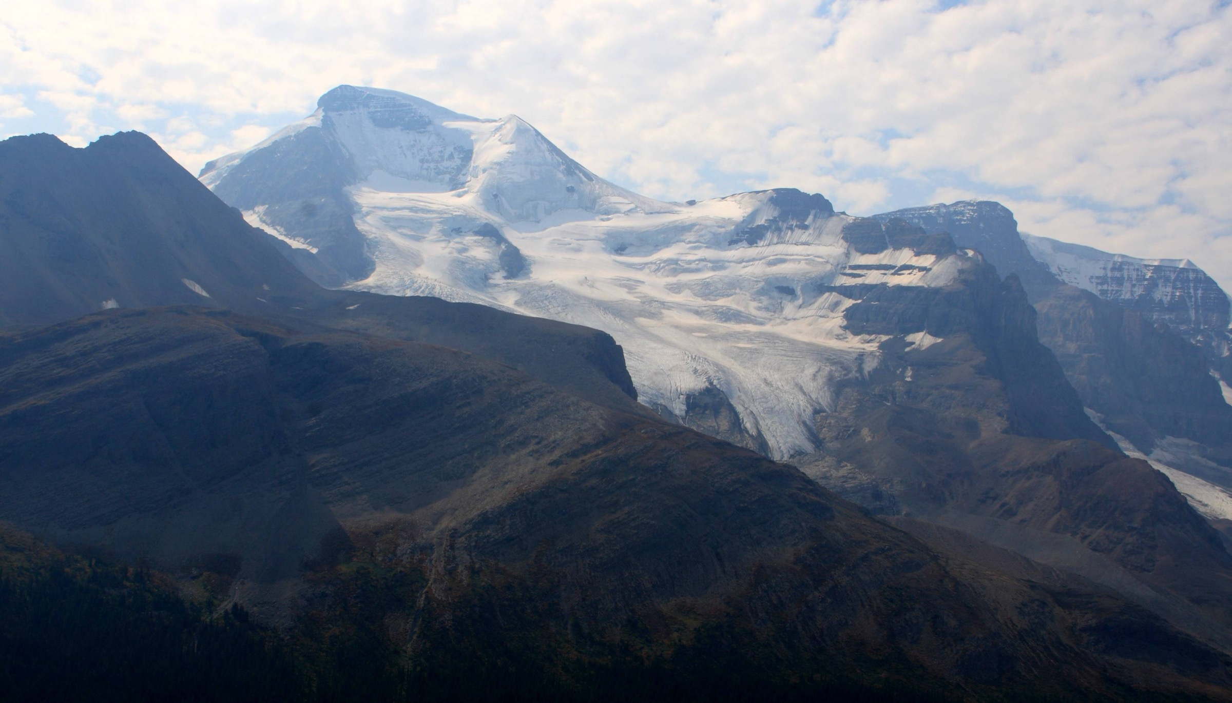
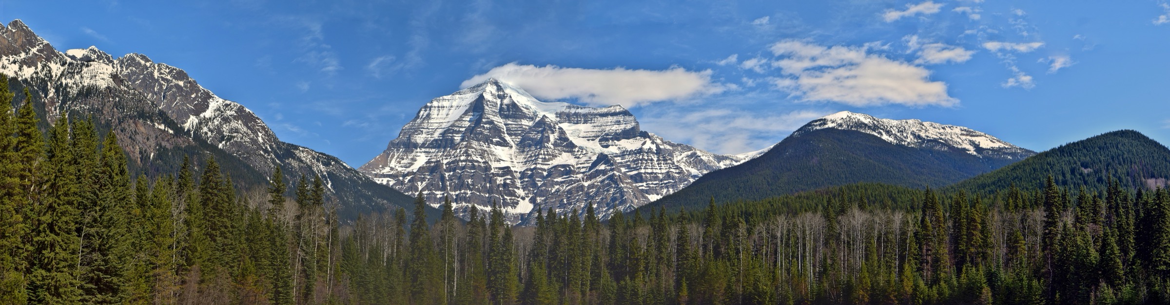
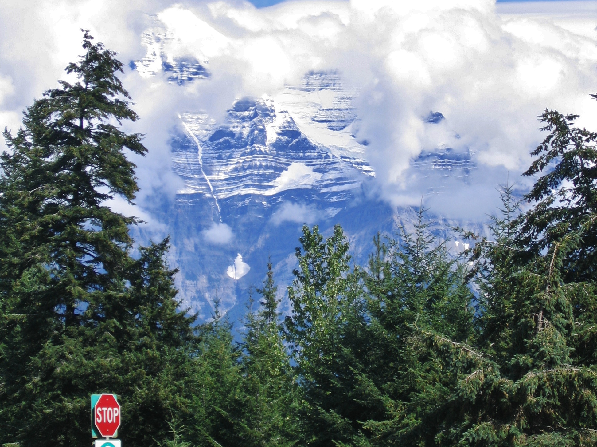
Mount Robson Provincial Park anchors the western flank of the Canadian Rockies in British Columbia and is dominated by Mount Robson itself (3,954 m), the range’s highest peak. The park is bisected by the Yellowhead Highway (BC Highway 16), the principal road link between Jasper and the Robson Valley, and includes the headwaters of the Fraser River. To the south lies Mount Terry Fox Provincial Park, named for the marathon runner whose 1980 Marathon of Hope made him a national figure; the peak that bears his name rises above the village of Valemount. Hundreds of kilometres further north along the Alaska Highway, Stone Mountain Provincial Park represents the most accessible alpine terrain of the truly Northern Canadian Rockies, sitting astride Summit Pass — the highest point on the Alaska Highway.
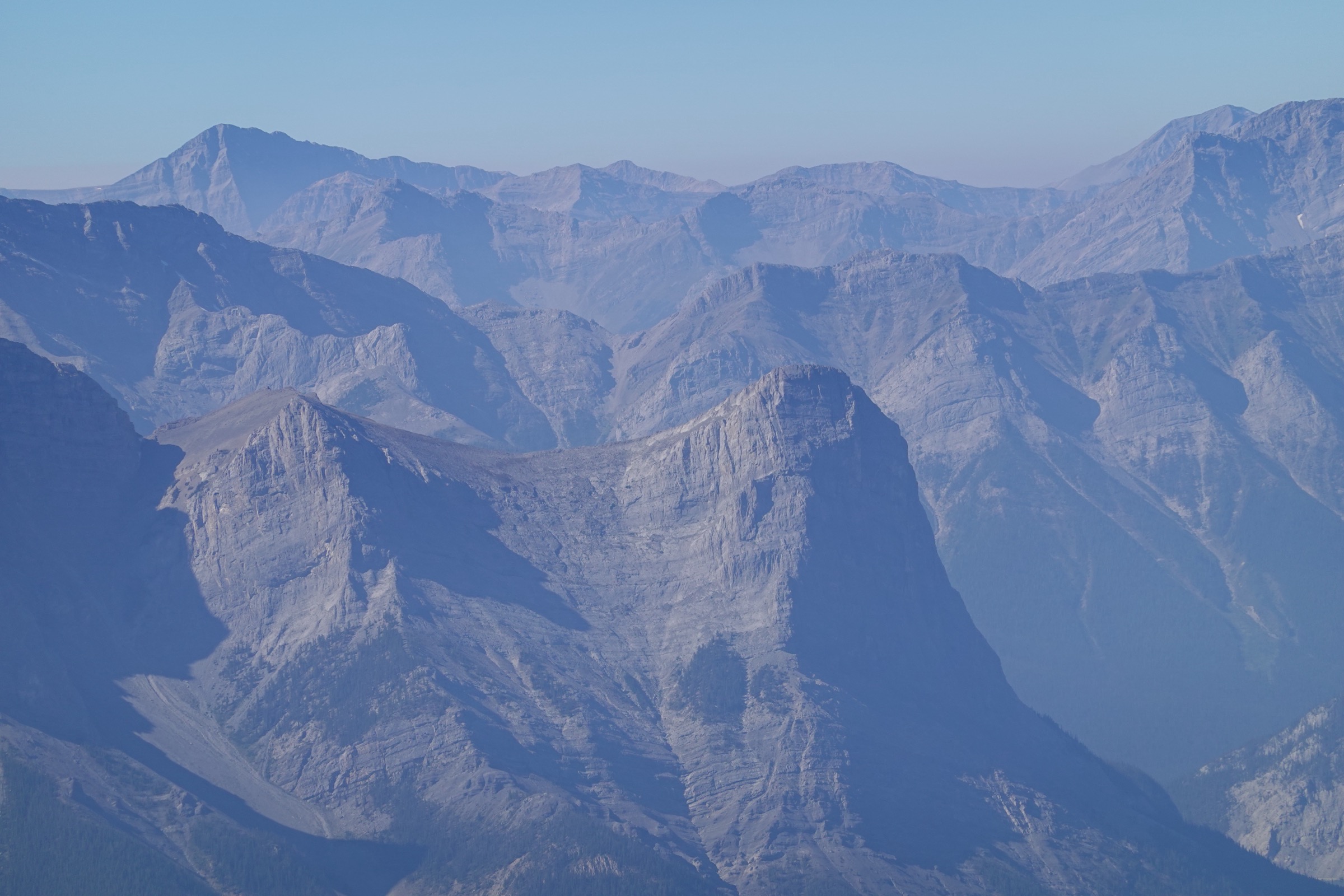
Terrain spans inland-temperate rainforest along the Robson and Fraser river corridors, glacier-carved cirques, hanging valleys, and exposed limestone-and-dolomite alpine ridges in the north. Wildlife includes grizzly and black bear, moose, caribou, mountain goat and marmot, and bear-aware practice is mandatory throughout. The reliable hiking season is short: late June to mid-September for most alpine destinations, with snow patches lingering into July and arriving again in September. Lower river-corridor walks such as Kinney Lake and Overlander Falls usually clear of snow by mid-May.
Main hiking centres are the Mount Robson Visitor Centre on Highway 16, the village of Valemount (the regional service hub) and Summit Lake Campground in Stone Mountain Provincial Park. Trailhead access is overwhelmingly by private vehicle; there is no scheduled public transport to any trailhead in this region. The VIA Rail Skeena passes Mount Robson but does not stop usefully for hikers, and the Alaska Highway corridor in particular demands self-sufficiency, with fuel, food and cell-service gaps measured in hundreds of kilometres.
Safety considerations are pronounced. This is a remote, wildlife-rich area with limited or no cellular coverage on most trails, including the entire Berg Lake corridor, all of Stone Mountain Park, and the Mount Terry Fox approach road. Carry bear spray and know how to use it. Stream crossings can become hazardous after summer storms, avalanche debris can persist on lower trails into early summer, and the river valleys are notable for intense mosquitoes from June through early August.
Selection rationale
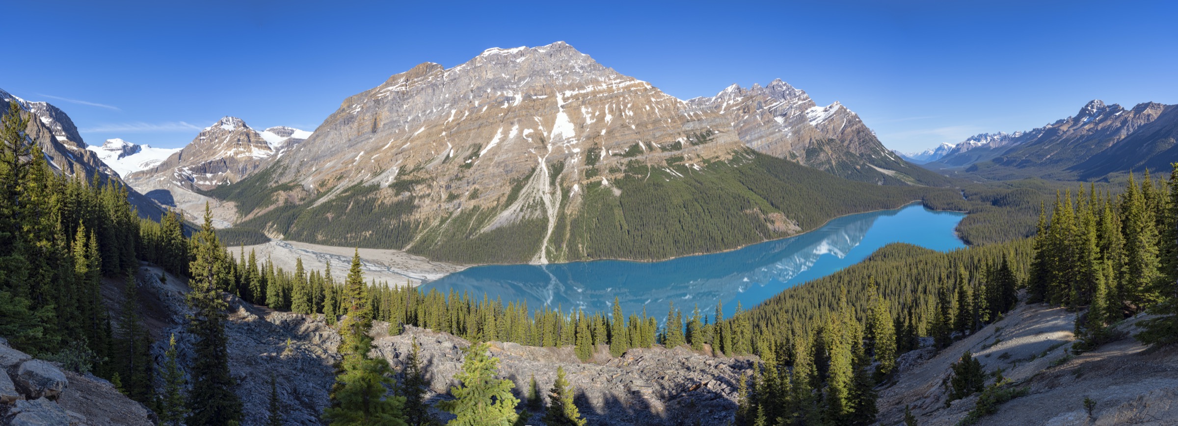
The five chosen routes balance the region’s headline destination — the Berg Lake Trail / Kinney Lake corridor at the foot of Mount Robson — with a representative cross-section of accessible alpine summits (Mount Terry Fox, Mount St. Paul / Summit Peak), a short low-level waterfall walk for visitors with limited time (Overlander Falls), and the longer Berg Lake corridor day to Whitehorn Campground that captures the Valley of a Thousand Falls without committing to an overnight stay. The full Berg Lake Trail (21 km one way, 800 m gain) is realistically a multi-day route; the Kinney Lake out-and-back is the day-hike-feasible section of that celebrated trail. Mount Fitzwilliam was considered but displaced — it is realistically an overnight given trail roughness — and the Stone Mountain entry pushes the catalogue genuinely into the Northern Rockies as the regional brief requests, adding a fifth distinctive landscape of open limestone alpine on the Alaska Highway.
Summary table
| # | Hike | Country | Route type | Distance | Gain | Max elevation | Difficulty |
|---|---|---|---|---|---|---|---|
| 1 | Kinney Lake (Berg Lake Trail day-hike section) | Canada | Out-and-back | 9–10 km | 130 m | 985 m | Easy |
| 2 | Berg Lake Trail to Whitehorn Campground | Canada | Out-and-back | 22 km | 245 m | 1,097 m | Moderate |
| 3 | Overlander Falls (long route) | Canada | Out-and-back | 5–6 km | 180 m | 860 m | Easy |
| 4 | Mount Terry Fox summit via Teepee Creek | Canada | Out-and-back | 16.5 km | 1,450 m | 2,651 m | Hard |
| 5 | Summit Peak / Mount St. Paul (Stone Mountain PP) | Canada | Out-and-back | 8 km | 750 m | 2,129 m | Moderate-Hard |
1. Kinney Lake (Berg Lake Trail day-hike section)
Snapshot
Itinerary
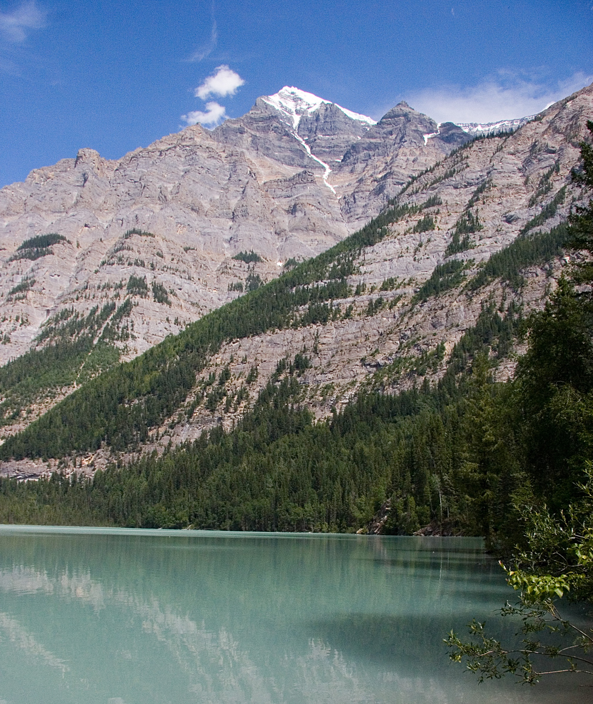
The trail starts at 853 m at the Berg Lake trailhead and follows the Robson River north through inland-temperate rainforest of western red cedar, hemlock and Douglas-fir. The grade is gentle and the surface a wide, gravel-and-boardwalk path that doubles as a cycling route as far as Kinney Lake. After approximately 4.2 km the route reaches the Kinney Lake bridge at 984 m, opening onto the turquoise lake with the Valley of a Thousand Falls and the south slopes of Whitehorn Mountain rising beyond. A further short walk leads to the Kinney Lake day-use area and the pontoon bridge before the trail proper continues to Kinney Lake campground (km 7) and onward up the Berg Lake corridor. Day-hikers turn back at the day-use area, giving a round trip of 9–10 km depending on chosen turnaround point.
Why it is essential
Kinney Lake is the only day-hike-feasible section of the Berg Lake Trail, the most internationally famous hiking route in the Canadian Rockies. The full Berg Lake Trail (21 km one way, 800 m gain) is a multi-day route in normal practice; reaching the lake and back in a single day is reported to take 14 hours or more and is not recommended. The Kinney Lake section delivers the trail’s opening signature view — an iconic Rockies turquoise lake at the foot of Mount Robson — with minimal effort and is suitable for a wide range of fitness levels. It is the only practical way for day visitors to set foot on the headline trail of the park.
Equipment
Standard hiking equipment: trail shoes, a weatherproof and warm layer, water, food and sun protection. Insect repellent is needed from June into August when mosquitoes are intense along the river corridor. Bear spray is standard practice in Mount Robson Park. A bike is optional — cycling is permitted as far as Kinney Lake.
Hazards and notes
A permanent boil-water advisory covers the Berg Lake corridor and there is no cell service. Day-hiking the corridor requires no permit; overnight camping requires a reservation through BC Parks. Dogs are allowed on day-hike sections, on leash only, and are not permitted on Snowbird Pass. Avalanche debris in the first kilometre may persist into late May — check the noticeboard at the Welcome Centre before departure. Bear, moose and occasional grizzly activity occurs along the corridor. The 2026 status is fully open for a second post-restoration season (27 May – 29 September 2026, with overnight reservations bookable since 2 December 2025).
GPX / KML links
| Source | URL |
|---|---|
| OpenStreetMap relation: Berg Lake Trail | openstreetmap.org |
| Wikiloc: Kinney Lake Trail | wikiloc.com |
| HikeValemount: Kinney Lake | hikevalemount.com |
2. Berg Lake Trail to Whitehorn Campground

Snapshot
Itinerary
From the Berg Lake trailhead the route follows the same gentle Robson River corridor as the Kinney Lake hike for the first 4.2 km. Beyond the Kinney Lake bridge it continues along the lake’s western shore on a new post-2021 reroute, crosses Hugo’s Bridge and the Kinney flats pontoon bridge, then runs along the gravel flats of the upper Robson River through the open Valley of a Thousand Falls. Whitehorn Campground is reached at km 11 (1,097 m). Strong day-walkers may continue to the foot of the Emperor Falls climb to view the river canyon, but should turn back well before the Emperor Falls headwall (km 16, 1,615 m) — that climb effectively converts the route into a Berg Lake attempt and is not advised as a single-day return.
Why it is essential
This is the longer day-hike option that captures the celebrated middle section of the Berg Lake Trail — the Valley of a Thousand Falls — without committing to an overnight stay. It is one of the Canadian Rockies’ most accessible long valley walks under iconic peaks (Whitehorn Mountain, the Mount Robson massif), passes the newly-rerouted post-flood trail sections that mark the 2025/26 reopening, and is the strongest single-day way to engage with the headline trail of the region.
Equipment
Mountain hiking equipment: sturdy boots, layers and trekking poles. Carry at least two litres of water plus a means of purification if drawing from streams. Insect repellent and bear spray are baseline. A headtorch is sensible for a long day attempted close to the season’s edges.
Hazards and notes
The permanent boil-water advisory applies, and no campfires are allowed anywhere on the trail. There is no cell service for the full route. Day-hiking requires no reservation or fee; overnight camping at any of the seven Berg Lake Trail campgrounds requires advance BC Parks reservation through the 2026 season (window opened 2 December 2025; season 27 May – 29 September 2026). Dogs are allowed on day-hikes only, on leash, and not on Snowbird Pass. The 2026 trail is rebuilt and well marked, with several post-flood reroutes (new bridge between Kinney Lake and Whitehorn, rerouted section past Marmot). The Berg Lake Trail Welcome Centre check-in is required only for overnight permit collection; day-hikers should still consult the advisories noticeboard.
GPX / KML links
| Source | URL |
|---|---|
| OpenStreetMap relation: Berg Lake Trail | openstreetmap.org |
| AllTrails: Berg Lake Trail | alltrails.com |
| BC Parks: Berg Lake Trail map (PDF) | nrs.objectstore.gov.bc.ca |
3. Overlander Falls (long route)
Snapshot
Itinerary
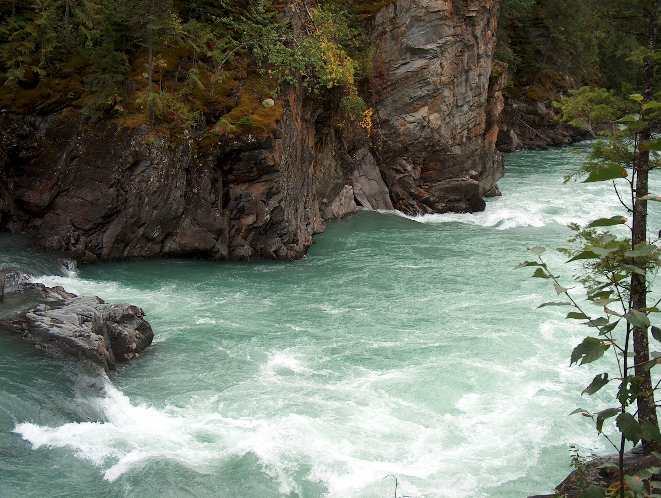
The short version drops on a wide gravel path with switchbacks to a viewing platform above Overlander Falls, where the Fraser River compresses through a basalt notch. The longer “river trail” variant starts from the main Visitor Centre area and contours east along the Fraser River with several canyon viewpoints, passing the historic remains of Hogan’s Cabin before joining the short trail near the falls; it can be combined with the Highway 16 verge to form a loop. The falls themselves are named for the 1862 Overlanders expedition, a party of around 175 prospectors travelling overland from Ontario to the Cariboo goldfields, who reached this point on the Fraser.
Why it is essential
Overlander Falls is the headline short walk on the Mount Robson corridor and the most historically resonant low-level site in the park, named for a foundational 19th-century overland expedition through the Yellowhead Pass. It also serves as the obvious “everyone can do this” option for visitors who lack the time or fitness for Kinney Lake, and the long-route variant adds enough Fraser River frontage to function as a half-day walk in its own right.
Equipment
Standard hiking equipment: light footwear is adequate for the short version; trail shoes for the long route. Insect repellent is essential June–August. Bear spray remains baseline practice for any walking in the park.
Hazards and notes
The long variant has narrow drop-offs above the canyon and is unsuitable for those uncomfortable with exposure. There are no facilities on the trail beyond an outhouse at the trailhead parking, and no cell service. Dogs are permitted on leash.
GPX / KML links
| Source | URL |
|---|---|
| Trailforks: Overlander Falls Trail | trailforks.com |
| AllTrails: Overlander Falls Long Trail | alltrails.com |
| OpenStreetMap (Mount Robson Park way data) | openstreetmap.org |
4. Mount Terry Fox summit via Teepee Creek
Snapshot
Itinerary
From the Teepee Creek trailhead the route climbs steeply through Engelmann spruce-subalpine fir forest beside the Teepee Creek waterfalls, with a sustained grade exceeding 25–30% in places. Above treeline the trail enters open alpine meadow with views back to Mount Robson and across the Robson Valley. The “Big Rock” loop variant rejoins the spur to the alpine lake, a small tarn. From the lake the route continues northeast across exposed alpine ridgeline, gaining elevation steadily over a series of false summits before reaching the Mount Terry Fox summit at 2,651 m, where a small memorial cairn commemorates the runner for whom the peak was named in 1981.
Why it is essential
Mount Terry Fox is the signature alpine summit hike of the southern Northern Rockies sub-region and the most culturally significant peak in the Valemount area, named after Terry Fox in recognition of his 1980 Marathon of Hope. The route is the standard local alpine objective and offers a direct, full-effort introduction to the open-ridge terrain that characterises the BC Rockies west of the Continental Divide, with views to Mount Robson and the Premier Range.
Equipment
Mountain hiking kit: sturdy boots, layers, hat and gloves, and trekking poles. Navigation backup is essential because the trail is indistinct above treeline — follow cairns and tree markings. Carry three to five litres of water per person; there is no water above treeline beyond the small alpine lake. Bear spray and a headtorch for long days are baseline. The access road is rough; a high-clearance or four-wheel-drive vehicle is strongly advised.
Hazards and notes
This is a long, sustained climb at altitude with limited shelter on the ridge — turn back early in deteriorating weather. Route-finding above treeline can be challenging in cloud or fresh snow. The access road is rough and not maintained. Both grizzly and black bear use the lower forest. There is no cell service. The annual community “Terry Fox Trek” event takes place in mid-to-late August.
GPX / KML links
| Source | URL |
|---|---|
| HikeValemount: Teepee Creek & Mt Terry Fox | hikevalemount.com |
| Trailforks: Mount Terry Fox Hiking Trail | trailforks.com |
| Caledonia Ramblers: Mount Terry Fox | caledoniaramblers.ca |
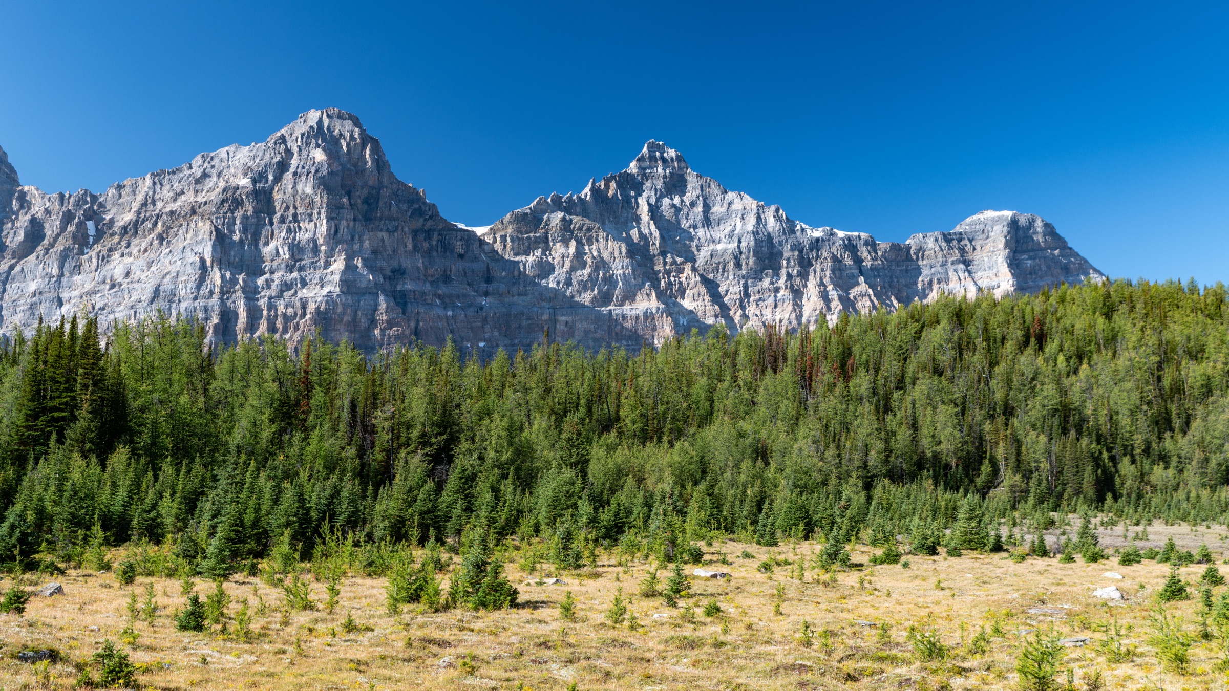
5. Summit Peak / Mount St. Paul (Stone Mountain Provincial Park)
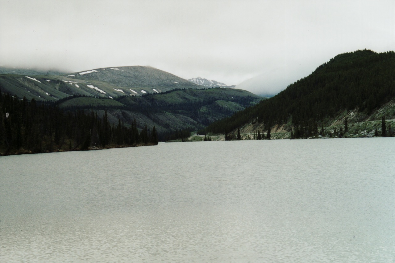
Snapshot
Itinerary
From the trailhead at Summit Pass — the highest point on the Alaska Highway — the path climbs through lodgepole pine forest above Summit Lake and emerges quickly into open alpine of limestone scree and dolomite-like bedrock typical of the Northern Rockies. After a short steep section the trail reaches the “Summit Peak” viewpoint at approximately 2,015 m, overlooking Summit Lake and the Rocky Mountain Trench. The route then continues northwest along the ridge, with some hands-on scrambling, to the true summit of Mount St. Paul at 2,129 m. Total distance varies by source — BC Parks describes the trail as 5 km round-trip, while local hiking accounts describe 6.7 km one-way to the upper viewpoint, suggesting either that the BC Parks distance refers only to the lower viewpoint or that turnaround conventions differ. Allow 4–6 hours for the full summit return.
Why it is essential
Summit Peak is the headline alpine day-hike of the Northern Canadian Rockies and the only major signed trail in Stone Mountain Provincial Park. In practical terms it is the most accessible true alpine summit on the entire Alaska Highway corridor and gives a sample of the limestone-and-sedimentary mountain landscape that characterises the Northern Rockies beyond the better-known southern Rocky front. Its inclusion brings the catalogue genuinely into the northern half of the BC Rockies.
Equipment
Mountain hiking kit, trekking poles, and a windproof / warm layer (Summit Pass weather changes quickly). Carry plenty of water — there is no reliable above-treeline water. Bear spray is baseline (high grizzly density in the Northern Rockies). Microspikes are useful in early or late season.
Hazards and notes
Weather changes rapidly at Summit Pass; carry extra warm layers and waterproofs. Loose rock and short scrambling sections punctuate the final summit climb. The strong grizzly population means group travel and noise are baseline. The park is remote — Fort Nelson is ~140 km east, Watson Lake ~250 km west — so carry self-sufficiency supplies. The trail is not signed beyond the lower viewpoint; follow cairns and the ridge line above. There is no cell service.
GPX / KML links
| Source | URL |
|---|---|
| AllTrails: Summit Peak Trail | alltrails.com |
| BC Parks: Stone Mountain Park map (PDF) | nrs.objectstore.gov.bc.ca |
| Outdoor Project: Mount St. Paul via Summit Peak Trail | outdoorproject.com |
External links
| Source | URL |
|---|---|
| BC Parks — Mount Robson Park | bcparks.ca |
| BC Parks — Mount Robson Park: Berg Lake Trail | bcparks.ca |
| BC Parks — Mount Robson Park: East End Wilderness Trails | bcparks.ca |
| BC Parks — Mount Terry Fox Park | bcparks.ca |
| BC Parks — Stone Mountain Park | bcparks.ca |
| BC Parks — Berg Lake Trail map (PDF) | nrs.objectstore.gov.bc.ca |
| BC Parks — Stone Mountain Park map (PDF) | nrs.objectstore.gov.bc.ca |
| BC Government news release — Berg Lake Trail full reopening 2025 | news.gov.bc.ca |
| BC Government news release — 2026 Berg Lake reservations open | news.gov.bc.ca |
| HikeValemount (Tourism Valemount) | hikevalemount.com |
| HikeValemount — Kinney Lake | hikevalemount.com |
| HikeValemount — Overlander Falls Trail | hikevalemount.com |
| HikeValemount — Teepee Creek & Mt Terry Fox | hikevalemount.com |
| Happiest Outdoors — Berg Lake Trail Hiking Guide (2026 update) | happiestoutdoors.ca |
| Off Track Travel — Berg Lake Trail Complete 2026 Hiking Guide | offtracktravel.ca |
| Caledonia Ramblers — Mount Terry Fox | caledoniaramblers.ca |
| ExploreNorth — Hiking the Summit Peak Trail | explorenorthblog.com |
| Outdoor Project — Mount St. Paul via Summit Peak Trail | outdoorproject.com |
| Trailforks — Mount Robson Provincial Park trails | trailforks.com |
| OpenStreetMap relation 6035635 — Berg Lake Trail | openstreetmap.org |
| Wikipedia — Mount Robson | en.wikipedia.org |
| Wikipedia — Berg Lake | en.wikipedia.org |
| Wikipedia — Overlander Falls | en.wikipedia.org |
| Wikipedia — Mount Terry Fox | en.wikipedia.org |
| Wikipedia — Saint Paul Peak | en.wikipedia.org |
| Wikipedia — Stone Mountain Provincial Park | en.wikipedia.org |
| Wikimedia Commons — Mount Robson category | commons.wikimedia.org |
| Wikimedia Commons — Berg Lake category | commons.wikimedia.org |
| Wikimedia Commons — Stone Mountain Provincial Park category | commons.wikimedia.org |