Regional overview
The McGerrigle Mountains are the high tundra heart of Parc national de la Gaspésie. They include Mont Jacques-Cartier, Mont Xalibu, Mont Richardson, Mont Joseph-Fortin, and the Lac aux Américains access basin. The walking character is compact but serious: short to medium mountain days with steep climbs, open summit terrain, fragile alpine vegetation, and a short reliable summer season.
Most day hikes are accessed from Route 299 and park roads, with Mont Jacques-Cartier requiring controlled shuttle or minibus access. The Sépaq visitor guide also describes a one-day McGerrigle traverse using a vehicle left at Lac aux Américains and minibus transport to the Mont Jacques-Cartier trailhead.
Snow, wind, fog, and cold can affect these routes outside settled summer conditions. Caribou protection, trail opening dates, and access windows are central to planning and must be checked before departure.
Selection rationale
These five hikes cover the main day-hiking expressions of the McGerrigles: the highest summit, the classic lake-and-summit approach, the Richardson expert summit, the Joseph-Fortin plateau, and the official one-day Jacques-Cartier-to-Xalibu traverse.
Summary table
| # | Hike | Country | Route type | Distance | Gain | Max elevation | Difficulty |
|---|---|---|---|---|---|---|---|
| 1 | Le Mont-Jacques-Cartier | Canada | Out-and-back, shuttle access | 8.2 km | 465 m | 1,268 m | Difficult |
| 2 | Le Mont-Xalibu | Canada | Out-and-back | 10.6 km | 540 m | approx. 1,120 m | Difficult |
| 3 | Le Mont-Richardson | Canada | Out-and-back | 11.6 km | 710 m | Not verified | Expert |
| 4 | Le Mont-Joseph-Fortin | Canada | Out-and-back / summit loop | 11.0 km | 500 m | Not verified | Difficult |
| 5 | Traversée Jacques-Cartier-Xalibu-Lac aux Américains | Canada | Point-to-point shuttle traverse | 17 km | Not verified | 1,268 m | Difficult |
1. Le Mont-Jacques-Cartier
Snapshot
Itinerary
The route climbs from the controlled-access Mont Jacques-Cartier trailhead through subalpine terrain to open alpine tundra and the summit shelter. The descent returns by the same trail within the daily access window.
Why it is essential
Mont Jacques-Cartier is the highest accessible McGerrigle summit and the defining tundra hike of Parc national de la Gaspésie.
Equipment
- Mountain hiking boots
- Warm and waterproof layers
- Water
- Food
- Map/GPS and navigation backup
- Wind protection
Hazards and notes
- The summit zone is exposed and weather-sensitive.
- Sépaq notes controlled access and a daily access window; shuttle/minibus logistics are part of the route.
GPX / KML links
| Source | URL | Format / access | Reuse status |
|---|---|---|---|
| Sépaq Parc national de la Gaspésie trail table | sepaq.com | Official trail table / source route | Website terms not fully checked; no GPX found; use for route/stat verification |
| Sépaq Parc national de la Gaspésie visitor guide | sepaq.com | Official access/map context | Website/PDF terms not fully checked; use for access restrictions and shuttle planning |
External links
- Sépaq — Parc national de la Gaspésie trail table
- Sépaq — Parc national de la Gaspésie visitor guide (PDF)
- Wikimedia Commons — Abri au sommet du Mont Jacques-Cartier
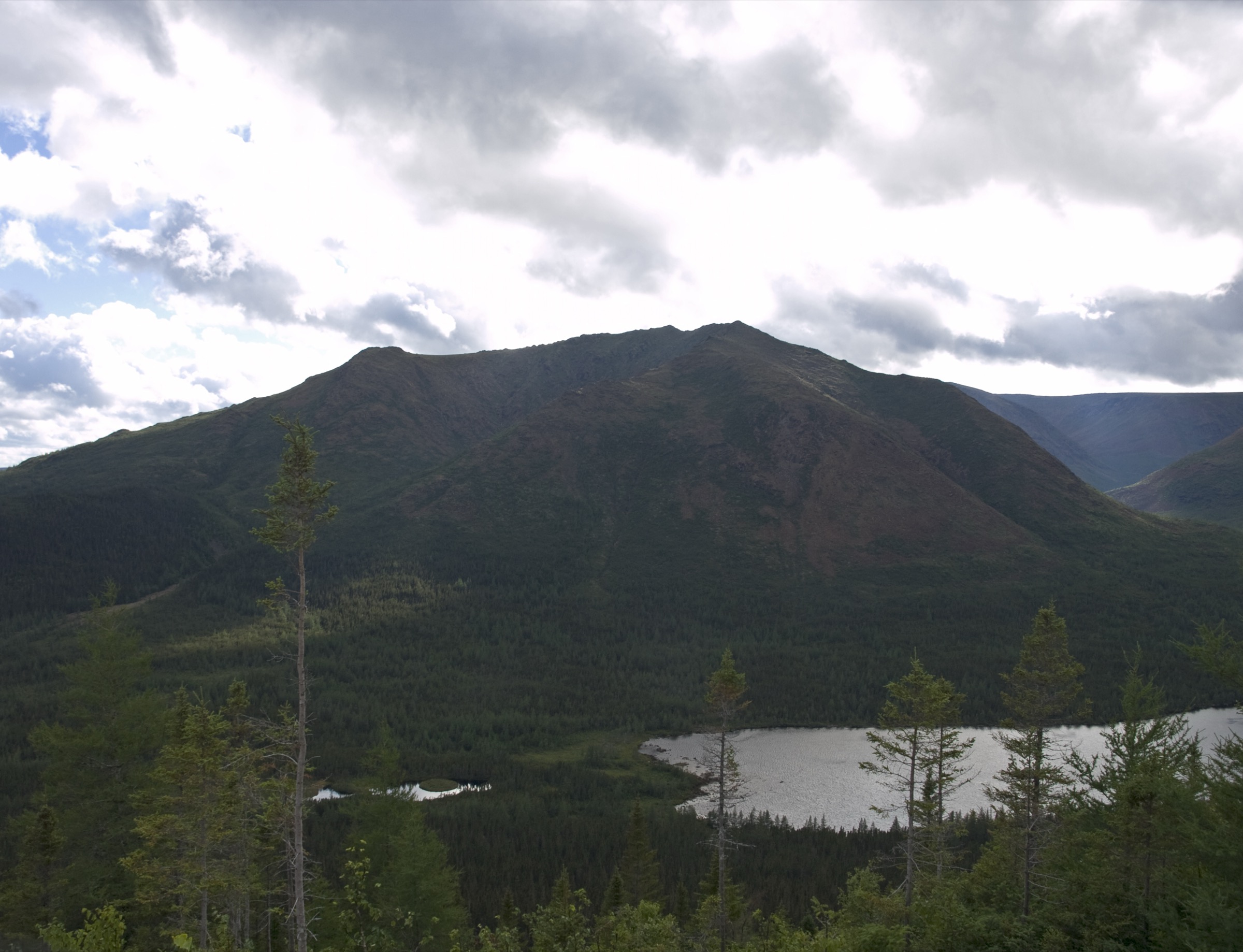
2. Le Mont-Xalibu
Snapshot
Itinerary
The trail reaches Lac aux Américains and then climbs above the cirque toward Mont Xalibu, entering more open and rugged mountain terrain before returning by the same route.
Why it is essential
Xalibu is the classic McGerrigle lake-and-summit hike, pairing one of the park’s most recognisable cirques with an alpine upper section.
Equipment
- Mountain hiking boots
- Waterproof and warm layers
- Water
- Food
- Poles recommended
- Map/GPS and navigation backup
Hazards and notes
- Snow, wet rock, fog, and wind can affect the upper trail.
- Stay on marked trail in fragile alpine areas.
GPX / KML links
| Source | URL | Format / access | Reuse status |
|---|---|---|---|
| Sépaq Parc national de la Gaspésie trail table | sepaq.com | Official trail table / source route | Website terms not fully checked; no GPX found; use for route/stat verification |
External links
- Sépaq — Parc national de la Gaspésie trail table
- Wikimedia Commons — Lac aux Américains vu du Mont Xalibu
- Wikimedia Commons — Mont Xalibu
3. Le Mont-Richardson
Snapshot
Itinerary
The route climbs steeply from the Mont Richardson trailhead toward a high, exposed summit area with wide McGerrigle views. The descent returns by the same trail.
Why it is essential
Mont Richardson is one of the principal strenuous day hikes in the McGerrigle sector and gives the selection a harder summit objective beyond Jacques-Cartier and Xalibu.
Equipment
- Sturdy mountain hiking boots
- Poles recommended
- Extra warm layer
- Waterproof shell
- Food
- Water
- Navigation backup
- Headtorch
Hazards and notes
- Sépaq rates the route expert.
- Expect steep gradients, exposure to weather, and slower travel in wet or cold conditions.
- Maximum elevation and open-licence imagery remain unresolved.
GPX / KML links
| Source | URL | Format / access | Reuse status |
|---|---|---|---|
| Sépaq Parc national de la Gaspésie trail table | sepaq.com | Official trail table / source route | Website terms not fully checked; no GPX found; use for route/stat verification |
External links
4. Le Mont-Joseph-Fortin
Snapshot
Itinerary
The route climbs to the Joseph-Fortin high ground and follows the marked summit-area route before returning to the trailhead. The hike gives access to open McGerrigle terrain without the controlled Mont Jacques-Cartier shuttle.
Why it is essential
Joseph-Fortin is a major maintained McGerrigle summit route and balances the selection with a classic plateau-style walk that is less globally famous than Jacques-Cartier.
Equipment
- Mountain hiking boots
- Warm and waterproof layers
- Food
- Water
- Navigation backup
- Poles
Hazards and notes
- Weather exposure, mud, wet rock, and lingering snow can affect the route.
- Maximum elevation and open-licence imagery still require follow-up.
GPX / KML links
| Source | URL | Format / access | Reuse status |
|---|---|---|---|
| Sépaq Parc national de la Gaspésie trail table | sepaq.com | Official trail table / source route | Website terms not fully checked; no GPX found; use for route/stat verification |
External links
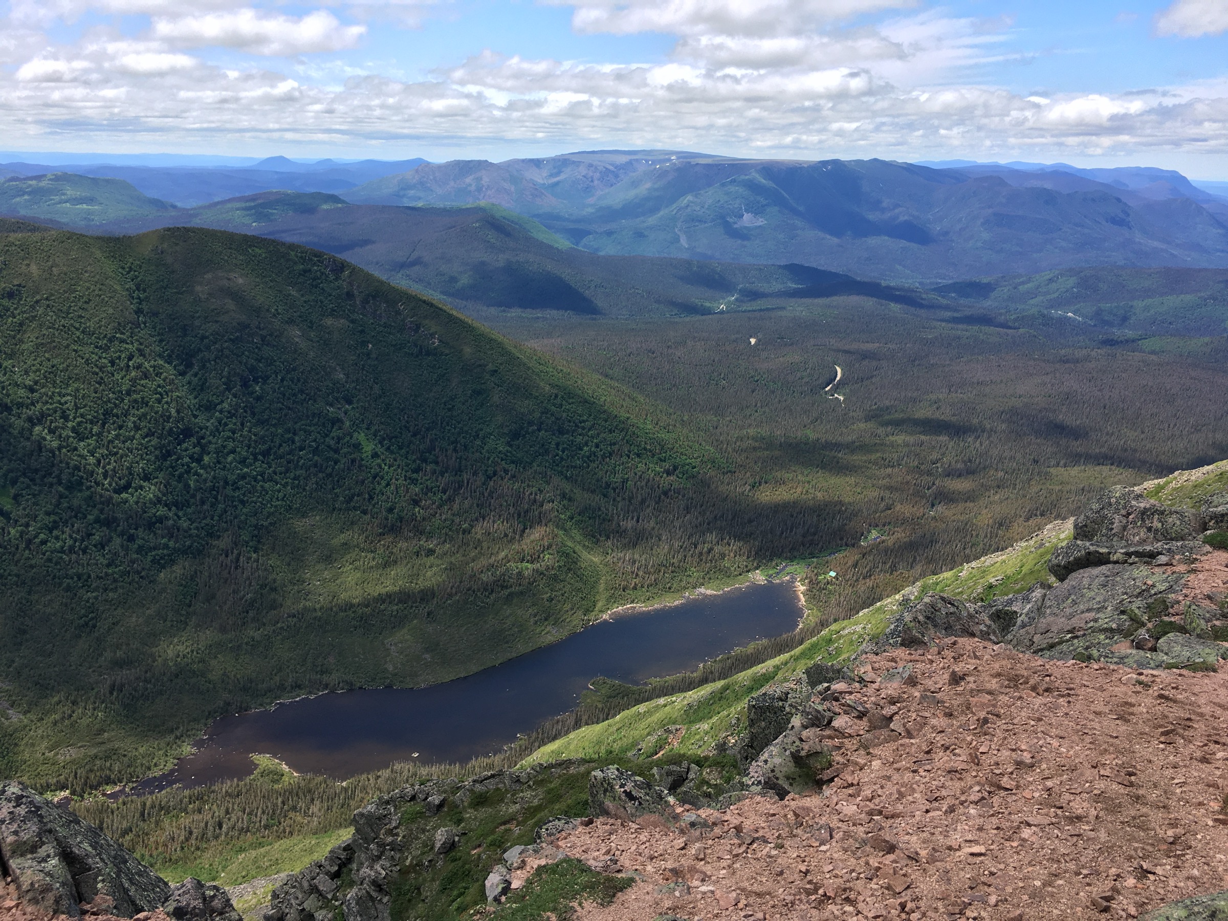
5. Traversée Jacques-Cartier-Xalibu-Lac aux Américains
Snapshot
Itinerary
The official traverse begins with a vehicle left at Lac aux Américains, followed by minibus transport to the Mont Jacques-Cartier trailhead. The route climbs Mont Jacques-Cartier, continues through high McGerrigle terrain toward Xalibu, and descends to Lac aux Américains.
Why it is essential
This is the classic one-day McGerrigle traverse, linking the range’s highest summit, alpine tundra, and the Lac aux Américains cirque in a single point-to-point day.
Equipment
- Mountain hiking equipment
- Extra food and water
- Headtorch
- Navigation backup
- Clothing for delays
- Confirm shuttle reservation before committing to the route
Hazards and notes
- This route depends on transport logistics and is more committing than the out-and-back hikes.
- Weather, fog, and access restrictions can make the traverse unsuitable even when shorter hikes are reasonable.
GPX / KML links
| Source | URL | Format / access | Reuse status |
|---|---|---|---|
| Sépaq visitor guide, McGerrigle traverse description | sepaq.com | Official route/access description | Website/PDF terms not fully checked; no GPX found; use for route concept and access logistics only |
| International Appalachian Trail Québec, Parc de la Gaspésie | sia-iat.com | Trail-corridor source | Terms not fully checked; use for context; route-file reuse not confirmed |
External links
- Sépaq — Parc national de la Gaspésie visitor guide (PDF)
- International Appalachian Trail Québec — Parc de la Gaspésie
- Wikimedia Commons — Chicchoc1
- Wikimedia Commons — Lac aux Américains vu du Mont Xalibu
Missing data / follow-up work
- No official downloadable GPX/KML files were found for these routes in this pass.
- Elevation gain/loss for the full McGerrigle traverse remains unresolved.
- Maximum elevations for Richardson and Joseph-Fortin need authoritative confirmation.
- Richardson and Joseph-Fortin need verified licence-compatible images.
- Shuttle reservations, access windows, and seasonal restrictions must be checked before publication.
External links
| Source | URL |
|---|---|
| Sépaq — Parc national de la Gaspésie hiking trail table | sepaq.com |
| Sépaq — Parc national de la Gaspésie visitor guide (PDF) | sepaq.com |
| International Appalachian Trail Québec — Parc de la Gaspésie | sia-iat.com |