Regional overview
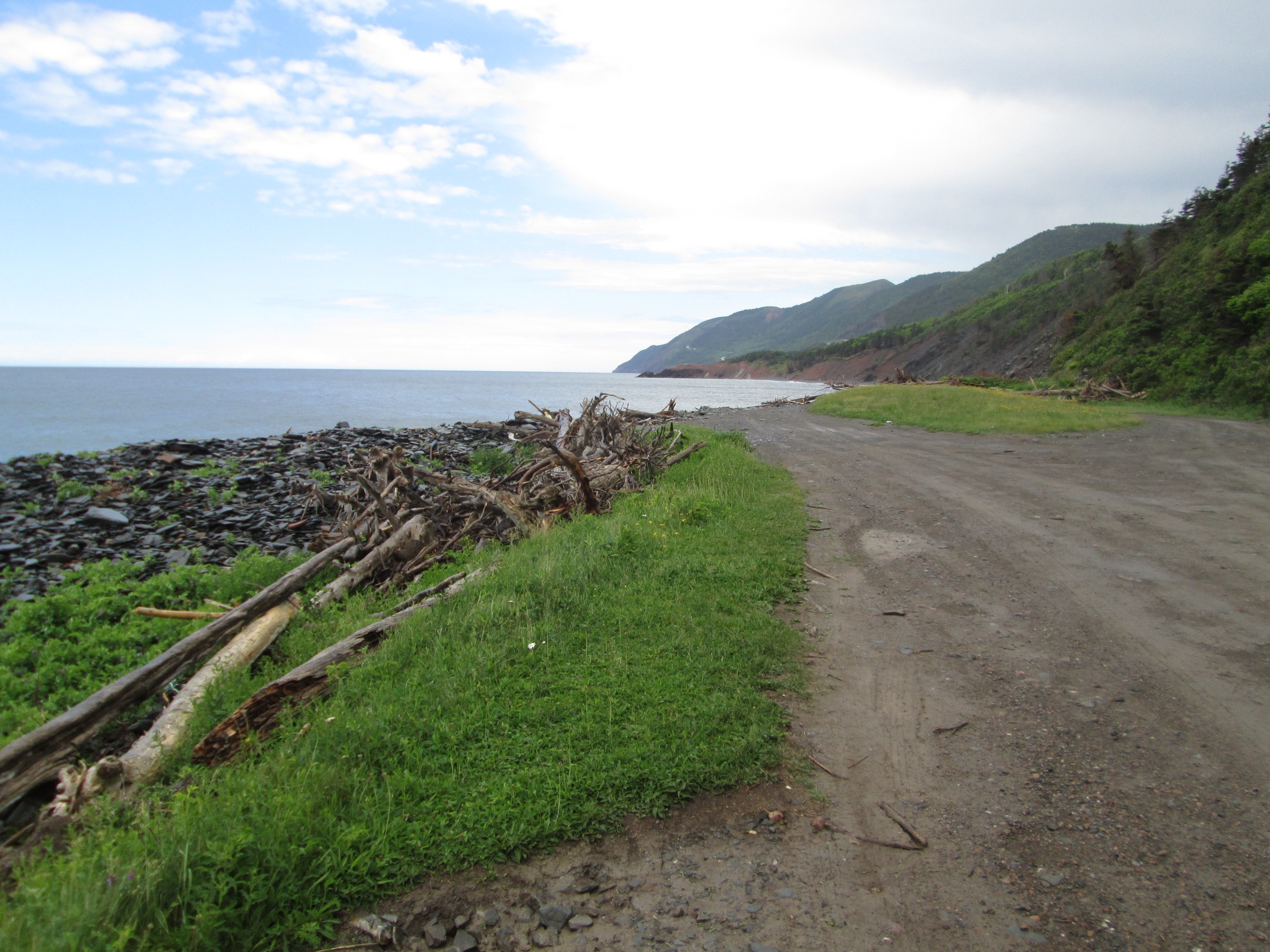
The Cape Breton Highlands form the northern roof of Nova Scotia: a Precambrian and early Palaeozoic plateau lifted to between 350 and 530 m and bounded on three sides by the Gulf of St Lawrence and the Atlantic. The plateau surface is a boggy, taiga-fringed barrens cut by short, steep canyons — Clyburn, Aspy, North Aspy, Cheticamp, MacKenzie and Mary Ann — that drop straight to the coast. The walking character is a sharp contrast between long flat plateau sections, short and steep canyon climbs, and exposed cliff-edge headlands above the open ocean.
Almost all of the formal day-hike network sits inside Cape Breton Highlands National Park, gazetted in 1936 and managed by Parks Canada. The park covers roughly 950 km² across the northern third of Cape Breton Island and is laced by the Cabot Trail — the 298 km loop road that is the only land link between the western (Cheticamp) and eastern (Ingonish) sides. Parks Canada maintains roughly 26 official day-hiking trails along the Cabot Trail corridor, the densest concentration of waymarked walks in eastern Canada outside Gros Morne.
The hiking season is short. The Skyline Trail’s high-use season runs roughly May through October; the higher plateau trails (Franey, Aspy, French Mountain) hold late-spring snow and the Cabot Trail itself sees fog through much of the summer. Atlantic exposure means weather can change in minutes — strong west-to-southwest winds, sea fog and rain are common even in July. Other regional hazards are moose (frequent at dawn and dusk on the Cheticamp side), coyotes (a 2009 fatality on the Skyline area led to ongoing Parks Canada coyote-awareness signage), winter ticks at low elevations, and the standard cliff-edge exposure of the Skyline and Middle Head trails.
Access is by car along the Cabot Trail from Baddeck or Sydney. There is no scheduled public transport into the park; the Cabot Trail Shuttle and the Hike the Highlands Festival (annual, late September) offer the only organised connecting services. Park gates at Cheticamp (west) and Ingonish (east) collect a daily entry fee. Skyline Trail parking is the busiest in the park and requires a reservation through Parks Canada in peak season; other trailheads use first-come first-served parking.
Selection rationale
These five hikes cover the canonical Cape Breton Highlands day-hike experience: the Skyline boardwalk as the iconic ocean-cliff route, Franey as the steep summit-ridge example with the Ingonish coast view, the Aspy Trail as the long plateau-edge and waterfall walk on the quieter north side, Middle Head as the peninsula classic at Keltic Lodge, and the Acadian Trail as the most demanding Cheticamp-side climb to the western plateau rim. Together they balance two short, accessible coastal routes, two long plateau climbs, and one summit-ridge ascent, and cover both sides of the Cabot Trail loop.
Summary table
| # | Hike | Country | Route type | Distance | Gain | Max elevation | Difficulty |
|---|---|---|---|---|---|---|---|
| 1 | Skyline Trail | Canada | Loop or out-and-back | 6.5-8.2 km | ~115 m | ~405 m | Easy-Moderate |
| 2 | Franey Trail | Canada | Loop | 7.4 km | ~406 m | 423 m | Difficult |
| 3 | Aspy Trail | Canada | Out-and-back | 9.6 km | ~390 m | ~450 m | Moderate-Difficult |
| 4 | Middle Head | Canada | Out-and-back | 3.8-5.3 km | ~45 m | ~55 m | Easy |
| 5 | Acadian Trail | Canada | Loop | 8.4 km | ~345 m | ~365 m | Moderate-Difficult |
1. Skyline Trail
Snapshot
Itinerary
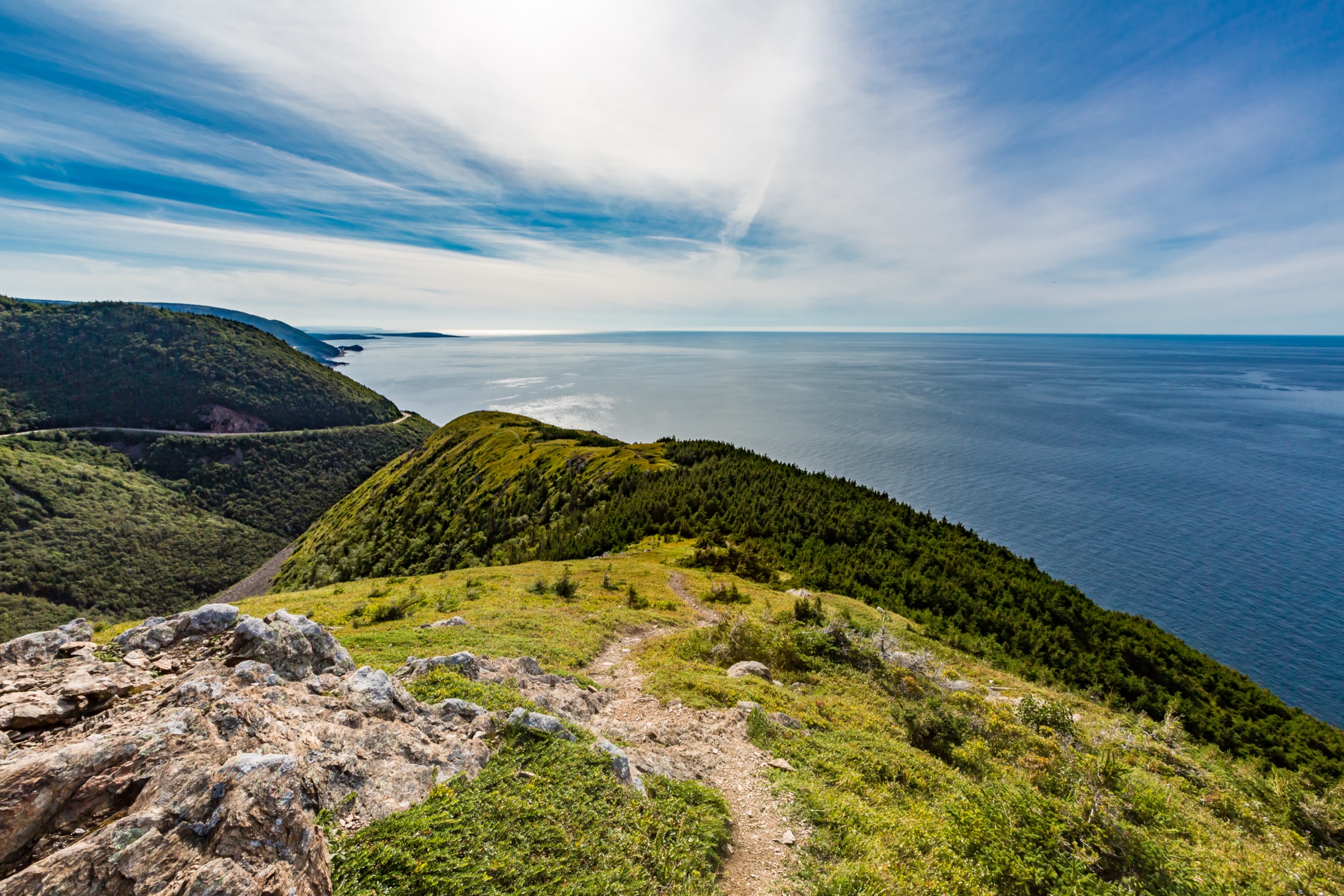
The route leaves the Skyline parking on French Mountain and heads west along a wide, mostly level gravel path through boreal taiga of balsam fir and white birch, much of it killed back by spruce budworm and now regenerating. The trail forks after about 1.5 km: the direct branch continues west to the headland; the longer northern arm contours the ridge and rejoins. Both arrive at a wooden viewing terrace at the tip of the headland, where a series of staircased boardwalks step down a long open ridge above the Gulf of St Lawrence. The boardwalk terraces are the canonical Cape Breton picture: the Cabot Trail switchbacks visible directly below as it climbs French Mountain, the open Gulf to the west, and a clear sightline north to the cliffs of MacKenzie Mountain. Pilot whales and minke are regularly visible offshore from June to September. The return is on the same boardwalk and then either back along the direct path (6.5 km total) or via the longer loop (8.2 km total).
Why it is essential
Skyline is the single image of Cape Breton Highlands National Park and the most-walked trail in Atlantic Canada. It combines a near-flat plateau approach with the only formally constructed cliff-edge boardwalk on the Cabot Trail, and gives the clearest single-day view of the relationship between the plateau, the Cabot Trail road and the Gulf coastline.
Equipment
- Standard hiking shoes; the boardwalk is the only steep section.
- Wind shell — the headland is regularly exposed to strong west winds.
- Sun protection on the open plateau; insect repellent in June and early July.
- Camera and binoculars for offshore whale watching.
Hazards and notes
- Coyote activity is monitored by Parks Canada and signage at the trailhead is current; hike in groups and do not leave food.
- The boardwalk is closed in icy conditions; the descent steps are slippery when wet.
- Strong winds at the headland — keep children supervised on the descent stairs.
- Parking reservation required at peak times.
GPX / KML links
| Source | URL | Format / access | Reuse status |
|---|---|---|---|
| Parks Canada — Skyline Trail | parks.canada.ca | Trail page; no open GPX | Reference only |
| AllTrails — Skyline Trail | alltrails.com | GPX (account download) | AllTrails proprietary; link only |
| Wikiloc — Skyline Trail | wikiloc.com | GPX (account download) | Wikiloc proprietary; link only |
External links
2. Franey Trail
Snapshot
Itinerary
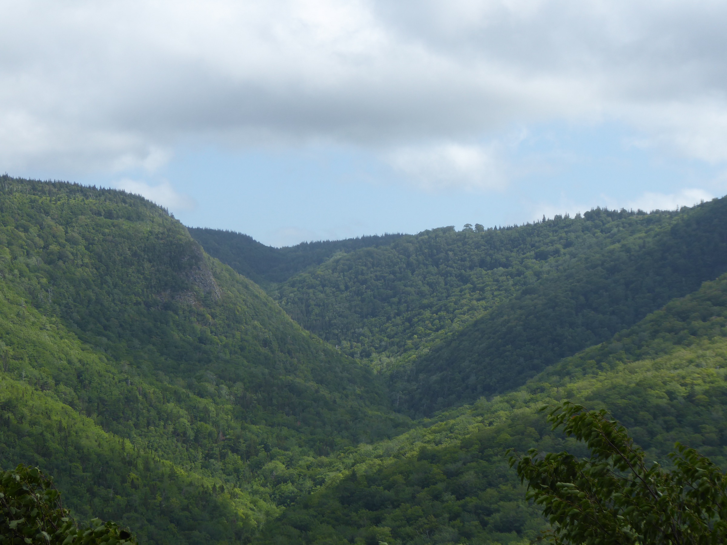
The trail leaves the small Franey parking and climbs almost continuously up the east face of Franey Mountain through mixed Acadian forest, gaining over 400 m in roughly 3.2 km. The grade is unrelenting and includes long stairway sections on the steepest pitches. Above about 350 m the canopy thins and the trail emerges onto an open plateau of barrens and stunted spruce. A short spur leads to the summit lookout above the Clyburn Brook canyon, with a clear view east to Middle Head, Ingonish Island and the Atlantic, and south across the Clyburn Valley to the Highlands plateau. The descent follows the fire-service road on the back of the summit, which loops gradually north and then east through forest to rejoin the original trail near the trailhead.
Why it is essential
Franey is the steepest sustained climb on the maintained Cape Breton Highlands network and gives the best aerial view of the eastern coast — the Clyburn canyon, the Middle Head peninsula and the Ingonish lakes — from a recognised national-park lookout.
Equipment
- Sturdy hiking shoes with good traction; the stair sections are slippery when wet.
- Two litres of water; the route is exposed once above tree line.
- Wind shell at the summit.
- Trekking poles recommended for the descent.
Hazards and notes
- The descent road can be muddy and slippery in shoulder season.
- No water on route once past the trailhead.
- Black bear range — make noise and keep food sealed.
- Cell coverage is patchy.
GPX / KML links
| Source | URL | Format / access | Reuse status |
|---|---|---|---|
| Parks Canada — Franey Trail | parks.canada.ca | Trail page; no open GPX | Reference only |
| AllTrails — Franey Trail | alltrails.com | GPX (account download) | AllTrails proprietary; link only |
External links
3. Aspy Trail
Snapshot
Itinerary
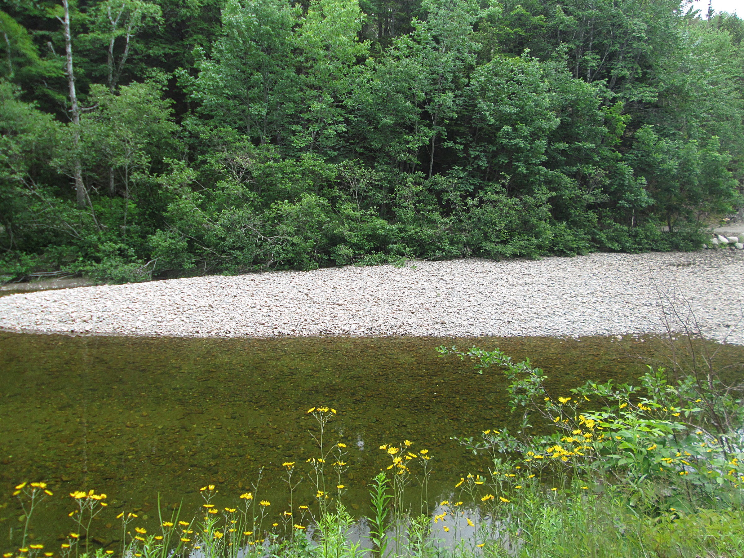
The trail leaves the Beulach Ban Falls picnic area and follows the old North Aspy River road on a steady gradient up the floor of the Aspy Valley. The walk passes through mature mixed hardwood and pockets of remnant Acadian forest, with several small brook crossings and the occasional moose track. After roughly 3 km the trail bends south and climbs more steeply through a series of broad switchbacks on the east-facing slope toward the plateau edge above Cape North. The upper section opens into stunted spruce barrens and reaches a quiet plateau viewpoint with a broad view down the Aspy Valley toward Cape North and the Aspy Bay coastline. Return is on the same route.
Why it is essential
The Aspy Trail is the longest maintained walk on the north side of the park and the only formal route into the Aspy Fault valley — the great structural lineament that defines the northern Cape Breton plateau. It is also the quietest of the five hikes in this list and the most likely to give a solo experience of the highland forest.
Equipment
- Sturdy hiking shoes.
- Two litres of water; the brook crossings can be dry late in summer.
- Insect repellent through July.
- Wind shell for the plateau edge.
Hazards and notes
- Moose are routinely encountered in the lower valley; give them wide space.
- The upper plateau is exposed to weather; turn back in poor visibility.
- Return distance is significant — start early.
GPX / KML links
| Source | URL | Format / access | Reuse status |
|---|---|---|---|
| Parks Canada — Aspy Trail | parks.canada.ca | Trail page; no open GPX | Reference only |
| AllTrails — Aspy Trail | alltrails.com | GPX (account download) | AllTrails proprietary; link only |
External links
4. Middle Head
Snapshot
Itinerary
The route begins beyond the Keltic Lodge entrance and follows a wide gravel path along the narrow Middle Head peninsula, which separates Ingonish Harbour from the open Atlantic at North Bay Ingonish. The first half is gentle, through balsam fir and white spruce, with two short side spurs giving access to a small cove and a clifftop view north toward Cape Smokey. After about 1.5 km the trail narrows and climbs onto an exposed grassy spine with steep drops on both sides, before terminating at a wooden viewing platform at the tip of the peninsula. The point is a major seabird vantage point, with regular sightings of black-legged kittiwakes, common eiders and great cormorants in season, and pilot whales offshore in late summer. Return is on the same trail.
Why it is essential
Middle Head is the easiest of the five and the only one that ends at a true sea-cliff point. It is the canonical eastern-shore short walk and the natural pairing with Franey for a Cabot Trail east-side day.
Equipment
- Standard hiking shoes; the path is well graded.
- Wind shell at the tip.
- Camera and binoculars for seabirds.
Hazards and notes
- The cliffs at the tip are unfenced; keep children close.
- The trail is very busy in summer.
- The grassy spine is slippery when wet.
GPX / KML links
| Source | URL | Format / access | Reuse status |
|---|---|---|---|
| Parks Canada — Middle Head Trail | parks.canada.ca | Trail page; no open GPX | Reference only |
| AllTrails — Middle Head | alltrails.com | GPX (account download) | AllTrails proprietary; link only |
External links
5. Acadian Trail
Snapshot
Itinerary
The route leaves the Cheticamp Campground day-use area and climbs steadily through Acadian hardwood forest of sugar maple, yellow birch and beech, gaining height on a series of well-graded switchbacks above the Cheticamp River. After roughly 2.5 km the trail levels out near the western plateau rim, where three short side spurs lead to open lookouts: the lower bench above the Cheticamp River canyon, the middle bench giving a partial view to the Gulf of St Lawrence, and the upper bench overlooking Petit Étang and the Cabot Trail switchbacks below. The trail then traverses the plateau edge for roughly 1.5 km through stunted spruce and exposed barrens, before descending the north arm back to the river and the campground. The descent is gentler than the ascent.
Why it is essential
Acadian is the most demanding hike on the Cheticamp (west) side of the park and the only one that climbs all the way from the Cabot Trail valley floor to the plateau rim on a single loop. It is the natural west-side counterpart to Franey on the east, and pairs naturally with the same day as a Skyline visit.
Equipment
- Sturdy hiking shoes; the ascent is rooty.
- Two litres of water.
- Wind shell on the plateau rim.
- Trekking poles useful on the descent.
Hazards and notes
- Moose are common on the lower forested section.
- The plateau edge is unfenced.
- Tick exposure on the lower meadows in spring and summer.
GPX / KML links
| Source | URL | Format / access | Reuse status |
|---|---|---|---|
| Parks Canada — Acadian Trail | parks.canada.ca | Trail page; no open GPX | Reference only |
| AllTrails — Acadian Trail | alltrails.com | GPX (account download) | AllTrails proprietary; link only |
External links
Missing data / follow-up work
- Elevation gain values for each trail are inferred from Parks Canada’s published trailhead-to-high-point elevation ranges; per-segment cumulative gain is not separately published.
- Parks Canada does not currently publish open GPX or KML for individual Cape Breton Highlands trails. Track files are available through AllTrails and Wikiloc but under proprietary licences, listed for reference only.
- The 2026 Skyline Trail parking reservation window and fee should be confirmed at Parks Canada at the time of travel.
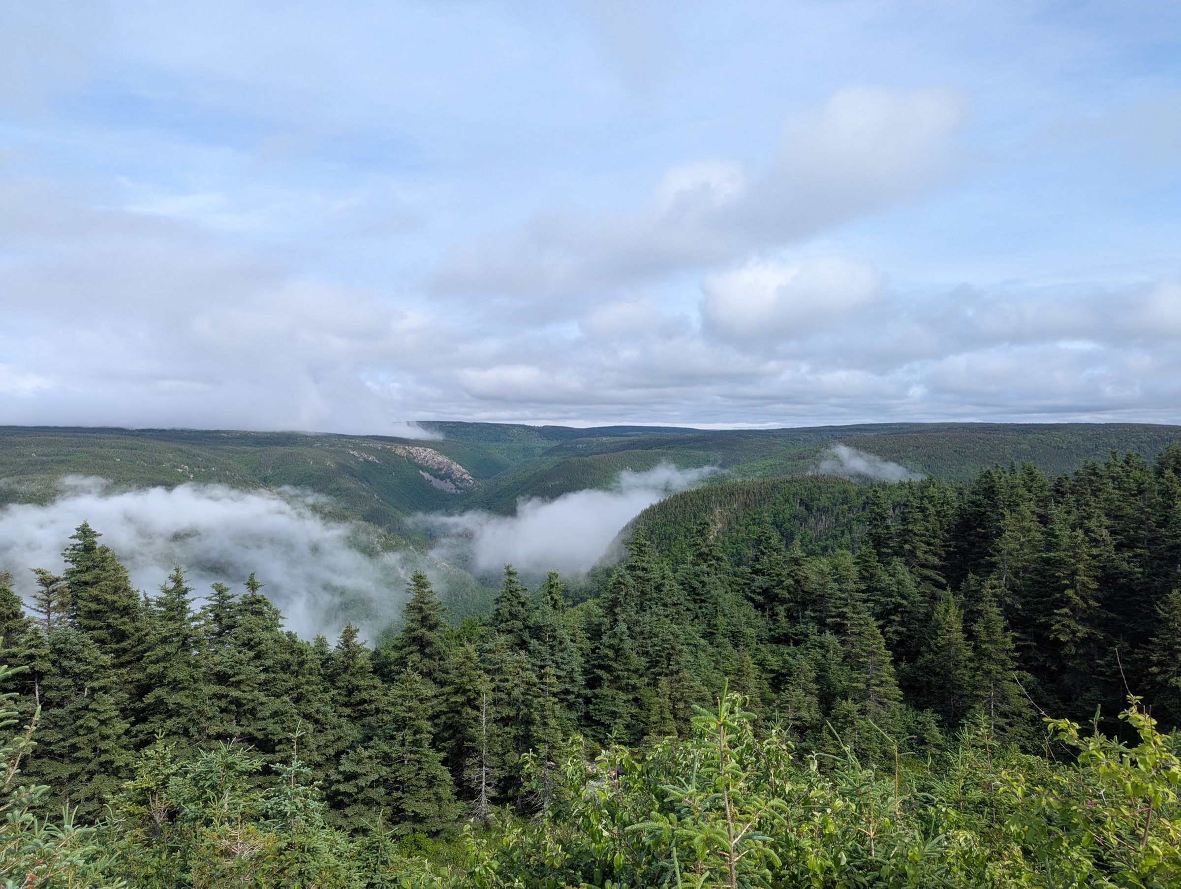
- No subject-matched, licence-compatible Wikimedia photographs were located for Franey Mountain summit or the Acadian Trail; the figures in those sections use representative valley and Cabot Trail views and are credited accordingly in the figcaptions.
- Hike the Highlands Festival dates and route variants vary year to year; consult the festival site for the current programme.
External links
| Source | URL |
|---|---|
| Parks Canada — Cape Breton Highlands NP hiking | parks.canada.ca |
| Parks Canada — Cape Breton Highlands NP | parks.canada.ca |
| Nova Scotia tourism — Cabot Trail | novascotia.com |
| Hike the Highlands Festival | hikethehighlands.com |
| Wikipedia — Cape Breton Highlands National Park | en.wikipedia.org |
| Wikipedia — Cabot Trail | en.wikipedia.org |
| AllTrails — Cape Breton Highlands National Park | alltrails.com |
| Wikiloc — Cape Breton Highlands | wikiloc.com |
| OpenStreetMap | openstreetmap.org |