Regional overview
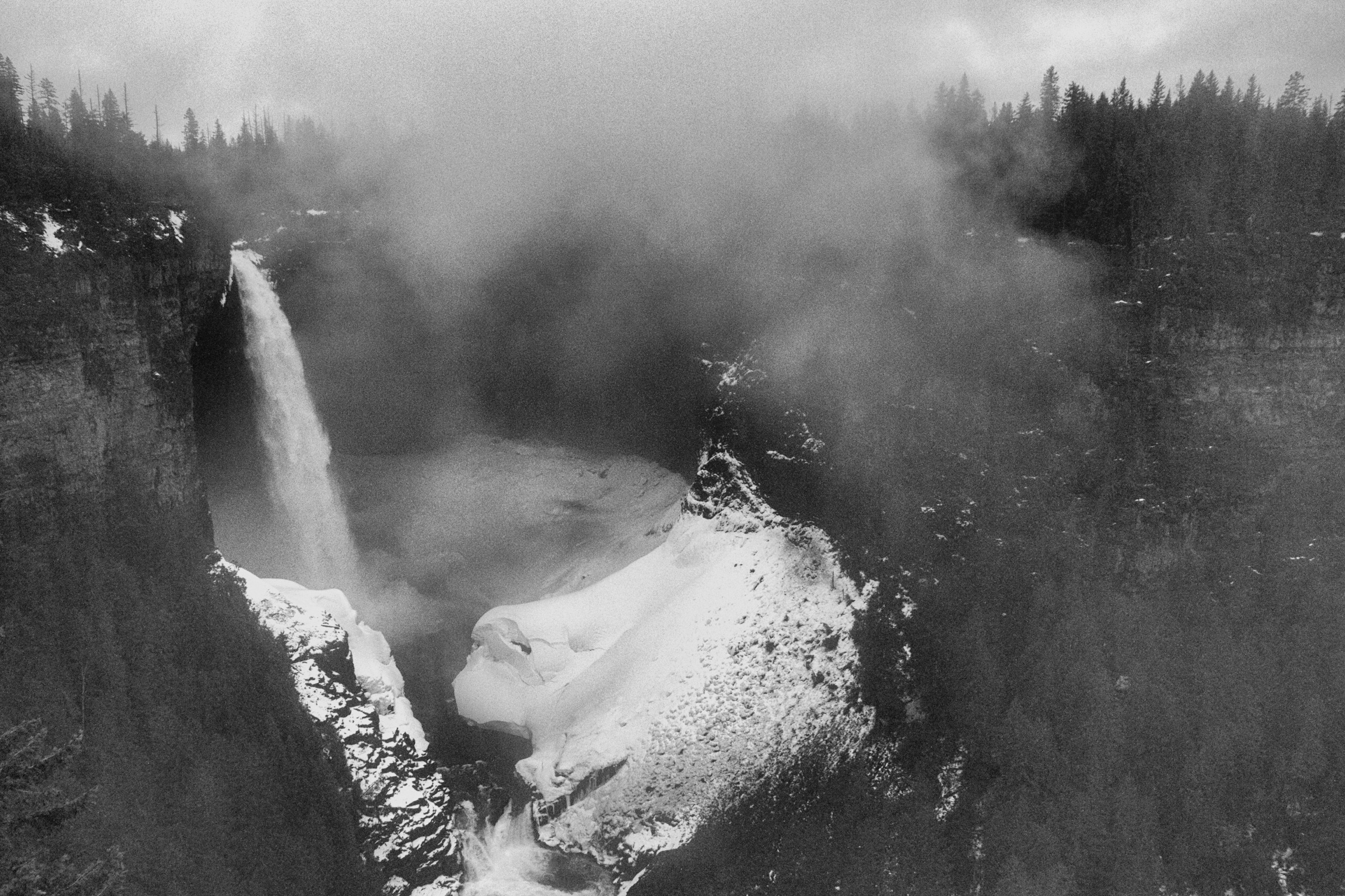
The Purcell Mountains are the eastern range of the Columbia Mountains in southeastern British Columbia, separated from the Canadian Rockies by the Rocky Mountain Trench and the Columbia Valley, and from the Selkirks by the Purcell Trench. The range runs from near Golden in the north into northern Idaho and Montana in the south, with the highest summits — Mount Farnham (3,493 m), Jumbo Mountain (3,437 m) and Howser Spire (3,412 m) — anchoring the central crest. Distinct subranges include the granite Bugaboos in the north, the Farnham Group at the centre, the Dogtooth Range north of the Bugaboos, and lower forested ranges around Kimberley and Creston in the south.
The hiking character of the Purcells is shaped by long unpaved access roads, big elevation gains over short distances, granite alpine landscapes (especially in the Bugaboos), larch parkland in autumn and a strong wilderness atmosphere. The classic centres are Bugaboo Provincial Park (Conrad Kain Hut, Cobalt Lake, Chalice Creek), the Jumbo and Toby Creek corridor between Invermere and Kaslo (Jumbo Pass, Mount Brewer, Brewer Creek), and the Forster and Horsethief drainages northwest of Invermere (Welsh Lakes). The Purcell Wilderness Conservancy protects the central crest crossed by the Earl Grey Pass; St Mary’s Alpine Provincial Park covers a remote southern alpine area. Trails are generally less developed than those in the adjacent Rockies, with very limited signage and few maintained paths.
The reliable hiking window runs from mid-July, when most upper trails clear of snow, through to late September or early October, when the larches turn gold and the first significant snowfalls arrive. Many trailheads require a high-clearance vehicle and several need 4WD on the final access kilometres. Cell coverage is essentially absent across the range. The Purcells lie within grizzly bear habitat, and bear-aware practices are essential on every hike below treeline. Weather can change rapidly at altitude, and creek crossings can become hazardous after heavy rain or rapid melt. The Conrad Kain Hut access trail was reported damaged by 2025 floods; conditions should be verified locally before travel.
Selection rationale
The five hikes were chosen to span the range geographically and thematically: an iconic alpine basin approach to a famous hut (Conrad Kain Hut Trail, Bugaboos); a classic alpine pass with cabin views over glacier-clad summits (Jumbo Pass); a high-elevation lake basin in the central Purcells (Welsh Lakes); a scrambly summit day with a panorama over the whole range (Mount Brewer); and a less-travelled alpine ridge with arguably the finest distant view of the Bugaboo Spires (Chalice Creek to Chalice Pond and Ridge). Pedley Pass, often listed in Invermere hiking guides, is deliberately excluded because it lies in the Stanford Range of the Rockies, not in the Purcells.
Summary
| # | Hike | Country | Route type | Distance | Gain | Max elevation | Difficulty |
|---|---|---|---|---|---|---|---|
| 1 | Conrad Kain Hut Trail | Canada | Out-and-back | ~9–10 km | ~700 m | ~2,230 m | Strenuous |
| 2 | Jumbo Pass | Canada | Out-and-back | ~10–10.7 km | ~800–957 m | ~2,350 m | Moderate–strenuous |
| 3 | Welsh Lakes (Lower) | Canada | Out-and-back | ~12 km | ~707 m | ~2,150 m | Moderate–strenuous |
| 4 | Mount Brewer | Canada | Out-and-back | ~12.9 km | ~959 m | ~2,812 m | Strenuous (light scramble) |
| 5 | Chalice Creek to Chalice Pond / Ridge | Canada | Out-and-back | ~12 km | ~660–1,250 m | ~2,200 m | Moderate–strenuous |
1. Conrad Kain Hut Trail
Snapshot
Itinerary
From the parking area at the end of the Bugaboo Creek Forest Service Road, the trail follows the northern lateral moraine of the Bugaboo Glacier. It crosses Bugaboo Creek and climbs steeply through subalpine forest, gaining most of the 700 m of elevation in roughly the first 3 km. Several short ladders and chain-assisted slabs help walkers up the steepest steps over slabby bedrock and water-polished granite. The gradient then eases as the trail traverses open subalpine terrain, with views opening onto Snowpatch and Bugaboo Spires before reaching the Conrad Kain Hut, perched on a bench at the foot of the spires. Confident walkers often continue another 30–60 minutes on the steep moraine path toward Applebee Dome and the Crescent Glacier viewpoint, although the highest sections soon become alpine and crevassed terrain.
The route to the hut was significantly damaged by flooding in 2025; bridges and creek crossings should be verified with BC Parks before departure.
Why it is essential
The Conrad Kain Hut Trail is the standard pedestrian approach to the most internationally famous granite cirque in the Canadian interior. It puts walkers at the foot of Bugaboo Spire, Snowpatch Spire and the Crescent Glacier within half a day, and is widely cited as the signature day-hike of Bugaboo Provincial Park.
Equipment
- Sturdy boots with good grip
- Trekking poles for the steep descent
- Weatherproof shell and warm mid-layer
- 2 L water minimum (limited reliable sources on the climb)
- Sun protection
- Map and GPS
- Bear spray and bear-aware food storage
- “Chicken-wire” wrapping is provided at the trailhead to deter porcupine damage to vehicle brake lines
Hazards and notes
- Steep, exposed sections with ladders and chains; not suitable in icy conditions.
- Snow lingers on the upper trail and around the hut into July; microspikes are useful in early season.
- Glacier travel beyond the hut requires roping and crevasse-rescue skills and is outside the scope of a day-hike.
- Grizzly bears are active throughout the area.
- 2025 flood damage may have altered the lower trail and bridges; check BC Parks updates before driving in.
- Hut day-use and overnight reservations run through the Alpine Club of Canada.
- The 50 km approach road is rough gravel; high clearance is recommended.
Routes and maps
| Source | URL |
|---|---|
| BC Parks — Bugaboo Provincial Park | bcparks.ca |
| BC Parks — Bugaboo Park map (PDF) | nrs.objectstore.gov.bc.ca |
| Trailforks — Conrad Kain Hut Trail | trailforks.com |
| OpenStreetMap — Conrad Kain Hut way | openstreetmap.org |
External links
- Alpine Club of Canada — Conrad Kain Hut
- Off Track Travel — Conrad Kain Hut Trail guide
- Wikipedia — Conrad Kain Hut
2. Jumbo Pass
Snapshot
Itinerary
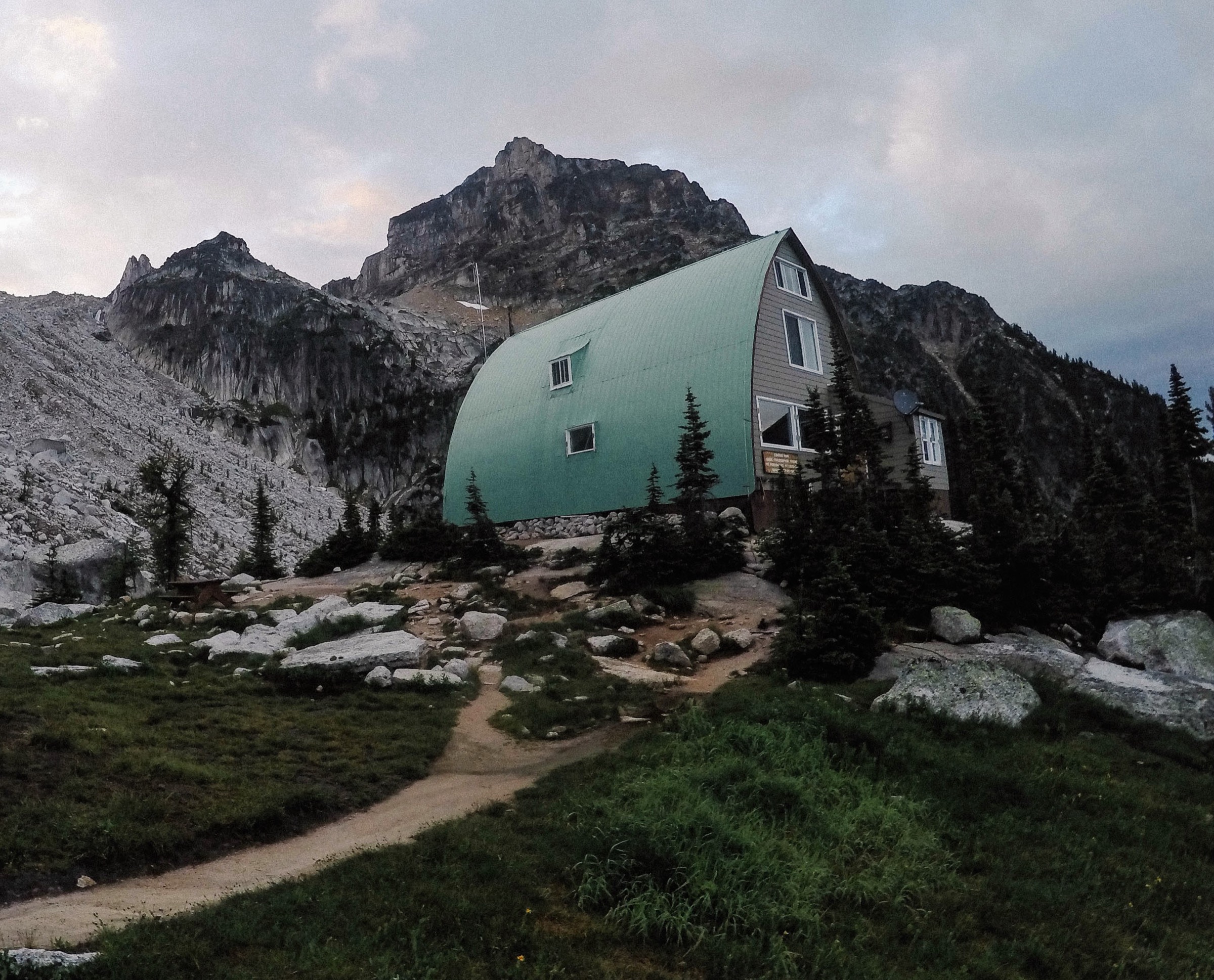
From the east-side (Toby Creek) trailhead the path climbs steadily through old-growth subalpine forest, switchbacking up the headwall before emerging into open meadows below the pass. The grade is consistent rather than punishing and the trail is generally well marked. At the broad pass the Jumbo Pass Cabin sits on the col with direct views east to Jumbo and Karnak Mountains and south-west across the Horseshoe Glacier draping off Cauldron Mountain. A short, optional ridge walk gains another 100–150 m for a wider panorama. The west-side trailhead (via Glacier Creek FSR from Kaslo) climbs slightly further and steeper through similar subalpine terrain to the same col. Most parties hike up one side and return the same way.
Why it is essential
Jumbo Pass is the most accessible alpine pass crossing of the central Purcells, with a famous hut at the col, comprehensive views of the Jumbo group and the Horseshoe Glacier, and strong cultural resonance as the symbolic centre of the long “Jumbo Wild” campaign against a proposed ski resort. It is consistently listed as a benchmark Purcell day-hike by local guidebooks and tourism bodies.
Equipment
- Mountain hiking boots
- Trekking poles for the steep descent
- Weatherproof layer, warm layer, hat and gloves outside midsummer
- Map and GPS
- Sun protection
- 2 L water; treat from creeks
- Bear spray and bear-aware food storage
Hazards and notes
- Rapidly changing weather at the pass, including snow showers possible in any month.
- Steep terrain on the upper switchbacks with some loose rock.
- Grizzly bear habitat throughout.
- No cell coverage in the access valleys.
- FSR access roads are rough; high clearance recommended, and the final kilometres on the west side may require 4WD.
- The Jumbo Pass Cabin is bookable through the Columbia Valley Hut Society; day-users should respect cabin occupants.
- Dogs are permitted on the trail.
Routes and maps
| Source | URL |
|---|---|
| Off Track Travel — Jumbo Pass Trail | offtracktravel.ca |
| 10adventures — Jumbo Pass and Horseshoe Glacier | 10adventures.com |
| AllTrails — Jumbo Pass Trail | alltrails.com |
| OpenStreetMap — Jumbo Pass | openstreetmap.org |
External links
- Columbia Valley Hut Society — Jumbo Pass Hut
- West Kootenay Hiking — Jumbo Pass
- Columbia Valley Greenways — Jumbo Pass
3. Welsh Lakes (Lower)
Snapshot
Itinerary
The route begins on an old logging road that climbs gently through subalpine forest along the lower flanks of Welsh Creek for roughly the first 2 km. The trail then enters older forest, crosses to the south side of the creek and follows a more conventional footpath through mossy spruce–fir terrain. Around 3 km in, the gradient steepens significantly, gaining the final ~300 m via a sustained climb up the headwall to emerge above treeline at Lower Welsh Lake, set in a granite basin ringed by surrounding peaks. Strong parties continue across rock benches and small meadows to Middle and Upper Welsh Lakes, where larch parkland and turquoise tarns sit beneath the headwall.
Why it is essential
Welsh Lakes is the most accessible of the classic Purcell lake basins between the Bugaboos and the Earl Grey corridor, with strikingly coloured glacial lakes, larch parkland in autumn and a wild, lightly travelled atmosphere. It is repeatedly identified as one of the signature hikes of the central Purcells by regional guidebooks and trip reports.
Equipment
- Mountain hiking boots — the steep upper section is rooty and slippery when wet
- Trekking poles
- Map and GPS; the trail is not heavily signed
- Weatherproof layer, warm layer, hat and gloves above treeline
- Sun protection
- 2 L water; treat from streams
- Bear spray and bear-aware food storage
- Spare tyre and basic vehicle recovery kit for the FSR drive
Hazards and notes
- Long, rough Forster Creek FSR access; the final spur road is steep and narrow.
- No cell coverage.
- Grizzly bear habitat; carry bear spray.
- Snow lingers in the lake basin and on the headwall into early or mid-July.
- The trail is informal and route-finding may be required if snow is patchy.
- Stream crossings can rise quickly after rain or hot afternoons.
- No facilities; no permit required.
Routes and maps
| Source | URL |
|---|---|
| Summit Trail Makers Society — Welsh Lakes | summittrailmakers.ca |
| Trailforks — Welsh Lakes | trailforks.com |
| AllTrails — Welsh Lakes via Welsh Creek Trail | alltrails.com |
| OpenStreetMap — Forster Creek area | openstreetmap.org |
External links
- Alisen Dopf — Welsh Lakes trip report
- Ron Perrier — Welsh Lakes
- BC Parks — Purcell Wilderness Conservancy Park
4. Mount Brewer
Snapshot
Itinerary
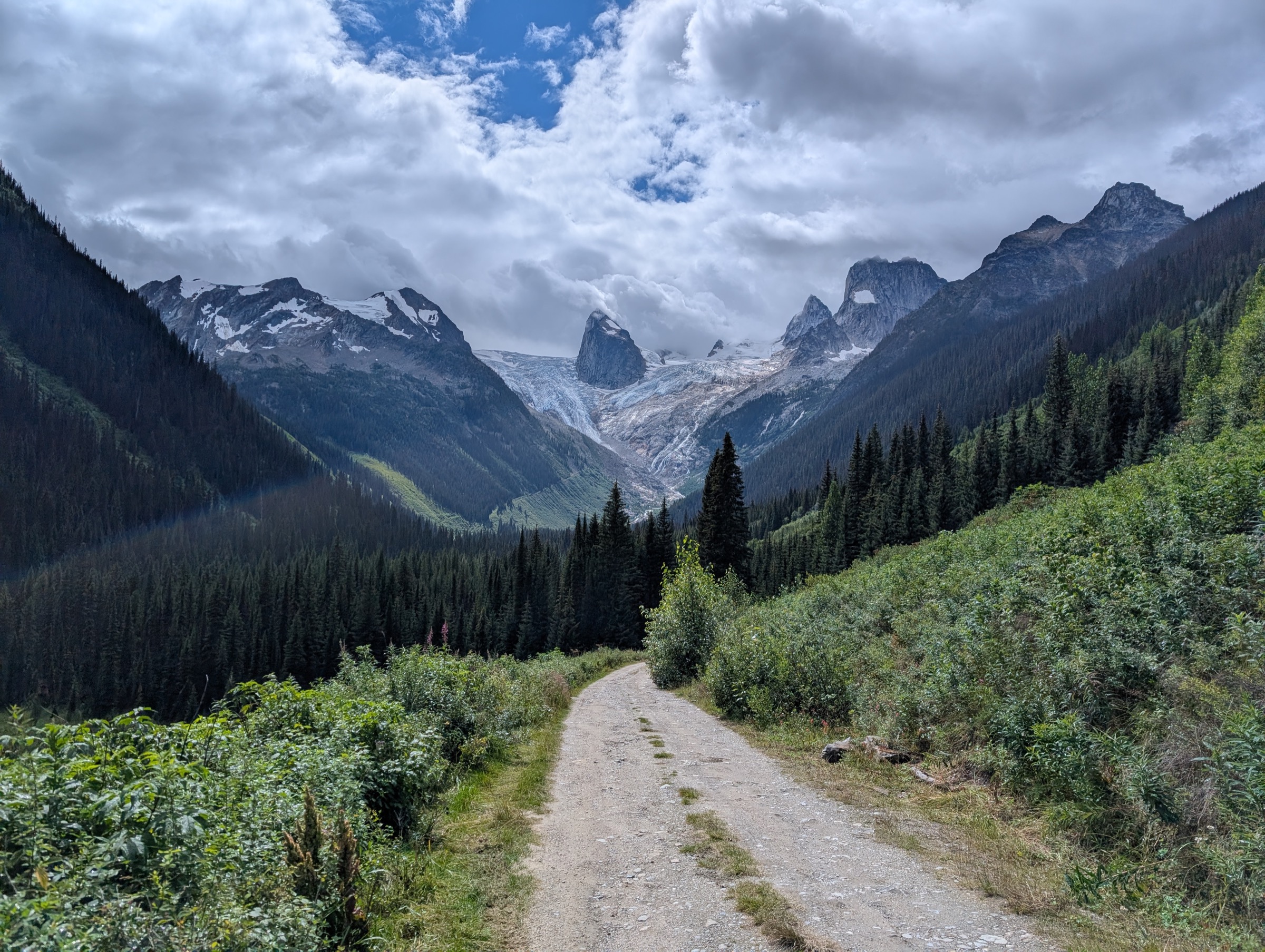
From the trailhead at the end of the Hawke Road spur off Brewer Creek FSR, the trail climbs gradually through subalpine forest into the open Brewer Creek basin, passing wet meadows, a bubbling creek and several small tarns surrounded by alpine larch. The footpath ascends to the broad Brewer / Mineral Pass area, with views opening onto Mount Brewer to the south. From the pass, the route turns south-south-east up open scree and grassy slopes onto the broad summit ridge. The final 200–300 m of gain involves light scrambling on stable but broken rock, with no technical difficulties under dry conditions. The summit offers a 360° panorama over the central Purcells, with the Bugaboos to the north-west and the Rocky Mountains across the Columbia Valley to the east.
Why it is essential
Mount Brewer is among the most attainable true alpine summits in the central Purcells, combining classic Brewer-basin larch meadows with a non-technical scramble to a 2,800 m top. It gives walkers a panoramic view across the entire Purcell crest that no valley-bottom hike can match, and is widely recommended by Invermere-area trail organisations.
Equipment
- Sturdy boots with good edging
- Trekking poles for the scree
- Helmet optional but worth carrying where parties are stacked on the upper scramble
- Weatherproof shell and warm mid-layer
- Hat and gloves above treeline
- Sun protection (very exposed above treeline)
- 2 L water; sources are limited high on the climb
- Map and GPS; the upper route is informal
- Bear spray and bear-aware food storage
Hazards and notes
- Light scrambling on the upper summit ridge; not suitable in icy conditions or wet snow.
- Lingering snow patches into July; cornice risk on the summit ridge in early season.
- Loose rock; small parties are preferred.
- Rapid weather changes typical of exposed Purcell summits.
- Grizzly bear habitat in the lower forest and meadows.
- No cell coverage.
- Long, rough Brewer Creek FSR access; the final road sections often need high-clearance 4WD.
Routes and maps
| Source | URL |
|---|---|
| 10adventures — Mount Brewer | 10adventures.com |
| Recreation Sites and Trails BC — Brewer Creek (REC5914) | sitesandtrailsbc.ca |
| Trailforks — Brewer Creek Trail | trailforks.com |
| AllTrails — Mount Brewer | alltrails.com |
External links
- Mountaineers — Brewer Creek Tarns and Brewer / Mineral Pass
- Steven’s Peak-bagging Journey — Mount Brewer
- Summit Trail Makers Society — Brewer Creek
5. Chalice Creek to Chalice Pond / Chalice Ridge
Snapshot
Itinerary
The trail starts on an old logging road and follows the Chalice Creek drainage gently uphill for approximately 3 km, with the creek and its waterfalls to one side. The route then crosses to the east side of the creek and steepens, switchbacking through subalpine forest. Around 4–5 km in it climbs through the headwall, gaining roughly 300 m in a sustained ascent, before opening onto a flat alpine bench around Chalice Pond. From the pond and ridge bench, the view across the Bugaboo Creek valley to the granite spires of Bugaboo Provincial Park — Bugaboo Spire, Snowpatch Spire, the Howser Towers — is one of the finest distant panoramas of the range. Parties returning the same way typically take 1 hour 20 minutes to 2 hours for the descent.
Why it is essential
Chalice Creek offers the most striking distant view of the Bugaboo Spires available to walkers — a perspective unavailable from the Conrad Kain Hut side, which sits beneath the spires rather than facing them. It is the natural complement to the Kain Hut hike for visitors basing themselves in the Bugaboos and is included as a key day-hike in regional Golden and Bugaboo trail catalogues.
Equipment
- Mountain hiking boots
- Trekking poles
- Weatherproof layer and warm layer
- Sun protection
- 2 L water; treat from the creek
- Map and GPS; the upper trail is informal
- Bear spray and bear-aware food storage
Hazards and notes
- The access road is deeply rutted with large holes; a high-clearance vehicle is helpful and may be required for the final approach.
- The trail becomes informal above the headwall; route-finding required.
- Grizzly bear habitat.
- Snow lingers on the upper bench into early or mid-July.
- Stream crossings can rise after rain or hot weather.
- No facilities or permits required.
Routes and maps
| Source | URL |
|---|---|
| Recreation Sites and Trails BC — Chalice Creek (REC5090) | sitesandtrailsbc.ca |
| Golden Hikes — Chalice Ridge | goldenhikes.ca |
| Trailforks — Chalice | trailforks.com |
| AllTrails — Chalice Creek Trail | alltrails.com |