Regional overview
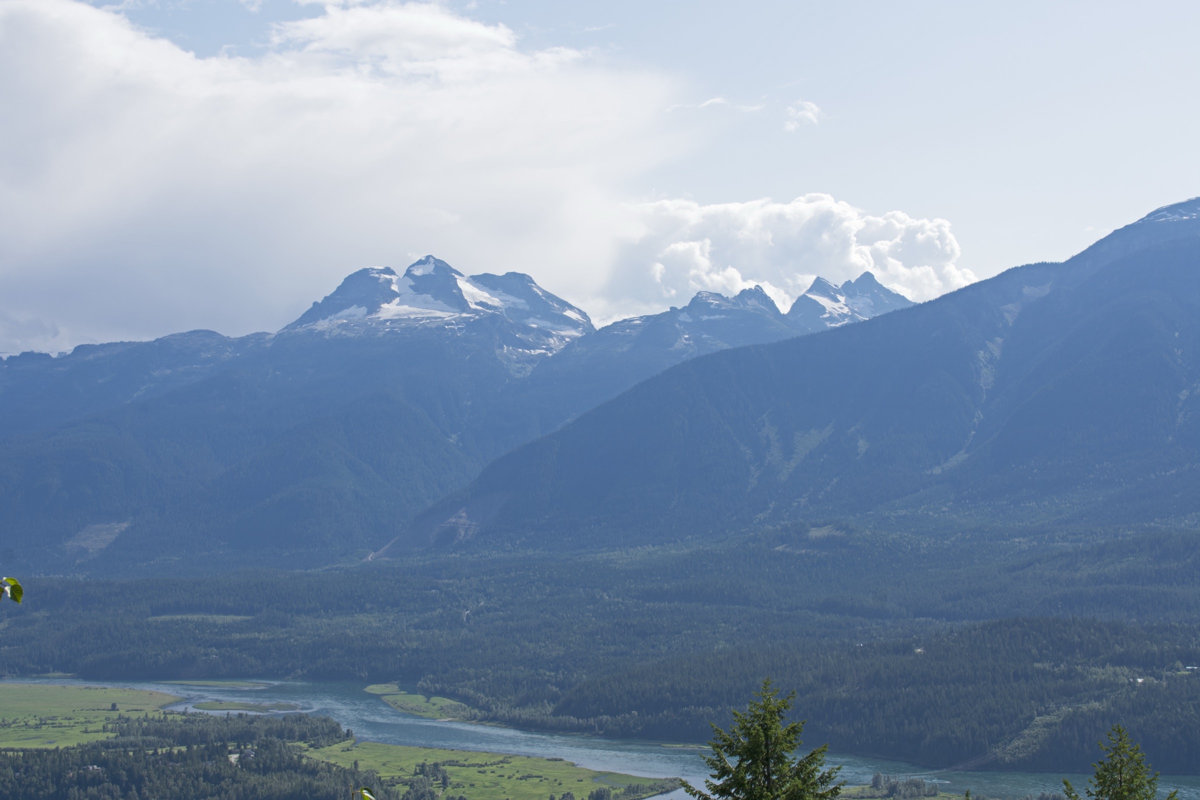
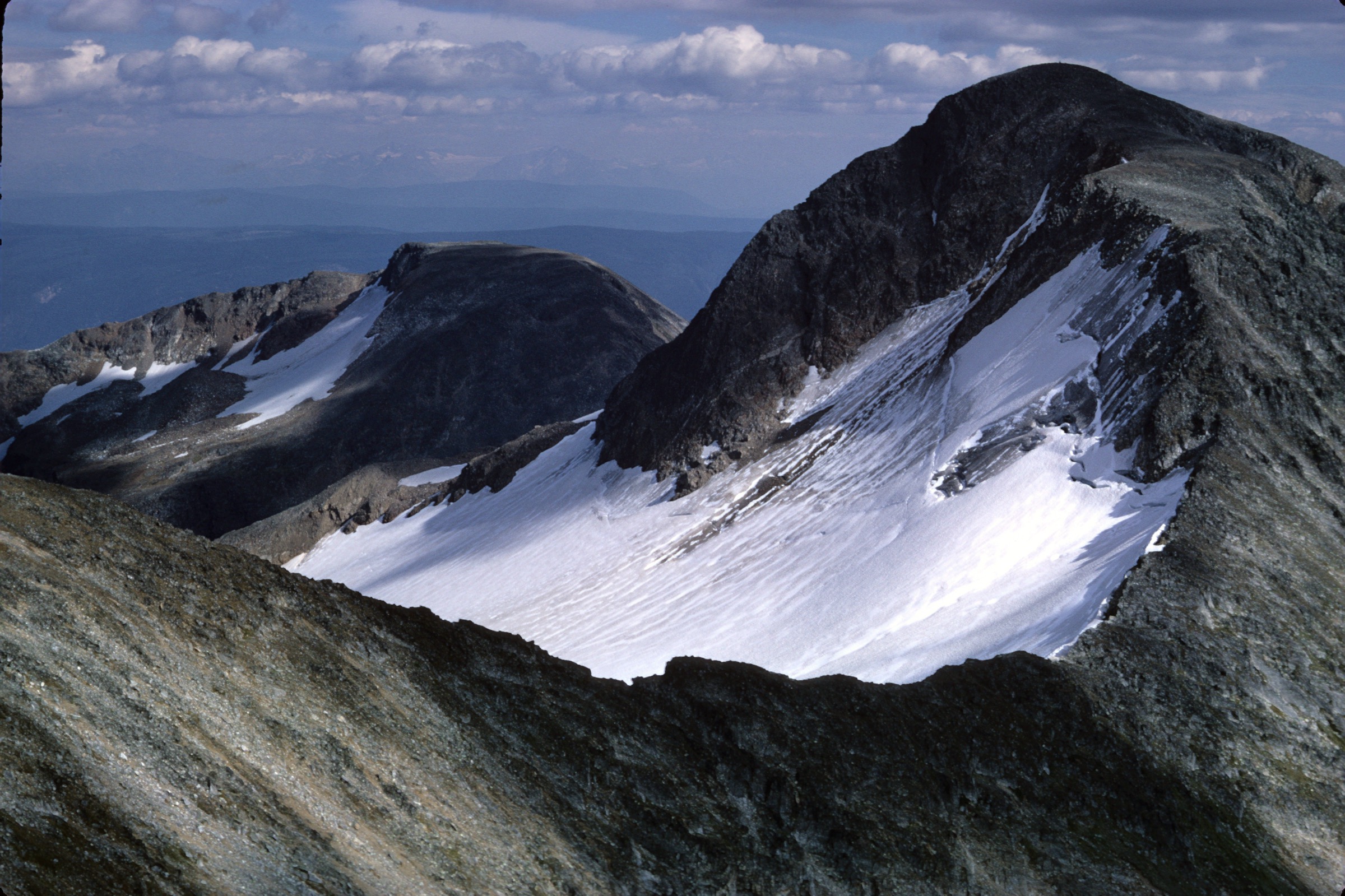
The Cariboo Mountains form the northernmost subrange of British Columbia’s Columbia Mountains, stretching roughly 245 km from south-east to north-west and spanning some 7,700 km². They are bounded by the Rocky Mountain Trench and the upper Fraser River to the east, the Quesnel Highland and Cariboo Plateau to the west, the Nechako Plateau near Prince George to the north-west, and the Shuswap Highland to the south. Unlike other Columbia subranges, drainage flows almost exclusively into the Fraser and North Thompson river systems rather than the Columbia. The highest summit, Mount Sir Wilfrid Laurier, reaches 3,516 m within the Premier Range, with several other peaks exceeding 3,000 m.
For walkers, the southern Cariboos are dominated by Wells Gray Provincial Park (often called “Canada’s Waterfall Park”), established in 1939 around the volcanic plateaus, lava-rim canyons and large lakes of the Clearwater and Murtle river systems. Trailheads cluster along the Clearwater Valley Road north of the town of Clearwater on Highway 5. Further north, Barkerville Historic Town and Park, the heart of the 1860s Cariboo Gold Rush, gives access to the alpine country at the southern edge of Bowron Lake Provincial Park. Two of the most popular subalpine hiking areas treated here — Trophy Mountain south of Clearwater and Mount Agnes above Barkerville — sit strictly in the Shuswap Highland and Quesnel Highland respectively, but are conventionally grouped with the Cariboos by local guidebooks and tourism bodies and are included on that basis.
Hiking conditions are strongly seasonal. Low-elevation waterfall and canyon-rim trails are usually walkable from May to October, while the subalpine and alpine meadows (Trophy, Green Mountain, Mount Agnes) are typically clear of lingering snow only from early July to mid-September. Late July and early August bring peak wildflower colour. The Cariboo Mountains hold one of British Columbia’s largest interior grizzly populations, plus black bear, moose, wolf and mountain caribou, so walkers should carry bear spray, travel in groups where possible, make noise on blind corners and store food securely. Weather can change quickly above treeline, and many access roads are gravel forest service routes subject to wildfire closures.
Selection rationale
The five hikes represent the region’s signature landscapes within reasonable day-hike effort: a flagship waterfall canyon rim (Helmcken Falls Rim Trail), a short waterfall walk that allows passage behind the curtain (Moul Falls), the classic Cariboo subalpine meadow-and-tarn outing (Trophy Meadows to Sheila Lake), a panoramic plateau viewpoint of the Wells Gray volcanic landscape (Green Mountain Lookout), and a historic gold-rush wagon road climbing to alpine country (Mount Agnes / Groundhog Lake from Barkerville). Together they cover canyon, forest, subalpine, alpine and cultural-historical terrain. Trophy Mountain and Mount Agnes sit in the Shuswap Highland and Quesnel Highland respectively but are conventionally treated by local guidebooks as part of the Cariboo Mountains hiking area; this is flagged in each entry.
Summary
| # | Hike | Country | Route type | Distance | Gain | Max elevation | Difficulty |
|---|---|---|---|---|---|---|---|
| 1 | Helmcken Falls Rim Trail | Canada | Out-and-back | ~8 km | ~150–200 m | ~880 m | Easy–moderate |
| 2 | Moul Falls | Canada | Out-and-back | ~5.4 km | ~120–195 m | ~700 m | Easy–moderate |
| 3 | Trophy Meadows to Sheila Lake | Canada | Out-and-back | ~10 km | ~400 m | ~2,070 m | Moderate |
| 4 | Green Mountain Lookout | Canada | Out-and-back / drive-and-walk | ~7 km on foot | ~340 m | ~1,280 m | Easy–moderate |
| 5 | Mount Agnes / Groundhog Lake | Canada | Out-and-back (loop variant) | 17–24 km | 410–1,090 m | ~1,841 m | Moderate–strenuous |
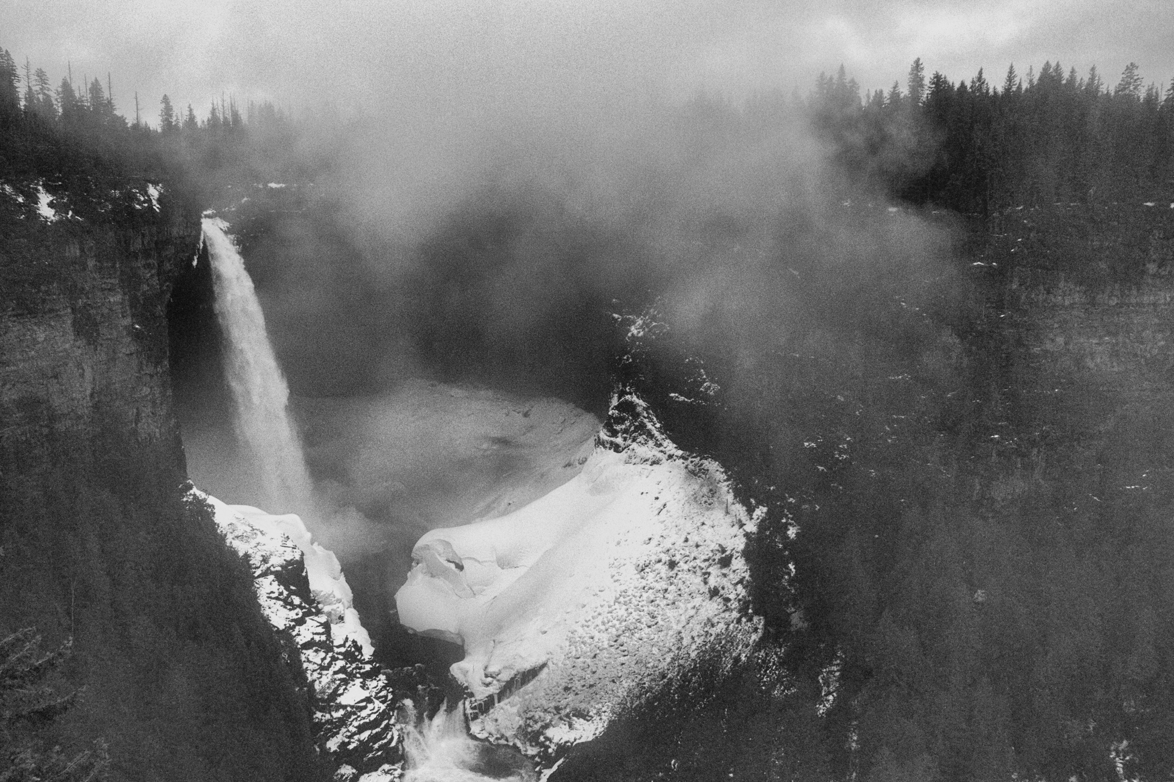
1. Helmcken Falls Rim Trail
Snapshot
Itinerary
The trail begins near the Dawson Falls day-use area on the Clearwater Valley Road and follows the south bank of the Murtle River through mixed conifer forest. The path stays well back from the canyon rim for most of its length, undulating gently over root-bound ground, with occasional short climbs and descents over side gullies. After approximately 4 km the forest thins and the route emerges at the brink of Helmcken Falls, where the Murtle River plunges 141 m into a basalt amphitheatre. There are no fences at the brink. Return is by the same path. A separate, much shorter walk from the main Helmcken Falls viewpoint (reached by paved road on the north side of the canyon) provides the standard frontal photograph of the falls and can be combined with the rim hike for a fuller visit.
Why it is essential
Helmcken Falls is the signature image of Wells Gray Park and one of the highest unbroken waterfalls in Canada at 141 m. The rim trail offers the only walking approach to the brink, complementing the drive-up frontal viewpoint, and passes through characteristic Cariboo plateau forest. It is the single best introduction to the volcanic-rim landscape that defines the southern Cariboo Mountains.
Equipment
- Hiking shoes
- Weatherproof and warm layers
- Water and food
- Sun protection
- Bear spray (recommended throughout Wells Gray)
- Headtorch advisable for late starts in shoulder season
Hazards and notes
- The trail ends at unfenced cliffs more than 140 m above the river; extreme caution is required with children and dogs.
- Spray from the falls makes the brink rock slippery, particularly in cold weather.
- The trail crosses bear habitat.
- Snow may linger into early May at the trailhead and longer in shaded forest.
- Dogs must be leashed in the day-use area; standard BC Parks rules apply.
Routes and maps
| Source | URL |
|---|---|
| Wikiloc — Wells Gray Park / Helmcken Falls Trail | wikiloc.com |
| Wikiloc — Helmcken Falls Rim Trail | wikiloc.com |
| AllTrails — Helmcken Falls Rim Trail | alltrails.com |
| Trailforks — Rim Trail (Helmcken Falls) | trailforks.com |
External links
- 10adventures — Helmcken Falls Rim Trail
- Hike Kamloops — Helmcken Falls Rim Trail
- Wikipedia — Helmcken Falls
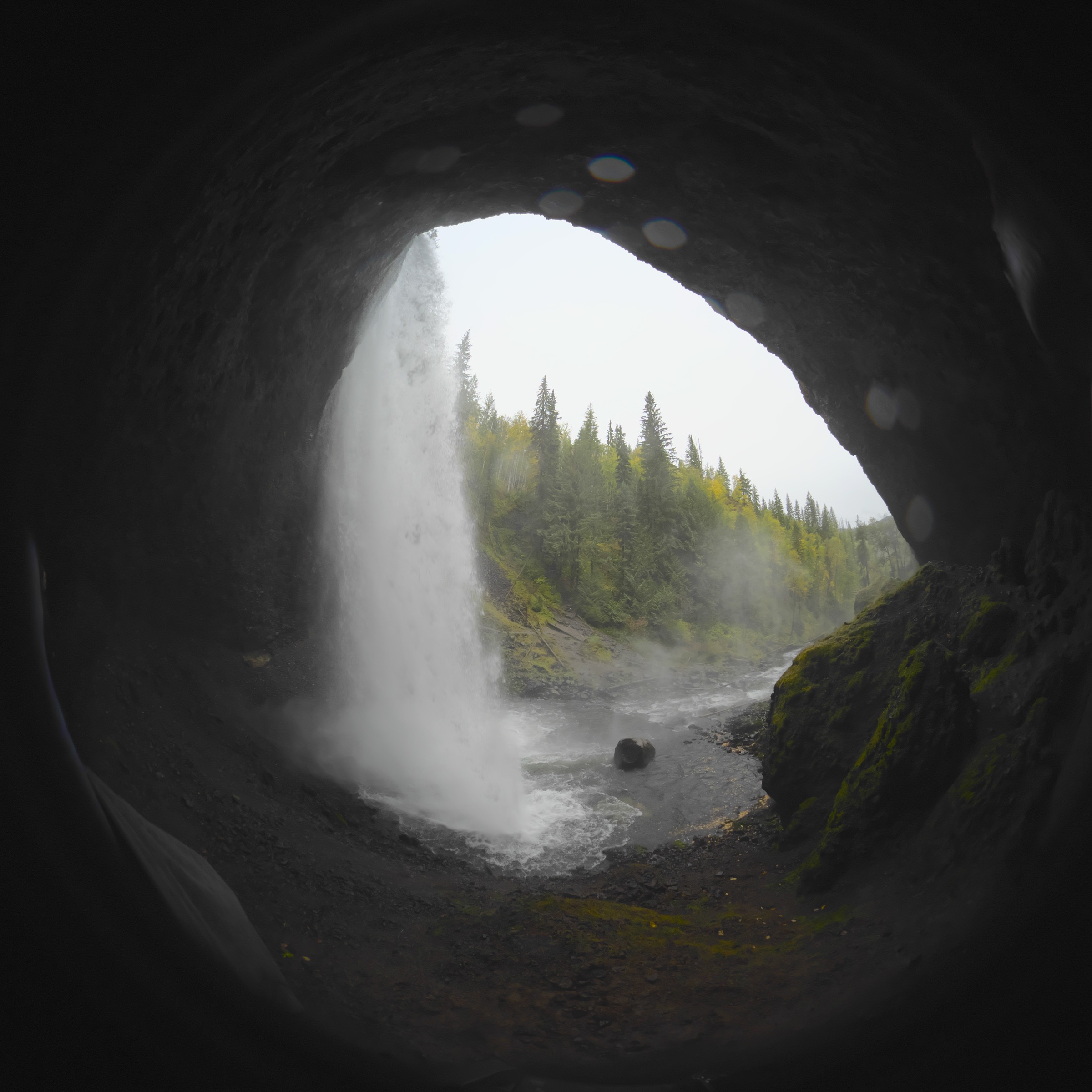
2. Moul Falls
Snapshot
Itinerary
The signed trail leaves the Moul Falls parking area on Clearwater Valley Road and descends gently through second-growth conifer forest. After roughly 2 km the trail reaches a rim viewpoint above the 35 m cascade on Grouse Creek. A signed side-trail then drops steeply down a rooty, rocky path with steps and a short ladder / handrail section to the plunge pool and the cave-like recess behind the curtain of water. Hikers can usually walk behind the falls in summer when flow is reduced. Return is by the same route, climbing back to the rim and then up to the trailhead.
Why it is essential
Moul Falls is one of very few large waterfalls in western Canada that hikers can legally walk behind, and it is the most popular short waterfall hike in Wells Gray after Helmcken. The combination of low effort, dramatic close-range view and the behind-the-curtain experience makes it a near-mandatory inclusion for any Wells Gray itinerary.
Equipment
- Standard hiking equipment
- Waterproof outer layer (spray reaches the cave route)
- Grippy footwear for the wet rock descent
- A small towel or change of clothing if planning to swim in the plunge pool
- Bear spray
- Headtorch is useful in the recess behind the falls
Hazards and notes
- The final descent to the cave is steep, slippery and exposed to constant spray; high flows in late spring can make the behind-the-falls route hazardous or impassable.
- Rock surfaces near the falls remain wet and mossy year-round.
- The cliff edge above the falls is unfenced.
- Pets should be leashed.
- Standard BC Parks bear-aware practice applies.
Routes and maps
| Source | URL |
|---|---|
| Wikiloc — Wells Gray Park / Moul Falls | wikiloc.com |
| AllTrails — Moul Falls Trail | alltrails.com |
| Trailforks — Moul Falls Trail | trailforks.com |
| Spahats Creek Resort — Moul Falls trail PDF | spahatscreekresort.ca |
External links
3. Trophy Meadows to Sheila Lake
Snapshot
Itinerary
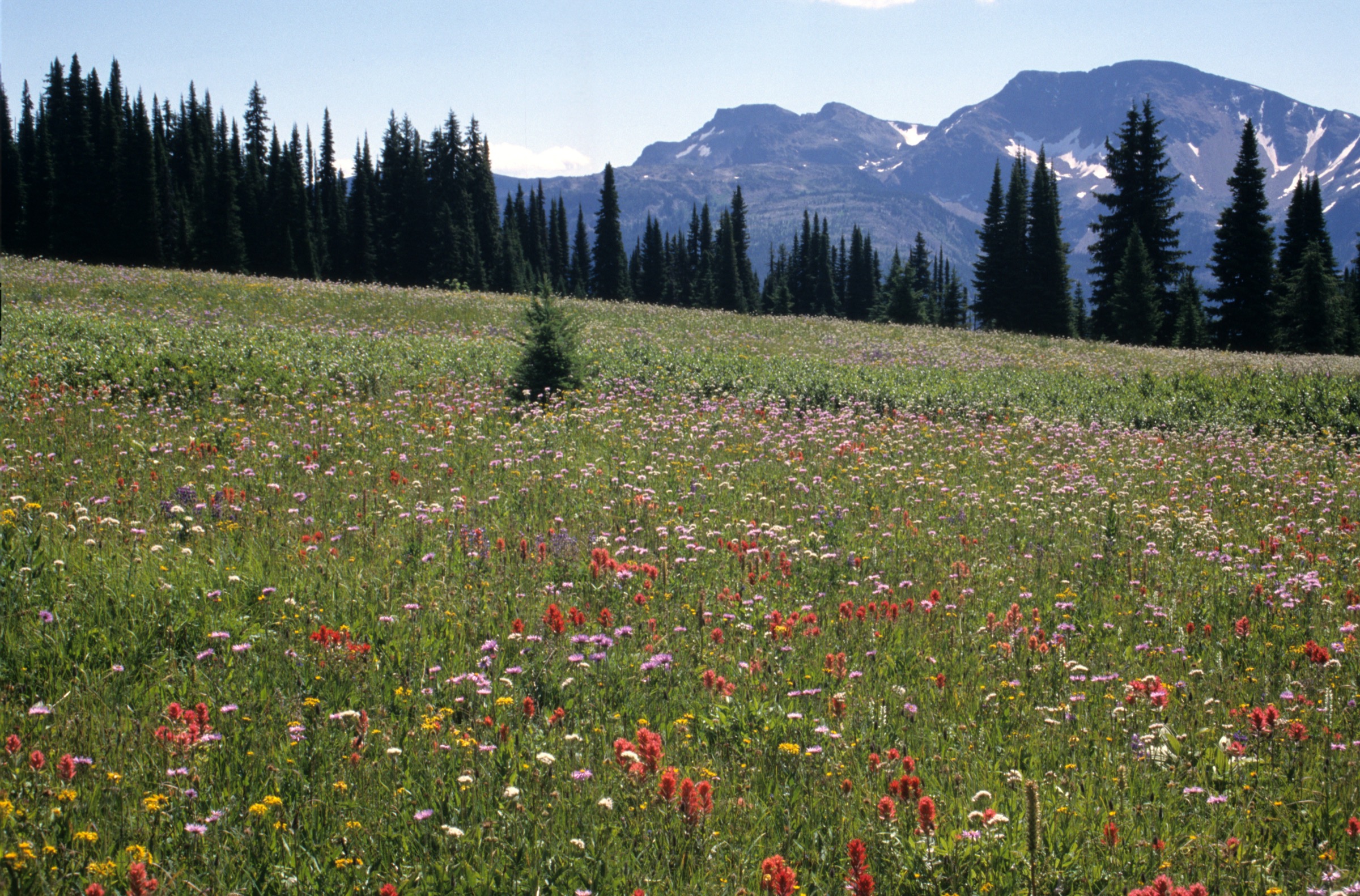
From the Trophy Mountain trailhead (~1,670 m) the path climbs steadily for roughly 1 km through subalpine fir and Engelmann spruce forest before opening abruptly into the famous Trophy flower meadows. The trail continues across rolling meadow benches, gaining height gradually, with the multiple summits of Trophy Mountain on the left and Raft Mountain and Table Mountain visible across the valley. After approximately 3–4 km the meadow gives way to a more open subalpine zone of low heather and lichen-covered glacial rubble, and the path traverses around to reach Sheila Lake (~2,070 m), a small cirque tarn beneath the Trophy ridge. Most hikers turn around at the lake; experienced parties continue beyond to the lookout col, to Trophy Summit (a much longer day) or to other peaks in the Trophy group.
Why it is essential
The Trophy Meadows are widely cited as one of the finest subalpine wildflower displays in interior British Columbia, with two distinct bloom windows: glacier lilies in late June and a peak display of paintbrush, lupine, valerian and arnica in late July and early August. Sheila Lake adds a classic cirque-tarn objective at a length and gradient suitable for fit day-hikers. The route is the most representative subalpine outing accessible from the Wells Gray corridor.
Equipment
- Sturdy boots
- Trekking poles
- Extra warm layer, hat and gloves outside midsummer
- Weatherproof shell
- Navigation backup
- Water (limited reliable sources high on the route)
- Sun protection (open meadows)
- Insect repellent — mosquitoes can be intense in July
- Bear spray
- Microspikes may be useful if snow lingers in the upper basin in early July
Hazards and notes
- Snow can persist in the Sheila Lake basin into early July; check current conditions.
- Afternoon thunderstorms are common above treeline in midsummer; start early.
- Grizzly and black bear use the meadows; make noise and travel in groups.
- The Trophy Mountain Forest Service Road is rough gravel — high clearance recommended; check road status with Wells Gray Park or BC Parks.
- Stay on existing tread to protect fragile meadow vegetation.
- Dogs permitted on leash; standard BC Parks rules apply.
Routes and maps
| Source | URL |
|---|---|
| BC Parks — Wells Gray Park / Trophy Mountain | bcparks.ca |
| Gaia GPS — Sheila Lake View Point via Trophy Mountain Trail | gaiagps.com |
| AllTrails — Trophy Meadows Trail | alltrails.com |
| Trailpeak — Trophy Meadows to Sheila Lake | trailpeak.com |
External links
- Off Track Travel — Trophy Meadows Trail
- 10adventures — Trophy Meadows Trail
- Wikipedia — Trophy Mountain
4. Green Mountain Lookout
Snapshot
Itinerary
A gravel access road climbs roughly 4 km from its junction with the Clearwater Valley Road (in the lower part of Wells Gray Park, south of Dawson Falls) to the summit of Green Mountain. The route can be driven in dry conditions but is also a satisfying foot ascent, climbing steadily through second-growth and mature subalpine forest, with occasional openings revealing the Clearwater valley. At the top, a metal viewing tower built above the surrounding forest gives a near-360° panorama over the southern third of Wells Gray Park — Mahood Lake to the south, the McLeod Hills, Garnet Peak, the Trophy Mountain group to the east, and on clear days the distant peaks of the Cariboo Mountains proper to the north. Short side-trails lead from the summit to Foot Lake and to White Horse Bluffs.
Why it is essential
Green Mountain is the only easy panoramic viewpoint in Wells Gray that takes in the full sweep of the volcanic plateau landscape — its waterfalls, lakes and surrounding ranges — in one view. The tower is widely recommended by BC Parks and the local tourism authority as an orientation stop for any first visit to the park. The road-walk format makes it accessible to walkers who are not ready for Trophy or Mount Agnes but want a representative high viewpoint.
Equipment
- Hiking shoes
- Weatherproof layer, warm layer
- Water and sun protection (sections of the road have no shade)
- Bear spray
- Drivers should carry a basic tyre repair kit on the gravel road
Hazards and notes
- The tower is a tall metal structure; the upper viewing platform is exposed to wind and lightning — descend in storms.
- The road is shared with vehicles; walk facing traffic.
- Black and grizzly bears use the surrounding forest.
- Foot Lake and White Horse Bluffs side-trails are less maintained and can be muddy.
- Standard BC Parks rules apply; dogs on leash.
Routes and maps
| Source | URL |
|---|---|
| BC Parks — Wells Gray Park Corridor area | bcparks.ca |
| Wells Gray Park / Destination Clearwater — Viewpoints | wellsgray.ca |
| AllTrails — Wells Gray Green Mountain Trail | alltrails.com |
External links
- Off Track Travel — Wells Gray Provincial Park: Best Things to Do and See
- Wikipedia — Wells Gray Provincial Park
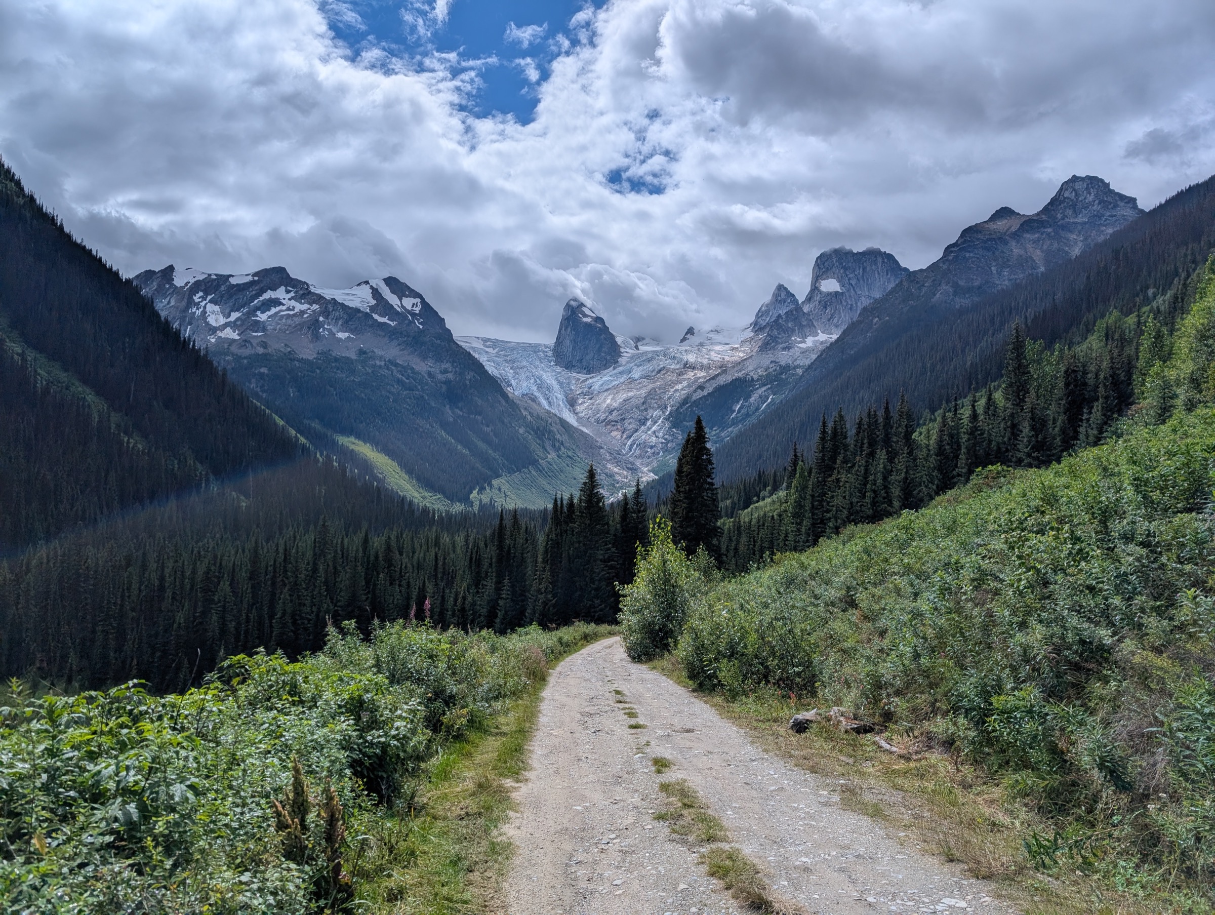
5. Mount Agnes / Groundhog Lake
Snapshot
Itinerary
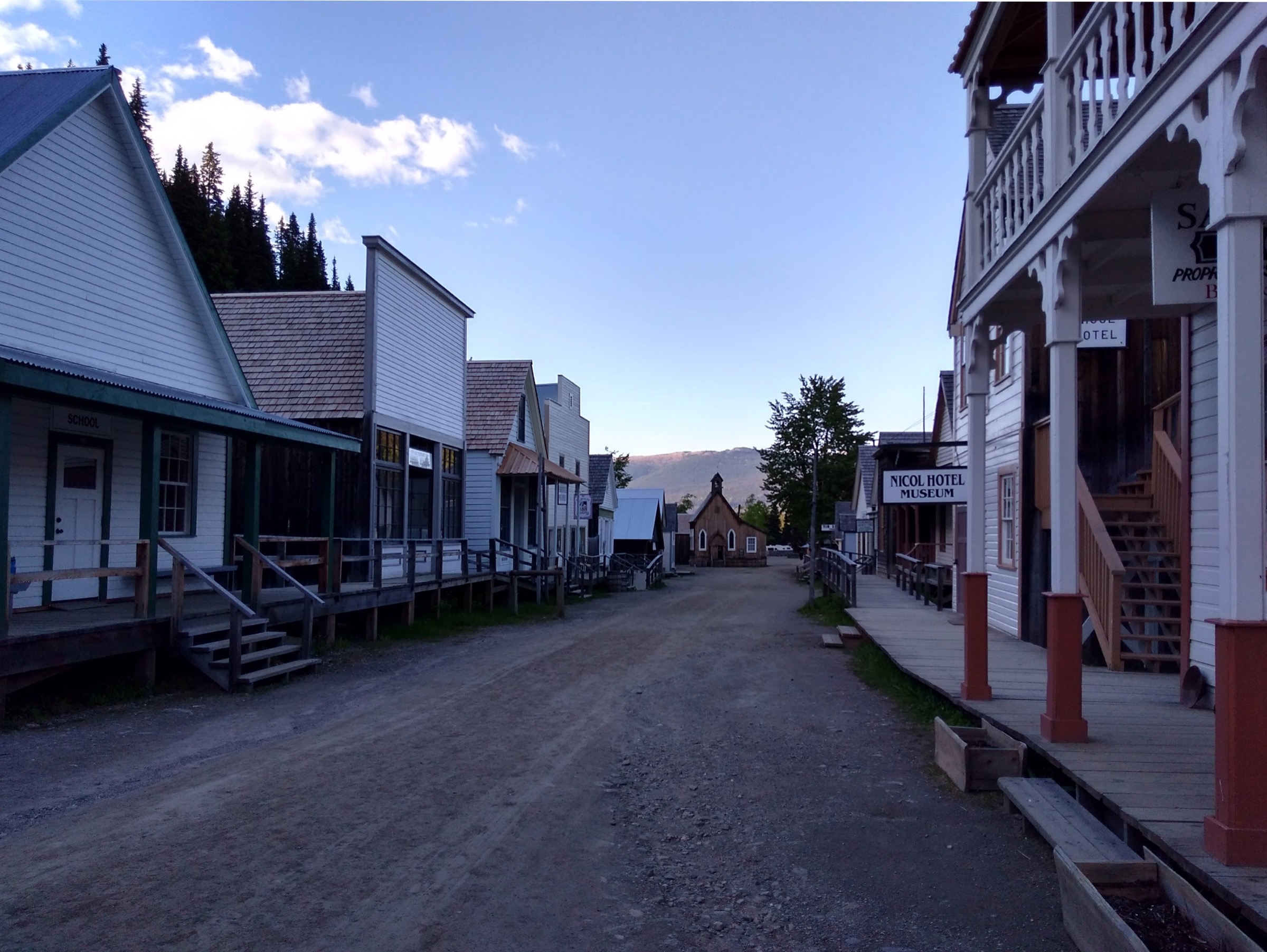
The trail begins at the upper (north-east) end of Barkerville’s preserved Main Street and immediately joins the line of the historic Cariboo Wagon Road, which continues uphill past the old Richfield Courthouse and on through second-growth forest. The route climbs steadily, in places following the original wagon grade, to Summit Rock at roughly 4.5 km. From here a steeper old mining road climbs to Groundhog Lake at approximately 8.5 km — a small subalpine lake in a bowl beneath Mount Agnes, with a basic shelter cabin maintained by local volunteers. From the lake, a marked path climbs west-north-west across open subalpine slopes to the broad summit of Mount Agnes (1,841 m), giving sweeping views over the Cariboo Mountains, the Bowron Lake basin and the gold-rush valleys. Strong parties can continue the loop south-east over Bald Mountain and descend via the Bald Mountain trail back to Barkerville, making a long but classic day.
Why it is essential
The route is the definitive walking combination of cultural and alpine landscape in the Cariboos: it follows the original Cariboo Wagon Road on which Barkerville’s gold-rush economy depended, then climbs into the subalpine and alpine country that frames the Barkerville bowl. It is the standard local objective recommended by the Friends of Barkerville and the Caledonia Ramblers, and the only commonly walked summit accessible directly from a Cariboo gold-rush townsite.
Equipment
- Sturdy boots
- Trekking poles
- Extra warm layer, hat and gloves outside midsummer
- Weatherproof shell
- Headtorch for long days
- Plenty of water and food; reliable water sources are limited above Summit Rock
- Bear spray (grizzly country)
- Map and compass / GPS backup; upper trail markings can be faint
- Microspikes may be useful in early July if snow patches remain
Hazards and notes
- Grizzly and black bears are common; the Friends of Barkerville trail notes specifically advise bear-aware travel.
- Weather above treeline can change rapidly; afternoon thunderstorms are a risk in July and August.
- The upper trail crosses open subalpine slopes with no shelter.
- The Bald Mountain extension adds significant ascent and time and should only be attempted by parties with reserve daylight.
- The Groundhog Lake shelter is a basic emergency cabin, not a booked hut.
- Barkerville Historic Town charges admission for the townsite during operating hours, although the trail itself begins at the public end of Main Street; check current access arrangements with Barkerville Historic Town and Park.
Routes and maps
| Source | URL |
|---|---|
| Friends of Barkerville — Groundhog Lake trail PDF | friendsofbarkerville.ca |
| Caledonia Ramblers — Mount Agnes / Groundhog Lake | caledoniaramblers.ca |
| AllTrails — Groundhog Lake via Mount Agnes Trail | alltrails.com |
| Trailpeak — Barkerville to Groundhog Lake | trailpeak.com |