Regional overview
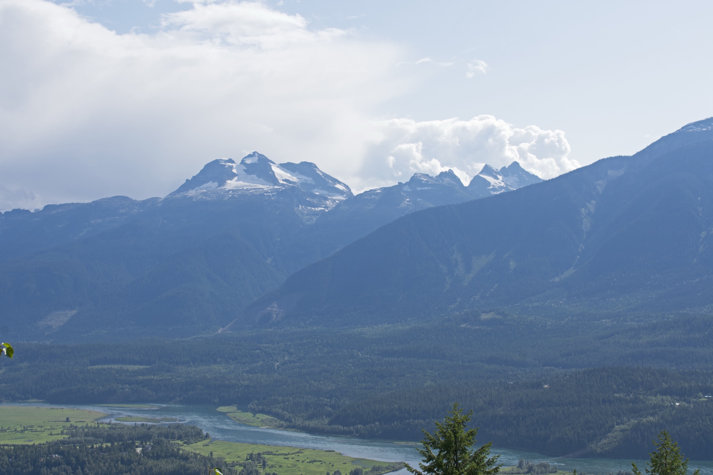
The Monashee Mountains form the westernmost range of the Columbia Mountains, separated from the Selkirks to the east by Upper Arrow Lake and the Columbia River valley, and from the Okanagan Highland to the west by the Shuswap and North Okanagan basins. The range stretches roughly 530 km from the Shuswap area north into the upper Columbia, with the highest peaks — Hallam, Begbie and Fosthall — topping 2,700 m. Glaciation has carved cirques, hanging valleys and long ridges; lower slopes carry interior cedar–hemlock rainforest, transitioning to subalpine fir, then to alpine meadow, lichen heath and rock above roughly 2,000 m.
There is no single dominant hiking centre. Revelstoke serves the northern (Gold Range) sector and is the closest town to Mount Begbie. Cherryville, Lumby and Vernon access the central Monashees via Highway 6, including Monashee Provincial Park and the Cherryville–Pinnacle area. Enderby and the Shuswap front sit on the western edge. Nakusp, on Upper Arrow Lake, anchors the eastern Monashee front and is reached from the Slocan and Columbia valleys via the Galena Bay or Needles free inland ferries; access to Saddle Mountain additionally requires the small Arrow Park cable ferry.
The reliable hiking window is roughly mid-July to early October; high-elevation snow can linger into July and return as early as late September. Many trailheads sit at the end of active forest service roads that may be rough, washed out or signed for industrial traffic. The entire range is grizzly and black bear habitat, and southern Monashee Provincial Park supports red-listed mountain caribou — dogs are prohibited there. Cell coverage is patchy to absent away from Highway 1 and the Okanagan corridor. Bear-aware practice (spray, food storage) is expected on every route; creek crossings are common and can be hazardous during snowmelt; the Mount Begbie route has a non-technical hiking section that ends abruptly at glaciated terrain, beyond which travel becomes mountaineering rather than hiking.
Selection rationale
The five hikes represent the major landscape signatures of the Monashees as a day-hiking range: a high alpine peak in the Gold Range (Begbie, to the non-technical limit), a subalpine lake in the protected core of Monashee Provincial Park (Spectrum), a remote alpine cirque on rough access roads (Pinnacle), a culturally and historically significant cliff-edge viewpoint co-managed with the Splatsin (Tplaqín / Enderby Cliffs), and a restored historic fire-lookout summit on the eastern Monashee front above Upper Arrow Lake (Saddle Mountain). Together they span the range geographically from Revelstoke south to Enderby and east to Nakusp, covering forest, lake, alpine, viewpoint and heritage themes without duplication. Mount Revelstoke National Park’s Eva and Jade Lakes hikes were considered and excluded because they lie within the Clachnacudainn sub-range of the Selkirks, not the Monashees.
Summary
| # | Hike | Country | Route type | Distance | Gain | Max elevation | Difficulty |
|---|---|---|---|---|---|---|---|
| 1 | Mount Begbie Trail (to alpine campground) | Canada | Out-and-back | ~12 km | ~1,500 m | ~1,830 m | Strenuous |
| 2 | Spectrum Lake Trail | Canada | Out-and-back | ~12 km | ~275 m | ~975 m | Moderate |
| 3 | Pinnacle Lake via Railroad Creek | Canada | Out-and-back | ~9 km | ~450 m | ~1,700 m | Moderate–strenuous |
| 4 | Tplaqín / Enderby Cliffs Trail | Canada | Out-and-back | ~12–14 km | ~700–820 m | ~1,000 m | Moderate–strenuous |
| 5 | Saddle Mountain Lookout | Canada | Out-and-back | ~5–7 km | ~500–860 m | ~2,330 m | Moderate–strenuous |
1. Mount Begbie Trail (to alpine campground and glacier viewpoint)
Snapshot
Itinerary
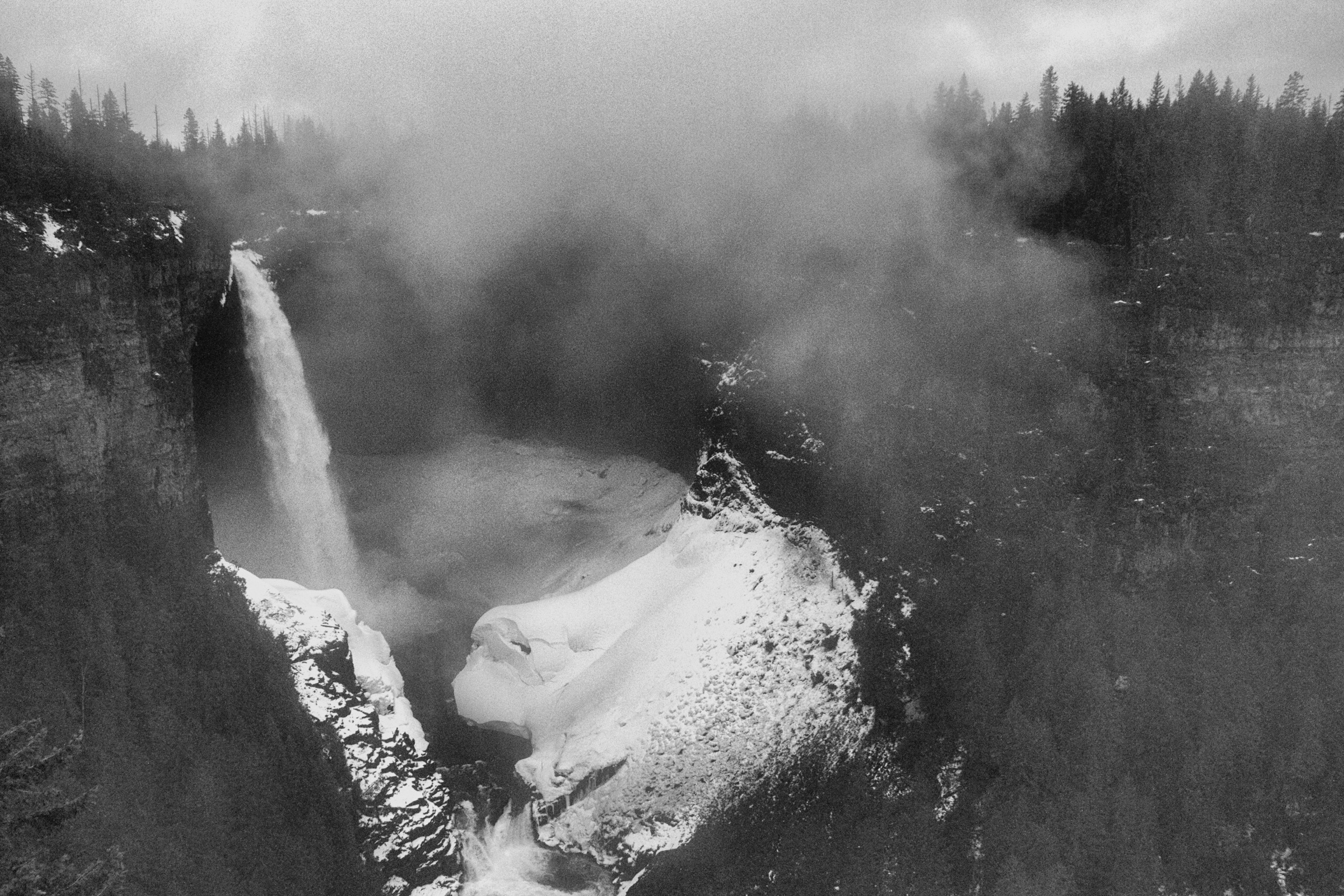
From the upper trailhead the path immediately enters dense interior cedar–hemlock forest and climbs steeply along a single-track. The grade is relentless for the first hours, gaining elevation on a mossy, root-laced tread with occasional creek crossings. After roughly 4 km the forest thins into subalpine fir and the trail breaks into open meadow, with the first clear views of the Mount Begbie massif and the Columbia valley. A short final climb across heather and boulder fields reaches a recreation-site campground with wooden tent pads, an outhouse and a bear cache, sited near a stream at approximately 1,830 m. From the campground a short walk leads to the moraine and the lower edge of the Begbie Glacier, which forms the natural turnaround point for hikers. The mountain above is glaciated and demands rope, crevasse-rescue and climbing kit; this entry covers only the hiking objective.
Why it is essential
Mount Begbie is the defining peak on Revelstoke’s skyline and one of the most recognised summits of the Monashees. The trail to the alpine campground delivers the full Monashee profile — old-growth interior rainforest, sustained alpine climb and a close-range glacier viewpoint — in a single day from a town that anchors hiking access to the northern range.
Equipment
- Sturdy boots
- Trekking poles strongly recommended for the descent
- Weatherproof and warm layers
- At least 2.5 L water
- Food, map and GPS
- Sun protection
- Bear spray and bear-aware food handling
- Microspikes in early summer where snow lingers above the forest
Helmet, rope, harness and crevasse-rescue gear are required only by parties continuing onto the glacier — they are not needed for the hiking objective.
Hazards and notes
- The route is sustained and steep; descent is hard on knees.
- Snow patches can persist into July and obscure the upper trail.
- The glacier edge is unstable in late summer and should not be approached closely.
- Grizzly and black bears are present; make noise and travel in a group where possible.
- The Mount Begbie FSR can be rough and is shared with industrial traffic; check current road status before departure.
Routes and maps
| Source | URL |
|---|---|
| Recreation Sites and Trails BC — Mt Begbie Trail (REC2475) | sitesandtrailsbc.ca |
| Trailforks — Mount Begbie Trail | trailforks.com |
| AllTrails — Mount Begbie Trail | alltrails.com |
| OpenStreetMap — Mount Begbie Trail | openstreetmap.org |
External links
2. Spectrum Lake Trail
Snapshot
Itinerary
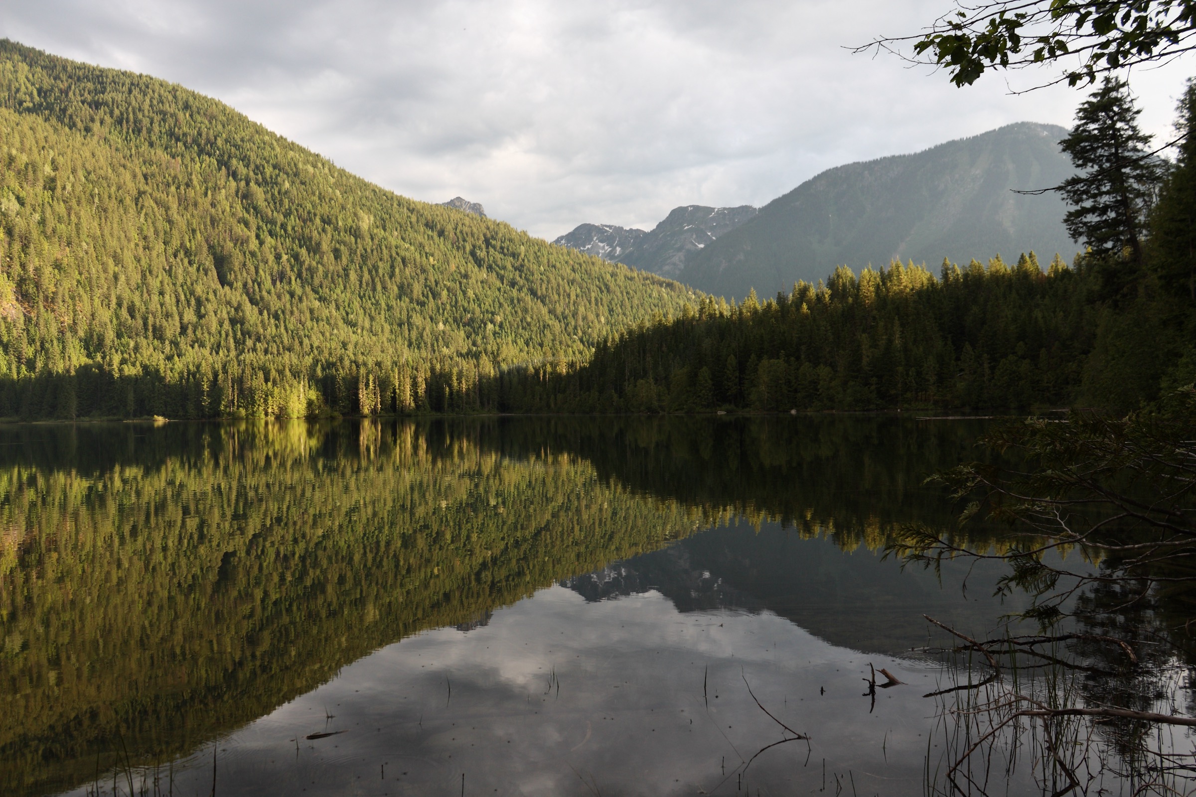
The trail begins at the west trailhead at the end of Spectrum Creek FSR and immediately enters interior cedar–hemlock rainforest. The grade is gentle and rolling, with several creek crossings on bridges or fixed logs. The path tracks Spectrum Creek upstream, passing through fern-rich groves and short boardwalk sections over wet ground. After approximately 4.5 km a junction signs the short spur to a viewpoint above the lake; the main trail continues at lake level to the Spectrum Lake campground on the north shore, which features wooden tent pads, sheltered picnic tables, a dock and a bear cache. The lake sits in a glacial basin ringed by Monashee peaks, with Mount Fosthall prominent to the south. This is the first stage of the multi-day Monashee Traverse; turning around at the campground gives a long but unhurried day.
Why it is essential
Spectrum Lake is the showpiece introduction to Monashee Provincial Park, the largest protected core of the central Monashees and the only place in the range where genuine interior wet-belt rainforest meets a roadhead trail. It is the most accessible objective in the park, the standard first stop on the Monashee Traverse, and a representative example of the lake-and-cedar landscape that defines the central range.
Equipment
- Waterproof hiking shoes or boots
- Weatherproof layer, warm layer
- Food and water
- Map
- Insect repellent in early and mid summer
- Bear spray
Dogs are not permitted in the park.
Hazards and notes
- The trail crosses several creeks that can run high during snowmelt.
- Forest sections hold mud through most of the summer.
- Active grizzly and black bear habitat — use the food caches and carry spray.
- Mountain caribou are present and dogs are prohibited park-wide.
- Overnight stays require a BC Parks backcountry camping permit booked in advance; day use does not.
- The access road is unsigned in places and subject to logging traffic; verify current conditions before driving in.
Routes and maps
| Source | URL |
|---|---|
| BC Parks — Monashee Park | bcparks.ca |
| AllTrails — Spectrum Lake | alltrails.com |
| Wikiloc — community tracks tagged “Spectrum Lake Monashee” | wikiloc.com |
| OpenStreetMap — Spectrum Lake area | openstreetmap.org |
External links
- Off Track Travel — Spectrum Lake Trail, Monashee Provincial Park
- Wikipedia — Monashee Provincial Park
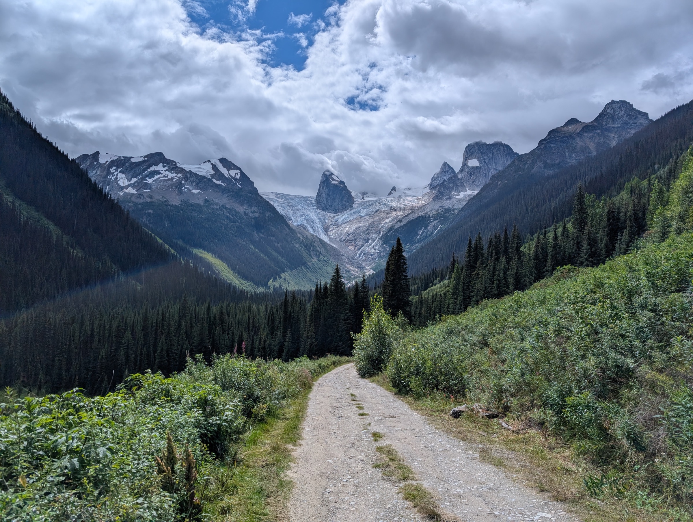
3. Pinnacle Lake via Railroad Creek
Snapshot
Itinerary
From the trailhead the route begins with an unbridged crossing of Railroad Creek. The first ~3 km are nearly level but consistently marshy, with multiple smaller creek crossings and long boardwalk-and-mud sections through subalpine forest. The trail then steepens and climbs alongside Railroad Creek, gaining most of its elevation in the second half. The path levels out as it enters the cirque and arrives at the north shore of Pinnacle Lake, a glacial pool walled by the cliffs of the Pinnacles range. In early summer, waterfalls thread the cirque headwall directly into the lake. Day hikers commonly continue a short distance around the shoreline for varied viewpoints before retracing the route.
Why it is essential
Pinnacle Lake is the most accessible classic alpine cirque in the southern Monashees, and the route is the standard introduction to the rugged sub-ranges that lie outside the protected core. It represents the experience of reaching a glacial tarn under cliffed peaks on a forest-service-road approach typical of the range.
Equipment
- Sturdy waterproof boots — mud is persistent through most of the season
- Trekking poles
- Weatherproof and warm layers
- Water and food
- Map and GPS
- Bear spray
- Insect repellent (mosquitoes are heavy in early summer)
- A high-clearance vehicle is sensible for the access road
Hazards and notes
- The opening creek crossing has no bridge and can run high in early summer.
- The trail is genuinely muddy — wet feet are normal.
- The South Fork / Monashee Creek FSR is unsigned in places, shared with industrial traffic and conditions vary year to year.
- The cirque holds snow into July.
- Grizzly and black bears are both present.
Routes and maps
| Source | URL |
|---|---|
| Recreation Sites and Trails BC — Pinnacle Lake (REC4725) | sitesandtrailsbc.ca |
| AllTrails — Pinnacle Lake Trail | alltrails.com |
| Trailforks — Pinnacles region | trailforks.com |
External links
- Off Track Travel — Pinnacle Lake, Monashee Mountains
- Ron Perrier — Pinnacle Lake via Railroad Creek
- TracksAndTrails.ca — Pinnacle Lake
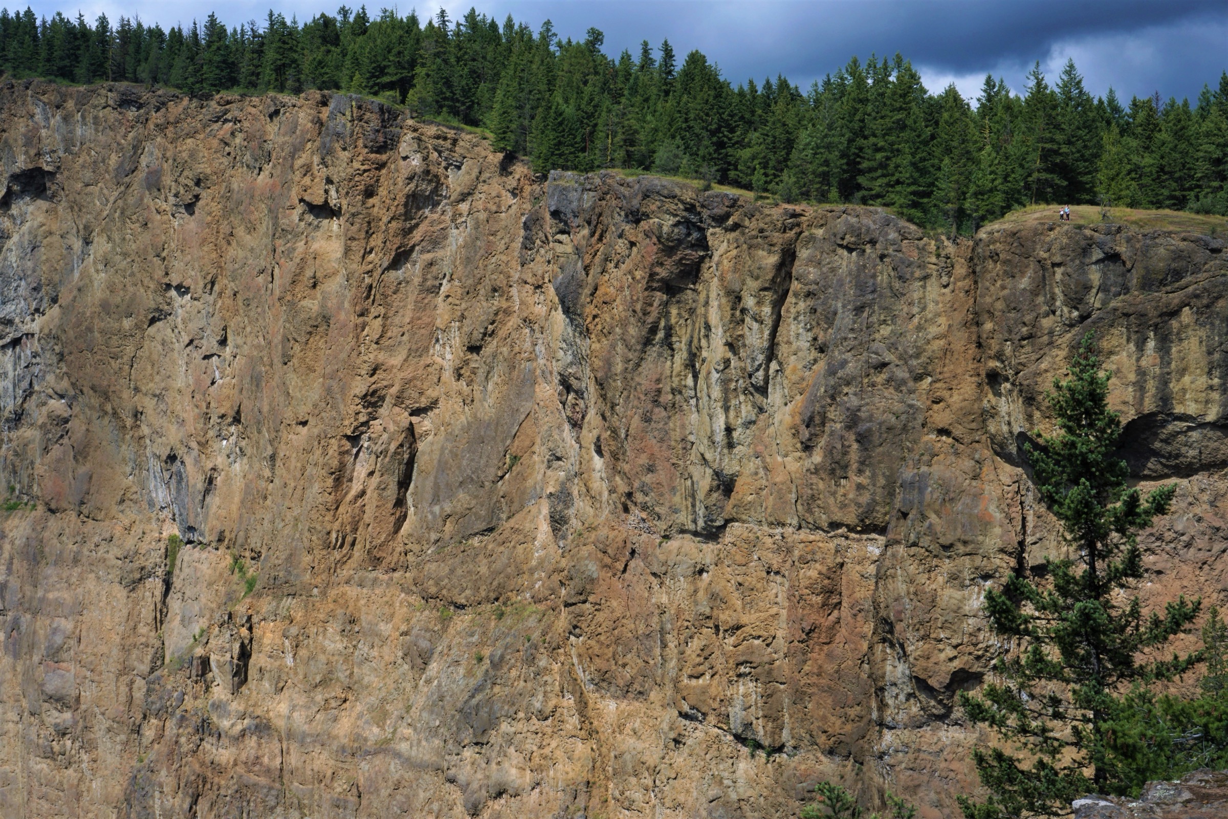
4. Tplaqín / Enderby Cliffs Trail
Snapshot
Itinerary
The trail leaves the upper parking area and climbs steadily through dry interior Douglas-fir forest on a single-track surface that was rebuilt collaboratively by BC Parks, the Shuswap Trail Alliance and the Splatsin. The grade is consistent rather than steep. Several signed switchbacks and re-routes redirect hikers away from older eroded lines and from areas closed for ecological and cultural protection. The path emerges near the cliff edge, with the Shuswap River bending below and the North Okanagan ranges and Shuswap Lake basin visible to the south and west. Fences and signage mark the closed cliff-edge sections; hikers should stay back from the edge. The maintained route continues along the rim to the summit viewpoint, then returns by the same line.
Why it is essential
Tplaqín is a sacred site of the Splatsin te Secwépemc and the most prominent escarpment on the western Monashee front. The recently rebuilt trail is the leading example in the range of collaborative First Nations co-management of a provincial park and the standard introduction to the Shuswap and North Okanagan landscape from above.
Equipment
- Hiking shoes or boots
- Weatherproof layer, warm layer
- Water (no reliable source on route)
- Food and sun protection (much of the route is dry and exposed in summer)
- Map
- Trekking poles for the descent
- Tick protection in spring and early summer
Hazards and notes
- Cliff edges are genuinely dangerous and partly fenced; respect closures, which exist for both safety and the protection of a Splatsin sacred area.
- The lower forest is dry and ticks are common in spring.
- The route is in bear country.
- Dogs must be on leash at all times under BC Parks rules.
- The trail is busy on summer weekends; midweek or early morning visits reduce crowding.
Routes and maps
| Source | URL |
|---|---|
| BC Parks — Tplaqín / Enderby Cliffs Park | bcparks.ca |
| BC Parks — Enderby Cliffs park map (PDF) | nrs.objectstore.gov.bc.ca |
| Shuswap Trails — Tplaqín / Enderby Cliffs Trail | shuswaptrails.com |
| Trailforks — Enderby Cliffs Tplaqin Trail | trailforks.com |
| OpenStreetMap — Enderby Cliffs | openstreetmap.org |
External links
5. Saddle Mountain Lookout
Snapshot
Itinerary
From Highway 6, drivers turn off about 21 km south-west of Nakusp and ride the free Arrow Park cable ferry across the Upper Arrow Lake narrows. From the west bank the route follows Saddle Mountain Road north for roughly 9 km, then turns left onto the signed Saddle Mountain Lookout Road and switchbacks 8–10 km up the mountain to the lower or upper trailhead (the latter is reached at approximately 19 km from the ferry; 2WD with care). The trail climbs through interior cedar–hemlock forest into subalpine fir, then breaks out onto a steep open ridge and finishes on a rocky knob above treeline, crowned by the restored 1923 wooden fire-lookout cabin. The summit gives a full panorama: the Monashees stretch west across Arrow Lake, the Selkirks rise to the east, Mosquito Lake sits to the north-west and Whatshan Lake to the south-west.
Why it is essential
The Saddle Mountain Lookout is one of the oldest surviving wooden fire-lookout cabins in interior British Columbia, in continuous community stewardship since 1923 and restored as an open public shelter in 2015–2017. It pairs a genuinely alpine summit on the eastern Monashee front with a piece of regional fire-watch heritage rare in the range. The Arrow Park ferry adds a distinctive inland-ferry approach.
Equipment
- Sturdy boots
- Trekking poles for the steep descent
- Weatherproof and warm layers (the summit is exposed and significantly cooler than the trailhead)
- Water (no reliable source above the lower forest)
- Food
- Map
- Sun protection
- Bear spray
Optional: sleeping mat and bag if intending to use the lookout cabin as an overnight shelter (free, first-come).
Hazards and notes
- The summit ridge is open and exposed to weather; afternoon thunderstorms in summer are a real risk and the cabin is the only shelter.
- Check Arrow Park ferry hours before departure — the lunchtime shutdown can strand vehicles for two hours on the return.
- The access roads are forest service roads and conditions vary; the lower trailhead is the conservative choice in marginal conditions.
- The lookout cabin is community-maintained; pack out all rubbish and leave it tidy for the next party.
- Bear country.
Routes and maps
| Source | URL |
|---|---|
| Nakusp and Area Community Trails Society — Saddle Mountain Lookout | nakusptrails.ca |
| Recreation Sites and Trails BC — Saddle Mountain Fire Lookout (REC169731) | sitesandtrailsbc.ca |
| Trailforks — Saddle Mountain Trail and Lookout | trailforks.com |
| OpenStreetMap — Saddle Mountain Lookout | openstreetmap.org |