Regional overview
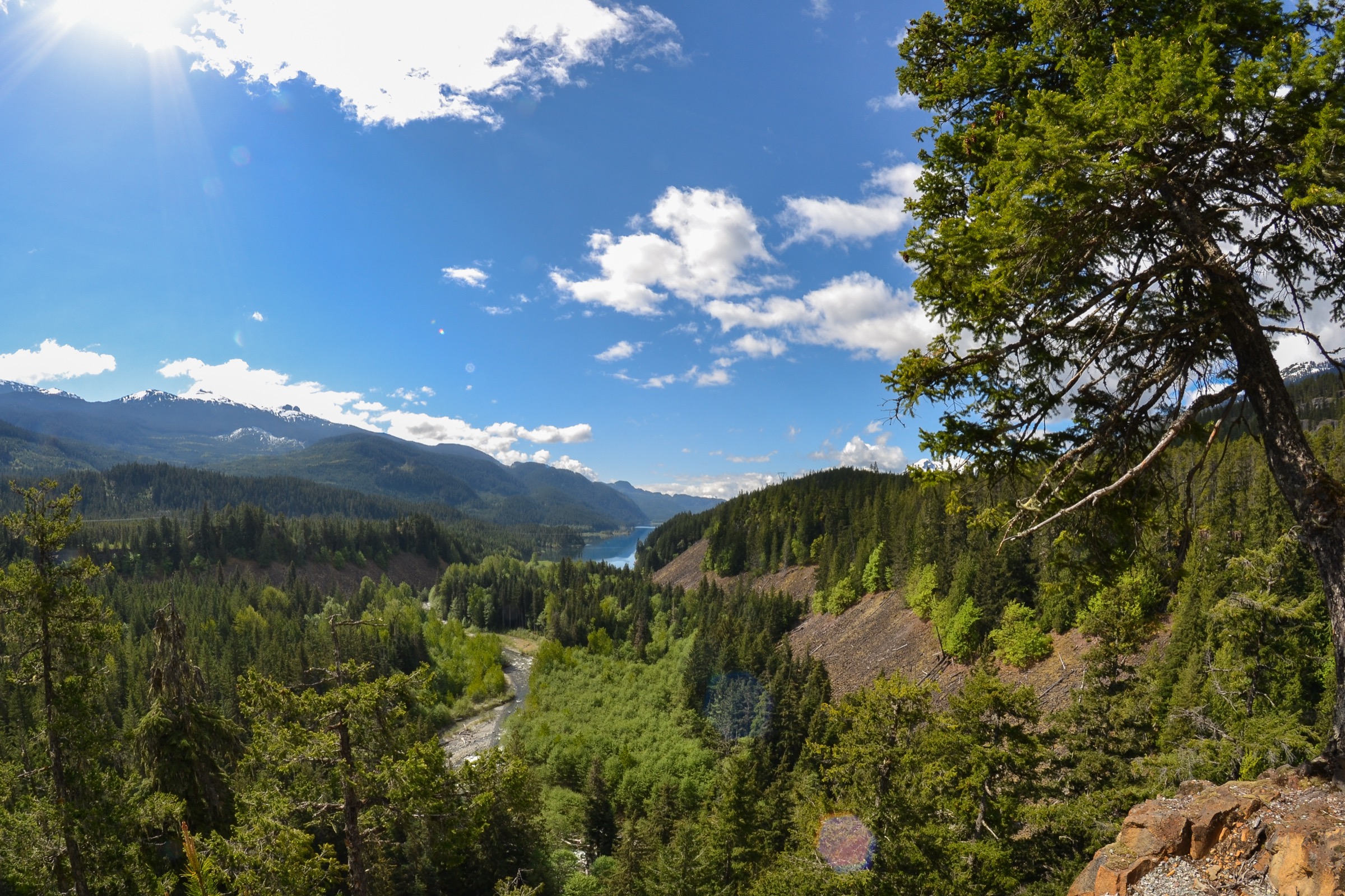
The Sea-to-Sky corridor stretches roughly 60 km north from Howe Sound at Squamish to the resort village of Whistler, framed by the granite walls of the southern Coast Mountains. The corridor is bracketed by tidal salt water at one end and the heavily glaciated peaks of the Garibaldi Ranges at the other, and BC Highway 99 ties together a remarkably concentrated set of walking objectives: the monolithic Stawamus Chief above Squamish, the cascading Shannon and Brandywine falls, the lift-served alpine of Whistler Mountain, and a string of cirque lakes, granite balcony viewpoints and wildflower meadows hung above the corridor floor.
Squamish itself is a low-elevation town that doubles as the rock-climbing capital of Canada; its trail network is dominated by steep, exposed granite slabs, second-growth coastal rainforest and viewpoints over Howe Sound. Whistler, 45 minutes further north, gives direct lift access (Whistler Village Gondola plus Peak Express chair) to a true subalpine plateau between roughly 1,850 m and 2,180 m, allowing fit walkers a near-Garibaldi-scale alpine experience without the 1,500 m approach climbs typical of the parks to either side. In between, side-valleys at Brandywine, Callaghan and the Squamish River drainage offer quieter meadow and lake objectives.
The reliable hiking season at lower elevations runs roughly April to October; alpine routes above 1,500 m are typically clear of consolidated snow from early July to mid-October, with wildflower peak in late July and early August. Coastal weather is highly variable — fog, rain and rapid temperature drops are common even in midsummer, and granite slabs become dangerously slippery when wet. Black bears are present throughout the corridor and grizzly sightings are increasing in the upper Squamish valley; bear-aware food handling is standard practice. There is currently no scheduled public transit linking Squamish and Whistler, although several private shuttles (Squamish Connector, Epic Rides, Squamish Shred Shuttle, SkyLynx) cover the corridor on a daily basis.
This entry deliberately excludes the major Garibaldi Provincial Park interior objectives (Garibaldi Lake, Black Tusk, Panorama Ridge, Wedgemount Lake, Elfin Lakes / Diamond Head), which are catalogued separately under a parallel Garibaldi entry.
Selection rationale
The five hikes are chosen to span the corridor’s principal walking experiences: the Stawamus Chief three-peak round as the iconic granite summit objective; the High Note Trail as the definitive lift-assisted alpine balcony route on Whistler Mountain; the Sea to Summit Trail as the sustained valley-to-summit classic linking Shannon Falls to the Sea-to-Sky Gondola; Brandywine Meadows as the representative side-valley wildflower-cirque objective; and Petgill Lake as a quieter forested counterpoint and one of the most accessible “wild” Howe Sound viewpoints in the area.
Garibaldi Provincial Park objectives are excluded by scope. Lake Lovely Water (Tantalus) was considered but is not feasible as a standard day hike for most visitors because of the cable-car / river-crossing access, and Tricouni Meadows was set aside in favour of Brandywine Meadows because Tricouni’s access road is currently impassable to most vehicles without a high-clearance 4×4.
Summary table
| # | Hike | Country | Route type | Distance | Gain | Max elevation | Difficulty |
|---|---|---|---|---|---|---|---|
| 1 | Stawamus Chief — First, Second and Third Peaks | Canada | Loop / multi-summit | 6.8–8.1 km | approx. 905 m | 702 m | Strenuous |
| 2 | High Note Trail (Whistler Mountain) | Canada | Lift-assisted loop | approx. 9.5 km | approx. 300 m | 2,182 m | Intermediate alpine |
| 3 | Sea to Summit Trail | Canada | Lift-assisted point-to-point | 6.5–7.5 km | approx. 918 m | 885 m | Advanced |
| 4 | Brandywine Meadows | Canada | Out-and-back | approx. 7 km | approx. 538 m | approx. 1,460 m | Difficult |
| 5 | Petgill Lake | Canada | Out-and-back | 11–11.5 km | approx. 650–696 m | approx. 770 m | Moderate–strenuous |
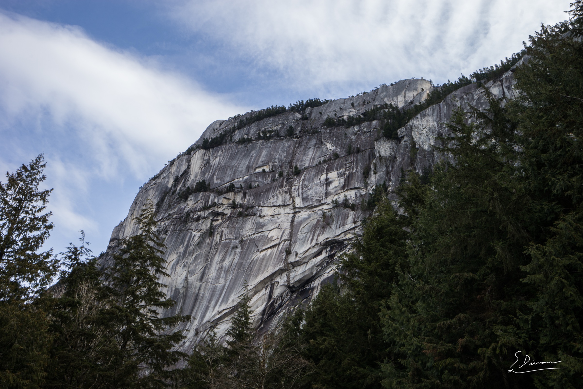
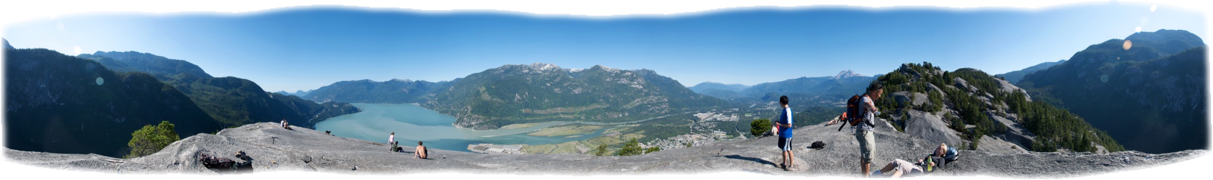
1. Stawamus Chief — First, Second and Third Peaks
Snapshot
Itinerary
The trail leaves the day-use area, climbs immediately on stone steps beside a creek and reaches a major junction at roughly 600 m horizontal distance, where the Sea-to-Summit Trail and the Stawamus Chief Trail diverge. Bearing left (signed for the peaks), the route ascends a sustained, rooted staircase for another 1 km before reaching the upper junction, sometimes referred to as the “saddle”, where the routes to First, Second and Third Peaks branch.
The First Peak branch (right at the upper junction) climbs steeply through forest, crosses open granite slab on chain-assisted steps and tops out on the broad south summit (approx. 612 m) with views down to the Howe Sound estuary, Shannon Falls and the Squamish wind sports estuary. The Second Peak branch climbs a short steep gully containing a fixed ladder and tops out on the central summit (approx. 655 m), generally regarded as the most open viewpoint on the massif. The Third Peak (left at the upper junction) climbs higher still, reaches the northern summit (approx. 702 m) and offers the most aerial views down the granite walls into the Squamish Valley and across to the Tantalus Range.
Most walkers complete all three by traversing inter-peak connector trails, which include short scrambling steps and chain-assisted descents into the saddles between the peaks. Descent uses the main approach trail back to the trailhead.
Why it is essential
The Chief is the largest exposed granite monolith in Canada and one of the largest in the world, and the multi-peak hike is the corridor’s signature on-foot objective. The three summits provide complementary perspectives — south over Howe Sound, north up the Squamish Valley to Mount Garibaldi, and west across the river to the Tantalus Range — and the sustained chain, ladder and slab sections make it a genuine introduction to Coast Mountains granite terrain without crossing into technical climbing.
Equipment
- Mountain hiking equipment: sturdy hiking shoes or low boots with sticky rubber soles, weatherproof shell, warm layer, 2 L of water, sun protection, snacks.
- Trekking poles are useful on descent but inconvenient on the chain and ladder sections.
- No specialist climbing equipment is required.
Hazards and notes
- Granite slabs become hazardous when wet; the chain-assisted sections in particular should not be attempted in rain or with snow lingering on the upper slabs.
- Drop-offs from all three summits are unfenced and substantial.
- The trailhead parking lot fills very early in summer (typically before 09:00 on weekends); overflow parking along the highway is signed and enforced.
- Dogs are permitted on the Chief Peaks Trail off-leash but must be leashed elsewhere in the park.
- Peregrine falcon nesting closures (typically 15 March to 31 July) affect specific climbing routes on the walls but do not normally affect the peak trails.
- Black bear sightings are routine in spring and autumn.
GPX / KML links
| Source | URL | Format / access | Reuse status |
|---|---|---|---|
| Trailforks — Stawamus Chief Trail | trailforks.com | GPX (account download) | Geometry reference only; not redistributable |
| OpenStreetMap — Stawamus Chief Provincial Park trail ways | openstreetmap.org | OSM export to GPX | ODbL; reusable with attribution to OpenStreetMap contributors |
No official GPX is published by BC Parks for the peak trails as of this research.
External links
- BC Parks — Stawamus Chief Park
- Tourism Squamish — Stawamus Chief Provincial Park
- Vancouver Trails — Stawamus Chief
2. High Note Trail (Whistler Mountain)
Snapshot
Itinerary
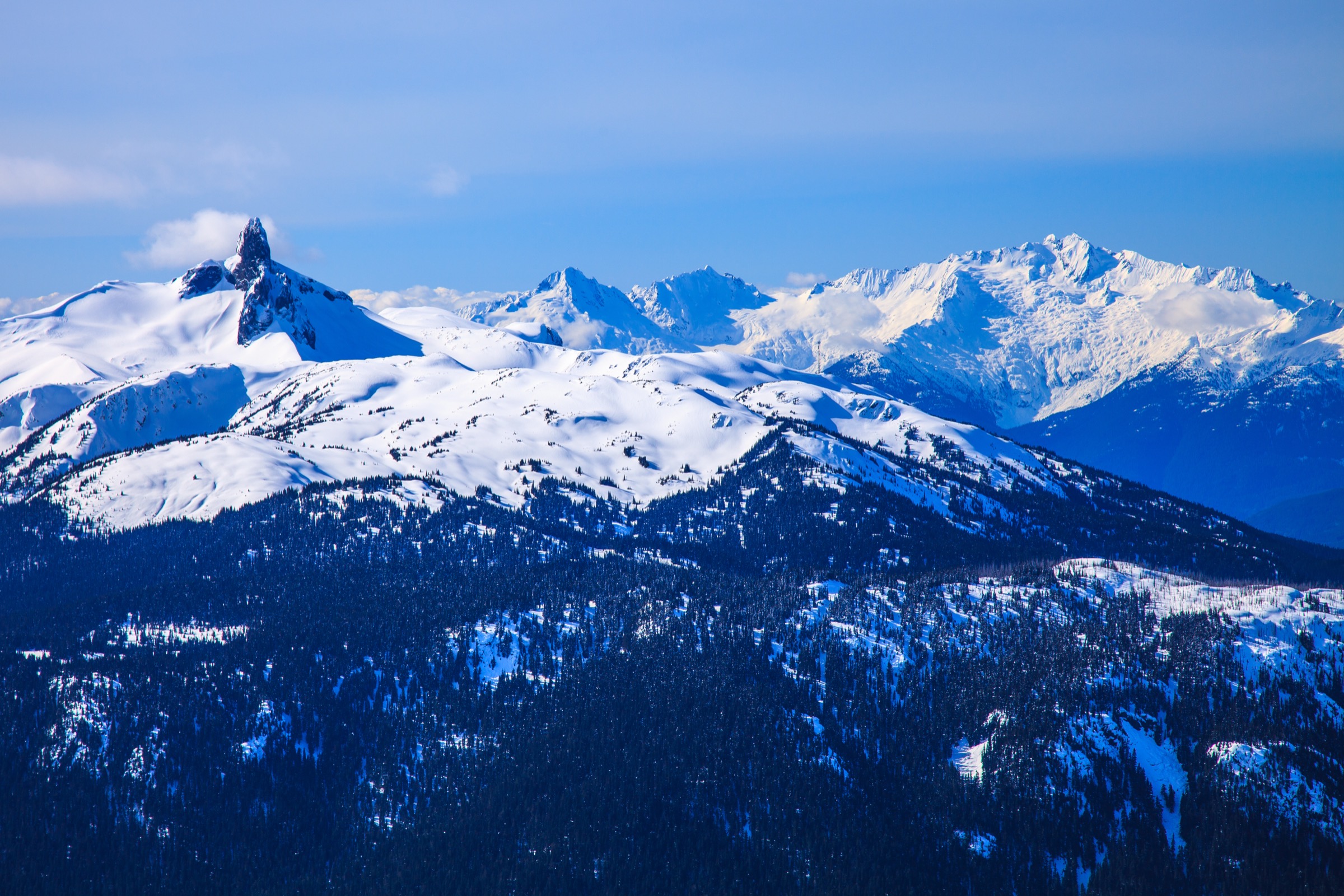
From the top of the Peak Express chair (2,182 m), the trail descends south-west across open alpine talus and meadow on the south flank of Whistler Mountain, with continuous views down to Cheakamus Lake and across to the Black Tusk and the Garibaldi Névé in the adjacent park. The route stays high for the first 3 km, contouring the Whistler ridgeline on a well-graded path with one short chain-assisted rock step.
The trail then drops through the Symphony Bowl area, where small alpine tarns and wildflower meadows (peak bloom typically late July to early August) provide the first reliable water on the route. From Symphony, the path links into the Burnt Stew Trail and crosses the Harmony Meadows zone before climbing a final 80–100 m back to the Roundhouse Lodge at 1,850 m, where the Whistler Village Gondola provides download to the valley.
Variants include the Half Note Trail (a shorter high-traverse alternative that links back into the High Note at the Pika’s Traverse), and extensions into the Musical Bumps / Singing Pass area, which leave the lift-assisted day-hike envelope.
Why it is essential
The High Note is the most representative day on Whistler Mountain’s summer hiking network: it covers the full lift-assisted alpine experience from the Peak chair to the Roundhouse, includes the corridor’s best easily-accessed view of the Black Tusk and Cheakamus Lake, and stays almost entirely in genuine subalpine and alpine terrain. The combination of low foot-borne ascent and high scenic return makes it the single hike most often cited by official Whistler Blackcomb materials as the resort’s signature summer walk.
Equipment
- Standard hiking equipment plus an extra warm layer (alpine wind exposure even in midsummer), sunglasses and sun protection (extended exposure above 1,800 m), 2 L of water, lift ticket (sightseeing or hiking pass).
- Trekking poles recommended for the descending sections.
- Snowfields may linger into early July in some seasons; microspikes are occasionally useful pre-mid-July.
Hazards and notes
- The trail is open only when the Peak Express chair is running; chair operating dates typically fall within late June to early October and are weather-dependent.
- Children must be at least 40 inches (102 cm) tall to ride the Peak Express.
- The single chain-assisted rock step on the upper traverse is straightforward but exposed in places.
- Afternoon thunderstorms develop quickly above treeline; an early start is standard.
- Black bears are routinely seen in the Symphony and Harmony bowls; cubs in late summer warrant extra caution.
- Lift passes must be purchased in advance during peak season.
GPX / KML links
| Source | URL | Format / access | Reuse status |
|---|---|---|---|
| Trailforks — High Note Trail | trailforks.com | GPX (account download) | Geometry reference only |
| Whistler Blackcomb hiking trail map (PDF) | whistler.com | Operator copyright; map reference only | |
| OpenStreetMap — footway/path objects on Whistler Mountain | openstreetmap.org | OSM export to GPX | ODbL; reusable with attribution |
No openly licensed GPX is published by Whistler Blackcomb for the High Note Trail as of this research.
External links
- Whistler Blackcomb — hiking trail map (PDF)
- Vancouver Trails — High Note Trail
- Happiest Outdoors — High Note Trail in Whistler
3. Sea to Summit Trail
Snapshot
Itinerary
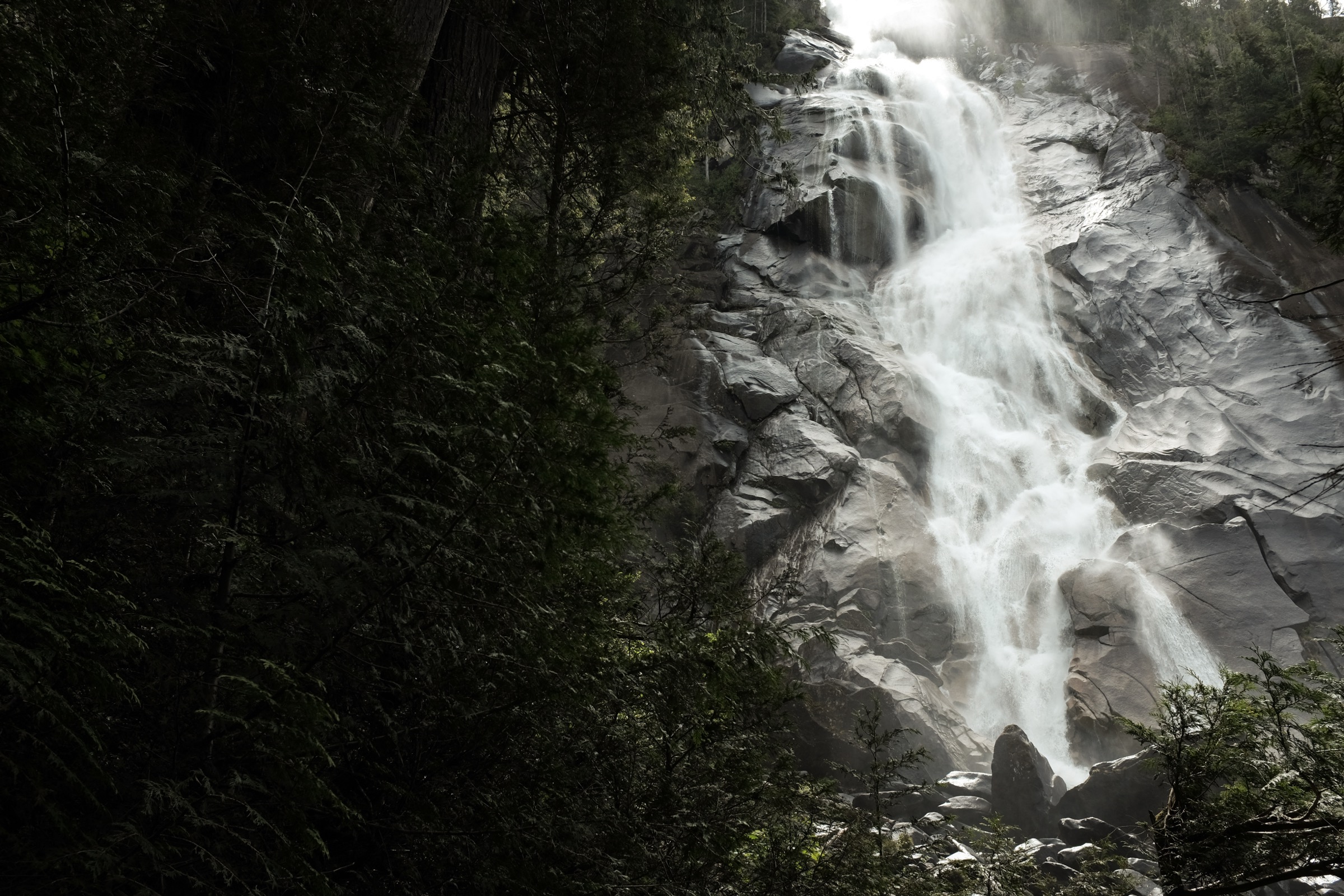
The route leaves the Shannon Falls Provincial Park lower lot, climbs to the base of Shannon Falls on the Upper Shannon Falls Trail, then joins the Stawamus Chief approach for a short distance before splitting at numbered marker 20 (green Sea-to-Summit diamonds, sequenced 1 at the trailhead to 128 at the summit station). The trail climbs steeply through rainforest, with several sections of staircases, rooted ramps and fixed-rope assists on granite slabs.
A mid-route viewpoint (the “Sea-to-Sky Viewpoint”, roughly halfway) opens out onto Howe Sound. The upper third of the route follows a sequence of granite benches and short fixed-rope steps before topping out at the gondola summit station beside the Summit Lodge and the suspension bridge. From the summit, walkers purchase a download ticket (CAD 25 / CAD 20 online at time of writing) and ride the gondola back to the base.
The trail is one-way on the diamond-marker system: descending on foot is actively discouraged because all numbered markers face uphill traffic.
Why it is essential
The Sea to Summit Trail is the most direct sea-level-to-summit experience in the Sea-to-Sky corridor: a sustained approx. 900 m climb on a properly engineered, signed and graded trail that finishes at a lift-served lodge and viewpoint complex. It links three signature sites of the corridor — Shannon Falls, the lower flanks of the Chief and the Sea to Sky Gondola summit — and is the standard “uphill traverse” objective for fit walkers visiting Squamish for a single day.
Equipment
- Mountain hiking equipment: sturdy boots with good grip (granite slabs and ropes), weatherproof shell, warm layer, headtorch (for long days or late starts), 2.5 L of water (no potable water on route), download ticket for the gondola, sun protection.
- Trekking poles useful on the lower forested section but inconvenient on the fixed-rope sections.
Hazards and notes
- Granite ramps and fixed-rope sections become hazardous when wet.
- There are no water sources or toilets on the route.
- The trail is one-way uphill in practical terms; descending on foot is discouraged by the operator.
- Gondola operating dates and the price of the download ticket are subject to change; purchasing online before starting the walk is recommended.
- Dogs are permitted on the trail but must remain in the designated Dog Parking area at the summit and require a separate CAD 20 gondola download ticket.
- Bears are present in the area; food storage is encouraged.
GPX / KML links
| Source | URL | Format / access | Reuse status |
|---|---|---|---|
| Sea to Sky Gondola — official trails page (map only) | seatoskygondola.com | Web map | Operator terms; no GPX |
| Trailforks — Sea to Summit | trailforks.com | GPX (account download) | Geometry reference only |
| OpenStreetMap — way tagged “Sea to Summit Trail” | openstreetmap.org | OSM export to GPX | ODbL; reusable with attribution |
No official downloadable GPX is published by the gondola operator as of this research.
External links
- Sea to Sky Gondola — Sea to Summit Trail
- Tourism Squamish — Sea to Summit Trail
- Vancouver Trails — Sea to Summit Trail blog
- 10Adventures — Sea to Summit Trail
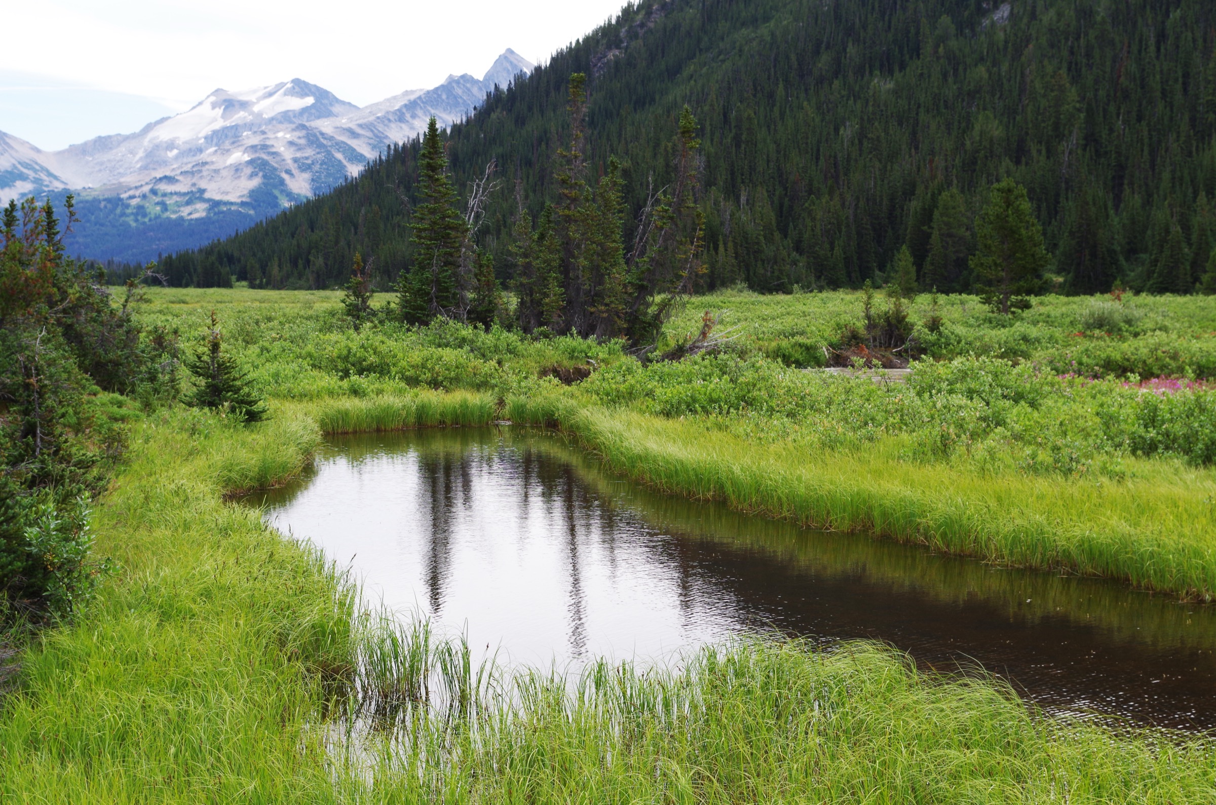
4. Brandywine Meadows
Snapshot
Itinerary
The route leaves the lower parking area on the Brandywine Forest Service Road and begins to climb almost immediately on a singletrack trail that parallels Brandywine Creek. The lower section is forested with frequent root steps and several short muddy crossings improved by short boardwalks. A creek viewpoint at roughly 200 m horizontal distance marks the first significant landmark; the trail veers right and continues climbing steadily.
At approximately 1.8 km the route crosses a muddy bench with boardwalk, and a waterfall on Brandywine Creek becomes visible through the trees at about 2 km. A trail fork at 2.3 km is taken to the left, and the route opens progressively into the lower edge of the meadow at around 2.8–3 km. The full meadow expands into a wide alpine basin with 360-degree views of Mount Fee, Brandywine Mountain and the surrounding Powder Mountain icefield. The standard turnaround is the meadow itself; stronger walkers continue toward the upper basin and the start of the Brandywine Mountain summit route, but that extends beyond the standard day-hike objective.
Why it is essential
Brandywine Meadows is the corridor’s most accessible classic alpine wildflower objective outside Garibaldi Park. The meadows lie in an open south-facing cirque with direct sight lines to several Coast Mountain icefields, and the comparatively short distance and gain make it a feasible day for fit walkers in a way that the bigger Garibaldi objectives (Garibaldi Lake, Black Tusk, Wedgemount) are not. The route also serves as the standard introduction to the side-valley walking character of the Callaghan area.
Equipment
- Mountain hiking equipment: sturdy boots (mud and rough trail), weatherproof shell, warm layer (the meadow is exposed and significantly cooler than the valley).
- Gaiters useful for the muddy lower section, insect repellent (mosquitoes can be intense in July), 2 L of water, bear spray.
- Trekking poles strongly recommended on descent.
- A high-clearance vehicle is essential for the access road; 4×4 is recommended for the upper trailhead.
Hazards and notes
- The Brandywine Forest Service Road is rough; potholes, washouts and two sharp hairpin turns are routine, and the road typically reopens “around May” each year after winter snowmobile use.
- There are no toilets, no potable water and no formal camping facilities on the route, although informal camping in the meadow is tolerated; campfires are prohibited and bear caches are not provided.
- Black bears are routinely seen in the meadow; grizzly bears have been recorded in the upper Callaghan in recent seasons.
- Dogs are permitted on leash.
GPX / KML links
| Source | URL | Format / access | Reuse status |
|---|---|---|---|
| Trailforks — Brandywine Meadows | trailforks.com | GPX (account download) | Geometry reference only |
| OpenStreetMap — way tagged “Brandywine Meadows Trail” | openstreetmap.org | OSM export to GPX | ODbL; reusable with attribution |
| AllTrails — Brandywine Meadows Trail | alltrails.com | Reference / app-only download | AllTrails terms; reference only |
No official GPX is published for the meadows trail as of this research.
External links
- Outdoor Vancouver — Brandywine Meadows hike near Whistler
- Wander Vancouver — Brandywine Meadows
- BC Parks — Brandywine Falls Park (corridor context)
5. Petgill Lake
Snapshot
Itinerary
From the Murrin Provincial Park parking area, the route follows the gravel shoulder of BC Highway 99 north for approximately 100 m, then leaves the road on a signed path on the east side. The trail climbs steeply on rocky, rooted terrain for the first 1–1.5 km, with several short scrambling moves and views back across to the Stawamus Chief and the Squamish estuary opening as height is gained.
After the initial climb the route levels onto an old logging road, follows switchbacks through second-growth forest and then alternates between short climbs and descents across rocky benches before reaching the lake at approximately 4.5 km from the trailhead. A continuation trail of roughly 10 minutes leads beyond the lake to a viewpoint over Howe Sound and the Tantalus Range, which is the recommended turnaround. Return is by the same route.
Why it is essential
Petgill Lake is one of the most reliably accessible “wild” Howe Sound viewpoints in the corridor and complements the granite-summit and lift-served alpine objectives with a forested, lake-and-view hike that opens early in the season. It is widely recommended by Tourism Squamish, Vancouver Trails and Squamish Adventure as the corridor’s representative quieter lake hike, and provides a counterpoint to the busier Chief and Sea to Summit routes.
Equipment
- Standard hiking equipment with extra grip on the rocky scrambles, 2 L of water (no reliable water on route), insect repellent (lake area), sun protection.
- Trekking poles useful on the descent.
- Dogs are not recommended due to steep scrambling sections.
Hazards and notes
- The trailhead requires walking on the shoulder of BC Highway 99 (vehicles travelling at 80 km/h); extreme caution is needed at the highway crossing.
- Several short scrambling sections become hazardous when wet.
- The trail is not maintained to BC Parks standards in places and includes informal sections through narrow boulder passages.
- There are no toilets or potable water on route.
- Black bears are routinely seen on the trail.
GPX / KML links
| Source | URL | Format / access | Reuse status |
|---|---|---|---|
| Trailforks — Petgill Lake Trail | trailforks.com | GPX (account download) | Geometry reference only |
| Gaia GPS — Petgill Lake Trail | gaiagps.com | GPX (account download) | Geometry reference only |
| OpenStreetMap — way tagged “Petgill Lake Trail” | openstreetmap.org | OSM export to GPX | ODbL; reusable with attribution |
No official GPX is published by BC Parks for this trail as of this research (Petgill Lake itself is outside Murrin Provincial Park).
External links
- Vancouver Trails — Petgill Lake
- Tourism Squamish — Petgill Lake
- Outdoor Vancouver — Petgill Lake Hike in Squamish
- 10Adventures — Petgill Lake Trail
Missing data / follow-up work
- No official GPX from BC Parks or Whistler Blackcomb for any of the five hikes. All geometry references rely on OpenStreetMap (ODbL, reusable with attribution) or third-party platforms (Trailforks, Gaia, AllTrails — reference only). New geometry should be derived from OpenStreetMap as the primary source.
- Sea to Summit Trail (Hike 3) — resolved: figure now uses Andrew Collins’ CC0 Shannon Falls photograph (the trailhead). A photograph of the upper route, gondola summit station or Howe Sound view from the summit would still be a worthwhile substitution if one becomes available under a CC-compatible licence.
- Brandywine Meadows (Hike 4) — no licence-compatible image of the alpine meadow itself was found in this pass; the figure above uses a Brandywine Falls image (the highway-side waterfall) instead, with the geographic difference flagged in the figcaption. Flickr Creative Commons should be searched specifically for “Brandywine Meadows” and “Brandywine Mountain meadows”.
- Petgill Lake (Hike 5) — resolved with a substitution: figure uses Dennis Sylvester Hurd’s CC0 photograph of Browning Lake in Murrin Provincial Park (the trailhead area), with the geographic difference flagged in the figcaption. A licence-compatible photograph of Petgill Lake itself or the upper Howe Sound viewpoint remains a follow-up target.
- Stawamus Chief — peak elevations vary slightly across sources (BC Parks signage 612 / 655 / 702 m; some references give 605 / 650 / 700 m). The values used here follow BC Parks. Confirm against on-park signage in the next pass if possible.
- Sea to Summit Trail distance — operator publishes 6.5 km but tracking-app logs commonly run 7.0–7.5 km. The 6.5 km figure is the published one; the 7+ km figures likely include the Upper Shannon Falls connector section.
- Public transport — no scheduled BC Transit service links Squamish and Whistler at the time of research; status should be re-confirmed before publication because a Sea-to-Sky regional transit project is reportedly under provincial discussion.
- Whistler Blackcomb lift schedules — Peak Express chair operating dates change annually; the High Note Trail is only accessible while the chair is running. Final season dates should be confirmed against the resort’s current-year schedule.
- Brandywine FSR road status — the access road condition is variable year-to-year and should be re-checked seasonally; current high-clearance / 4×4 recommendation reflects 2024–2025 trip reports.
External links
| Source | URL |
|---|---|
| BC Parks — Stawamus Chief Park | bcparks.ca |
| BC Parks — Brandywine Falls Park | bcparks.ca |
| BC Parks — Murrin Park | bcparks.ca |
| Tourism Squamish — Trails | exploresquamish.com |
| Sea to Sky Gondola — Sea to Summit Trail | seatoskygondola.com |
| Whistler Blackcomb — hiking trail map (PDF) | whistler.com |
| Vancouver Trails | vancouvertrails.com |
| Trailforks — Sea-to-Sky region | trailforks.com |
| 10Adventures — Squamish hikes | 10adventures.com |
| Happiest Outdoors — High Note Trail | happiestoutdoors.ca |
| Outdoor Vancouver | outdoorvancouver.ca |
| OpenStreetMap | openstreetmap.org |
| Waymarked Trails (hiking) | waymarkedtrails.org |