Regional overview
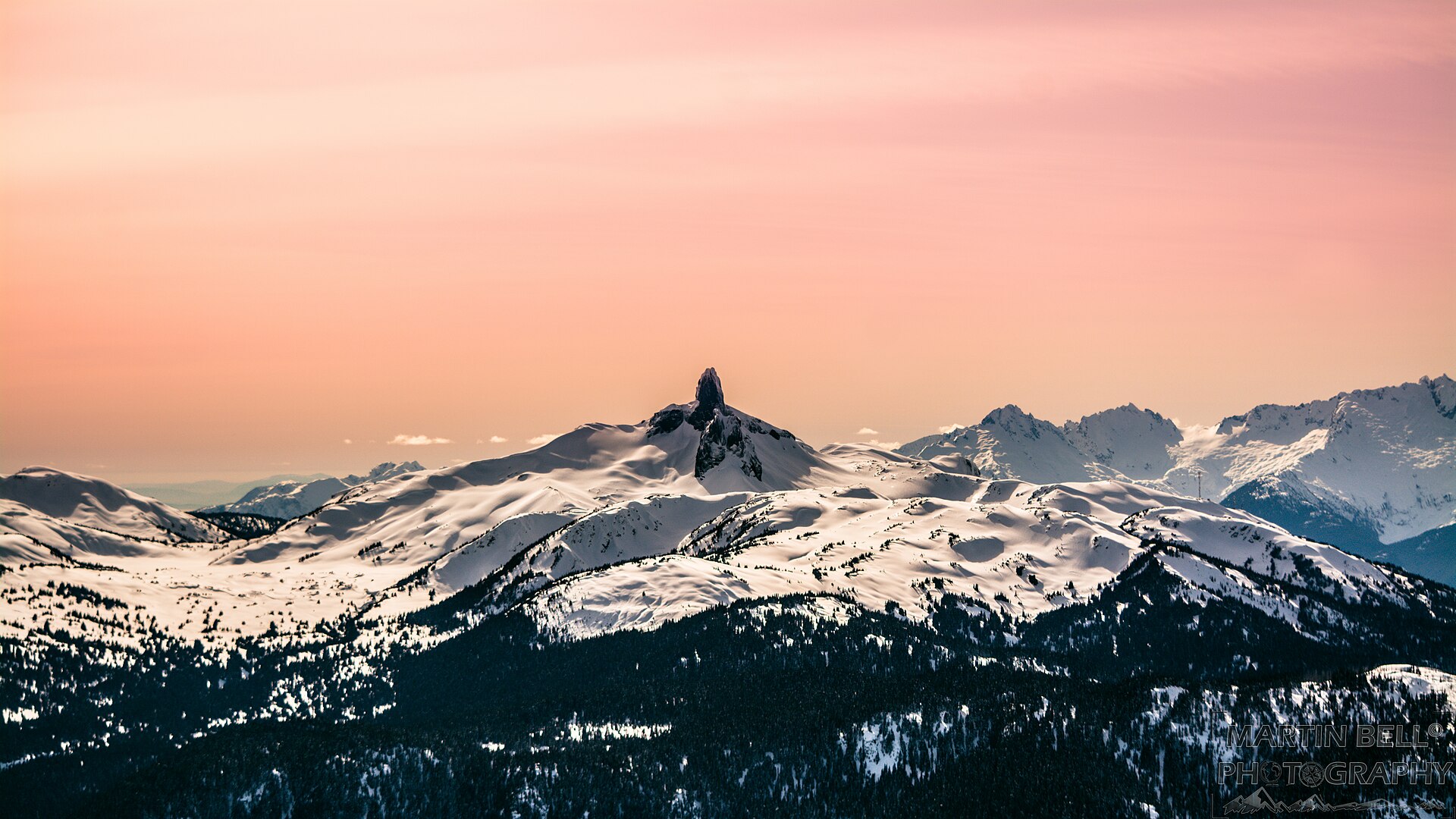
The Pacific Ranges are the southernmost and largest of the three subdivisions of British Columbia’s Coast Mountains, stretching roughly 400 km from the Fraser Lowland north to the Klinaklini River and Dean Channel. Within this span sit the granite walls of Squamish, the glaciated stratovolcanoes of Garibaldi Provincial Park, the turquoise cirques of Joffre and Wedgemount, the bladed ridges of the Tantalus, and the remote icefields of the Whitemantle and Waddington ranges. Day-hiking is overwhelmingly concentrated in the southern third along the Sea-to-Sky corridor.
The main hiking centres are Squamish, Whistler, Pemberton and West Vancouver / Lions Bay. BC Highway 99 links them and supplies trailheads for Garibaldi Park’s four major access points (Diamond Head, Rubble Creek, Cheakamus, Wedgemount) as well as Joffre Lakes and the Tantalus. Beyond Pemberton, vehicle access fades into forest-service roads in the Cayoosh and Bridge River country, and the Waddington massif is helicopter-accessed only.
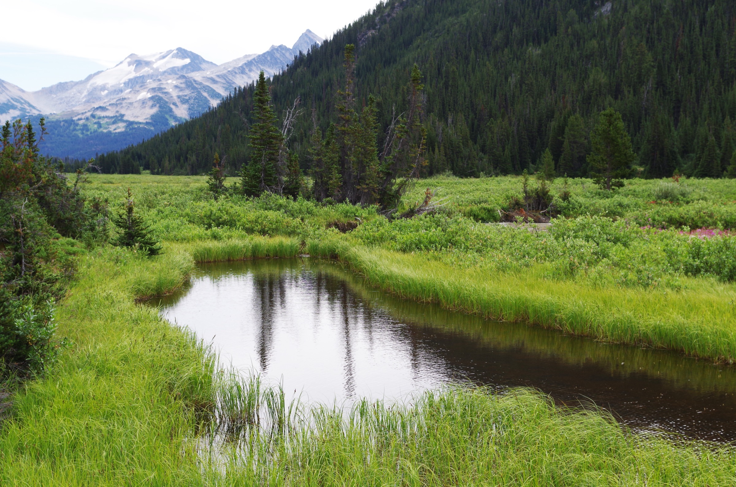
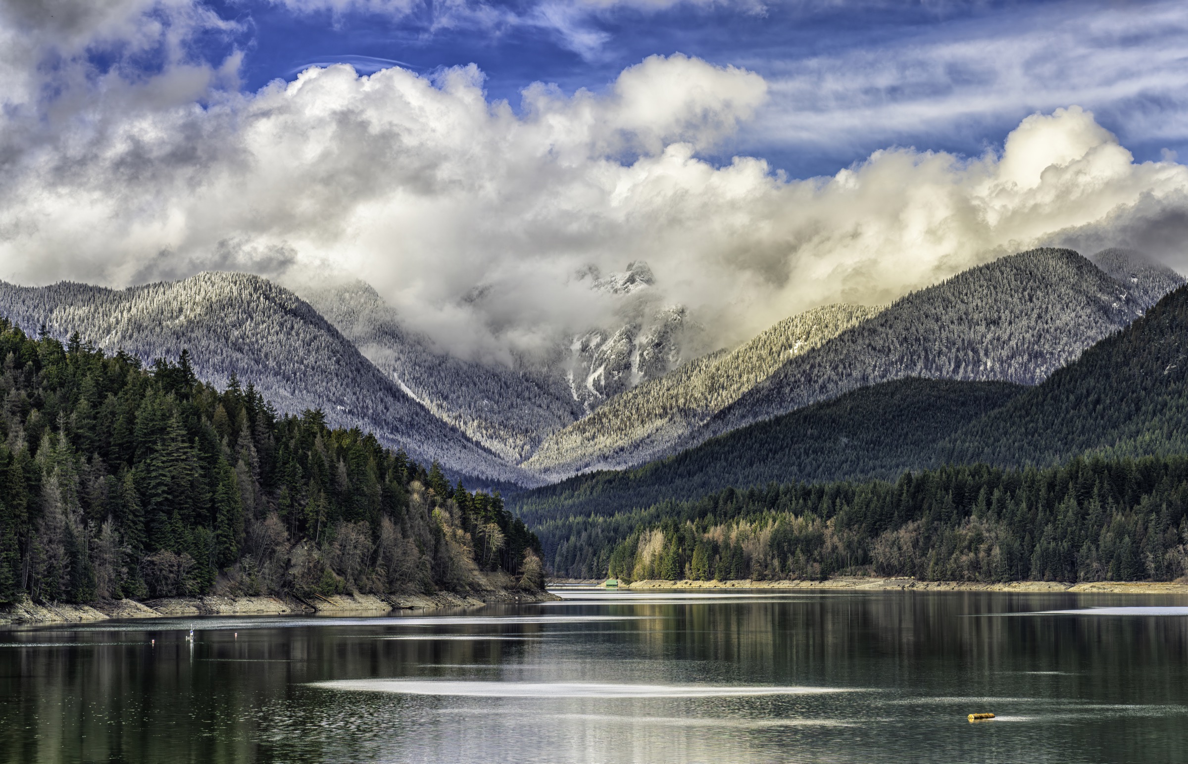
Terrain is steep, glaciated and maritime: sea-level fjord at Howe Sound rises to summits above 3,000 m, with old-growth coastal forest below ~1,200 m, subalpine meadows between ~1,400 and 1,800 m, and bare granite, snowpatch and glacier above. Lakes are typically dammed by lateral or terminal moraines and acquire their turquoise colour from rock flour. Trails clear progressively from July through early August in the alpine; the reliable season runs mid-July to late September, and by October fresh snow and avalanche risk return quickly above 1,800 m.
Safety considerations are dominated by fast-changing maritime weather, lingering hard snowpatches on north aspects into August, and bears — both black and grizzly inhabit the range, with grizzly density increasing north of Pemberton. Cell service is unreliable to absent in most parks. BC Parks operates a day-use pass system for Joffre Lakes (daily, May–October) and for the Rubble Creek, Diamond Head and Cheakamus trailheads in Garibaldi (Friday–Monday and statutory holidays, June–October, with daily passes for Cheakamus at peak season). Dogs are prohibited in Joffre Lakes, in all backcountry zones of Garibaldi Park, and in most of Stawamus Chief Provincial Park’s interior.
Selection rationale
The five hikes below were selected to span sub-areas, hike-types and difficulty bands while staying inside day-feasibility (usually under 30 km, under ~1,800 m of ascent, non-technical in summer):
- Panorama Ridge — the defining viewpoint over Garibaldi Lake, a non-technical summit walk with the most-photographed Pacific Ranges vista.
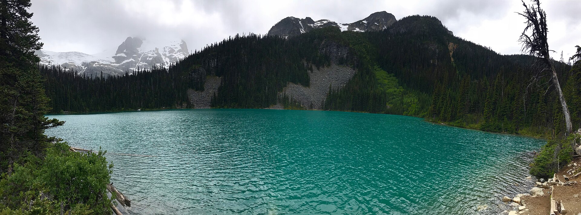
- Joffre Lakes — Upper Lake — a short, dense glacier-and-lake circuit in the Cayoosh Range, co-managed with the Lil’wat and N’Quatqua First Nations under the Pipi7íyekw name.
- High Note Trail (Whistler) — the corridor’s only lift-assisted high-alpine balcony walk above 2,000 m, accessible without an alpine approach climb.
- Elfin Lakes (Diamond Head) — a long, moderate-gradient ridge-and-pass route on a former ski-touring track, with sustained subalpine views and a historic backcountry shelter.
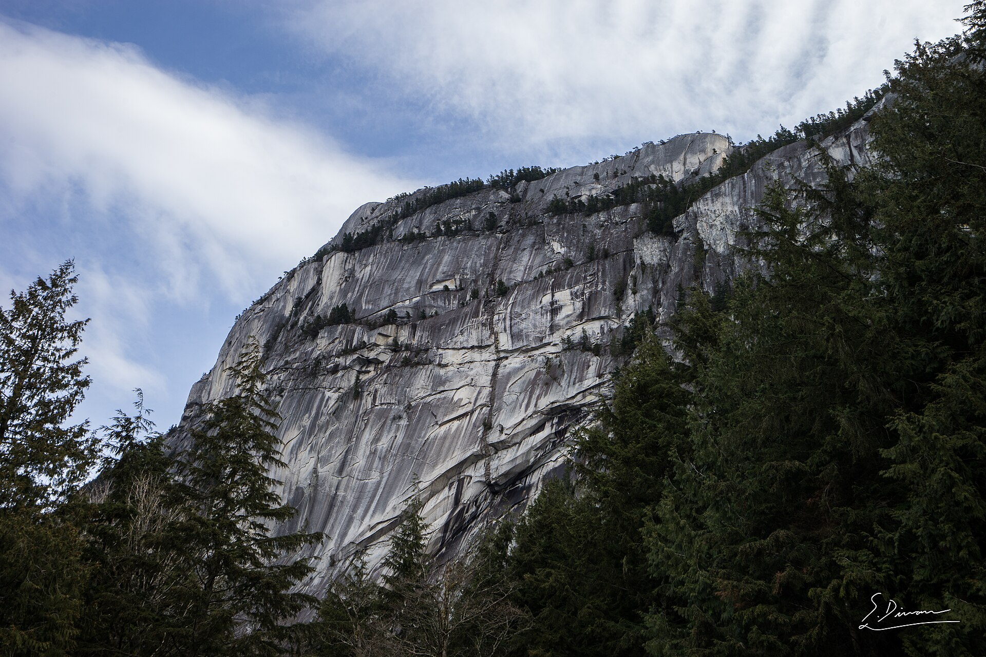
- Stawamus Chief (Peaks 1 and 2) — the granite-monolith landmark of the Sea-to-Sky’s southern entrance, a short steep hike on chains and ladders with Sḵwx̱wú7mesh Úxwumixw (Squamish Nation) cultural significance.
Black Tusk’s true summit was excluded as a Class 3 rockfall-prone scramble; the West Lion was excluded for the same reason. Wedgemount Lake is documented in the follow-up notes as a borderline day-hike alternate.
Summary table
| # | Hike | Country | Route type | Distance | Gain | Max elevation | Difficulty |
|---|---|---|---|---|---|---|---|
| 1 | Panorama Ridge via Rubble Creek | Canada | Out-and-back | 30 km | ~1,520–1,600 m | 2,135 m | Strenuous |
| 2 | Joffre Lakes — Upper Lake | Canada | Out-and-back | 10 km | 370–400 m | ~1,670 m | Moderate |
| 3 | High Note Trail (Whistler) | Canada | Lift-assisted loop | 9.4 km | ~150–200 m gain / ~420 m net descent | 2,182 m | Moderate |
| 4 | Elfin Lakes (Diamond Head) | Canada | Out-and-back | 22 km | ~600 m net (up to ~820 m with rolling) | ~1,640 m | Moderate–strenuous |
| 5 | Stawamus Chief, First and Second Peaks | Canada | Loop | 6–7 km | ~590–630 m | ~702 m | Moderate–strenuous |
1. Panorama Ridge
Snapshot
Itinerary
The route begins at the Rubble Creek parking area at about 600 m and climbs steady switchbacks through coast Douglas-fir and western hemlock forest. After roughly 6 km the trail gains the lip of the Barrier — the lava cliff that dams Garibaldi Lake — and reaches a junction between the Taylor Meadows and Garibaldi Lake branches. Both reconverge above the meadows; the Taylor branch is marginally drier in early season.
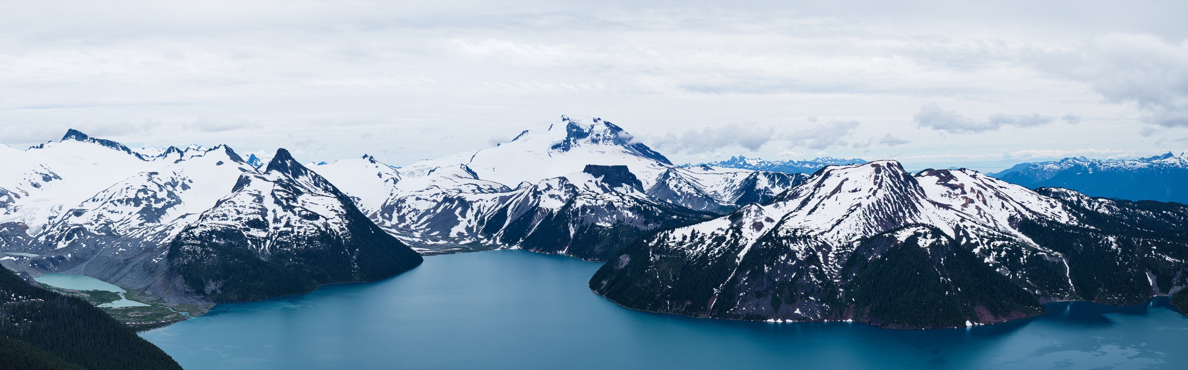
Above Taylor Meadows the trail enters subalpine parkland of mountain hemlock and subalpine fir. At about 13 km a signed spur turns east toward Panorama Ridge, climbing a wide ramp under the southern flank of Black Tusk before turning south onto the open ridge. The final 500 m of ascent is a steep loose-scoria slope. The summit ridge gives an arc of views: Garibaldi Lake’s full 9 km length below; the Tantalus Range and Squamish River valley west; Mount Garibaldi, Mount Price and Castle Towers east; and the basalt prow of Black Tusk to the north.
Why it is essential
Panorama Ridge delivers the most-photographed Pacific Ranges vista without any technical climbing. It crosses coastal forest, subalpine meadow and alpine scree in turn, passes the geological feature that defines Garibaldi Lake, and reaches a non-technical 2,135 m summit. It is the benchmark long day of the Sea-to-Sky.
Equipment
- Mountain hiking equipment: sturdy boots, trekking poles, weatherproof shell, warm midlayer, hat and gloves.
- 2.5–3 L of water; refill is possible at Taylor Meadows or Garibaldi Lake with a filter.
- Map, GPS backup, headtorch for long-day insurance, sun protection.
- Microspikes useful into early July on the upper scoria slope and lingering snowpatches.
Hazards and notes
- BC Parks day-use pass required at Rubble Creek (Friday–Monday and holidays, mid-June to mid-October); confirm dates on the reservation portal.
- Dogs prohibited in Garibaldi backcountry — service animals only.
- Both black and grizzly bears are present; carry bear spray and store food well.
- Weather changes rapidly above tree line; descend at first sign of thunderstorm build-up on the exposed ridge.
- Loose scoria on the summit pitch — be aware of falling rock onto hikers below.
- No reliable cell coverage. No fires; pack out all waste.
GPX / KML links
| Source | URL | Format / access | Reuse status |
|---|---|---|---|
| BC Parks: Black Tusk / Garibaldi Lake area | bcparks.ca | Official description and PDF map | BC Parks website terms not evaluated; no GPX found |
| OpenStreetMap | openstreetmap.org | OSM XML / GPX export | ODbL; reusable with attribution |
| Vancouver Trails: Panorama Ridge | vancouvertrails.com | Source route / app map | Site terms apply; GPX behind paywall |
External links
- BC Parks — Garibaldi Park: Black Tusk / Garibaldi Lake area
- BC Parks — Day-use passes
- Vancouver Trails — Panorama Ridge
2. Joffre Lakes — Upper Lake
Snapshot
Itinerary
From the highway car park at Cayoosh Pass, a 200 m level path leads to a viewpoint of Lower Joffre Lake, framed by the Matier Glacier across the water. The main trail climbs gently through subalpine forest of mountain hemlock and amabilis fir, crossing boulder fields and a footbridge over Joffre Creek. At about 3 km the path reaches Middle Joffre Lake, the most photographed of the three, where a wooden viewing platform sits above a moraine bank.
The grade steepens beside a series of cascades for 1.5 km to Upper Joffre Lake at ~1,670 m, ringed by the Matier and Stonecrop glaciers and the seracs of Mount Matier and Joffre Peak. A rougher path continues 500 m along the shore to the campground and a viewpoint of the icefall.
Why it is essential
Joffre Lakes is the showpiece short hike of the Lillooet Ranges, demonstrating glacial geology compactly: three rock-flour-blue lakes, a hanging glacier and a textbook cirque within 5 km of the trailhead. The site is co-managed with the Lil’wat (Lil̓wat7úl) and N’Quatqua First Nations under the Pipi7íyekw name, and cultural-practice closures are part of the seasonal calendar.
Equipment
- Standard hiking equipment upgraded for rocky tread: sturdy trail shoes or light boots.
- Weatherproof shell and warm layer; the basin stays cool even in summer.
- 2 L water; no reliable potable source on the route.
- Insect repellent through August.
- Microspikes useful for residual snow on the upper switchbacks before mid-July.
Hazards and notes
- Day-use pass required daily through the operating season; reserve at 7 am two days before visit. Daily visitor cap of 500.
- The park is closed for short windows in June and September each year for First Nations cultural practices and conservation — confirm exact 2026 dates before travel.
- Dogs strictly prohibited; no cell service; no on-site emergency response.
- Glacier instability above Upper Lake; scrambling onto moraine or icefall is strongly discouraged because of rockfall and crevasse hazard.
- Avalanche risk through fall and spring.
GPX / KML links
| Source | URL | Format / access | Reuse status |
|---|---|---|---|
| BC Parks: Joffre Lakes Park | bcparks.ca | Official description and PDF map | BC Parks website terms not evaluated; no GPX found |
| OpenStreetMap | openstreetmap.org | OSM XML / GPX export | ODbL; reusable with attribution |
| BC Government — 2026 day-use passes news release | news.gov.bc.ca | Official statement | Government source |
External links
- BC Parks — Joffre Lakes Park
- BC Parks — Day-use passes
- Province of BC — 2026 day-use pass and closures release
3. High Note Trail (Whistler)
Snapshot
Itinerary
From the top of the Peak Express chair at 2,182 m, the trail traces the western flank of Whistler Mountain south along a high contour. Within the first kilometre the path opens to views across the Cheakamus drainage to Black Tusk, Mount Garibaldi and Castle Towers. The route loses elevation gently through alpine heath and boulderfield, passing beneath Piccolo Summit and rounding into Symphony Bowl.
At about 5 km a signed junction marks the connection to the Musical Bumps Trail and Singing Pass. The High Note bears north here, climbing briefly back toward Flute Summit (skirted to the east), then descending via the Mathew’s Traverse and Harmony Express area back to the Roundhouse Lodge at 1,860 m. The Whistler Village Gondola provides the descent to the valley.
Why it is essential
The High Note is the only alpine balcony walk in the Pacific Ranges that crosses the 2,000 m line on a well-graded, signed, non-technical tread. It compresses a panoramic ridge experience — Cheakamus Lake below, Black Tusk and Garibaldi to the south, the Spearhead glaciers to the east — into a half-day with no driving beyond Whistler Village.
Equipment
- Mountain hiking equipment: sturdy trail shoes or boots, weatherproof shell, warm layer.
- Hat and gloves; the alpine zone is exposed and cool even in midsummer.
- 2 L of water; no water sources on the route.
- Sun protection — UV is intense above 2,000 m.
- Headtorch as insurance for a missed last lift.
- Lift ticket or sightseeing pass required. Microspikes useful in early July for residual snowpatches.
Hazards and notes
- Lift schedules control trip planning; confirm last downloads on Peak Express and Village Gondola.
- Pets prohibited on lifts and alpine trails.
- Lightning risk on exposed terrain — descend toward the Roundhouse at first sign of thunderstorm build-up.
- Black bears frequent the area; lift staff post current sightings.
- Marmot habitat; do not approach or feed.
GPX / KML links
| Source | URL | Format / access | Reuse status |
|---|---|---|---|
| Whistler-Blackcomb hiking trail map (PDF) | cdn.whistler.com | Official PDF map | All rights reserved (Vail Resorts); reference only |
| OpenStreetMap | openstreetmap.org | OSM XML / GPX export | ODbL; reusable with attribution |
| Trailforks: High Note | trailforks.com | Community trace | Trailforks terms apply |
External links
- Whistler.com — Alpine hiking on Whistler and Blackcomb
- Vancouver Trails — High Note Trail
- Trailforks — High Note
4. Elfin Lakes (Diamond Head)
Snapshot
Itinerary
From the gate at the end of Mamquam Road, the route follows the old Diamond Head jeep road — a wide, well-graded former ski-touring track. The first 5 km climb steadily through silver fir and mountain hemlock forest to Red Heather Meadows, a broad subalpine flat with a day-use shelter, picnic tables and a winter warming hut. Above Red Heather, hikers transfer to the summer Paul Ridge trail, a single-track parallel route that climbs onto the bare crest of Paul Ridge at ~1,640 m.
The ridge undulates north-east for 4 km with continuous views: the glaciated summit of Mount Garibaldi and the Pyramid to the north, the Tantalus Range across the Squamish valley to the west, and Mamquam Mountain to the east. The trail drops gently past Columnar Peak to Elfin Lakes at ~1,600 m — two small ribbon tarns beside the 1973 Elfin Lakes shelter and campground. Return is by the ascent route; the original jeep road can be used as an easier-grade option in dry summer conditions.
Why it is essential
Elfin Lakes is the gateway high country of Garibaldi Park’s southern half — a sustained alpine walk on a moderate gradient that suits walkers building toward Panorama Ridge or Black Tusk. The Paul Ridge crossing gives the most open south-flank view of Mount Garibaldi available without alpinism, and the Elfin Lakes shelter is one of the oldest continuously operating backcountry huts in the Pacific Ranges.
Equipment
- Mountain hiking equipment: sturdy boots, trekking poles for the long descent, weatherproof shell, warm midlayer.
- Hat and gloves outside midsummer.
- 2.5 L water; the only source is at Elfin Lakes and requires filtering.
- High-energy food and sun protection on the exposed ridge.
- Headtorch for long-day insurance in shoulder season. Microspikes for snowpatches before late July.
Hazards and notes
- BC Parks day-use pass required at Diamond Head (Friday–Monday and holidays, mid-June to mid-October); confirm dates.
- Dogs prohibited in Garibaldi backcountry.
- Black and grizzly bears present; carry bear spray.
- Open ridge — lightning risk in afternoon storms.
- Snow lingers on north-facing pitches into late July.
- No fires; pack out all waste. Pit toilets at Red Heather and Elfin Lakes only.
GPX / KML links
| Source | URL | Format / access | Reuse status |
|---|---|---|---|
| BC Parks: Diamond Head area | bcparks.ca | Official description and PDF map | BC Parks website terms not evaluated; no GPX found |
| OpenStreetMap | openstreetmap.org | OSM XML / GPX export | ODbL; reusable with attribution |
| Vancouver Trails: Elfin Lakes | vancouvertrails.com | Source route / app map | Site terms apply; GPX behind paywall |
External links
- BC Parks — Garibaldi Park: Diamond Head area
- BC Parks — Day-use passes
- Vancouver Trails — Elfin Lakes
5. Stawamus Chief — First and Second Peaks
Snapshot
Itinerary
From the lower trailhead near Shannon Falls / Stawamus Chief day-use, the path climbs immediately and aggressively through coastal forest on a stone-step trail beside Olesen Creek. At about 1.5 km the route forks at the saddle behind the monolith.
The Peak 1 (South) spur turns sharply right (south-west). It includes the iconic sections of metal chains bolted to the granite slab and a short metal ladder before topping out on the broad summit dome at about 610 m, with a panoramic view down Howe Sound to Vancouver Island, across to the Tantalus Range, and up the Squamish River valley to Mount Garibaldi.
Returning to the saddle, the Peak 2 (Central) spur climbs north on a more forested grade with a final scramble onto the open summit at about 702 m. The view from Peak 2 captures the Squamish River estuary, Howe Sound and the curving granite arête to Peak 1. A connector descends from Peak 2 to Peak 3, and a loop trail returns to the saddle and the main descent. Many walkers descend directly from Peak 2.
Why it is essential
The Stawamus Chief is the defining granite landmark of the Pacific Ranges’ southern entrance and the largest exposed granite monolith in Canada. It carries cultural significance to the Sḵwx̱wú7mesh Úxwumixw (Squamish Nation) as Siy̓ám̓ Smánit, “Chief Mountain”, and the trail compresses vertical relief at a rate unusual in the corridor: ~600 m gain in 1.5 km, on chains and ladders, with a sweeping fjord-to-glacier vista at the top.
Equipment
- Grippy hiking shoes or approach shoes — heavy boots are less effective on the smooth granite slabs.
- Gloves useful on chains.
- Weatherproof shell; 1.5–2 L water; food; sun protection on exposed summits.
- Headtorch as insurance for late starts. Helmet is not normally worn, but rockfall from climbers above can occur on the steep sections.
Hazards and notes
- No day-use pass required; standard paid parking at the day-use lot.
- Pets on leash permitted to peak trails per BC Parks, but ladders and chains make Peak 1 impractical for dogs.
- Peregrine falcon nesting closures apply to climbing routes from mid-March to end of July; hiking trails are not affected.
- Slippery granite in wet weather; chains and ladders are hazardous when iced.
- Crowding: arrive before 08:00 in summer.
GPX / KML links
| Source | URL | Format / access | Reuse status |
|---|---|---|---|
| BC Parks: Stawamus Chief Park | bcparks.ca | Official description and PDF map | BC Parks website terms not evaluated; no GPX found |
| OpenStreetMap | openstreetmap.org | OSM XML / GPX export | ODbL; reusable with attribution |
| Komoot smart tour | komoot.com | Community trace | Komoot terms apply |
External links
External links
| Source | URL |
|---|---|
| BC Parks — Garibaldi Park overview | bcparks.ca |
| BC Parks — Black Tusk / Garibaldi Lake area | bcparks.ca |
| BC Parks — Diamond Head area | bcparks.ca |
| BC Parks — Joffre Lakes Park | bcparks.ca |
| BC Parks — Stawamus Chief Park | bcparks.ca |
| BC Parks — Day-use passes | bcparks.ca |
| Province of BC — 2026 day-use pass release | news.gov.bc.ca |
| Whistler.com — Alpine hiking on Whistler and Blackcomb | whistler.com |
| Whistler-Blackcomb hiking map (PDF) | cdn.whistler.com |
| Vancouver Trails — Panorama Ridge | vancouvertrails.com |
| Vancouver Trails — Elfin Lakes | vancouvertrails.com |
| Vancouver Trails — High Note Trail | vancouvertrails.com |
| Tourism Squamish — Stawamus Chief | exploresquamish.com |
| Outdoor Vancouver — Stawamus Chief | outdoorvancouver.ca |
| Trailforks — High Note | trailforks.com |