Regional overview
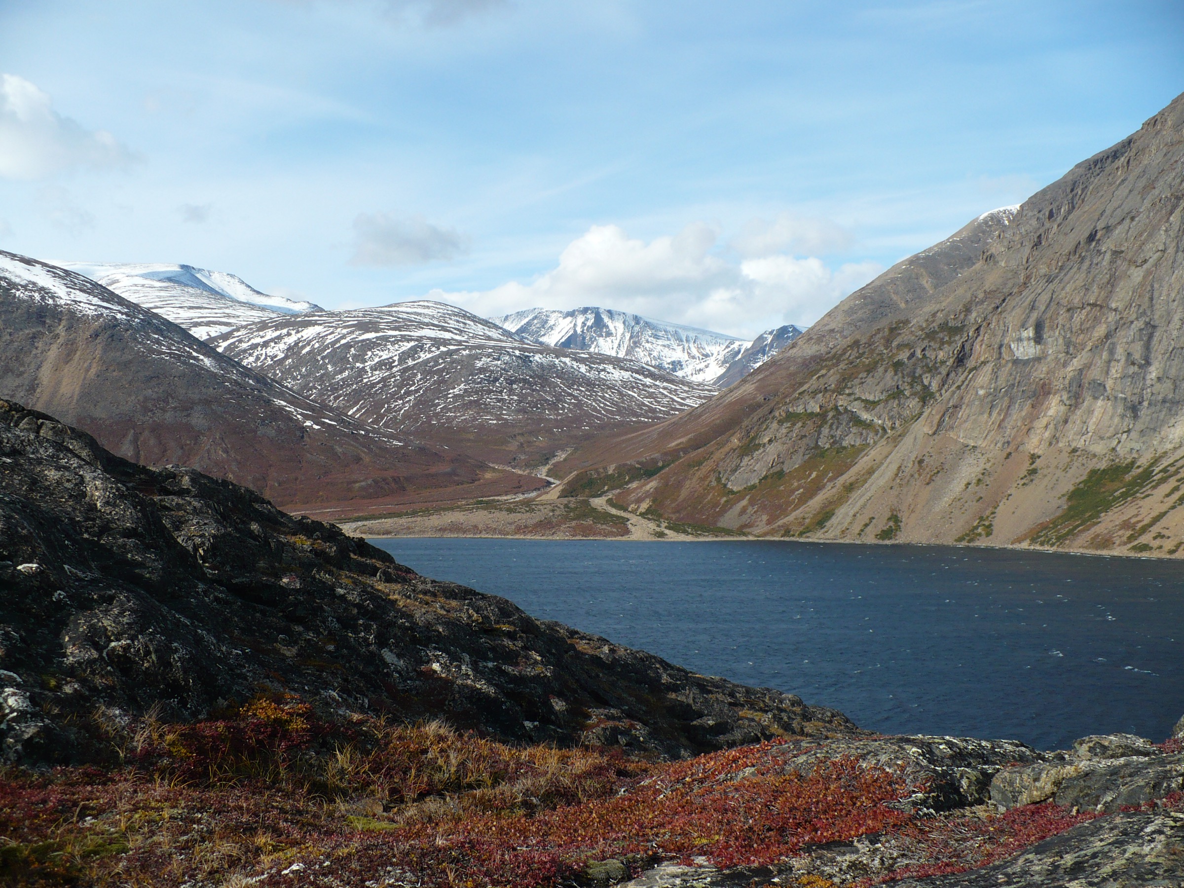
Saglek Fjord and Nachvak Fjord form the dramatic southern and central spine of Torngat Mountains National Park in northern Labrador (Nunatsiavut). Both are deep, glacially carved sea inlets where walls of Archean gneiss and folded Paleoproterozoic quartzite plunge straight from sea level to summits of 900 to 1,500 metres. Saglek Fjord, about 21 km wide at its mouth and roughly 50 km long, is the access fjord for the park: the Torngat Mountains Base Camp and Research Station sits inside its southern shore, at St. John’s Harbour (Kangidluasuk), just outside the formal park boundary. Nachvak Fjord, about 90 km north, is narrower — roughly 2 km wide and 20 km long — and forks at its head into Tallek Arm and Tasiuyak Arm, the gateways to the highest peaks of Labrador (Mount Caubvick 1,652 m, Torngarsoak 1,595 m, Cirque Mountain 1,568 m).
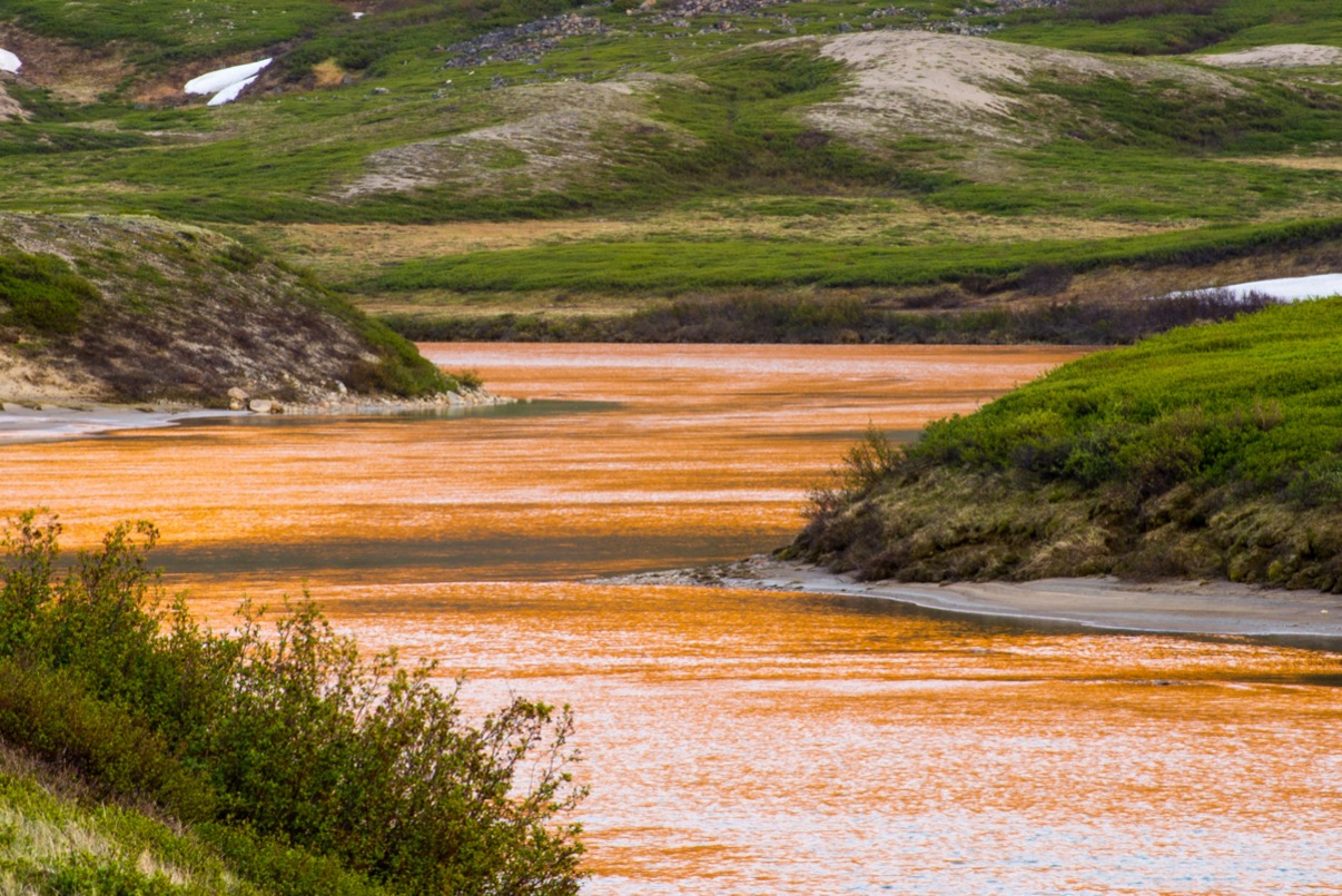
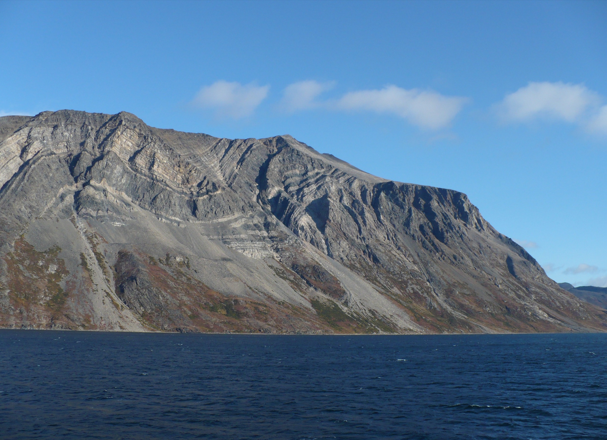
The geology gives both fjords their distinctive shape. The lower walls are Nain Province Archean gneisses, locally including the Nanok gneiss of Saglek Bay, dated at roughly 3.9 billion years and among the oldest exposed rocks on Earth. Above and unconformably overlying these, the Paleoproterozoic Ramah Group — clean quartz sandstones, mudstones and chert beds about 1.9 billion years old — was tightly folded and metamorphosed during the Torngat Orogeny (c. 1.9–1.8 Ga), when the Nain craton collided with the Rae craton. The result is the spectacular layered, contorted cliff walls of Saglek Fjord’s north side and the Ramah Bay area, locally exceeding 1,100 m of vertical relief. Pleistocene glaciation then over-deepened the fjord troughs and carved the cirques, hanging valleys and U-shaped tributary basins seen today; small alpine glaciers still persist on north-facing slopes of the Selamiut Range above Nachvak.
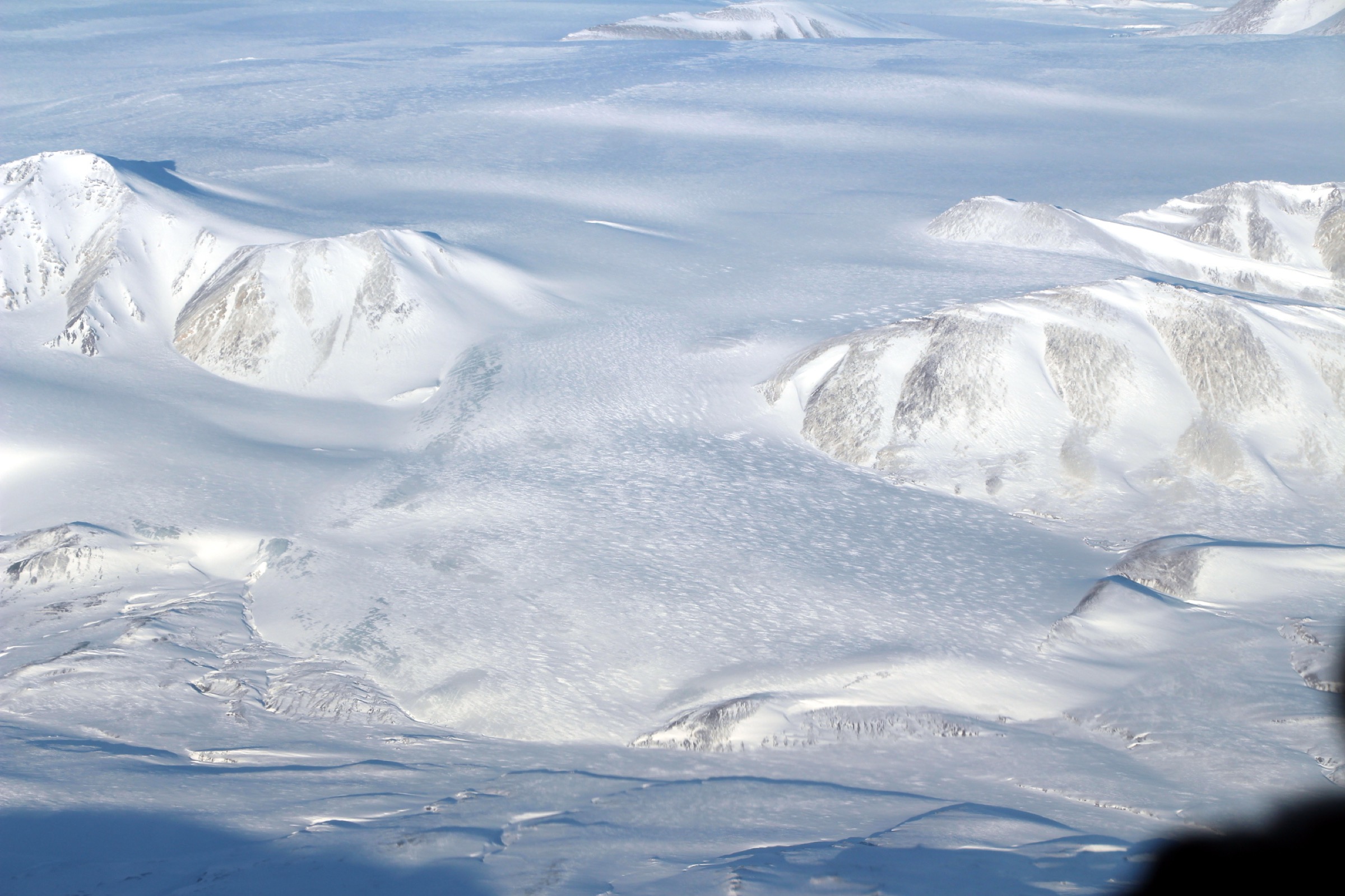
For the walker, this is fly-in, boat-in country. There are no roads, no marked trails, no signs, no huts, no benchmarked routes. Access is by chartered Twin Otter from Goose Bay to the airstrip at Saglek and onward by zodiac, longliner or Bell helicopter from Saglek to base camp and to landing sites in both fjords. The operating season is extremely short — typically mid-July to early September, with the base camp itself open for roughly five weeks. Polar bears are present year-round and become more concentrated on the coast in late August and September as sea ice retreats; black bears, wolves and caribou are also common. Parks Canada and the Nunatsiavut Government strongly recommend, and in practice all guided operators require, that any party leaving base camp or stepping off a vessel be accompanied by an armed Inuit bear monitor. Weather is fully maritime sub-Arctic: katabatic winds funnel down the fjord walls, fog can shut down helicopter movements for days, and snow is possible in any month.
For this catalogue the “day-hike” definition has been widened — by necessity — to include routes operated as guided day excursions from the Torngat Mountains Base Camp at Saglek, even though access requires boat, zodiac or helicopter. Five hikes were selected to span the geographic and experiential range of the two fjords: a fjord-mouth cultural walk at Sallikuluk; a classic boat-in valley walk on the north arm of Saglek at Silluak; a cliff-and-chert shore walk in Ramah Bay; a fjord-head walk at Tallek Arm in Nachvak; and the Bears Gut plateau approach above Saglek’s north arm. None of these routes is “marked” in the conventional sense, and almost none has a published GPX track — that absence is itself a feature of the region and is recorded honestly below.
Selection rationale
The five chosen hikes concentrate on the Saglek and Nachvak fjord systems specifically, with Ramah Bay treated as the cliff-and-shore route immediately north of Saglek inside the same fjord-rim landscape. They avoid duplication with the broader Labrador-Torngats and Kuururjuaq / Koroc-side catalogues by omitting long multi-day backcountry traverses and Mount Caubvick approaches except as day variants. The set reflects what is actually walked under guided operation from the Torngat Mountains Base Camp: short fjord-rim viewpoints, beach-and-meadow shore walks, valley-floor day-sections of multi-day routes, and one cultural / archaeological interpretive walk. It balances one short, beginner-friendly fjord-mouth cultural walk (Sallikuluk), two scenic moderate fjord-floor walks (Saglek North Arm; Tallek Arm), one cliff and chert-bed historic walk (Ramah Bay), and one harder plateau / ridge route (Bears Gut). Only candidates documented in Parks Canada, Torngat Mountains Base Camp, Nunatsiavut, Adventure Canada, SOI Foundation or SummitPost trip reports were used. Pyramid Mountain (Saglek), an unnamed peak directly above base camp and a full ascent of Cirque Mountain could not be verified at day-hike grade against reliable sources and were not selected; Cirque Mountain is acknowledged in the Tallek Arm entry as the regional skyline feature.
Summary table
| # | Hike | Country | Route type | Distance | Gain | Max elevation | Difficulty |
|---|---|---|---|---|---|---|---|
| 1 | Sallikuluk (Rose Island) interpretive walk | Canada | Loop / out-and-back | ~3–5 km | ~80–120 m | ~80 m | Easy (cultural) |
| 2 | North Arm Saglek — Silluak beach, lake and waterfall | Canada | Out-and-back | ~5–8 km | ~150–250 m | ~200 m | Easy–moderate |
| 3 | Ramah Bay shore and chert-quarry walk | Canada | Out-and-back | ~6–10 km | ~100–200 m | ~150 m | Easy–moderate |
| 4 | Tallek Arm fjord-head walk, Nachvak Fjord | Canada | Out-and-back | ~8–12 km | ~200–350 m | ~300 m | Moderate |
| 5 | Bears Gut plateau — day-section to Skull Lake | Canada | Out-and-back | ~10–14 km | ~400–500 m | ~500 m | Moderate–strenuous |
No published GPX or KML tracks exist for any of the five routes. Distances, ascents and turnaround points are reconstructed from Parks Canada narrative descriptions, base-camp operator material and trip-report sources, and are honestly approximate.
1. Sallikuluk (Rose Island) interpretive walk
Snapshot
Itinerary
The excursion begins with a short zodiac or longliner crossing from base camp into the island group at the mouth of Saglek Bay. Sallikuluk is one of five sizeable islands at the entrance to Saglek and is the focal cultural site of the southern park. After a beach landing, the Inuit guide and bear monitor lead the party up a short tundra rise from the shore onto the broad, low back of the island. The interpretive walk visits a Maritime Archaic site dated to approximately 4500 BCE, layered Pre-Inuit and Thule occupation surfaces, tent rings, sod-house ruins and a hilltop with the marked burial ground of more than 600 Inuit, repatriated and reburied after a 1970s archaeological removal was returned by the provincial museum in 1995.
Walking surfaces are mostly soft tundra, low Arctic heath, gravel beach berms and occasional patches of wet ground. The hilltop section offers panoramic views back across Saglek Bay to the southern wall of Saglek Fjord and out to the open Labrador Sea. The pace is interpretive rather than athletic and is dictated by the cultural guide; the group typically circulates between several discrete sites with significant time spent listening rather than walking.
Why it is essential
Sallikuluk is the obvious anchor cultural walk of the Saglek fjord system. It is the only short, fjord-mouth route that combines a low-effort walk with a 5,000-year archaeological record and an actively curated Inuit memorial site, and it is the excursion that almost every base-camp visitor undertakes. For a five-hike set focused on the Saglek/Nachvak fjord systems it provides the necessary cultural counterweight to the four scenic walks.
Equipment
- Sturdy hiking shoes or light boots
- Weatherproof shell
- Warm insulating layer, hat and gloves (cold sea wind even in July)
- Water and snack
- Sun protection
- Midge/blackfly head net in calm conditions
- Tide-appropriate boots for the wet beach landing
- Camera with rain protection
Firearms and bear deterrents are carried by the Inuit bear monitor, not by the visitor.
Hazards and notes
Polar bear and black bear hazard requires an armed Inuit bear monitor at all times; this is non-negotiable. The zodiac transfer is weather-dependent and can be cancelled at short notice for wind, fog or sea state. The site is a registered cultural and burial landscape; visitors must not pick up artefacts, walk on grave mounds or photograph individual burials, and must follow the cultural guide’s direction strictly. There is no drinking water on the island. Sea fog can drop visibility to a few metres, in which case the group stays together with the guide and bear monitor.
GPX / KML links
No published GPX track. The base-camp operator does not publish a route; the line is interpreted on the ground by the cultural guide.
Sources
- The Torngats — Sallikuluk (Rose Island)
- The Torngats — Excursions index
- Parks Canada — Torngat Mountains National Park, Inuit Story
2. North Arm Saglek — Silluak beach, lake and waterfall

Snapshot
Itinerary
A boat or zodiac transfer from base camp at St. John’s Harbour rounds the headland and continues into the north arm of Saglek Fjord, beneath the 900–1,100 m folded quartzite walls of the Ramah Group on the fjord’s north side. The landing is at Silluak, a rocky beach cradled by steep scree walls created by long-term rockfall from the cliffs above. From the beach, the route crosses a broad tundra meadow at the back of the cove, where caribou trails and braided streams cut through low Arctic heath, willow scrub and patches of cottongrass.
The walk traces the stream upvalley to a small lake — informally described in operator material as the “indigo-blue lake” — set in a glacial-cirque basin under near-vertical fjord walls. A waterfall drops from a hanging valley above the lake; depending on conditions, guided parties either turn around at the lake or continue a short distance up to the base of the waterfall, where the cascade can sometimes be skirted behind the curtain of falling water. Return is by the same route to the landing beach, where a beach fire, fresh char and bannock are commonly organised by the guides while the boat returns.
Why it is essential
The north-arm walk is the signature scenic day excursion of the Saglek fjord system. It combines the fjord-floor cliff experience — walls of 900 m or more rising directly from the sea — with a self-contained cirque-and-waterfall feature in a single, relatively easy walking objective. It is what most base-camp visitors do as their archetypal “Saglek Fjord” hiking day.
Equipment
- Sturdy hiking boots
- Weatherproof shell
- Warm insulating layer, hat and gloves
- Trekking poles useful for stream crossings and scree edges
- Water (filterable on route) and food
- Tide-appropriate footwear or wading sandals for the beach landing
- Dry bag for camera and electronics
- Head net for blackflies in calm conditions
- Swimwear if intending to plunge in the lake
Hazards and notes
Armed Inuit bear monitor mandatory; polar bears are commonly seen along these fjord shores and black bears use the valley. Boat and zodiac access is weather-dependent and can be turned back by wind, swell or fog. The scree slopes flanking the cove are active; do not scramble onto rubble below the cliffs. Stream crossings can rise rapidly after rain or warm afternoons. There are no facilities, no marked trail and no signage — navigation by guide and topographic map (NTS 1:50,000). The park is open year-round but the base camp operates only from approximately mid-July to early September; outside that window there is no realistic guided access.
GPX / KML links
No published GPX. The base-camp operator does not publish a track; Parks Canada does not list this as a named route. Trailhead coordinates approximate (north arm of Saglek Fjord, Silluak cove); route geometry must be reconstructed from NTS 1:50,000 mapping and an on-the-ground guided visit.
Sources
- The Torngats — North Arm excursion
- Wedge Hills Lodge — Saglek Fjord overview
- Parks Canada — Torngat Mountains National Park, Nature and Science
3. Ramah Bay shore and chert-quarry walk
Snapshot
Itinerary
The boat or zodiac crosses out of Saglek and rounds northward up the open coast to Ramah Bay. The transit is exposed and can be rough; parties are sometimes turned back at this stage. Landing is on the broad pebble beach lined with black sand and flat stone fragments — many of them the distinctive semi-translucent Ramah chert that drew Indigenous toolmakers to this site for at least 7,000 years.
From the beach, the walk strolls along the shoreline, the cultural guide pointing out the Moravian mission ruins (a station active from 1871 until 1908), the flat-stone strand, the chert fragments and, depending on the chosen direction, a detour to a powerful waterfall close to the bay where the curtain of water can be approached and partially walked behind. The Kitjigattalik (Ramah Chert Quarries) National Historic Site is reached via a short ascent onto the bench above the bay, where the in-situ quarried beds and worked floors are visible — this is a working National Historic Site of Canada and is treated with the same care as Sallikuluk. Return is by the same shore back to the landing. Caribou, polar bears, black bears and a variety of seabirds may be encountered.
Why it is essential
Ramah Bay is, with Sallikuluk, the cultural keystone of the Saglek-system catalogue. Ramah chert is one of the most widely traded tool stones known from pre-contact northeastern North America and the only known source of this semi-translucent variety; Kitjigattalik was designated a National Historic Site in 2016. The route also gives a clean fjord-rim-cliff and waterfall experience along the open coast immediately north of Saglek Fjord, and is included on essentially every base-camp itinerary that can secure the weather window.
Equipment
- Sturdy hiking boots
- Weatherproof shell
- Warm insulating layer, hat and gloves
- Water and food for a full day
- Dry bag for the long zodiac transfer
- Extra dry layer in a sealed bag
- Head net for blackflies in calm conditions
- Camera rain cover
Hazards and notes
Polar and black bears are regularly seen at Ramah Bay; armed Inuit bear monitor mandatory. The open-coast zodiac transit between Saglek and Ramah Bay is the most weather-sensitive part of the day and parties have been turned back by sea state. Kitjigattalik is a National Historic Site of Canada; no collection of chert fragments or artefacts is permitted. The Moravian-mission ruins are fragile — stay off built structures. Long days require sun protection and adequate insulation against cold sea wind on the return run.
GPX / KML links
No published GPX. Parks Canada documents Kitjigattalik as a National Historic Site but does not publish a hiking track, and the operator (The Torngats / Nunatsiavut Group of Companies) does not publish a GPX.
Sources
- The Torngats — Ramah excursion
- Parks Canada — Kitjigattalik (Ramah Chert Quarries) National Historic Site
- University of Waterloo, Chem 13 News — Ramah Bay: 7,000 years of culture and chemistry
4. Tallek Arm fjord-head walk, Nachvak Fjord
Snapshot
Itinerary
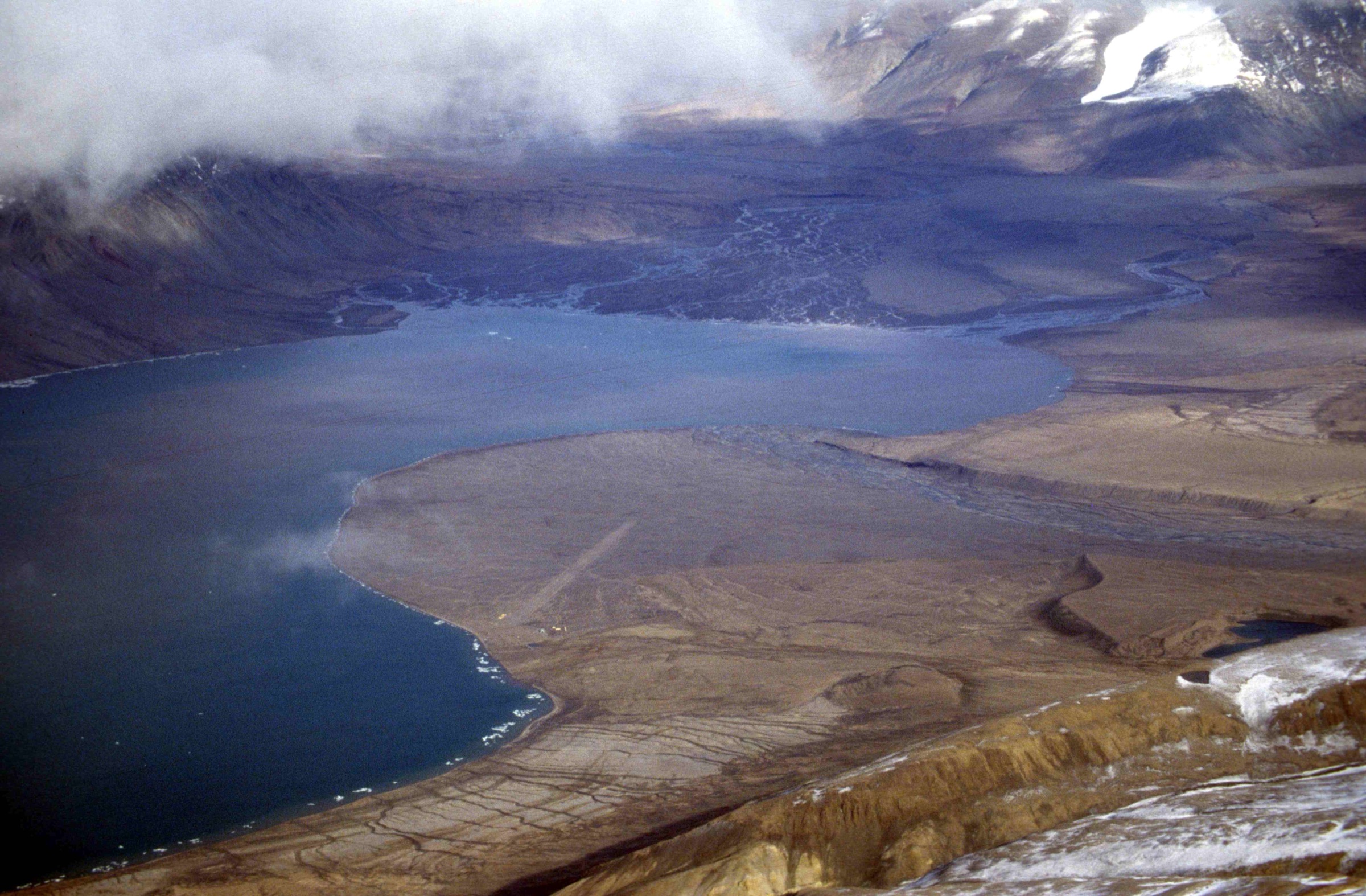
A helicopter or boat-and-zodiac combination brings the party from base camp at Saglek north past the open coast and into Nachvak Fjord. The route into the inner fjord runs between near-vertical walls of Archean gneiss; both Mount Razorback (north side) and the Selamiut Range with Mount Caubvick (south side) dominate the skyline. At the western end of the fjord, Nachvak forks into Tallek Arm (the more southerly fork, into which the Palmer River flows down from the Selamiut Range) and Tasiuyak Arm (the more northerly fork). The landing is on the gravel flats at the head of Tallek Arm.
The walk follows the broad braided gravel flats of the Palmer River outwash inland for several kilometres, with the cirque architecture of the Selamiut Range — including the unmistakable hanging-cirque profile of Cirque Mountain (1,568 m) — opening up to the south. Caribou trails are the practical waypoints; the underlying ground is a mosaic of dry tundra, sedge meadow and gravel bars. Depending on guide preference and group ability, the route either continues up the valley floor or gains a low ridge spur on the south side of the river for a panoramic view back down Tallek Arm and out to the main fjord. Return is by the same route.
This walk is best understood as the day-section of the published Parks Canada Koroc River – Palmer River Loop, taken from the Tallek Arm end and walked only as far as a turnaround point that returns the party to the landing within the day.
Why it is essential
Tallek Arm is the only practical day-walk that delivers the inner-Nachvak experience: a sea-level approach into one of the most spectacular alpine cirque amphitheatres in eastern North America, with Cirque Mountain, Razorback and the Selamiut Range as the skyline. It connects the fjord-system catalogue to the highest peaks of Labrador without requiring the multi-day commitment of the Koroc–Palmer loop or a Cirque Mountain attempt.
Equipment
- Sturdy boots
- Weatherproof shell
- Warm insulating layer, hat and gloves
- Trekking poles
- Navigation backup (compass + map + GPS)
- Full day’s food and water
- Stream-crossing footwear (wading sandals or neoprene booties) for braided channels of the Palmer River outwash
- Dry bag for camera
- Head net for blackflies
- Emergency bivvy / shelter as a precaution because of the remote landing
Hazards and notes
Polar and black bears are present in the inner fjord; armed Inuit bear monitor mandatory. The valley floor is a braided gravel outwash and channels can rise dramatically after rain or warm afternoons. Helicopter and boat access into Nachvak is weather-sensitive and can be cancelled or shortened with no notice. This is the upper, “alpine” end of the catalogue: in any month including July, fresh snow on the surrounding peaks is possible and katabatic winds are common down the fjord walls. Navigation is entirely off-trail; the Parks Canada route description for the wider Koroc–Palmer loop emphasises that route descriptions are not a substitute for NTS 1:50,000 mapping plus compass and GPS. No GPX is published; on-the-ground judgement by the Inuit guide is essential.
GPX / KML links
No published GPX. Parks Canada publishes a narrative route description for the broader Koroc River – Palmer River Loop (Crown copyright; textual reference only) into which the Tallek Arm day-section drops. A suggested camping / landing waypoint at the head of Tallek Arm appears in regional route material near UTM 20V 449553 E / 6526775 N and should be field-verified on NTS 1:50,000 before any field work.
Sources
- Parks Canada — Koroc River – Palmer River Loop
- Wikipedia — Nachvak Fiord
- SummitPost — Cirque Mountain
5. Bears Gut plateau — day-section to Skull Lake
Snapshot
Itinerary
A boat or helicopter transfer from base camp lands the party at the eastern foot of Bears Gut, on the north arm of Saglek Fjord. The full Parks Canada route then runs in three sections over 3–5 days; the day-version selected here uses only Section 1, the 12 km traverse from Bears Gut to Skull Lake — turning earlier as needed to fit a single boat-supported day.
From the landing the route follows the lower valley on the north side of the river to avoid unnecessary crossings, climbing gently through tundra and caribou-trail terrain. Waterfalls and a short canyon punctuate the walk and the underlying ground reveals approximately 1.9-billion-year-old sedimentary rocks of the Ramah Group, with bedding-plane ripple marks identical to those found in modern-day estuaries and preserved continuously for nearly two billion years. The route then trends upward toward the plateau edge above Skull Lake.
A genuine day-out version turns at, or just below, the plateau edge — typically once a clear view down to Skull Lake is reached — and returns by the same line to the landing. Walkers who continue beyond into Sections 2 and 3 of the published route enter multi-day, fully self-supported terrain and fall outside the day-hike definition.
Why it is essential
Bears Gut is the strongest “plateau and ridge” day-experience accessible directly from base camp at Saglek. It is the only Parks-Canada-documented Torngat route immediately on the north arm of Saglek Fjord, it crosses the most accessible exposures of the Ramah Group quartzites with their preserved ripple-marked sedimentary surfaces, and it gives a serious sense of the upper plateau landscape without requiring a multi-day commitment. Together with Tallek Arm it covers the “ridge” and “fjord-head valley” categories of the five-hike set.
Equipment
- Sturdy boots
- Trekking poles
- Weatherproof shell
- Warm insulating layer, hat and gloves
- Navigation backup (compass + map + GPS)
- Full day’s food and water
- Headtorch as a precaution
- Stream-crossing footwear (wading sandals or neoprene booties); side channels need crossing even on the day-version
- Extra dry layer
- Emergency bivvy as a precaution because of the remote landing
Hazards and notes
Polar and black bears are present throughout; armed Inuit bear monitor mandatory and Parks Canada explicitly recommends hiring a bear guard for this route. Section 1 has wet, boggy ground in the lower valley and cold, fast streams; afternoon high-water conditions are normal after rain or sun. Steep upper-plateau descents on the multi-day route are noted by Parks Canada to be prone to “mini-landslide” rubble; day-walkers turning at the plateau edge avoid the worst of this but should still treat scree slopes with care. Parks Canada requires visitor registration at base camp before, and de-registration after, any backcountry travel including day-sections of this route. No published GPX; route is followed by guide judgement and NTS 1:50,000 mapping. Weather changes rapidly on the plateau and fog can shut down the helicopter pickup.
GPX / KML links
No published GPX. Parks Canada publishes a narrative route description for the Bears Gut to Branagin Island Valley multi-day route (Crown copyright; textual reference only).
Sources
- Parks Canada — Bears Gut to Branagin Island Valley
- Parks Canada — Torngat Mountains hiking index
- Parks Canada — Safety and guidelines, Torngat Mountains
External links
| Source | URL |
|---|---|
| Parks Canada — Torngat Mountains National Park | parks.canada.ca |
| Parks Canada — Plan your visit | parks.canada.ca |
| Parks Canada — Hiking, Torngat Mountains | parks.canada.ca |
| Parks Canada — Safety and guidelines | parks.canada.ca |
| Parks Canada — Kitjigattalik (Ramah Chert Quarries) NHS | parks.canada.ca |
| The Torngats — base camp and excursions | thetorngats.com |
| Wedge Hills Lodge — Saglek Fjord overview | wedgehillslodge.com |
| Wikipedia — Torngat Mountains National Park | en.wikipedia.org |
| Wikipedia — Nachvak Fiord | en.wikipedia.org |
| SummitPost — Cirque Mountain | summitpost.org |
| Wikimedia Commons — Torngat Mountains National Park | commons.wikimedia.org |