Regional overview
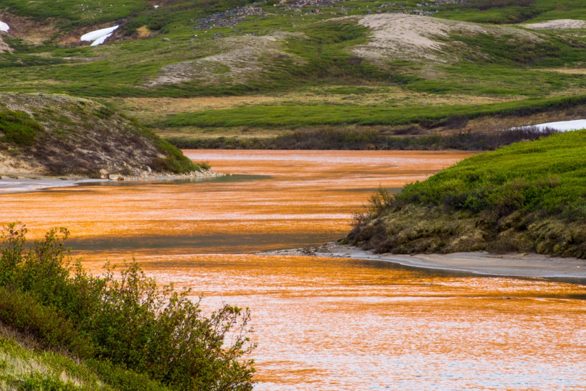
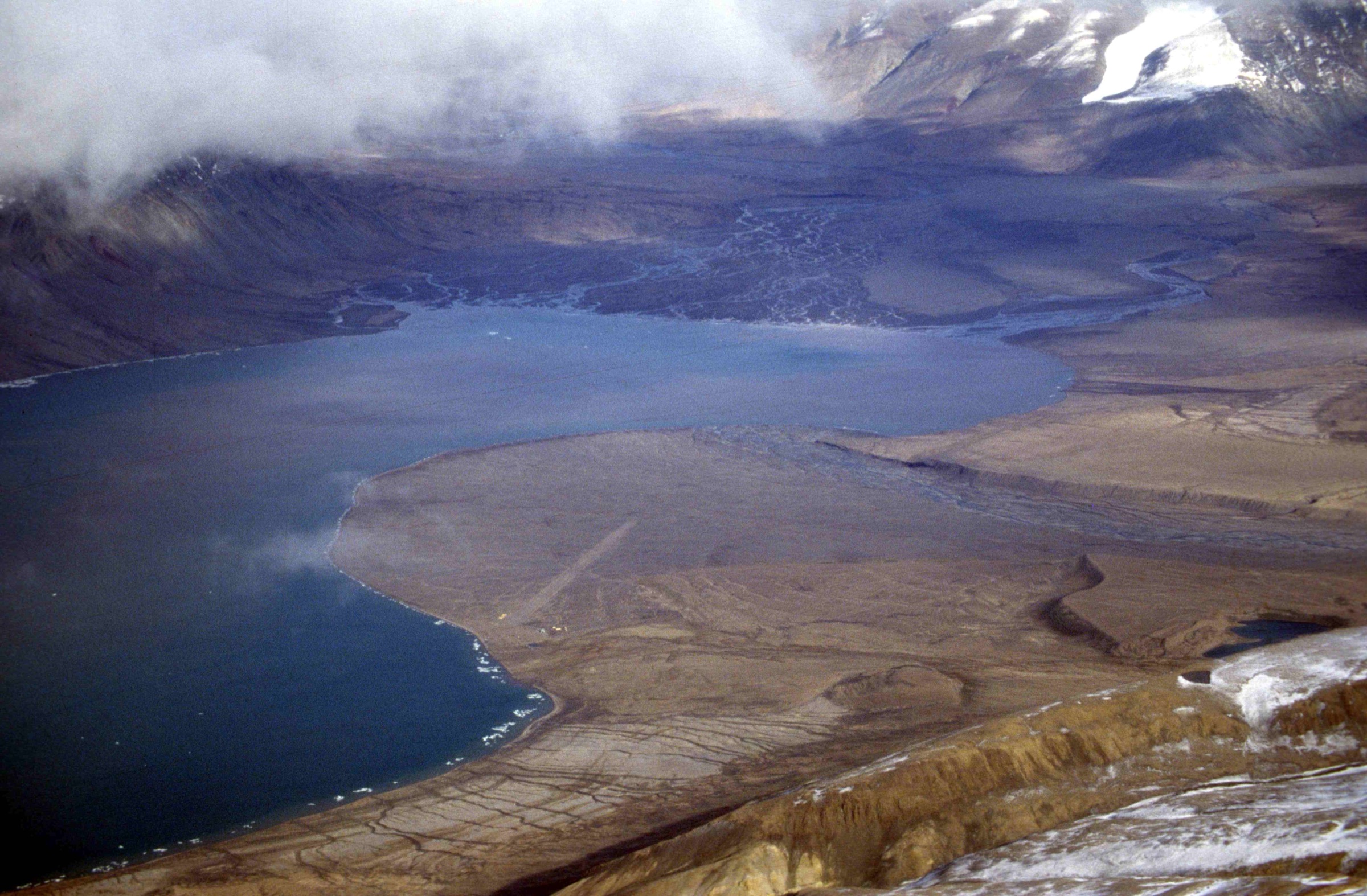
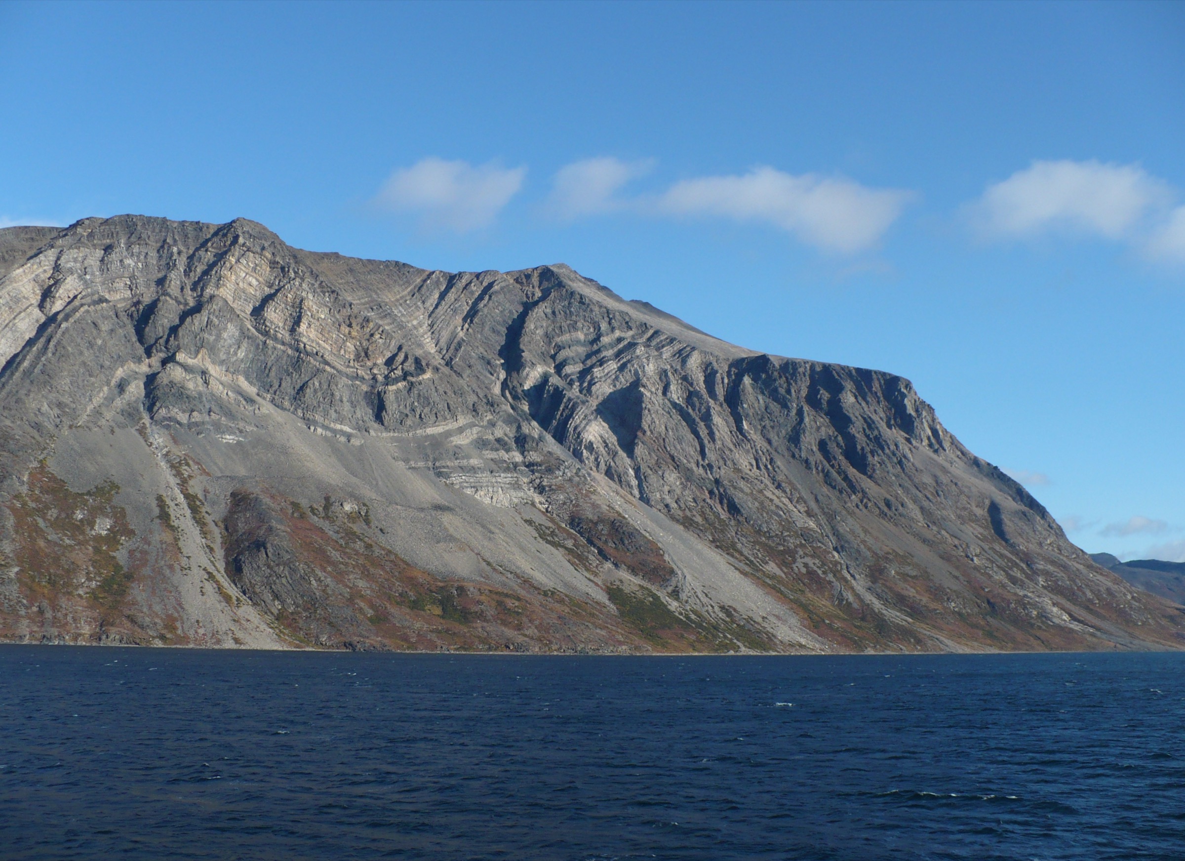
The Labrador Torngats form the southern and central Newfoundland-and-Labrador sector of Torngat Mountains National Park, an Arctic-Cordillera wilderness of 9,700 km² that covers the entire northern tip of the Quebec–Labrador peninsula. The range is built almost entirely of Archean and Paleoproterozoic gneisses — some among the oldest rocks on Earth — raised into a serrated alpine spine that climbs from raw Labrador-Sea coastline to summits over 1,500 m within only a handful of kilometres. Mount Caubvick / Mont D’Iberville (1,652 m), on the provincial boundary with Quebec at the head of the Koroc and Minaret valleys, is the high point of mainland Canada east of the Rockies. The Labrador side is defined by deeply incised fjords — Saglek, Nachvak, Komaktorvik, Seven Islands Bay — separated by knife-edge ridges, hanging cirques and tundra benches grazed by the Torngat Mountains caribou herd. Polar bears patrol every coastline; black bears roam inland; ringed seals, harp seals and minkes use the fjord mouths.
There is no road access to any part of the park. There is no public transport. There are no marked trails, no signs, no maintained huts and no shelters. The only practical way for a non-expedition visitor to walk on Labrador-side land within the park is through the Torngat Mountains Base Camp and Research Station at St. John’s Harbour in Saglek Bay, operated under the Nunatsiavut-co-managed model by the Nunatsiavut Group of Companies / Air Borealis. The Base Camp runs from roughly mid-July to late August (the 2026 season is advertised as mid-July to late August), is enclosed by an electric polar-bear fence, and offers a daily menu of guided day excursions reached by Zodiac, longliner fishing boat or AStar helicopter. Independent expedition parties exist but are rare and must arrange charter air access from Goose Bay, Nain or Kuujjuaq and full self-rescue capability.
Every visitor stepping outside the Base Camp perimeter must be accompanied by a trained Inuit polar-bear monitor — a “bear guard” — carrying a rifle and deterrents, under a Parks Canada policy enforced jointly with the Nunatsiavut Government. This is non-negotiable and shapes the entire concept of a day-hike in the Labrador Torngats: routes are not self-guided line-and-bearing exercises but interpretive walks in small groups, often combining a boat or short helicopter approach with a few hours on foot at the destination. Weather is the second constraint — fog, North Atlantic squalls and freezing rain can ground aircraft and boats for days, so itineraries are flexible rather than fixed.
The hiking character of the Labrador Torngats is therefore distinctive: short, low-mileage, high-value walks on trackless tundra, talus and beach gravel, almost always combined with archaeology, Inuit oral history and wildlife observation. True summit objectives in the alpine interior (Mount Caubvick, Razorback, Cirque Mountain) sit beyond the day-hike envelope unless an expedition flies a fly camp deep into the range. The day-hikes that visitors actually walk are coastal, valley-mouth and ridge-vista routes operated as Base Camp excursions — and a handful of those, by national and international recognition, are essential.
Selection rationale
This catalogue covers the Labrador-side Torngats in the broad sense, deliberately excluding the signature Saglek-Fjord and Nachvak-Fjord fjord-rim walks (covered in a sibling article) and the Koroc River / Kuururjuaq Quebec-side approaches to Mount Caubvick (also a sibling article). Within that scope, the realistic universe of guided day-hikes from the Torngat Mountains Base Camp is small and well-defined. The five selected represent the full character of what a fit walker can actually achieve on the Labrador side in a single day: the iconic Sallikuluk archaeological landscape; the official Parks Canada “Walk in the Footsteps of Inuit Ancestors” at PitukKik on the Nakvak Brook delta; the de facto house hike from the Base Camp gate to the Inukshuk ridge above St. John’s Harbour; the Kitjigattalik – Ramah Bay Chert Quarries National Historic Site; and the easy-scenic North Arm of Saglek Fjord with its waterfall, indigo lake and beach archaeology. A Mount Caubvick day-ascent has been deliberately excluded — from a Labrador-side perspective it functions as a Quebec-staged expedition rather than a day-hike, and is treated in the Koroc / Kuururjuaq sibling article.
Summary table
| # | Hike | Country | Route type | Distance | Gain | Max elevation | Difficulty |
|---|---|---|---|---|---|---|---|
| 1 | Sallikuluk (Rose Island) Archaeological Walk | Canada | Boat-assisted wander | ~3–6 km | <100 m | ~60 m | Easy (guided) |
| 2 | PitukKik (Nakvak Brook Delta) Commemorative Inuksuk Walk | Canada | Boat-assisted out-and-back | ~4–8 km | 100–250 m | ~150 m | Easy–moderate |
| 3 | St. John’s Harbour Inukshuk Ridge | Canada | Out-and-back from camp | ~3–6 km | 200–350 m | ~250–350 m | Moderate |
| 4 | Kitjigattalik — Ramah Bay Chert Quarries Walk | Canada | Boat/heli-assisted wander | ~3–6 km | <150 m | ~100 m | Easy–moderate |
| 5 | North Arm of Saglek Fjord — Waterfall and Indigo Lake | Canada | Boat-assisted out-and-back | ~3–5 km | 100–150 m | ~120 m | Easy (guided) |
No GPX track is publicly available for any Labrador-side Torngat day-hike — Parks Canada publishes no route geometry and the park has no marked trails. Distances and elevations are operator-derived estimates rather than measured statistics, and the on-the-ground walking line varies daily with the bear guard’s call.
1. Sallikuluk (Rose Island) Archaeological Walk
Snapshot
Itinerary
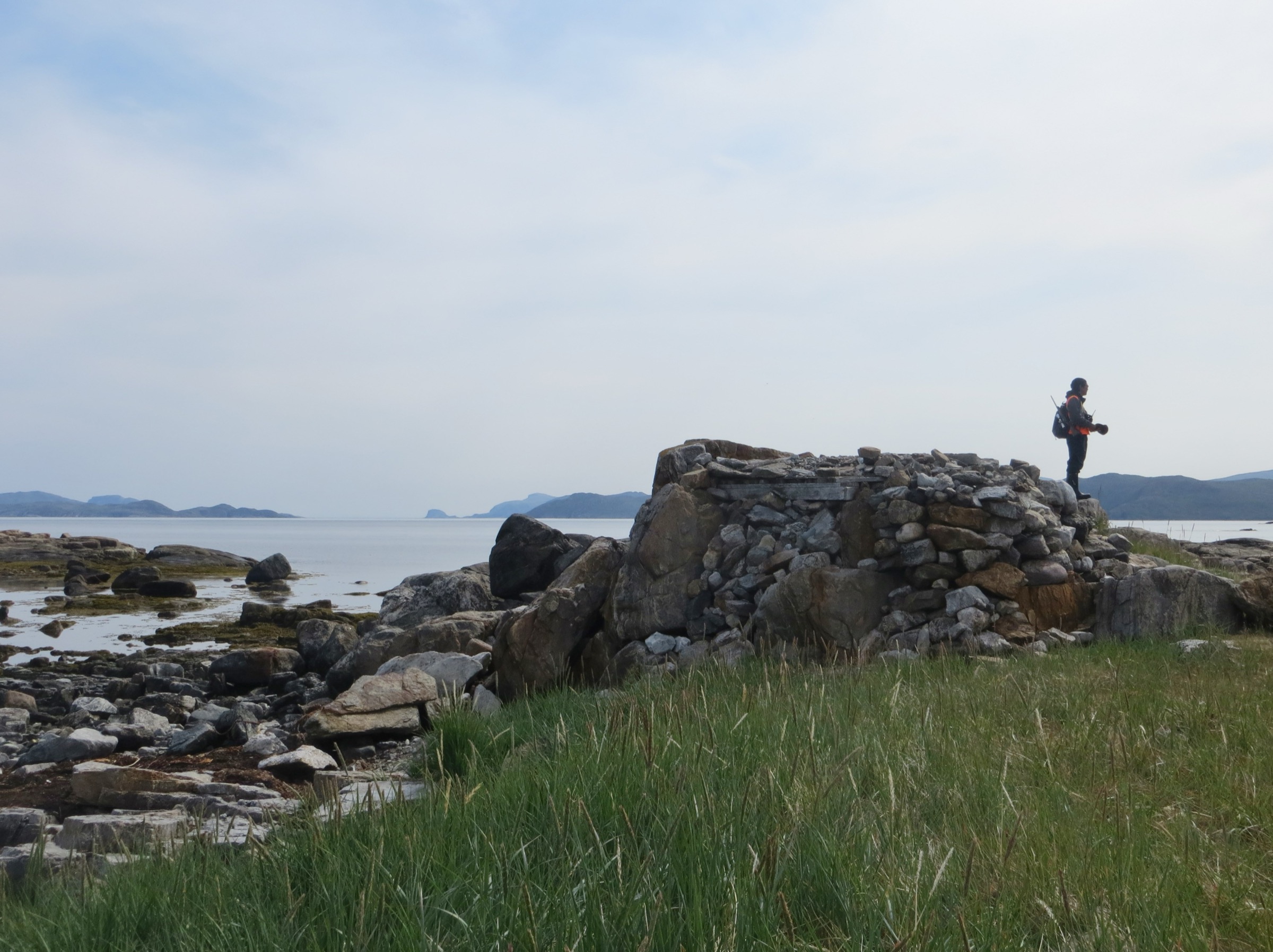
Sallikuluk — Rose Island in English — is a low, gneiss-and-tundra island in outer Saglek Bay, north of St. John’s Harbour and within the boundary of Torngat Mountains National Park. The excursion departs Base Camp by Zodiac or longliner, typically a 1.5–2 hour outbound transit through outer Saglek Bay past cliff-rim seabird colonies and seal haul-outs, with polar-bear watch maintained throughout. Landing is on a sheltered beach on the west or south side, depending on swell and bear presence.
Once ashore the group spreads slowly across a sequence of raised beach terraces. The first terrace holds the Thule-period sod-house village known archaeologically as Ikkusik, where rectangular depressions, slab-lined entrance passages and whale-bone roof supports are still visible on the ground surface. A second terrace contains Tuglavina with further Inuit winter housing. The walking is gentle — the island’s highest point is only around 60 m — but the surface alternates between firm crowberry tundra, sphagnum hollows and coarse beach gravel, and the group is held together at the bear guard’s pace.
Inland and upslope the route passes through the Site Q stratified deposit, where the first traces in northern Labrador of the Pre-Inuit Groswater culture were identified, and then across a tundra plateau scattered with over 600 traditional Inuit graves, cairns and burial mounds — the largest concentration of Inuit burials in Labrador. The 1995 reburial site, marked by a low stone enclosure, is the focal point of the visit; Inuit guides typically lead a moment of reflection here. Return walking is via the shoreline, watching for ringed seals and incoming weather, and the boat re-embarkation is timed to the tide. Total foot mileage is modest — most parties walk between three and six kilometres on the island — but the day is long because of boat logistics.
Why it is essential
Sallikuluk is the single most culturally important place in the Labrador Torngats and one of the deepest archaeological landscapes in Arctic Canada, with 5,000 years of continuous human use spanning the Maritime Archaic, Pre-Inuit (Groswater and Dorset), Thule and historic Inuit periods. It is also the closest the park comes to having a must-do walk: every Base Camp itinerary offers it, and it is the only excursion that combines accessible terrain, dense visible archaeology, and the chance to meet former Hebron and Nutak residents (or their descendants) on land their families used directly. As an interpretive experience it represents the Labrador Torngats in a way no summit can.
Equipment
- Sturdy waterproof hiking boots (rubber rands useful for beach work)
- Full waterproof shell jacket and trousers
- Warm insulating layer (fleece or light puffy) — air temperatures rarely exceed 12 °C
- Hat and gloves even in midsummer
- Sun protection and sunglasses (long Arctic days, low haze, snow on inland peaks)
- Personal water; high-energy snacks
- Camera with weatherproofing
- Dry-bag for valuables on the boat ride
- Provided / required: Inuit bear guard, group radio, marine PFDs on transit
Hazards and notes
The dominant hazard is polar bears — Sallikuluk is on an active polar-bear travel route and the bear guard sets the entire pace and footprint of the walk. The site is a designated burial ground under Nunatsiavut and Parks Canada protocols: visitors must not pick up artefacts, stand on sod-house walls, walk on cairns or graves, or remove stones. Photography of human-remains features is restricted and guided. Sea conditions in outer Saglek Bay can deteriorate quickly; trips are routinely cancelled or shortened on short notice. No permits beyond the Base Camp booking are needed by individual visitors, as the operator handles park registration. Dogs are not permitted.
GPX / KML links
| Source | URL | Format | Notes |
|---|---|---|---|
| None located | — | — | No GPX or KML published; Parks Canada and the Base Camp operator do not release route geometry. The walking line varies daily with bear presence. |
Sources
- Parks Canada — The Inuit Story / Sallikuluk
- Torngat Mountains Base Camp — Sallikuluk (Rose Island)
- Government of Newfoundland and Labrador — 2011 Rose Island reburial release
- Inside Newfoundland and Labrador Archaeology — Prehistory of Saglek Bay
- Parks Canada — Safety and guidelines (bear-guard requirement)
2. PitukKik (Nakvak Brook Delta) Commemorative Inuksuk Walk
Snapshot
Itinerary
Nakvak Brook (Inuttitut PitukKik) drains the inland Torngat plateau westward across the Quebec / Nunavik divide and discharges into the north shore of Saglek Fjord through a broad braided delta of grey cobble, willow flats and dwarf-birch tundra. The excursion runs as a full-day Base Camp trip: Zodiac or longliner across Saglek Fjord, beach landing on the delta’s southern margin, and a walk inland up the river benches.
The signature feature, and the official reason this is a Parks Canada “Walk in the Footsteps of Inuit Ancestors” experience, is the commemorative inuksuk erected on a prominent mound on the west side of the river in 2009 by the Torngat Mountains National Park Cooperative Management Board. The inuksuk marks the Saglek-end terminus of the historic Inuit travel route across the Labrador peninsula linking Nunatsiavut (Labrador-coast Inuit communities) to Nunavik (Ungava-Bay Inuit communities) — the same route that later became the Nakvak Brook Trek, a 68 km five-to-six-day expedition to the Quebec / Nunavik border.
For day visitors the walk goes only as far up the brook as conditions and the group’s pace allow — typically up the south or west bank past the delta proper, onto the first vegetated bench with a clear view back to the inuksuk, the open mouth of Saglek Fjord, and the Kaumajet-line peaks south. Inuit guides walk the route as a teaching trip, sharing knowledge about caribou crossings, char fishing in the lower brook, and the families who passed through here on foot and by dog team. Return is by the same line and by boat to Base Camp.
Why it is essential
PitukKik is the only Labrador-side Torngat day-walk built explicitly around a living Inuit travel route still used today (by snowmobile in winter) and around a commemorated landscape feature placed by the park’s Inuit co-management board. It is also the only day option that lets a visitor stand on a fjord-shore tundra bench, look directly into the mountain interior of the park, and walk the first kilometre of a traditional crossing to Nunavik — without the technical, polar-bear and logistical demands of the full Nakvak Brook trek. Parks Canada’s own “Walk in the Footsteps of Inuit Ancestors” experience page is built around this single excursion.
Equipment
- Sturdy waterproof boots with good ankle support — river-cobble and willow underfoot
- Gaiters (river bank vegetation and possible small braided-channel crossings)
- Full waterproof shell layer top and bottom
- Warm midlayer; hat and gloves
- Sun and wind protection
- Personal water and food
- Trekking poles useful but not required
- Camera and binoculars
- Provided / required: Inuit bear guard with rifle; marine PFDs on boat
Hazards and notes
Polar bears use the delta and lower brook actively in summer to ambush char; the bear guard’s authority is absolute, and the walking line may be diverted at short notice. Black bears are also present inland. River channels can change between years; crossings are at the guide’s discretion, never independently. Weather on the fjord can deteriorate within minutes and cancel the return boat — operators carry contingency for an overnight at the Base Camp’s spare-tent capacity. The inuksuk itself is a culturally and legally protected feature: do not climb on it, modify it or place stones. Carry-out is required for all trash. Parks Canada registration is handled by the operator.
GPX / KML links
| Source | URL | Format | Notes |
|---|---|---|---|
| None located | — | — | No GPX or KML published for the inuksuk walk or for the first kilometres of the Nakvak Brook Trek. Parks Canada publishes the trek as a written narrative only. |
Sources
- Parks Canada — Walk in the Footsteps of Inuit Ancestors
- Parks Canada — Nakvak Brook Trek
- Newfoundland and Labrador Tourism — Pitukkik (Nakvak Brook)
- Torngat Mountains Base Camp — excursions overview
- Parks Canada — Two paths, one destination (Inuit co-management)
3. St. John’s Harbour Inukshuk Ridge from the Base Camp

Snapshot
Itinerary
This is the Base Camp’s standing house hike — the route operators run when fog grounds the helicopter and seas keep the boats in. The walking starts from inside the camp’s polar-bear-fenced perimeter on the flat shingle of St. John’s Harbour at the head of Saglek Bay. After a brief briefing the group exits the gate behind the bear guard and crosses willow flats and a low alder zone onto open tundra rising west and north toward the ridge that forms the harbour’s amphitheatre.
The route is route-found rather than trailed; bear guards and Base Camp guides typically pick a line that climbs a vegetated rib past a small tarn, swings northward across crowberry and lichen tundra, and gains the ridge crest at the prominent inukshuk visible from the camp. Operators describe the favourite vistas as “from the hilltop inukshuk and Torr Bay,” and parties that want more often continue along the ridge crest for an out-and-back view down into adjacent valleys. The crest itself is broken into shattered Archean gneiss and scattered erratics, with continuous views over Saglek Fjord, Sallikuluk to the east, and the white walls of the inland Selamiut Range. Descent is by the ascent line. Some itineraries instead descend obliquely toward Torr Bay and arrange a Zodiac pickup, turning the route into a half-traverse rather than a strict out-and-back; this depends on sea state.
Why it is essential
It is the only meaningful Torngat day-hike that does not require a boat or helicopter approach: every visitor to Base Camp can do some version of it, and it is the route most likely to actually happen on weather days. The Inukshuk ridge gives the single most efficient overview of the central Labrador-side park — Saglek Fjord, the outer Saglek archipelago, Sallikuluk, the Kaumajet headlands south and the inland Selamiut peaks — and is the way most visitors first see Torngat tundra and rock in detail. For a regional catalogue intended for fit walkers, it is the closest thing the Labrador Torngats have to a trailhead hike.
Equipment
- Sturdy hiking boots with good traction on loose rock
- Gaiters helpful for wet tundra
- Full waterproof shell layer
- Insulating midlayer (and a spare warm layer in the pack for stops on the ridge)
- Hat, gloves, buff
- Trekking poles recommended for tundra hummocks and scree descent
- Sun protection
- Water and food (no reliable water on the ridge)
- Headlamp (long July days, but useful in fog)
- Provided / required: Inuit bear guard with rifle and deterrents
Hazards and notes
Polar bears do come into the immediate hinterland of Saglek Bay; the bear guard’s authority is absolute and the route is sometimes shortened or relocated. Black bears occur inland. Tundra footing is uneven and ankle-twisting; loose Archean gneiss on the ridge crest can slide. Sudden fog is the main weather hazard — visibility can drop to under 50 m within ten minutes, and parties stay close together. The Base Camp perimeter is electrified; do not leave or re-enter outside guided trips. No permits beyond the Base Camp booking are required.
GPX / KML links
| Source | URL | Format | Notes |
|---|---|---|---|
| None located | — | — | The ridge is unsigned and untracked; the walking line varies daily. A future GPX would have to be constructed from NRCan 1:50,000 sheet 14L/12 (Saglek Fjord) and Base Camp coordinates. |
Sources
- Parks Canada — Activities and experiences
- Parks Canada — Hiking
- Parks Canada — Safety and guidelines
- Torngat Mountains Base Camp — Excursions overview
- Torngat Mountains Base Camp — Heli-hiking
4. Kitjigattalik — Ramah Bay Chert Quarries Walk
Snapshot
Itinerary
Ramah Bay opens north of Nachvak Fjord, hemmed by pale Ramah-Group quartzites and a wide black-sand-and-pebble beach. The excursion runs from Base Camp by longliner (about four hours each way), Zodiac (about two hours but weather-sensitive), or AStar helicopter (about 30 minutes, advance booking only). Landing is usually on the inner east shore near the abandoned Moravian mission ruins; from there the walk turns inland toward the foot of the Kitjigattalik quarry outcrops on a low scree-and-talus bench above the beach.
The walking itself is undramatic — a few kilometres of beach traverse, a short climb onto the talus, a slow exploration of the quarry faces, and the same line back — but the content is exceptional. Ramah chert is a translucent, silica-rich tool stone unique to this small belt of outcrops. It was actively quarried from roughly 5,000 to 600 years ago by Maritime Archaic, Pre-Inuit, Dorset and Thule cultures, and is the most widely traded tool stone in the pre-contact eastern Canadian and northeastern American archaeological record — chert flakes from Kitjigattalik are found from Maryland to Ungava to inland Quebec. The quarry faces still carry visible flake scars, debitage scatters and shaped preforms. Kitjigattalik was designated a National Historic Site of Canada in 2016. It is not a UNESCO World Heritage Site; references to “UNESCO consideration” in popular media reflect ongoing discussion only.
After exploring the quarries and the mission ruins, the group returns to the beach, often with a stop to look for ringed seals or polar bears at the bay mouth, and re-embarks for the long transit back to Base Camp.
Why it is essential
Ramah Bay is one of the most archaeologically important single sites in eastern North America and the cultural-historical anchor of the central Labrador Torngats. As a day-walk it is short and gentle, but it is the only Labrador-side excursion that combines a National Historic Site, a documented 5,000-year industrial-extraction landscape, intact Moravian mission ruins and dramatic Ramah-Group quartzite scenery in one trip. Inuit guides routinely describe it as the most powerful cultural day available beyond Sallikuluk. The bay is also a primary polar-bear and char habitat, making wildlife viewing on the boat transit consistently strong.
Equipment
- Sturdy waterproof boots (beach, scree, wet sand)
- Full waterproof shell jacket and trousers
- Warm midlayer; insulated layer for the long boat transit
- Hat, gloves, buff
- Sun and wind protection
- Personal water and substantial food (long day)
- Camera; binoculars useful for the boat leg
- Dry-bag and marine PFD for the boat leg
- Provided / required: Inuit bear guard with rifle
Hazards and notes
The principal hazards are marine (open-water transit in conditions that change quickly) and polar bears (Ramah Bay is high-density bear habitat in summer and the guide may shorten or relocate the walk). Quarry-face scree is loose; do not undermine working faces or remove chert nodules. Removal of any chert, artefact or stone is prohibited under the National Historic Site designation and park regulations; the rule is strictly enforced. The Moravian mission ruins are fragile and not to be entered. Trip frequency is low and on-request — visitors should ask at the time of booking. No additional permits are needed; Parks Canada registration is handled by the operator.
GPX / KML links
| Source | URL | Format | Notes |
|---|---|---|---|
| None located | — | — | No GPX or KML published. Parks Canada’s archived “Ramah Bay to Saglek Bay” brochure describes a multi-day backpacking route but no day-walk track. |
Sources
- Parks Canada Directory of Federal Heritage Designations — Kitjigattalik
- Government of Canada news release (2016 designation)
- Torngat Mountains Base Camp — Ramah excursion
- Canada C3 — Ramah Bay
- Parks Canada — archived Ramah Bay to Saglek Bay hiking-route brochure
5. North Arm of Saglek Fjord — Waterfall, Indigo Lake and Archaeological Beach Walk
Snapshot
Itinerary
North Arm is the inner northern branch of Saglek Fjord, walled by approximately 900 m of vertical Archean gneiss. The day starts with a boat transit through the main fjord — passing icebergs in early-season years, seabird ledges and seal haul-outs — and ends with a Zodiac landing on a sheltered sand-and-gravel beach at the head of the arm. From the landing the walking turns inland, crossing dune-edge tundra and a low willow zone onto an open valley bench.
The signature destinations are a small waterfall dropping off the valley’s lip and a high tundra lake (operators describe its water as “indigo blue”) fed by snowmelt from the surrounding peaks. The walk follows the brook from beach to lake at an easy gradient, with the option to continue a short distance further onto the valley bench for views back down North Arm. The corridor is heavily documented archaeologically: visitors pass scattered stone tent rings, food caches, hunting blinds built into boulder fields, and graves — all features of Inuit caribou-hunting use of the upper fjord. The bear guard and Inuit guide interpret each feature on the way through.
Many parties combine the walk with a beach picnic — bannock cooked on the spot, char if a fishing boat is present — and a swim in the cold lake for those willing. Return is by the same line and by boat to Base Camp.
Why it is essential
North Arm is the standard easy-scenic Saglek-Fjord day excursion offered alongside Sallikuluk and the Inukshuk Walk in every Base Camp itinerary. It combines the only sandy-beach landing inside Saglek Fjord with a short, family-friendly walk to a waterfall and a high tundra lake, all set under genuine 900 m fjord walls and embedded in a dense archaeological landscape of Inuit hunting infrastructure. It is the route that makes the Labrador Torngats accessible to walkers who cannot manage the rougher tundra of the Inukshuk ridge or the longer day at Ramah Bay.
Equipment
- Sturdy boots (some shoreline mud and gravel)
- Full waterproof shell
- Warm midlayer; insulating layer for the boat
- Hat and gloves
- Sun protection
- Personal water and food
- Camera; binoculars
- Swimwear and a towel for those tempted by the lake (water is extremely cold)
- Dry-bag and marine PFD for the boat leg
- Provided / required: Inuit bear guard
Hazards and notes
Polar bears regularly use the head of North Arm and the bear guard’s authority is absolute. The lake water is just above freezing and short immersion is a real cold-shock risk — operators allow swims but supervise them strictly. The waterfall pool is slippery; do not approach the lip. All archaeological features — tent rings, caches, blinds — are protected under the park’s regulations and Nunatsiavut cultural-heritage protocols: no entry into structures, no displacement of stones, no removal of artefacts. Sudden katabatic wind off the inland icecap and out the arm can render the return boat trip rough. No additional permits are required.
GPX / KML links
| Source | URL | Format | Notes |
|---|---|---|---|
| None located | — | — | No GPX or KML published. A future track could be built from NRCan 1:50,000 topographic data for Saglek Fjord (sheet 14L), with the brook centreline as the natural route. |
Sources
- Torngat Mountains Base Camp — North Arm excursion
- Torngat Mountains Base Camp — Excursions overview
- Canada C3 — North Arm Fiord
- Parks Canada — Activities and experiences
- Newfoundland and Labrador Tourism — Torngat Mountains
External links
| Source | URL |
|---|---|
| Parks Canada — Torngat Mountains National Park | parks.canada.ca |
| Parks Canada — Plan your visit | parks.canada.ca |
| Parks Canada — Getting here | parks.canada.ca |
| Parks Canada — Activities and experiences | parks.canada.ca |
| Parks Canada — Hiking | parks.canada.ca |
| Parks Canada — Safety and guidelines | parks.canada.ca |
| Parks Canada — Walk in the Footsteps of Inuit Ancestors | parks.canada.ca |
| Parks Canada — The Inuit Story | parks.canada.ca |
| Parks Canada — Kitjigattalik (Ramah Chert Quarries) NHSC | pc.gc.ca |
| Torngat Mountains Base Camp — operator | thetorngats.com |
| Torngat Mountains Base Camp — excursions | thetorngats.com |
| Newfoundland and Labrador Tourism — Torngat Mountains | newfoundlandlabrador.com |
| Wikimedia Commons — Torngat Mountains National Park | commons.wikimedia.org |