Regional overview
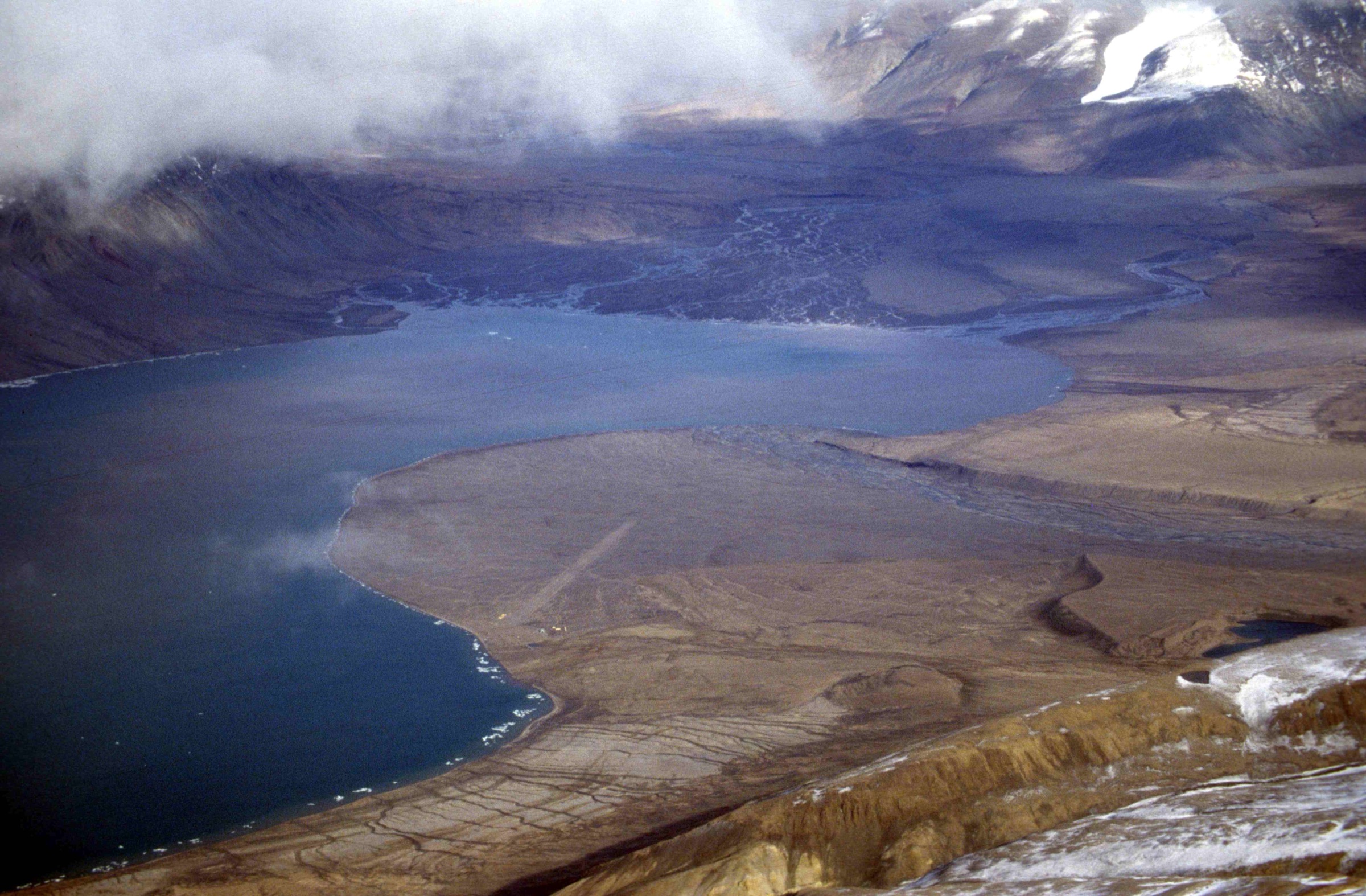
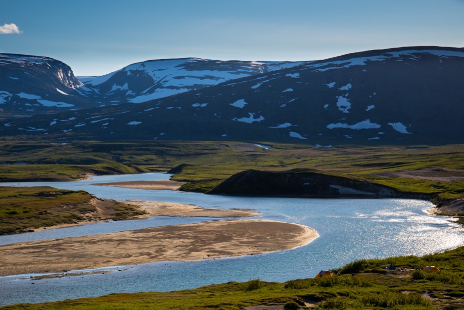
Parc national Kuururjuaq covers roughly 4,461 km² of the Quebec/Nunavik side of the Torngat Mountains, stretching from the head of Ungava Bay near the Inuit village of Kangiqsualujjuaq inland and east to Mont D’Iberville (1,646 m on Quebec maps; 1,652 m as Mount Caubvick on Newfoundland and Labrador maps), the highest summit in mainland Canada east of the Rockies. The park was created in May 2009 and is co-managed by Nunavik Parks under the Kativik Regional Government, with operational support from the Société Makivik and the community of Kangiqsualujjuaq. The Inuktitut name Kuururjuaq — “the very large river” — refers to the Koroc River (Rivière Koroc), which rises in glacier cirques on the west flank of the Selamiut Range and runs roughly 160–166 km to George River bay on the Ungava coast. The provincial border with Newfoundland and Labrador, and the boundary with Parks Canada’s Torngat Mountains National Park, follows the summit ridge of the Torngats, so the Quebec side approaches the great peaks of the range — D’Iberville, Cirque, Torngarsoak — from the west, up the Koroc.
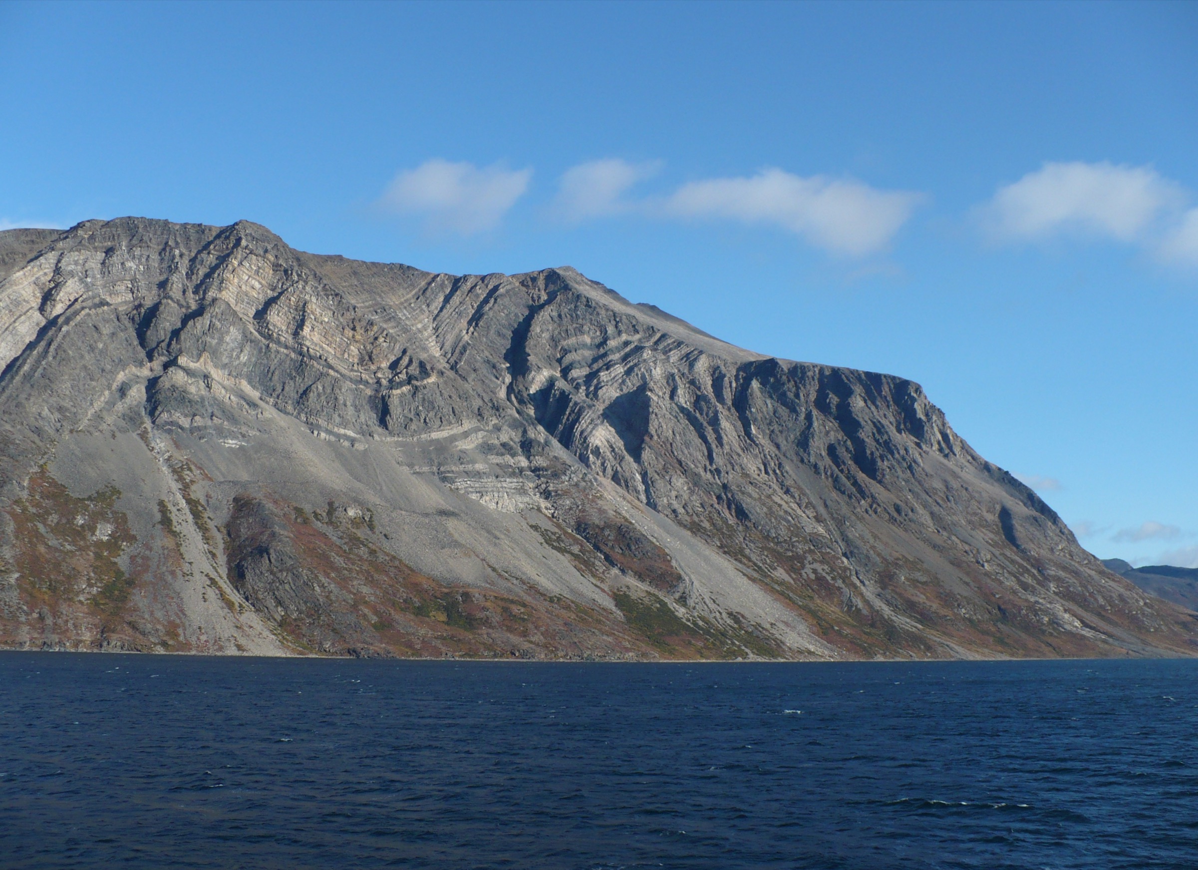
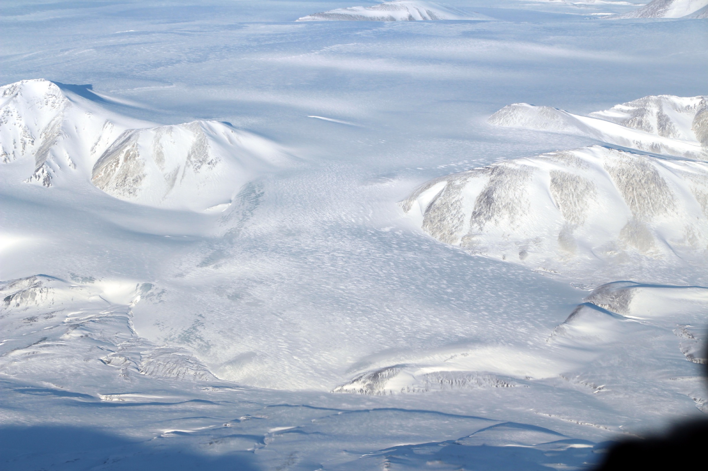
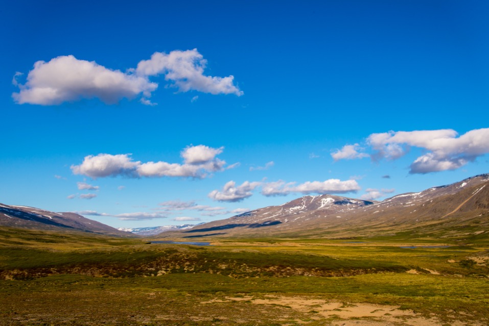
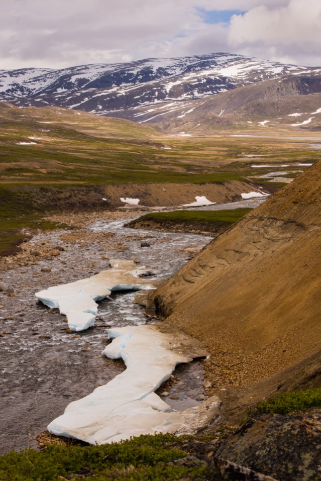
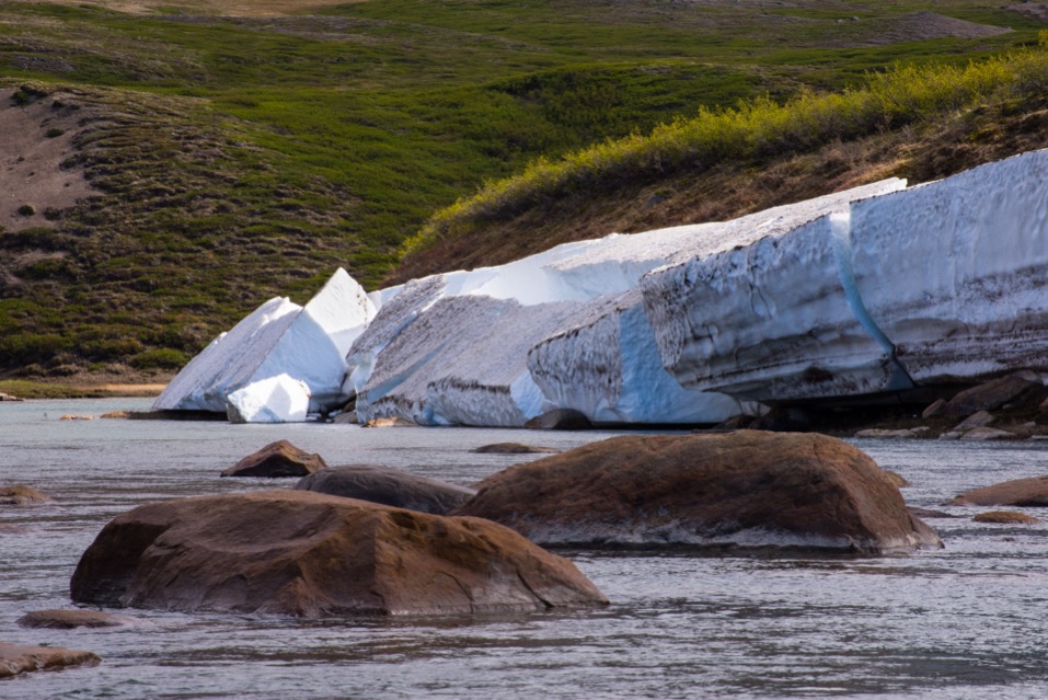
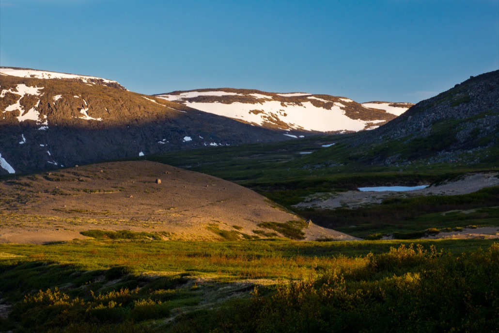
Geologically the park lies at the eastern edge of the Canadian Shield, where Archean and Paleoproterozoic gneisses of the Nain and Rae cratons were welded together along the Torngat Orogen roughly 1.8 billion years ago. The Selamiut Range, which holds the highest peaks, is built largely of rust-coloured, banded gneiss and anorthosite that weather to knife-edged ridges and deep glacial cirques. Quaternary glaciation carved the Koroc valley into a broad U-shaped trough with hanging tributaries; small remnant cirque glaciers — the last in eastern North America — still cling to the north and east faces of D’Iberville and Cirque Mountain. The lower Koroc runs through a sheltered microclimate where stands of black spruce and tamarack reach unusually far north, before the river breaks out onto barren tundra and the salt flats of the Ungava coast.
There are no roads. All access is by fixed-wing charter — typically Twin Otter operated by Air Inuit — from Kuujjuaq or Kangiqsualujjuaq, with scheduled passenger flights to those communities from Montreal (Air Inuit / Canadian North). Two natural gravel airstrips are mowed inside the park: one in the Koroc River valley at the foot of the Iberville sector (roughly 200 km from Kangiqsualujjuaq, around 25–45 minutes by Twin Otter depending on aircraft and load) and a second near Korluktok Falls on the mid-Koroc, served by Camp Qurlutuarjuq. Nunavik Parks markets all higher-mountain itineraries — including any ascent of Mont D’Iberville — as guided packages with Inuit guides and a mountaineering guide on the technical sections; independent expeditions to the summit are extremely rare and must register with both Nunavik Parks and Parks Canada (Torngat Mountains National Park) because the routes cross the inter-park boundary. The functional season is mid-July to late August; snow patches linger in the cirques year-round, daytime highs at base camp are typically 5–15 °C with frequent fog and high winds, and storms can pin parties down for days.
Hazards are serious but different from the Labrador coast. Polar bears occur only on the Ungava coastal fringe and at the very mouth of the Koroc, so they are a much smaller concern at the Iberville sector than at Saglek or Nachvak, but black bears and wolves are present throughout the valley and caribou of the George River and Torngat Mountain herds move through in summer. Stream crossings are the most common objective hazard — the Koroc and its tributaries run cold and fast all season, and several of the side valleys cannot be safely forded after rain. Weather windows for the summit are tight, and the upper Koroc and Minaret ridges of D’Iberville are exposed scrambling/low-grade rock terrain (graded 5.6 on the Koroc Ridge crux; 5.2 on the Minaret Ridge) that demands roped protection and is well beyond an unguided walker’s competence. Day-hike opportunities therefore fall into two clusters: short walks from Camp Qurlutuarjuq on the mid-Koroc (river-canyon and waterfall walks) and “summit-block” day excursions from the Iberville base camp under D’Iberville — the latter run as part of guided multi-day packages but each individual day, including the famous summit push from high camp, is structured and travelled as a single day.
Selection rationale
The five hikes below span the entire Quebec-side gradient from the Ungava coast inland to the highest summit in mainland eastern Canada, while staying inside the project’s definition of a day hike (a single-day excursion, even where the surrounding logistics are multi-day). Sibling files cover the Labrador-side Torngats and the Saglek/Nachvak fjords, so coastal Labrador classics (Mount Razorback, Pyramid Mountain, North Arm) are deliberately excluded here.
The selection balances one iconic summit — the Mont D’Iberville / Mount Caubvick ascent from the Koroc-side high camp via the Koroc Ridge, structured as a single big push, included despite its technical crux because it is the defining objective of the region and Nunavik Parks itself markets it as a one-day summit day — with one classic valley/glacier approach (the Iberville Valley walk from the Koroc airstrip to base camp), one ridge/acclimatisation walk (Bear’s Ridge, the Nunavik Parks-recommended warm-up above base camp), one waterfall/canyon walk (Korluktok Falls from Camp Qurlutuarjuq, the most accessible “named feature” hike in the park) and one river-canyon viewpoint walk (the Qurlutuarjuq camp riverside loop along the Koroc gneiss walls, the only short day route inside the park that is regularly walked unguided). Together these five represent the highest summit, the deepest valley, the best ridge viewpoint, the signature waterfall, and the river-canyon walk that anchors most non-mountaineering visits.
Summary table
| # | Hike | Country | Route type | Distance | Gain | Max elevation | Difficulty |
|---|---|---|---|---|---|---|---|
| 1 | Mont D’Iberville (Kauvvik) summit day — Koroc Ridge | Canada | Out-and-back from high camp | ≈10–14 km | ≈900–1,100 m | 1,652 m | Strenuous; technical scramble |
| 2 | Iberville Valley approach — Koroc airstrip to base camp | Canada | Out-and-back | ≈12 km one-way / ≈24 km return | ≈400–500 m | ≈700 m est. | Strenuous off-trail tundra |
| 3 | Bear’s Ridge (Crête de l’Ours) acclimatisation | Canada | Out-and-back ridge | ≈6–8 km return | ≈400–500 m est. | ≈1,100 m est. | Moderate–strenuous |
| 4 | Korluktok Falls from Camp Qurlutuarjuq | Canada | Out-and-back / short loop | ≈3–6 km return | <150 m est. | ≈150 m est. | Easy–moderate |
| 5 | Qurlutuarjuq canyon and Koroc River viewpoints | Canada | Loop / out-and-back | ≈5 km | <100 m est. | ≈120 m est. | Easy–moderate |
All distance and gain figures other than the Koroc airstrip-to-base-camp leg are estimated from descriptive sources and topographic context; Nunavik Parks does not publish per-day route statistics.
1. Mont D’Iberville (Kauvvik) summit day — Koroc Ridge
Snapshot
Itinerary
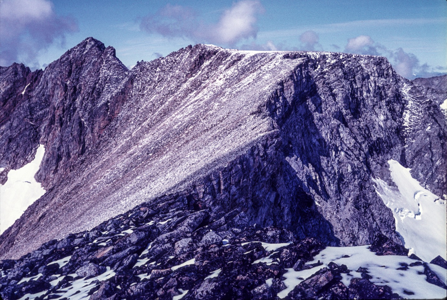
The summit day starts from a high camp pitched on glacial outwash and moraine below the west face of Mont D’Iberville, reached the previous day from base camp at the foot of the mountain. The Koroc Ridge route — the standard line from the Quebec side — leaves camp before first light during the operating window and climbs first on talus and snow patches towards a small tarn just north of camp. From the tarn the route scrambles up rock to the right (north) of a prominent snow couloir, then turns right at the top onto a broad talus shoulder that forms the lower start of the Koroc Ridge proper.
The ridge climbs in alternating sections of class 3–4 scrambling on rust-coloured gneiss with intermittent narrow sections and gendarmes. Roughly half-way up the ridge the route passes a small emergency shelter erected by the park authorities; above the shelter the ridge narrows. A short class-3 descent into a notch leads to the crux, a low-fifth-class step (consistently graded 5.6 in mountaineering literature) where the guide places rope protection. Above the crux the ridge eases onto a broad rocky plateau locally known as “the football field” at approximately 1,554 m, from which the view opens east into Labrador and out over Rama Bay and the Labrador Sea. The final block to the summit cairn at 1,646/1,652 m involves a short walk and easy scramble across loose blocks.
Descent retraces the line of ascent, with the crux step typically rappelled or down-climbed on rope. Most guided parties allow 10–14 hours on the move and budget the following day as a contingency to allow a second weather window if the first fails.
Why it is essential
Mont D’Iberville / Mount Caubvick is the highest summit in Quebec, the highest in Newfoundland and Labrador, the highest in mainland Canada east of the Rockies, and the high point of the Torngat Mountains. From the Quebec side it is the defining objective of Parc national Kuururjuaq — Nunavik Parks names two of its three flagship summer packages after it (“Conquer Kauvvik (Iberville) Summit” and “Discover the Torngats”) — and the Koroc Ridge is the standard line from the Quebec/Koroc base camp. Although the surrounding trip is multi-day, the summit attempt itself is structured as a single big day from high camp and is the moment around which all other Kuururjuaq mountaineering itineraries are designed. No honest catalogue of the Quebec Torngats can omit it.
Equipment
- Sturdy mountain boots
- Climbing harness, helmet, slings, locking carabiners (provided by guide service)
- Rope (carried and managed by guide)
- Microspikes for snow patches in the couloir and on the upper plateau
- Trekking poles for the lower talus
- Full waterproofs, warm insulating layer, hat and gloves (summit temperatures often near freezing even in mid-July)
- Headtorch for the pre-dawn start
- Sun protection (snow glare on the upper plateau)
- Bear-aware food storage at base and high camps
- Permit and registration: mandatory with Nunavik Parks (Kuururjuaq) and Parks Canada (Torngat Mountains NP) because the summit ridge crosses the inter-park boundary
- Guided ascent: required in practice by Nunavik Parks’ programmed itineraries
Hazards and notes
The Koroc Ridge crux is graded 5.6 and is genuinely technical; the alternate Minaret Ridge from the Labrador side is graded 5.2 but more exposed and not the standard Quebec-side line. The summit itself sits roughly 10 m northeast of the Quebec border and is technically inside Labrador; all standard approaches from the Koroc cross into Parks Canada jurisdiction near the top. Weather is the dominant variable — storms can pin parties at high camp for days, which is why the standard 6-day packages build in contingency days. Two climbers died in August 2003 descending the mountain after a roped fall; the incident is a recurring case study in Torngat mountaineering reports and underlines the seriousness of the crux step. Cirque glaciers around the upper mountain are small and shrinking, but rockfall from melting snow is a real hazard in the upper couloir. Polar bear risk in the Iberville sector is low but not zero; black bear and wolf precautions are standard. No mobile signal; satellite communications carried by guide.
GPX / KML links
| Source | URL | Format | Notes |
|---|---|---|---|
| OpenStreetMap node for Mount Caubvick | openstreetmap.org | OSM node | ODbL; coordinates reusable, no route line |
| Wikidata entity for Mount Caubvick | wikidata.org | Wikidata | CC0; summit coordinates and elevation reusable |
No public GPX track for the Koroc Ridge summit route has been located on Wikiloc, Komoot, AllTrails or any official source. Nunavik Parks does not publish route geometry. A working line would have to be drafted manually from mountaineering trip-report descriptions cross-checked against Natural Resources Canada 1:50,000 topographic sheet 14M/01 (Mount Caubvick) and 24P/04 on the Quebec side.
Sources
- Nunavik Parks — Conquer Kauvvik (Iberville) Summit (6-day)
- Nunavik Parks — Discover the Torngats (6-day trek)
- Nunavik Parks — Parc national Kuururjuaq
- Wikipedia — Mount Caubvick
- SummitPost — Mount Caubvick
- Andrew Lavigne — Tragedy in the Torngats / Climbing guide
- Steven Song — Mount Caubvick (Mont D’Iberville)
2. Iberville Valley approach — Koroc airstrip to base camp
Snapshot
Itinerary
The route leaves the mowed gravel strip on the south bank of the upper Koroc River and works east-southeast up the Iberville Valley, which enters the Koroc from the north under the west face of Mont D’Iberville. From the airstrip, the route first crosses about 3 km of broad valley floor — willow, dwarf birch and tundra hummocks, with the Koroc itself running glacial-grey to the south — to reach the mouth of the Iberville Valley. The Iberville tributary is then followed upstream on its east bank, staying on the east side of the watercourse throughout, for roughly 12 km. The valley is described in mountaineering literature as offering “some of the best views of Mount Caubvick and the glacier that bears its name”, with the small remnant cirque glaciers on D’Iberville’s north and east aspect visible as the head of the valley opens out.
Underfoot, the route is unmarked. Walking surface alternates between tundra mat, dry talus, glacial moraine and willow patches, with several small side streams that are routine in fair weather and serious after rain. Base camp is pitched on glacial outwash below the west cirque of Mont D’Iberville, in a position from which the next day’s high camp move (a further short carry onto moraine below the west face) and the subsequent summit attempt are staged.
For a fit party day-tripping from the airstrip, the round trip is roughly 24 km with around 800–1,000 m of total ascent and descent, plus river crossings. In practice the route is almost always walked one-way as the load-carrying first day of the Nunavik Parks 6-day Kauvvik itinerary, then reversed as the load-carrying final day after summit and contingency days.
Why it is essential
This is the access walk that defines the Quebec side of the Torngats. Every mountaineering itinerary on Mont D’Iberville from the Koroc starts here, and the Iberville Valley itself offers the best non-technical views of the west face of the mountain and of the small Iberville-area cirque glaciers — the last surviving glaciers in eastern North America. The route also samples the full vertical gradient of the upper Koroc head: from the willow flats of the river plain through dry tundra moraine to the bare gneiss and snow patches of the cirque floor. For a visitor on a Nunavik Parks package who does not attempt the summit, the walk in and out of base camp constitutes the entire on-foot experience of the Iberville sector and is the closest a non-mountaineer can come to the highest peak in eastern Canada.
Equipment
- Sturdy boots (wet ground, sharp talus)
- Trekking poles strongly recommended for river fords
- Crossing footwear (sandals or dedicated wet shoes) for cold stream crossings
- Full waterproofs and a warm insulating layer
- Map and GPS — no marked trail; Natural Resources Canada 1:50,000 sheet recommended
- Headtorch
- Bear-aware food storage (black bear, wolf)
- Permit and registration with Nunavik Parks (Kangiqsualujjuaq office); guided in practice as part of programmed itineraries
- Satellite communicator
Hazards and notes
Cold, fast stream crossings are the dominant objective hazard; the Iberville tributary and its side streams are fed by snowmelt year-round. There is no marked or maintained trail, and navigation off-line in low cloud is non-trivial. Wind and exposure increase rapidly with elevation as the valley narrows under D’Iberville. Black bear and wolf are present; polar bears are very unlikely this far inland but not impossible. Charter aircraft schedules can shift by days for weather, which constrains any day-return plan that depends on a fixed extraction. Independent travel is permitted but requires registration with Nunavik Parks; Nunavik Parks strongly recommends guided travel and arranges the standard itineraries through Aventures Inuit.
GPX / KML links
| Source | URL | Format | Notes |
|---|---|---|---|
| OpenStreetMap (Koroc River and Kuururjuaq park boundary) | openstreetmap.org | OSM | ODbL; river and boundary geometry reusable; no marked trail |
| Parks Canada — Koroc / Palmer loop route description (PDF) | parks.canada.ca | PDF narrative | Open Government Licence with attribution; no GPX |
No public GPX track has been located for the dedicated Iberville Valley spur from the Koroc airstrip. The Parks Canada PDF cited above covers the broader Koroc–Palmer loop but treats this section as a side branch rather than as a logged track.
Sources
- Nunavik Parks — Conquer Kauvvik (Iberville) Summit
- Parks Canada — Koroc River / Palmer River Loop
- Papa Bear — Torngats Information Page (Iberville Valley)
- Wikipedia — Kuururjuaq National Park
3. Bear’s Ridge (Crête de l’Ours) acclimatisation walk
Snapshot
Itinerary
Bear’s Ridge — Crête de l’Ours in the French-language Nunavik Parks materials — is the acclimatisation outing offered on the second full day of the Nunavik Parks Kauvvik (Iberville) summit package, after the load-carry from the Koroc airstrip and before the move to high camp. The exact line is not published in detail by Nunavik Parks, but the experience description consistently positions it as a half-day to full-day walk above base camp on a subsidiary ridge from which the upper Iberville Valley, the west face of Mont D’Iberville, and across to the Selamiut summits all open up.
From base camp the route leaves the glacial outwash and climbs west or northwest onto the lower flanks of the ridge dividing the Iberville Valley from the next side valley to the north. Initial ground is dry tundra and scree; higher up the ridge the route includes one short scrambling step on bedrock where the guide places a rope as practice for the upper-mountain crux on summit day. The high point of the walk gives the first uninterrupted view of the line of attack on D’Iberville — the Koroc Ridge dropping west from the summit football-field plateau — and is described by Nunavik Parks as the “perfect outing for acclimatisation and to familiarise yourself with the environment and your group”. Descent retraces the line of ascent to base camp in time for an early evening.
Why it is essential
This is the only structured non-summit-day walk inside the Iberville sector that Nunavik Parks promotes as a named route. For any visitor on the standard Kauvvik package who does not reach the summit (whether by choice or because of weather), Bear’s Ridge is the closest practical viewpoint of the west face of Mont D’Iberville and the only opportunity to gain real height on day-hike terms. It represents the “ridge/viewpoint” archetype for the Quebec side of the Torngats and, unusually for this catalogue, is a hike the park itself singles out by name as part of a standard itinerary.
Equipment
- Sturdy boots
- Trekking poles
- Climbing harness and helmet (provided and used by guide on the roped step)
- Full waterproofs and a warm insulating layer
- Hat and gloves outside high midsummer
- Map/GPS
- Sun protection
- Bear-aware food storage at base camp
- Guided in practice — Nunavik Parks runs this outing as part of its summit package
Hazards and notes
Exposure on the ridge is the main concern: wind and visibility can change quickly. One short roped step on solid rock; the rest is class 1–2 tundra and scree. Loose blocks are reported on the upper sections. No published topographic line — route execution depends on the guide. The walk doubles as a rope-skills rehearsal for the summit day, so non-mountaineering participants should expect deliberate instruction time rather than a continuous walking pace.
GPX / KML links
| Source | URL | Format | Notes |
|---|---|---|---|
| (none located) | — | — | No public GPX, KML or topographic line for Bear’s Ridge has been located |
Nunavik Parks does not publish the route. Recommended approach for later mapping: cross-reference the Nunavik Parks itinerary description against the Natural Resources Canada 1:50,000 sheet covering the Iberville Valley after on-the-ground reconnaissance.
Sources
- Nunavik Parks — Conquer Kauvvik (Iberville) Summit (6-day)
- Nunavik Parks — Discover the Torngats (6-day trek)
- Sépaq — Parc national Kuururjuaq
- Attitude Montagne — Ascension du mont d’Iberville (PDF)
4. Korluktok Falls walk from Camp Qurlutuarjuq
Snapshot
Itinerary
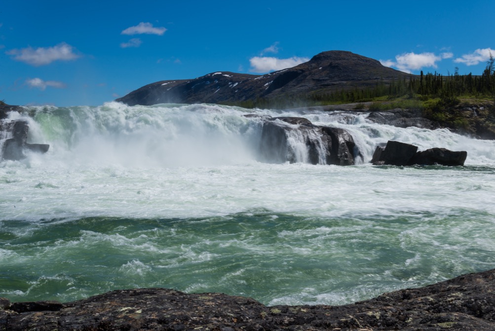
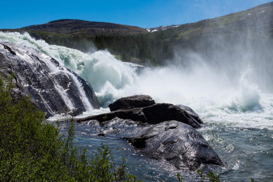
Camp Qurlutuarjuq is a serviced Nunavik Parks camp on the south bank of the Koroc River, roughly 100 km up-valley from Kangiqsualujjuaq. The camp has a heated kitchen building with dormitory, private bedrooms, a separate camping area with platforms, dry toilets, an outdoor solar shower and a boat ramp, and is set roughly 240 m back from the river. From the camp, the dedicated walk to chutes Korluktok works east-southeast along the south bank of the Koroc to the head of the falls, a 30-metre cascade comprising three distinct drops at approximately 58°36′38″ N, 64°33′30″ W.
The walking surface is mixed tundra, low willow and gneiss bedrock benches. The Koroc here runs through a constriction in the valley with rust-coloured gneiss walls that the Nunavik Parks promotional material describes as 1,500–2,000 feet high on either side, although the route stays low on the river bench rather than climbing the walls. The falls themselves form a natural barrier to upstream migration of Arctic char and are reliably one of the loudest features in the park outside the spring runoff peak. A small bush landing strip and refuge sit near the falls, which is why the walk works equally as an excursion from a fly-in day visit and from an overnight at Camp Qurlutuarjuq. Return is by the same line.
Why it is essential
Korluktok Falls is the only large, named waterfall in Parc national Kuururjuaq and the focal point of the mid-Koroc section. Nunavik Parks specifically lists “observation hikes” to the falls as an activity organised by the park, and the falls feature in nearly every published itinerary for the river — including the rafting descent of the Koroc, where they are the most serious portage. For a day-hike catalogue, the walk to the falls from Camp Qurlutuarjuq is the most accessible “headline feature” hike in the entire Quebec-side Torngats: it does not require the mountaineering commitment of the Iberville sector, it lands on a dedicated airstrip rather than requiring a long valley walk in, and it captures the gneiss-canyon character of the lower Koroc.
Equipment
- Hiking boots or sturdy shoes (wet, uneven ground in places)
- Weatherproof layer; warm layer; gloves and hat outside high midsummer
- Insect repellent and head net (mosquitoes and black flies are intense in the sheltered river microclimate in July)
- Map/GPS — no marked trail
- Bear-aware food storage at Camp Qurlutuarjuq (black bear in the area)
- Permit and registration with Nunavik Parks; Camp Qurlutuarjuq bookings are made through Nunavik Parks
- Sun protection
Hazards and notes
The river bank above the falls is undercut in places; viewpoints should be approached cautiously, particularly with the lip of the upper drop close to the trail line. Insects in the sheltered Koroc microclimate can be severe. No marked trail; navigation in fog requires GPS or local guide. Black bear and wolf are possible; polar bear unlikely this far inland. Charter weather windows from Kangiqsualujjuaq are tight and a planned day visit may slip by a day.
GPX / KML links
| Source | URL | Format | Notes |
|---|---|---|---|
| Wikipédia (FR) — Chute Korluktok (coordinates) | fr.wikipedia.org | Coordinates | CC BY-SA (text); coordinates reusable as a waypoint |
| OpenStreetMap (Koroc geometry around the falls) | openstreetmap.org | OSM | ODbL; river geometry reusable; no walking trail mapped |
No dedicated GPX track for the Camp Qurlutuarjuq → Korluktok Falls walk has been located. The route should be drafted from the Koroc River geometry on OSM and the falls coordinates from the Wikipédia article, cross-checked against Natural Resources Canada 1:50,000 topographic mapping for the mid-Koroc.
Sources
- Nunavik Parks — The Secrets of the Koroc
- Nunavik Parks — Parc national Kuururjuaq
- Wikipédia (FR) — Chute Korluktok
- Sépaq — Parc national Kuururjuaq
- Espaces — 3 femmes à travers le parc Kuururjuaq
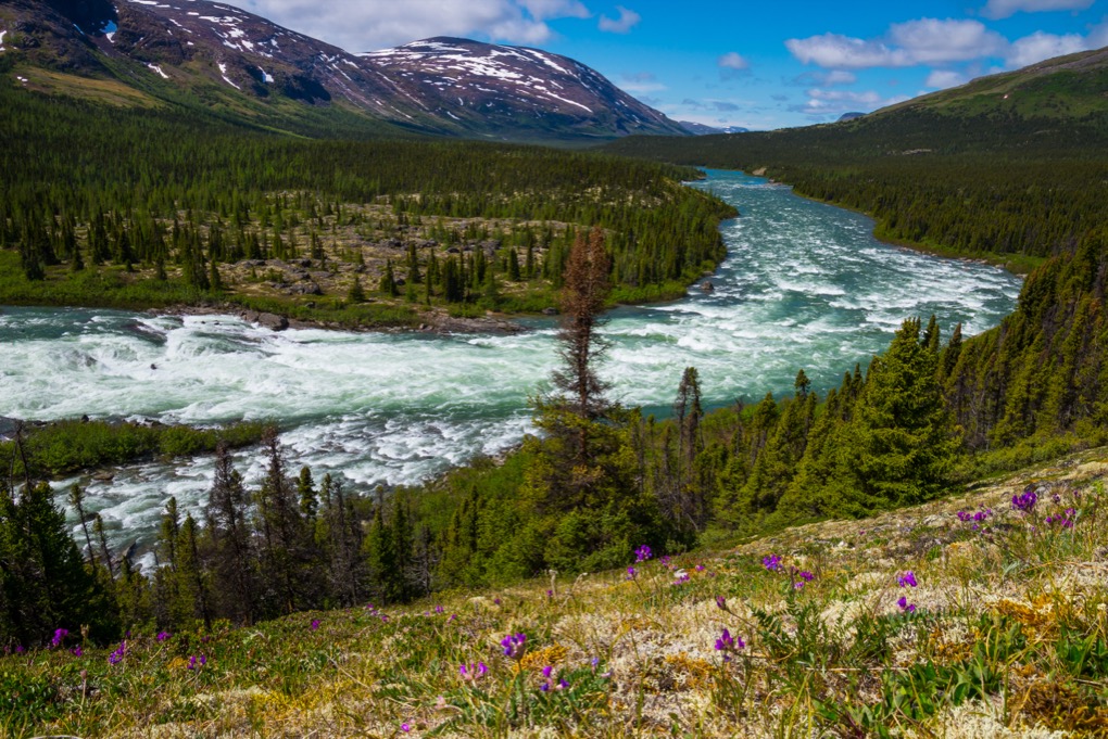
5. Qurlutuarjuq canyon and Koroc River viewpoints
Snapshot
Itinerary
This is the short signature day-walk based at Camp Qurlutuarjuq, designed for visitors on either a weekend Nunavik Parks package or a layover day during a river descent. From the camp gate the route works along the south bank of the Koroc in a downstream/upstream loop, depending on conditions, weaving between tundra mat, gneiss benches and stands of black spruce and tamarack that survive in the sheltered Koroc microclimate well north of the normal tree line. Several open viewpoints on the gneiss benches give views across the river to the rust-coloured walls of the Koroc canyon, with the river running broad and shallow over a sand-and-gravel bed except where it accelerates towards the head of Korluktok Falls.
Nunavik Parks consistently describes “superb hiking opportunities” from Camp Qurlutuarjuq and references a 5 km trail in the area without publishing a detailed route. In practice the loop is run with a Nunavik Parks guide or with simple route advice from camp staff. The walk is the standard non-falls outing for visitors at Camp Qurlutuarjuq and can be combined with the Korluktok Falls walk (Hike 4) for a full day on foot.
Why it is essential
The Qurlutuarjuq camp-side loop is the only short, gentle, named day-walk inside Parc national Kuururjuaq. It is included partly to balance the demanding Iberville-sector hikes with one route that is genuinely accessible to non-mountaineering visitors, and partly because it samples a unique aspect of Kuururjuaq that the upper-mountain itineraries miss entirely: the sheltered mid-Koroc microclimate where boreal trees grow far above their normal latitudinal limit, juxtaposed against the bare gneiss canyon walls. For a visitor on a Nunavik Parks weekend package this is effectively the regional walk.
Equipment
- Hiking shoes or boots
- Weatherproof and warm layers
- Water and food
- Insect repellent and head net (essential in July in the sheltered river microclimate)
- Map/GPS
- Sun protection
- Bear-aware food storage at camp
- Booking and registration: Camp Qurlutuarjuq stays are managed through Nunavik Parks
Hazards and notes
The riverbank in places overlooks the upper approach to Korluktok Falls; do not stray onto wet bedrock at the lip. Insects can be severe in July. There is no marked trail; navigation is by handheld GPS or with the camp guide. Black bear is possible; polar bear extremely unlikely this far inland. Weather windows for the charter flight in and out of the Korluktok strip are tight, and may extend a planned 2-night stay by a day.
GPX / KML links
| Source | URL | Format | Notes |
|---|---|---|---|
| OpenStreetMap (Koroc geometry near Qurlutuarjuq) | openstreetmap.org | OSM | ODbL; river geometry reusable; no walking trail mapped |
No dedicated GPX track for the Qurlutuarjuq camp loop has been located on Wikiloc, Komoot or AllTrails. Nunavik Parks does not publish the route. Drafting a working line from OSM river geometry and a guide-led reconnaissance is the realistic path to a clean route file.
Sources
- Nunavik Parks — The Secrets of the Koroc
- Nunavik Parks — Parc national Kuururjuaq
- Nunavik Parks — Weekend in parc national Kuururjuaq
- Sépaq — Parc national Kuururjuaq
- Wikipédia (FR) — Chute Korluktok
External links
| Source | URL |
|---|---|
| Nunavik Parks — Parc national Kuururjuaq | nunavikparks.ca |
| Nunavik Parks — Conquer Kauvvik (Iberville) Summit | nunavikparks.ca |
| Nunavik Parks — Discover the Torngats (6-day trek) | nunavikparks.ca |
| Nunavik Parks — The Secrets of the Koroc | nunavikparks.ca |
| Sépaq — Parc national Kuururjuaq | sepaq.com |
| Parks Canada — Torngat Mountains National Park, Koroc / Palmer River Loop | parks.canada.ca |
| Wikipedia — Kuururjuaq National Park | en.wikipedia.org |
| Wikipedia — Mount Caubvick | en.wikipedia.org |
| Wikipédia (FR) — Mont D’Iberville | fr.wikipedia.org |
| Wikipédia (FR) — Chute Korluktok | fr.wikipedia.org |
| SummitPost — Mount Caubvick | summitpost.org |
| Andrew Lavigne — Climbing guide to Caubvick / D’Iberville | alavigne.net |
| Air Inuit — Kangiqsualujjuaq destination | airinuit.com |
| Air Inuit — Charter | airinuit.com |
| OpenStreetMap (ODbL 1.0) | openstreetmap.org |