Regional overview
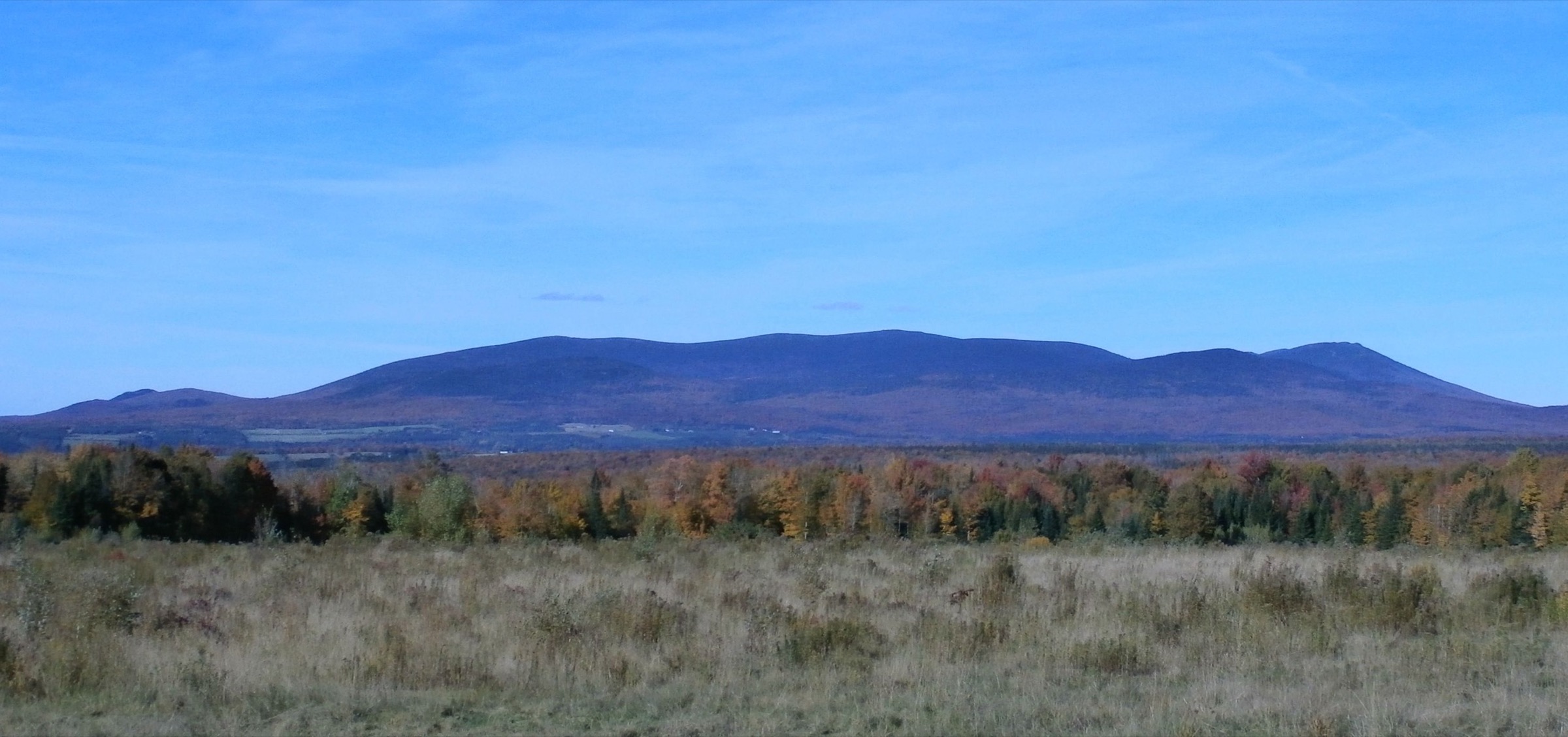
The Mégantic Hills (Massif du Mont-Mégantic / Monts Mégantic) are a compact group of summits in the Estrie (Eastern Townships) region of southern Québec, close to the borders with Maine and New Hampshire. Geologically they form the easternmost and largest of the Monteregian intrusions — a body of leucogranite, syenite and gabbro that rises sharply above the surrounding rolling Appalachian plateau. The three main peaks — Mont Mégantic (1,105 m), Mont Saint-Joseph (1,065 m) and Mont Victoria (c. 1,090 m) — are among the highest points in southern Québec away from the Chic-Chocs and stand well above the surrounding farmland of Notre-Dame-des-Bois, La Patrie and Val-Racine.
Almost all of the day hiking is concentrated inside Parc national du Mont-Mégantic, a 59.9 km² SÉPAQ-managed protected area created in 1994. The park is split into two sectors connected by a single cross-park trail: the southern Observatoire sector (Notre-Dame-des-Bois), home to the ASTROLab science centre and the Mont-Mégantic Observatory, and the northern Franceville sector, which protects the rocky escarpment of the Montagne de Franceville and the valley of the Ruisseau de la Montagne. The park is the heart of the world’s first International Dark Sky Reserve, designated in September 2007, which extends over roughly 5,500 km² and 34 municipalities.
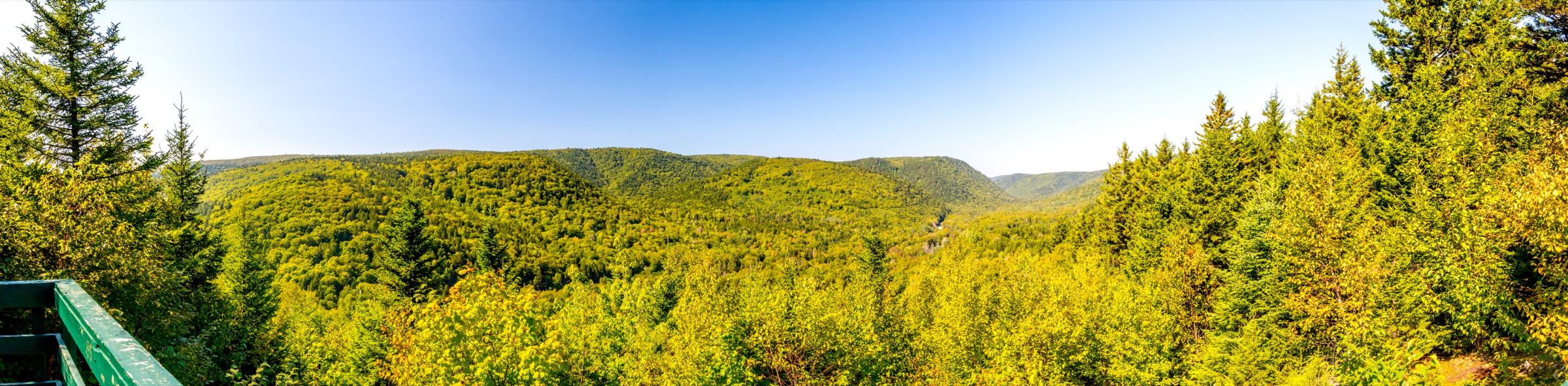
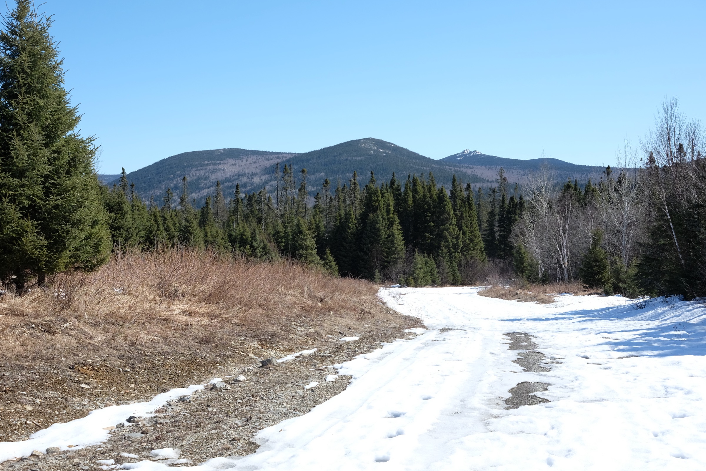
Terrain is classic northern-Appalachian: closed sugar-maple and yellow-birch forest at lower elevations, balsam-fir and mountain wood-sorrel stands higher up, and short stretches of open rock and granite ridge at the summits. Trails are well marked, generally well graded with stairways on the steep sections, and free of glaciers or scrambling. The main hiking season is mid-May to mid-October, with peak conditions from late June through early October (autumn foliage usually peaks late September). Trails remain open in winter for snowshoeing in the Observatoire sector and on the Franceville circuits; the summit access road to the Observatory is closed to private vehicles from roughly mid-October to mid-May. SÉPAQ levies a daily access fee per adult (around CA$10–11 in recent seasons; children 17 and under free with family); rates and seasonal road access should be confirmed on the SÉPAQ site before travel. Dogs are not permitted on park trails. Black bears and moose are present but rarely seen; ticks are an increasing concern at lower elevations in summer.
Selection rationale
The five hikes below were chosen to cover the full character of the Mégantic Hills as a compact day-hike destination: the iconic summit of Mont Mégantic itself with its observatory; the historic pilgrimage summit of Mont Saint-Joseph with its 1883 chapel; the demanding three-summit ridge traverse that links them; the signature Franceville cliff-and-ridge loop, which is the best non-Mégantic walk in the park; and the full park-to-park traverse (La Traversée), which is the closest equivalent to a long-distance Appalachian day-section through the massif. The originally suggested SIA-QC (Sentier International des Appalaches – Québec) does not actually pass through the Mégantic Hills — the official SIA-QC route runs through Gaspésie. The cross-border Sentiers Frontaliers network (SF-9 link to Mont-Mégantic and onward to Mont Gosford) is the local long-distance Appalachian equivalent and is noted in the regional source list rather than chosen as one of the five, because its day-section is essentially the La Traversée itself plus forest road.
No official SÉPAQ GPX/KML files exist for any of the five hikes — SÉPAQ publishes Avenza-format trail maps only, and all GPX sources cited below are user-uploaded (AllTrails, Wikiloc, Trailforks, Gaia, Hikster) or derived from OpenStreetMap. A SÉPAQ daily access fee applies at all park entrances. All five routes are flagged “Partially verified” in their snapshot panels.
Summary table
| # | Hike | Country | Route type | Distance | Gain | Max elevation | Difficulty |
|---|---|---|---|---|---|---|---|
| 1 | Boucle du Mont-Mégantic (summit loop) | Canada (QC) | Loop | 10.7 km | ~515 m | 1,105 m | Difficult |
| 2 | Boucle du Mont-Saint-Joseph | Canada (QC) | Loop | 10.1–10.6 km | ~465 m | 1,065 m | Difficult |
| 3 | Boucle des Trois Sommets (Mégantic – Victoria – Saint-Joseph) | Canada (QC) | Loop | 15.0–15.8 km | 515–720 m | 1,105 m | Difficult |
| 4 | Sentier des Cimes de Franceville (Pic de l’Aurore loop) | Canada (QC) | Loop | 11.2–13.7 km | ~390 m | 835 m | Intermediate |
| 5 | La Traversée (Observatoire – Franceville) | Canada (QC) | Point-to-point | 13.8–21 km | ~700–900 m | 1,105 m | Difficult |
1. Boucle du Mont-Mégantic (summit loop)


Snapshot
Itinerary
The loop starts from the main Accueil de l’Observatoire car park at the foot of the mountain, beside the ASTROLab. From there the trail climbs steadily through a sugar-maple / yellow-birch forest, then transitions to balsam fir as it gains height. Stairways and engineered switchbacks ease the steepest pitches. After about 4 km the route emerges on the broad summit plateau of Mont Mégantic (1,105 m), where the ridge tops out beside the Université de Montréal / Laval Mont-Mégantic Observatory dome and a smaller popular telescope building. On clear days the view extends across the Estrie plateau, Lac Mégantic, the White Mountains in New Hampshire and the Maine border ranges. The descent loops back on the eastern side via the Col-des-Trois-Sommets junction (the link toward Mont Saint-Joseph and the Trois Sommets circuit), then drops through fir forest back to the ASTROLab. The summit road is open to private vehicles in summer (mornings only in many seasons) and to a SÉPAQ minibus shuttle — walkers should be aware they may share the upper summit area with visitors arriving by vehicle.
Why it is essential
This is the namesake hike of the Mégantic Hills and the only Québec summit walk that ends beside a working professional astronomical observatory inside the world’s first International Dark Sky Reserve. It tops out at the highest point of the massif and gives the cleanest single-day expression of the park’s combined natural and scientific identity.
Equipment
Mountain hiking equipment: sturdy boots, weatherproof shell, warm extra layer (summit can be 8–10 °C cooler and noticeably windier than the trailhead), water (no reliable water on the loop), food, map/GPS, sun protection. Headtorch advisable for late starts in shoulder season. Microspikes useful from late October through April when the trail is open for snowshoeing/walking.
Hazards and notes
The route is non-technical but sustained; the descent has long stair sections that are slippery when wet. The summit area can be in cloud while the trailhead is clear. Vehicles use the summit road, so cross with care near the top. Dogs are not allowed. SÉPAQ park access fee payable at the Accueil. The summit Observatory access is restricted in 2026 due to enhancement works at the summit; daytime astronomy activities are running at the ASTROLab — confirm with SÉPAQ before arrival.
Routes and maps
| Source | URL | Format | Reuse status |
|---|---|---|---|
| AllTrails — Sentier du Mont Mégantic | alltrails.com | Track view / app GPX | AllTrails terms — user content, geometry cross-check only |
| Wikiloc — Mont Mégantic tracks | wikiloc.com | GPX (per user) | Wikiloc user-uploaded; geometry cross-check |
| Trailforks — Parc national du Mont-Mégantic | trailforks.com | GPX/KML download | Trailforks terms; geometry cross-check |
| OpenStreetMap — park trails | openstreetmap.org | OSM data | ODbL; reusable with attribution |
No official SÉPAQ GPX/KML exists — only Avenza-format trail maps.
External links
- sepaq.com — SÉPAQ: Parc national du Mont-Mégantic hiking page
- cantonsdelest.com — Cantons-de-l’Est: Boucle du Mont-Mégantic
- easterntownships.org — Eastern Townships: Boucle du Mont-Mégantic
- en.wikipedia.org — Wikipedia: Mont-Mégantic National Park
2. Boucle du Mont-Saint-Joseph


Snapshot
Itinerary
From the Observatoire trailhead the route climbs north-east on the Sentier du Mont-Saint-Joseph, gaining height through a mixed maple–birch forest. After several stairway sections it reaches the open summit plateau of Mont Saint-Joseph (1,065 m), which is crowned by a small stone chapel originally built in 1883 and rebuilt in 1916 — the only mountain-top chapel in the park and a long-standing pilgrimage site. A wooden cross and several lookouts give panoramas across the Estrie plateau toward Mont Mégantic to the south-west and the Maine border mountains to the east. The loop continues over the secondary summit of Pic des Crépuscules (~1,060 m), then descends a steeper 3.2 km return arm through fir and mountain wood-sorrel forest back to the trailhead.
Why it is essential
Mont Saint-Joseph is the second peak of the Mégantic massif and the only one with an in-situ historical/cultural feature on its summit — the 19th-century pilgrimage chapel. The loop has the most open viewpoints in the Observatoire sector and is the natural complement to the Boucle du Mont-Mégantic; together they cover both major summits without requiring the full three-summit traverse.
Equipment
Mountain hiking equipment: sturdy boots, weatherproof shell, warm layer for the summit, water (carry full amount; no on-route source), food, map/GPS, sun protection. Trekking poles useful on the steep descent. Microspikes/snowshoes in winter conditions.
Hazards and notes
Non-technical but cumulatively steep; the descent has a long stair sequence that is slippery when wet or icy. Cloud cover can build quickly on the summit. Dogs not permitted. SÉPAQ park access fee payable. The chapel is open during the summer season; check SÉPAQ for current visiting arrangements.
Routes and maps
| Source | URL | Format | Reuse status |
|---|---|---|---|
| AllTrails — Sentier du Mont Saint-Joseph | alltrails.com | Track view / app GPX | AllTrails terms; geometry cross-check only |
| AllTrails — Saint-Joseph Mountain Loop (longer variant) | alltrails.com | Track view / app GPX | AllTrails terms; geometry cross-check only |
| Trailforks — Le Mont-Saint-Joseph | trailforks.com | GPX/KML | Trailforks terms; geometry cross-check |
| OpenStreetMap | openstreetmap.org | OSM data | ODbL; reusable with attribution |
No official SÉPAQ GPX/KML exists — only Avenza-format trail maps.
External links
- sepaq.com — SÉPAQ: Parc national du Mont-Mégantic sentiers pédestres
- cantonsdelest.com — Cantons-de-l’Est: Boucle du Mont-Saint-Joseph
- easterntownships.org — Eastern Townships: Boucle du Mont-Saint-Joseph
- danenbottines.com — Dan en bottines: Mont Saint-Joseph
3. Boucle des Trois Sommets (Mégantic – Victoria – Saint-Joseph)


Snapshot
Itinerary
The full Trois Sommets circuit links the three principal peaks of the park in a single day. From the ASTROLab car park the route climbs to Mont Saint-Joseph (1,065 m) via the Mont-Saint-Joseph trail and chapel, then drops to the Col-des-Trois-Sommets saddle and crosses Mont Victoria (~1,090 m), a forested summit with limited views. From the col below Victoria the route climbs the upper Mont-Mégantic trail to the main summit (1,105 m) and the observatory, before descending the standard Mont-Mégantic loop back to the trailhead. The order can be reversed; many parties prefer doing Saint-Joseph first because it has the most exposed sections.
Why it is essential
It is the only single-day route that links all three of the main Mégantic summits and is the closest equivalent of a “high traverse” the massif offers. It is widely listed by Québec hiking sources as the signature challenging day in the park.
Equipment
Mountain hiking equipment: sturdy boots, weatherproof shell, warm extra layer, hat/gloves outside midsummer, plenty of water (no reliable on-route source — at least 2 L recommended), food, headtorch (long day with limited shoulder-season daylight), map/GPS with backup. Trekking poles strongly recommended for the long descents.
Hazards and notes
Non-technical but a long day with cumulative gain and several sustained descents. Mont Victoria’s summit is forested and easy to miss — pay attention to junction signs. Weather can change quickly at 1,000+ m. Late starts are not advised. Dogs not allowed. SÉPAQ access fee payable. Carry layers even in summer.
Routes and maps
| Source | URL | Format | Reuse status |
|---|---|---|---|
| Gaia GPS — Col des Trois Sommets – Mont Mégantic Observatory loop from ASTROLab | gaiagps.com | GPX (Gaia subscribers) | Gaia terms; geometry cross-check only |
| Cantons-de-l’Est — Boucle des Trois Sommets | cantonsdelest.com | Web map | Site terms; geometry cross-check |
| Wikiloc — Trois Sommets tracks | wikiloc.com | GPX (per user) | Wikiloc user uploads; geometry cross-check |
| OpenStreetMap | openstreetmap.org | OSM data | ODbL; reusable with attribution |
No official SÉPAQ GPX/KML exists — only Avenza-format trail maps.
External links
- cantonsdelest.com — Cantons-de-l’Est: Boucle des Trois Sommets
- espaces.ca — Espaces: Les 5 plus belles randonnées du parc national du Mont-Mégantic
- danenbottines.com — Dan en bottines: Randonnée aux monts Saint-Joseph, Victoria et Mégantic
- metmmetoutlemonde.com — M et Mme Tout le monde: Boucle des trois sommets
4. Sentier des Cimes de Franceville (Pic de l’Aurore loop)


Snapshot
Itinerary
From the Franceville visitor centre the trail climbs gradually through a sugar-maple and yellow-birch forest before traversing the rocky escarpment that gives the route its name. The first major viewpoint is Repos du Dragon (~595 m), followed by Gardien des Méandres (~650 m), Porte du Ciel (~755 m) and the high point at Pic de l’Aurore (835 m), from which the view extends back to Mont Mégantic and its observatory across the Ruisseau de la Montagne valley. The descent loops back through the wooded stream valley with several small waterfalls before rejoining the start.
Why it is essential
Franceville is the park’s “other half” and the Sentier des Cimes is its signature loop. It contains the longest stretch of open rocky-ridge walking in the park and offers the best external view of the Mont-Mégantic massif. Including it ensures the five-hike selection covers both sectors of the protected area, not just the Observatoire side.
Equipment
Standard mountain hiking equipment: hiking boots, weatherproof shell, warm layer, water (no reliable source on the ridge), food, map/GPS, sun protection. Hat and gloves outside midsummer. Trekking poles useful on the wet descents through the stream valley.
Hazards and notes
Ridge sections are open and exposed in storms; the descent through the valley can be slippery. The Franceville sector is less busy than the Observatoire sector — carry navigation backup. Dogs not allowed. SÉPAQ access fee payable at the Franceville Centre de services. Ticks are increasingly present at lower elevations in late spring and summer.
Routes and maps
| Source | URL | Format | Reuse status |
|---|---|---|---|
| Trailforks — Sentier des Cimes | trailforks.com | GPX/KML | Trailforks terms; geometry cross-check |
| AllTrails — Sentier des Cimes | alltrails.com | Track / app GPX | AllTrails terms; geometry cross-check only |
| Wikiloc — SEPAQ Mont Mégantic. Sentier des Cimes | wikiloc.com | GPX | Wikiloc user upload; geometry cross-check |
| OpenStreetMap | openstreetmap.org | OSM data | ODbL; reusable with attribution |
No official SÉPAQ GPX/KML exists — only Avenza-format trail maps.
External links
- cantonsdelest.com — Cantons-de-l’Est: Sentier des Cimes de Franceville
- easterntownships.org — Eastern Townships: Sentier des Cimes de Franceville
- routedessommets.com — La route des sommets: Montagne de Franceville
- lequebecensentiers.com — Le Québec en sentiers: Le sentier des cimes du Parc National du Mont Mégantic
5. La Traversée (Observatoire — Franceville)

Snapshot
Itinerary
La Traversée is the park’s signature linking route, completed in its current dedicated alignment in the mid-2010s. From the Accueil de l’Observatoire the route climbs through the Observatoire sector — most parties choose to include the Mont Saint-Joseph or Mont Mégantic summit on the way — then drops on the central Sentier de la Traversée over a forested col toward the Refuge Ruisseau-de-la-Montagne and onward into the Franceville sector, where it joins the Sentier des Cimes valley and descends to the Franceville Centre de services. The fastest direct line skips both summits; most hikers prefer the variant that takes in Mont Saint-Joseph for the chapel and views, giving a total of about 17–18 km.
Why it is essential
La Traversée is the only true cross-park route in the Mégantic Hills and the closest day-hike equivalent of an Appalachian long-distance section through the massif. It is the recommended day-section selection in lieu of the SIA-QC (which does not pass through this region) or the Sentiers Frontaliers SF-9 link (which uses the same in-park trail before continuing south by forest road).
Equipment
Mountain hiking equipment: sturdy boots, weatherproof shell, warm extra layer, hat/gloves outside midsummer, headtorch, food and at least 2 L water (some refill possible at the mid-park refuge in season but not guaranteed), map/GPS with backup. Trekking poles strongly recommended. Pre-arranged car shuttle or transport between the two sector entrances is essential.
Hazards and notes
Long and committing for a day hike — start early. Sections of the central traverse are remote and lightly travelled compared with the Mont-Mégantic loop; carry navigation backup. Cell coverage is patchy. The Refuge Ruisseau-de-la-Montagne is on the route (booking via SÉPAQ for overnight use; not required for through-hikers). SÉPAQ park access fees apply at both ends. Dogs not allowed. Confirm trail status with SÉPAQ — sections may close seasonally for maintenance.
Routes and maps
| Source | URL | Format | Reuse status |
|---|---|---|---|
| AllTrails — The Mont-Mégantic Crossing | alltrails.com | Track / app GPX | AllTrails terms; geometry cross-check only |
| Hikster — La Traversée | hikster.com | Track | Hikster terms; geometry cross-check |
| Gaia GPS — Refuge La Voie-Lactée loop via Sentier du Mont-Mégantic and Sentier du Col | gaiagps.com | GPX (Gaia subscribers) | Gaia terms; geometry cross-check only |
| OpenStreetMap — Mont-Mégantic park trails | openstreetmap.org | OSM data | ODbL; reusable with attribution |
No official SÉPAQ GPX/KML exists — only Avenza-format trail maps.
External links
- espaces.ca — Espaces: Nouveau sentier de la Traversée au parc national du Mont-Mégantic
- easterntownships.org — Eastern Townships blog: La grande traversée du parc national du Mont-Mégantic
- blogue.randoquebec.ca — Rando Québec: La traversée du parc national du Mont-Mégantic
- easterntownships.org — Eastern Townships: La Traversée trail page
External links
| Source | URL |
|---|---|
| SÉPAQ — Parc national du Mont-Mégantic main page | sepaq.com |
| SÉPAQ — Hiking trails | sepaq.com |
| SÉPAQ — Information / fees / access | sepaq.com |
| SÉPAQ — Portrait of the park (geology, biodiversity) | sepaq.com |
| SÉPAQ — Visitor guide (PDF, English) | sepaq.com |
| ASTROLab du Mont-Mégantic | astrolab.qc.ca |
| Observatoire du Mont-Mégantic (OMM) | omm-astro.ca |
| Réserve internationale de ciel étoilé du Mont-Mégantic | cieletoilemontmegantic.org |
| Tourisme Mégantic — Parc national du Mont-Mégantic | tourisme-megantic.com |
| Cantons-de-l’Est — park trails listing | cantonsdelest.com |
| Eastern Townships — park overview | easterntownships.org |
| La route des sommets — Mont-Mégantic | routedessommets.com |
| La route des sommets — Montagne de Franceville | routedessommets.com |
| Espaces — Les 5 plus belles randonnées du parc national du Mont-Mégantic | espaces.ca |
| Wikipedia (EN) — Mont-Mégantic National Park | en.wikipedia.org |
| Wikipedia (FR) — Parc national du Mont-Mégantic | fr.wikipedia.org |
| Wikipedia — Mont Mégantic Observatory | en.wikipedia.org |
| Wikipedia — Monteregian Hills (geology context) | en.wikipedia.org |
| Sentiers Frontaliers — main site (long-distance Appalachian linkage to SF-9 / Mont Gosford) | sentiersfrontaliers.com |
| Tourisme Mégantic — Sentiers Frontaliers | tourisme-megantic.com |
| Sentier International des Appalaches – Québec (SIA-QC) (covers Gaspésie, not the Mégantic Hills) | sia-iat.com |
| Wikimedia Commons — Parc national du Mont-Mégantic | commons.wikimedia.org |
| Wikimedia Commons — Mont Mégantic Massif | commons.wikimedia.org |
| Wikimedia Commons — Observatoire du Mont-Mégantic | commons.wikimedia.org |
| Trailforks — Parc national du Mont-Mégantic region | trailforks.com |
| AllTrails — Parc national du Mont-Mégantic | alltrails.com |