Regional overview
Mount Cameroon (Mongo ma Ndemi, “Mountain of Greatness”) is an active basaltic stratovolcano on the eastern Gulf of Guinea coast, anchoring the southern end of the Cameroon Volcanic Line. At a summit elevation cited variously as 4,040 m (Wikipedia) and 4,095 m (most operator pages), it is the highest mountain in West Africa and one of the most prominent volcanoes on the African continent. The mountain rises almost directly from the Atlantic, producing one of the steepest elevation gradients of any volcano in the world and a near-complete vertical sweep of climate zones in under 20 km.
Almost all organised hiking begins from Buea (~1,000 m), the colonial-era German hill station on the south-east flank. The Mount Cameroon Inter-Communal Ecotourism Board (Mount CEO) and Mount Cameroon National Park (gazetted 2009, 581 km²) manage a permit-and-guide system; independent ascents without a registered guide are not permitted. The canonical line is the Guinness Track, named after the long-running Guinness Mount Cameroon Race of Hope. The track passes Hut 1, an intermediate hut, Hut 2 and Hut 3 before the final scree push to the Fako summit. Multi-day variants drop west from the summit via the Elephant Opening and Mann’s Spring camp to the Bakingili lava fields and the coast.
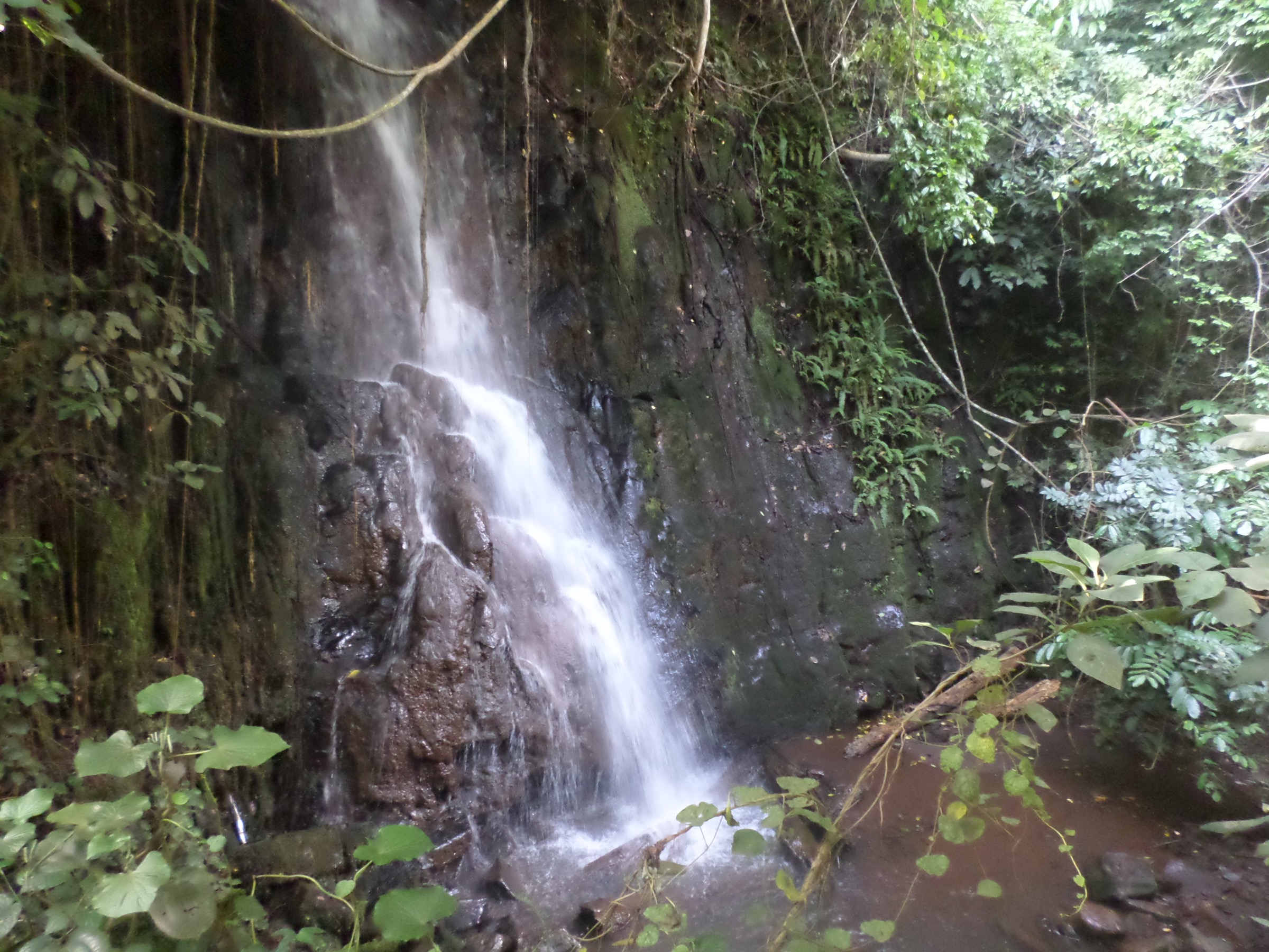
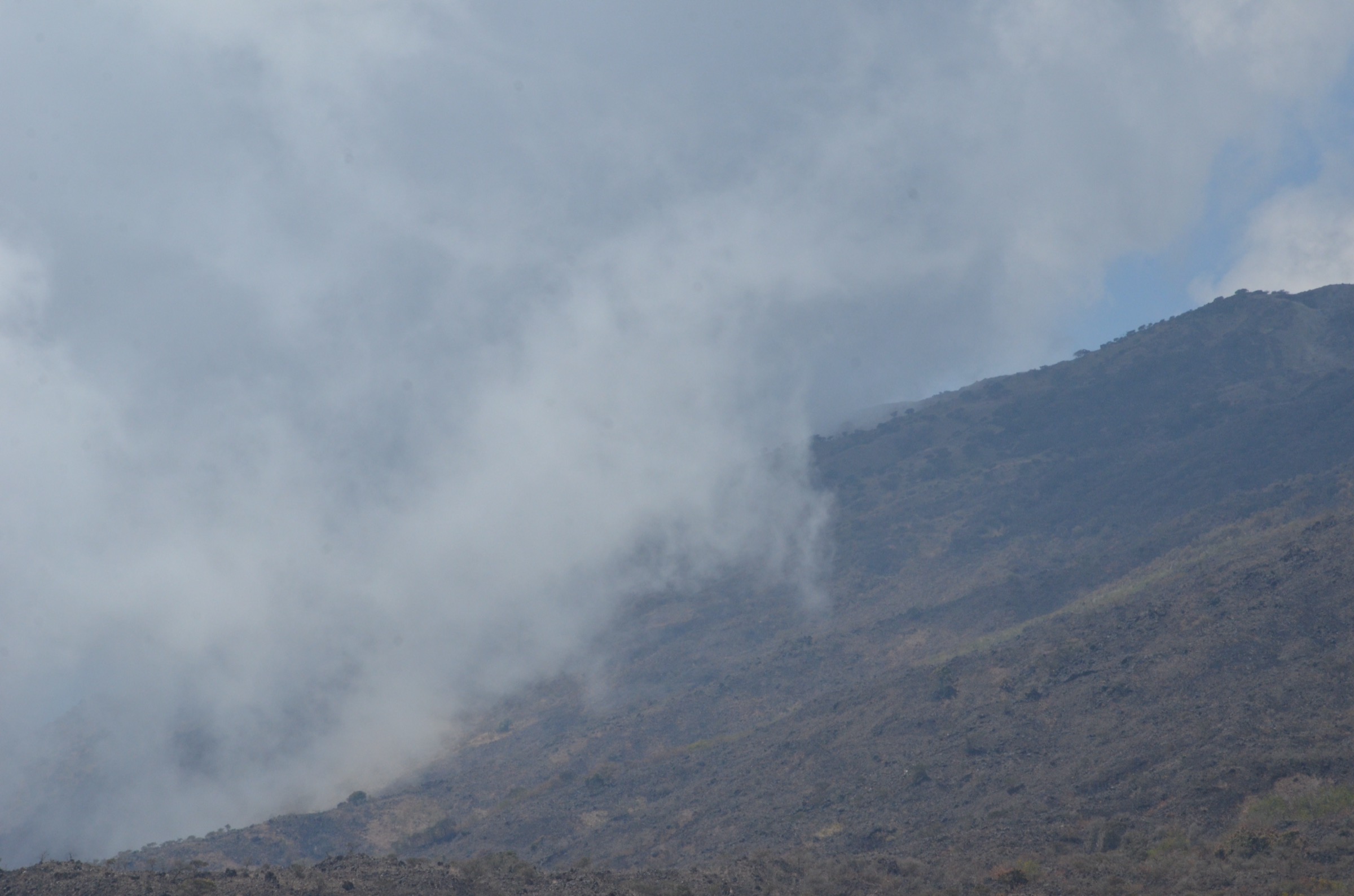
Vegetation zones change quickly: lowland rainforest below about 1,800 m, montane forest, tree-fern savannah, and bare volcanic ash and scree above the treeline. Mount Cameroon erupted in 1909, 1922, 1925, 1954, 1959, 1982, 1999, 2000 and 2012; the 1999 and 2000 flows reshaped the south-west flank around Bakingili. The mountain is one of the wettest places on Earth at its windward base, but the upper slopes are markedly drier. The recommended hiking window is mid-November to mid-February, with a shorter dry break around June-July. Wind, sub-zero overnight temperatures at the upper huts, persistent cloud, and slick lava scree are routine.
Access to the wider South West Region has been complicated by the ongoing Anglophone Crisis (2017-present). Travellers should verify the current security situation with their embassy and with Mount CEO before booking; ghost-town days can affect access on specific weekdays.
Selection rationale
These five routes cover the canonical summit ladder (Hut 1 day return; Hut 2 day return; full summit day for very fit walkers), a satellite cone day-hike on Mount Etinde, and a recent-volcanism walk on the coastal lava flows around Bakingili. The set spans the rainforest, savannah, and scree gradient and gives scope from a moderate day-out to an extreme summit-in-a-day, including the south-flank ecosystem that the Buea routes do not pass through.
Summary table
| # | Hike | Country | Route type | Distance | Gain | Max elevation | Difficulty |
|---|---|---|---|---|---|---|---|
| 1 | Guinness Track to Hut 1 | Cameroon | Out-and-back | 8-9 km | ~1,000 m | ~1,850 m | Moderate-strenuous |
| 2 | Guinness Track to Hut 2 | Cameroon | Out-and-back | 14-15 km | ~1,900 m | ~2,825 m | Very strenuous |
| 3 | Fako summit single-day push | Cameroon | Out-and-back | 22-23 km | ~3,000 m | 4,040-4,095 m | Extreme |
| 4 | Mount Etinde (Little Mount Cameroon) | Cameroon | Out-and-back | 8-10 km | ~1,200 m | ~1,713 m | Strenuous |
| 5 | Bakingili lava flows and Crater Lake | Cameroon | Out-and-back | 6-10 km | ~300-500 m | ~600 m | Easy-moderate |
1. Guinness Track to Hut 1
Snapshot
Itinerary
The route leaves the upper Buea trailhead, above Molyko and Upper Farms, and climbs steeply through dense lowland rainforest on a heavily eroded foot-path. Gradient is uncompromising from the first metre — Mount Cameroon’s lower track has none of the switchbacks typical of alpine paths. The track passes through the forest reserve, crosses a series of small streams in the lower section, then breaks out into transitional tree-fern country shortly before reaching Hut 1, sometimes referred to as the “Magic Tree”, a simple corrugated-iron shelter at roughly 1,850 m. Return is by the same route.
Why it is essential
Hut 1 is the day-hike option for visitors who want a representative taste of Mount Cameroon — the steep forest climb, a glimpse of the upper savannah, and panoramic views over Buea, Limbe and the Atlantic — without committing to the full multi-day summit. It is also the standard acclimatisation and training walk for Race of Hope competitors.
Equipment
- Standard hiking equipment
- Sturdy boots with good ankle support
- Trekking poles strongly recommended for the steep descent
- 2-3 litres of water (no reliable resupply above the lower streams)
- Light rain shell year-round
Hazards and notes
- The track is steep, slippery in cloud or rain, and erodes badly between dry-season passes.
- A registered Mount CEO guide is required; the route is not intended for independent ascent.
- Park entry and guide fees are payable at the Mount Cameroon National Park HQ or through registered agencies in Buea.
- Volcanic activity is monitored by the Institute of Geological and Mining Research (IRGM); check current status before booking.
GPX / KML links
| Source | URL | Format / access | Reuse status |
|---|---|---|---|
| OpenStreetMap — Mount Cameroon paths | openstreetmap.org | OSM way data / GPX export | Geometry reusable under ODbL with attribution |
| AllTrails — Mount Cameroon via Guiness Track | alltrails.com | Route page; AllTrails terms apply | Secondary route source only |
External links
2. Guinness Track to Hut 2
Snapshot

Itinerary
The track follows the same eroded forest spur as the Hut 1 day-hike. Above Hut 1 it leaves the tall-tree zone, climbs through bracken and dwarf shrubs, and reaches the intermediate hut, sometimes referred to as P&T Camp, at around 2,600 m. From there the ground turns to pumice and ash and the gradient eases slightly before reaching Hut 2 at approximately 2,825 m, on the broad upper savannah. The hut is a low concrete shelter on an exposed shoulder. Return is by the same route.
Why it is essential
Hut 2 is the highest point reachable as a day-return for very fit walkers without committing to an overnight on the mountain. It crosses the entire forest-savannah transition and gives the first true alpine view: the Cameroon coast, Bioko Island in clear weather, and the upper crater fields of Fako above.
Equipment
- Sturdy boots and weatherproof shell
- Warm layer, hat and gloves outside midsummer
- Trekking poles
- Head-torch (essential — descents routinely finish in the dark)
- 3-4 litres of water (no resupply above ~1,500 m)
- High-calorie food
- Basic first aid
Hazards and notes
- Cumulative ascent is greater than the standard Ben Nevis tourist path; the track is unremittingly steep and physically demanding.
- Sub-zero conditions are possible at Hut 2 even in dry season.
- Cloud envelopment is the rule, not the exception; visibility may drop to under 50 m.
- Volcanic gas hazards are minimal at this elevation but check current advisories before departure.
- Registered Mount CEO guide and porter required.
GPX / KML links
| Source | URL | Format / access | Reuse status |
|---|---|---|---|
| OpenStreetMap — Mount Cameroon paths | openstreetmap.org | OSM way data / GPX export | Geometry reusable under ODbL with attribution |
External links
- Mount Cameroon National Park
- Discover Cameroon — multi-day trek itinerary
- Wikivoyage — Mount Cameroon
3. Fako summit single-day push
Snapshot
Itinerary
Above Hut 2 the Guinness Track climbs onto open scree, threading between Hut 3 (~3,760 m) and the summit cone. Footing changes to loose volcanic ash and weathered basalt block-fields; route-finding in cloud requires a guide who knows the cairn-line. The final approach to Fako rises along the broad summit ridge to a marked high point at 4,040-4,095 m. Return reverses the entire ascent on the same line. For most walkers this is a multi-day undertaking from Hut 2, but a small number of very fit hikers complete it within a 14-17 hour day, and the annual Guinness Mount Cameroon Race of Hope covers it in about 4.5 hours.
Why it is essential
This is the canonical summit of West Africa, included in any survey of the continent’s iconic walks. The Race of Hope, run since 1973, is the most famous distance race in central Africa.
Equipment
- Mountain hiking equipment with extra warm and windproof layers
- Balaclava and gloves
- Head-torch
- Emergency bivvy or foil blanket
- 4-5 litres of water and electrolytes
- Dense calorie food
- Blister kit
- Mount CEO guide and porter system is mandatory
Hazards and notes
- This is not a recommended day-itinerary for most walkers — it is included because it is the iconic day-line. The typical guided product is 2-3 days with overnights at Hut 2 and Hut 3.
- Altitude near 4,100 m can cause AMS in unacclimatised walkers.
- Hypothermia, cloud disorientation and falls on scree have caused fatalities.
- Race of Hope incident reports are documented.
- Volcanic activity status must be verified before each ascent.
GPX / KML links
| Source | URL | Format / access | Reuse status |
|---|---|---|---|
| OpenStreetMap — Mount Cameroon paths | openstreetmap.org | OSM way data / GPX export | Geometry reusable under ODbL with attribution |
| AllTrails — Mount Cameroon via Guiness Track | alltrails.com | Route page; AllTrails terms apply | Secondary route source only |
External links
4. Mount Etinde (Little Mount Cameroon)
Snapshot
Itinerary
Etinde is a satellite stratovolcanic cone on the southern flank of Mount Cameroon, rising directly above the Atlantic coastal forest. The standard ascent begins from a trailhead in the villages around Bonadikombo, Etinde and Bakingili and climbs through dense lowland rainforest. Higher up, the path narrows on the cone’s steep upper flanks and finishes with a short scrambling section to the summit ridge. Detailed route data from official sources is not currently available; current itineraries should be confirmed with Mount CEO or a registered operator.
Why it is essential
Etinde is the recognised half-day to full-day alternative for visitors who do not have the time, fitness or budget for the main Mount Cameroon climb. It is part of the National Park system and gives the only coastal-rainforest summit experience on the mountain.
Equipment
- Sturdy boots
- Rain shell
- Trekking poles
- Gloves for the scramble
- 2-3 litres of water
- Tropical insect repellent
Hazards and notes
- Trail is informally maintained and route-finding without a guide is risky.
- Mount CEO guide is required.
- Some operators report the upper section is technically harder than the main Guinness Track in places.
- Coastal rainforest weather is humid with frequent showers.
GPX / KML links
No reliable open route file located in current sources. Geometry should be reconstructed from a guided ascent or from local Mount CEO records.
External links
5. Bakingili lava flows and Crater Lake
Snapshot

Itinerary
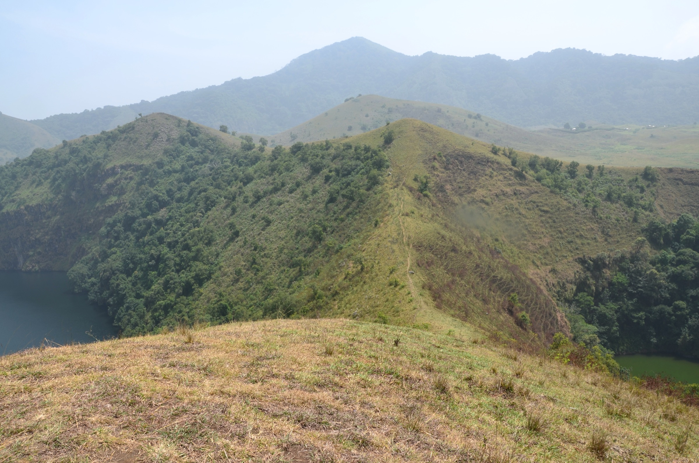
The 1999 and 2000 eruptions of Mount Cameroon sent basaltic lava flows down the south-west flank, narrowly missing Bakingili village before reaching the Atlantic at Mile 14. The lava-field walk begins at the village and tracks east onto the still-bare cooled-lava surface, then climbs gently along the western edge of the flow before returning to the coast road. The full-day Crater Lake variant — the “secret lake” filling an older volcanic crater roughly 7 miles north-east of the 1999 flow — is much longer, about 16 miles round-trip through forest, and requires a knowledgeable local guide.
Why it is essential
This is the only essential day-route on Mount Cameroon that does not require ascent of the main edifice. It gives direct contact with one of West Africa’s most recent volcanic events, plus coastal rainforest and ocean panoramas. The Bakingili lava is a textbook example of a young pahoehoe flow.
Equipment
- Standard hiking equipment
- Sturdy soles — fresh lava is razor-edged
- Sun protection
- 2 litres of water for the lava loop; double for the Crater Lake variant
Hazards and notes
- The lava surface is sharp and uneven; falls cause severe abrasion.
- The Crater Lake variant passes through dense forest with limited path-marking and requires a local guide.
- Mount Cameroon NP rules apply on the flanks; a permit may not be needed for the village-side lava-field, but this should be confirmed with local guides.
GPX / KML links
No open route file located in current sources for the Bakingili lava-field loop or the Crater Lake variant. Geometry should be recorded on a guided walk or reconstructed against the documented Crater Lake coordinates (4°6‘7.6”N, 8°58‘50.1”E).
External links
- Wikipedia — Mount Cameroon (1999/2000 eruption details)
- Wikimedia Commons — Crater Lake near Bakingili
- Mount Cameroon National Park
External links
| Resource | Link |
|---|---|
| Mount Cameroon National Park (official) | mtcameroonnationalpark.org |
| Wikipedia — Mount Cameroon | en.wikipedia.org |
| Wikipedia — Mount Cameroon Race of Hope | en.wikipedia.org |
| Wikipedia — Little Mount Cameroon | en.wikipedia.org |
| Wikivoyage — Mount Cameroon | en.wikivoyage.org |
| AllTrails — Mount Cameroon via Guiness Track | alltrails.com |
| Discover Cameroon — multi-day trek itinerary | discover-cameroon.com |
| Wikimedia Commons — Category:Mount Cameroon | commons.wikimedia.org |