Regional overview
The Bakossi Mountains rise inland from the South West Region of Cameroon, forming a damp, densely forested block of the Cameroon Volcanic Line between Mount Cameroon to the west and the Bamileke Plateau to the east. The range incorporates two distinct massifs: Mount Kupe (2,064 m), a sharp plutonic horn above the Nyasoso valley, and Mount Muanenguba (2,411 m, also spelled Manengouba or Mwanenguba), an older, broad caldera volcano whose summit ridge encircles the famous Twin Lakes. Together the two massifs form the heart of one of the wettest and oldest forest blocks in West Africa, designated Bakossi National Park (29,320 ha, gazetted in 2007/2008) and a BirdLife International Important Bird Area.
Hiking infrastructure is rudimentary by international standards. The Bakossi Cultural and Development Association (BACDA), the WWF-Cameroon office in Yaoundé, and several Bangem and Nyasoso-based community guides are the main practical contacts. There is no developed network of waymarked trails comparable to a European national park. Routes generally follow existing village paths, forest research transects opened by the Mount Kupe Forest Project and BirdLife International in the 1990s, and pastoralist tracks across the Muanenguba caldera. The standard trailhead villages are Nyasoso (for Mount Kupe), Bangem (for the Twin Lakes and Mount Muanenguba summit), Tombel and Nguti (for the deeper park interior), and Melong (lower-elevation approach via the Littoral side).
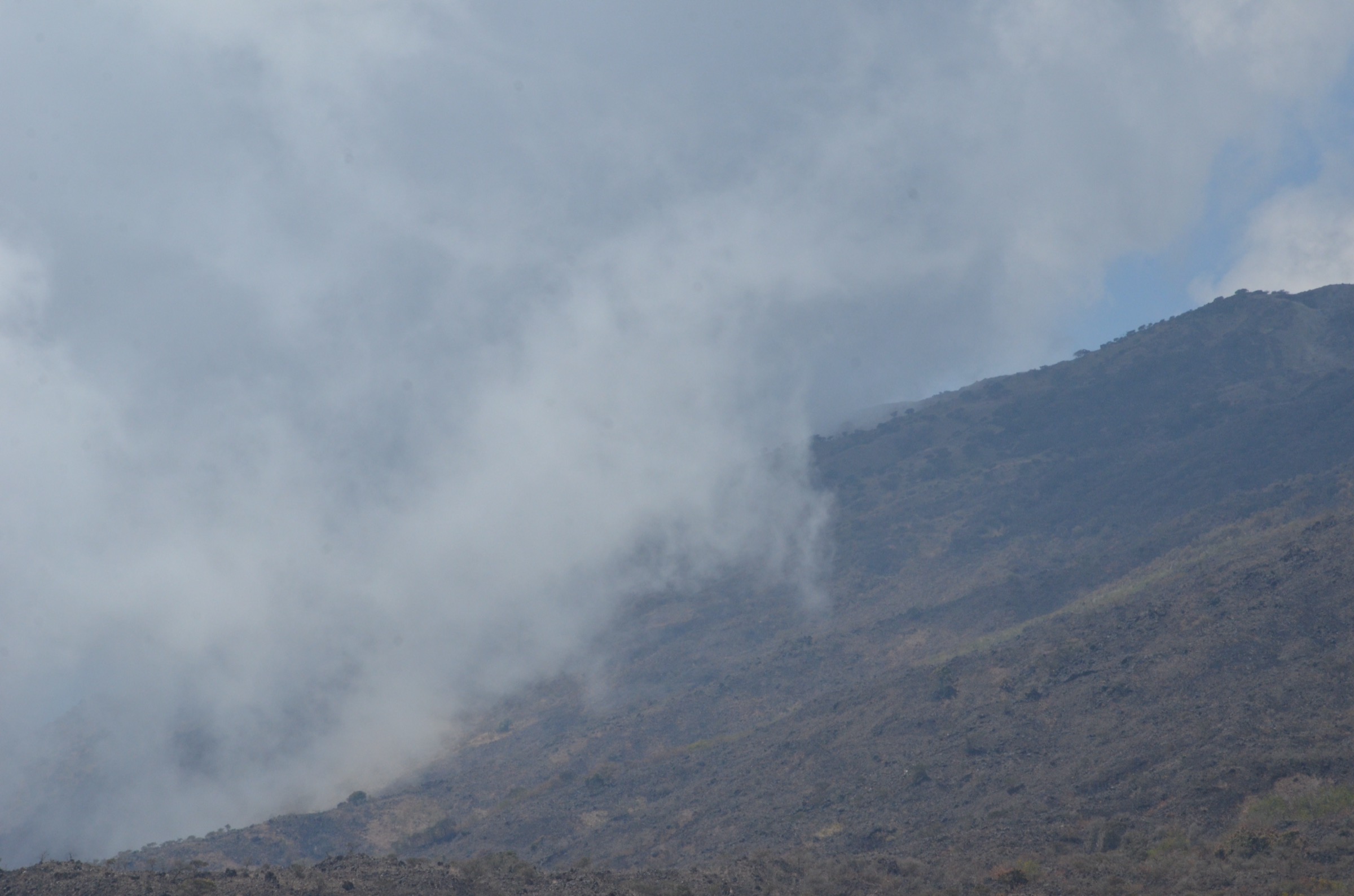
Terrain is forested below about 1,800 m, transitioning to montane grassland and high-altitude pasture on Muanenguba’s caldera floor. Annual rainfall around Lake Edib is among the highest in central Africa (3-4 m). The drier window from mid-November to early March is the practical hiking season; the rest of the year sees persistent cloud, slippery clay paths and limited visibility. The 2017-present Anglophone Crisis has affected access to the South West Region; security advisories should be checked, and ghost-town days monitored, before any travel. Lake Edib in particular sits in a remote interior block of the national park and is not visited casually.
Selection rationale
These five routes span the range’s signature destinations: the highest point of the Bakossi massif (Mount Kupe summit), the highest point of the older caldera volcano (Muanenguba summit), the cultural and scenic centrepiece (the Twin Lakes loop), the deep-interior remote-forest objective (Lake Edib, included here as a candidate destination rather than a publishable day-route), and a major waterfall on the south-eastern flank reachable from the Littoral approach (Ekom-Nkam Falls).
Summary table
| # | Hike | Country | Route type | Distance | Gain | Max elevation | Difficulty |
|---|---|---|---|---|---|---|---|
| 1 | Mount Kupe summit from Nyasoso (Max’s Trail) | Cameroon | Out-and-back | 9-11 km | ~1,250 m | 2,064 m | Strenuous |
| 2 | Mount Muanenguba summit from Bangem | Cameroon | Out-and-back | 14-16 km | ~1,000-1,300 m | 2,411 m | Moderate-strenuous |
| 3 | Twin Lakes (Lacs Jumeaux) loop | Cameroon | Loop | 8-12 km | ~250-350 m | ~2,000 m | Moderate |
| 4 | Lake Edib (Bakossi NP interior) | Cameroon | Point-to-point | 20+ km | ~1,000 m+ | ~1,400 m | Extreme; expedition |
| 5 | Ekom-Nkam Falls from Nkongsamba | Cameroon | Out-and-back | ~9 km | ~300 m | ~600 m | Easy-moderate |
1. Mount Kupe summit from Nyasoso (Max’s Trail)
Snapshot
Itinerary
The route leaves Nyasoso village and climbs east through farmland and cocoa plots before entering the lower-altitude forest reserve. The path joins a clear forest track, locally referred to as Max’s Trail and established by birding researchers in the 1990s, which ascends through patches of well-preserved primary mid-altitude rainforest with abundant epiphytes and tree ferns. Above approximately 1,500 m the trail steepens sharply; the upper third becomes a near-vertical scramble on roots and packed earth through montane forest. The summit ridge breaks out of the trees onto the narrow Kupe horn at 2,064 m, with views across the Mungo Valley toward Muanenguba and, in clear weather, Mount Cameroon. Return reverses the ascent.
Why it is essential
Mount Kupe is the headline summit of the Bakossi range, the highest point of the plutonic block, and a globally significant biodiversity hotspot — the only known habitat of the Mount Kupe bushshrike (Telophorus kupeensis) and one of the best-preserved cloud-forest summits in West Africa.
Equipment
- Sturdy boots with good grip (path is slick clay and exposed roots)
- Weatherproof shell and warm layer for the summit
- Trekking poles strongly recommended
- 2-3 litres of water
- Insect repellent for the forest
- Head-torch (descent may finish in poor light)
- Gloves for the rooty upper sections
Hazards and notes
- A local guide is essential — the upper trail is hard to follow alone and falls on the steep section are not uncommon.
- Forest leeches and ticks in the wet months.
- No mobile reception above the village.
- Permit arrangements for non-Cameroonian visitors should be confirmed through Mount CEO, WWF-Cameroon or Nyasoso-based community guides.
- Path can be washed out after heavy rain.
GPX / KML links
No open route file located in current sources for Max’s Trail. Trailhead coordinates: Nyasoso approximately 4.836°N, 9.687°E. Summit coordinates: approximately 4.799°N, 9.704°E. Geometry should be reconstructed from a guided ascent.
External links
- Wikipedia — Mount Kupe
- Wikipedia — Bakossi Mountains
- BirdLife — Mount Kupe IBA factsheet
- Key Biodiversity Areas — Mount Kupe
2. Mount Muanenguba summit from Bangem
Snapshot
Itinerary
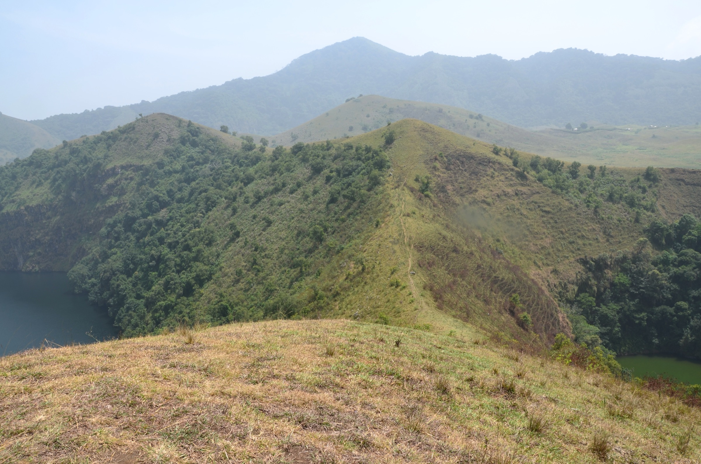
From Bangem, the access road climbs west onto the Muanenguba caldera floor; vehicles typically reach the lower-elevation parking and refuge area near the Twin Lakes. From the parking area, the hiking route turns north-east and climbs through open caldera grassland and Mbororo cattle pasture, then ascends the eroded inner caldera wall on a series of cattle-trampled paths. The summit ridge is broad and grass-covered, and the high point at 2,411 m carries a small crater lake, described locally as the “female lake” of the upper crater system. Return descends to the Twin Lakes basin and the same road back to Bangem.
Why it is essential
This is the highest summit of the Bakossi-Muanenguba range, a textbook example of an eroded shield/stratovolcano caldera, and the entry to one of the most striking landscapes in inland Cameroon — open high-altitude pasture above 2,000 m within a tropical country.
Equipment
- Sturdy boots
- Warm layer (caldera floor is windy and cool, 10-15 °C in the morning)
- Waterproof shell
- Sun protection on the open ridge
- Trekking poles for the eroded inner caldera wall
- 2 litres of water (no reliable source above the lakes)
Hazards and notes
- The mountain is grazed by Mbororo cattle herders; respect informal land use and ask local guides about route variations.
- No formal park infrastructure on the caldera rim.
- In thick cloud the broad summit can be disorienting; carry a GPS or compass.
- Twin Lakes are sites of strong Bakossi cultural significance; entering the water is taboo at certain points and should be avoided.
- Permit arrangements are managed informally through the Bangem council, which oversees the Twin Lakes tourist site.
GPX / KML links
No open route file located for the Bangem-summit line. Twin Lakes coordinates approximately 5.036°N, 9.830°E (Muanenguba summit area: 5°02′10″N, 9°49′49″E).
External links
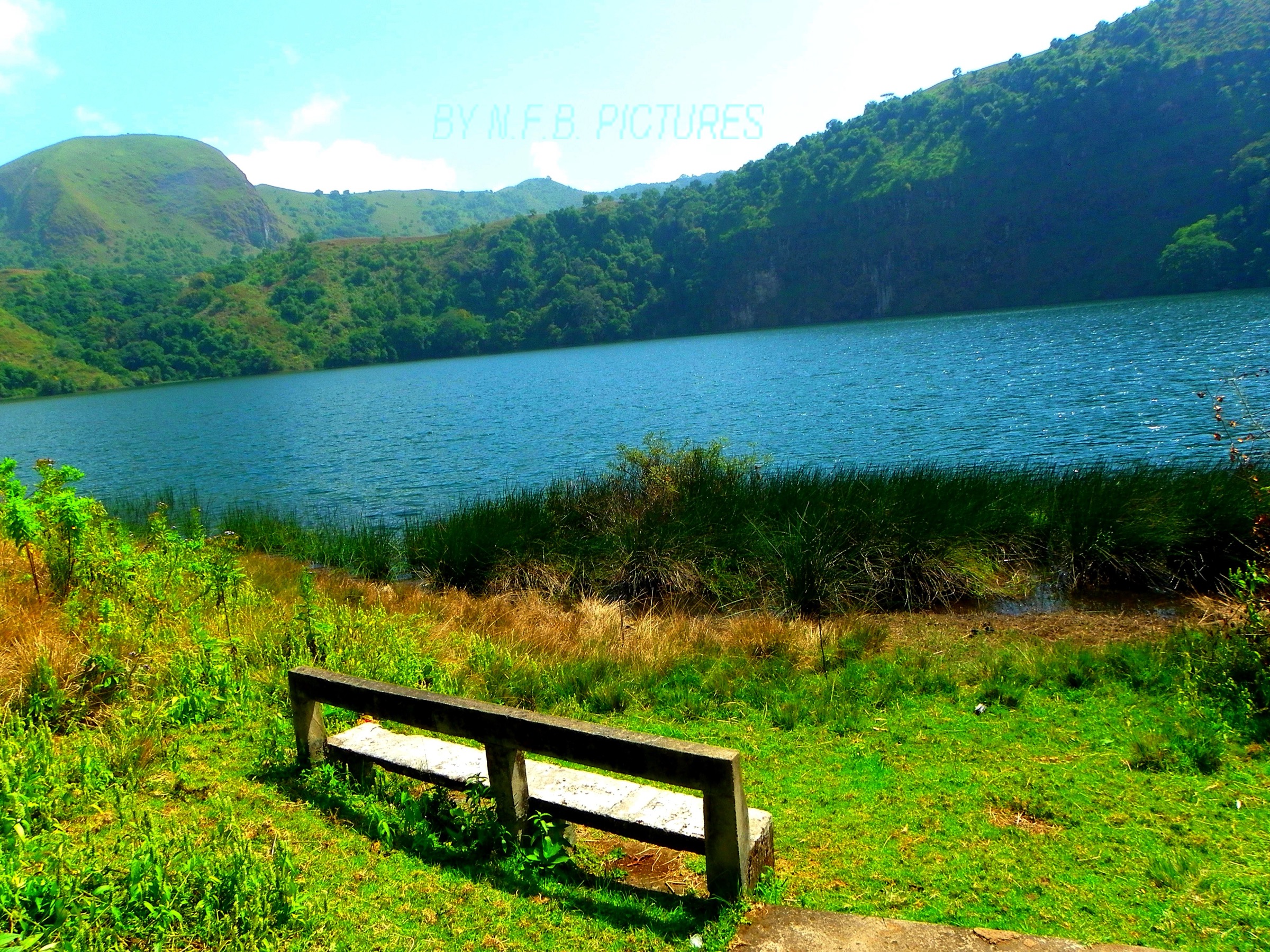
3. Twin Lakes (Lacs Jumeaux) loop
Snapshot
Itinerary
From the parking and refuge area, the path drops gently to the western edge of the Male Lake (Lac Mâle), an open blue crater lake at the lower end of the caldera floor. A clear pastoralist track skirts the lakeshore and climbs north over a low ridge to reach the Female Lake (Lac Femelle), a greener and shallower basin separated from the first by a low volcanic divide. From the ridge between the two lakes, a short detour east climbs onto the inner caldera rim for the panoramic view used in most tourism imagery of Muanenguba. The route returns via the southern shore of the Male Lake to the refuge.
Why it is essential
The Twin Lakes are the most photographed landscape of the Bakossi range, a national-scale tourism icon, and a site of major Bakossi cultural significance. The loop is the only easy day-hike in the region that gives the full caldera experience without requiring a long ascent.
Equipment
- Standard hiking equipment
- Windproof layer year-round
- Sun protection on the open grassland
- Cash for community fees at the Bangem council kiosk
Hazards and notes
- The lakes hold strong taboos — swimming, washing, and bottling water are not appropriate.
- Mbororo cattle on the caldera floor; dogs are generally a problem near settlements.
- Visibility can drop to under 100 m within minutes; do not leave the path in cloud.
- Council fees apply at the Twin Lakes tourist site.
- Photography around the lake edges should be discussed with the local guide.
GPX / KML links
No open route file located. Twin Lakes area centroid approximately 5.034°N, 9.832°E. Geometry should be reconstructed from a guided loop.
External links
- Wikipedia — Muanenguba Lakes
- TakeYourBackpack — Mount Manengouba
- Hiking Adventures — Hike 247: Mount Manengouba
4. Lake Edib (Bakossi NP interior)
Snapshot
Itinerary
Lake Edib is a small crater lake and swamp in the wettest, coldest interior block of Bakossi National Park, surrounded by primary rainforest and reached only by long off-trail traverses from southern park-edge villages such as Mwambong. The route descends and re-climbs a series of forested ridges and small valleys; published accounts describe several days of walking in dense vegetation and frequent rain to reach the crater rim. There is no established trail network and no formal park infrastructure at the lake itself.
Why it is essential
Lake Edib is the headline interior destination of Bakossi National Park, a geologically unusual mist-fed crater swamp with strong cultural significance to the local Bakossi people. It is included here as a candidate for a future deeper expedition product rather than a publishable day-hike.
Equipment
- Full expedition kit including tent, jungle hammock or bivvy
- GPS
- Machete carried by guides
- Water purification
- Rain protection
- Sealed food
- Leech and tick protection
- A local guide team is mandatory
Hazards and notes
- This route does not meet the standard day-hike definition and is included only as a research candidate.
- Access requires WWF-Cameroon or BACDA coordination and the agreement of park management.
- Trail is unmarked; navigation in dense forest is highly hazardous without local knowledge.
- Rainfall is among the highest in central Africa.
GPX / KML links
No open route file located. No reliable coordinates published for the lake; estimated centroid in the Bakossi NP interior block.
External links
- Wikipedia — Bakossi National Park
- WWF Cameroon — Bakossi National Park
- National Geographic — Cameroon volcanic crater lake fish
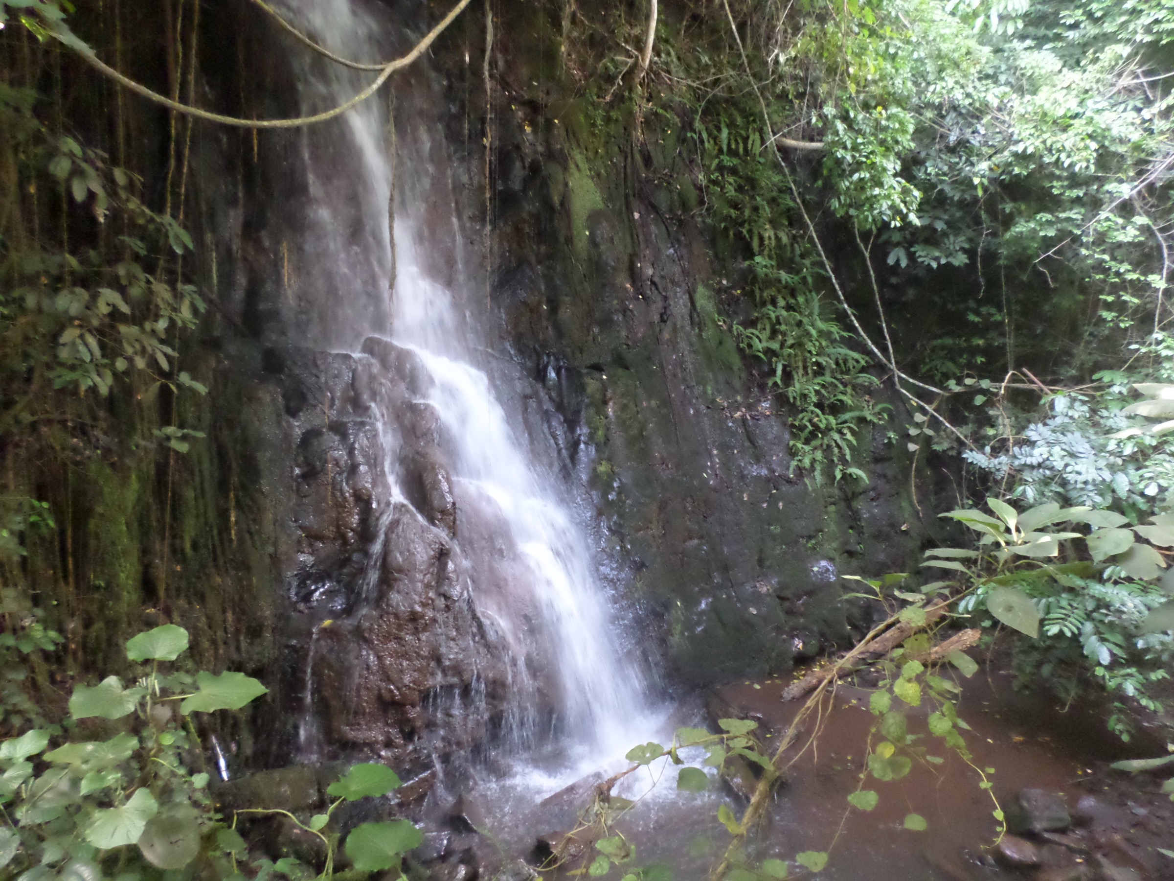
5. Ekom-Nkam Falls from Nkongsamba
Snapshot
Itinerary
From Nkongsamba, the road north toward Bafang crosses the Nkam river valley. From the signposted access point — or directly from the town for a longer walk — a footpath descends gently through a mosaic of cocoa plantations and remnant forest toward the Nkam river. The route reaches the rim platform overlooking the 80-metre twin Ekom-Nkam Falls, the larger “male” fall (perennial Nkam river) and the smaller “female” fall (seasonal Oham river). Return is by the same path. Reported route stats vary: 4.5 km from Nkongsamba with about 300 m gain is the most commonly cited figure, giving a total return of about 9 km.
Why it is essential
Ekom-Nkam is the most famous waterfall on the south-eastern flank of the Bakossi-Muanenguba complex, made internationally recognisable by its appearance in the 1984 film Greystoke: The Legend of Tarzan. It is the most accessible scenic day objective in the wider Bakossi catchment and gives a culturally and geographically distinct alternative to the high mountains.
Equipment
- Standard hiking equipment
- Sturdy footwear (path is slick in the wet season)
- Insect repellent
- Modest cash for the local site fee
Hazards and notes
- The viewpoint platform is unguarded; do not approach the rim too closely.
- The lower river section is dangerous to swim.
- A small site fee is collected by the local council.
- Rainy-season flows can submerge the lower path.
GPX / KML links
No open route file located. Falls coordinates approximately 4.967°N, 9.967°E (cross-check before publication).
External links
External links
| Resource | Link |
|---|---|
| Wikipedia — Bakossi Mountains | en.wikipedia.org |
| Wikipedia — Mount Kupe | en.wikipedia.org |
| Wikipedia — Bakossi National Park | en.wikipedia.org |
| Wikipedia — Muanenguba Lakes | en.wikipedia.org |
| Wikipedia — Bangem | en.wikipedia.org |
| BirdLife — Mount Kupe IBA factsheet | datazone.birdlife.org |
| Key Biodiversity Areas — Mount Kupe | keybiodiversityareas.org |
| Key Biodiversity Areas — Bakossi | keybiodiversityareas.org |
| WWF Cameroon — Bakossi National Park | cameroon.panda.org |
| Bakossi Cultural and Development Association | bacda.org |
| National Geographic — Cameroon volcanic crater lakes (Lake Edib) | nationalgeographic.com |