.jpg)
Regional overview
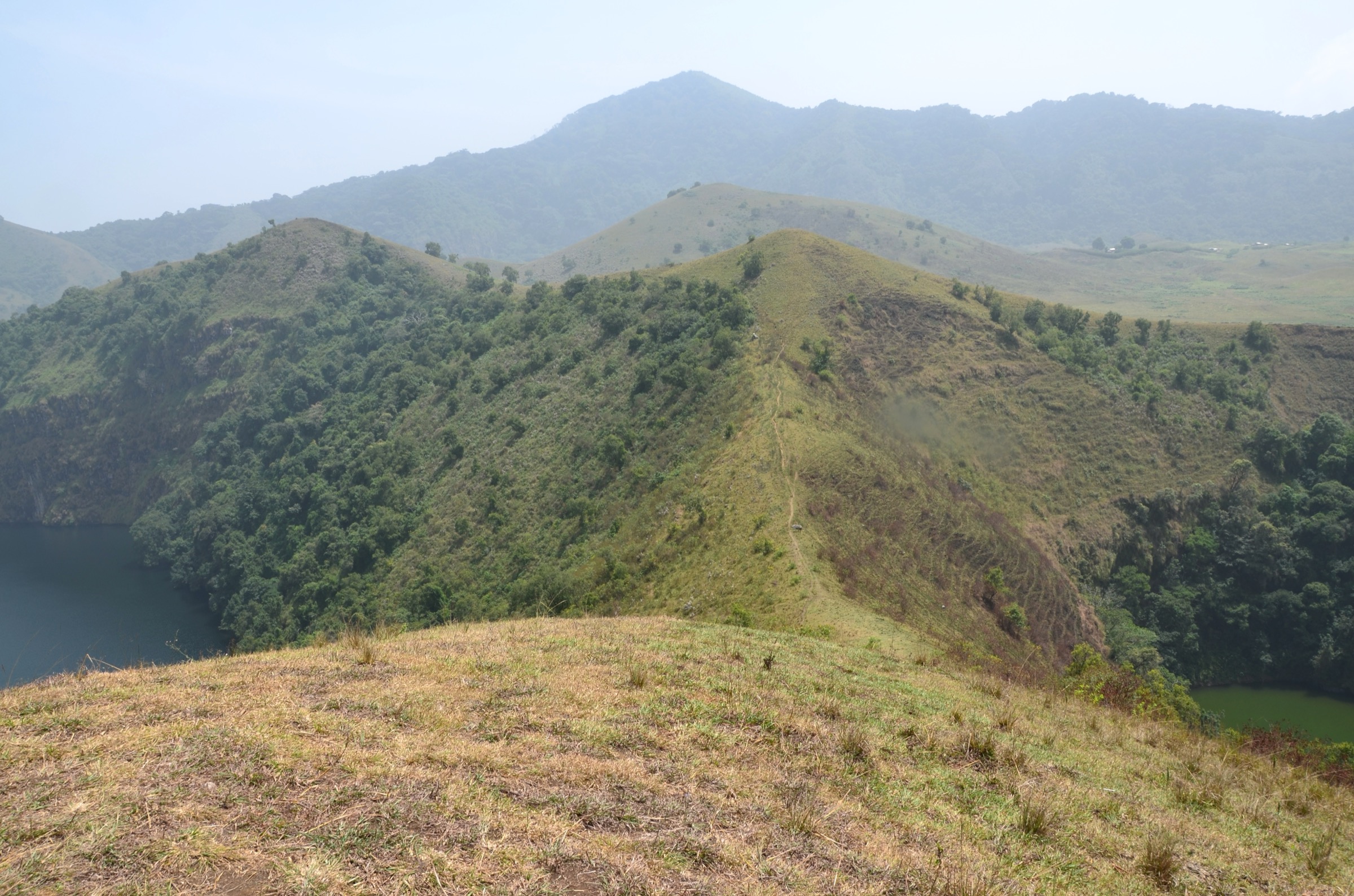
The Bamboutos Mountains (Mont Bambouto, Bamboutos massif) are the central, highest section of the Western High Plateau of Cameroon and the third-highest range in West Africa after Mount Cameroon and Mount Oku. The massif is a Late Miocene–Pliocene shield-stratovolcano complex on the Cameroon Volcanic Line, culminating at Mont Meletan (2,740-2,744 m) on the rim of a striking elliptical caldera (~16 × 8 km) that opens to the west. From the caldera rim, the high plateau falls away in a series of grass-covered crater walls and farmed valleys toward the three administrative regions — West, Northwest and Southwest — that the massif straddles.
The range is densely populated for a tropical highland: more than twenty hill villages including Bafou, Bangang, Babadjou, Bamumbu and Fossimondi sit on the slopes, alongside the larger trading towns of Mbouda, Dschang and Bamendjou below. The plateau is a major water tower, supplying around a third of the water that drives the Edéa hydropower complex; the rivers Mbam, Noun, Mifi, Manyu and Menoua all rise here. The Cameroonian government designated the massif a proposed Integral Ecological Reserve in 2009, but no formal national park has yet been gazetted; conservation work is led by the NGO ERuDeF through the Mount Bamboutos Initiative (MBI), implemented in nine partner villages.
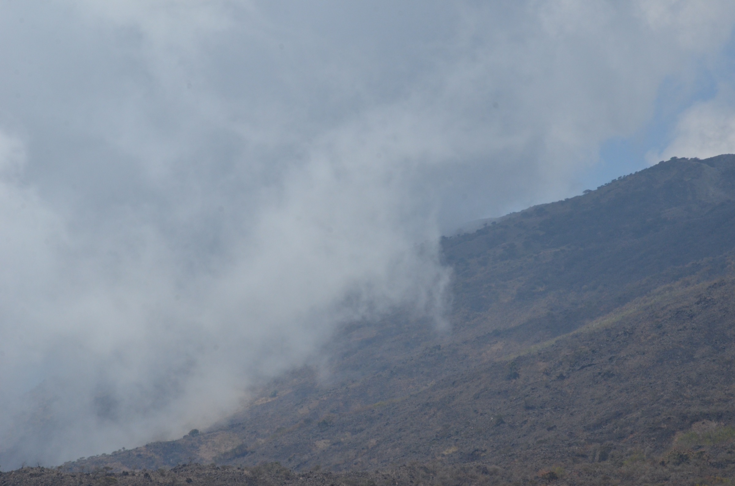
Hiking is informal. There is no published trail network, no waymarking, no entrance fees and no official maps. The standard tourist line, promoted by the Office Regional du Tourisme de l’Ouest Cameroun (ORTOC), runs from Dschang through the Bafou market and ascends the eastern flank of the caldera in three named stages — Méléta (the upper crater rim), Ashuala (deeper into the caldera) and the final ascent to the Babadjou peak on the western shoulder. Other day options exist around Dschang itself (Mount Bani above Bamendou) and on the lower volcanic outliers (Mont Batchingou). Best season is mid-November to early March, the regional dry window; cloud, hail and persistent rain are common at the rim outside this period. Several MBI partner villages observe sacred-site protocols on certain ridges and caves; visits should be coordinated through ERuDeF or local chiefdom contacts.
The Anglophone Crisis has affected access to some Southwest and Northwest Region villages (Bamumbu, Fossimondi); West Region villages including Bafou and Babadjou have been calmer, but security advice should be checked before travel.
Selection rationale
Bamboutos has very thin published trail data. Of the five hikes listed here, the Méléta–Ashuala caldera route is the only itinerary actively promoted by the regional tourism office; Mont Bani is the only Bamboutos-area day-hike with published distance, elevation and a recorded GPX track. The remaining three hikes are best understood as candidate routes that publish-ready field-recordings would confirm. The set covers the highest summit (Mont Meletan), the canonical Bafou tourist circuit (Méléta–Ashuala–Babadjou peak), an accessible Dschang day-hike (Mont Bani), a southern caldera viewpoint approach (Bangang), and a documented lower volcanic outlier (Mont Batchingou).
Summary table
| # | Hike | Country | Route type | Distance | Gain | Max elevation | Difficulty |
|---|---|---|---|---|---|---|---|
| 1 | Mont Meletan summit from Bafou (Méléta route) | Cameroon | Out-and-back | 14-18 km | ~1,200 m | 2,740-2,744 m | Strenuous |
| 2 | Méléta–Ashuala–Babadjou tourist circuit | Cameroon | Point-to-point | 18-22 km | ~1,300 m | ~2,600 m | Strenuous |
| 3 | Mont Bani circular from Sonkeng (Bamendou) | Cameroon | Loop | ~12 km | ~510 m | 1,921 m | Moderate-difficult |
| 4 | Bangang caldera-rim viewpoint | Cameroon | Out-and-back | 10-14 km | ~700 m | ~2,400 m | Moderate-strenuous |
| 5 | Mont Batchingou (lower volcanic outlier) | Cameroon | Out-and-back | 6-10 km | ~500 m | 2,098 m | Moderate |
1. Mont Meletan summit from Bafou (Méléta route)
Snapshot
Itinerary
From Bafou market, the route climbs north-west through smallholder agriculture and reforestation plots managed by the Mount Bamboutos Initiative. Above the cultivated belt, the path crosses open montane grassland and traces the eroded eastern wall of the Bamboutos caldera. The named viewpoint Méléta sits high on the rim and gives the first full panoramic view across the caldera floor and to the west. From Méléta, a short summit detour ascends the basaltic block of Mont Meletan, the highest point of the massif at 2,740-2,744 m. Return reverses the climb to Bafou.
Why it is essential
Mont Meletan is the highest summit of the Bamboutos massif and the third-highest peak in West Africa. The Méléta line is the only route to it that appears in regional tourism literature, and the caldera rim view from the summit is the headline landscape of the entire Western High Plateau.
Equipment
- Sturdy boots
- Warm and windproof layer (the rim is cool year-round)
- Rain shell
- Sun protection
- 2-3 litres of water
- Trekking poles
- Head-torch
- Modest cash for community fees
Hazards and notes
- No formal park infrastructure on the massif.
- A local guide from Bafou or via ERuDeF is essential; upper slopes are open and easy to lose in cloud.
- Cattle grazing is widespread; respect local pastoralist boundaries.
- Some ridges and caves have sacred-site significance; these should be flagged in advance by the village guide.
- Mobile reception is unreliable above the cultivated zone.
- Anglophone Crisis primarily affects Northwest and Southwest flanks; West Region approaches (Bafou) have been calmer but advice should be checked.
GPX / KML links
No open route file located in current sources. Bafou market coordinates approximately 5.45°N, 10.13°E (verify locally). Mont Meletan summit area cited in academic literature at approximately 5.65°N, 10.05°E.
External links
- Wikipedia — Bambouto Massif
- IntechOpen — The Caldera of Mount Bambouto
- ERuDeF — Discover Mt Bamboutos
2. Méléta–Ashuala–Babadjou tourist circuit
Snapshot
Itinerary
This is the canonical caldera traverse referenced by the West Region tourism office. From Bafou market, the route follows the same line as Hike 1 to the Méléta rim viewpoint (the first official stop). Instead of detouring to Mont Meletan, the path drops west into the caldera floor and crosses pastoralist grassland to Ashuala, the named second stop near the centre of the caldera. From Ashuala, the route climbs the western caldera wall to the Babadjou peak (third and final stop, on the western shoulder), then descends the western flank to Babadjou village, a Bamileke-country town on the regional road between Mbouda and Bamenda.
Why it is essential
This is the only published tourist circuit on the Bamboutos massif and the most complete way to experience the caldera — both rims, the inner basin, and a high lateral peak. The route connects two distinct ethnolinguistic zones (Bafou/Yemba on the east and Babadjou/Bamileke on the west) and gives a transect view of the high plateau that no shorter route reproduces.
Equipment
- As for Hike 1
- Pre-arranged transport at the western Babadjou end
- Local guide essential
- Second water resupply at Ashuala village to be arranged in advance
Hazards and notes
- Long day, weather-dependent; route-finding inside the caldera basin without a guide is impractical.
- MBI partner villages of Bafou and Babadjou are organised hubs for community-led tourism; coordinating through ERuDeF is the most reliable approach.
- Sacred-site protocols on certain ridges may divert the route.
GPX / KML links
No open route file located. The line is described only in narrative form by the West Region tourism office; geometry should be recorded on a guided traverse.
External links
3. Mont Bani circular from Sonkeng (Bamendou)
Snapshot
Itinerary
From Sonkeng village (Visorando coordinates 5.372°N, 10.156°E), the path climbs steeply through smallholder farmland on a series of village access tracks before entering a partly forested ridge zone. The route ascends the south-east shoulder of Mont Bani (1,921 m), with the summit giving a broad panoramic view across the Grassfields, the upper Menoua valley and, in clear weather, the southern Bamboutos rim. A circular descent through neighbouring hamlets returns to Sonkeng. A secondary loop variant ascends a second nearby summit.
Why it is essential
Mont Bani is the only Bamboutos-area day-hike with a published distance, elevation gain and a recorded GPX track. It is the most accessible introduction to the Bamboutos foothill landscape from Dschang and a practical fitness day for visitors before attempting the higher caldera routes.
Equipment
- Standard hiking equipment
- Sturdy boots
- Rain shell
- 2 litres of water (village resupply available on the lower section)
- Trekking poles for the steep descent
Hazards and notes
- The path passes through cultivated land and inhabited hamlets; respect crops and livestock.
- Steep grass slopes are slippery in the rainy months.
- The Visorando track is the work of an independent route author published “for personal use only”; the geometry should be re-recorded for any publishable derivative.
GPX / KML links
| Source | URL | Format | Licence / terms | Reuse status |
|---|---|---|---|---|
| Visorando — Boucle du Mont Bani | visorando.com | GPX (free account) | Author retains rights; “Please do not copy them without permission” | Reference only, not reusable; re-record geometry independently |
External links
- Visorando — Boucle du Mont Bani
- Yengafrica — Hiking on Mount Bani Dschang
- Peakvisor — Mont Bani
- Wikipedia — Dschang
4. Bangang caldera-rim viewpoint
Snapshot
Itinerary
From Bangang village, the path climbs north through a band of replanted mountain forest (an MBI restoration zone) onto the open southern caldera wall. The path follows established cattle and forest-restoration tracks to a viewpoint on the southern rim, overlooking the caldera floor and the Mont Meletan summit block on the opposite side. Return reverses the ascent.
Why it is essential
Bangang offers the only widely-known southern approach to the caldera rim and is one of the three ERuDeF / MBI flagship villages, with an organised community-tourism interface. The route is shorter and less demanding than the Bafou ascent.
Equipment
- Sturdy boots
- Warm layer
- Rain shell
- 2 litres of water
- Head-torch
- Gloves for cool mornings on the rim
Hazards and notes
- No waymarking. A village guide arranged through ERuDeF or the Bangang chiefdom is essential.
- The route crosses Mount Bamboutos Initiative restoration plots; visitors are asked not to enter young plantings off-path.
GPX / KML links
No open route file located. Bangang centroid approximately 5.49°N, 10.13°E.
External links
5. Mont Batchingou (lower volcanic outlier)
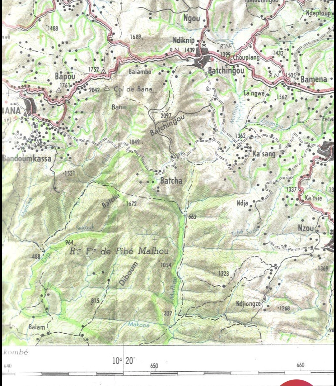
Snapshot
Itinerary
Mont Batchingou is a 2,098 m volcanic peak in the Ndé department, on the south-east margin of the wider Bamboutos volcanic system. Detailed route data has not been located; available photographic evidence (Wikimedia Commons, 2025) indicates a clear pyramidal summit accessible from the surrounding village road network. The route should be confirmed locally before publication.
Why it is essential
Mont Batchingou is the most accessible lower-elevation summit on the eastern flank of the Bamboutos volcanic system and one of the few peaks in the wider massif with an open-licence photograph already available, making it a candidate for a future shorter day-hike entry.
Equipment
- Standard hiking equipment
- Sturdy boots
- Rain shell
- 2 litres of water
Hazards and notes
- Without a published trail, route-finding and seasonal access need on-the-ground verification.
- The Ndé department is generally calmer than the Northwest and Southwest Region flanks, but security advice should be checked.
GPX / KML links
No open route file located. Trailhead and summit coordinates require local confirmation.
External links
- Wikimedia Commons — File:Mont Batchingou (2098m).jpg
- Wikimedia Commons — Category:Bamboutos Mountains
External links
| Resource | Link |
|---|---|
| Wikipedia — Bambouto Massif | en.wikipedia.org |
| Wikipedia — West Region (Cameroon) | en.wikipedia.org |
| Wikipedia — Dschang | en.wikipedia.org |
| IntechOpen — Caldera of Mount Bambouto | intechopen.com |
| ERuDeF — Discover Mt Bamboutos | erudef.org |
| ERuDeF — Mount Bamboutos Initiative | erudef.org |
| Visorando — Boucle du Mont Bani | visorando.com |
| Yengafrica — Hiking on Mount Bani Dschang | yengafrica.com |
| Peakvisor — Mont Bani | peakvisor.com |
| Wikimedia Commons — Category:Bamboutos Mountains | commons.wikimedia.org |