
Regional overview
Serra dos Órgãos National Park protects one of Brazil’s classic granite-and-Atlantic-Forest mountain landscapes: steep forested valleys, waterfalls, cloud forest, high campos de altitude, and rock towers such as Dedo de Deus. The main hiking bases are Teresópolis, Petrópolis/Bonfim and Guapimirim.
The region’s best day hikes range from short waterfall and viewpoint walks to long, strenuous summit approaches. The dry winter season, roughly May-September, is generally preferred for high routes because summer rain, lightning and muddy trails can make the granite and forest sections hazardous.
Park entry, camping, shelter use, guide requirements and high-route quotas can change. The ICMBio site was not readable from this environment during the pass, so official rule details need a final local check before publication.
Selection rationale
The five hikes represent the region’s essential day-walking range: Pedra do Sino as the high-point classic, Morro Açu / Castelos do Açu as the Petrópolis-side highland objective, the Mozart Catão / Cartão Postal viewpoints for Dedo de Deus views, a longer waterfall-and-ridge route via Véu da Noiva, and Poço Verde as the accessible Guapimirim forest-water route.
Summary table
| # | Hike | Country | Route type | Distance | Gain | Max elevation | Difficulty |
|---|---|---|---|---|---|---|---|
| 1 | Pedra do Sino from Teresópolis | Brazil | Out-and-back | 20.9-22 km | 1,200-1,552 m | 2,229 m route source; summit ca. 2,263-2,275 m | Hard |
| 2 | Bonfim to Morro Açu / Castelos do Açu | Brazil | Out-and-back | 15.6 km | 1,230 m | 2,164 m | Hard |
| 3 | Mirante Mozart Catão / Cartão Postal via Trilha 360 | Brazil | Loop | 4.3 km | 308 m | 1,312 m | Moderate |
| 4 | Cachoeira Véu da Noiva - Morro dos Dois Irmãos | Brazil | Out-and-back | 11.9 km | 1,052 m | 737 m in route source; route data inconsistent with described high point | Hard |
| 5 | Poço Verde Trail | Brazil | Out-and-back | 1.3 km | 46 m | 437 m | Easy |
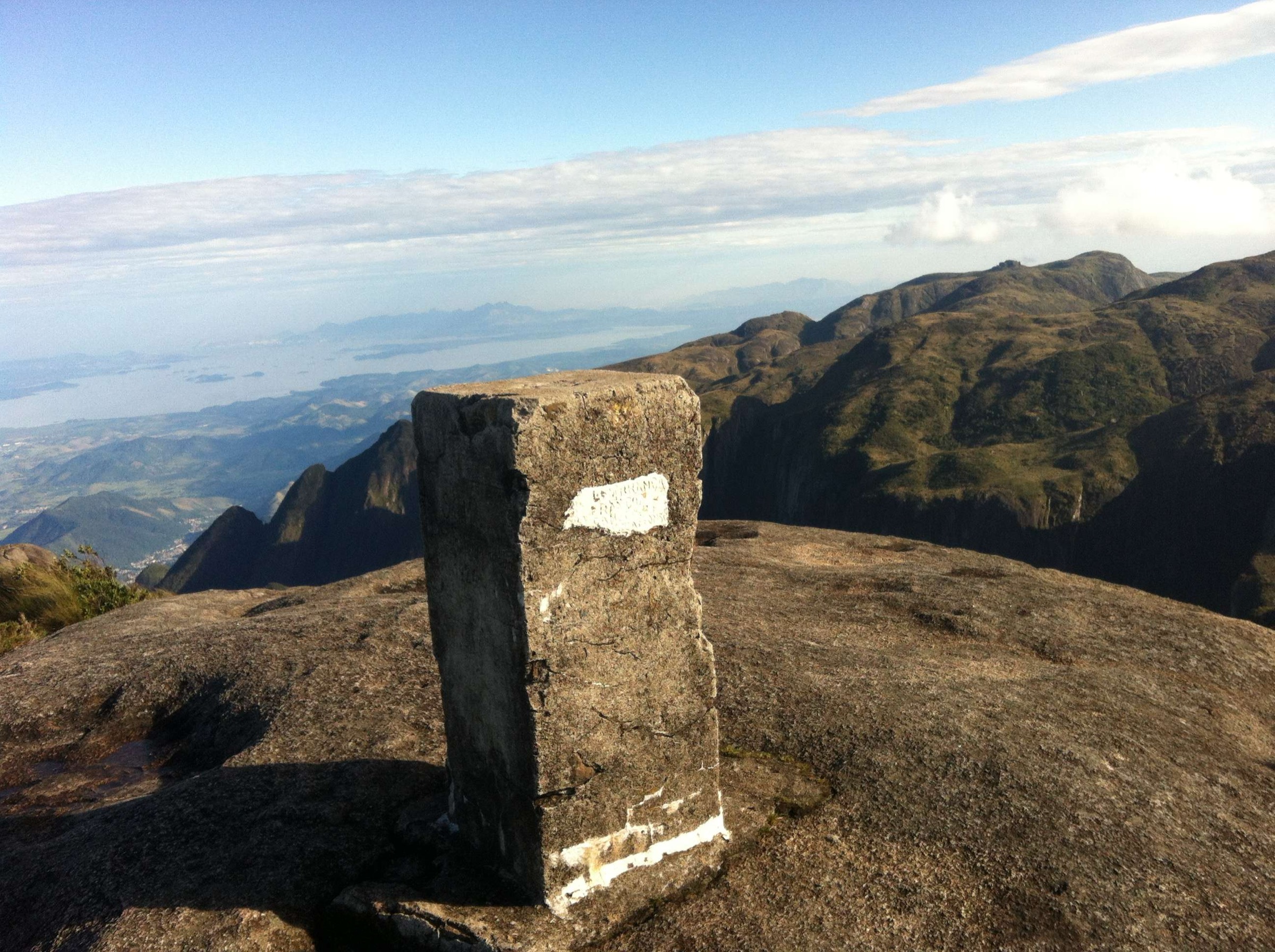
1. Pedra do Sino from Teresópolis

Snapshot
Itinerary
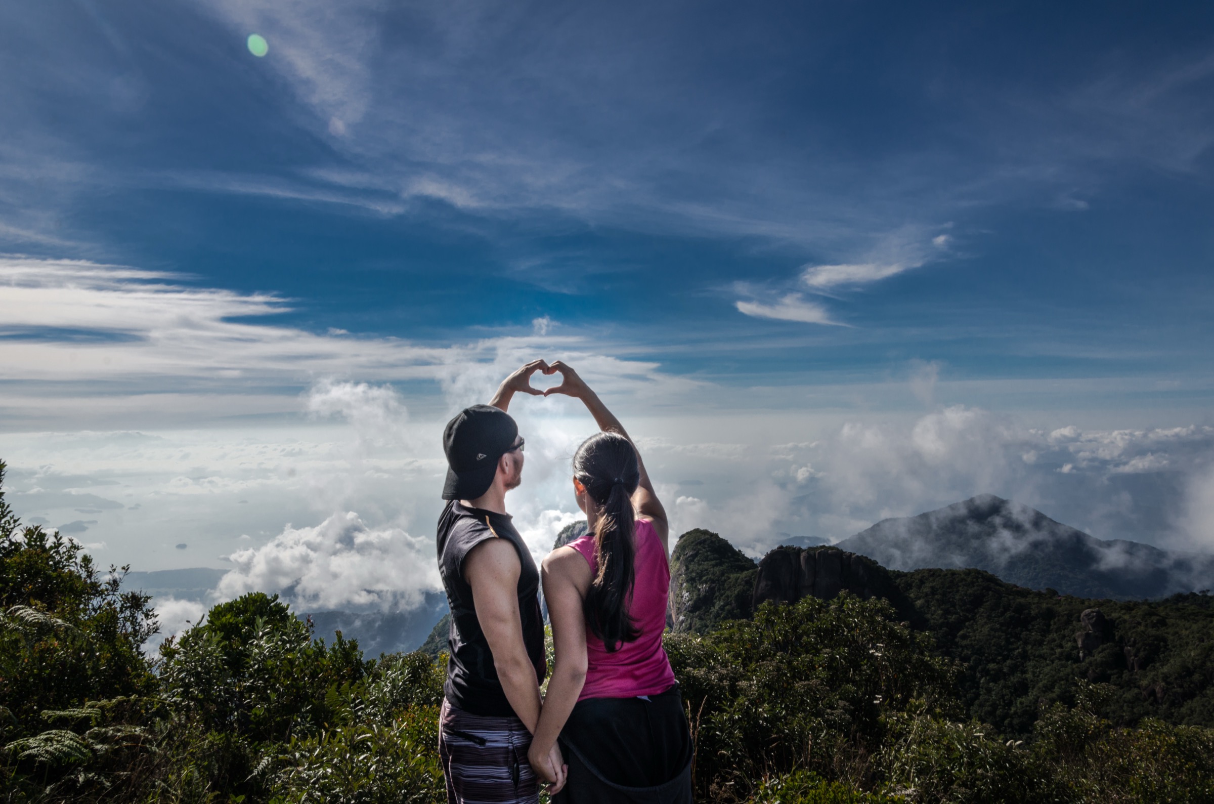
The classic ascent starts at the Teresópolis side of Serra dos Órgãos National Park and climbs from forest into higher mountain vegetation toward Pedra do Sino. The route passes waterfalls and old paved/stone sections before reaching the upper mountain terrain. From the summit area the view can extend to Guanabara Bay, Rio de Janeiro and the Paraíba Valley in clear weather. Descend the same way unless continuing the multi-day traverse, which is outside this day-hike entry.
Why it is essential
Pedra do Sino is the park high-point classic and one of the defining mountain-walking objectives in the Brazilian Highlands near Rio.
Equipment
Mountain hiking equipment, sturdy boots, warm layer, waterproof/windproof shell, 2-3 litres water, food, headtorch, navigation backup and trekking poles. Cold-weather clothing is important in winter.
Hazards and notes
Long ascent, fatigue, cold, wind, fog, storms and slippery forest sections are the main hazards. Public summaries state the trail has visitor limits; current park booking/entry rules must be checked.
GPX / KML links
| Source | URL | Format / access | Reuse status |
|---|---|---|---|
| AllTrails — Pedra do Sino - Garrafão - Cabeça de Cão | alltrails.com | Source map / route page | AllTrails terms apply; direct GPX not retrieved |
External links
- AllTrails — Pedra do Sino - Garrafão - Cabeça de Cão
- Pedra do Sino — Wikipedia
- Serra dos Órgãos National Park — Wikipedia
2. Bonfim to Morro Açu / Castelos do Açu
Snapshot
Itinerary
From Bonfim, the trail climbs through Atlantic Forest, streams, waterfalls and progressively higher mountain terrain toward Morro Açu and the Castelos do Açu rock formations. The area is a celebrated sunset/high-camp section of the Petrópolis-Teresópolis traverse, but strong parties can walk it as a long out-and-back day.
Why it is essential
Morro Açu is the Petrópolis-side counterpart to Pedra do Sino and one of the signature highland viewpoints of Serra dos Órgãos.
Equipment
Mountain hiking kit, warm layers, rain/wind shell, headtorch, food, 2-3 litres water, navigation backup and trekking poles.
Hazards and notes
The ascent is sustained and exposed to cold, fog and storms near the top. AllTrails and local descriptions note that the route is often better divided into two days; day-hike treatment is for fit walkers only.
GPX / KML links
| Source | URL | Format / access | Reuse status |
|---|---|---|---|
| AllTrails — Bonfim - Morro Açu | alltrails.com | Source map / route page | AllTrails terms apply; direct GPX not retrieved |
External links
3. Mirante Mozart Catão / Cartão Postal via Trilha 360
Snapshot
Itinerary
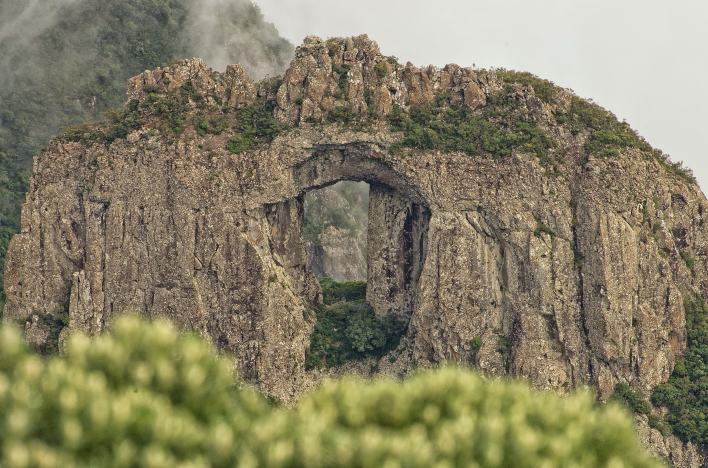
The Trilha 360 loop links forest walking with Mirante Mozart Catão and Mirante Cartão Postal. The viewpoints look toward Teresópolis and the park’s famous granite skyline, including Dedo de Deus from the Cartão Postal side.
Why it is essential
This is the most practical short-to-moderate viewpoint route for the iconic Dedo de Deus skyline and the Teresópolis face of the park.
Equipment
Standard hiking equipment, water, rain layer, grippy shoes and sun protection.
Hazards and notes
The route is shorter than the high summits but still humid, rooty and slippery after rain. Crowding is possible on clear weekends.
GPX / KML links
| Source | URL | Format / access | Reuse status |
|---|---|---|---|
| AllTrails — Mirante Mozart Catão - Mirante Cartão Postal via Trilha 360 | alltrails.com | Source map / route page | AllTrails terms apply; direct GPX not retrieved |
External links
4. Cachoeira Véu da Noiva - Morro dos Dois Irmãos
Snapshot
Itinerary
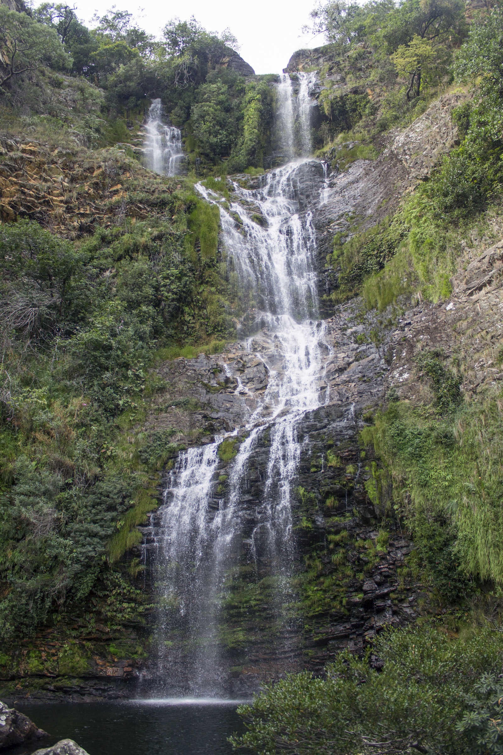
The route source describes a forest path sharing its beginning with routes toward Pedra Mãe and Morro Companhia, with a notable stop at Cachoeira Véu da Noiva before continuing toward Morro dos Dois Irmãos. Because the published route statistics and descriptive high point are inconsistent, this hike should be treated as a candidate pending official/GPX verification.
Why it is essential
Véu da Noiva is a recognised waterfall name in the Serra dos Órgãos walking landscape, and the route adds a waterfall-and-ridge contrast to the summit and viewpoint selections.
Equipment
Mountain hiking equipment, grippy shoes, water, food, rain layer, trekking poles and navigation backup.
Hazards and notes
Waterfall rocks can be very slippery. Heavy rain can make streams unsafe. Route data requires verification before publication-grade use.
GPX / KML links
| Source | URL | Format / access | Reuse status |
|---|---|---|---|
| AllTrails — Cachoeira Véu da Noiva - Morro dos Dois Irmãos | alltrails.com | Source map / route page | AllTrails terms apply; direct GPX not retrieved; verify before use |
External links
5. Poço Verde Trail
Snapshot
Itinerary
The short trail follows a well-marked Atlantic Forest route to Poço Verde, a natural pool on the Soberbo River, with green water and large boulders. It is the accessible low-elevation water route in the set.
Why it is essential
Poço Verde represents the Guapimirim forest-and-river side of Serra dos Órgãos, balancing the long summit routes with a short classic natural-pool walk.
Equipment
Standard hiking equipment, grippy footwear, water and insect protection.
Hazards and notes
Slippery rocks and flashier water conditions after rain are the key hazards. Swimming safety and current park rules should be checked on site.
GPX / KML links
| Source | URL | Format / access | Reuse status |
|---|---|---|---|
| AllTrails — Poço Verde Trail | alltrails.com | Source map / route page | AllTrails terms apply; direct GPX not retrieved |
External links
Missing data / follow-up work
- Check current ICMBio/PARNASO official visitor rules, booking, quotas and closures; the official page was not readable from this environment.
- Verify the Cachoeira Véu da Noiva / Morro dos Dois Irmãos route elevation inconsistency before publication.
- Find exact licence-compatible photos for Morro Açu, Cartão Postal, Véu da Noiva and Poço Verde.
- Download GPX files from route platforms only where account and terms permit, or redraw from verified OSM/official geometry later.
External links
| Source | URL |
|---|---|
| Serra dos Órgãos National Park — Wikipedia | en.wikipedia.org |
| Parque Nacional da Serra dos Órgãos — Wikipedia | pt.wikipedia.org |
| Pedra do Sino — Wikipedia | pt.wikipedia.org |
| AllTrails — Pedra do Sino - Garrafão - Cabeça de Cão | alltrails.com |
| AllTrails — Bonfim - Morro Açu | alltrails.com |
| AllTrails — Mirante Mozart Catão - Mirante Cartão Postal | alltrails.com |
| AllTrails — Cachoeira Véu da Noiva - Morro dos Dois Irmãos | alltrails.com |
| AllTrails — Poço Verde Trail | alltrails.com |
| Wikimedia Commons — Serra dos Órgãos National Park | commons.wikimedia.org |
| Wikimedia Commons — Dedo de Deus | commons.wikimedia.org |