.jpg)

.jpg)
Regional overview
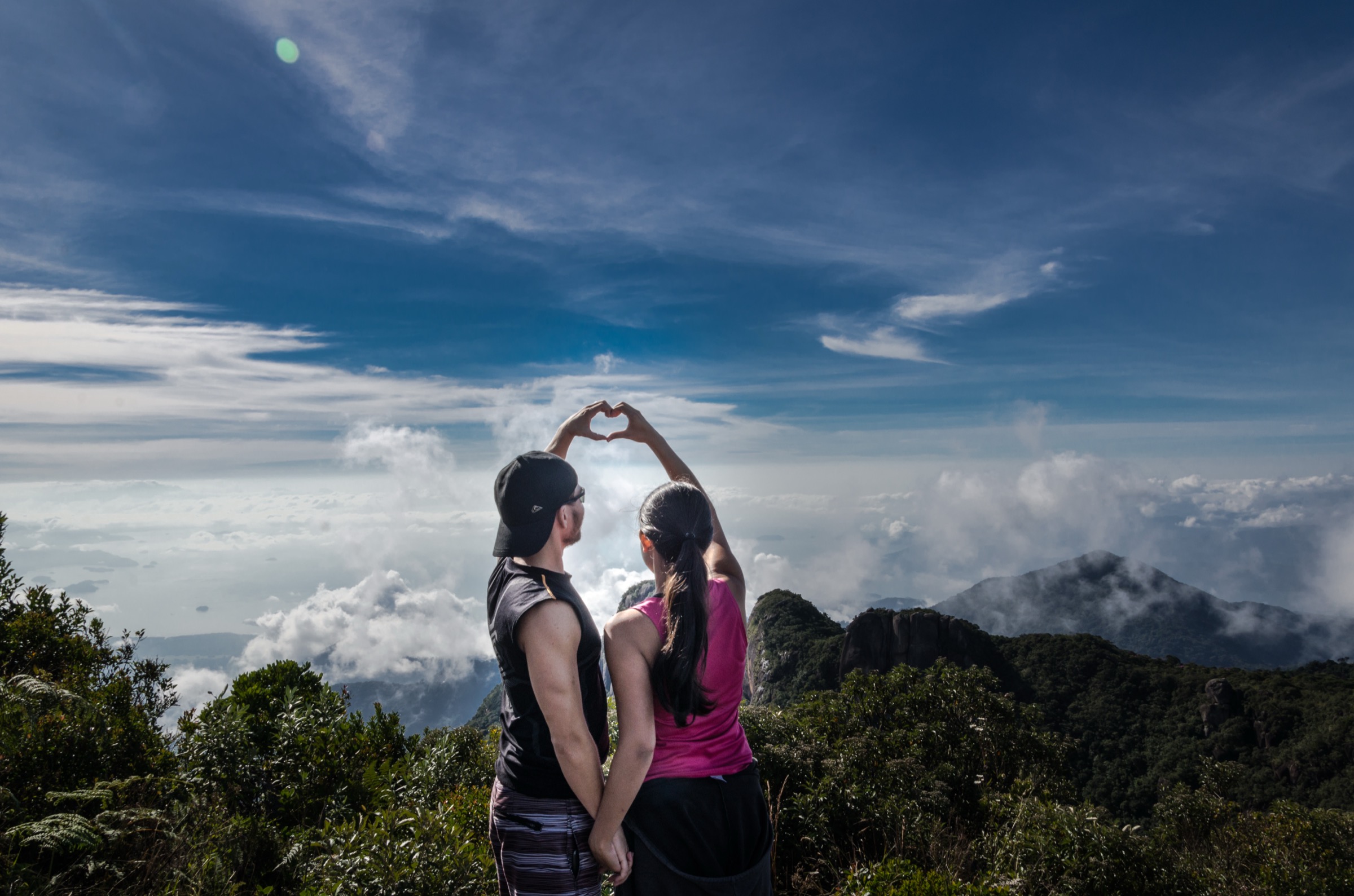
The Serra Catarinense is a cool, high plateau and escarpment landscape of araucaria forest, cloud forest, basalt cliffs, canyons, waterfalls and exposed campos de altitude. The main hiking centres are Urubici, Bom Jardim da Serra, Orleans/Grão-Pará access to Serra Furada, and the Serra do Rio do Rastro escarpment.
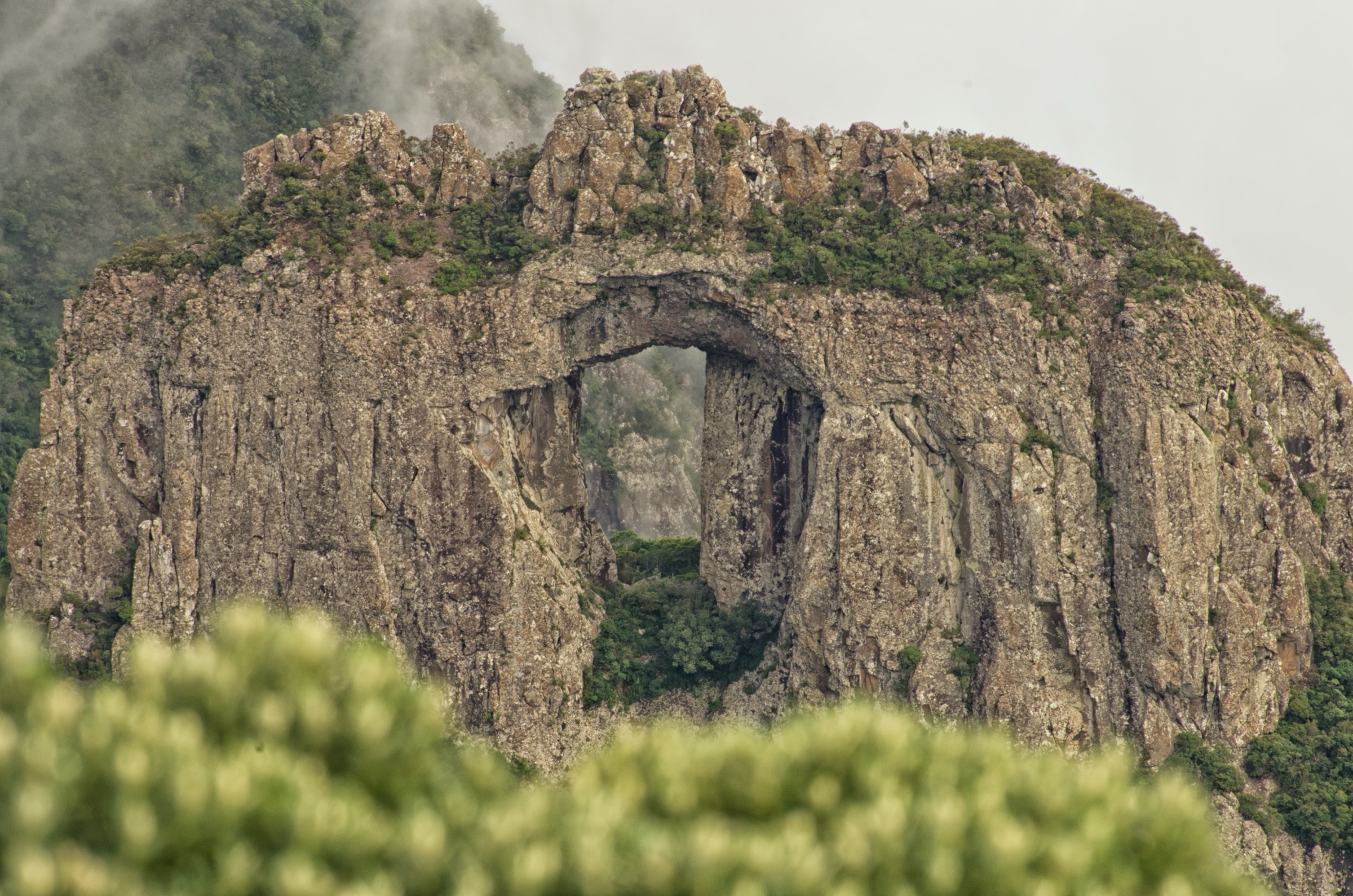
Parque Nacional de São Joaquim is the region’s anchor protected area. Its altitudes range from about 300 m to 1,822 m at Morro da Igreja, and its best-known features include Pedra Furada/Janela Furada and Cânion das Laranjeiras. Trails inside the national park require accredited guides according to published park summaries; many surrounding objectives cross private land and require local arrangements.
Weather is the defining safety factor. The highlands are among the coldest places in Brazil, with fog, strong wind, frost and occasional snow in winter. Summer brings storms and reduced afternoon visibility. Dry, stable days are best for exposed escarpment routes.
Selection rationale
The five hikes represent the region’s most recognisable escarpment features: Pedra Furada/Morro da Igreja, the Laranjeiras canyon sector, Serra Furada/Rio Pelotas headwater terrain, Cânion Espraiado/Pedra da Águia, and the Serra do Rio do Rastro/Ronda viewpoint side.
Summary table
| # | Hike | Country | Route type | Distance | Gain | Max elevation | Difficulty |
|---|---|---|---|---|---|---|---|
| 1 | Pedra Furada from Morro da Igreja | Brazil | Out-and-back | 5.1 km AllTrails | 347 m | ca. 1,822 m area | Hard |
| 2 | Cânion Laranjeiras | Brazil | Out-and-back | 5.1 km AllTrails | 316 m | ca. 1,650 m area | Moderate |
| 3 | Mirante da Serra Geral via Nascentes do Rio Pelotas | Brazil | Out-and-back | 8.5 km AllTrails | 470 m | Unresolved | Moderate |
| 4 | Pedra da Águia - Cânion Espraiado | Brazil | Out-and-back | 22.5 km AllTrails | 799 m | Unresolved | Hard |
| 5 | Serra do Rio do Rastro / Morro da Ronda viewpoint walk | Brazil | Out-and-back / local viewpoint route | 4.2 km AllTrails for nearby passarela route; Ronda variant unresolved | 241 m for listed route | 1,507 m Morro da Ronda | Moderate |
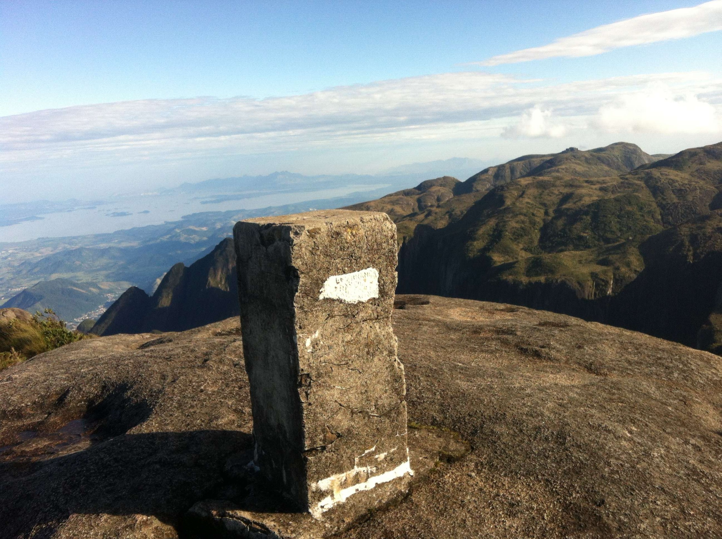
1. Pedra Furada from Morro da Igreja

Snapshot
Itinerary
The route leaves the Morro da Igreja high area and traverses exposed escarpment terrain toward the Pedra Furada/Janela Furada basalt window. Return follows the same route.
Why it is essential
Pedra Furada and Morro da Igreja are the most recognisable landmarks of the Serra Catarinense highlands.
Equipment
Mountain hiking equipment, warm/windproof layer, rain shell, navigation backup.
Hazards and notes
Accredited PNSJ guide required according to park summaries; exposure, fog, wind, slippery rock and cold-weather hypothermia risk.
GPX / KML links
| Source | URL | Format / access | Reuse status |
|---|---|---|---|
| AllTrails — Pedra Furada | alltrails.com | Source map / route page | AllTrails terms apply; reuse unresolved |
External links
2. Cânion Laranjeiras
Snapshot
Itinerary
From the Bom Jardim da Serra/Santa Bárbara side, the path reaches viewpoints and open highland terrain around Cânion Laranjeiras, a recognised attraction of PNSJ.
Why it is essential
It is the key canyon walk on the Bom Jardim da Serra side of the national park.
Equipment
Mountain hiking equipment, warm layer, rain shell, sun protection.
Hazards and notes
Poor road access, private-property entry/fees, fog, storms and cliff-edge exposure.
GPX / KML links
| Source | URL | Format / access | Reuse status |
|---|---|---|---|
| AllTrails — Cânion Laranjeiras | alltrails.com | Source map / route page | AllTrails terms apply; reuse unresolved |
External links
3. Mirante da Serra Geral via Nascentes do Rio Pelotas

Snapshot
Itinerary
The trail follows headwater terrain toward a Serra Geral viewpoint, crossing forest and open highland sections near the Serra Furada/PNSJ protected-area boundary.
Why it is essential
It represents the Serra Furada side of the highlands and the source-area character of the Pelotas basin.
Equipment
Mountain hiking equipment, navigation backup, rain layer and warm layer.
Hazards and notes
Fog, wet forest, slippery ground and uncertain park/private access.
GPX / KML links
| Source | URL | Format / access | Reuse status |
|---|---|---|---|
| AllTrails — Mirante da Serra Geral via Trilha Nascentes do Rio Pelotas | alltrails.com | Source map / route page | AllTrails terms apply; reuse unresolved |
External links
- AllTrails — Mirante da Serra Geral via Trilha Nascentes do Rio Pelotas
- Parque Nacional de São Joaquim — Wikipedia
4. Pedra da Águia - Cânion Espraiado
Snapshot
Itinerary
A long highland route reaches the Pedra da Águia and Cânion Espraiado area, crossing open campos, forested drainages and escarpment viewpoints.
Why it is essential
Cânion Espraiado is one of the best-known rugged day objectives around Urubici and provides a longer strenuous option.
Equipment
Mountain hiking equipment, extra water/food, headtorch, rain/wind layer and navigation backup.
Hazards and notes
Long distance, private access/fees, fog, storms, stream crossings and exposed viewpoints.
GPX / KML links
| Source | URL | Format / access | Reuse status |
|---|---|---|---|
| AllTrails — Pedra da Águia - Cânion Espraiado | alltrails.com | Source map / route page | AllTrails terms apply; reuse unresolved |
External links
5. Serra do Rio do Rastro / Morro da Ronda viewpoint walk

Snapshot
Itinerary
Walk from the high road/viewpoint area to an escarpment viewpoint such as Morro da Ronda, where the canyon/road switchback landscape and high plateau are visible in clear weather.
Why it is essential
Serra do Rio do Rastro is one of Santa Catarina’s emblematic mountain passes and gives the catalogue a road-pass/escarpment viewpoint walk.
Equipment
Standard hiking equipment, warm/wind layer.
Hazards and notes
Road traffic if walking near SC-390/SC-438, fog, cliff exposure, private land and sudden weather changes.
GPX / KML links
| Source | URL | Format / access | Reuse status |
|---|---|---|---|
| AllTrails — Urubici / Parque Altos Corvo Branco / Passarela de Vidro | alltrails.com | Source map / route page | Secondary nearby route; AllTrails terms apply |
| OpenStreetMap / Waymarked Trails search | openstreetmap.org | Map data / search | OSM data is ODbL; no exact Morro da Ronda GPX found |
External links
Missing data / follow-up work
- Confirm current guide/permit requirements for each PNSJ trail.
- Confirm legal access and fees for Cânion Espraiado, Cânion Laranjeiras and Morro da Ronda.
- Find official GPX/KML downloads, if any exist.
- Find open-licence route-specific images for Cânion Laranjeiras and Cânion Espraiado.
External links
| Source | URL |
|---|---|
| Parque Nacional de São Joaquim — Wikipedia | pt.wikipedia.org |
| Pedra Furada — Wikipedia | pt.wikipedia.org |
| Serra do Rio do Rastro — Wikipedia | pt.wikipedia.org |
| AllTrails — Pedra Furada | alltrails.com |
| AllTrails — Cânion Laranjeiras | alltrails.com |
| AllTrails — Mirante da Serra Geral via Trilha Nascentes do Rio Pelotas | alltrails.com |
| AllTrails — Pedra da Águia - Cânion Espraiado | alltrails.com |
| AllTrails — Urubici / Altos Corvo Branco / Passarela de Vidro | alltrails.com |